Report 293 By E.T. Baker, Jr., R.M. Slade, Jr., M.E. Dorsey and L.M. Ruiz U.S. Geological Survey and Gail L. Duffin TWDB | March 1986
This report is published in two parts due to file size considerations
- Report 293 (part A) - Geohydrology of the Edwards Aquifer in the Austin Area, Texas
- Report 293 (part B) - Geohydrology of the Edwards Aquifer in the Austin Area, Texas
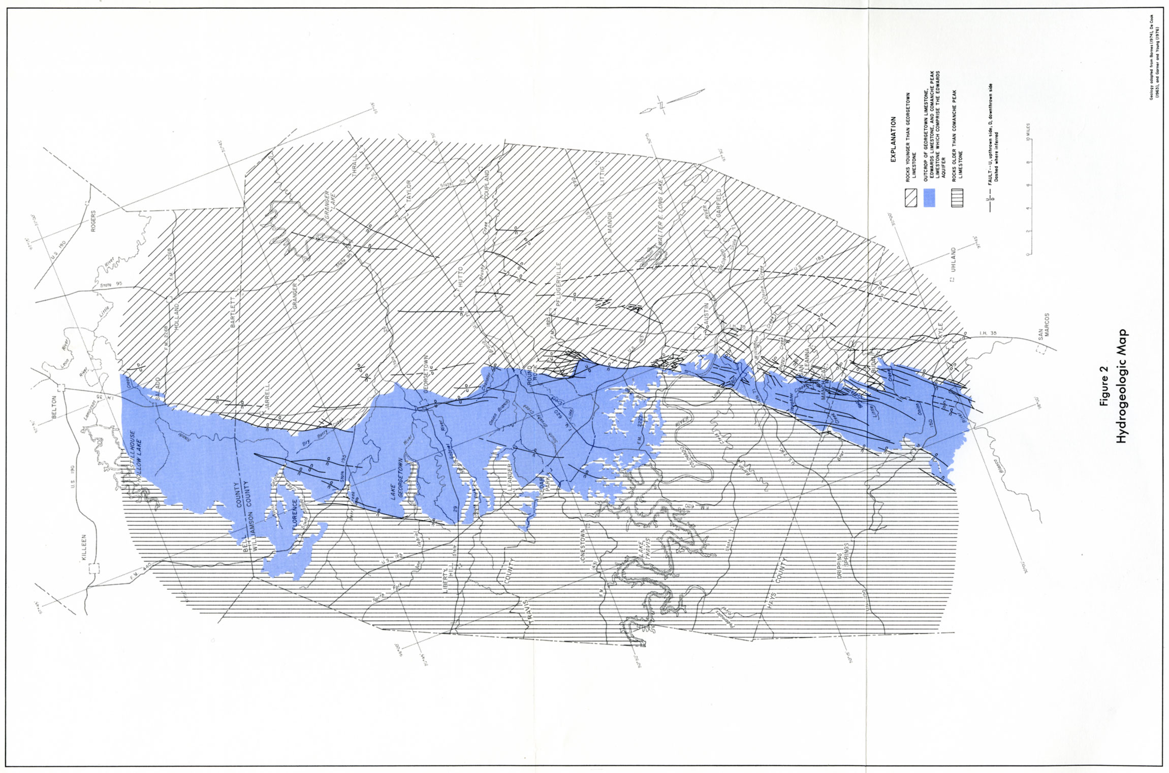
- Figure 2 Hydrogeologic Map
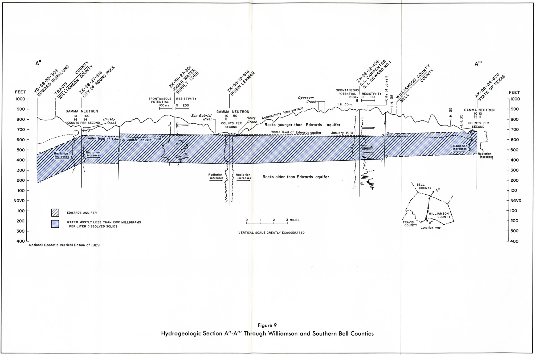
- Figure 9 Hydrogeologic section A"-A'" Through Williamson and Southern Bell Counties
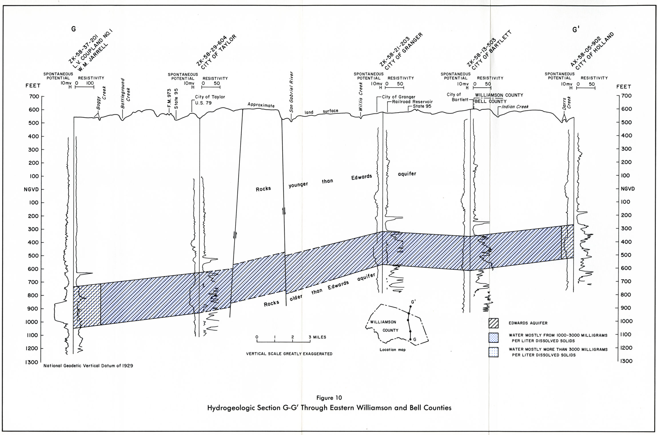
- Figure 10 Hydrogeologic section G"-G'" Through Eastern Williamson and Bell Counties
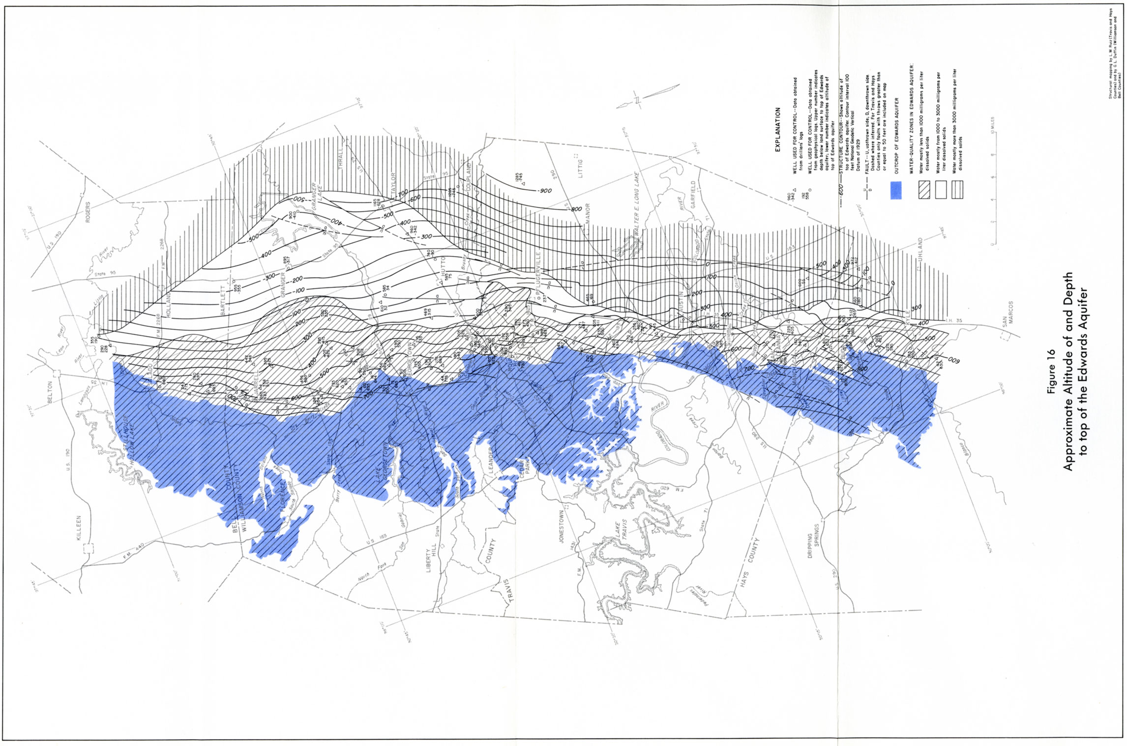
- Figure 16 Approximate Altitude of and Depth to top of the Edwards Aquifer
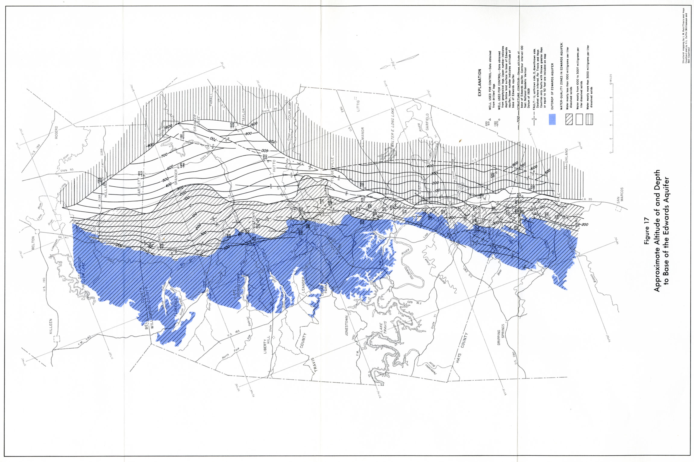
- Figure 17 Approximate Altitude of and depth to Base of the Edwards Aquifer
- Figure 18 Approximate Thickness of the Edwards Aquifer
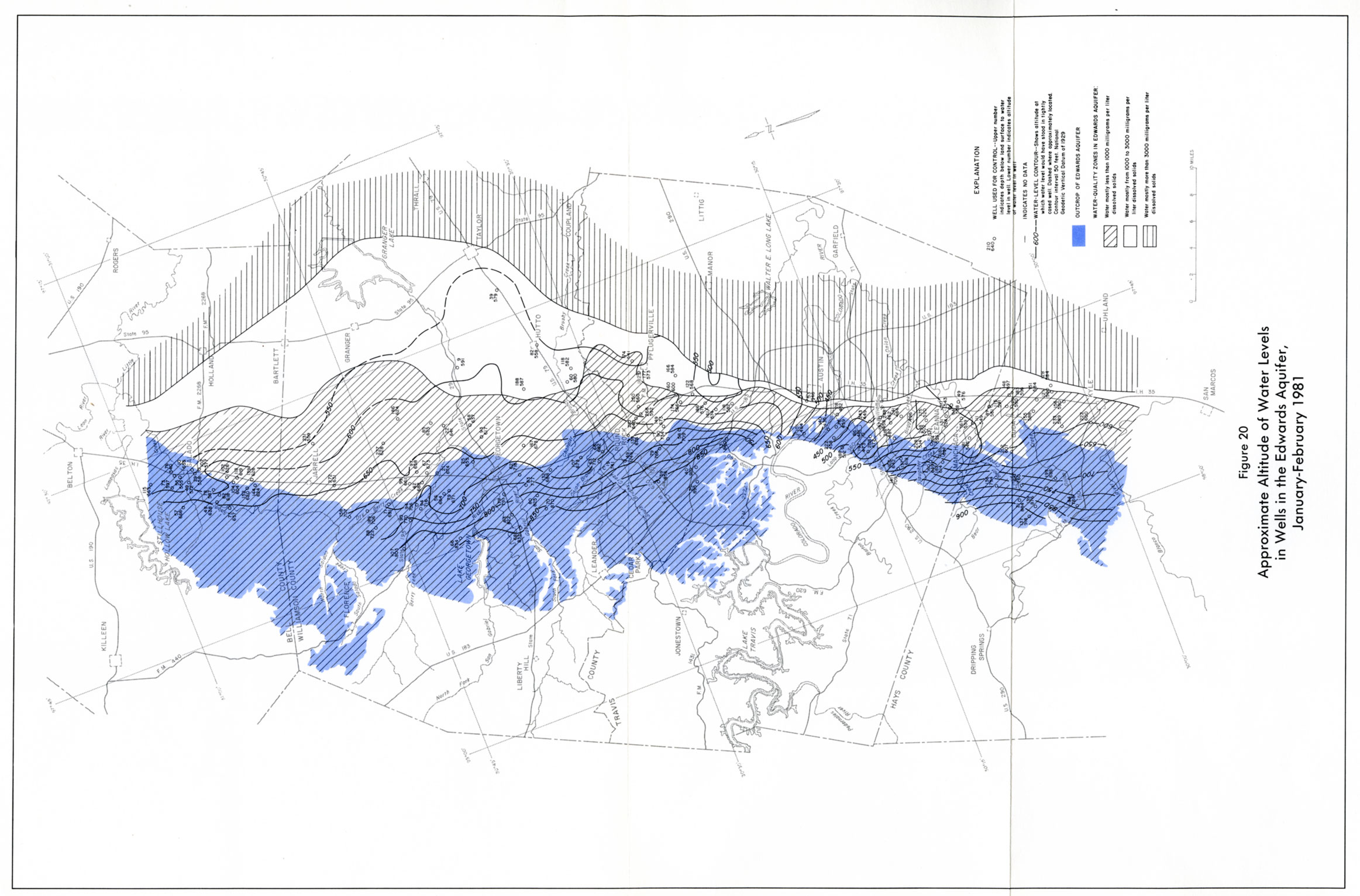
- Figure 20 Approximate Altitude of Water Levels in Wells in the Edwards Aquifer, January-February 1981
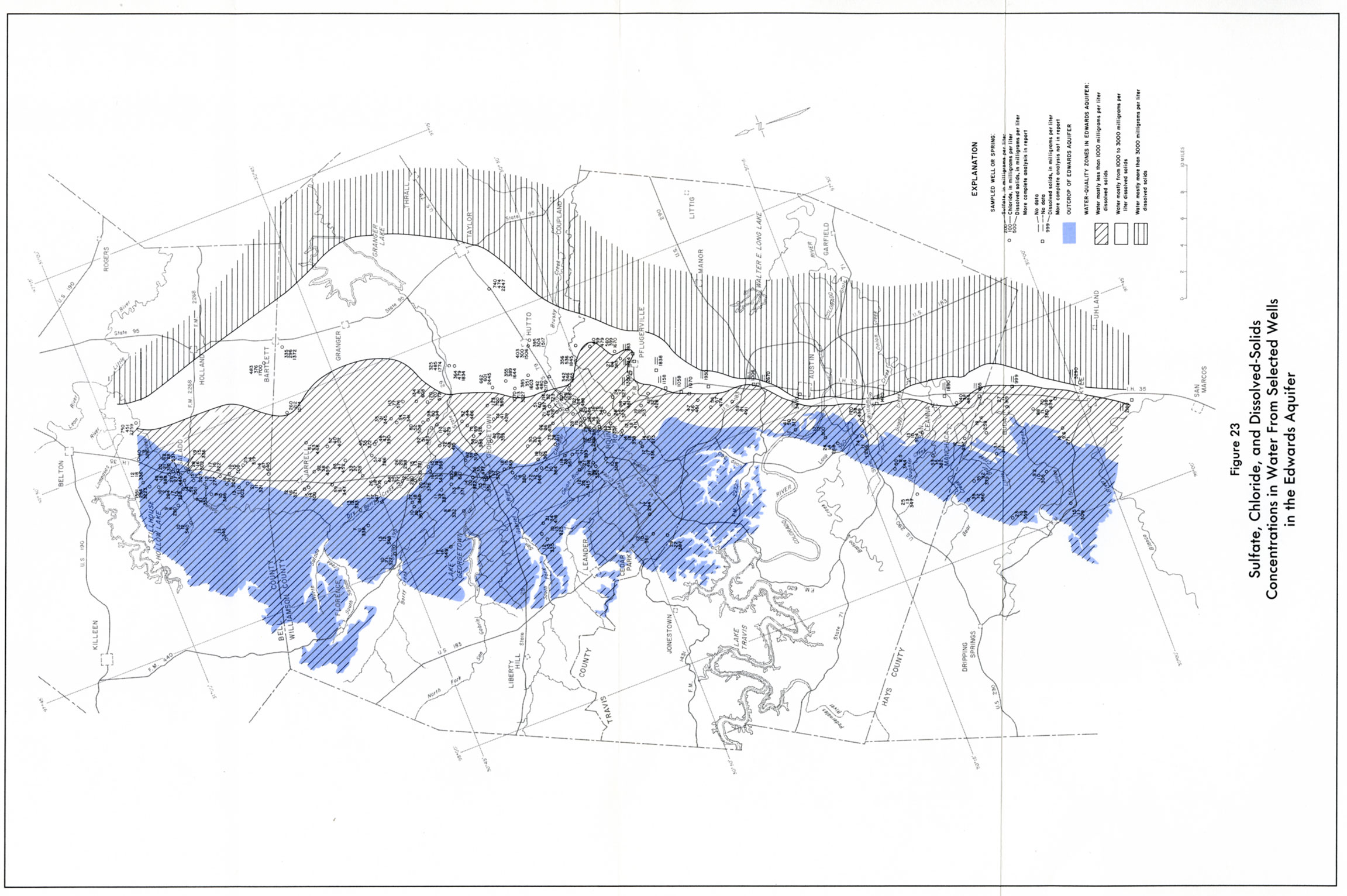
- Figure 23 Sulfate, Chloride, and Dissolved Solids Concentrations in Water From Selected wells in the Edwards Aquifer
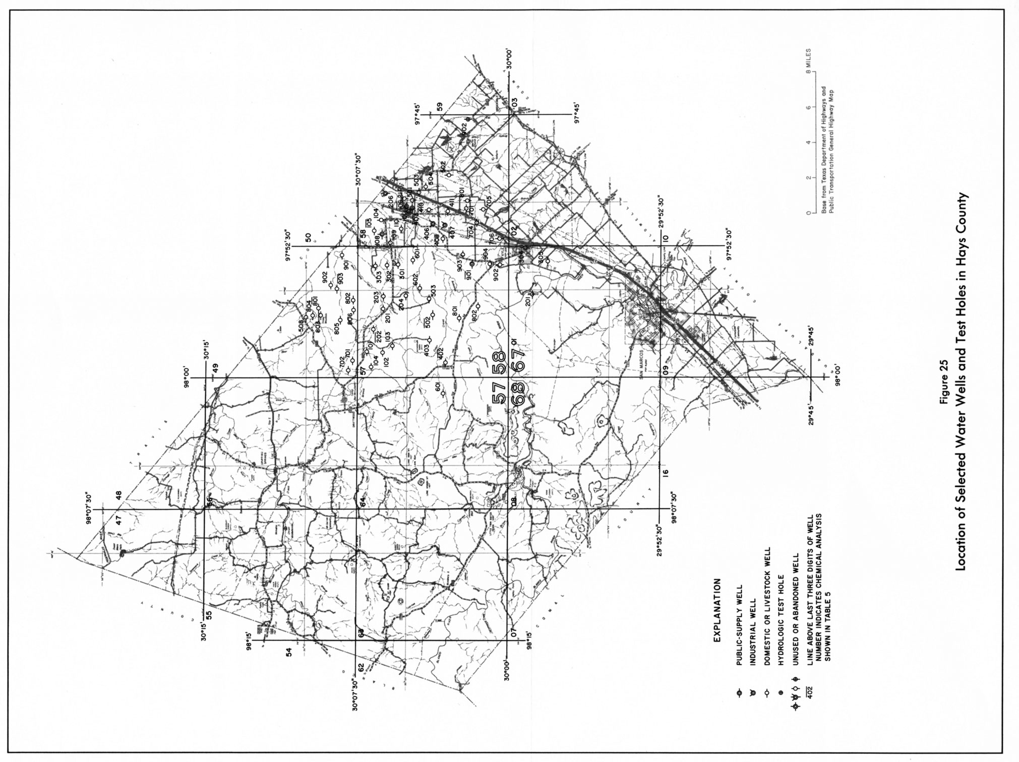
- Figure 25 Location of Selected Water Wells and Test Holes in Hays County
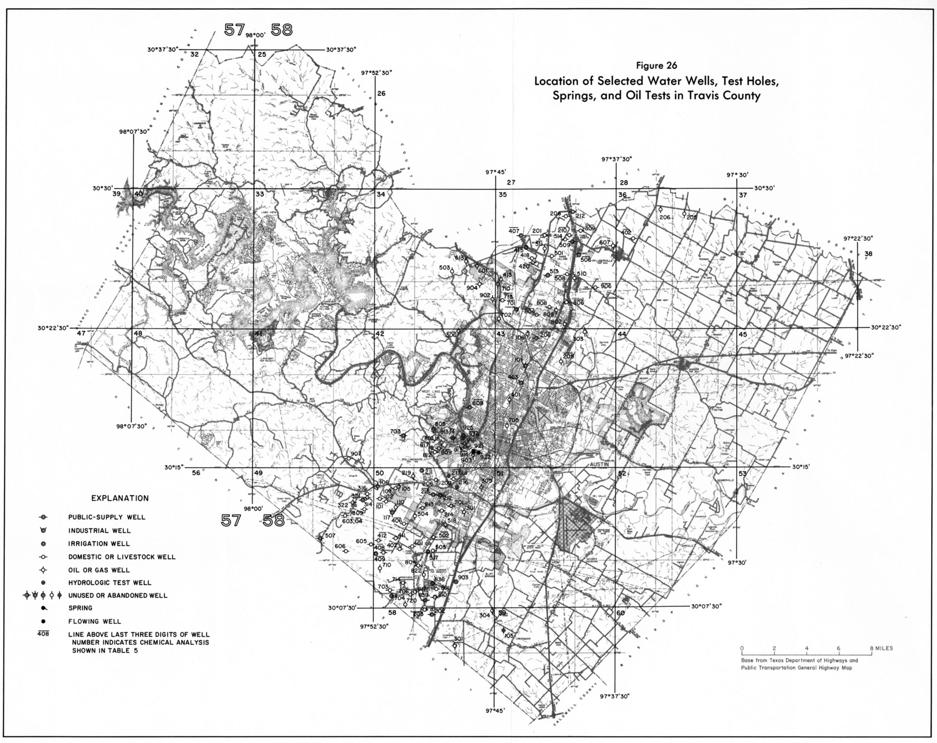
- Figure 26 Location of Selected Water Wells, Test Holes, Springs, and Oil Tests in Travis County
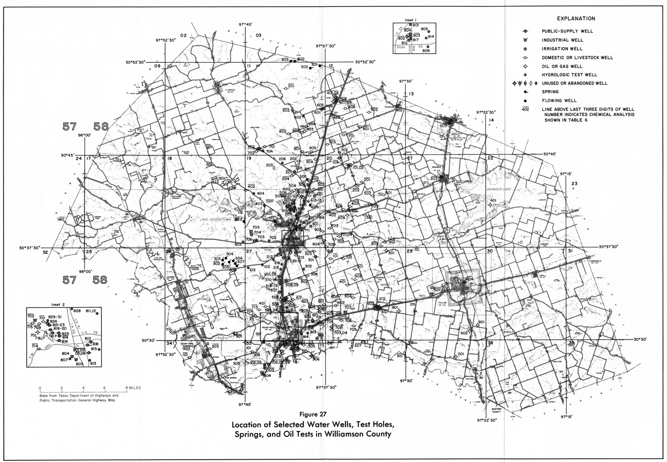
- Figure 27 Location of Selected Water Wells, Test Holes, Springs, and Oil Tests in Williamson County
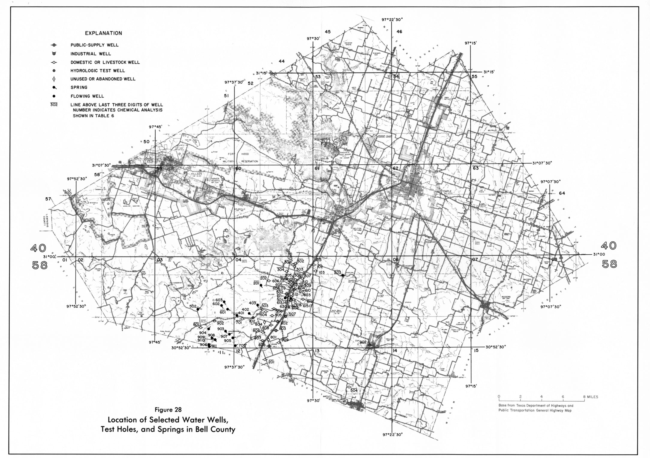
- Figure 28 Location of Selected Water Wells, Test Holes, and Springs in Bell County
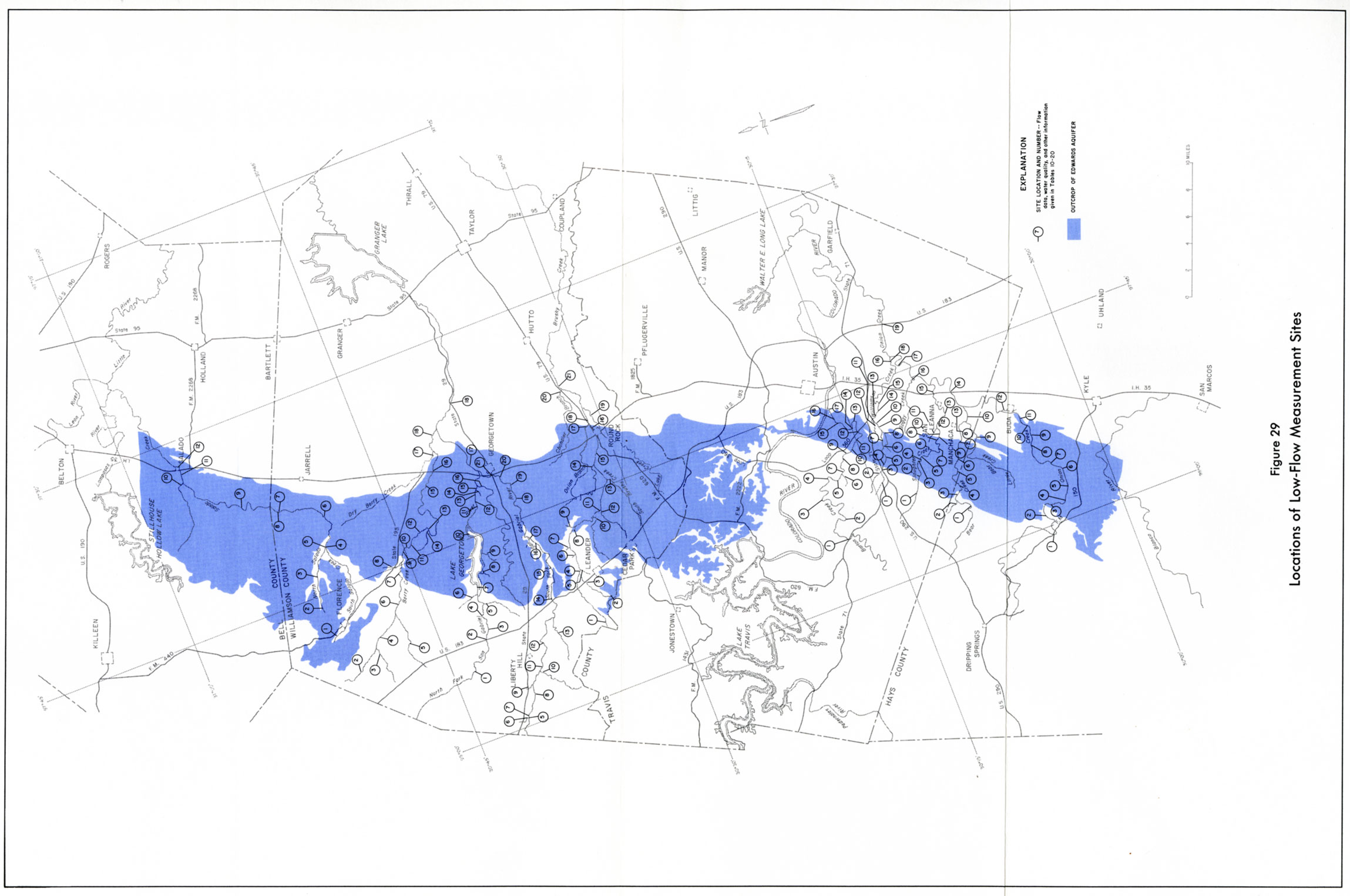
- Figure 29 Location of Low-Flow Measurement Sites