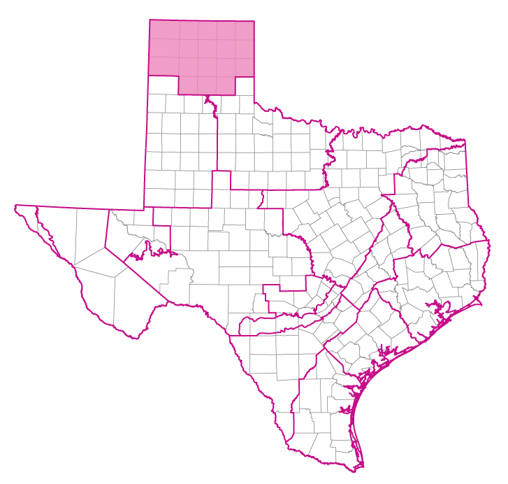
Groundwater Management Area 1
Groundwater Management Area 1 Webpage
Contact Information
Panhandle Regional Planning Commission
Alex Guerrero
Local Government Services Director
4415 Southwest Eighth Avenue
P.O. Box 9257
Amarillo, Texas 79105
Telephone: (806) 372-3381
Email: aguerrero@theprpc.org
2021 Joint Planning Desired future conditions and modeled available groundwater
Summary of Desired Future Conditions for GMA 1
Summary of Modeled Available Groundwater for GMA 1 by Groundwater Conservation District
Summary of Modeled Available Groundwater for GMA 1 by County
Groundwater Conservation Districts (4 either partially or completely included)
- Hemphill County Underground Water Conservation District
- High Plains Underground Water Conservation District No. 1
- North Plains Groundwater Conservation District
- Panhandle Groundwater Conservation District
Additional Groundwater Conservation District Information
Exempt Groundwater Use Estimates
Aquifers(either partially or completely included)
Minor Aquifers
Component Counties
GMA 1 Reports
| ID | Date | Type | Description |
|---|---|---|---|
| R-111 | 03/11/1970 | TWDB numbered report | An Investigation of Clouds and Precipitation for the Texas High Plains |
| R-116 | 05/01/1970 | TWDB numbered report | Quantity and Chemical Quality of Low Flow in the Prairie Dog Town Fork Red River near Wayside, Texas, February 6-9,1968 |
| R-288 | 05/01/1984 | TWDB numbered report | Evaluating the Ground-Water Resources of the High Plains of Texas, Volumes 1-4 |
| R-341 | 09/01/1993 | TWDB numbered report | The High Plains Aquifer System of Texas, 1980 to 1990 - Overview and Projections |
| R-315 | 11/01/1989 | TWDB numbered report | Evaluation of Ground-Water Resources in Dallam County, Texas |
| R-355 | 01/01/2003 | TWDB numbered report | Evaluation of Enhanced Recharge Potential to the Ogallala Aquifer in the Brazos River Basin, Hale County, Texas |
| R-357 | 08/01/2003 | TWDB numbered report | Characterization of Playa Basins on the High Plains of Texas |
| R-359 | 12/01/2003 | TWDB numbered report | The Groundwater Resources of the Dockum Aquifer in Texas |
| HA-10 | 01/01/1998 | Hydrologic atlas | Updated Water-Quality Evaluation of the Ogallala Aquifer, Including Selected Metallic and Non-Metallic Inorganic Constituents |
| R-010 | 12/01/1965 | TWDB numbered report | Studies of Playa Lakes in the High Plains of Texas |
| R-096 | 06/01/1969 | TWDB numbered report | A Statistical Study of the Depth of Precipitable Water in Western Texas and Eastern New Mexico |
| GMA1_DFC_01 | 07/07/2009 | DFC submission | Desired future conditions for the Ogallala and Rita Blanca aquifers |
| GMA1_DFC_02 | 06/03/2010 | DFC submission | Desired future conditions for the Blaine and Dockum aquifers |
| R-337 | 03/01/1992 | TWDB numbered report | Evaluation of Water Resources in Parts of the Rolling Prairies Region of North-Central Texas |
| R-342 | 08/01/1993 | TWDB numbered report | Water-Quality Evaluation of the Ogallala Aquifer, Texas |
| HA-01 | 01/01/1991 | Hydrologic atlas | Water-Level Changes in the High Plains Aquifer of Texas, 1980-1990 |
| R-376 | 05/01/2011 | TWDB numbered report | Water Quality in the Blaine Aquifer |
| GR11-014_MP | 10/04/2011 | GAM run - Management Plan | Management plan information for Hemphill County UWCD |
| GR11-009_MP | 06/24/2011 | GAM run - Management Plan | Management plan information for High Plains UWCD No. 1 |
| GT11-010 | 06/14/2011 | GAM task | Total pumping estimates for the Ogallala, Edwards-Trinity (High Plains), and Dockum aquifers in High Plains UWCD No. 1 |
| GR09-014 | 09/21/2010 | GAM run | Predictive simulation for the Dockum Aquifer in Groundwater Management Area 1 |
| GR09-014_Add | 09/21/2010 | GAM run | Predictive simulations for the Dockum Aquifer in Groundwater Management Area 1 |
| GR09-006_MP | 03/17/2009 | GAM run - Management Plan | Management plan information for High Plains UWCD No. 1 |
| GR09-003_MP | 01/23/2009 | GAM run - Management Plan | Management plan information for High Plains UWCD No. 1 |
| GR09-001 | 02/17/2009 | GAM run | Predictive simulations for the Ogallala Aquifer in Groundwater Management Area 1 |
| GR09-001_S | 02/26/2009 | GAM run | Predictive simulations for the Ogallala Aquifer in Groundwater Management Area 1 |
| GR08-063_MP | 09/24/2008 | GAM run - Management Plan | Management plan information for High Plains UWCD No. 1 |
| GR08-028_MP | 05/16/2008 | GAM run - Management Plan | Management plan information for Panhandle GCD |
| GR08-016 | 07/31/2008 | GAM run | Predictive simulations for the Ogallala Aquifer in Groundwater Management Area 1 |
| GR08-016_S | 09/30/2008 | GAM run | Predictive simulations for the Ogallala Aquifer in Groundwater Management Area 1 |
| GR07-038_Rev1 | 01/15/2008 | GAM run | Volume calculations for the Ogallala Aquifer in Groundwater Management Area 1 |
| GR07-031 | 11/11/2007 | GAM run | Volume calculations and pump rates for the Ogallala Aquifer in Groundwater Management Area 1 |
| GR07-019 | 08/10/2007 | GAM run | Analysis using specified depletions for districts in Groundwater Management Area 1 |
| GR07-006_MP | 03/27/2007 | GAM run - Management Plan | Management plan information for North Plains GCD |
| GR07-001 | 01/22/2007 | GAM run | Volume calculations for the Ogallala Aquifer in Groundwater Management Area 1 |
| GR06-025 | 11/02/2006 | GAM run | Volume calculations for the Ogallala Aquifer in Groundwater Management Area 1 |
| GR05-026 | 09/01/2005 | GAM run | Water budget and GIS information for the Ogallala Aquifer in Hemphill County |
| GR05-021 | 06/20/2005 | GAM run | Saturated thickness shapefile for the Ogallala Aquifer in Hemphill County |
| GR05-021_Att | 06/20/2005 | GAM run | Saturated thickness shapefile for the Ogallala Aquifer in Hemphill County (zip file) |
| GR05-017 | 05/16/2005 | GAM run | Saturated thickness maps for the Blaine and Seymour aquifers in Region A |
| GR05-016 | 06/12/2005 | GAM run | Saturated thickness maps for the Ogallala Aquifer in Region A |
| GR05-011 | 03/04/2005 | GAM run | Groundwater volumes for the Ogallala Aquifer in Randall and Oldham counties |
| GR05-010 | 03/03/2005 | GAM run | Comparison of groundwater volumes between GR 04-13 and GR 05-09 for the Ogallala Aquifer in Region A |
| GR05-009 | 02/28/2005 | GAM run | Saturated thickness, groundwater volumes, and water level maps for the Ogallala Aquifer in Region A |
| GR05-012 | 04/08/2005 | GAM run | Various pumping scenarios for the Ogallala Aquifer in Hemphill County |
| GR04-022 | 03/04/2005 | GAM run | Volume in storage for Seymour and Baline aquifers in Childress, Collingsworth, Hall, and Wheeler counties |
| GR04-016 | 03/21/2005 | GAM run | Water budget and volume of water in storage for Hemphill County using a predictive simulation |
| GR04-015 | 10/21/2004 | GAM run | Saturated thickness map for the Ogallala (north) Aquifer |
| GR04-014 | 09/22/2004 | GAM run | Recharge rates per model cell in the Ogallala (north) Aquifer GAM |
| GR04-014_Att | 09/22/2004 | GAM run | Recharge data for GAM run 04-014 |
| GR04-013 | 09/22/2004 | GAM run | Groundwater in storage for Region A using a 1.25% annual depletion rate |
| GR04-012 | 10/01/2004 | GAM run | Hydraulic conductivity data for the Ogallala Aquifer GAMs |
| GR04-002 | 04/30/2004 | GAM run | Determine pumping rate equivalent to a volume depletion rate of no more than 1% per year |
| GR11-021_MP | 01/27/2012 | GAM run - Management Plan | Panhandle GCD Management Plan |
| GR10-020_MAG | 06/22/2011 | GAM run - MAG | Managed available groundwater for the Blaine Aquifer in Groundwater Management Area 1 |
| GR09-026_MAG | 06/22/2011 | GAM run - MAG | Managed available groundwater for the Ogallala Aquifer in Groundwater Management Area 1 |
| GR12-003_MP | 07/02/2012 | GAM run - Management Plan | Management plan data for North Plains GCD |
| GR12-005_MAG | 08/21/2012 | GAM run - MAG | Modeled available groundwater for the Ogallala Aquifer in Groundwater Management Area 1 |
| CR-0704830686 | 01/01/2009 | Contract report | Groundwater Recharge in the Central High Plains of Texas: Roberts and Hemphill Counties |
| GR10-019_MAG_Ver2 | 08/30/2011 | GAM run - MAG | Managed available groundwater for the Dockum Aquifer in Groundwater Management Area 1 |
| GR07-038_Ver2 | 01/05/2008 | GAM run | Volume calculations for the Ogallala Aquifer in Groundwater Management Area 1 |
| GR05-013_Ver2 | 05/17/2012 | GAM run | Saturated thickness maps for the Ogallala Aquifer in Region A |
| GR12-003_MP_Ver2 | 09/17/2012 | GAM run - Management Plan | Revised management plan data for North Plains GCD |
| GT13-025_TERS | 08/20/2013 | GAM task - Total Estimated Recoverable Storage | Total Estimated Recoverable Storage for aquifers in Groundwater Management Area 1 |
| GT13-042_TERS | 11/01/2013 | GAM task - Total Estimated Recoverable Storage | Total Estimated Recoverable Storage by county for aquifers in High Plains UWCD No. 1 |
| GT15-006_TERS | 12/17/2015 | GAM task - Total Estimated Recoverable Storage | Total Estimated Recoverable Storage for aquifers in Groundwater Management Area 1 |
| GR16-001_MP | 04/28/2016 | GAM run - Management Plan | Management plan information for Panhandle GCD |
| GR16-010 | 10/31/2016 | GAM run | Management Plan Information for Hemphill County UWCD |
| GR17-008_MP | 04/07/2017 | GAM run - Management Plan | Management plan information for North Plains GCD |
| GR16-029_MAG | 04/20/2017 | GAM run - MAG | Modeled available groundwater for the aquifers in GMA 1 |
| GR19-002_MP | 3/1/2019 | GAM run - Management Plan | Management plan information for High Plains UWCD #1 |
| GR22-001_MP | 2/2/2022 | GAM run - Management Plan | Management plan information for Hemphil County UWCD |
| GR22-015_MP | 1/13/2023 | GAM run - Management Plan | Management plan information for North Plains GCD |
| GR21-007_MAG | 2/28/2023 | GAM run - MAG | Modeled available groundwater estimates for the High Plains Aquifer System in Groundwater Management Area 1 |
| GR24-003_MP | 04/02/2024 | GAM run - Management Plan | Management plan information for Panhandle Groundwater Conservation District |
| GR24-006_MP | 05/20/2024 | GAM run - Management Plan | Management plan information for High Plains UWCD #1 |