2002 State Water Plan
Approved 2001 Regional Water Plans
Many of the following files are Adobe Acrobat PDFs.
Volume 1:
- Table of Contents and Chapter 1 (PDF 861KB) (Word file)
- Chapter 2 - 4 (PDF 806KB) (Word file)
- Chapter 5 (PDF 8,435KB) (Word file)
- Chapter 6 - 8 (PDF 2,641KB) (Word file)
- Chapter 9-10 (PDF 256K) (Word file)
- Chapter 11 (PDF 5,474KB) (Word file)
- Chapter 12-14 (PDF 3,143KB) (Word file)
- Appendix 1 (PDF 396KB) (Word file)
- Volume 1 - Entire Document (PDF 15,700KB)
- Volume 1 - Word Document (.DOC 12,310KB)
Volume 2
- Downloadable WinZip file of Volume 2
Volume 3
Individual Graphic Files from the State Water Plan. Clicking on the links below will bring up a message box allowing you to download the individual graphics in Jpeg format:
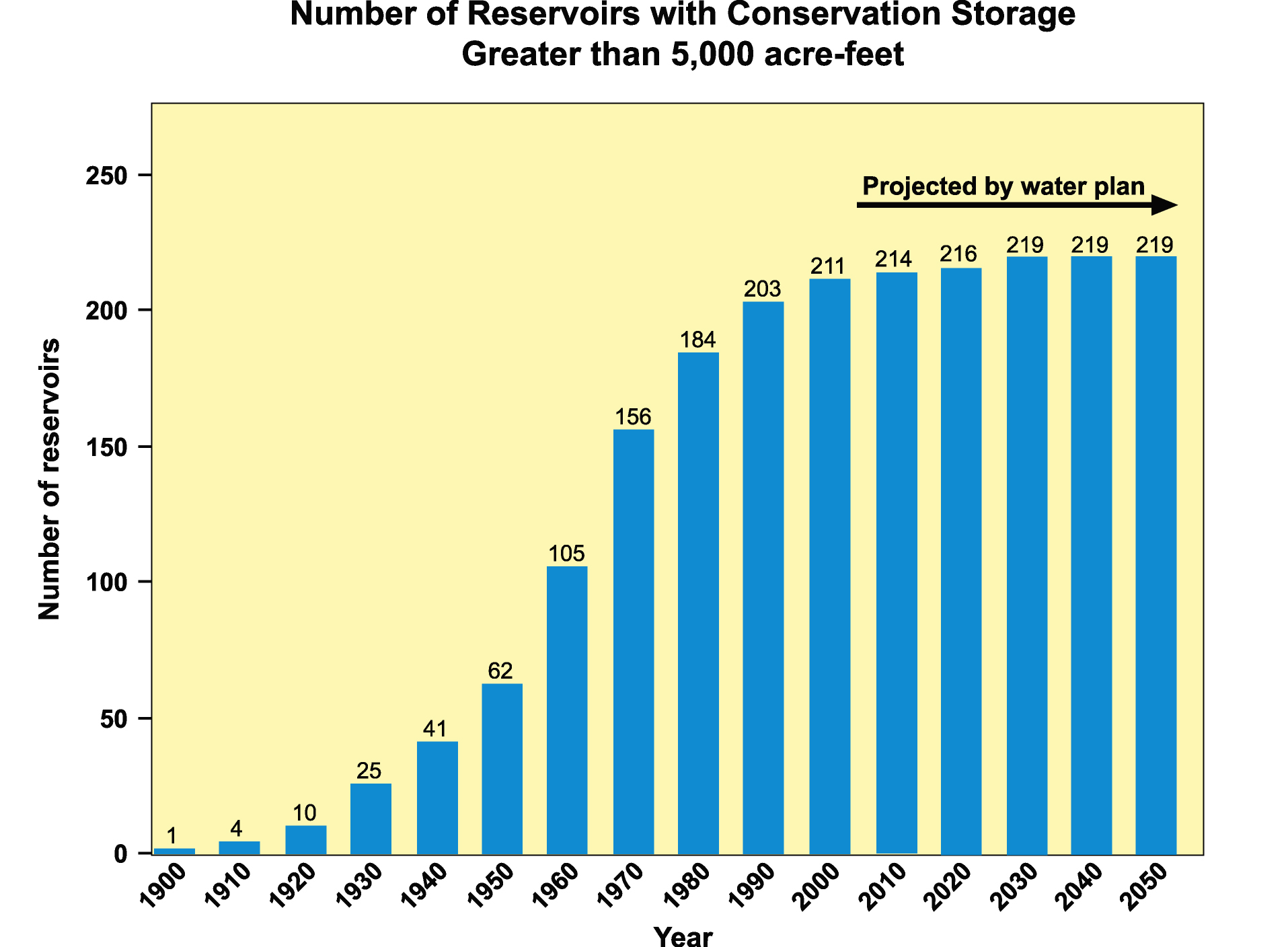
- 3-1 History and projected future of reservoir development in Texas
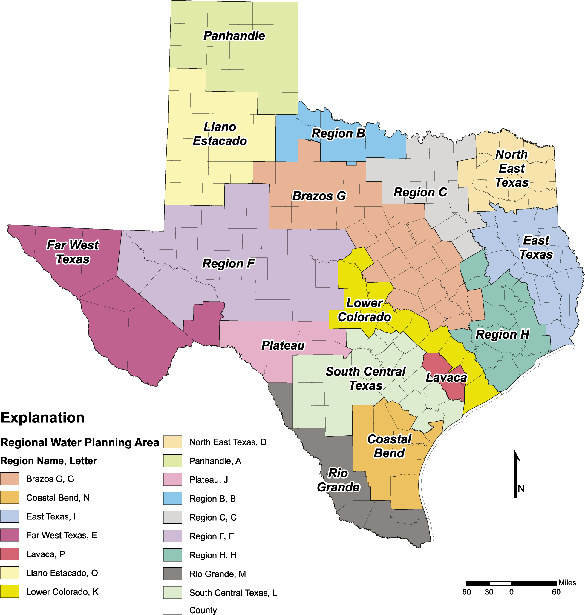
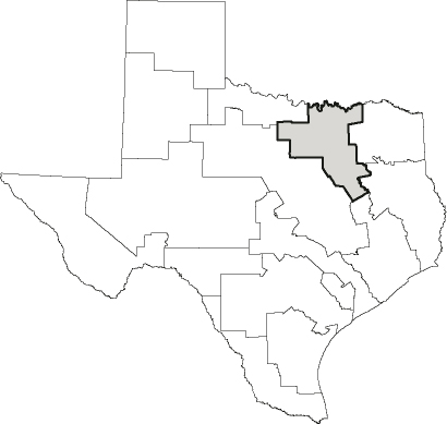
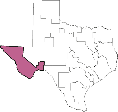
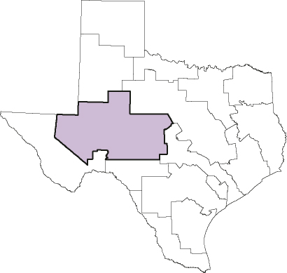
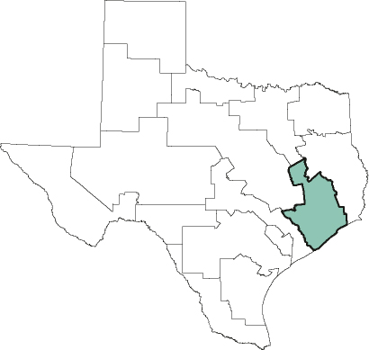
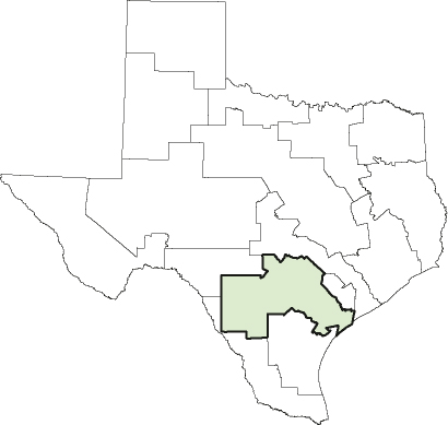
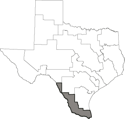
- 4-1 Location of the 16 regional water planning areas in Texas
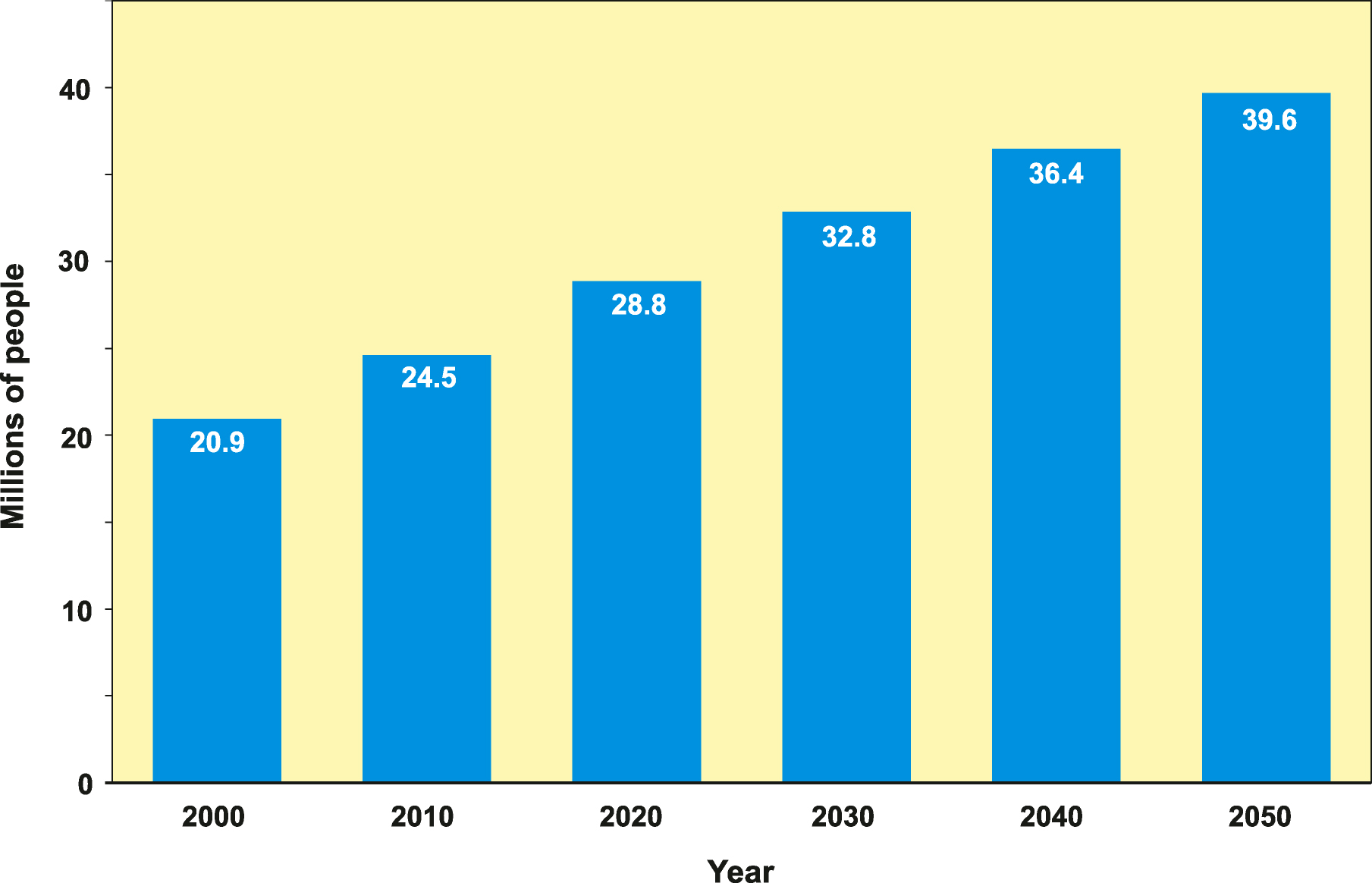
- 5-1 Projected population growth in Texas
- 5-2 Numerical difference between TWDB’s projection for 2000 and the 2000 Census
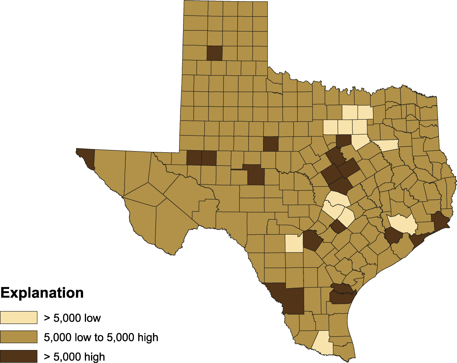
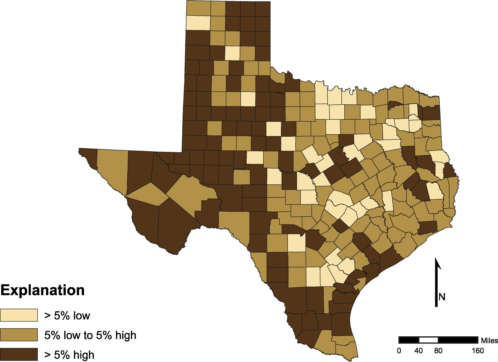
- 5-3 Percent difference between TWDB’s projection for 2000 and the 2000 Census
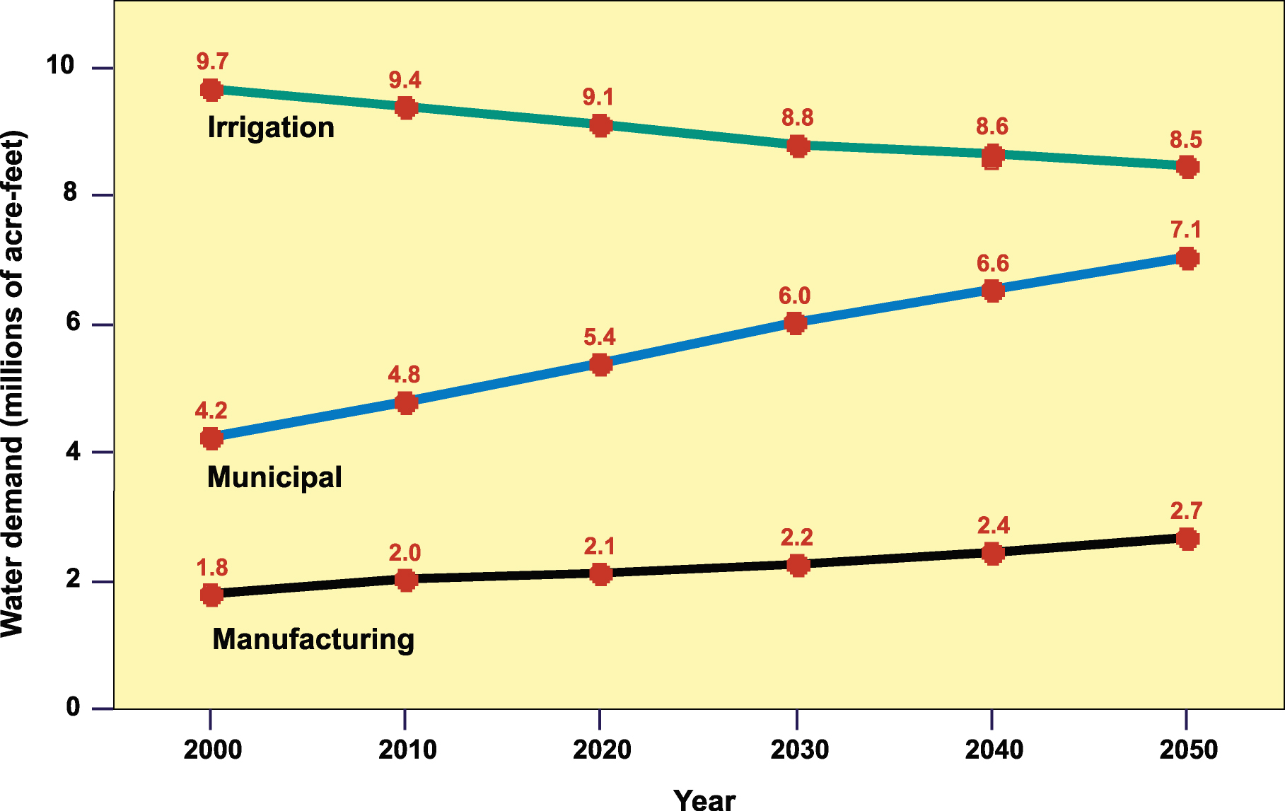
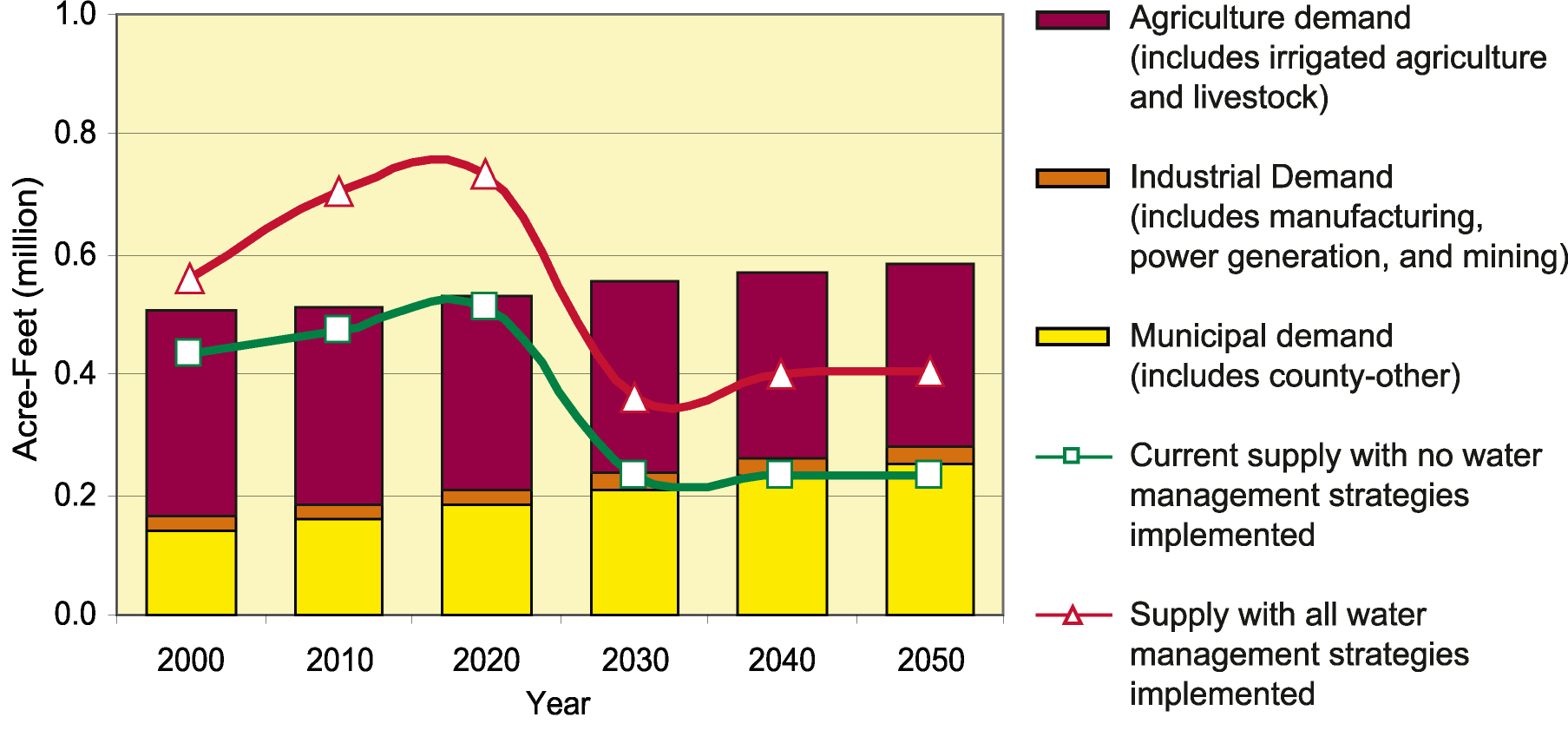
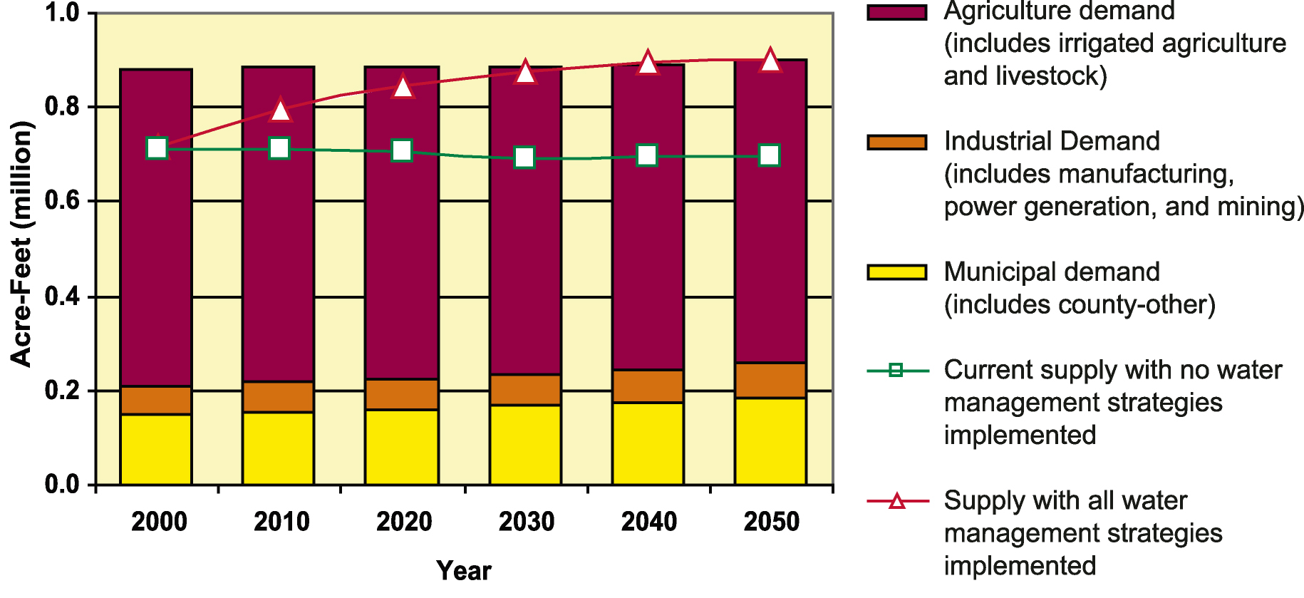
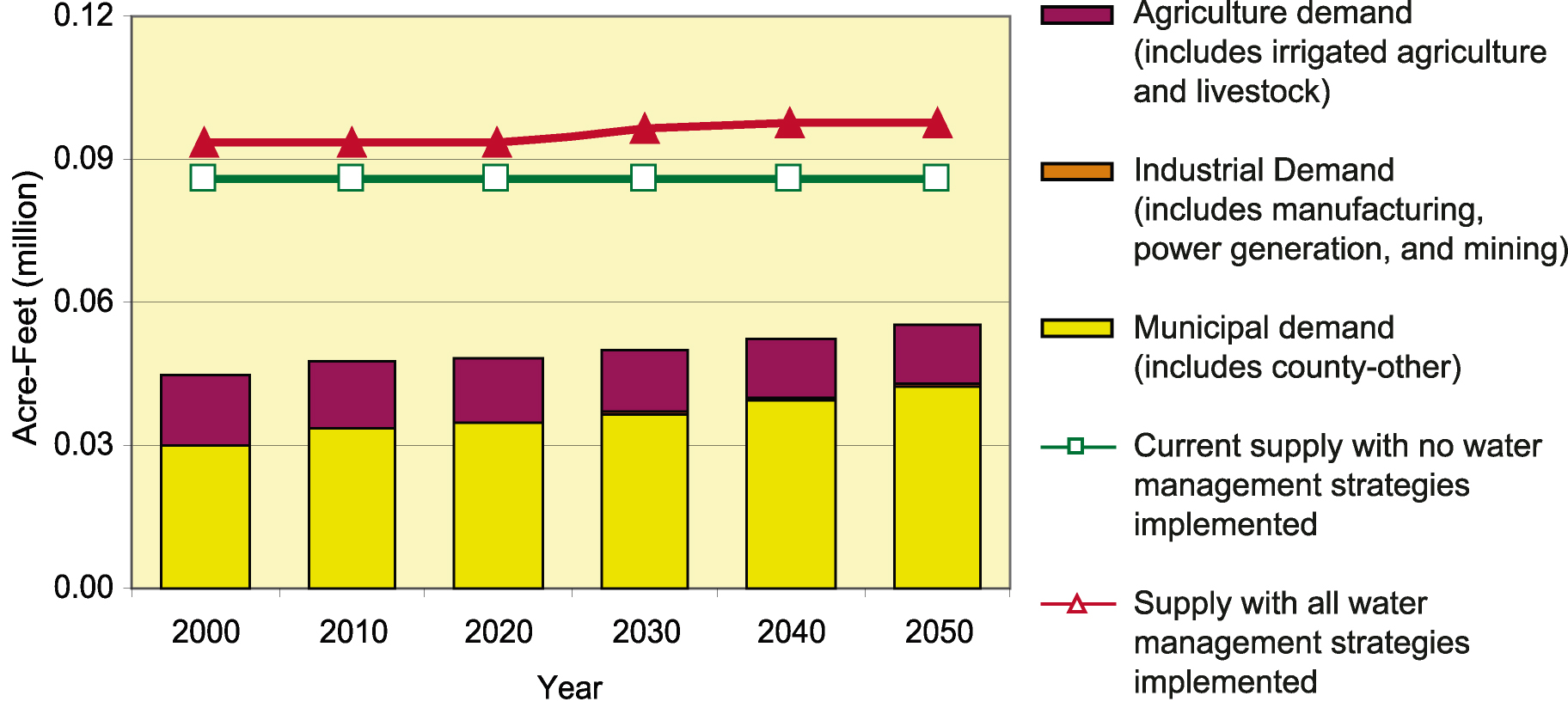
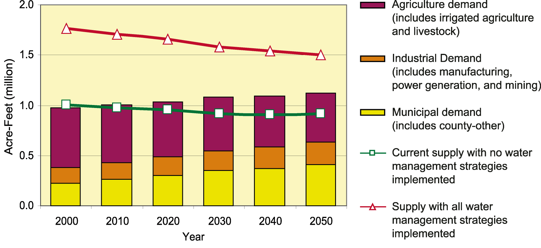
- 5-4 Projected water demand for irrigation, municipal, and manufacturing water uses during drought
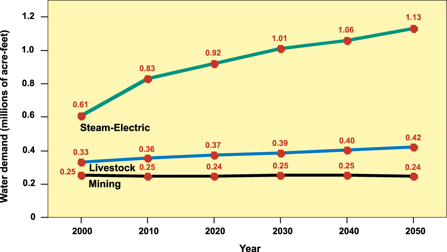
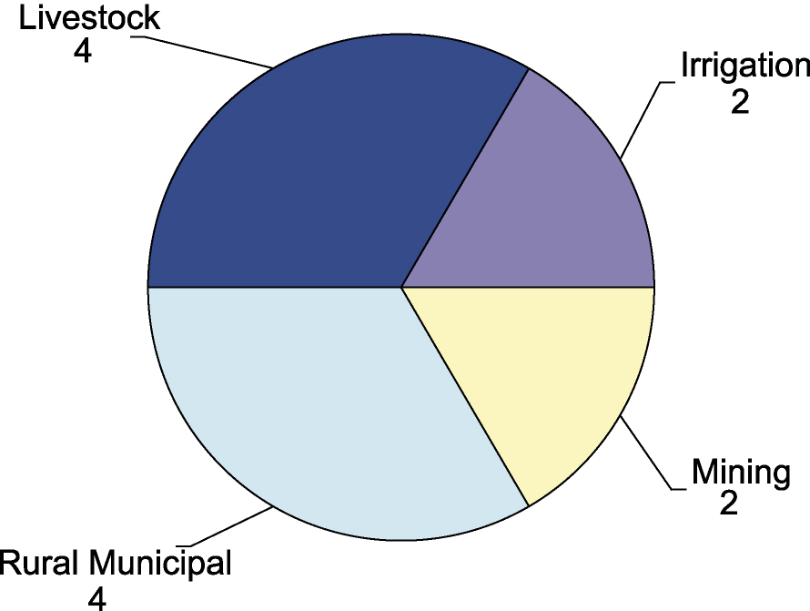
- 5-5 Projected water demand for steam-electric, livestock, and mining water uses during drough
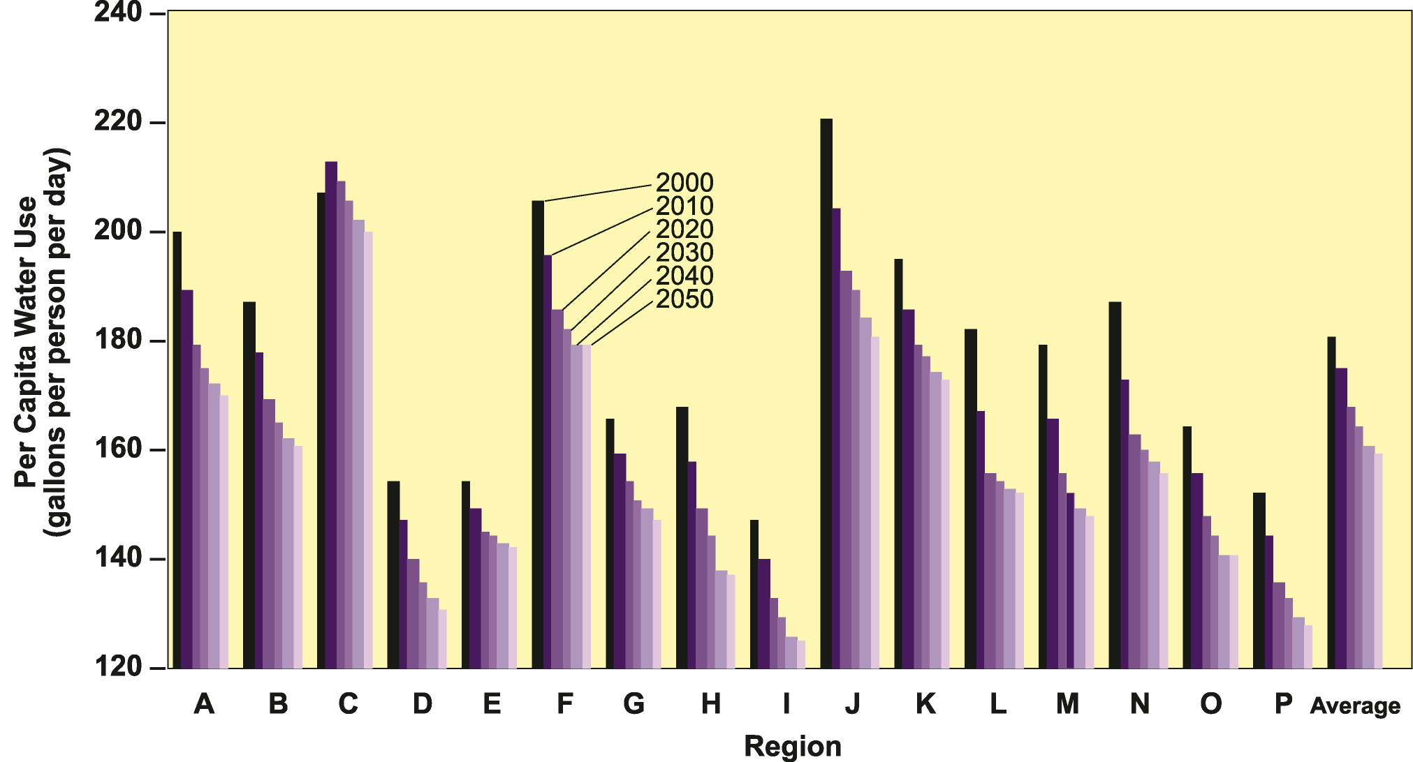
- 5-6 Regional per capita water demand projections for 2000-2050
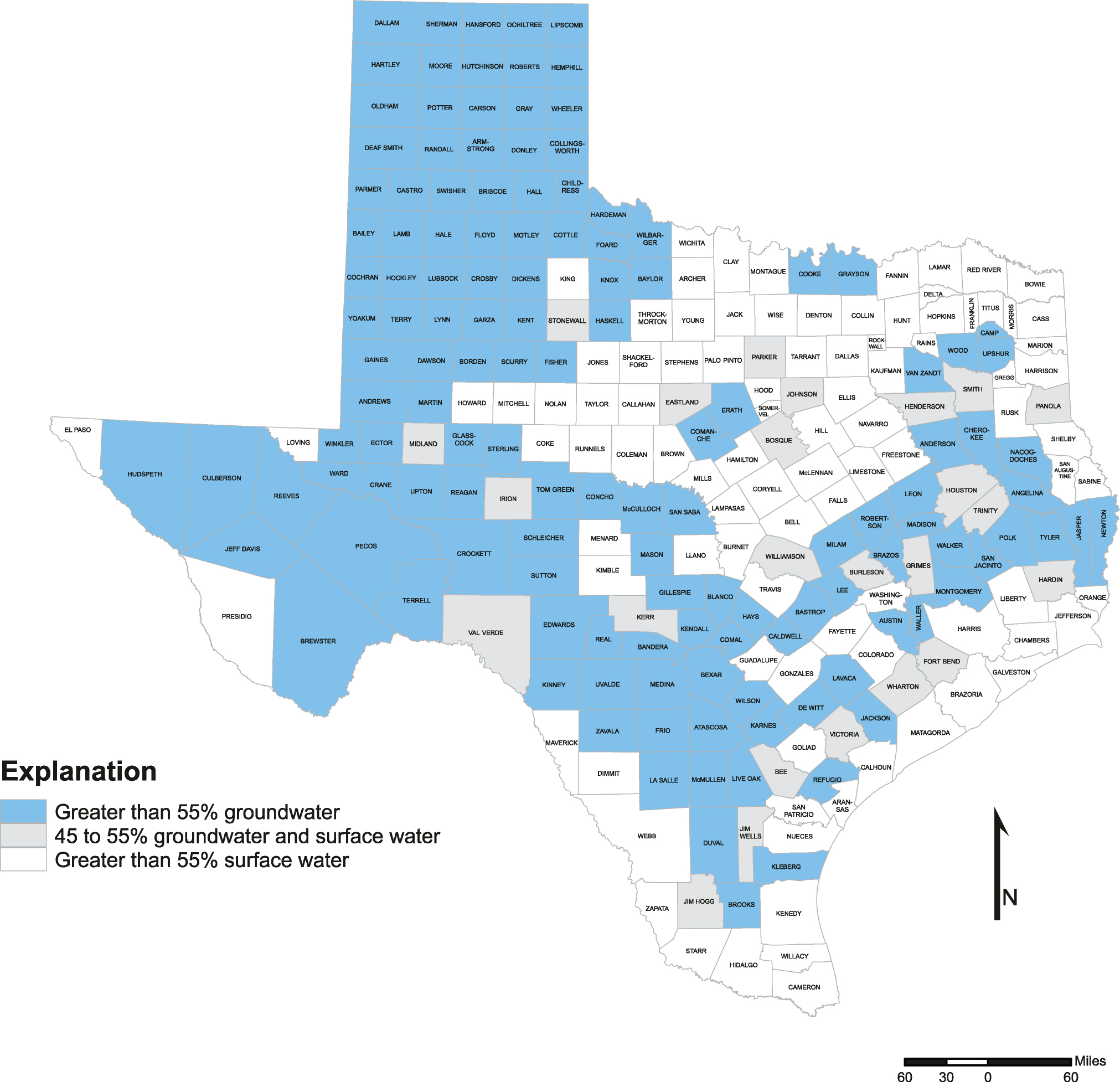
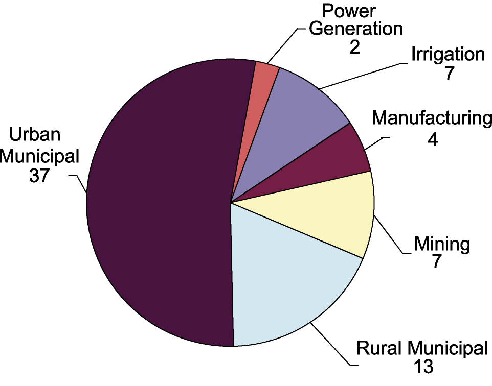
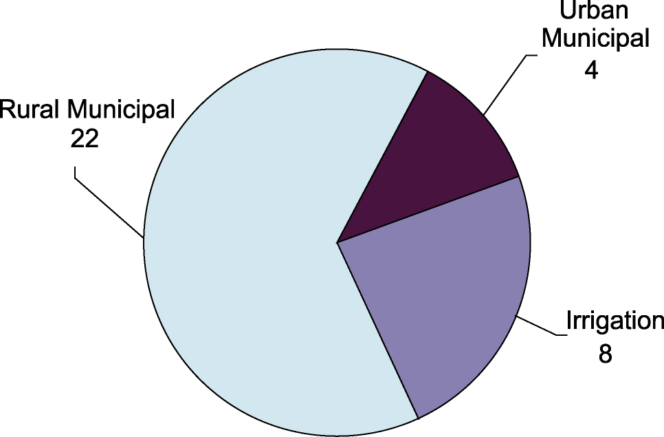
- 5-7 Analysis of total 1999 water use by county in Texas, illustrating dominant supply source
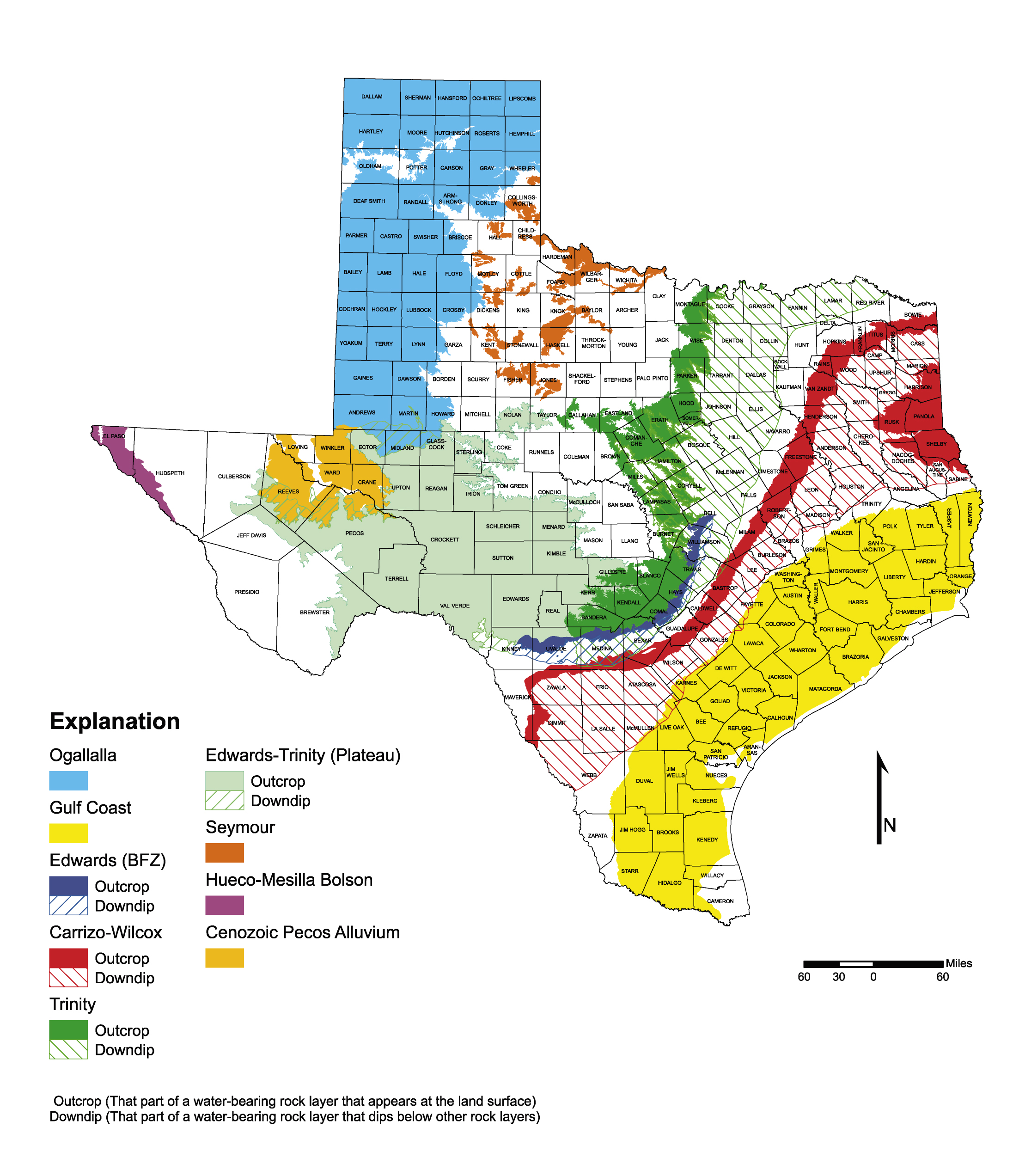
- 5-8 The major aquifers of Texas
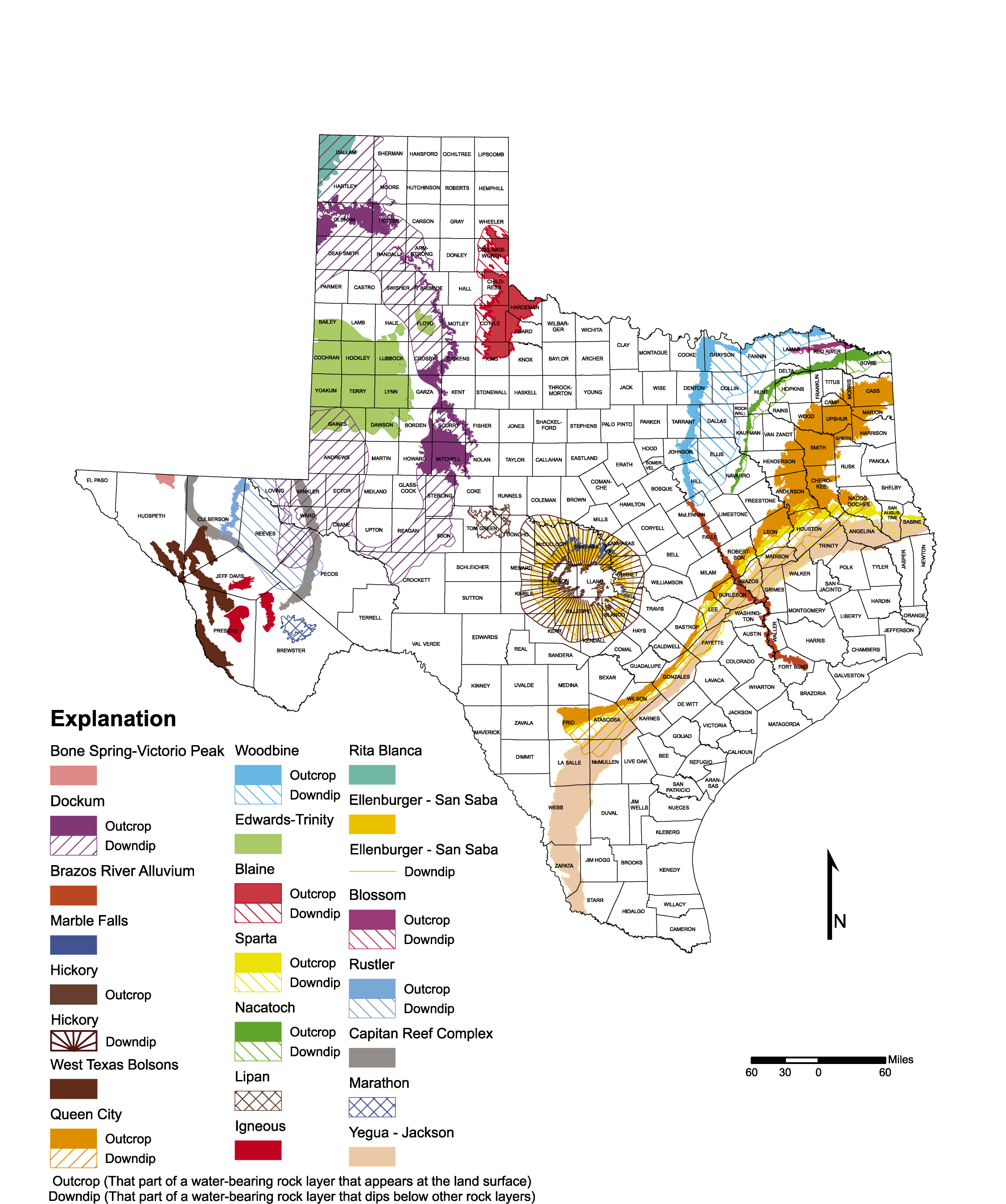
- 5-9 The minor aquifers of Texas
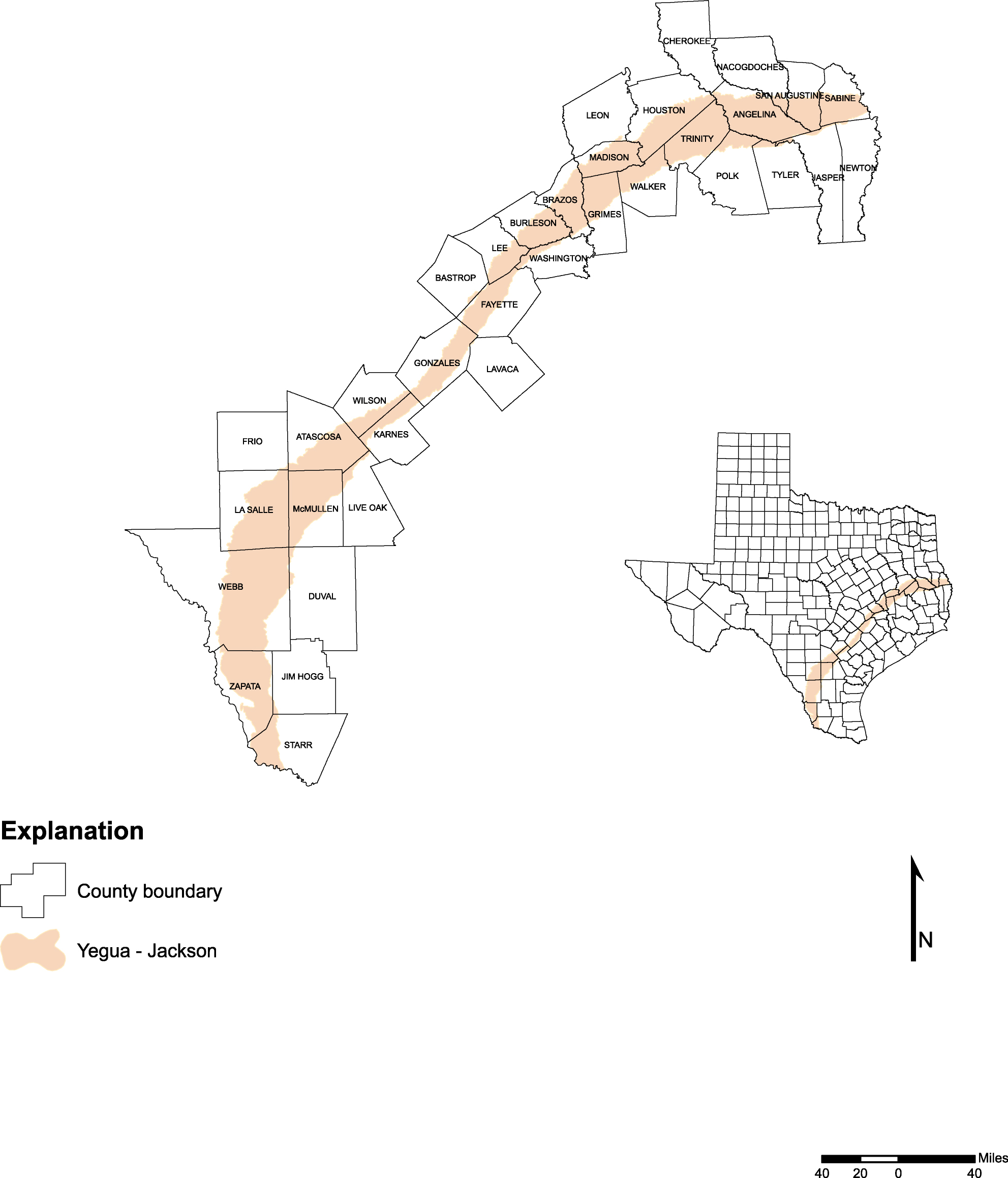
- 5-10 Location of the Yegua-Jackson aquifer in Texas
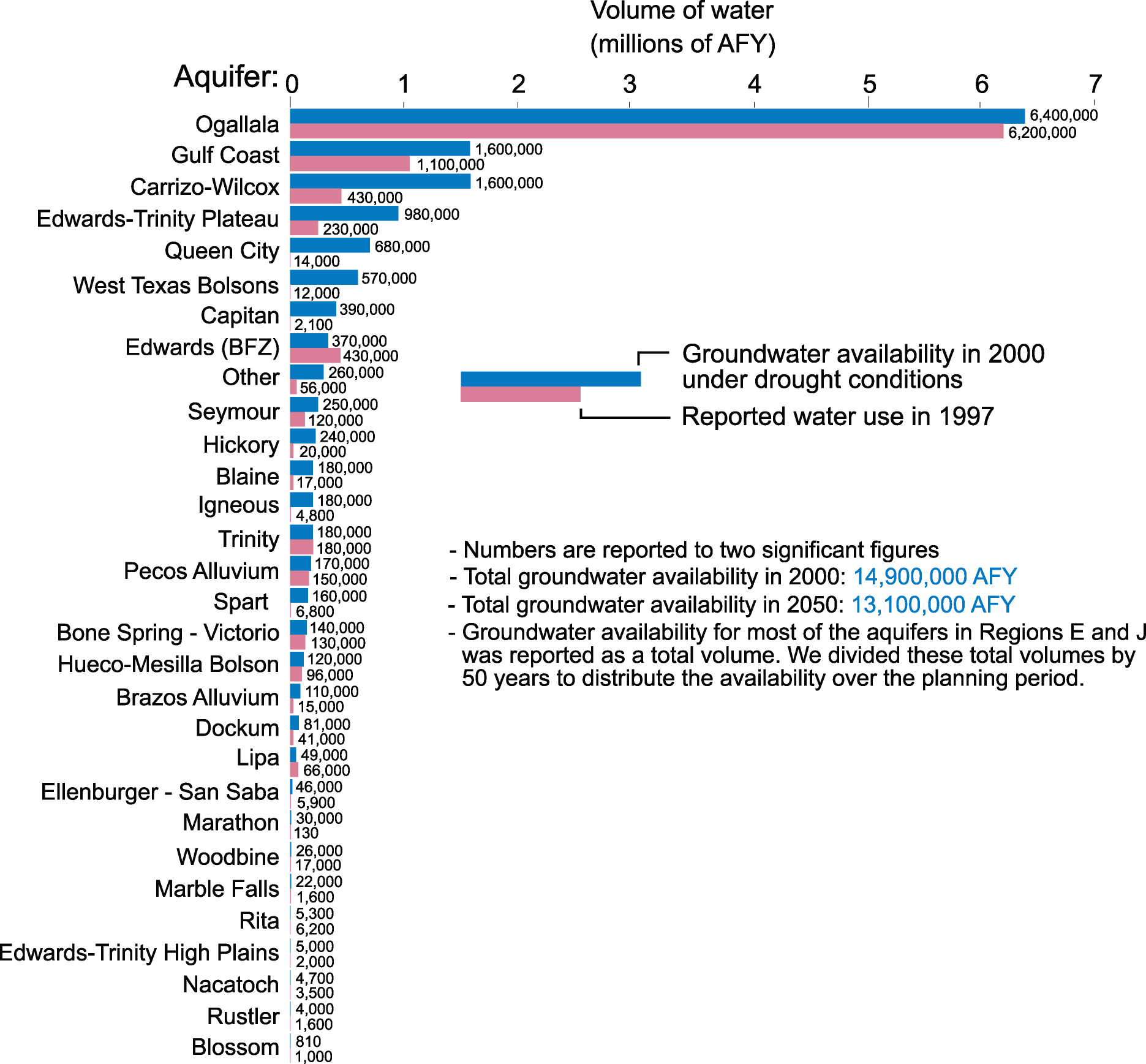
- 5-11 Groundwater availability for aquifers of Texas under drought conditions, as reported by Planning Groups
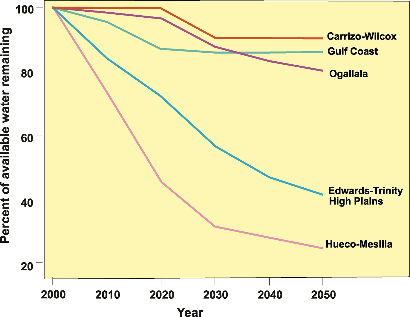
- 5-12 Percent of available groundwater remaining for the Carrizo-Wilcox, Gulf Coast,Ogallala, Edwards-Trinity High Plains, and Hueco-Mesilla Bolson aquifers through 2050
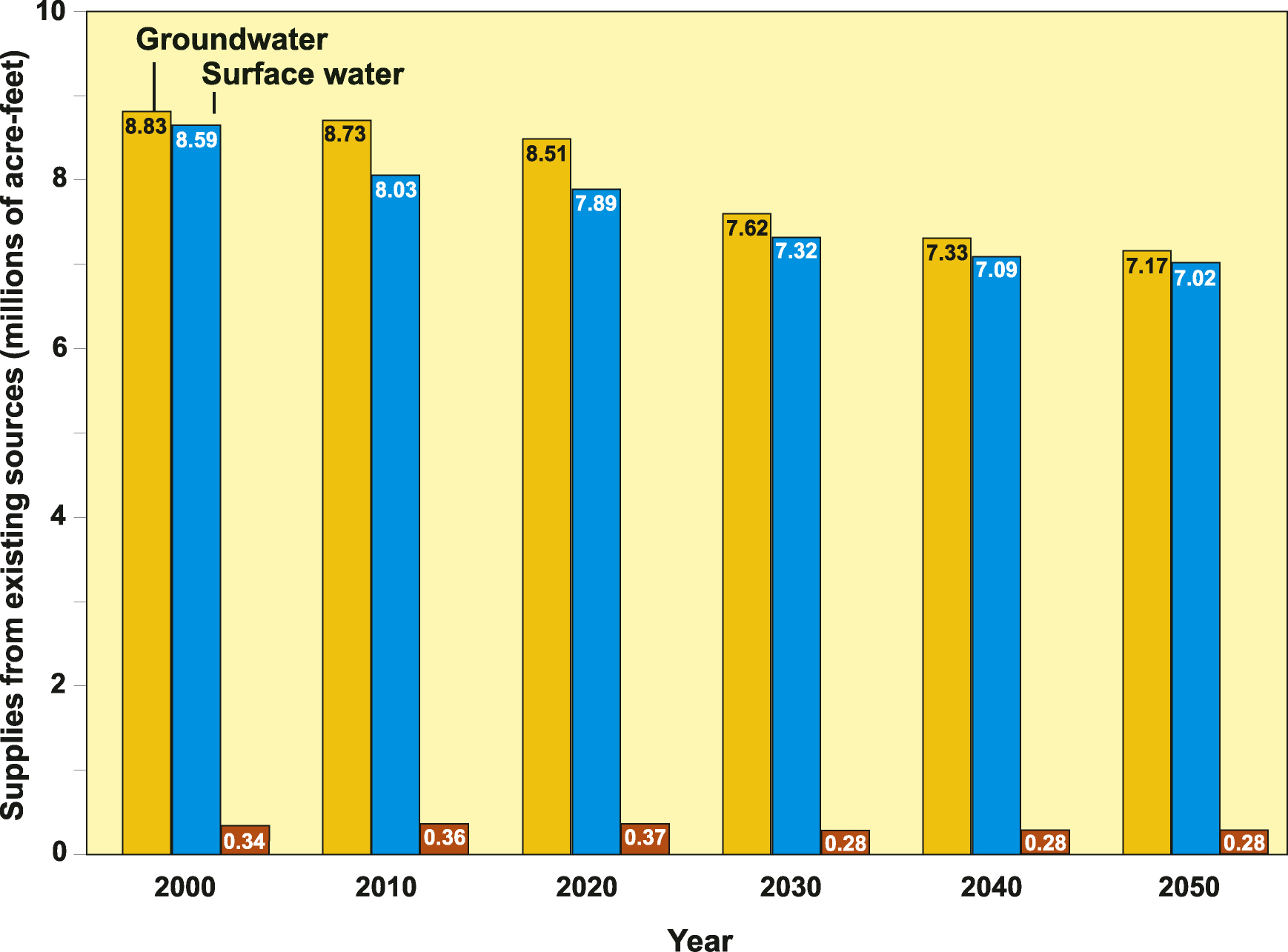
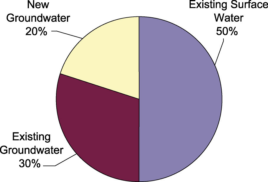
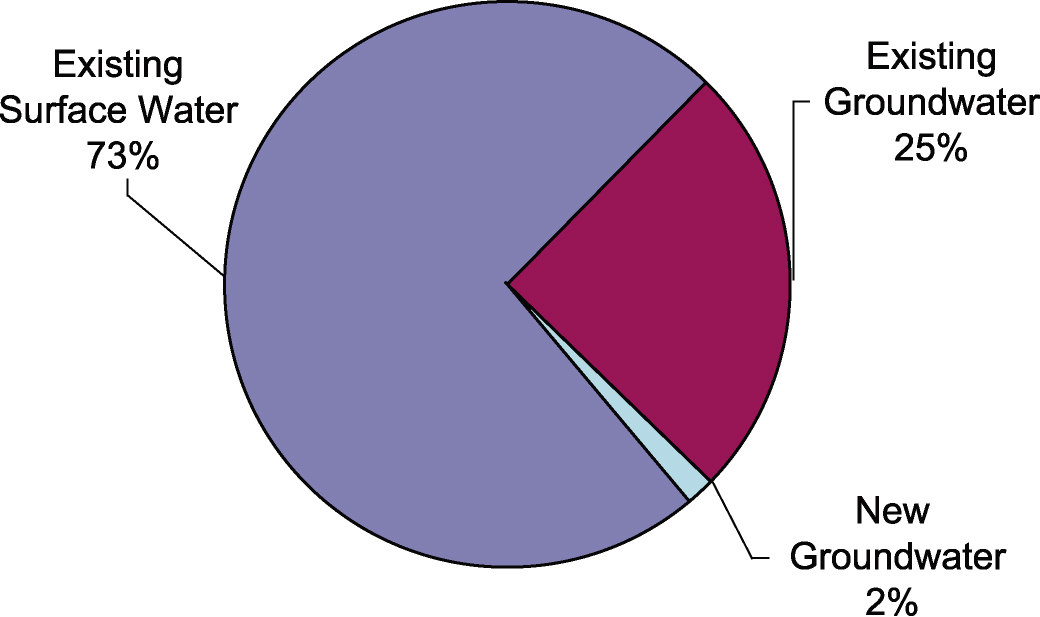
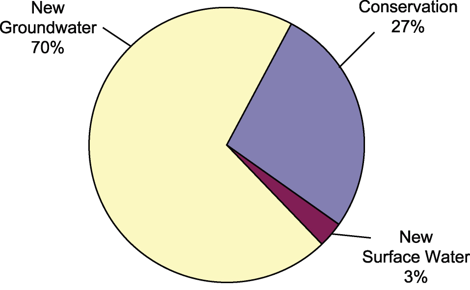
- 5-13 Current groundwater, surface water, and wastewater reuse supplies from existing sources through 2050 under drought conditions
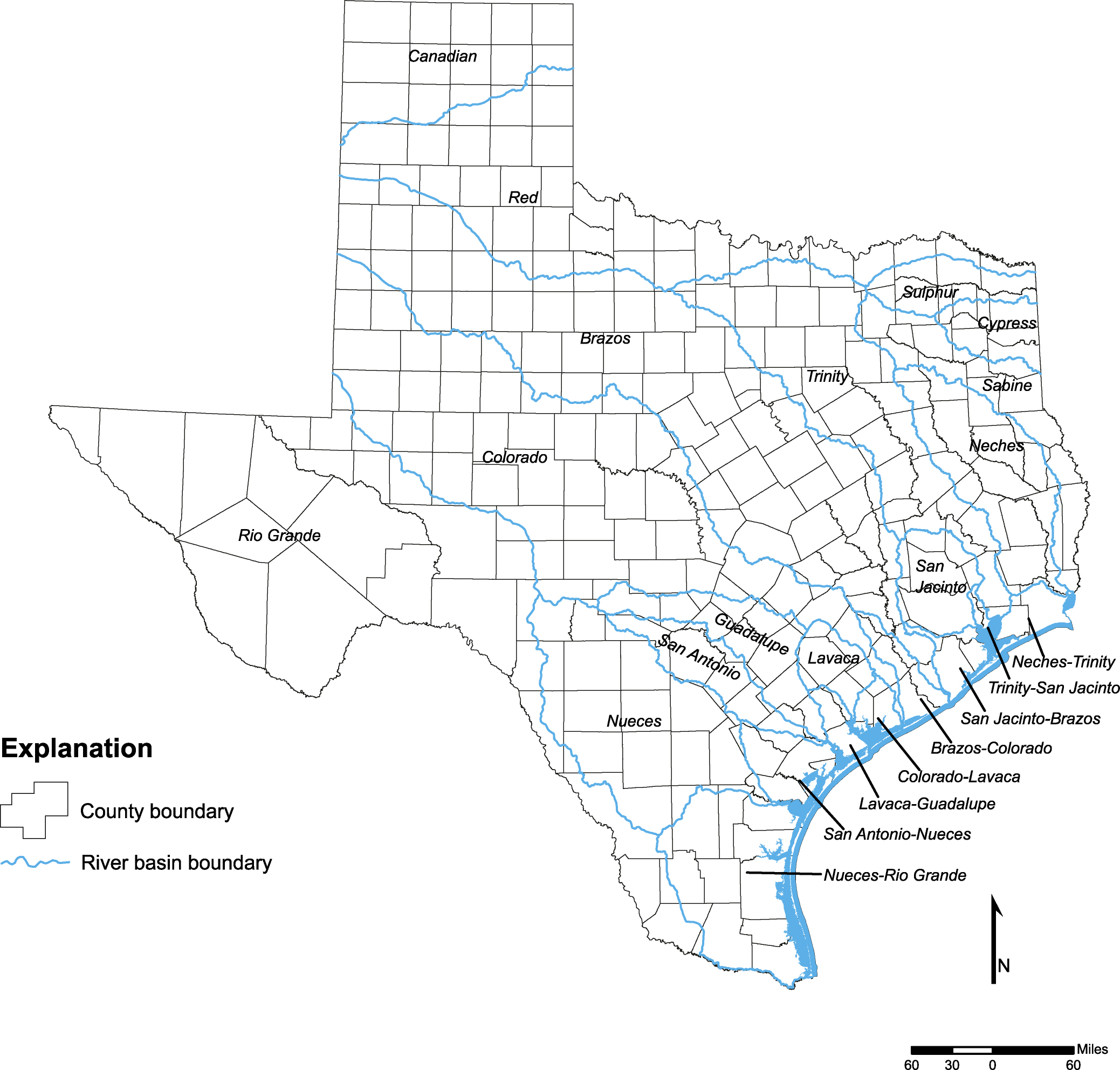
- 5-14 Major river basins of Texas
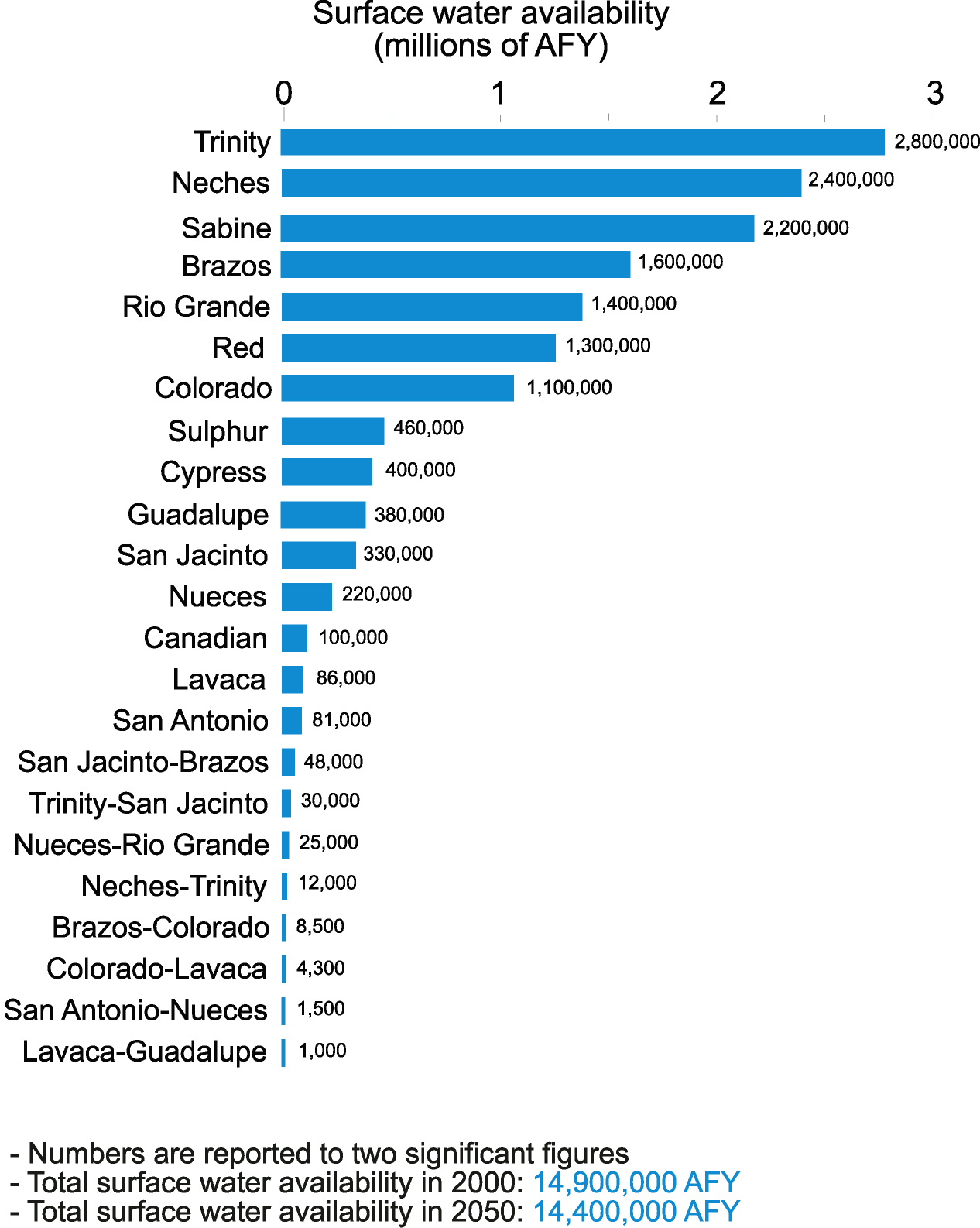
- 5-15 Surface water availability index
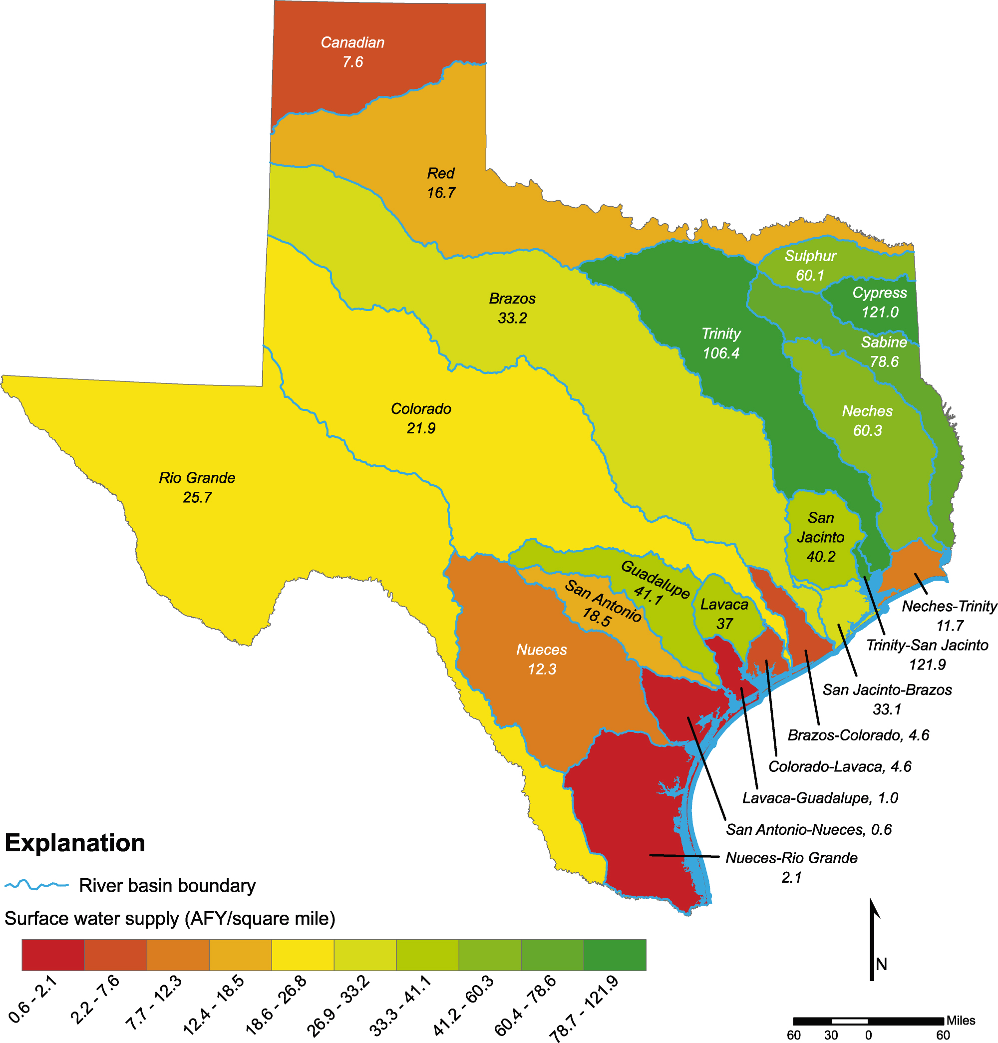
- 5-16 Surface water supply index
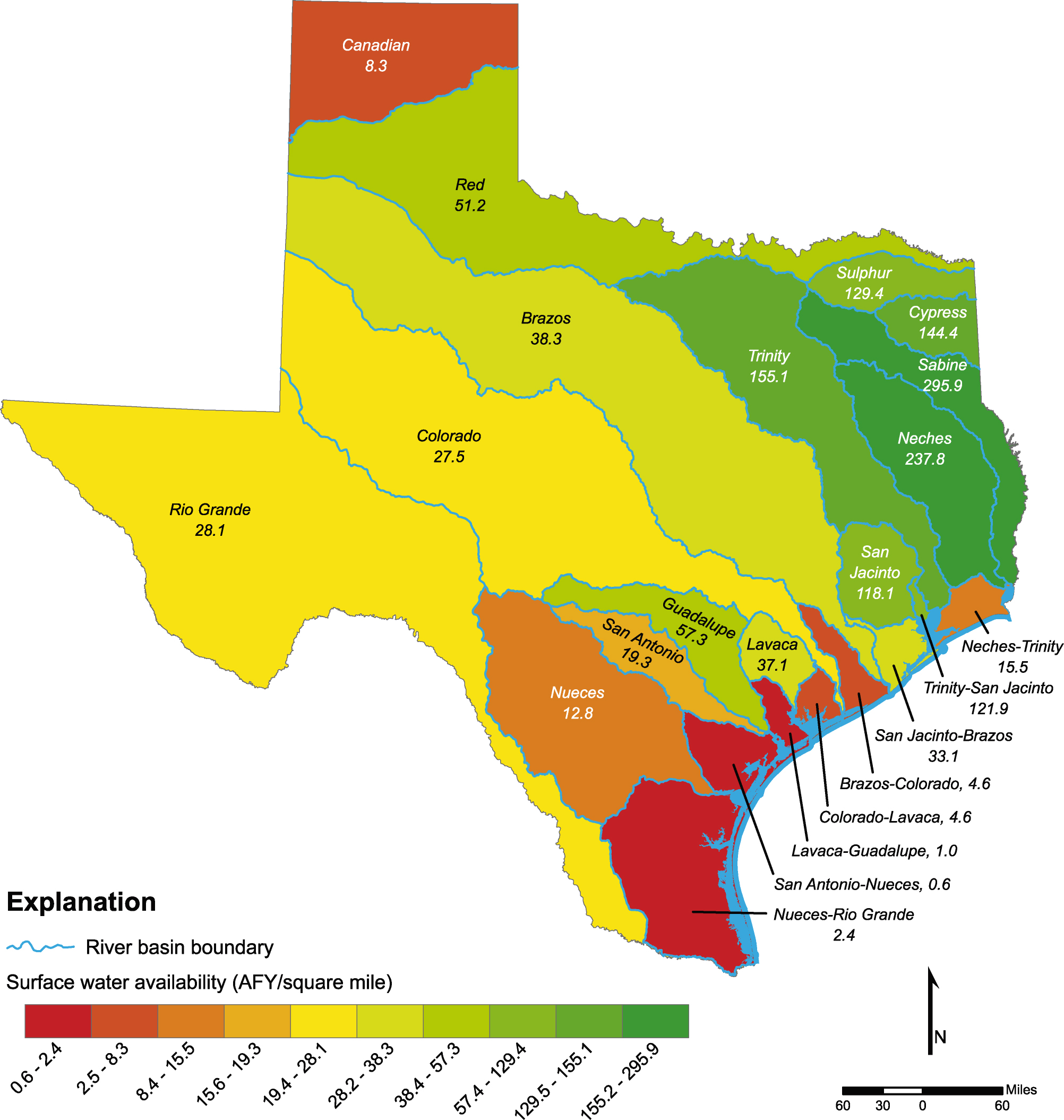
- 5-17 Surface water availability for the different river basins in 2000 under drought conditions
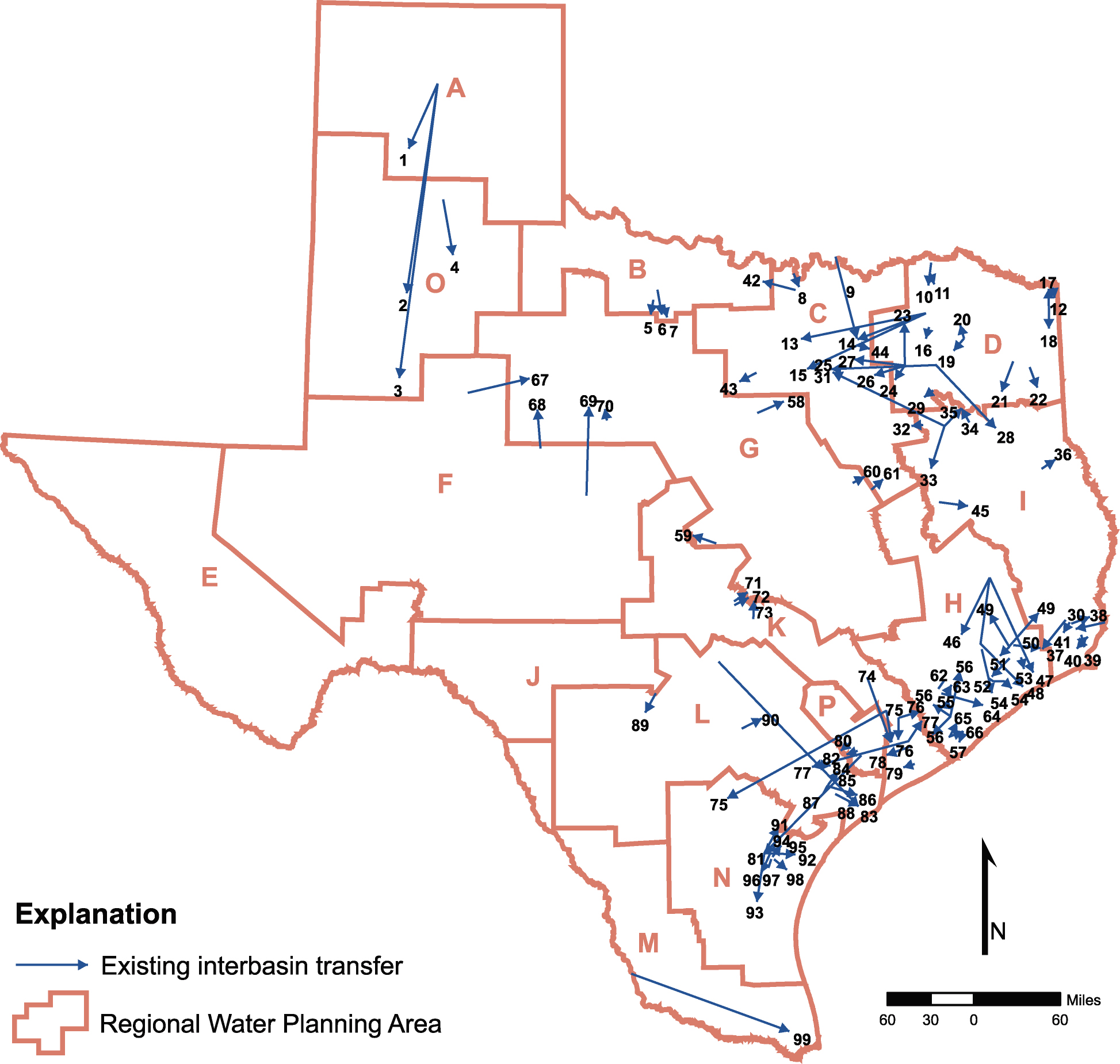
- 5-18 Existing interbasin transfers in the State
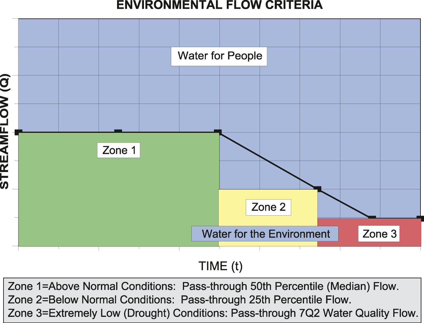
- 6-1 Environmental flow criteria for regional and State water planning
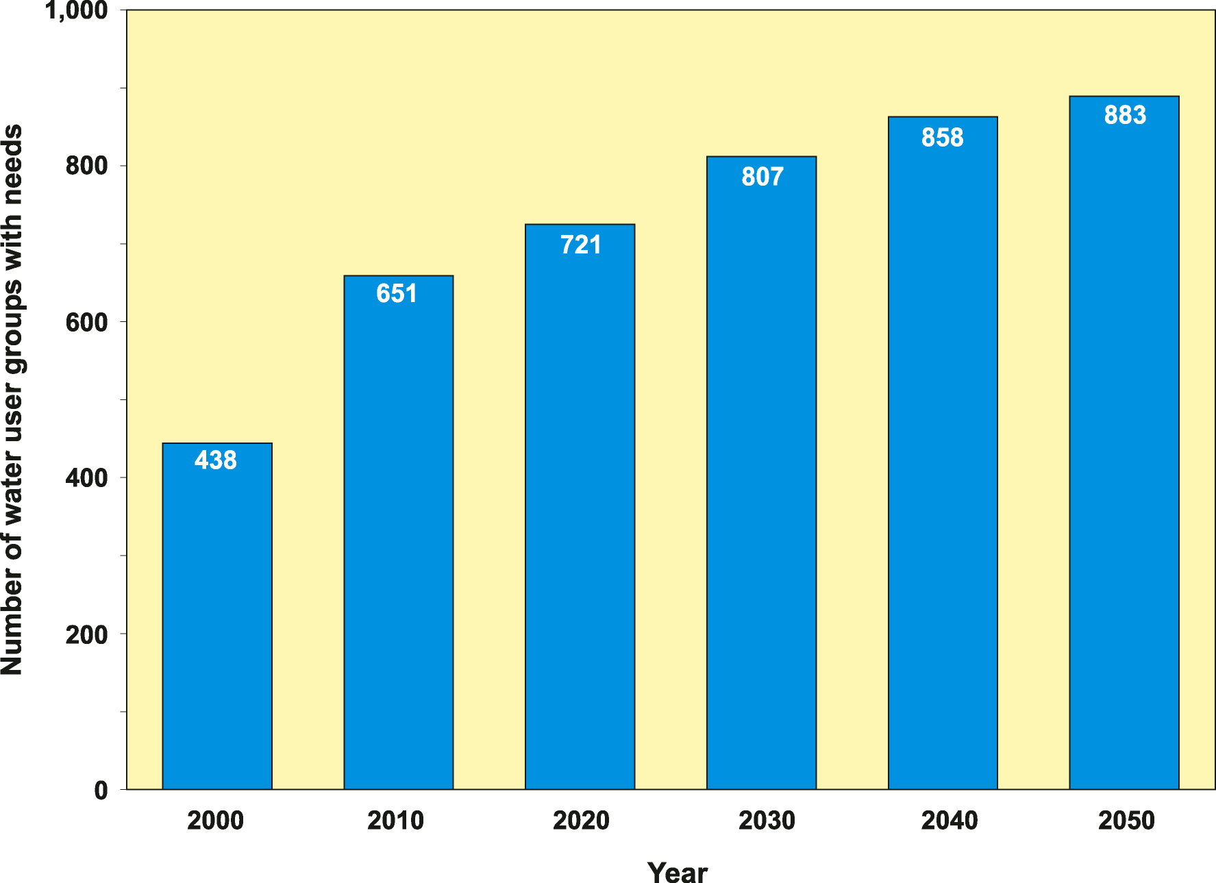
- 7-1 Number of water user groups with projected needs Statewide
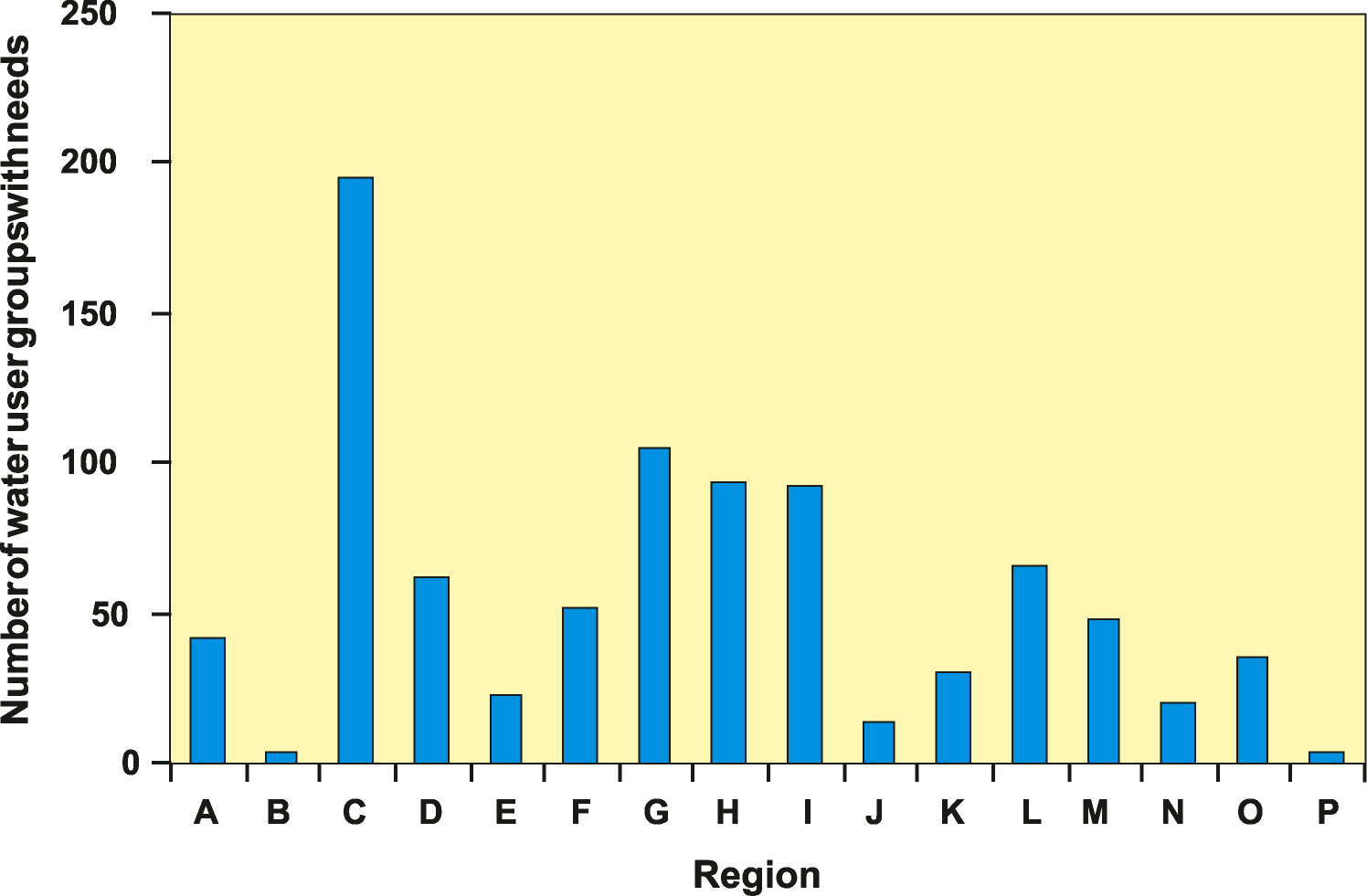
- 7-2 Number of water user groups with projected needs in regional water planning areas in 2050
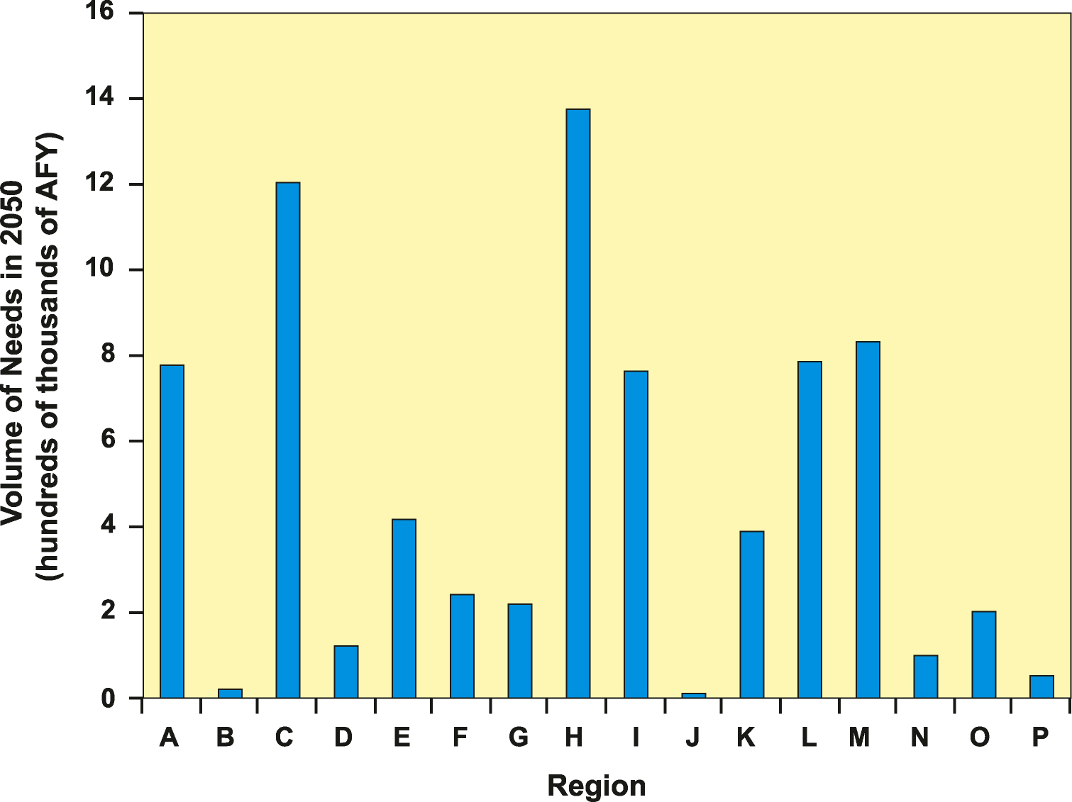
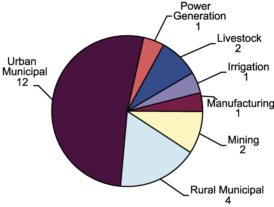
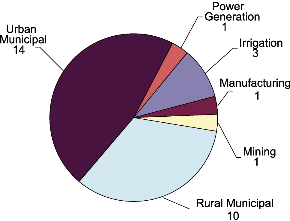
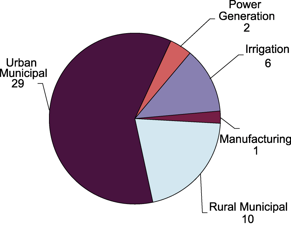
- 7-3 Volume of needs in regions in 2050
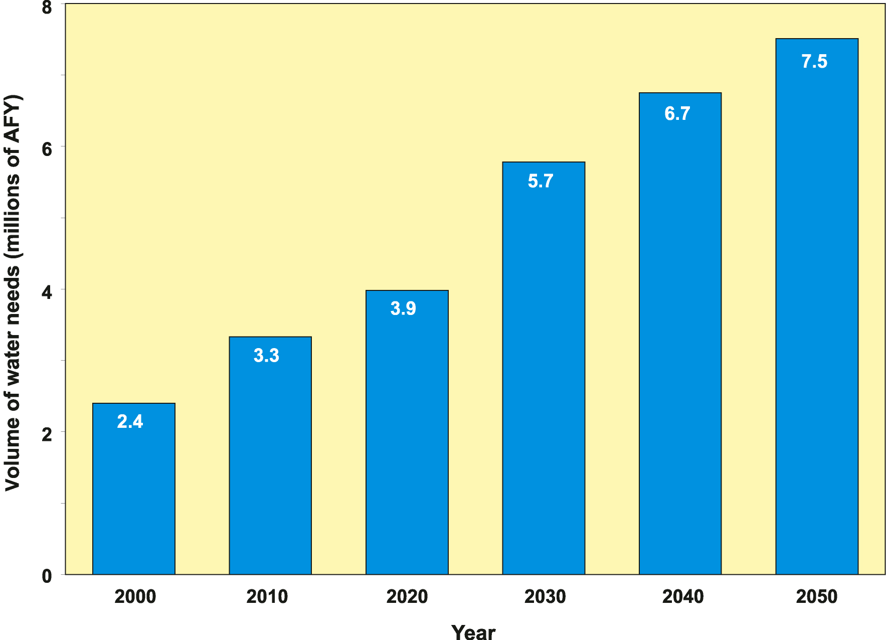
- 7-4 Volume of needs Statewide in 2050
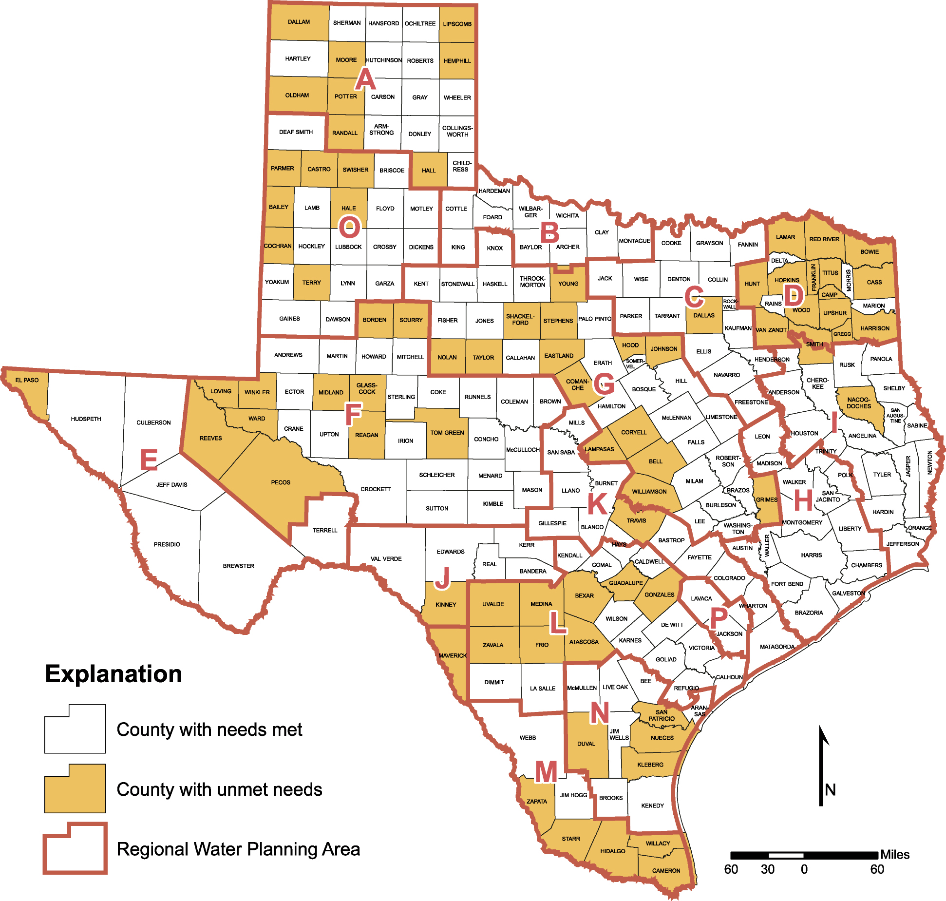
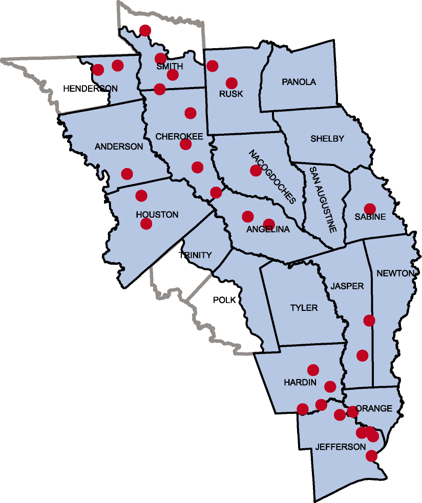
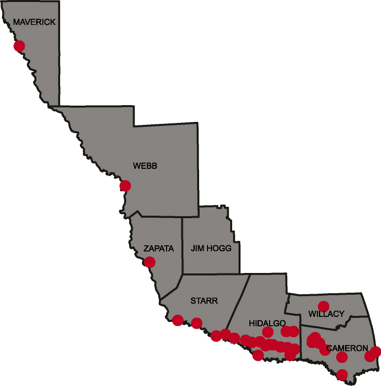
- 7-5 Counties in Texas with unmet needs in 2050
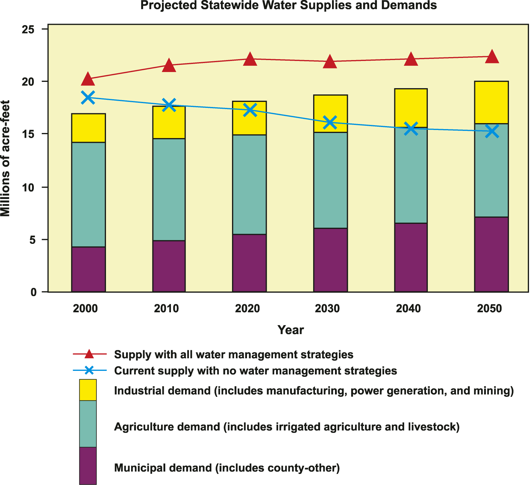
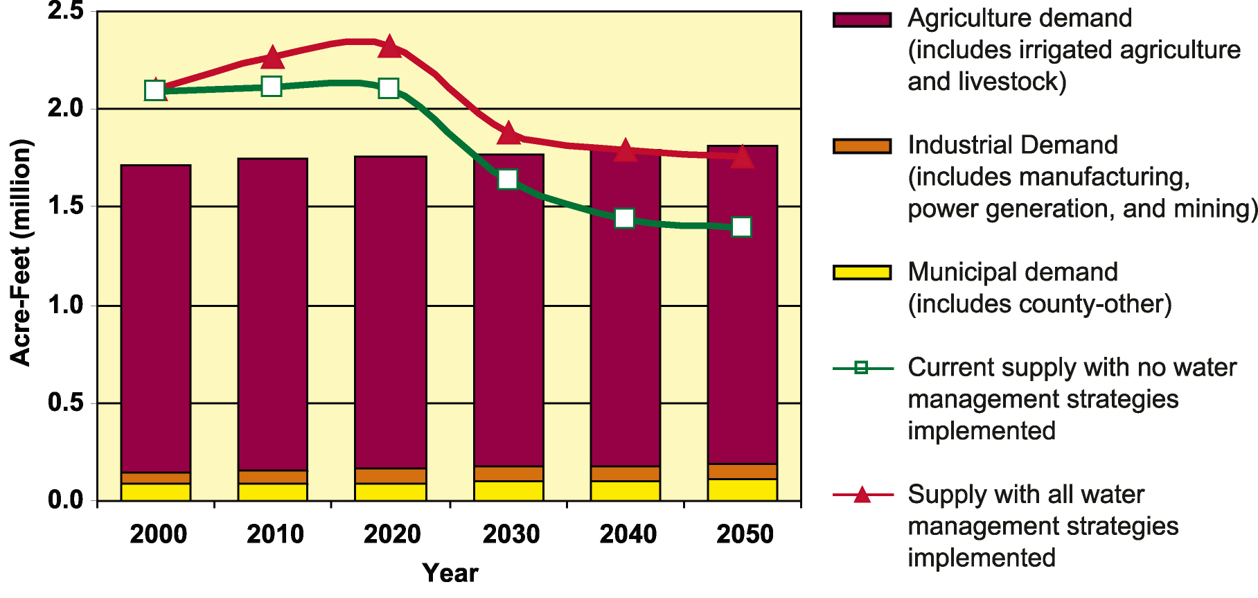
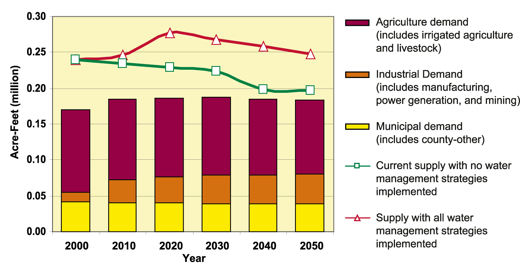
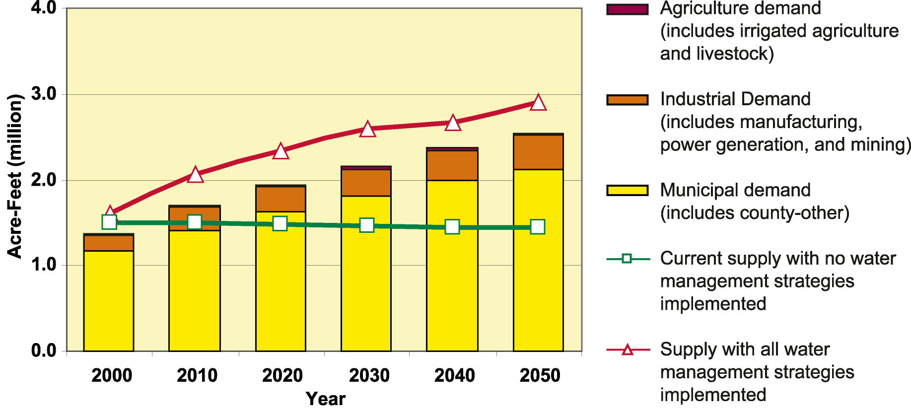
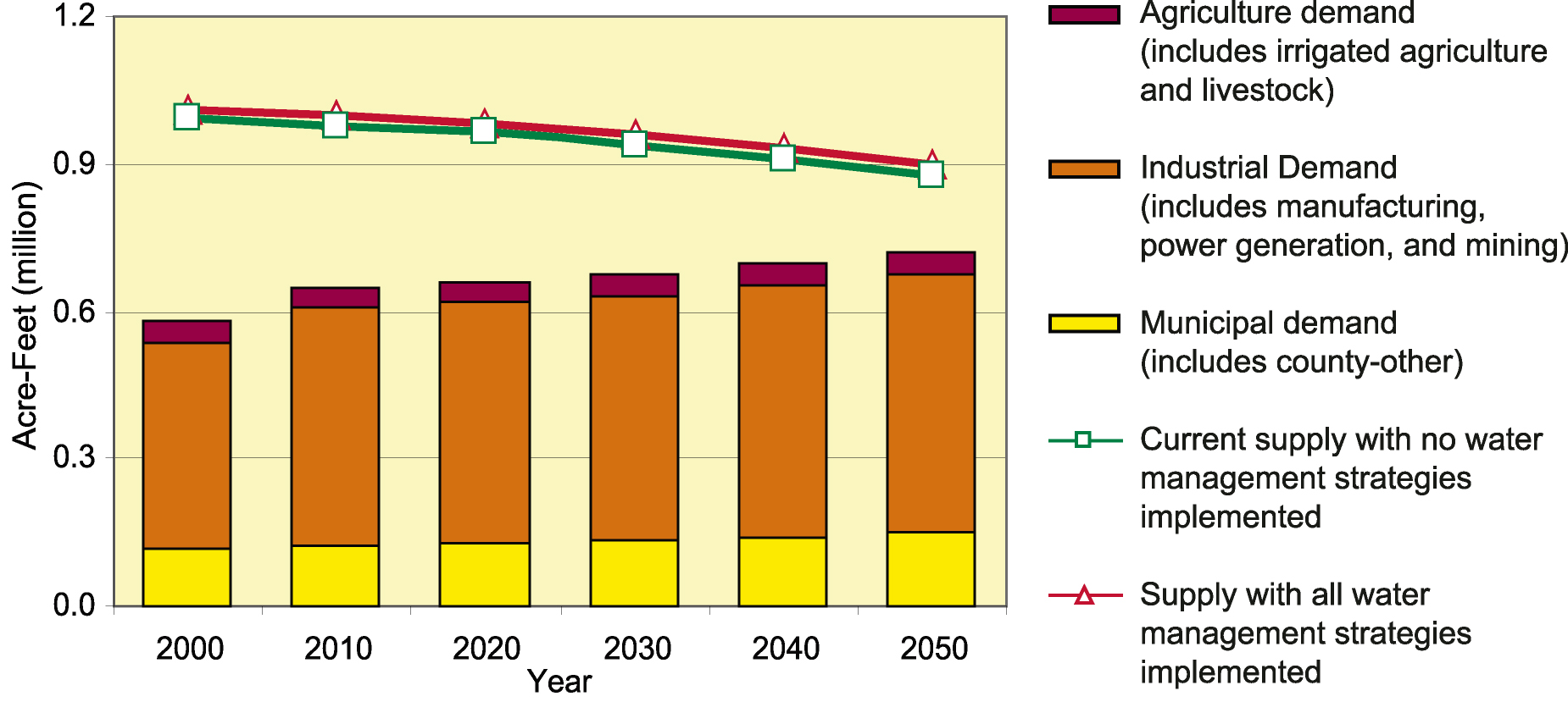
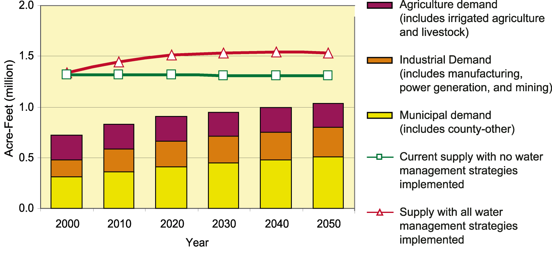
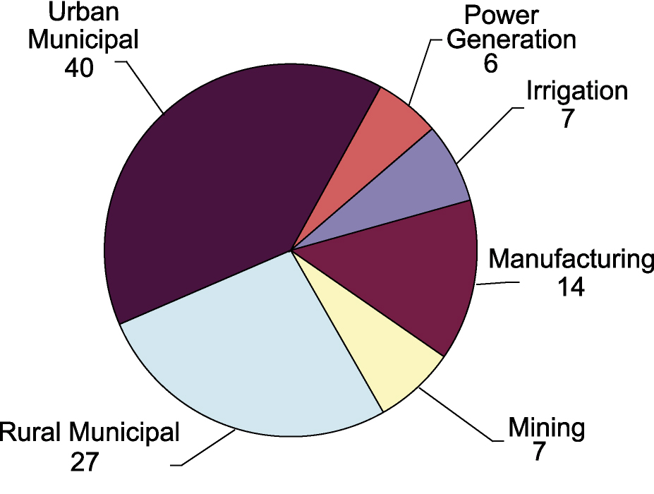
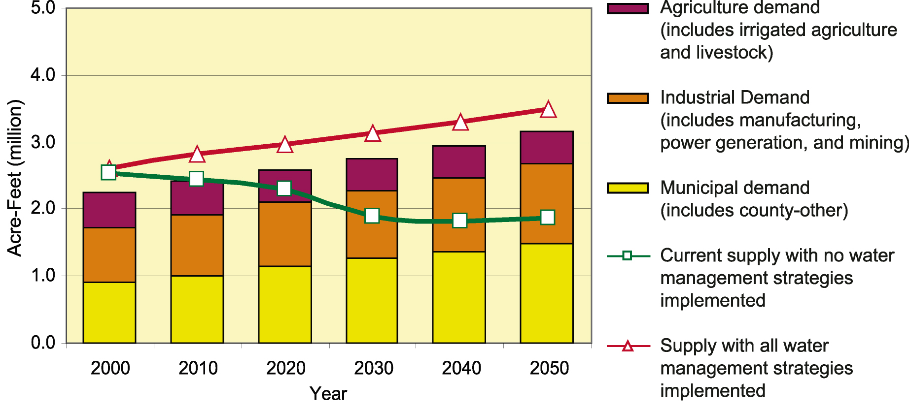
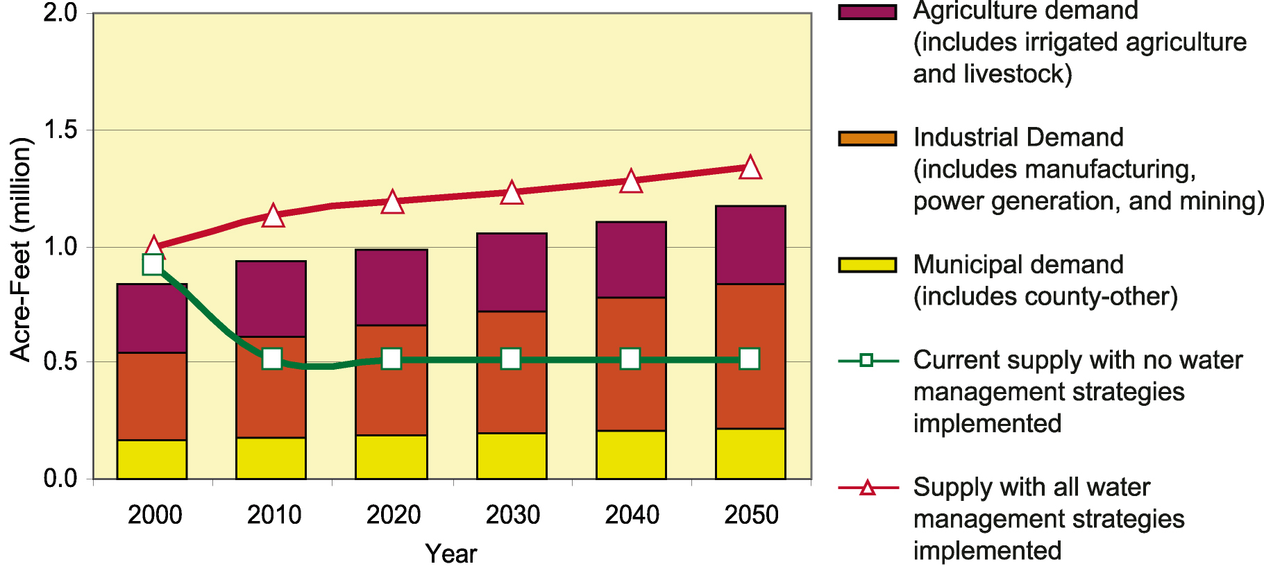
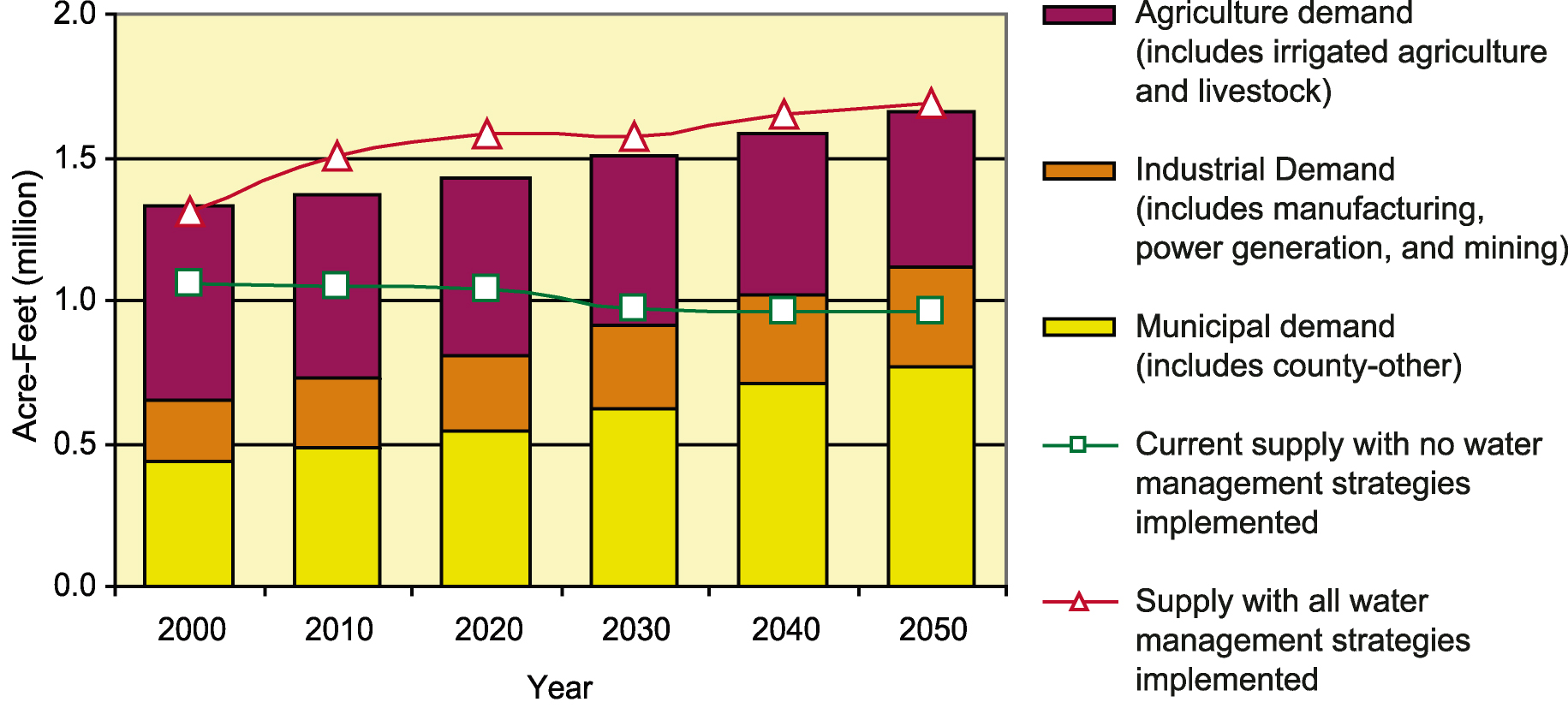
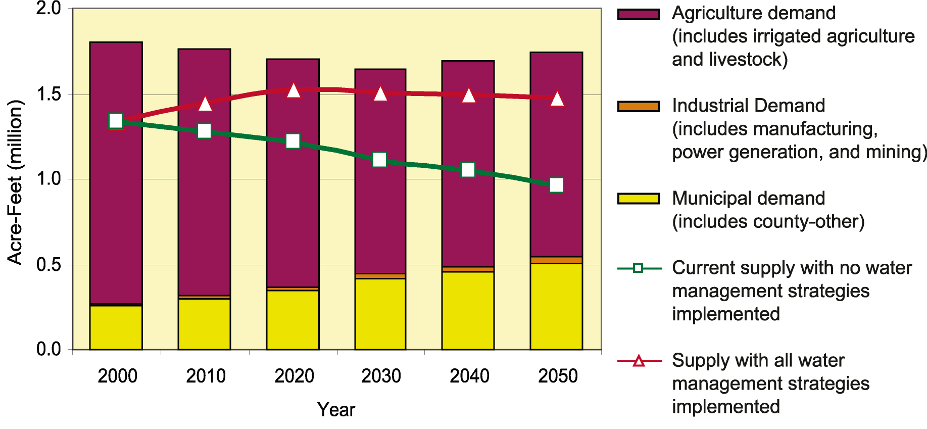
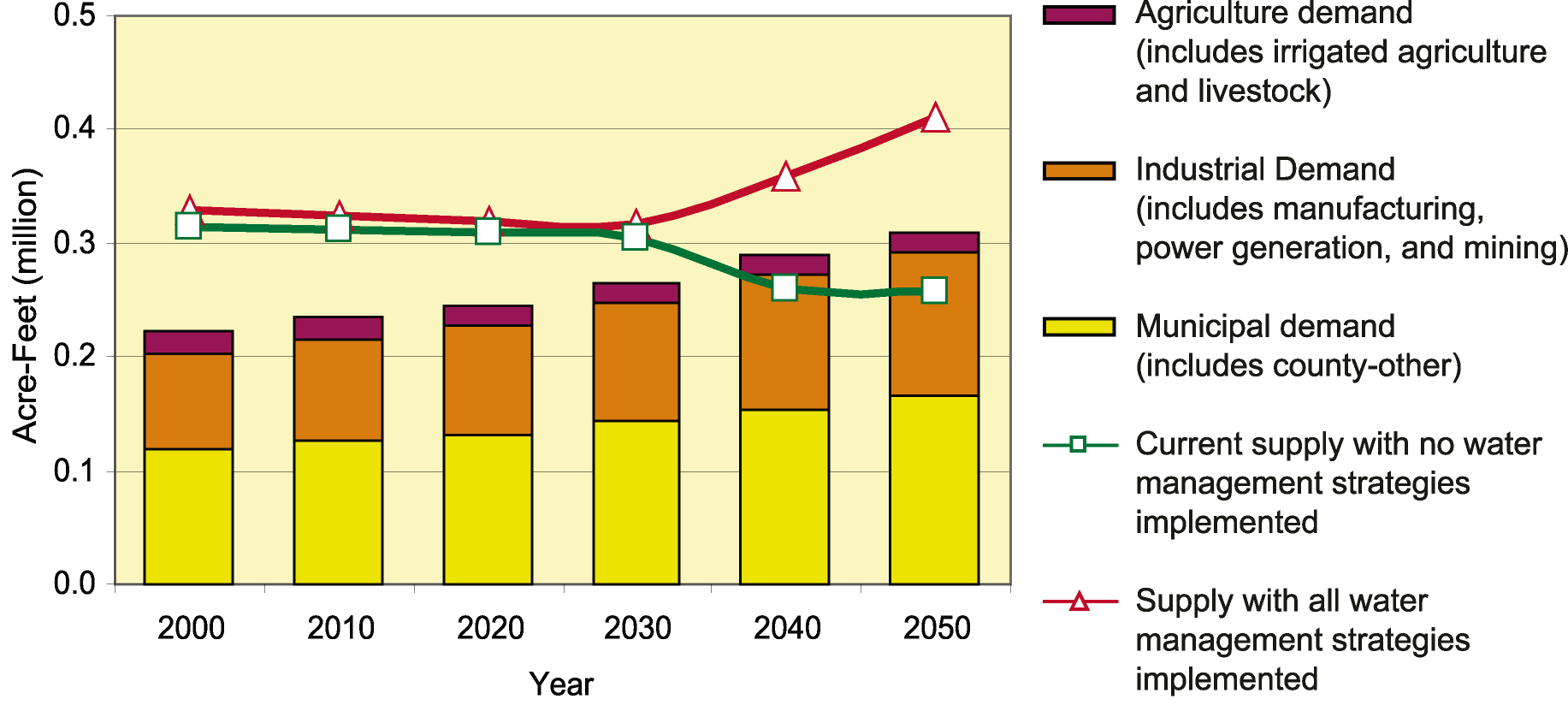
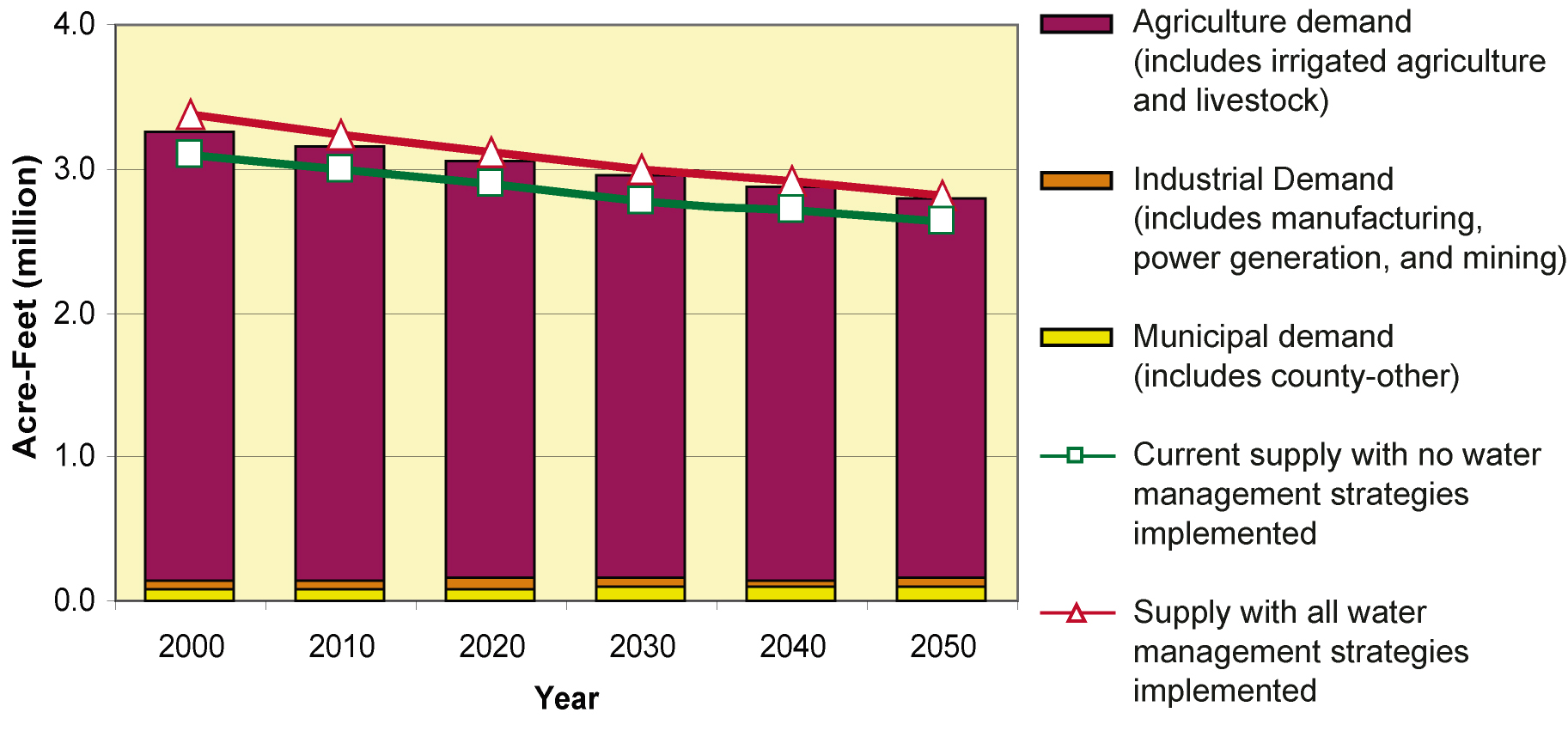
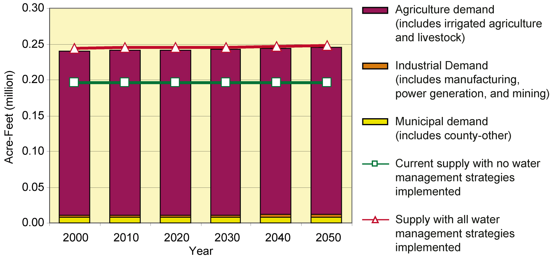
- 8-1 Statewide comparison of demands versus supplies with and without implementation of the regional water plans
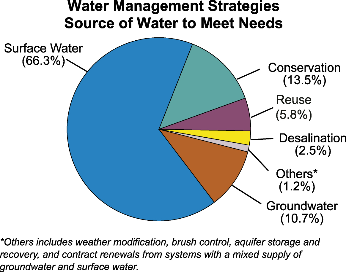
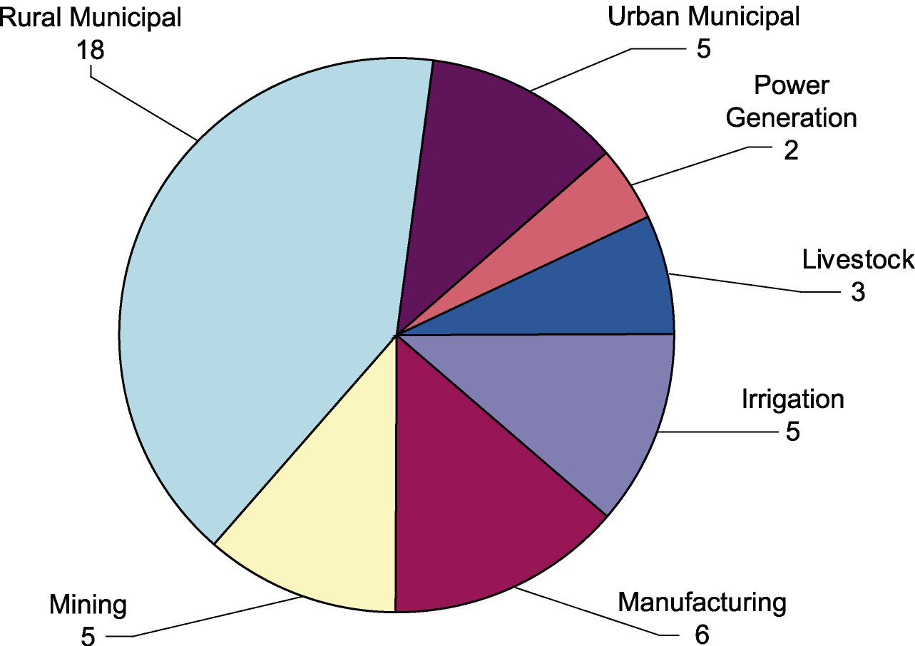
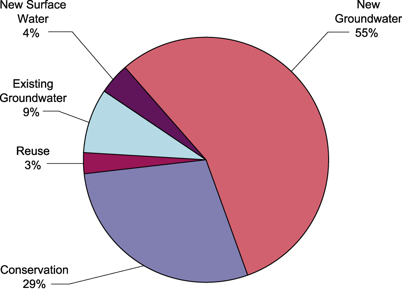
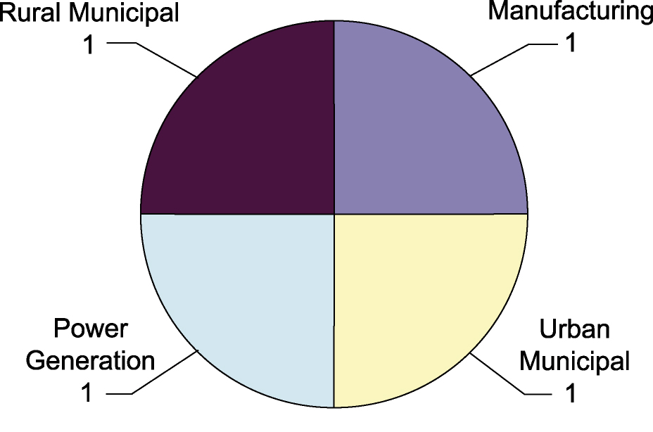
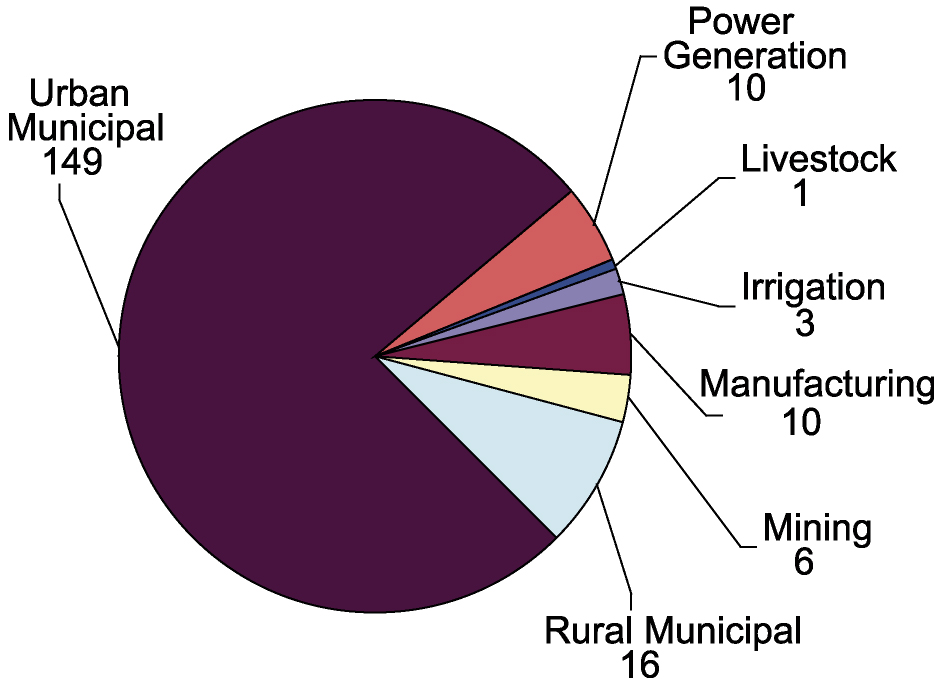
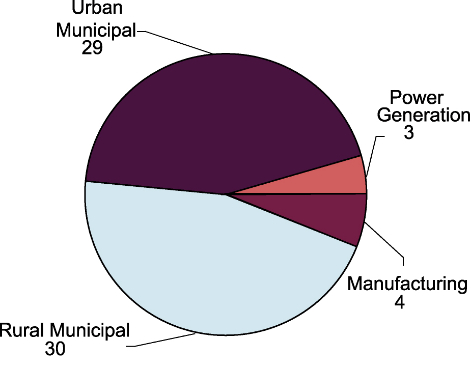
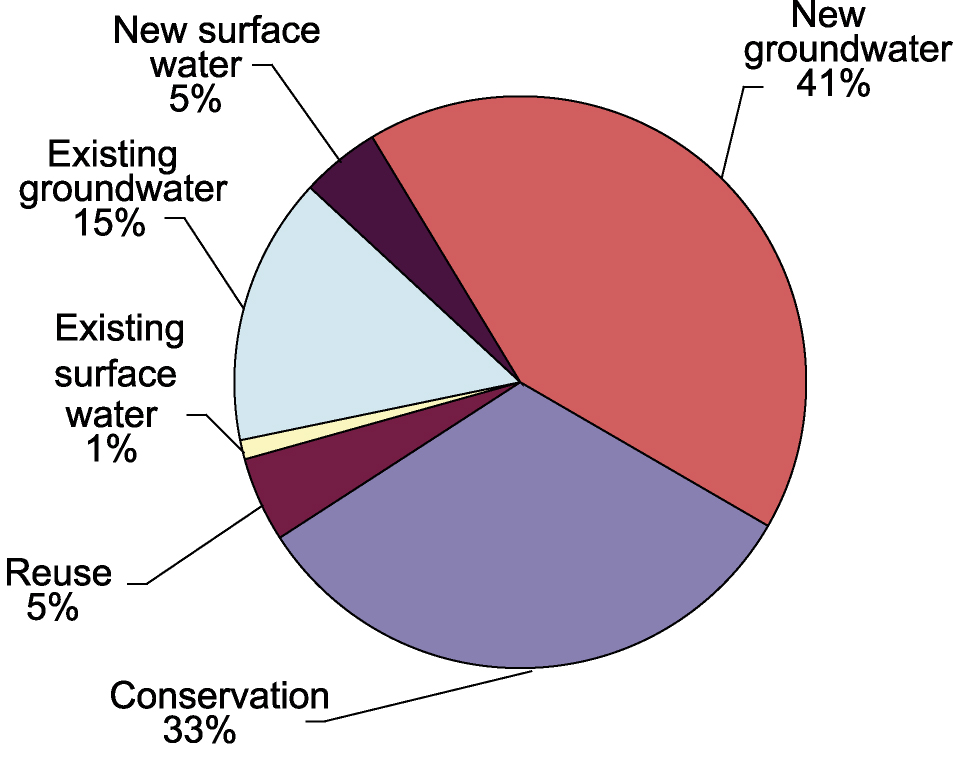
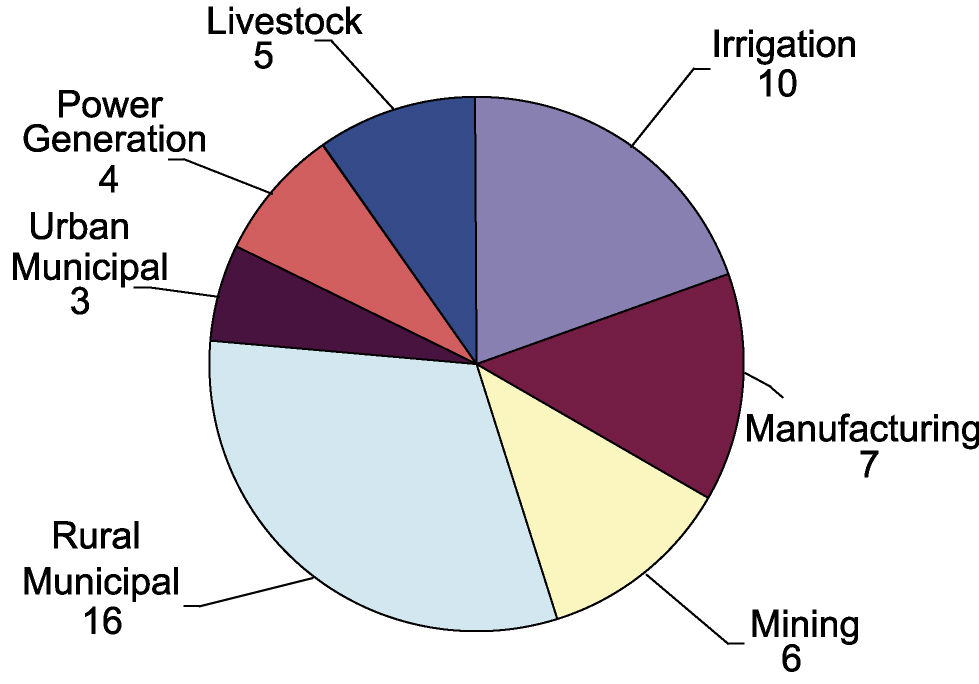
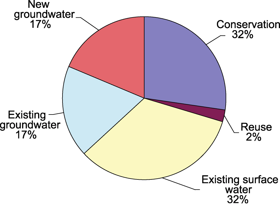
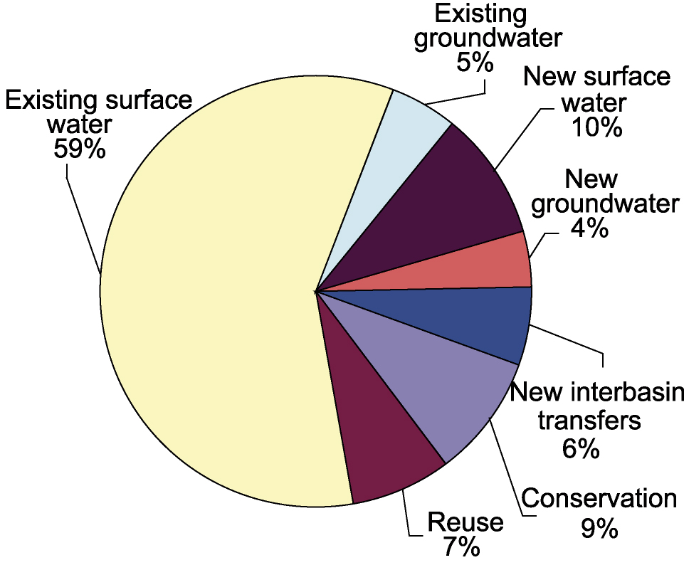
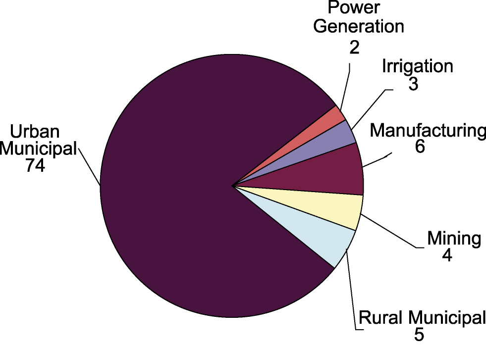
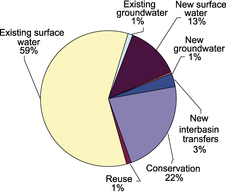
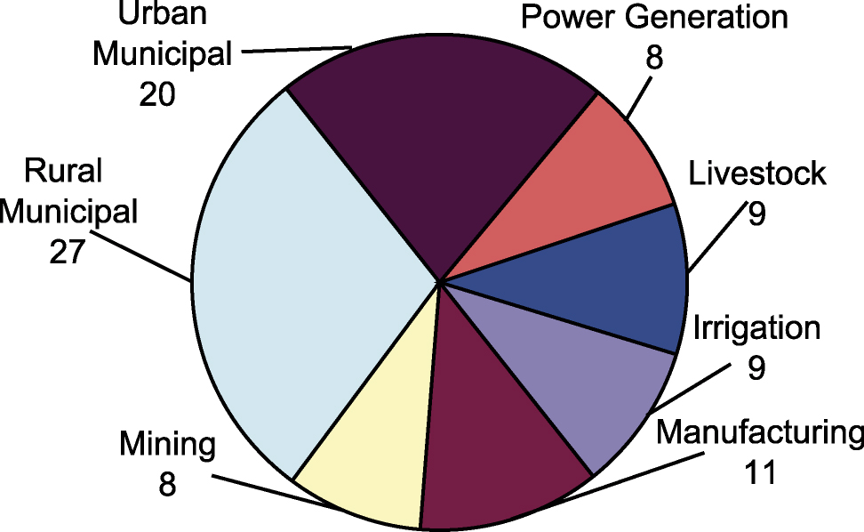
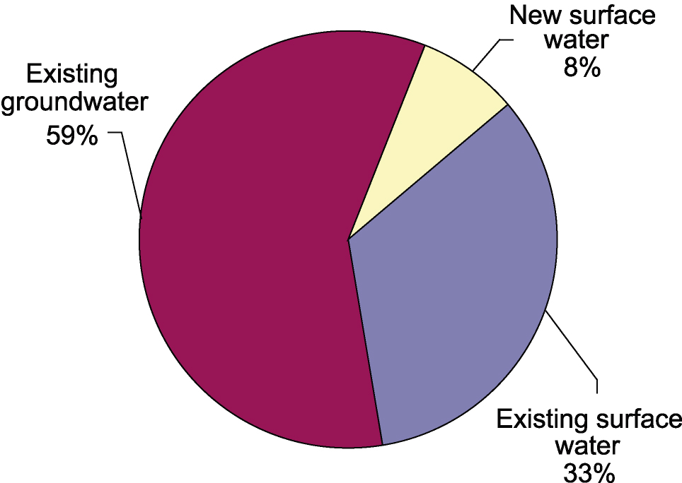
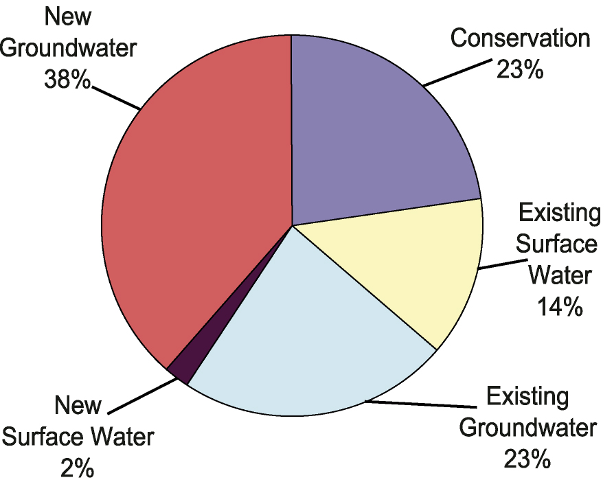
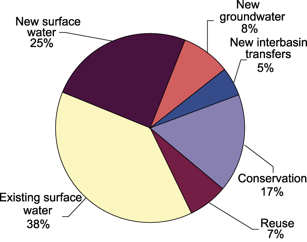
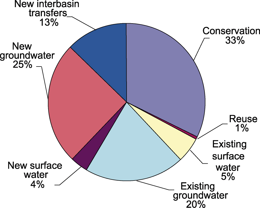
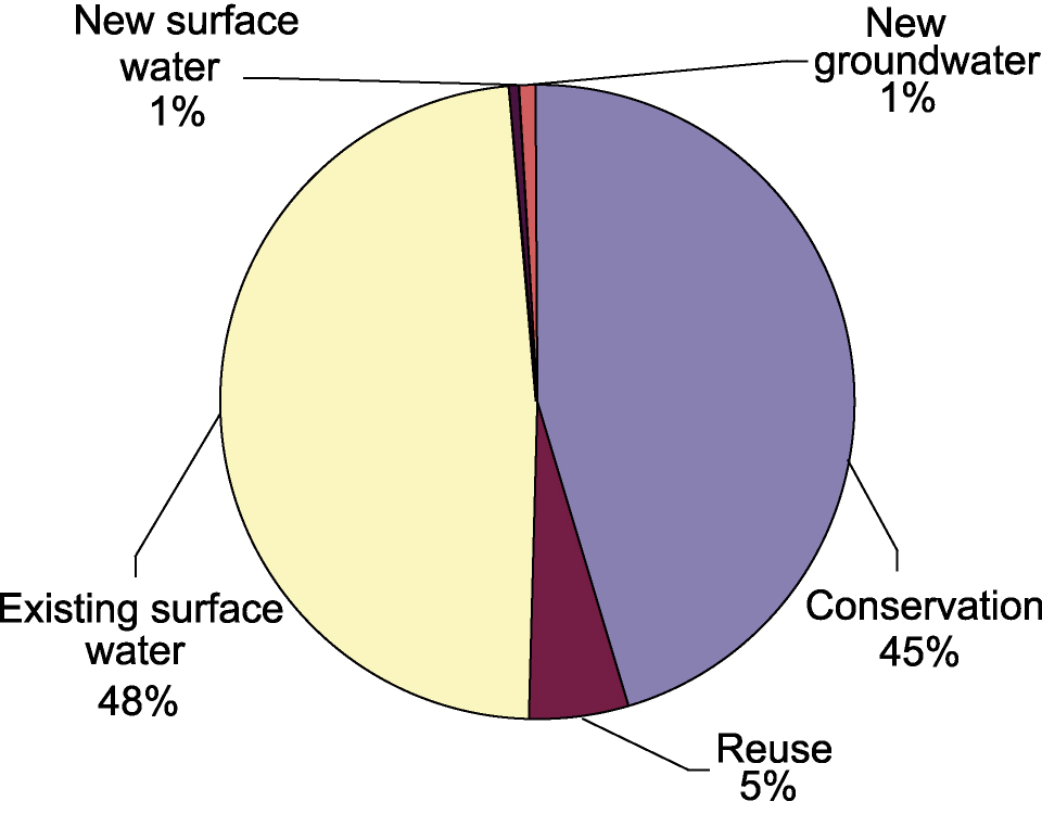
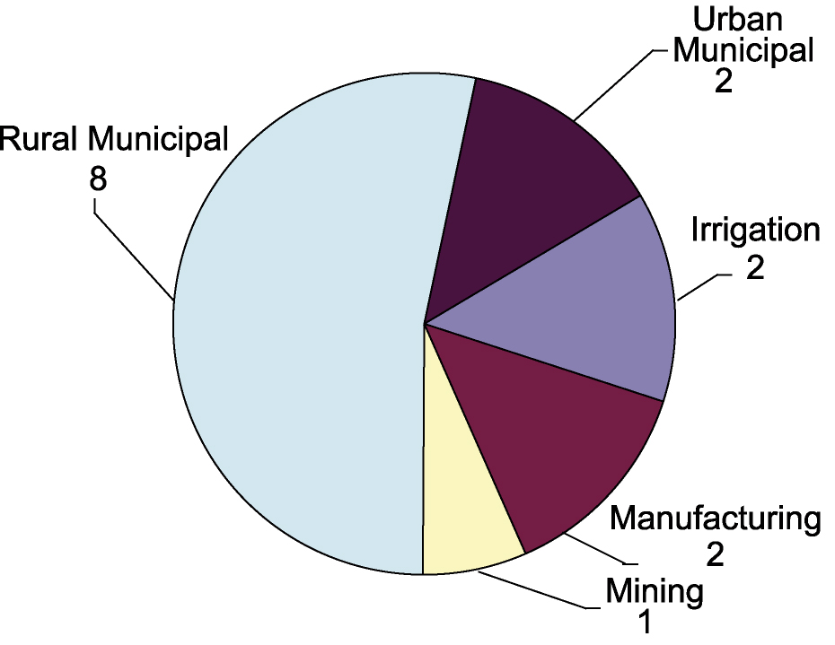
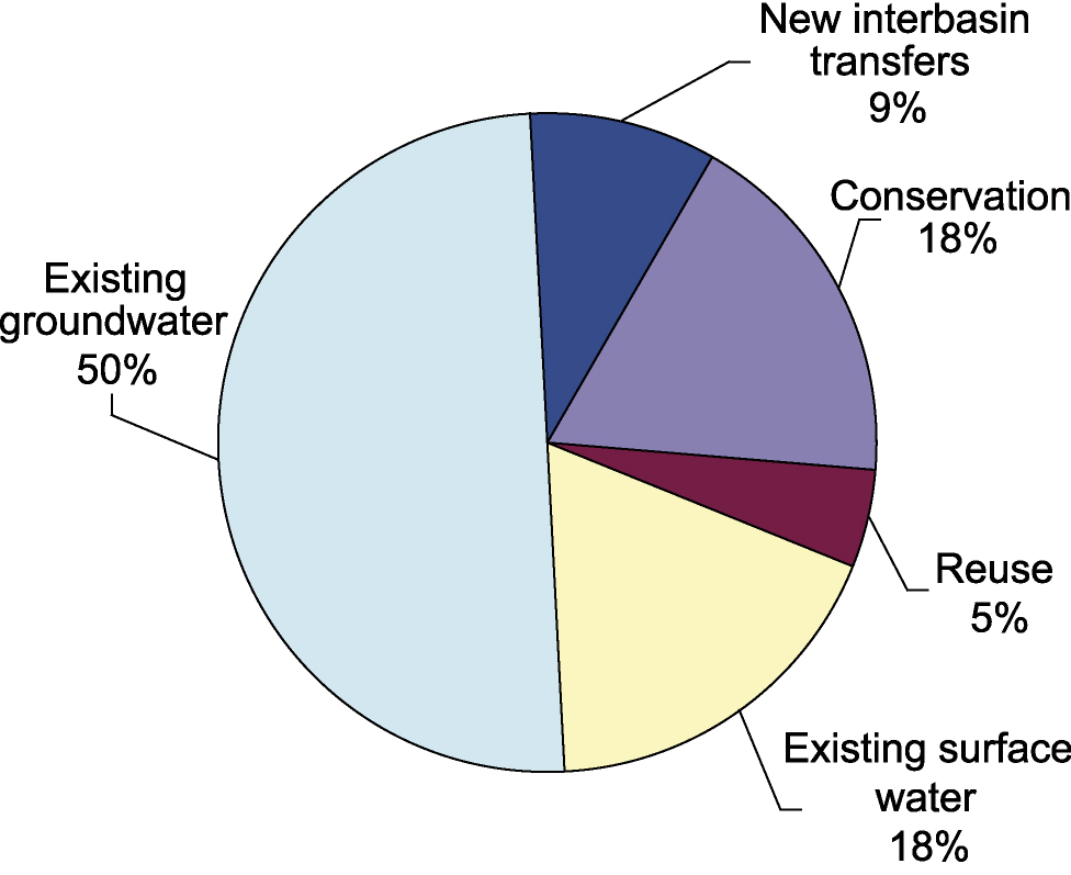
- 8-2 Volumetric comparison of the various sources of water utilized by recommended water management strategies to meet needs in the regional water plans
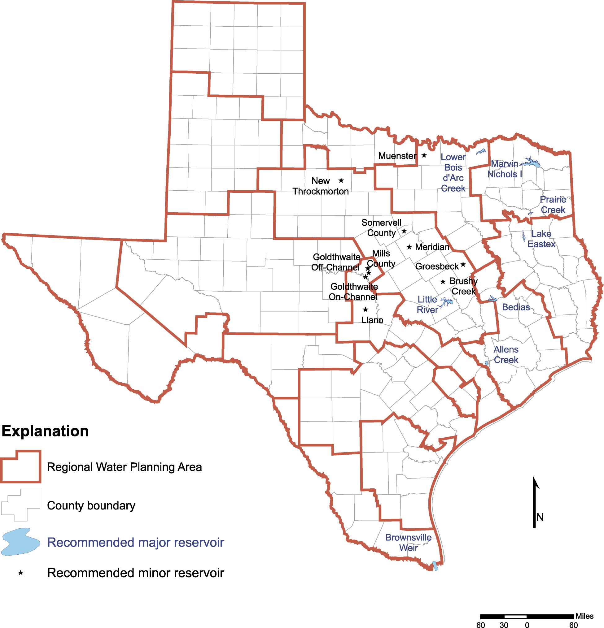
- 8-3 Major and minor reservoirs recommended in the regional water plans to meet needs
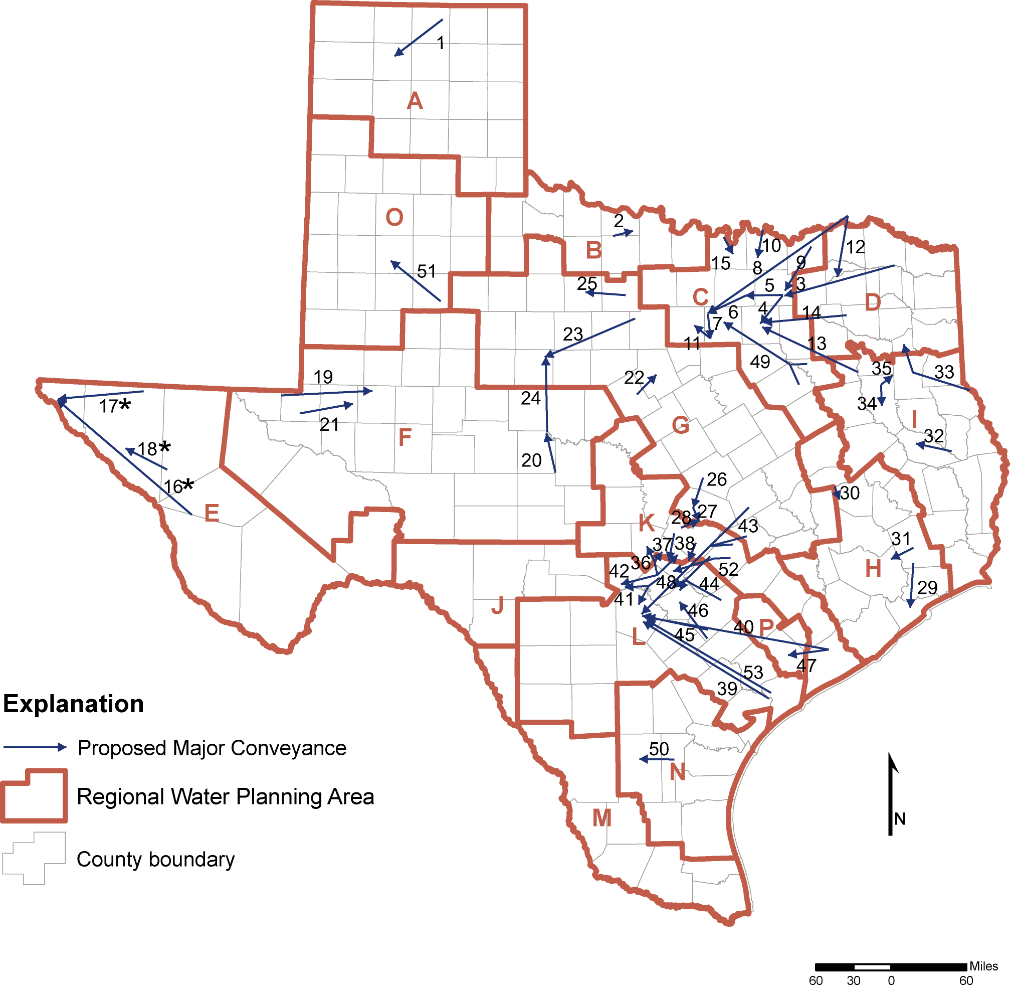
- 8-4 Major water conveyances proposed by Planning Groups
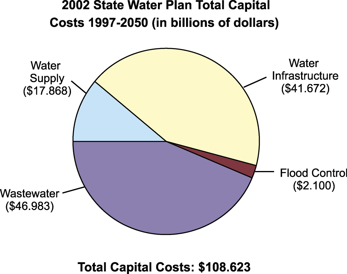
- 9-1 Relative proportion of estimated capital costs to meet water-related needs for Texas through 2050
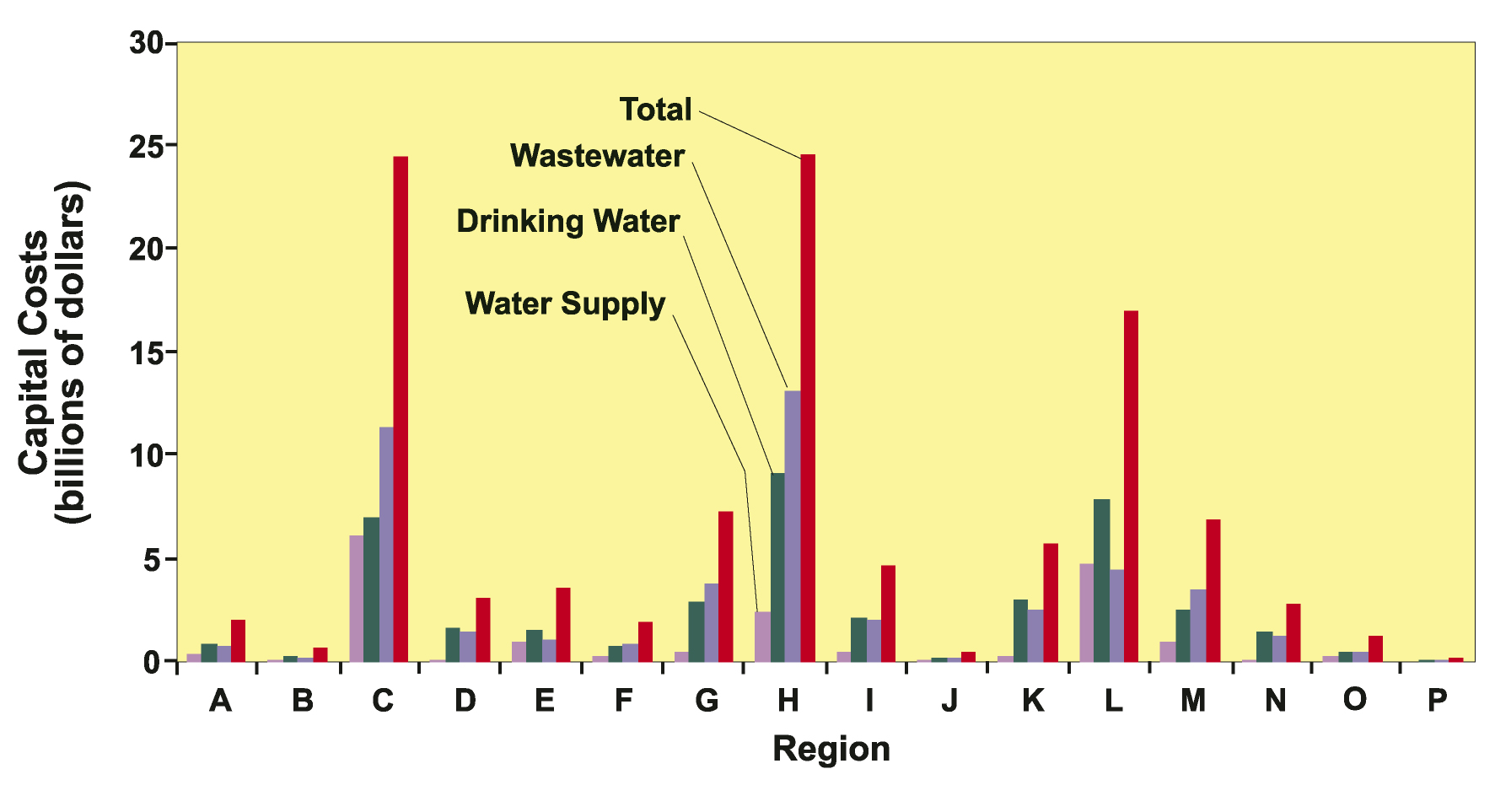
- 9-2 Through 2050, capital costs of (1) water supply, (2) drinking water (infrastructure), (3) wastewater, and (4) total capital costs, for the 16 planning areas
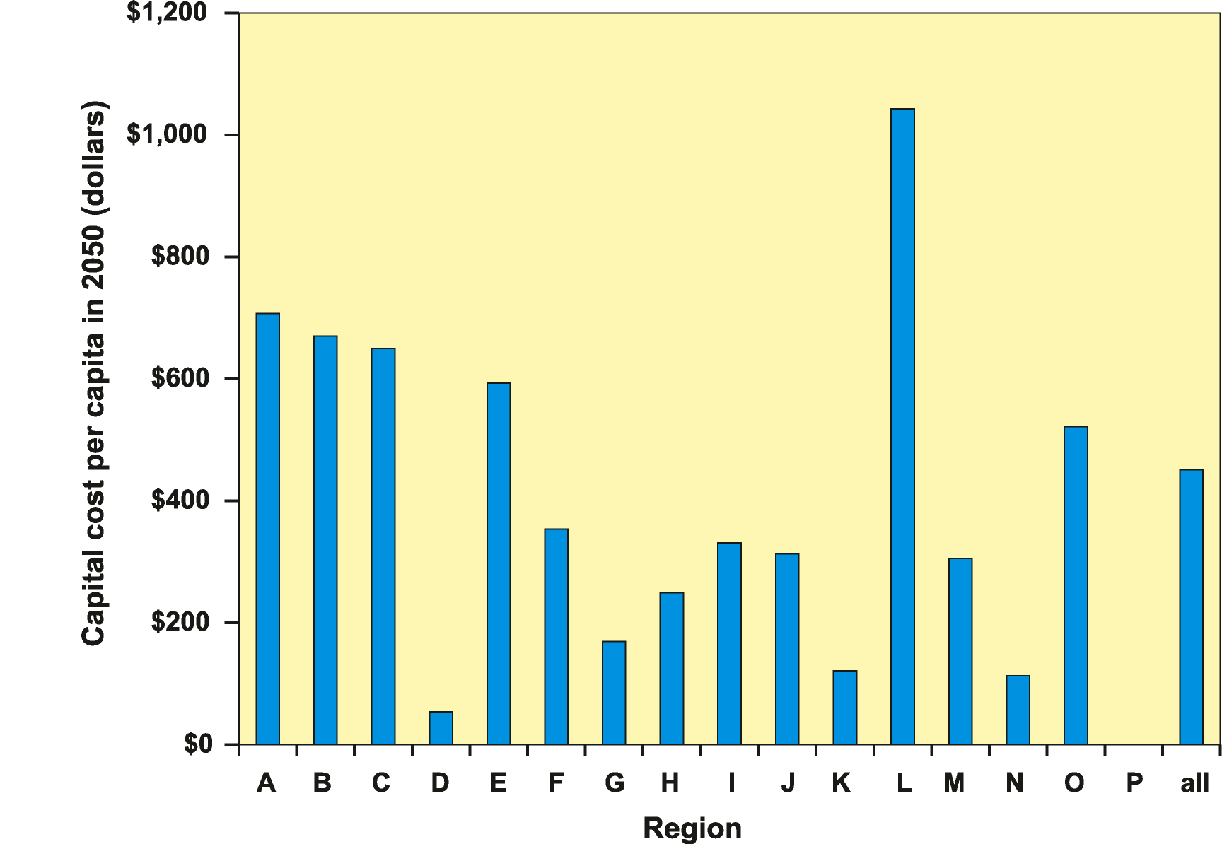
- 9-3 Capital costs on a per capita basis comparing projected population in 2050 and total capital costs through 2050
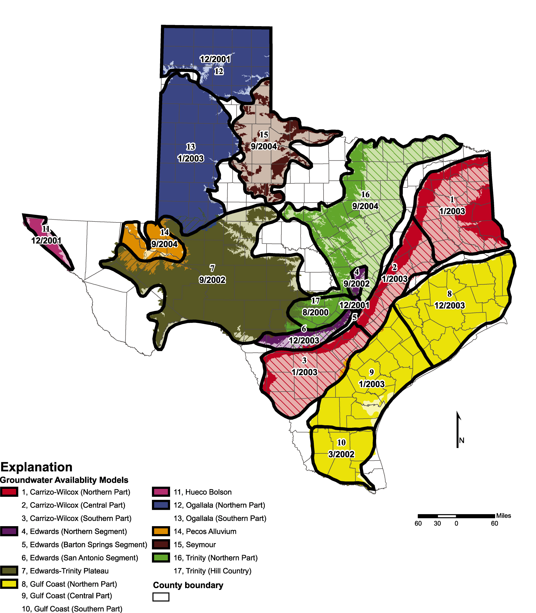
- 13-1 Locations and expected completion dates of groundwater availability models of the major aquifers of Texas
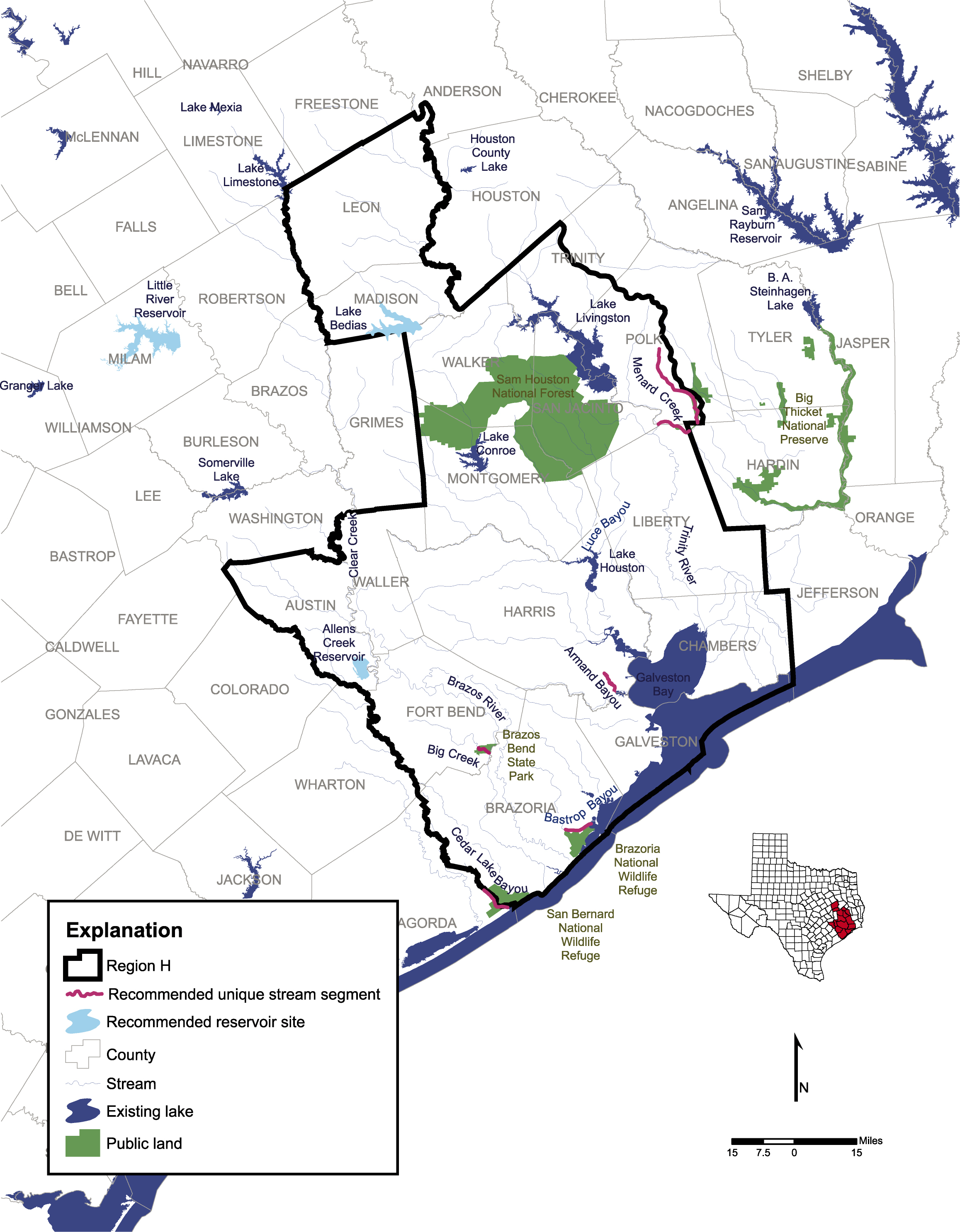
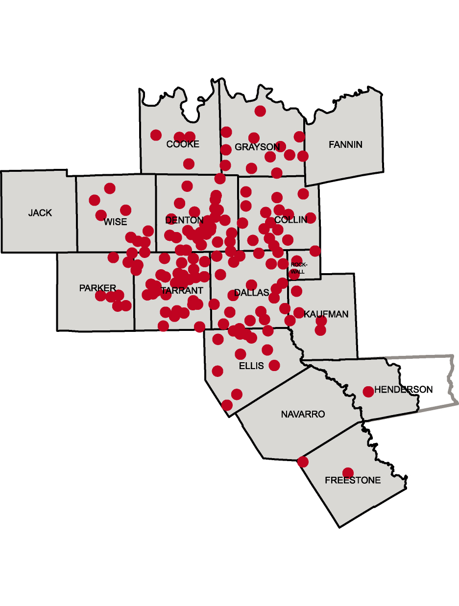
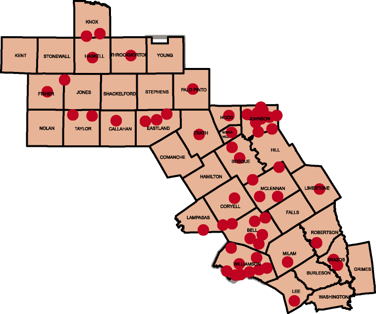
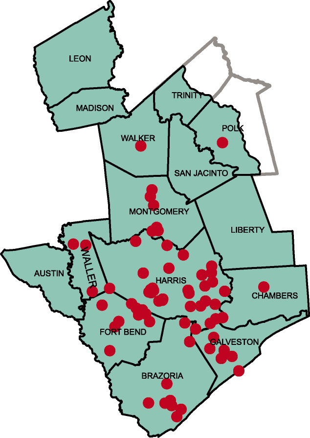
- 14-1 Reservoir sites and unique stream segments recommended by Region H
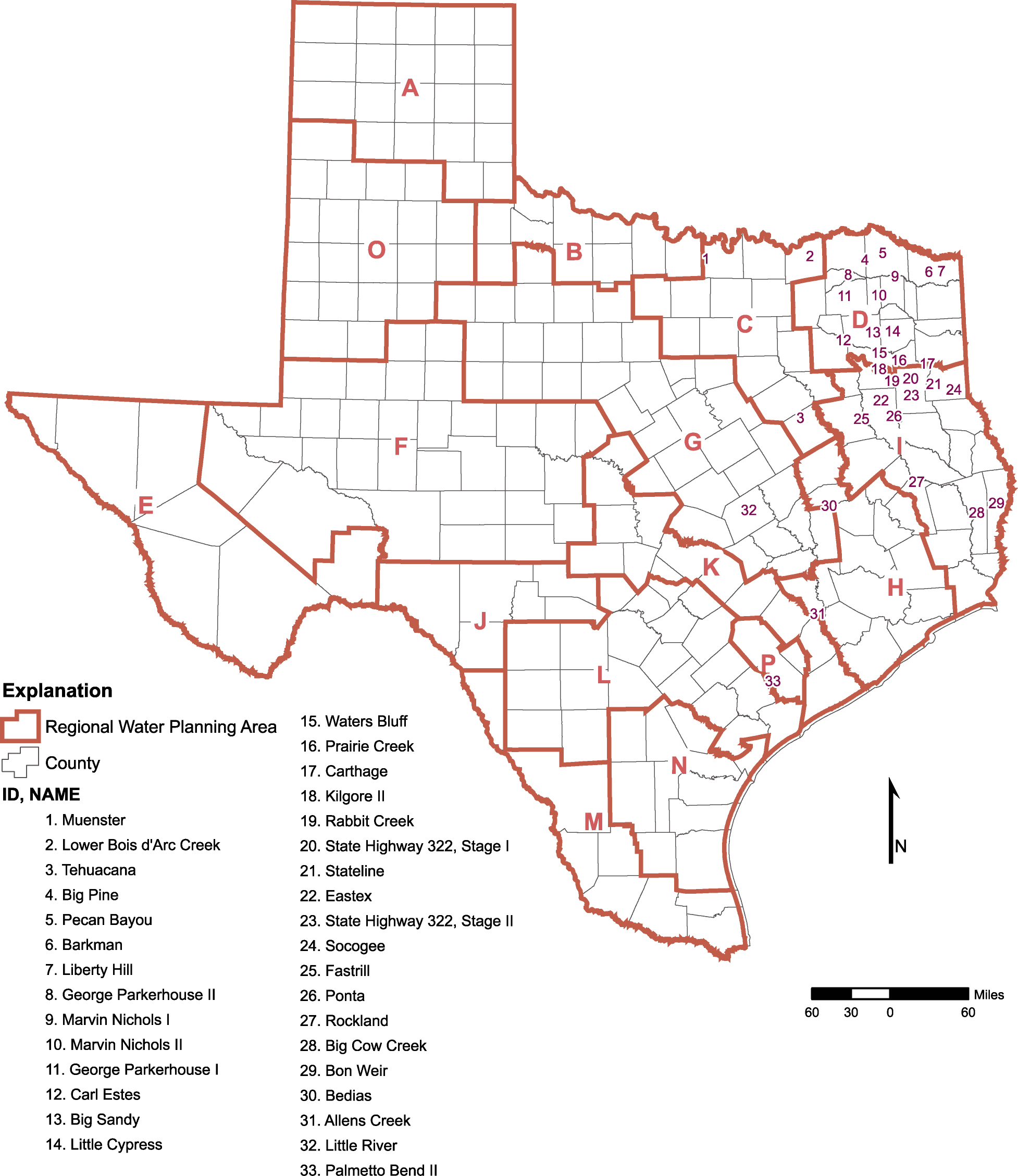
- 14-2 Unique reservoir sites proposed by Planning Groups
-
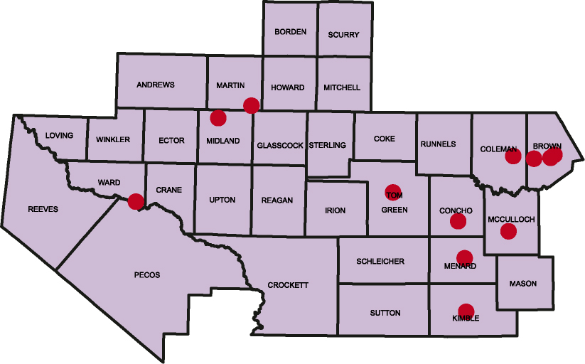
Regional Summary Pages Chapter 11:
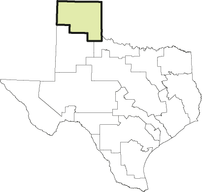
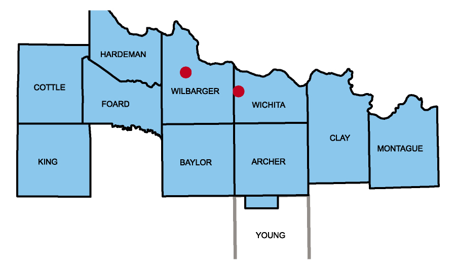
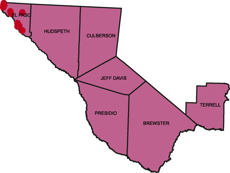
- Region A
- Region B
- Region C
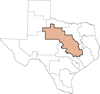
- Region D
- Region E
- Region F
- Region G
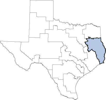
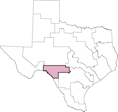
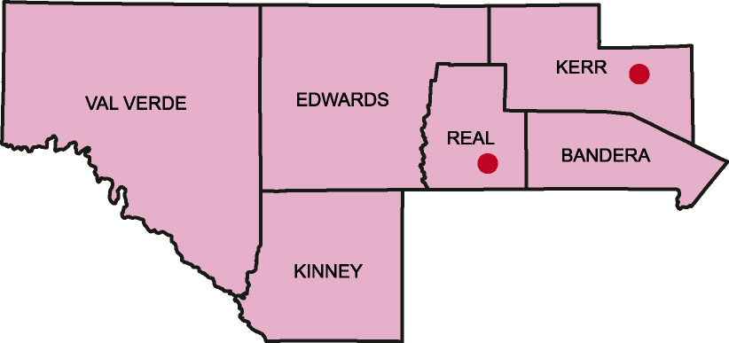
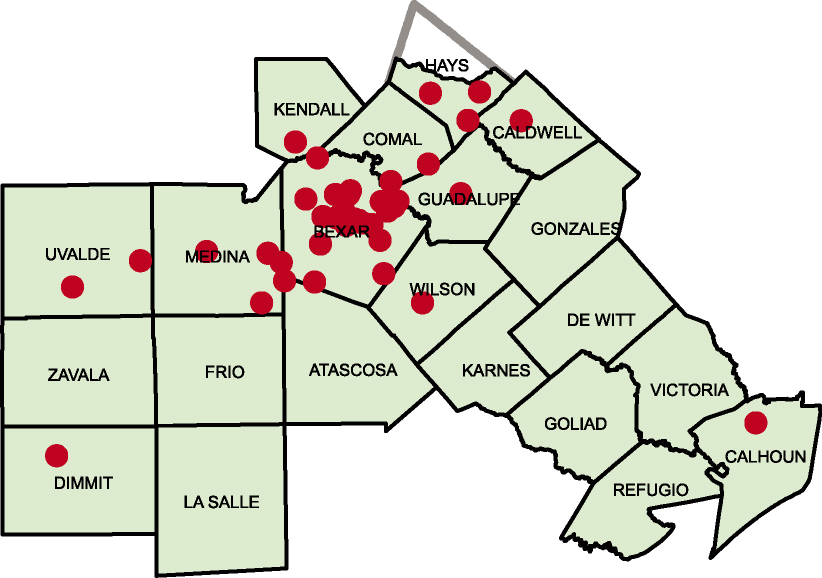
- Region H
- Region I
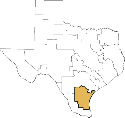
- Region J
- Region K
- Region L
- Region M
- Region N
- Region O
- Region P