Understanding Drought Status and Impacts
Because drought is typically a slow-moving disaster, understanding current drought conditions and the impacts they cause isn't always easy. Thankfully, numerous resources exist to illustrate and provide information on both drought status and impacts.
Understanding Drought Status
A variety of online resource are available for understanding drought conditions at a variety of geographic scales.
- North American Drought Monitor: This map provides a broad perspective on drought, especially in areas outside of Texas that impact water resources in Texas, namely southern Colorado and northern New Mexico (flows in the Rio Grande and levels in Elephant Butte Reservoir that impact water supplies in the El Paso area), eastern New Mexico (impacts to flows in the Canadian and Pecos rivers), and northern Mexico south of Big Bend (impacts to inflows to the Rio Grande). Note that this map reflects rainfall and soil moisture deficits and does not necessarily indicate water supply status. Also note that the D0-Abnormally Dry category is not technically drought and represents a transition into or out of drought conditions.
- Texas Drought Monitor: This map focuses on Texas. The Texas Drought Monitor also has historical data for the state in tabular format. Note that this map reflects rainfall and soil moisture deficits and does not necessarily indicate water-supply status. Also note that the D0-Abnormally Dry category is not technically drought and represents a transition into or out of drought conditions.
- Texas drought status over time: The graph at the bottom of this page reflects how drought conditions have changed over time.
- Drought in your backyard: Type in your zip code to find out your Drought Monitor intensity. Fun for the whole family!
- Drought webinars: This site contains links to past drought-related webinars from the National Integrated Drought Information System Southern Plains Drought Early Warning System.
Understanding Drought Impacts
The TWDB provides valuable information for understanding the impacts of drought through its online platforms.
- Streamflow: This site reflects how drought might be affecting streamflow across the state. We chose the gages shown on this site to reflect relatively undeveloped areas not impacted by reservoir releases or wastewater return flows. This gives us a sense of natural runoff into rivers and streams that might be expected above a reservoir. We consider flow less than 30 percent to be low. More detailed (and less restrictive) information on streamflow is available on the U.S. Geological Survey's WaterWatch website.
- Reservoir storage: This site indicates how drought might be affecting reservoir levels across the state, including Elephant Butte Reservoir, which is located in New Mexico but is an important source of water to the El Paso area.
- Groundwater levels: This site shows how drought might be affecting groundwater levels across the state. Note that water levels in many aquifers decline every year regardless of drought but may decline faster during droughts. Information on J-17, an important well important for the management of the San Antonio Segment of the Edwards (Balcones Fault Zone) Aquifer, can be found on the Water Data for Texas, Edwards Aquifer Authority, and San Antonio Water System websites.
Below are additional sources of information about drought impacts.
- Rainfall (precipitation): We use this site to map accumulated rainfall over a specific time period. There are options to map observed rainfall, average rainfall, departure from average rainfall, and percent of average rainfall for the time period specified.
- Soil moisture: We use this site, particularly the Monthly Percentile, to assess soil moisture conditions across the state. Soil moisture affects crops as well as runoff into rivers and reservoirs.
- Priority calls on surface water: Texas manages surface water through prior appropriations. When a senior right holder doesn't have enough water, he or she can make a priority call to the Texas Commission on Environmental Quality to require more junior, upstream water right holders to stop taking water from the river. We use this site to see the status of priority calls on surface water.
- Public water systems: We use this site to see how many and which public water supply systems have been impacted by drought through the activation of their drought contingency plans. The Texas Commission on Environmental Quality provides a list of the affected communities and which ones have reported less than 180, 90, and 45 days of water.
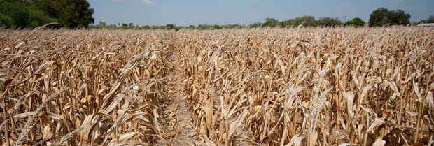
- Vegetation Drought Response Index: We use this site to see how vegetation in the state is responding to drought.
- County burn bans: We use this site to see which counties have instituted burn bans.
- Wildfires: We use this site to see how many wildfires have occurred in Texas and the current status of wildfires.
- Drought Impact Reporter: We use this site to find media and other reports about drought impacts.
- Governor's Drought Disaster Proclamations: Based on recommendations from representatives of the Drought Preparedness Council, the governor makes a drought disaster proclamation that is delivered to county judges, who in turn share the proclamation with public water supply systems. Notified systems must then implement their water conservation plans and drought contingency plans as applicable.