Report 248 By Howard D. Taylor | June 1980
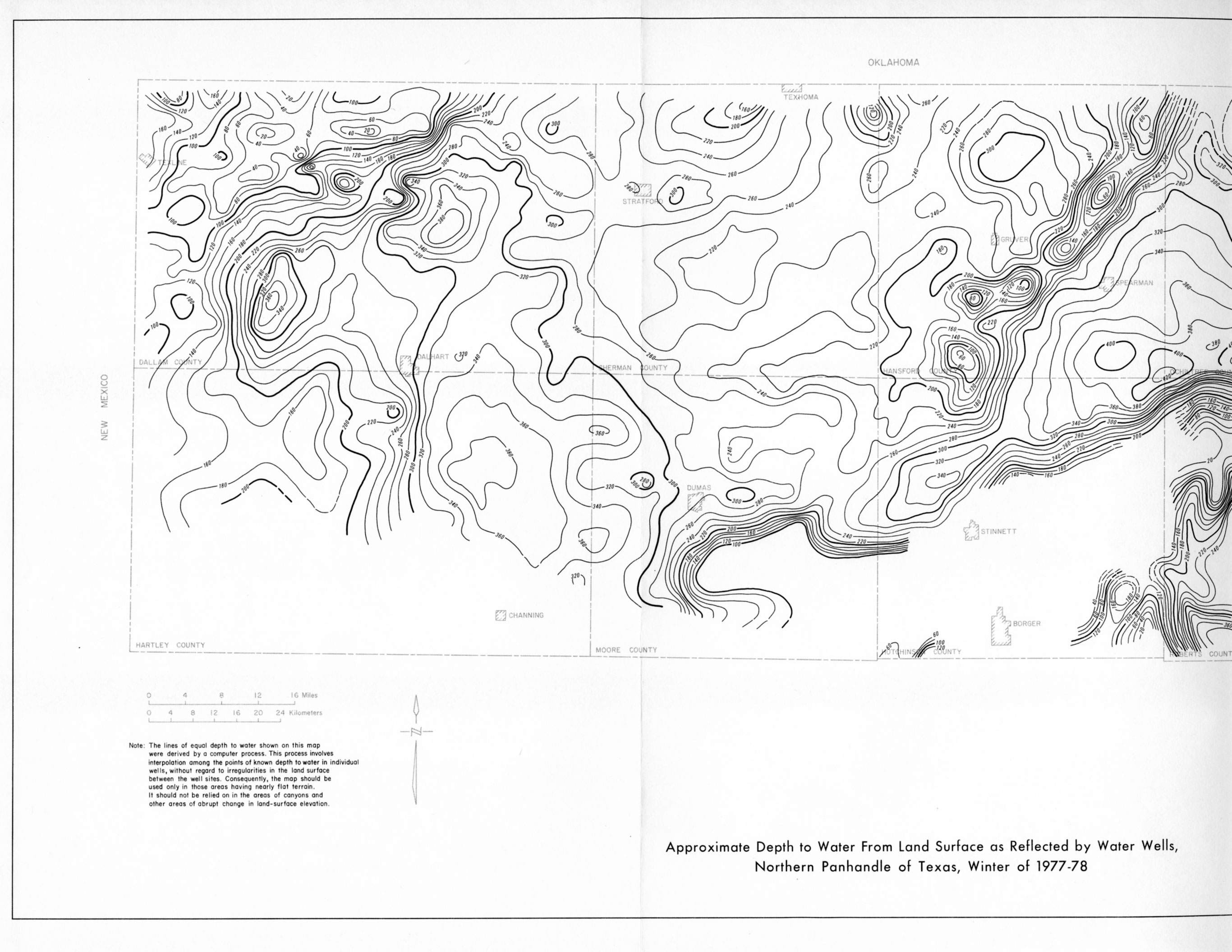
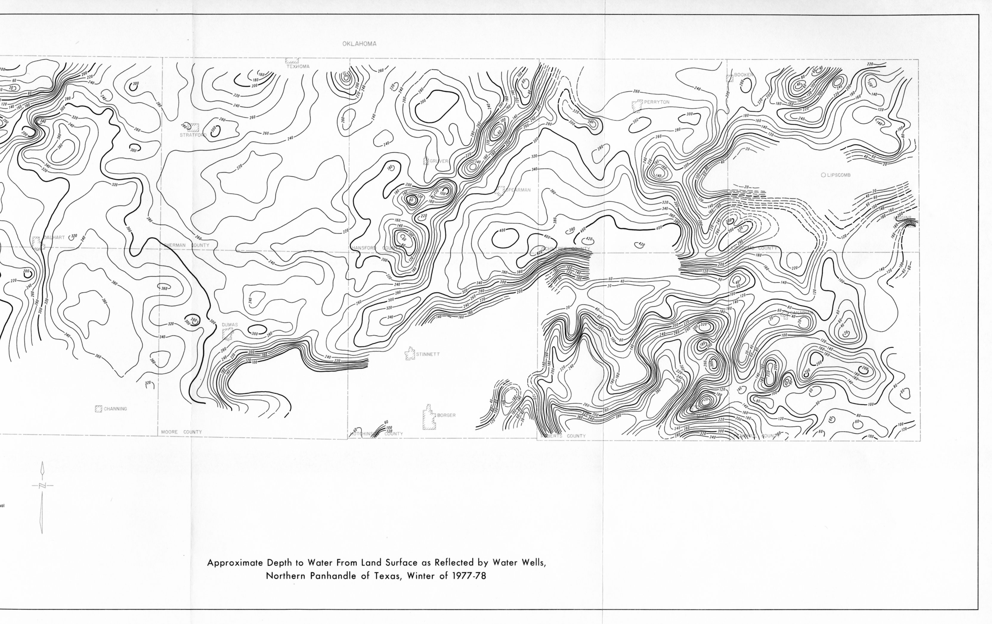
Note: oversized fold-out map was scanned in two pieces
- Report 248 - Water-Level Data From Observation Wells in the Northern Panhandle of Texas, 1972-78
- Color maps showing well locations by county (these color pages are also included in the scanned greyscale report above)
- Figure A
- Figure B Approximate Depth to Water From Land Surface as Reflected by Water Wells, Northern Panhandle of Texas, Winter of 1977-78