Report 160 by Gerald L. Thompson U.S. Geological Survey | November 1972 (reprinted January 1987)
- Report 160 (pdf - 12.0MB) - Ground-Water Resources of Navarro County, Texas
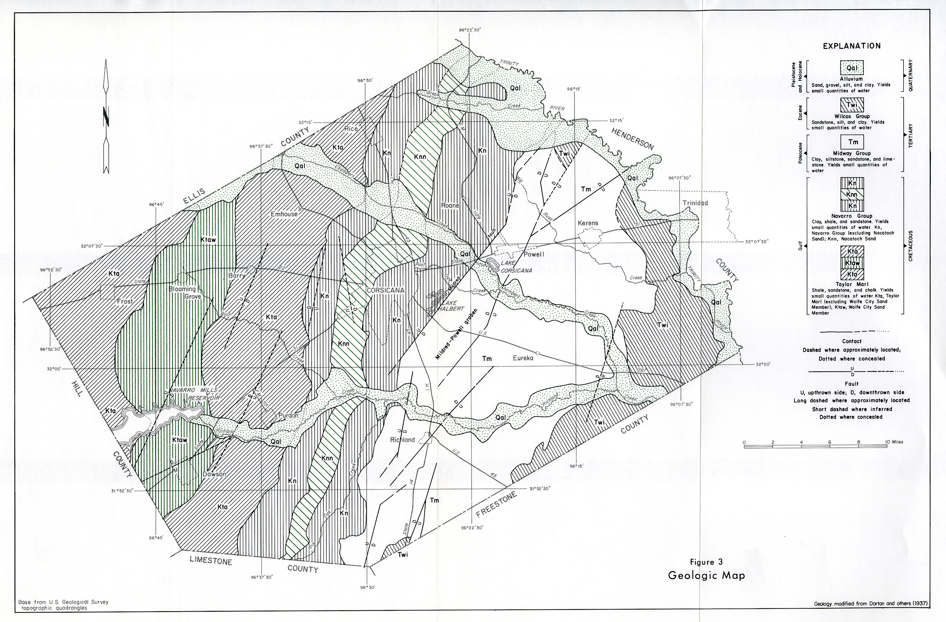
- Figure 3 - (JPG - 5.97MB) Geologic Map
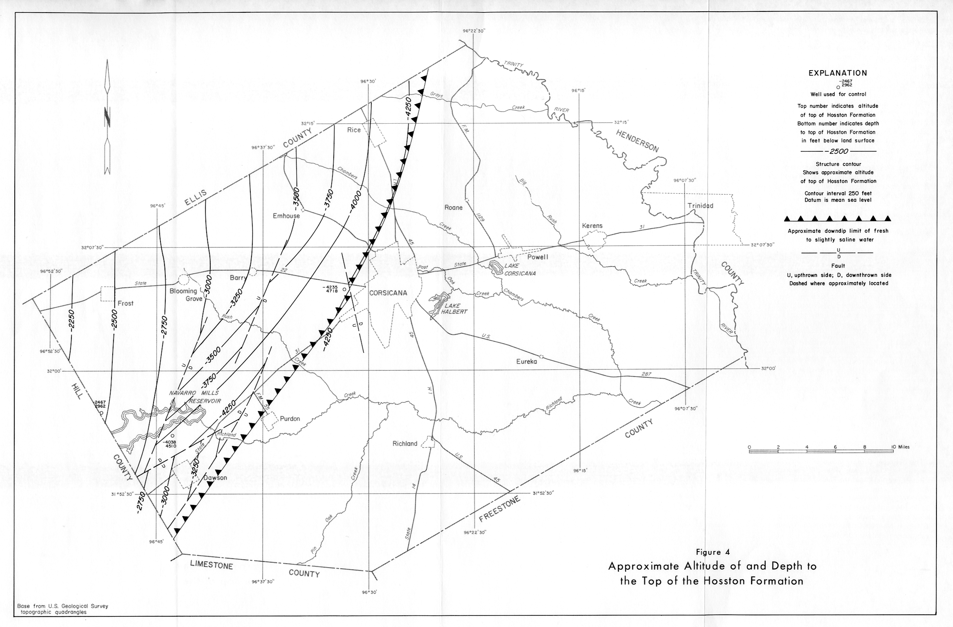
- Figure 4 - (JPG - 2.09MB) Approximate Altitude and Depth to the top of the Hosston Formation
- Figure 5 - (JPG - 1.99MB) Approximate Altitude and Depth to the top of the Woodbine Formation
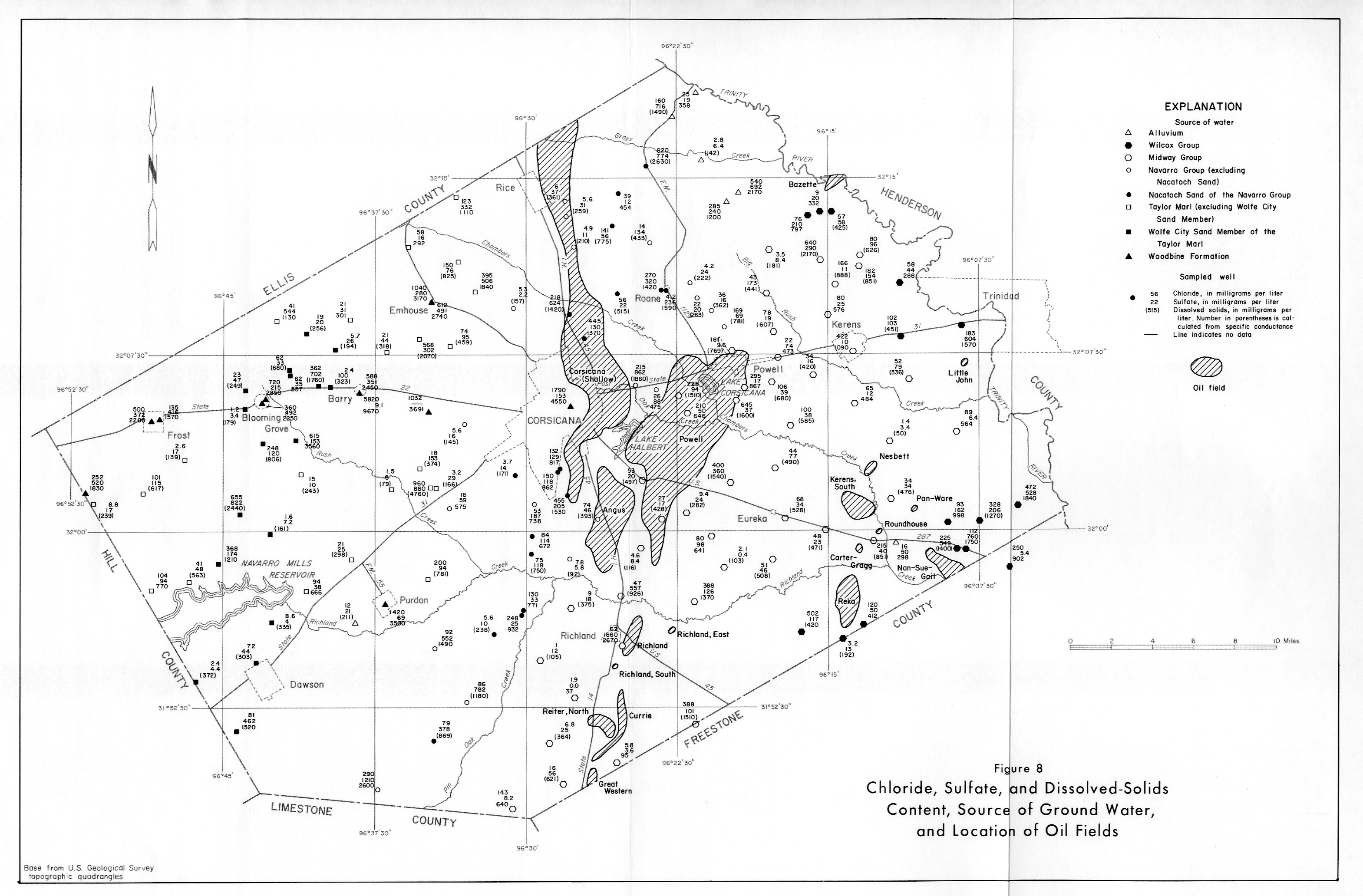
- Figure 8 - (JPG - 2.31MB) Chloride, Sulfate, and Dissolved-Solids Content, Source of Ground Water and Location of Oil Fields
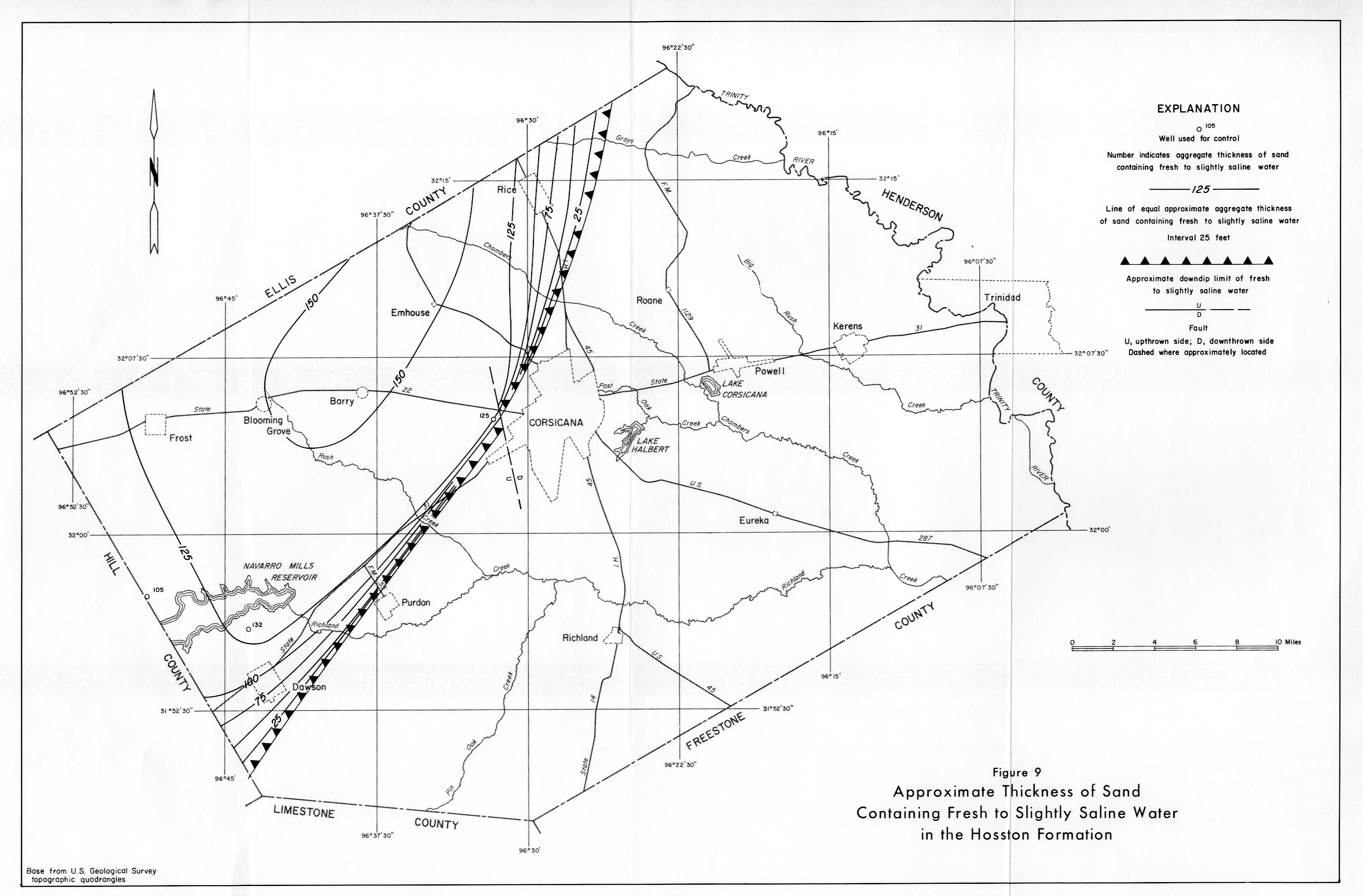
- Figure 9 - (JPG - 2.43MB) Approximate Thickness of Sand Containing Fresh to Slightly Saline Water in the Hosston Formation
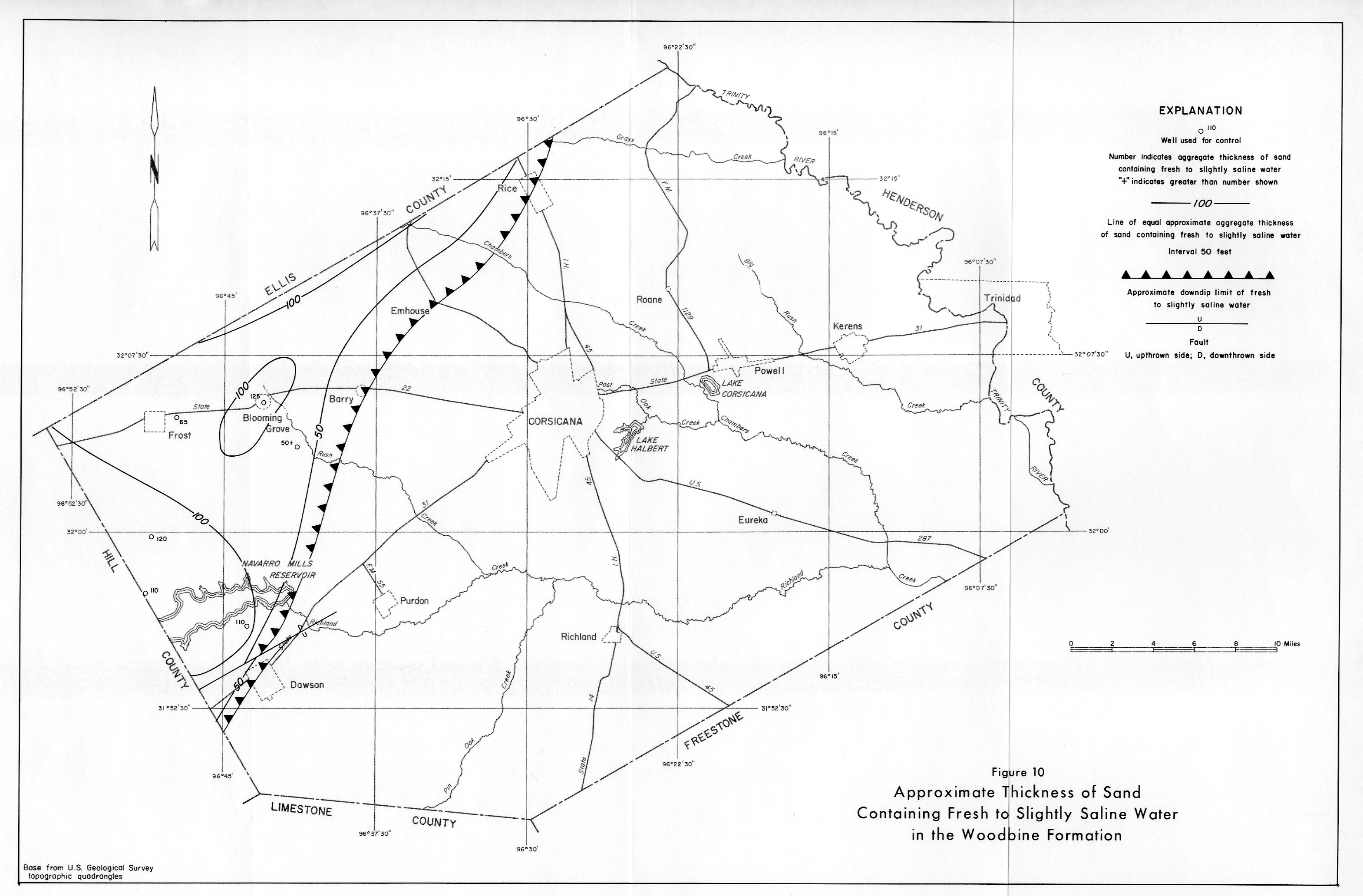
- Figure 10 - (JPG - 2.40MB) Approximate Thickness of Sand Containing Fresh to Slightly Saline Water in the Woodbine Formation
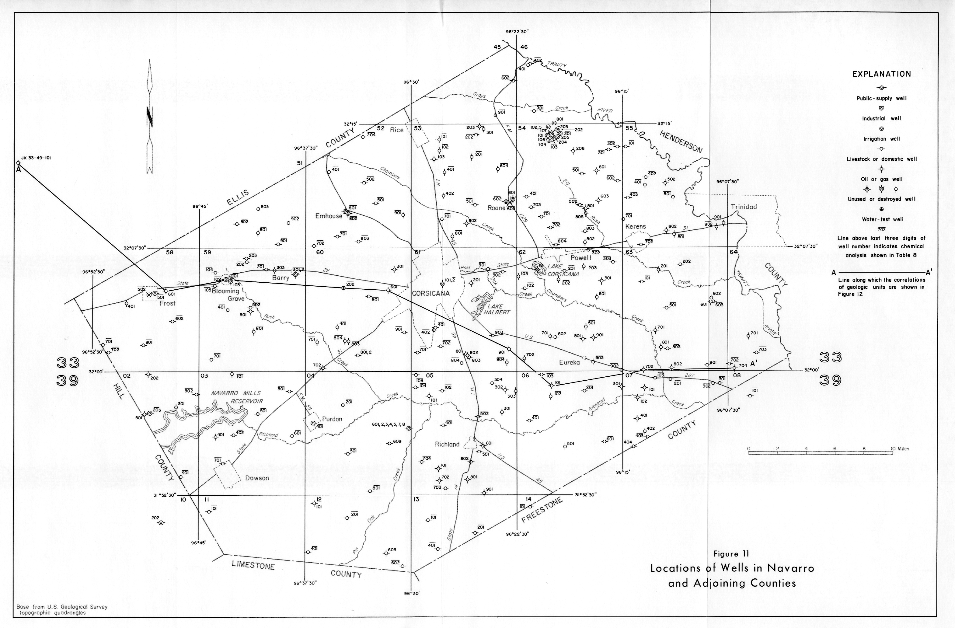
- Figure 11 - (JPG - 2.28MB) Locations of Wells in Navarro and Adjoining Counties
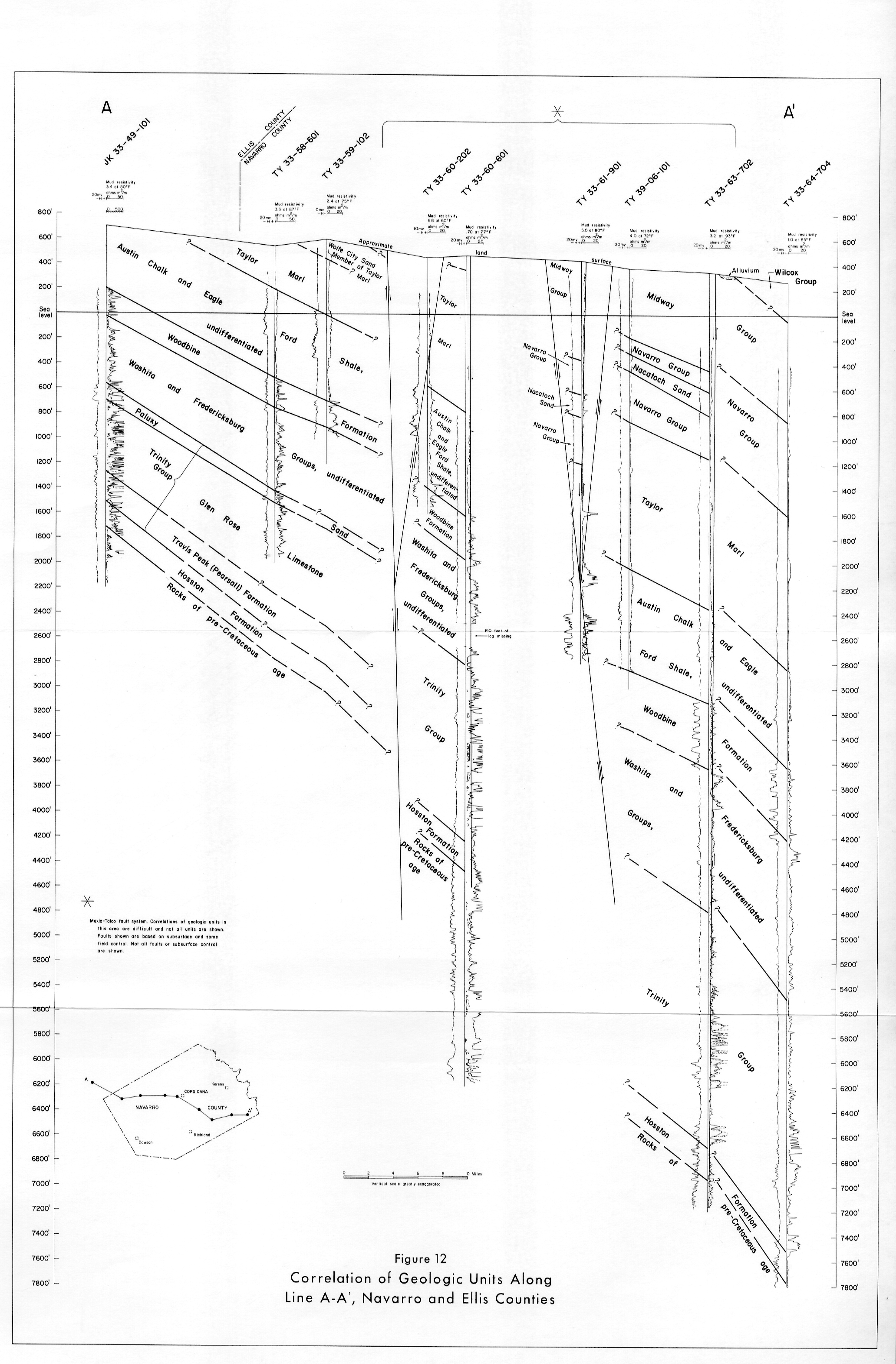
- Figure 12 - (JPG - 2.28MB) Correlation of Geologic Units Along Line A - A', Navarro and Ellis Counties