Report 1 By E.T. Baker, Jr., U.S. Geological survey | October, 1965
Note: this report is posted in two parts due to file size considerations (18 MB and 23.3MB respectively).
Note: oversize plates and figures were scanned separately from the report, and "missing pages" in those PDFs are the following maps:
- Ground-Water Resources of Jackson County, Texas - Part 1
- Ground-Water Resources of Jackson County, Texas - Part 2
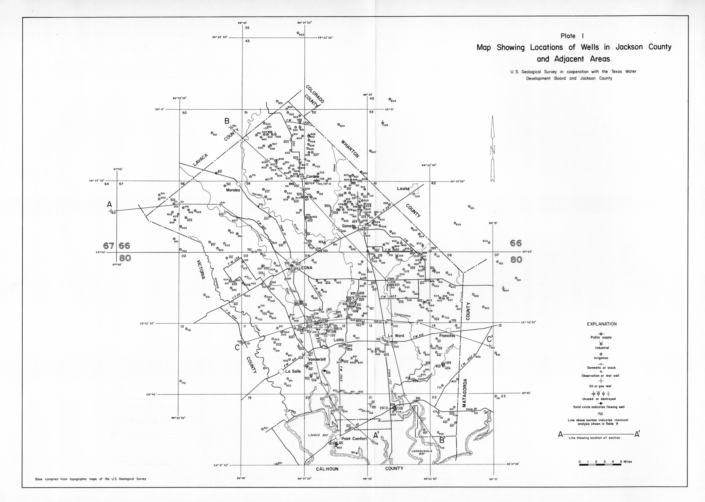
- Plate 1 - Map Showing Locations of Wells in Jackson County
- Plate 2 - Section A-A' Showing Approximate Base of the Fresh Water and of the Slightly Saline Water, Jackson County and Adjacent Areas
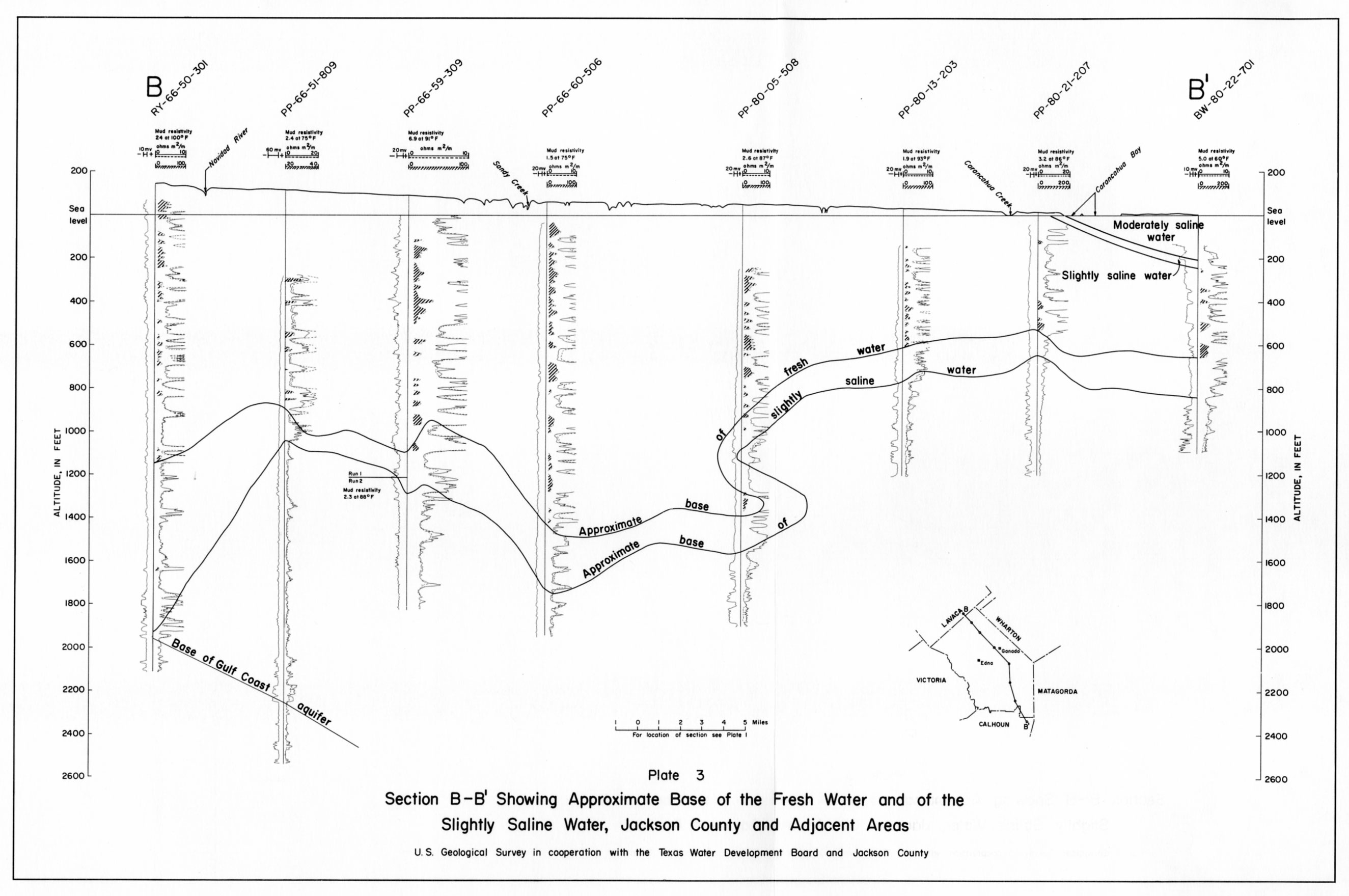
- Plate 3 - Section B-B' Showing Approximate Base of the Fresh Water and of the Slightly Saline Water, Jackson County and Adjacent Areas
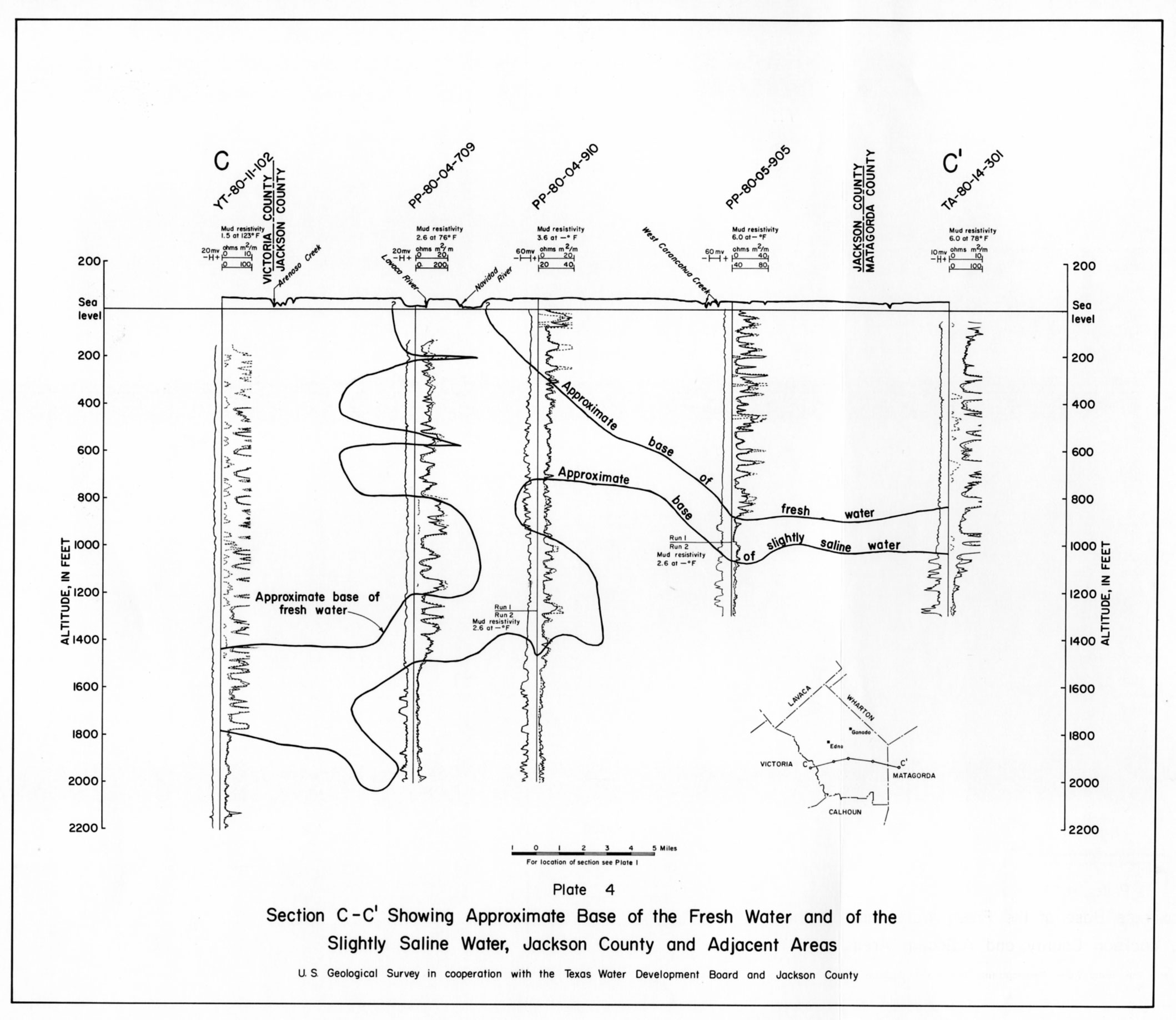
- Plate 4 - Section C-C' Showing Approximate Base of the Fresh Water and of the Slightly Saline Water, Jackson County and Adjacent Areas
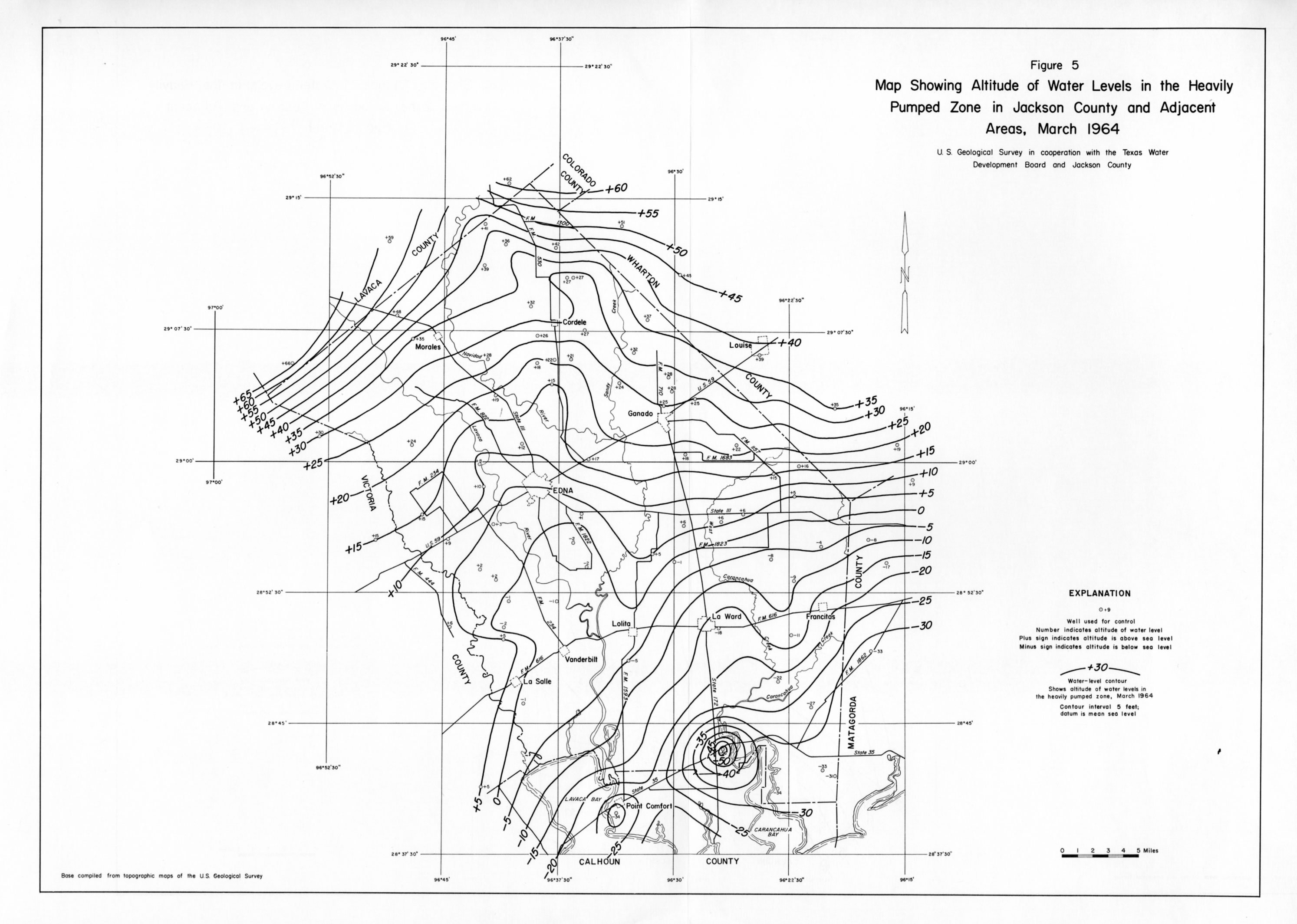
- Figure 5 - Map Showing Altitude of Water Levels in the Heavily Pumped Zone in Jackson County and Adjacent Areas, March 1964
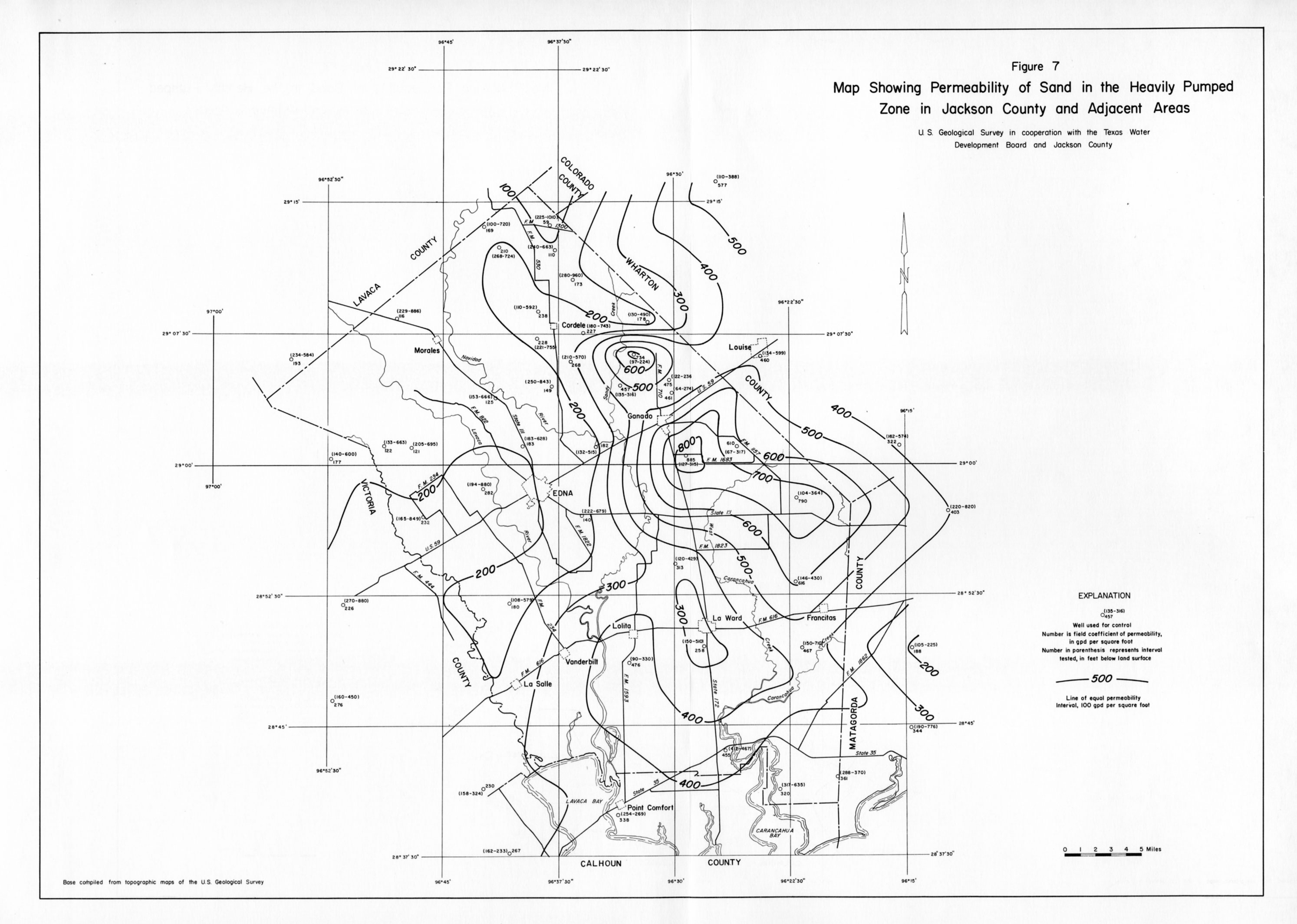
- Figure 7 - Map Showing Permeability of Sand in the Heavily Pumped Zone in Jackson County and Adjacent Areas
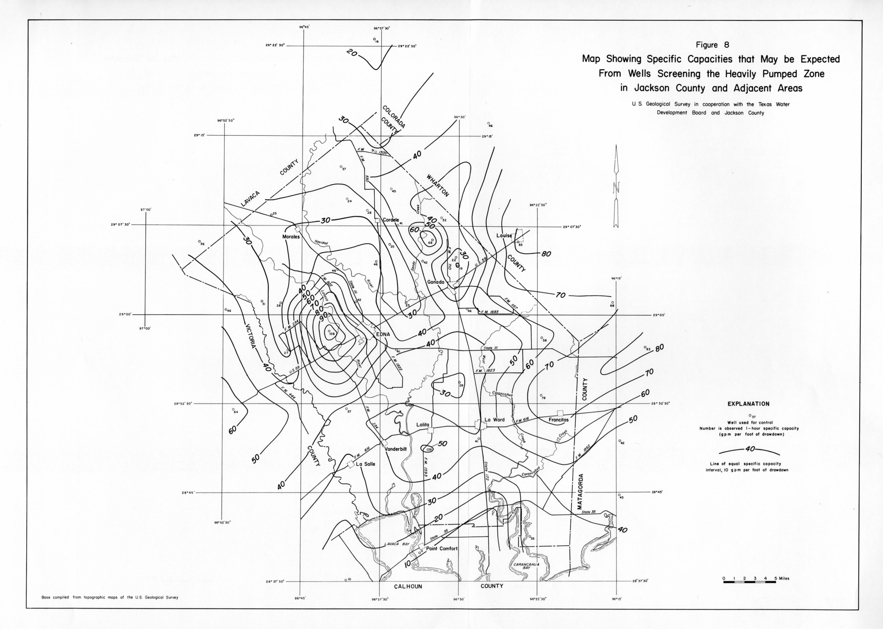
- Figure 8 - Map Showing Specific Capacities that May be Expected From Wells Screening the Heavily Pumped Zone in Jackson County and Adjacent Areas
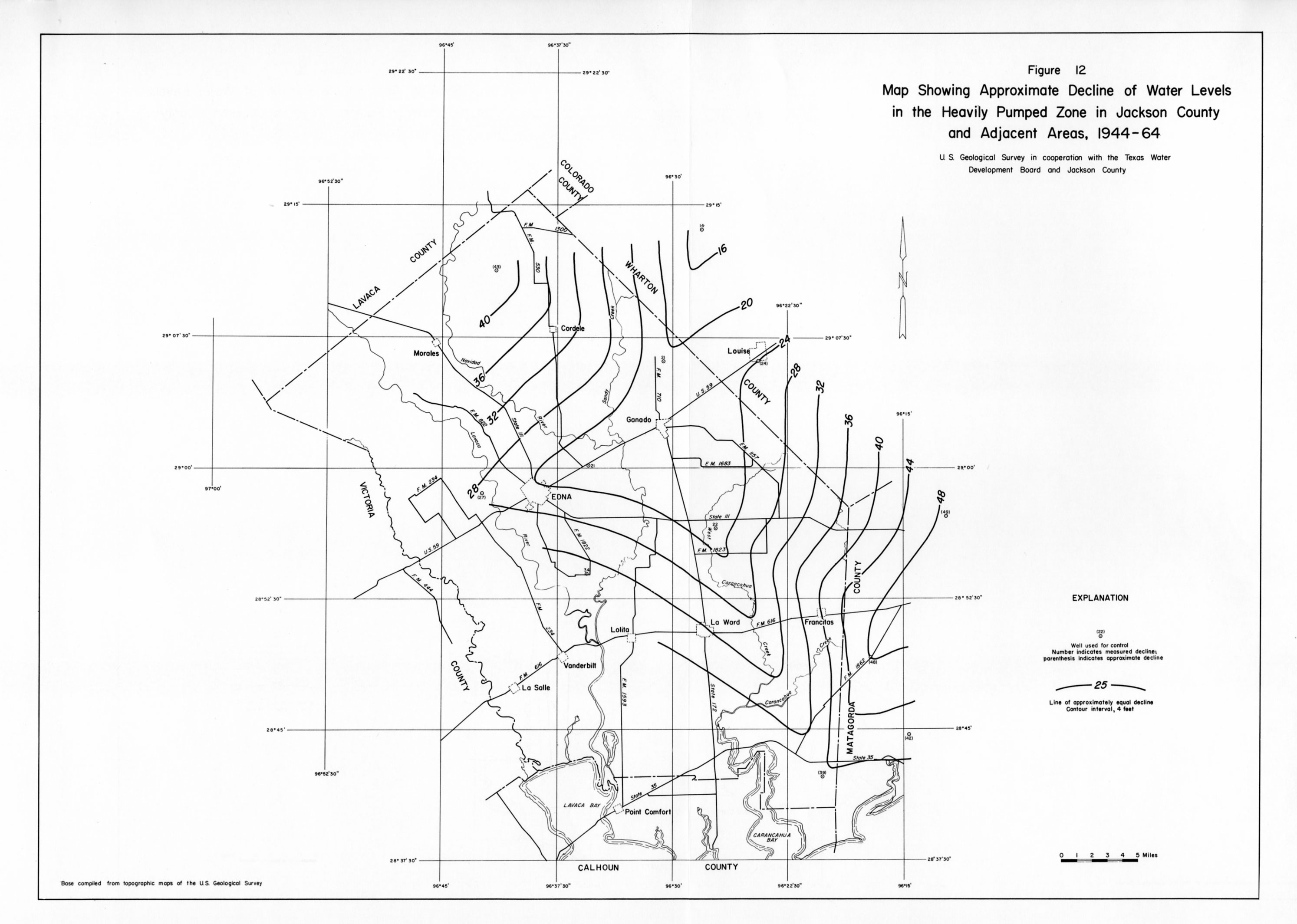
- Figure 12 - Map Showing Approximate Decline of Water Levels in the Heavily Pumped Zone in Jackson County and Adjacent Areas, 1944 - 64
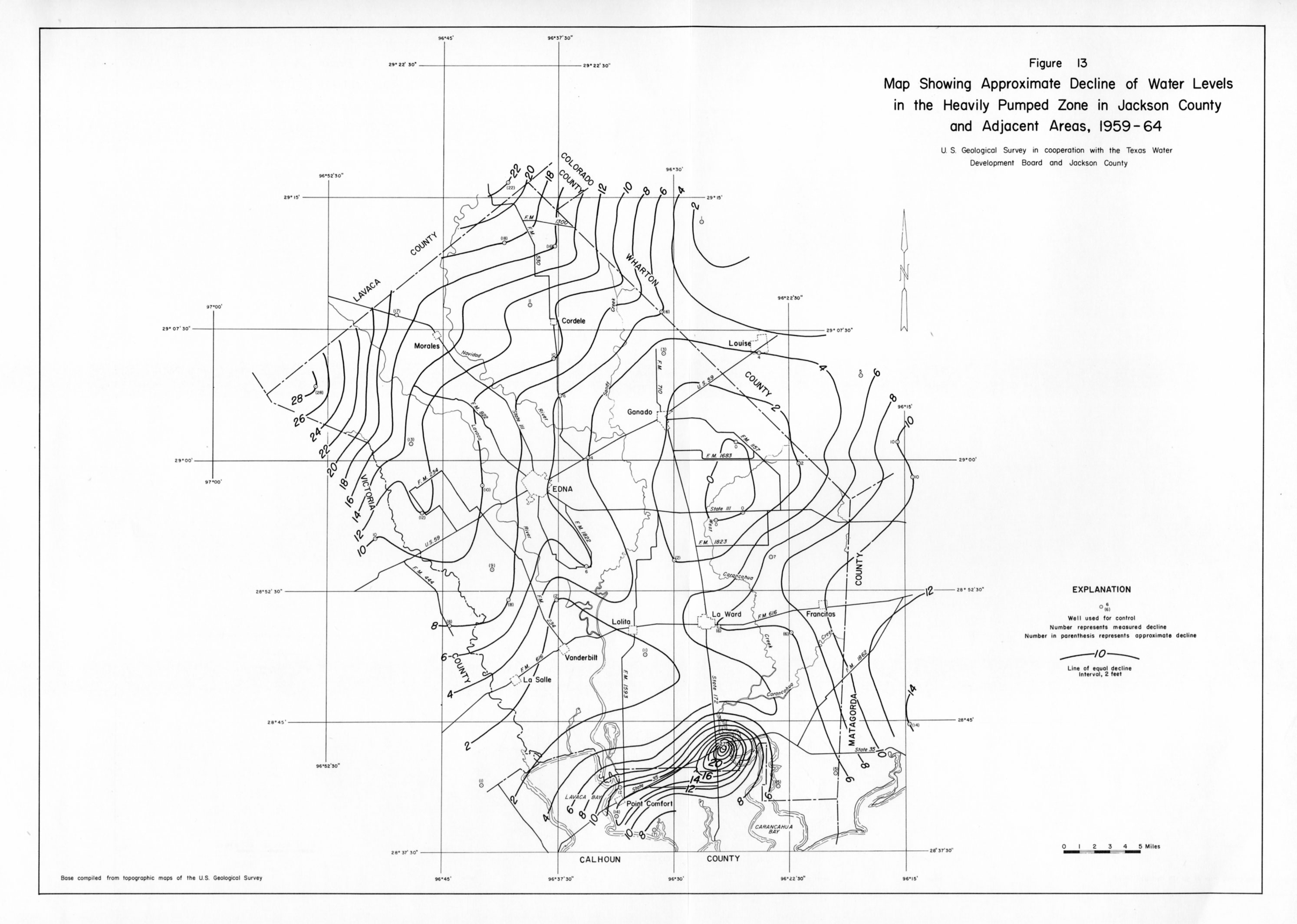
- Figure 13 - Map Showing Approximate Decline of Water Levels in the Heavily Pumped Zone in Jackson County and Adjacent Areas, 1959 - 64
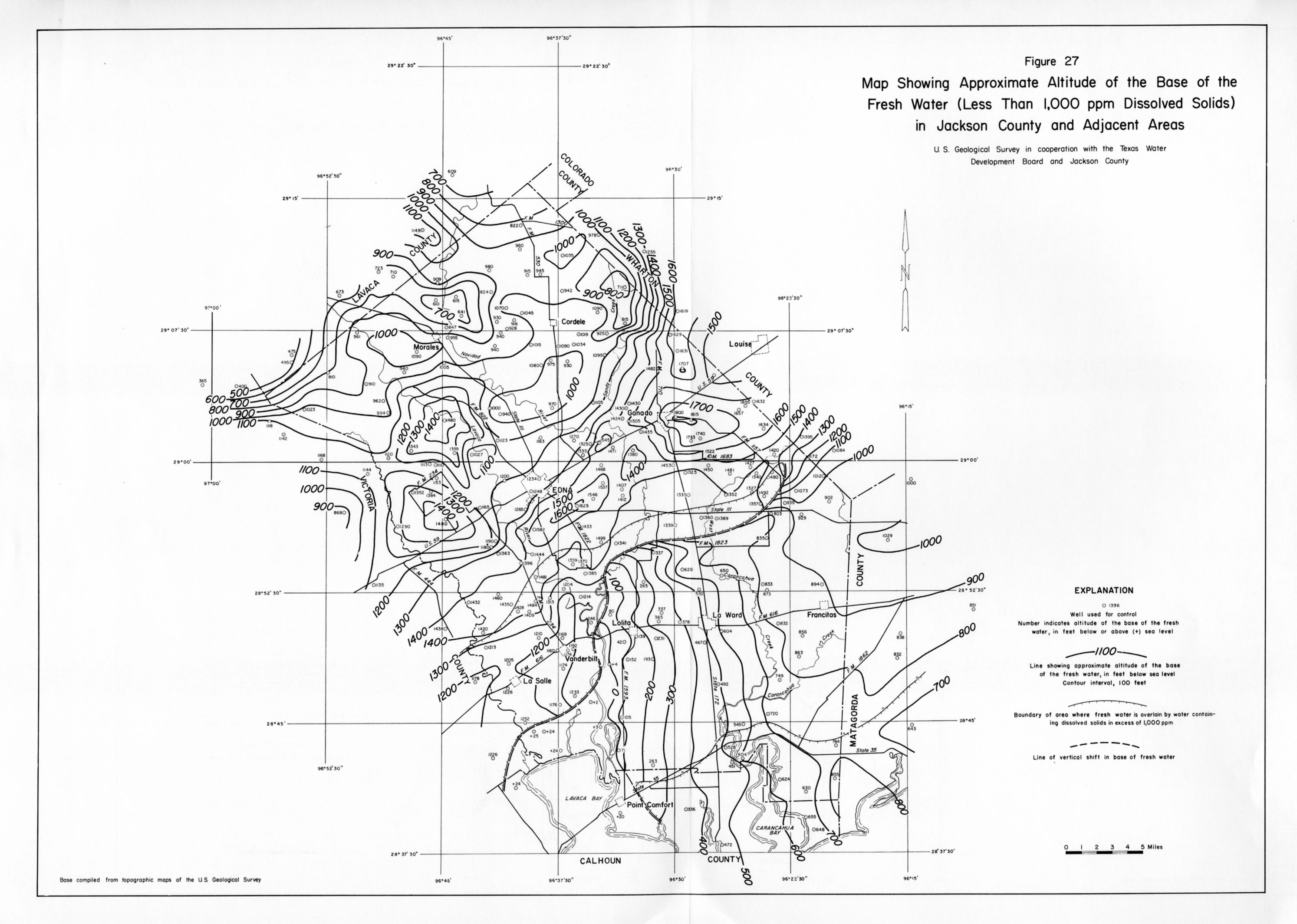
- Figure 27 - Map Showing Approximate Altitude of the Base of the Fresh Water (Less Than 1,000 ppm Dissolved Solids) in Jackson County and Adjacent Areas
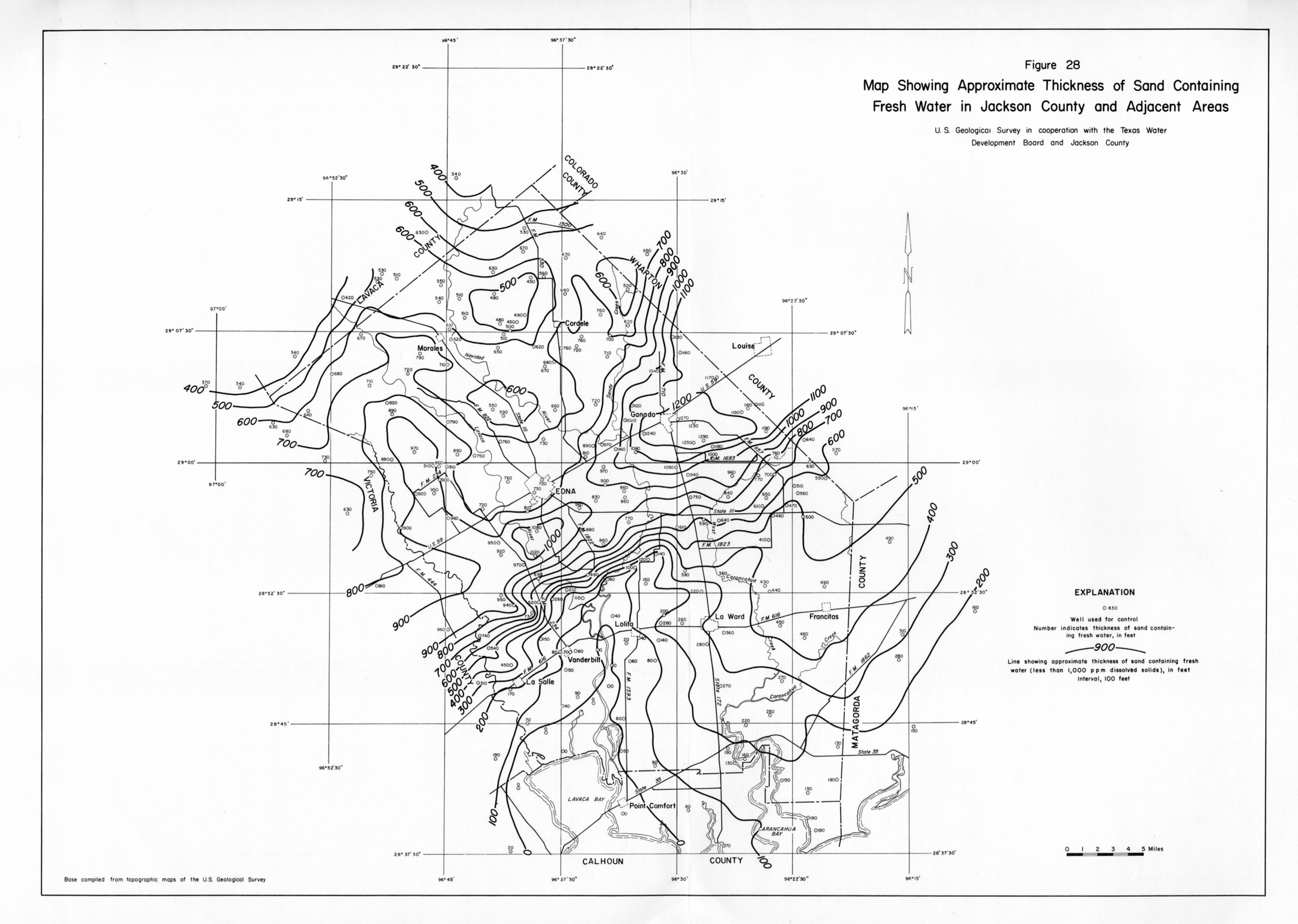
- Figure 28 - Map Showing Approximate Thickness of Sand Containing Fresh Water in Jackson County and Adjacent Areas
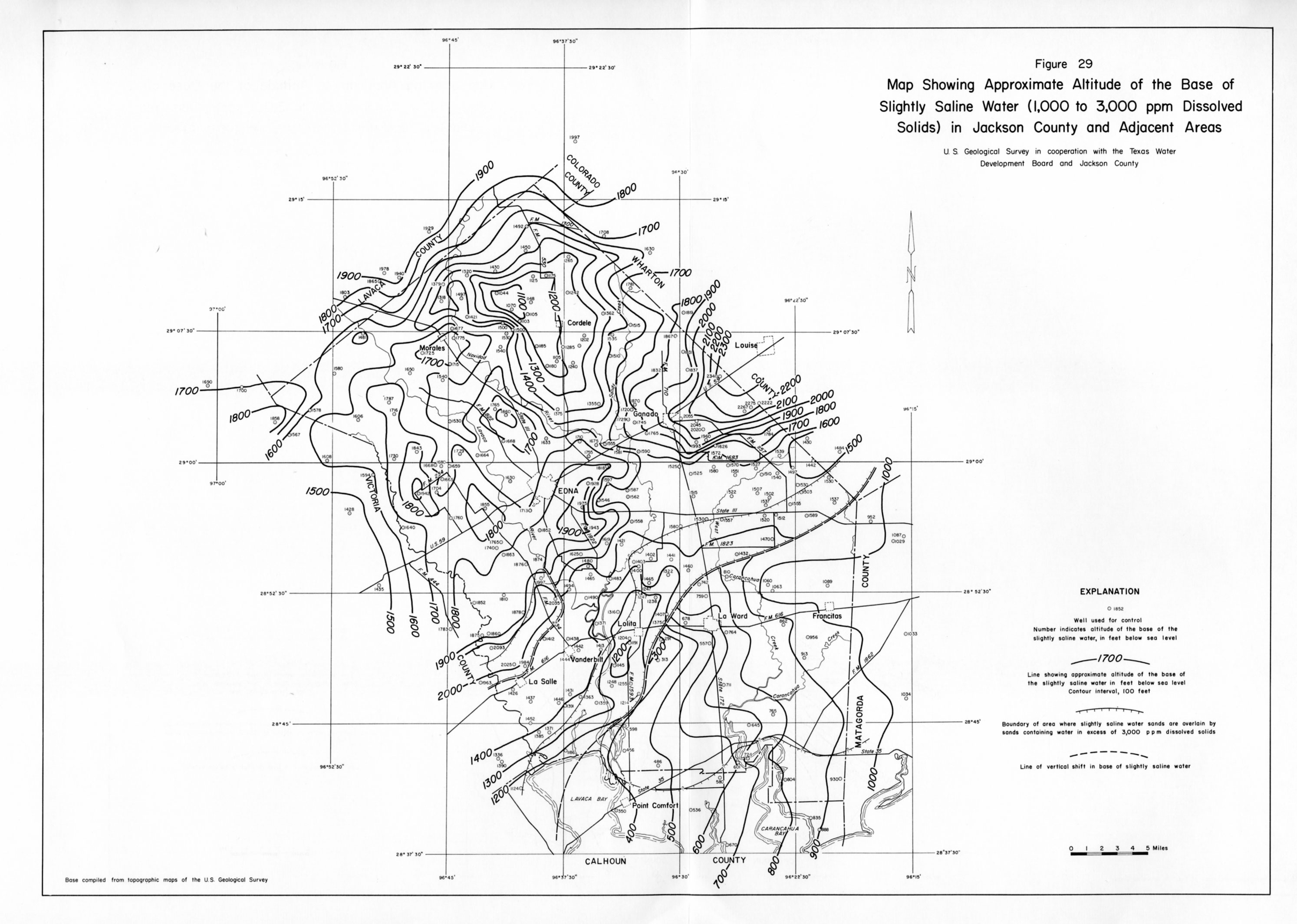
- Figure 29 - Map Showing Approximate Altitude of the Base of the Slightly Saline Water (1,000 to 3,000 ppm Dissolved Solids) in Jackson County and Adjacent Areas
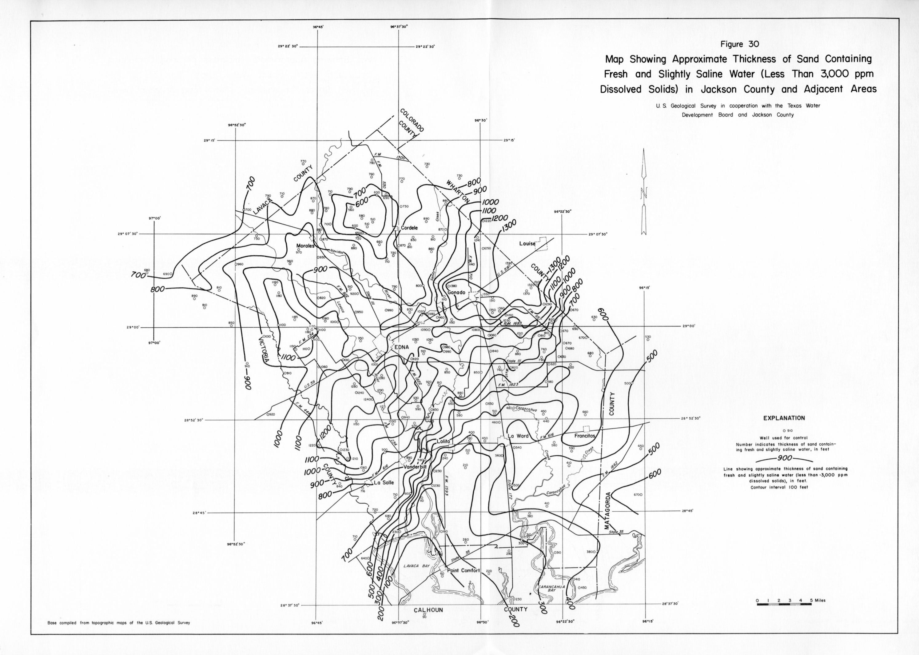
- Figure 30 - Map Showing Approximate Thickness of Sand Containing Fresh and Slightly Saline Water (Less Than 3,000 ppm Dissolved Solids) in Jackson County and Adjacent Areas
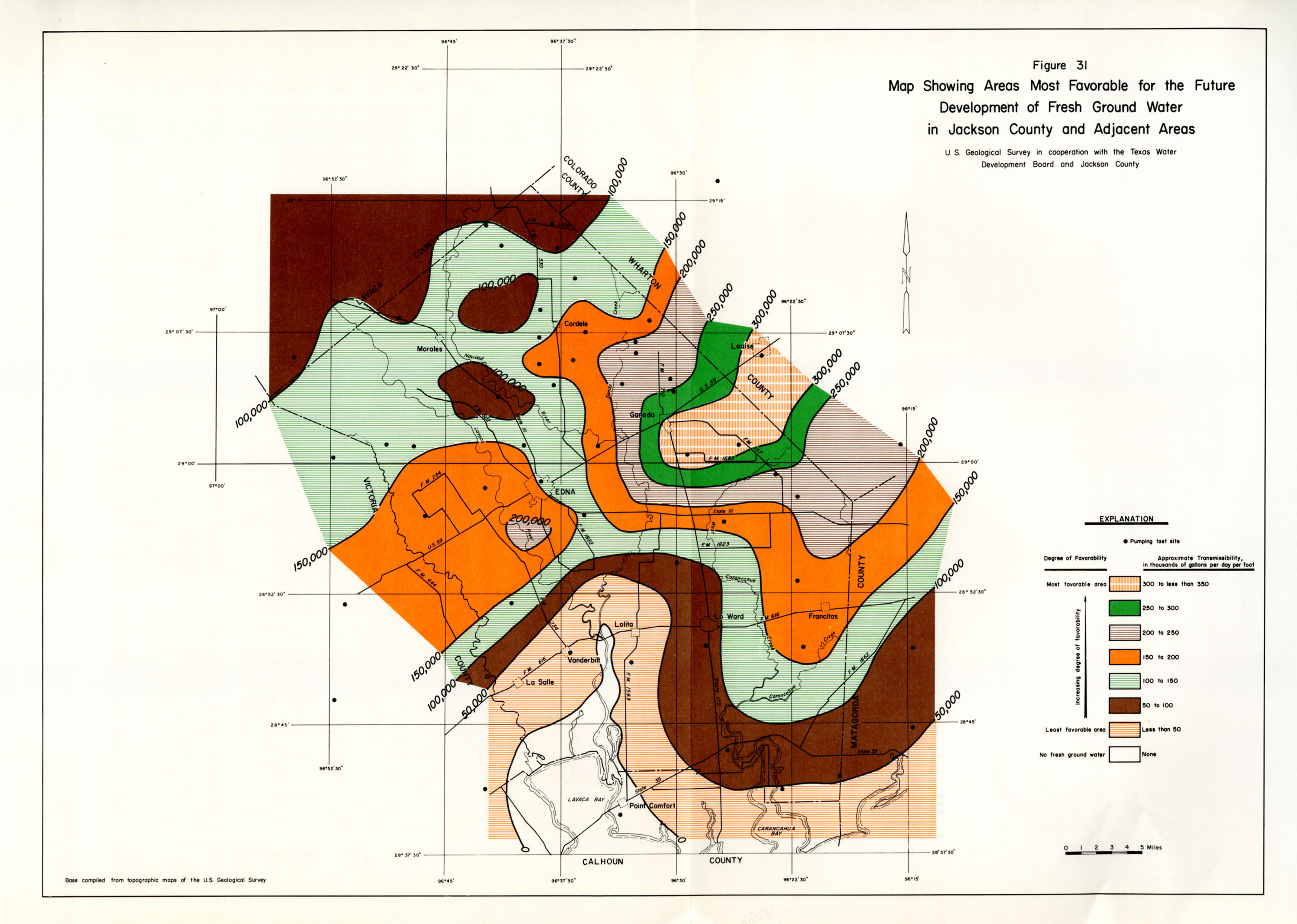
- Figure 31 (color) - Map Showing Areas Most Favorable for the Future Development of Fresh Ground Water in Jackson County and Adjacent Areas