Report 41 By James G. Cronin and Clyde A. Wilson, United States Geological Survey | March, 1967
- Report 41 (report body) - Ground Water in the Flood Plain of the Brazos River, Whitney Dam to Vicinity of Richmond, Texas
- Report 41 (tabular data) - Ground Water in the Flood Plain of the Brazos River, Whitney Dam to Vicinity of Richmond, Texas
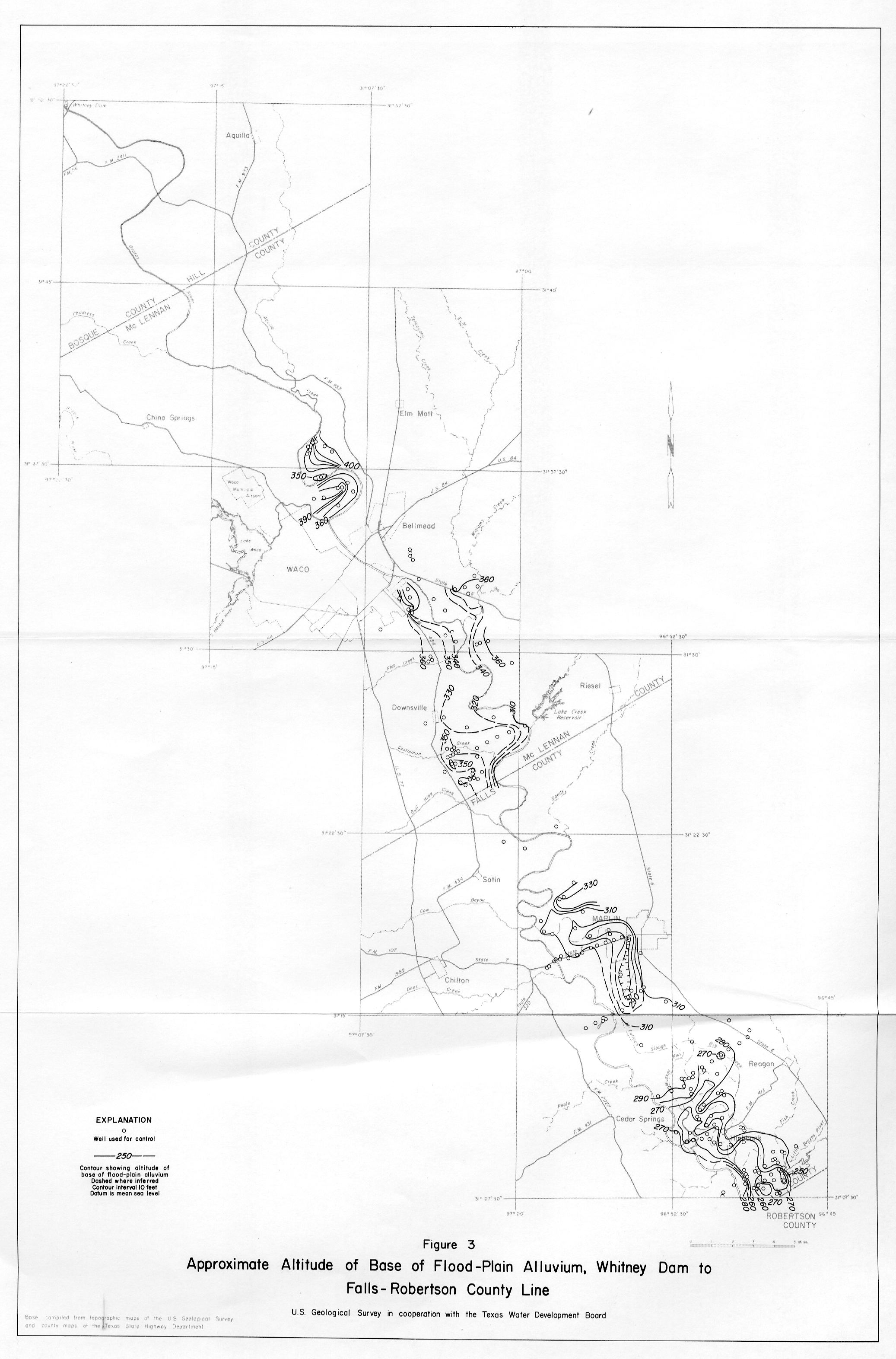
- Figure 3 Base of Flood-Plain Alluvium
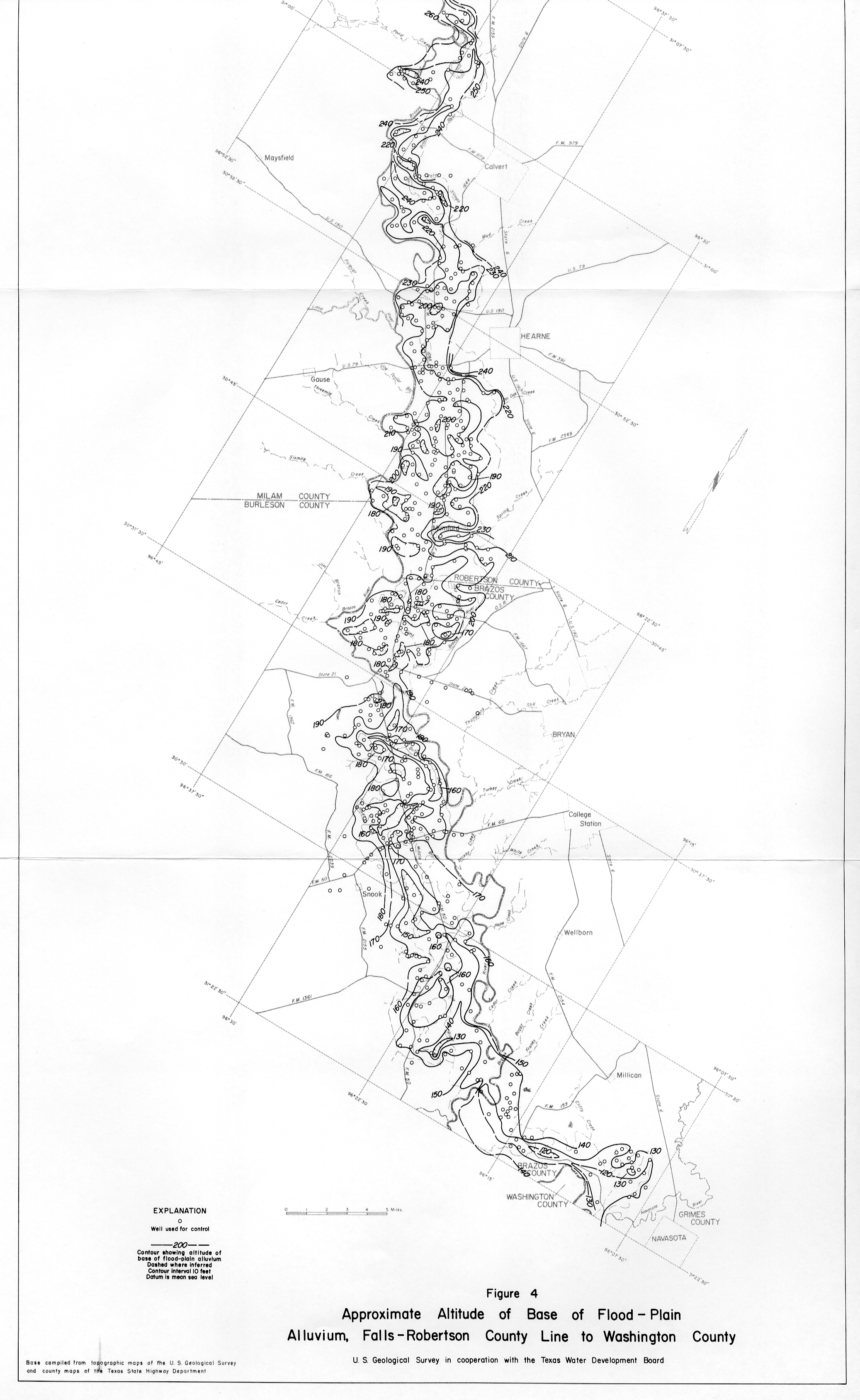
- Figure 4 Base of Flood-Plain Alluvium Falls-Robertson county line
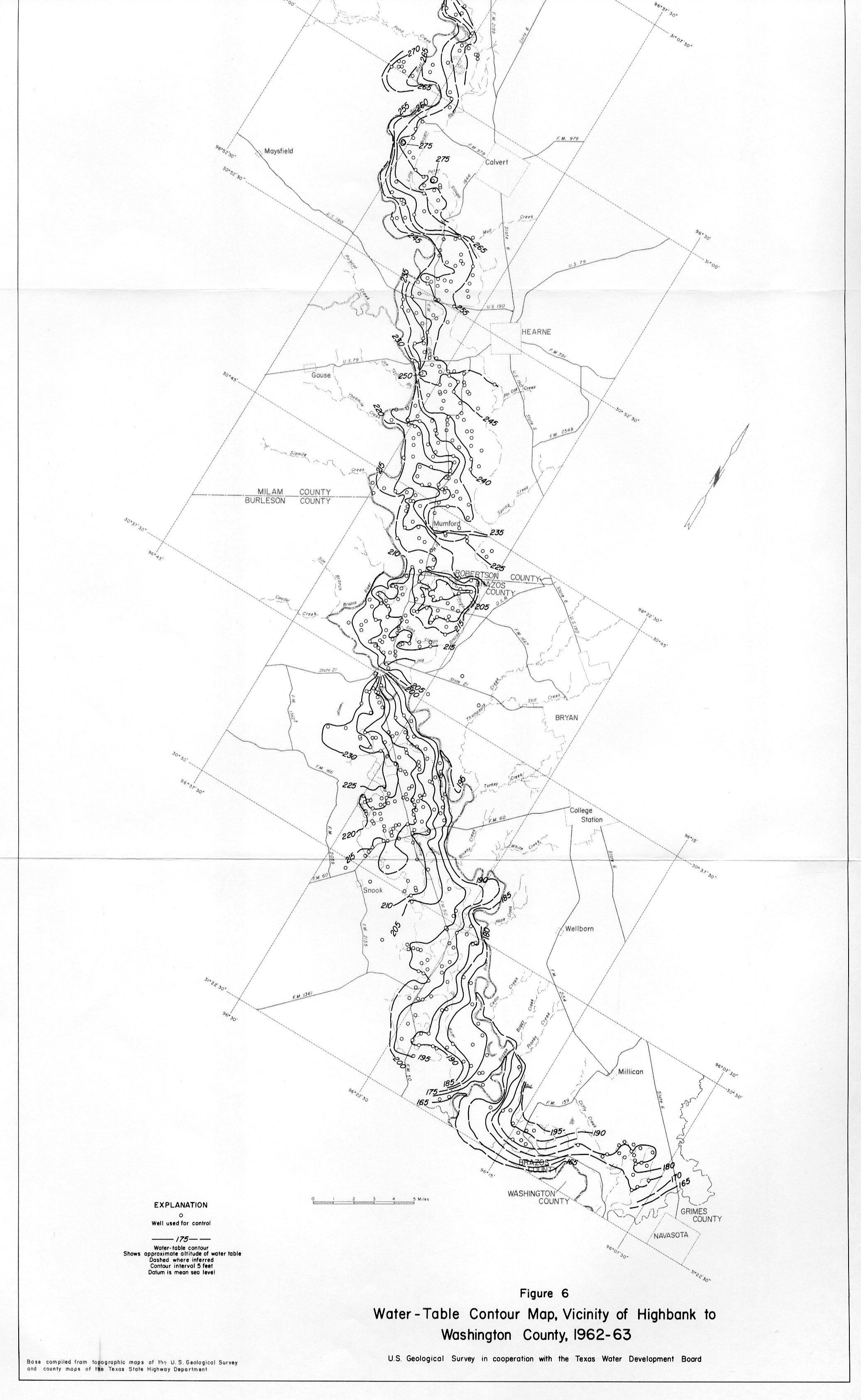
- Figure 6 Water Table Contour map, Vicinity of Highbank, 1962-63
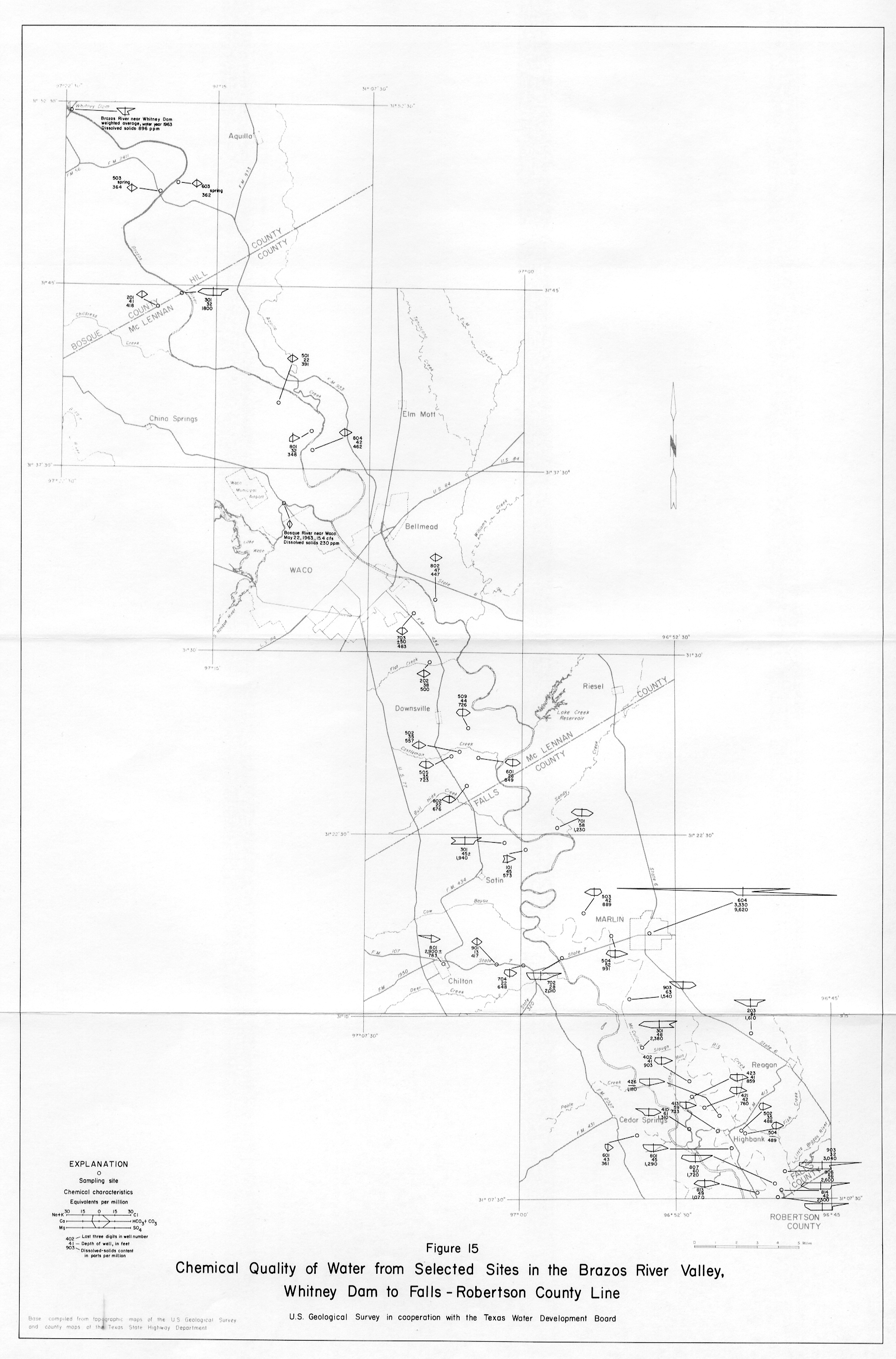
- Figure 15 Chemical Quality of Water from Selected Sites in the Brazos River Valley
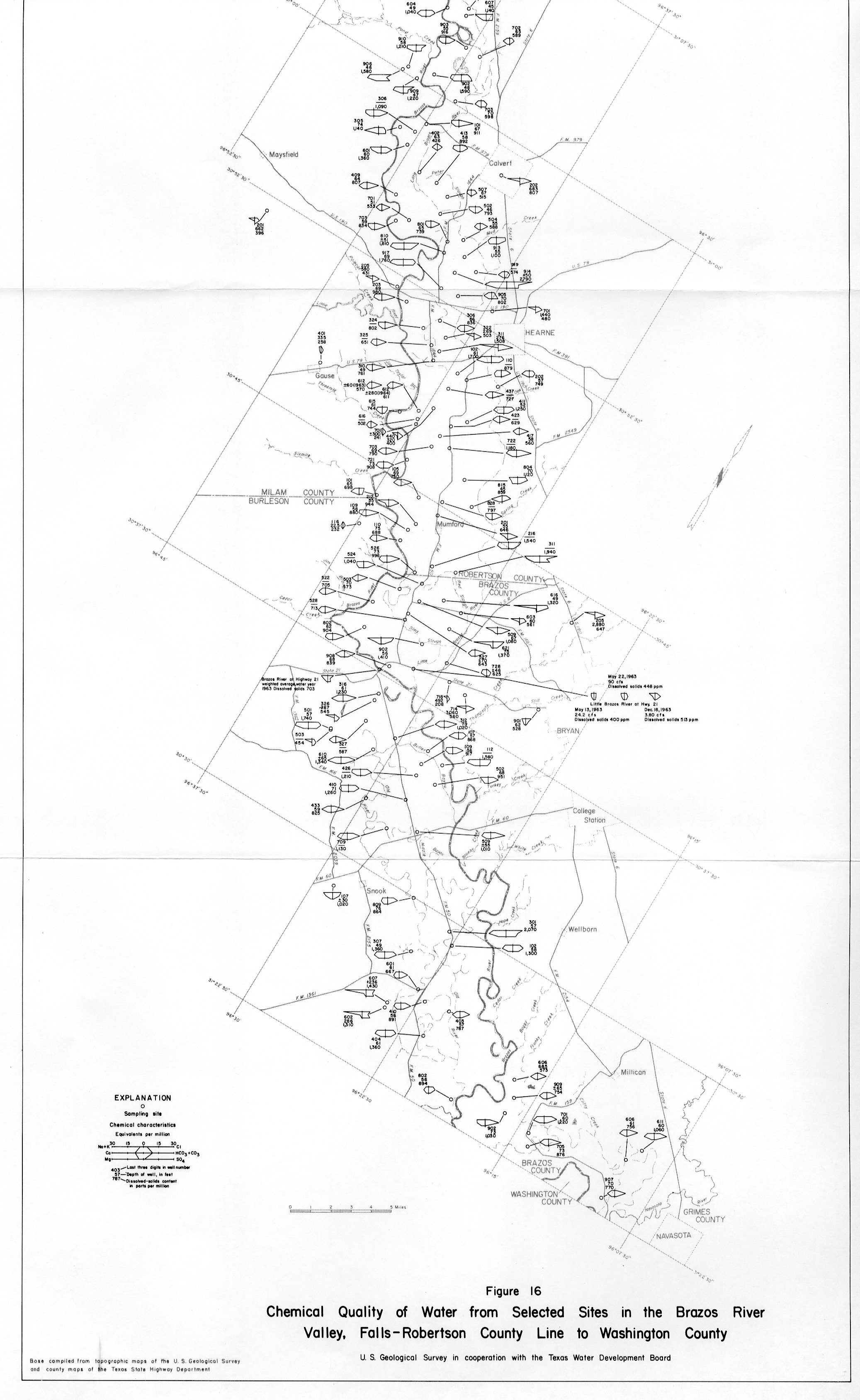
- Figure 16 Chemical Quality of Water from Selected Sites in the Brazos River Valley, Falls-Robertson county line
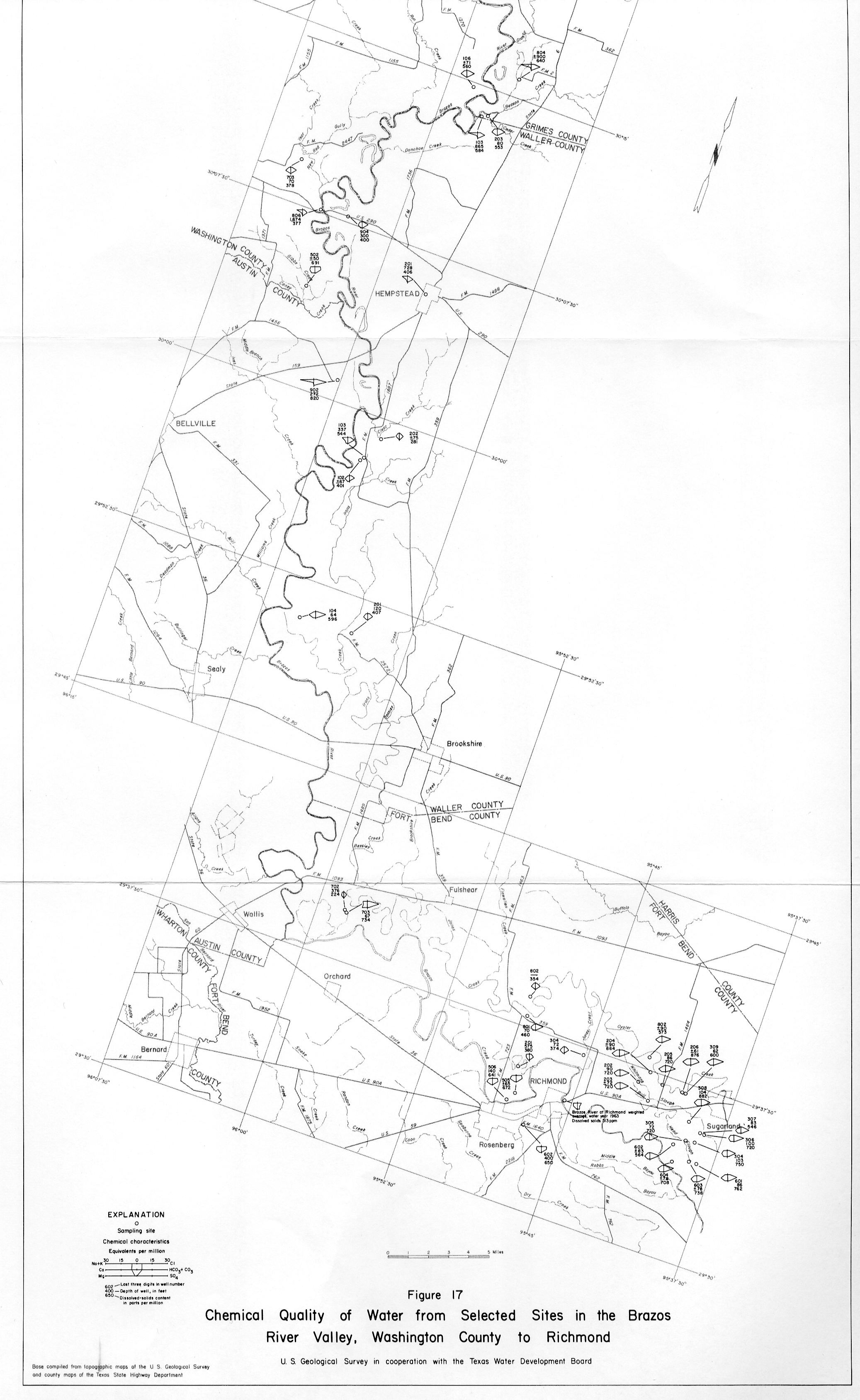
- Figure 17 Chemical Quality of Water from Selected Sites in the Brazos River Valley, Washington County
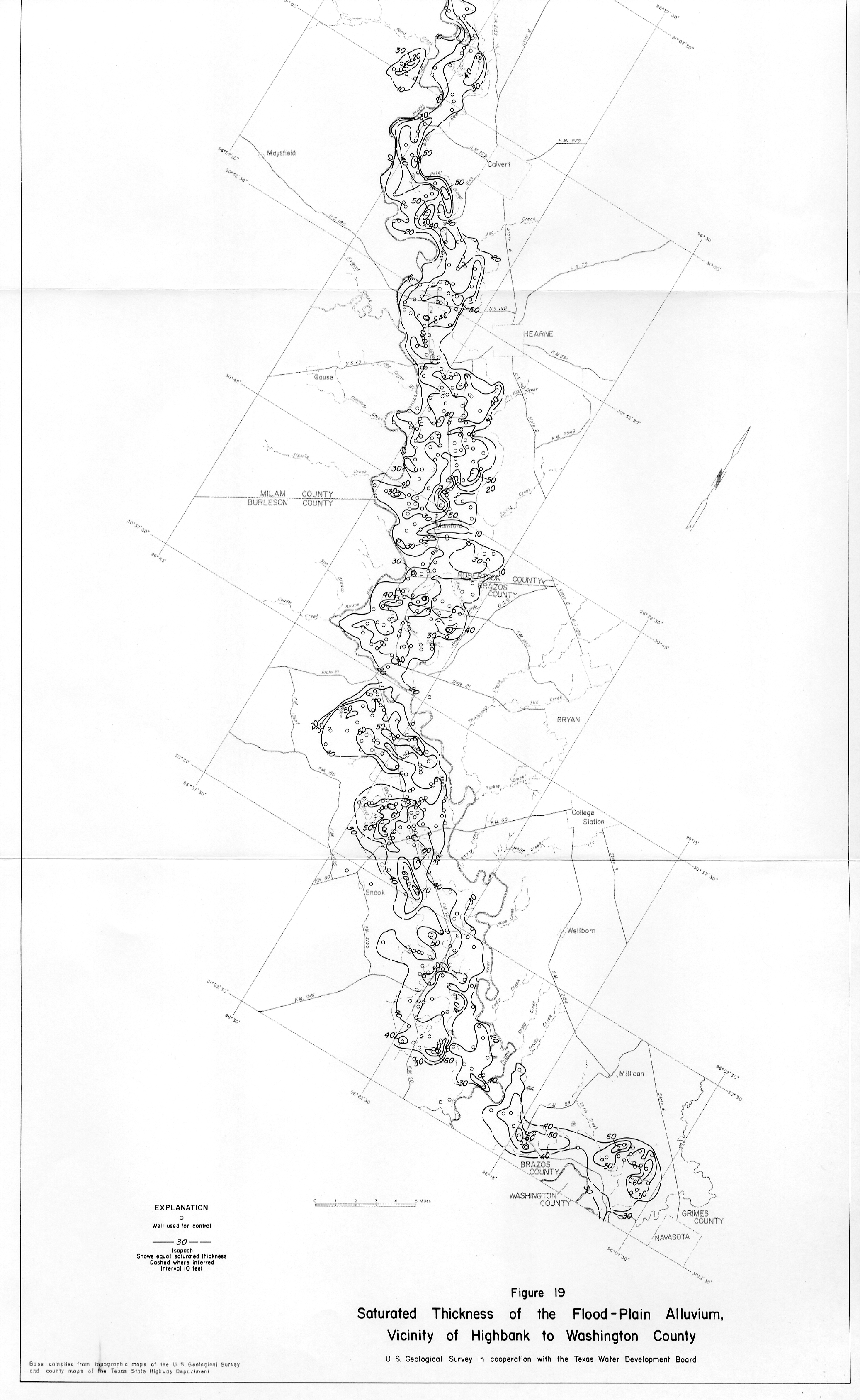
- Figure 19 Saturated Thickness of Flood Plain Alluvium
- Figure 20 Locations of Wells, Whitney Dam
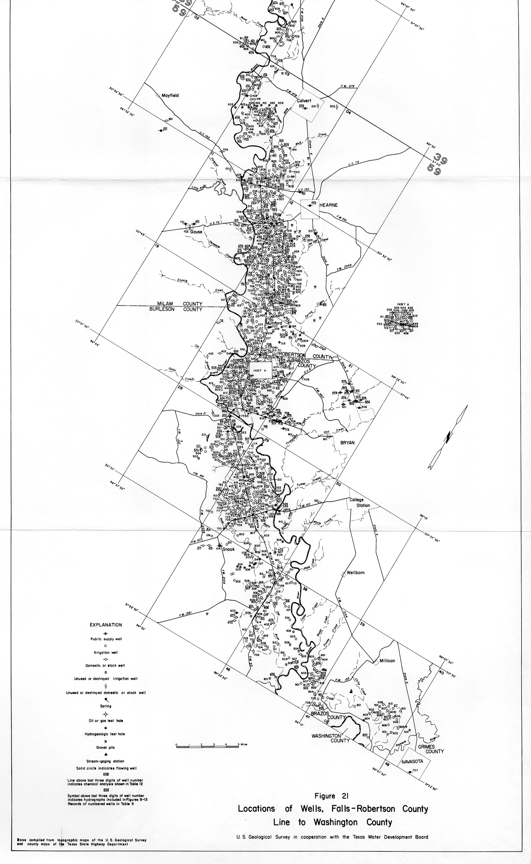
- Figure 21 Locations of Wells
- Figure 22 Locations of Wells, Washington County
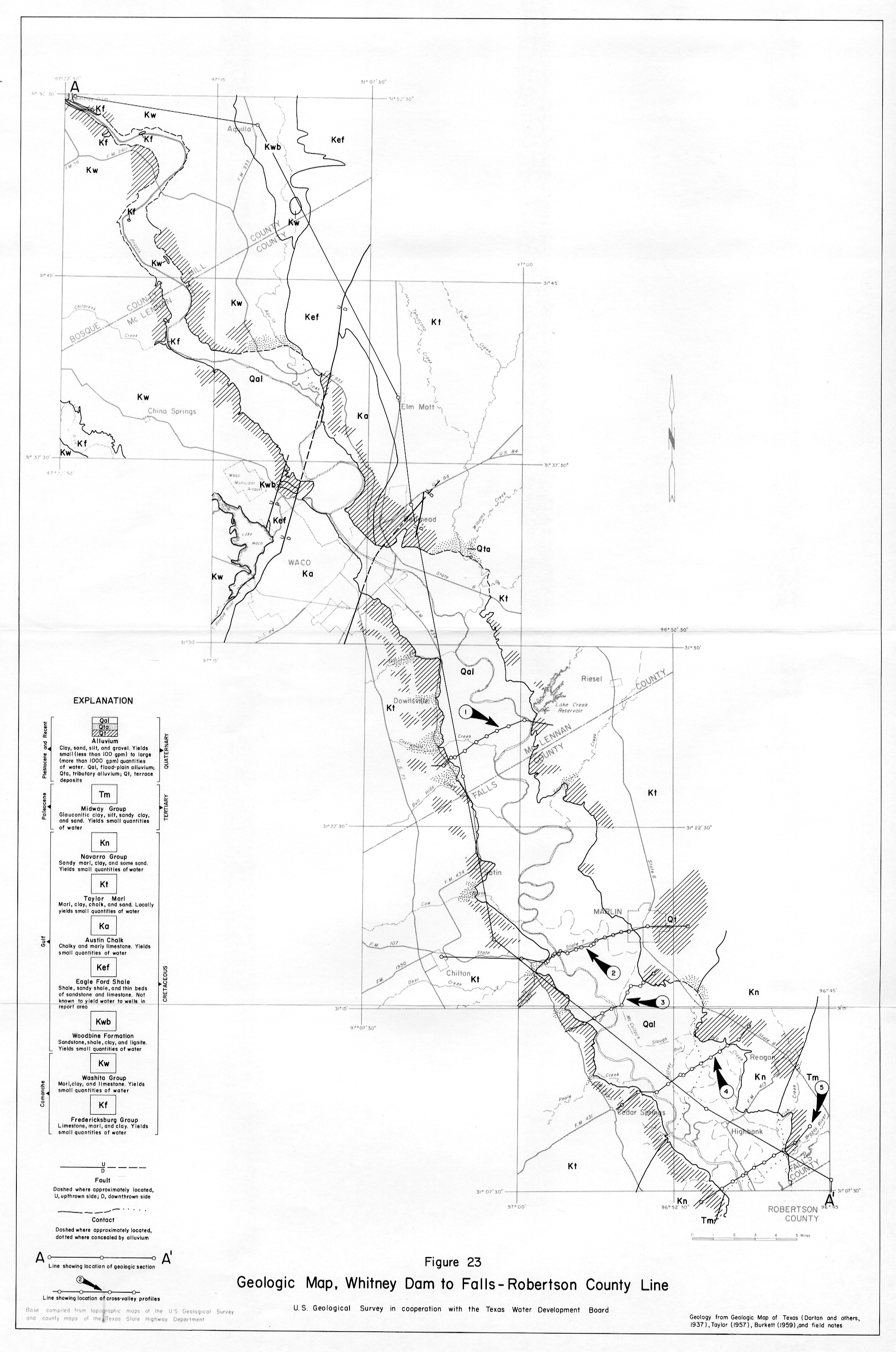
- Figure 23 Geologic Map
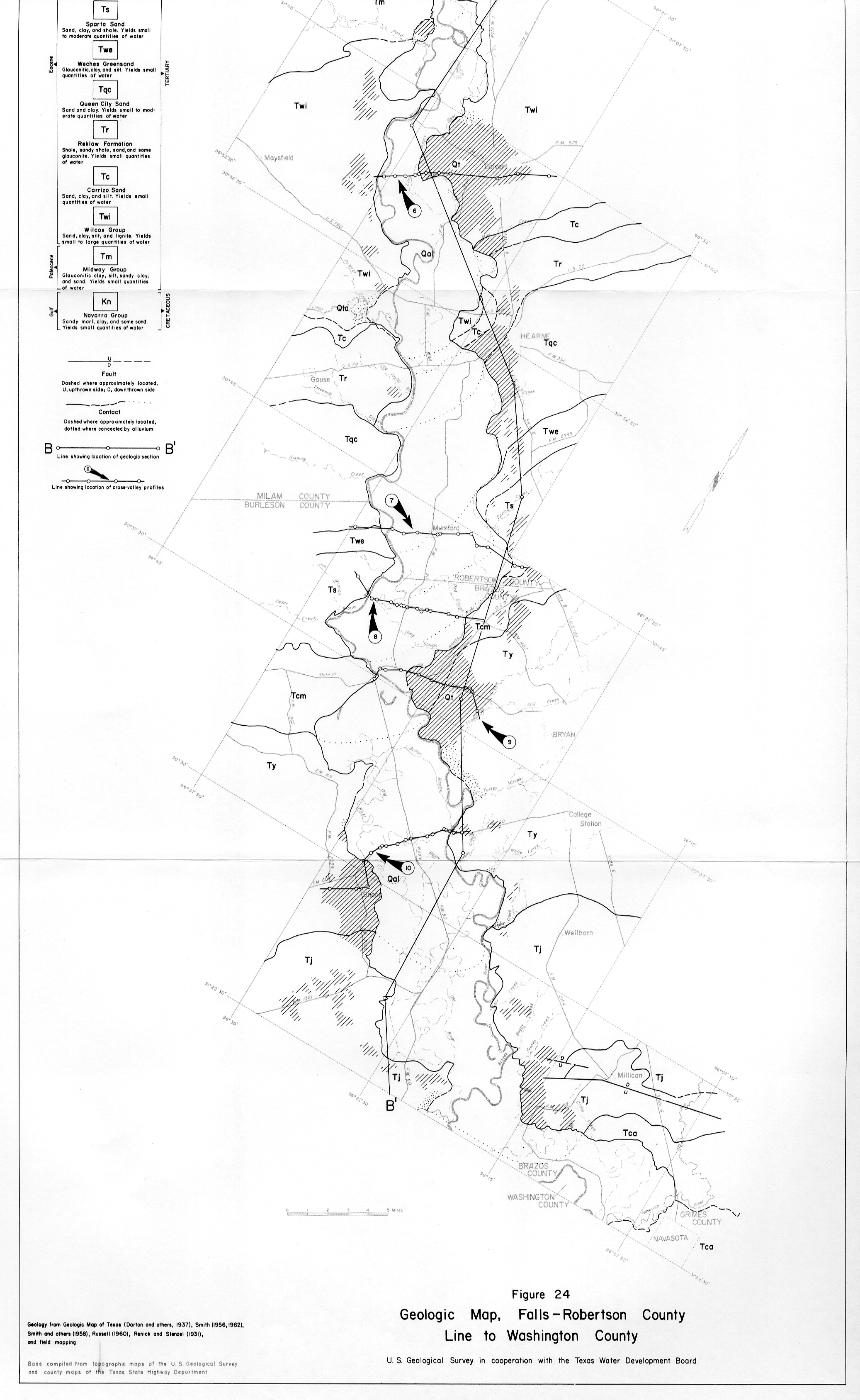
- Figure 24 Geologic Map, Falls - Robertson County
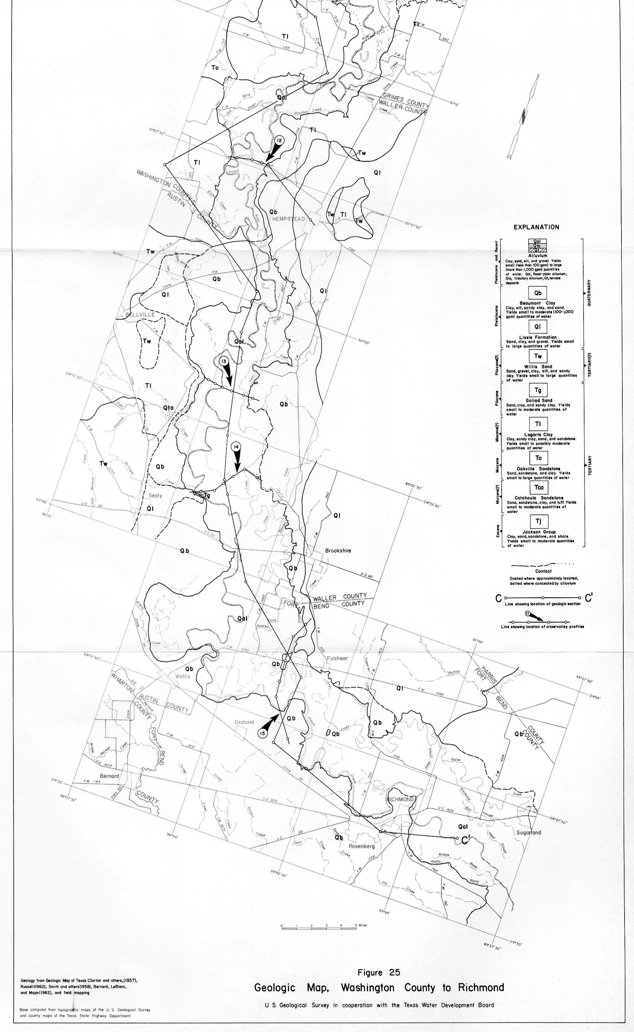
- Figure 25 Geologic Map, Washington County
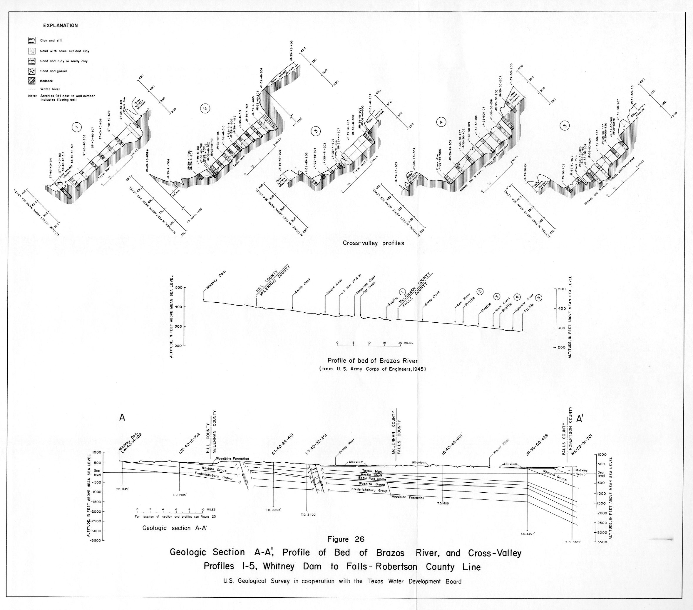
- Figure 26 Geologic Section A-A' Profile of Bed of Brazos River
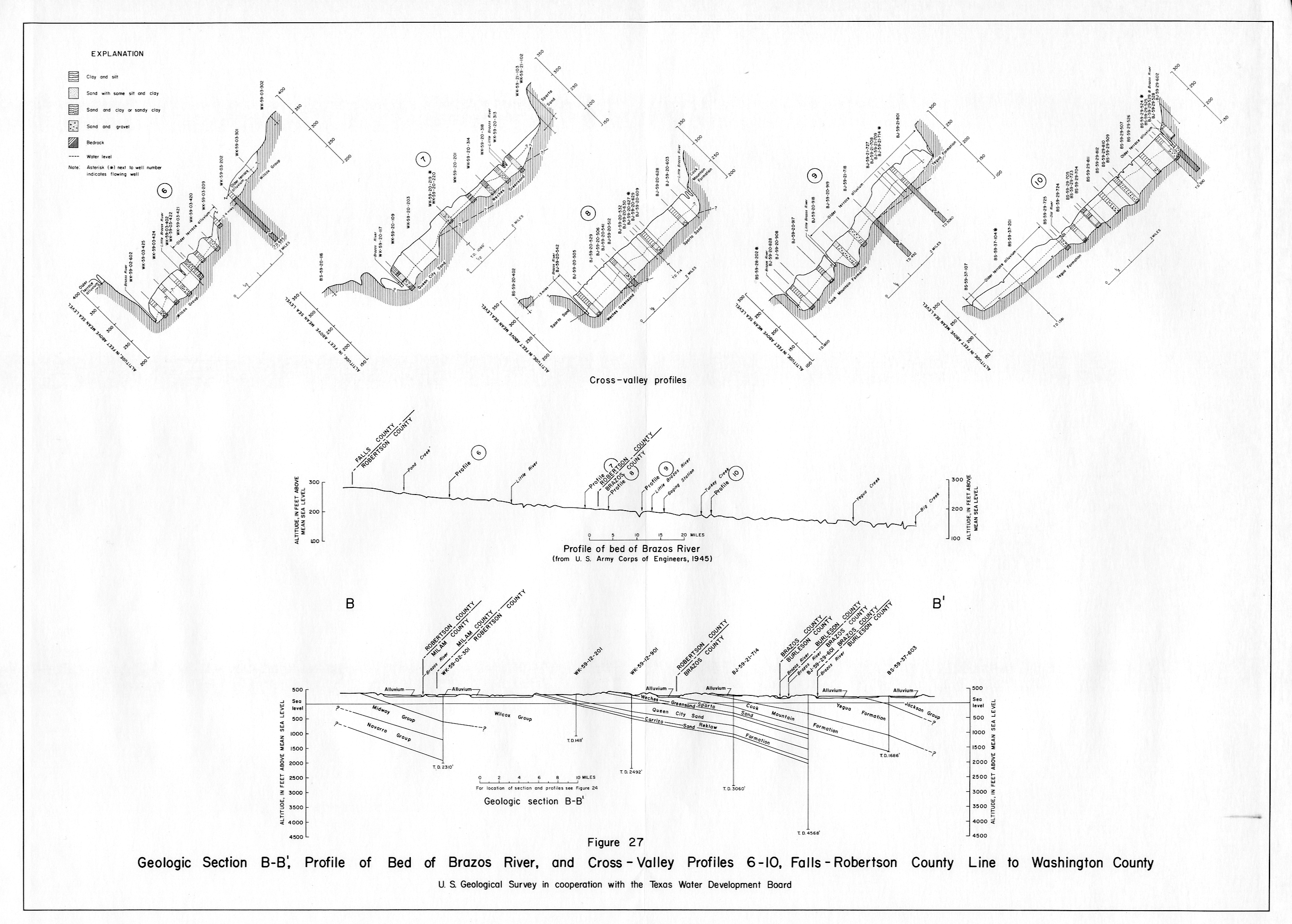
- Figure 27 Geologic Section B-B' Profile of Bed of Brazos River
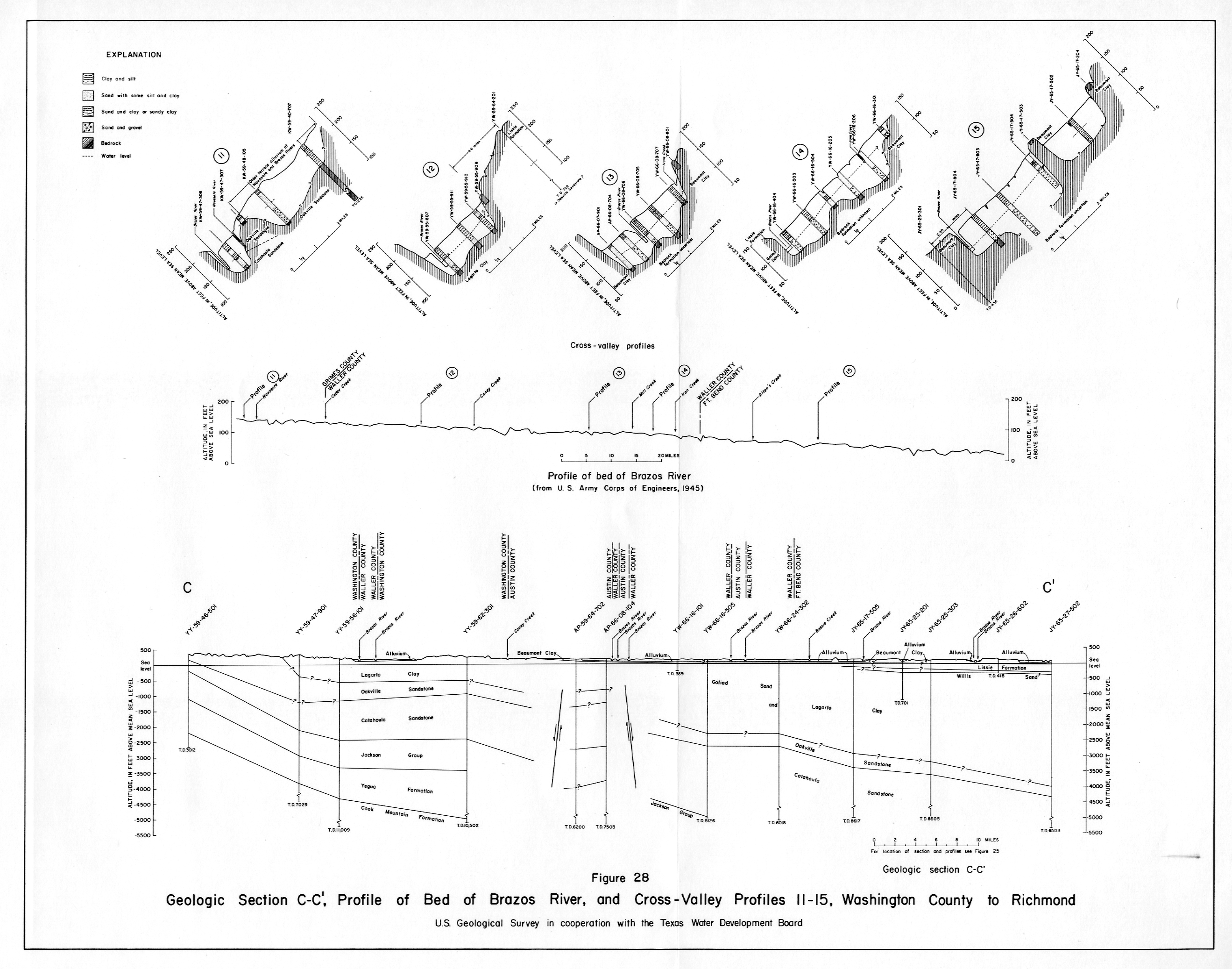
- Figure 28 Geologic Section C-C' Profile of Bed of Brazos River