Report 20 by Gerald L. Thompson, Geologist, U.S. Geological Survey | March 1966
- Report 20 - Ground-Water Resources of Lee County, Texas (pdf - 4.28MB)
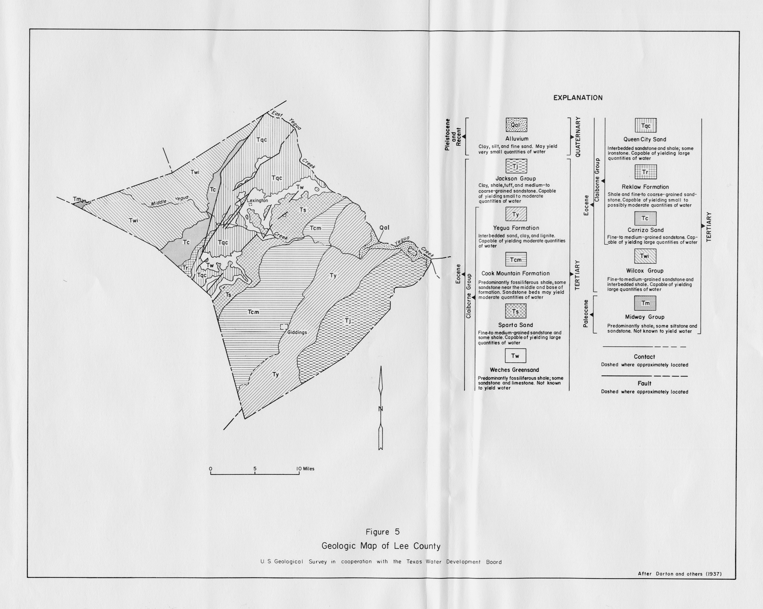
- Figure 5 - Geologic Map of Lee County
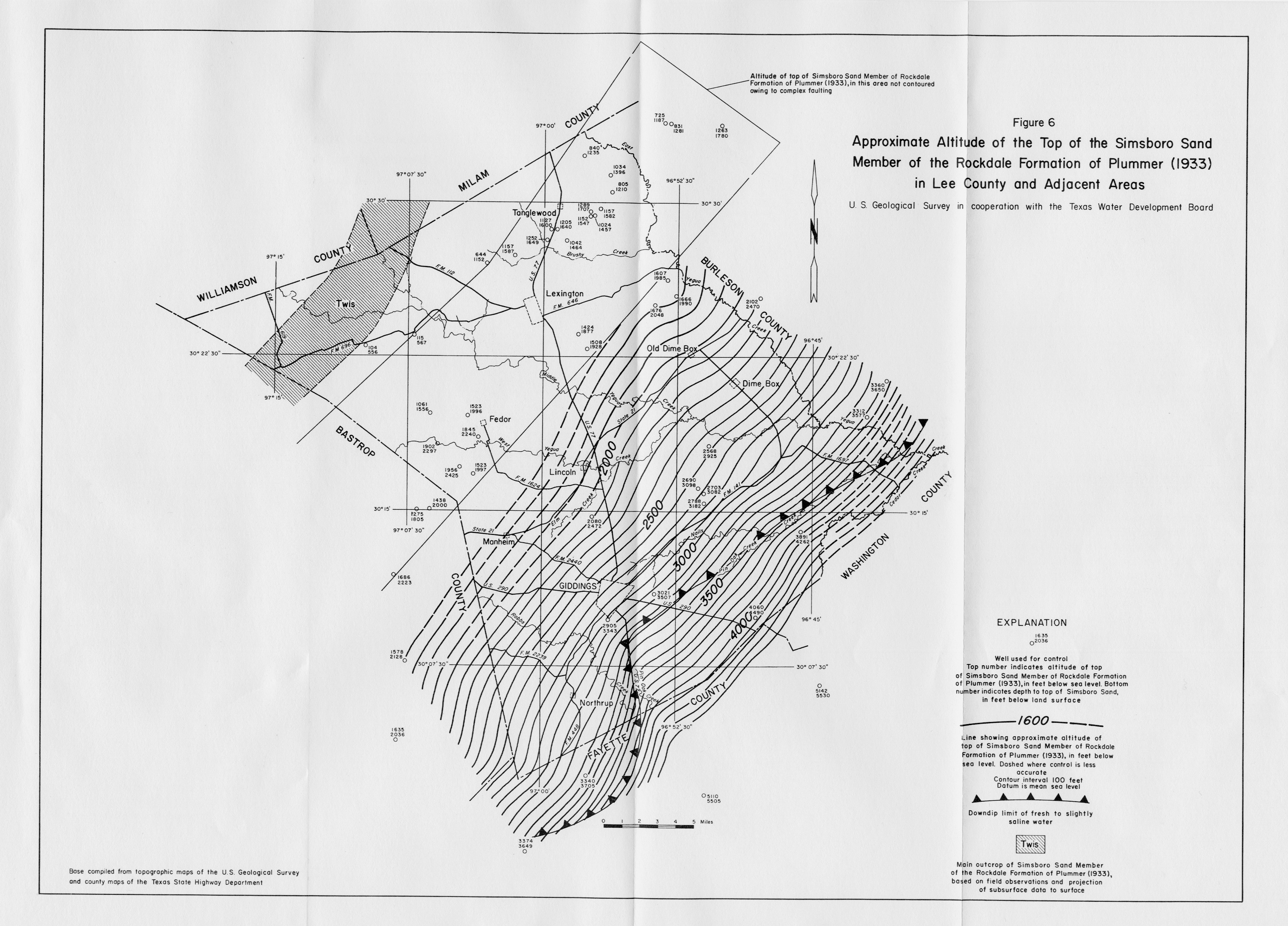
- Figure 6 - Map Showing Approximate Altitude of the top of the Simsboro Sand Member of the Rockdale Formation of Plummer (1933) in Lee County and Adjacent Areas
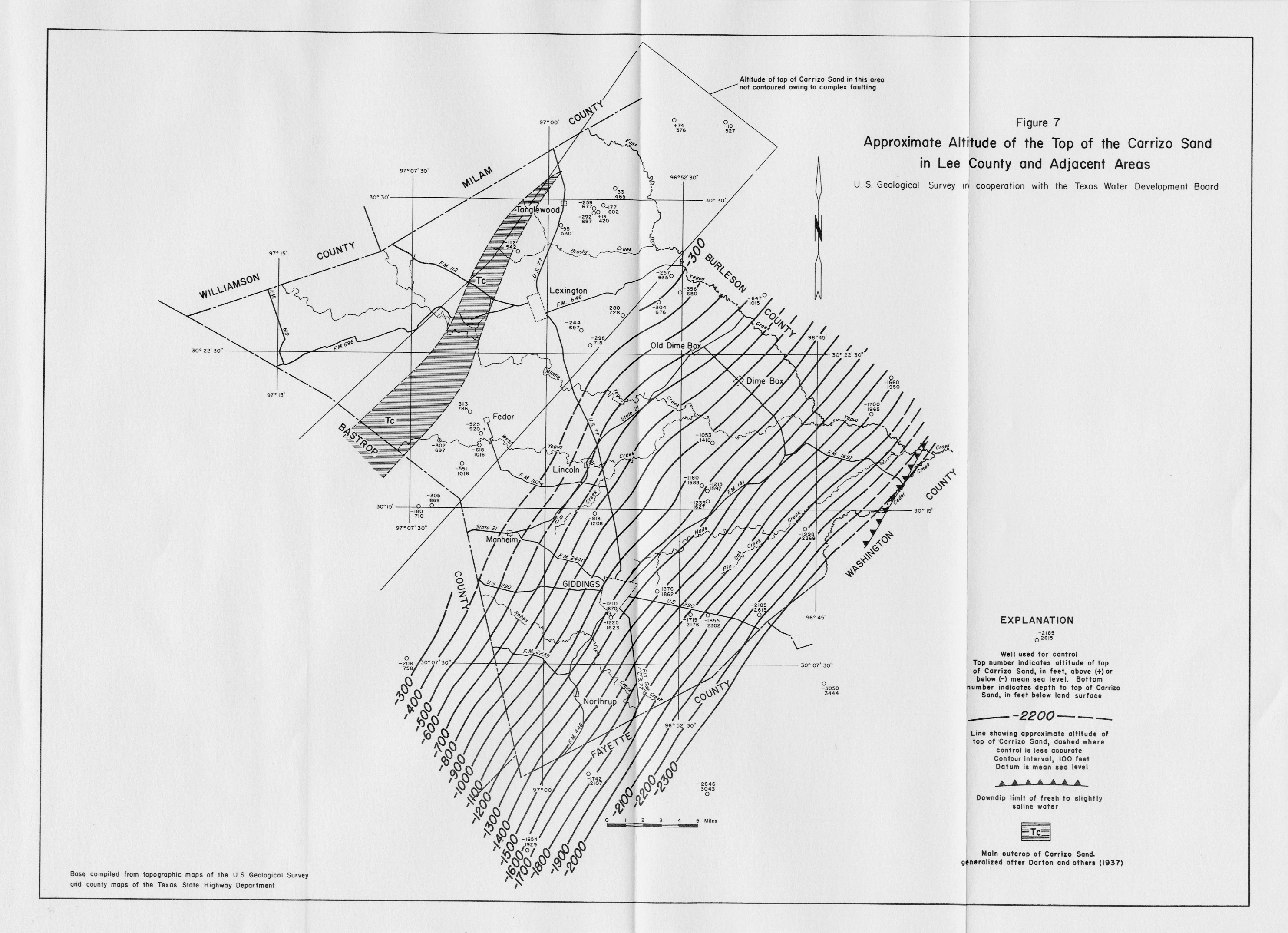
- Figure 7 - Map Showing Approximate Altitude of the top of the Carrizo Sand in Lee County and Adjacent Areas
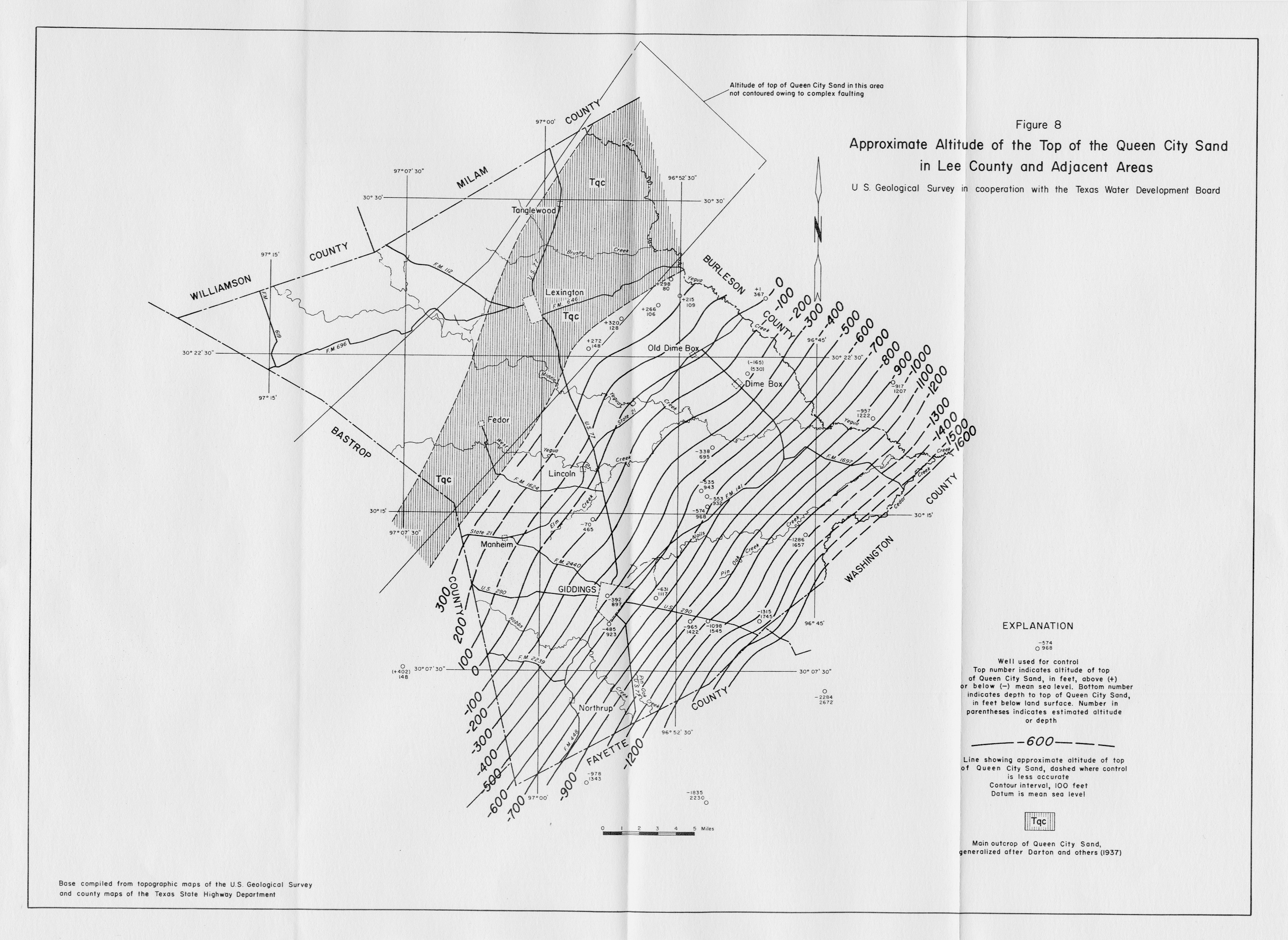
- Figure 8 - Map Showing Approximate Altitude of the top of the Queen City Sand in Lee County and Adjacent Areas
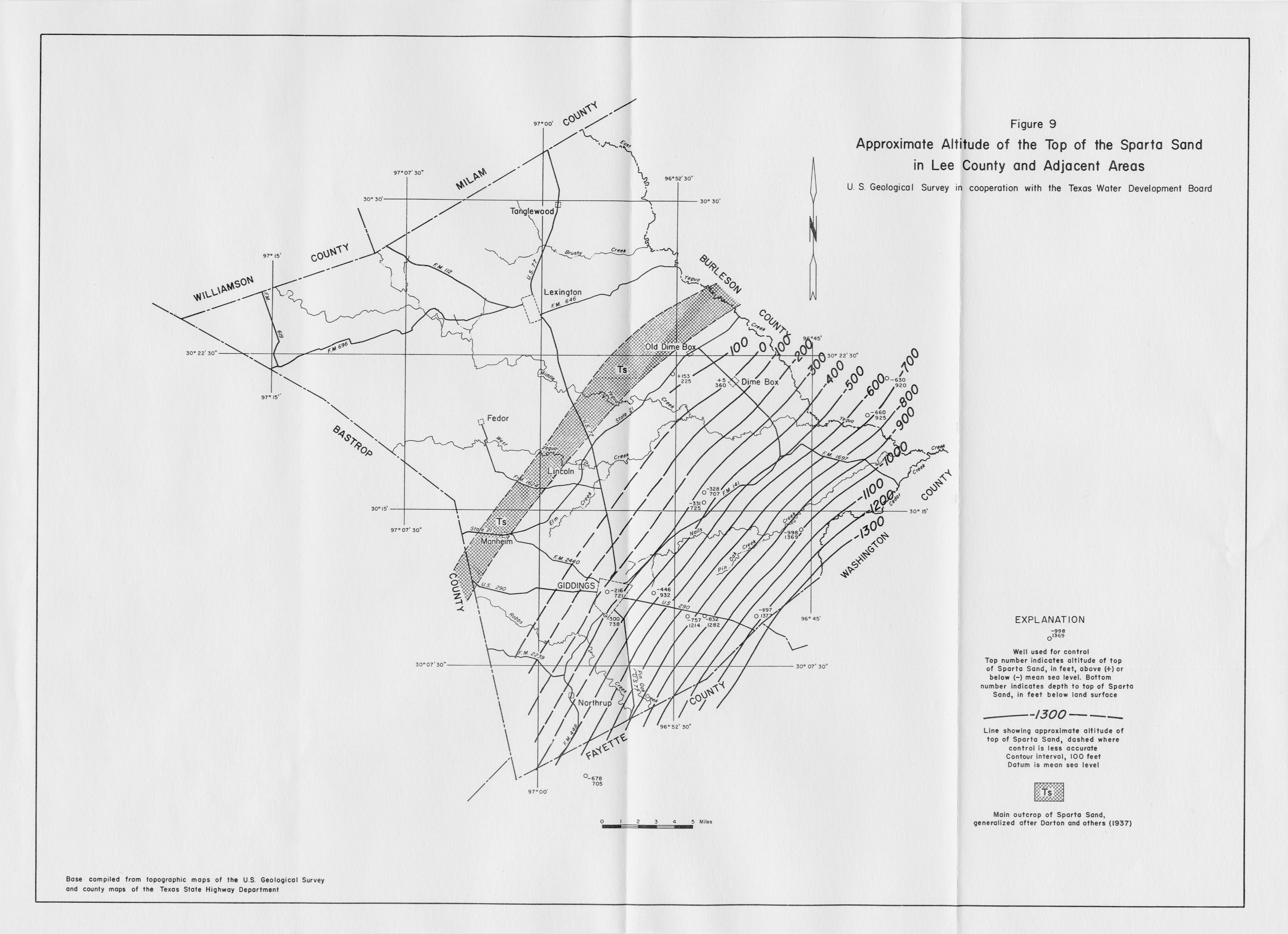
- Figure 9 - Map Showing Approximate Altitude of the top of the Sparta Sand in Lee County and Adjacent Areas
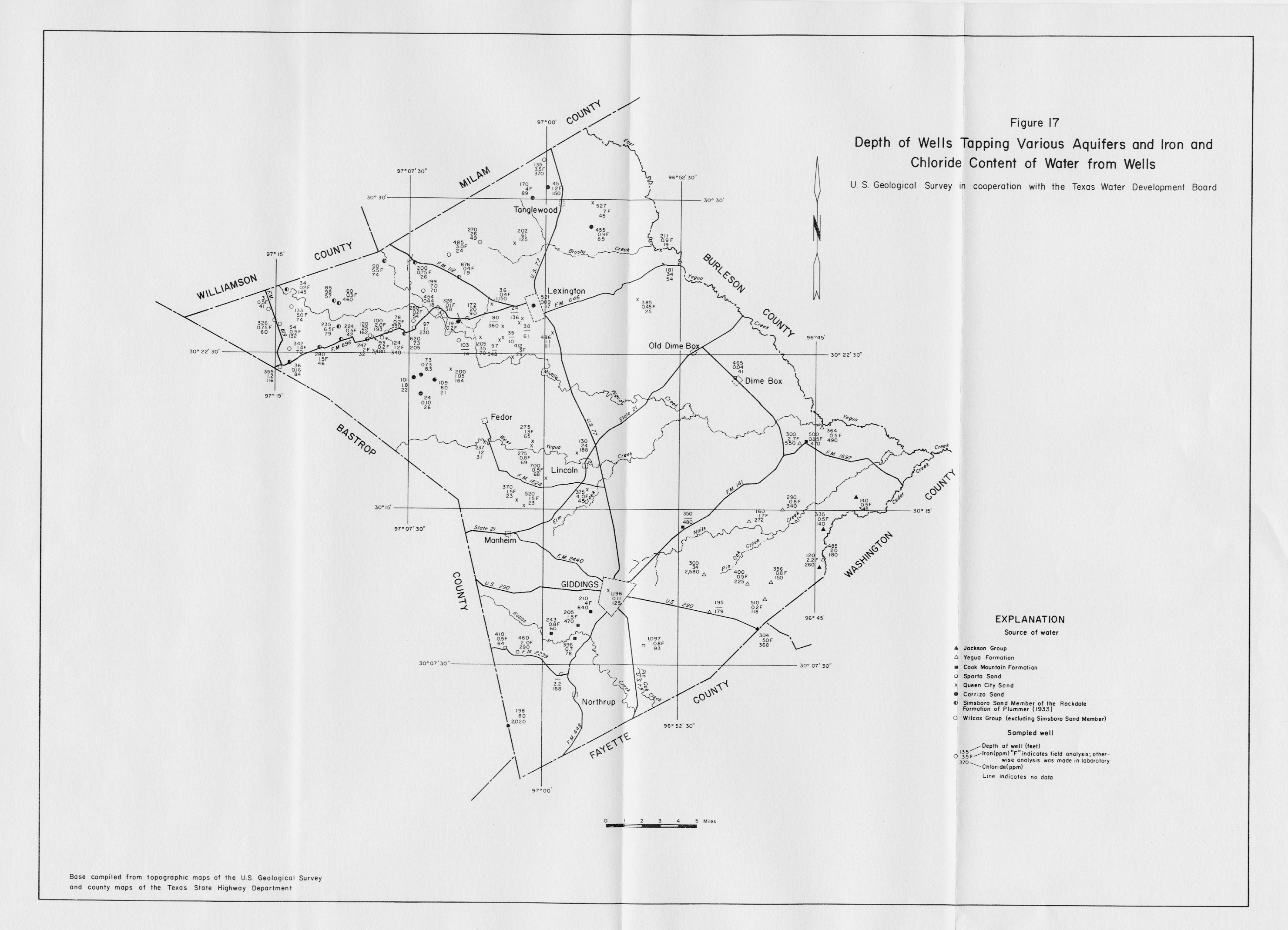
- Figure 17 - Map Showing Depth of Wells Tapping Various Aquifers and Iron and Chloride Content of Water from Wells
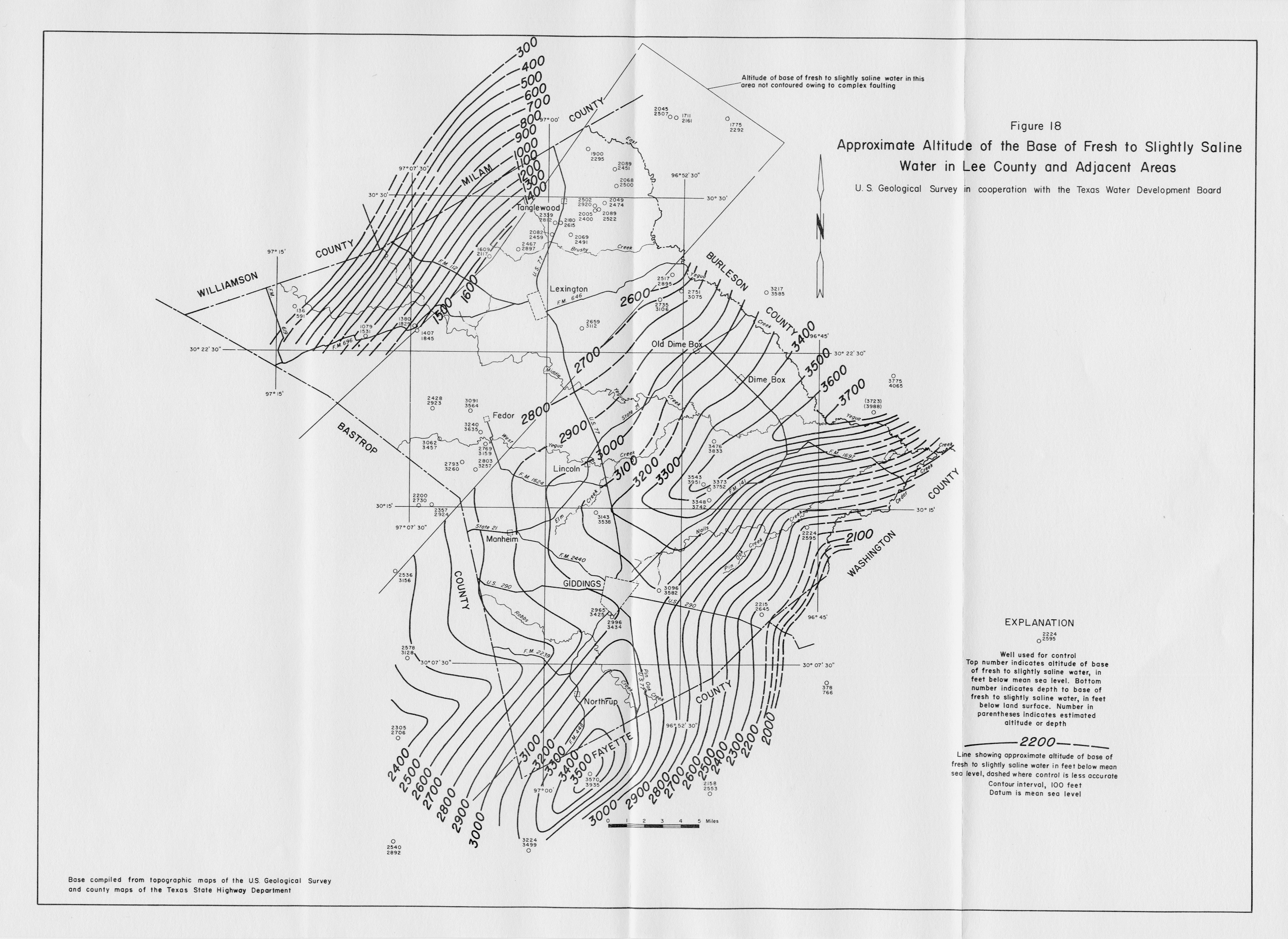
- Figure 18 - Map Showing Approximate Altitude of the Base of Fresh to Slightly Saline Water in Lee County and Adjacent Areas
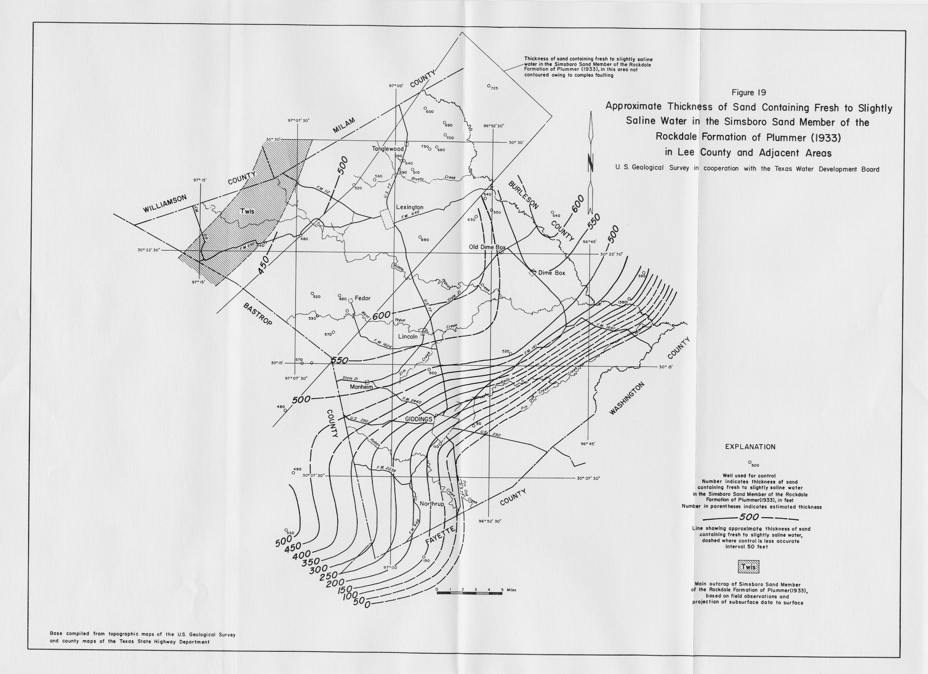
- Figure 19 - Map Showing Approximate Thickness of Sand Containing Fresh to Slightly Saline Water in the Simsboro Sand Member of the Rockdale Formation of Plummer (1933) in Lee County and Adjacent Areas
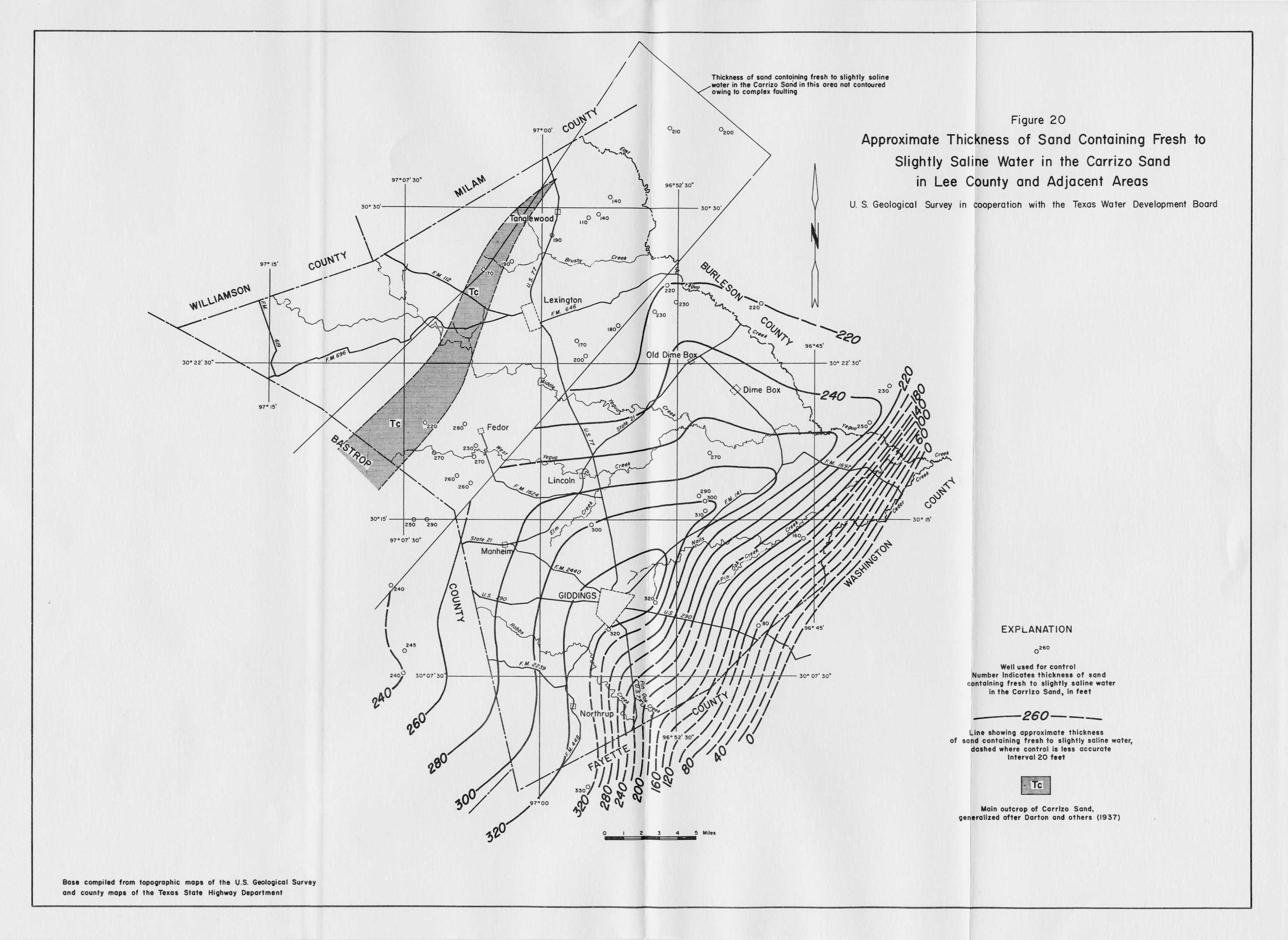
- Figure 20 - Map Showing Approximate Thickness of Sand Containing Fresh to Slightly Saline Water in the Carrizo Sand in Lee County and Adjacent Areas
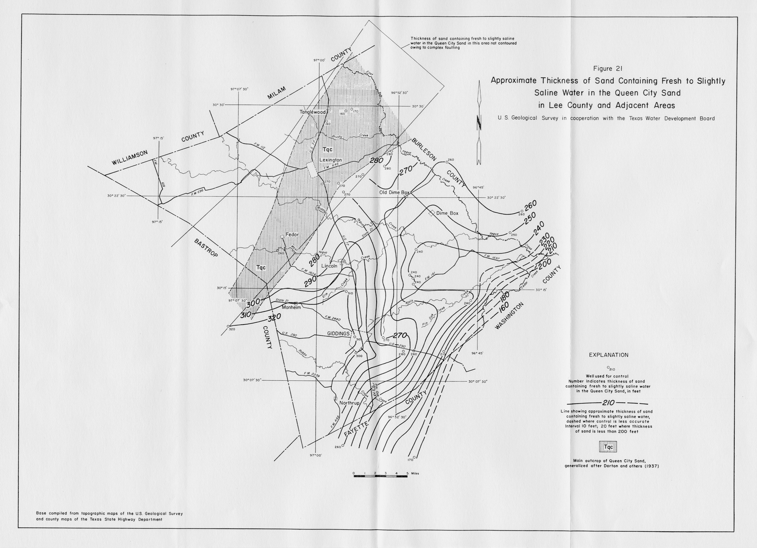
- Figure 21 - Map Showing Approximate Thickness of Sand Containing Fresh to Slightly Saline Water in the Queen City Sand in Lee County and Adjacent Areas
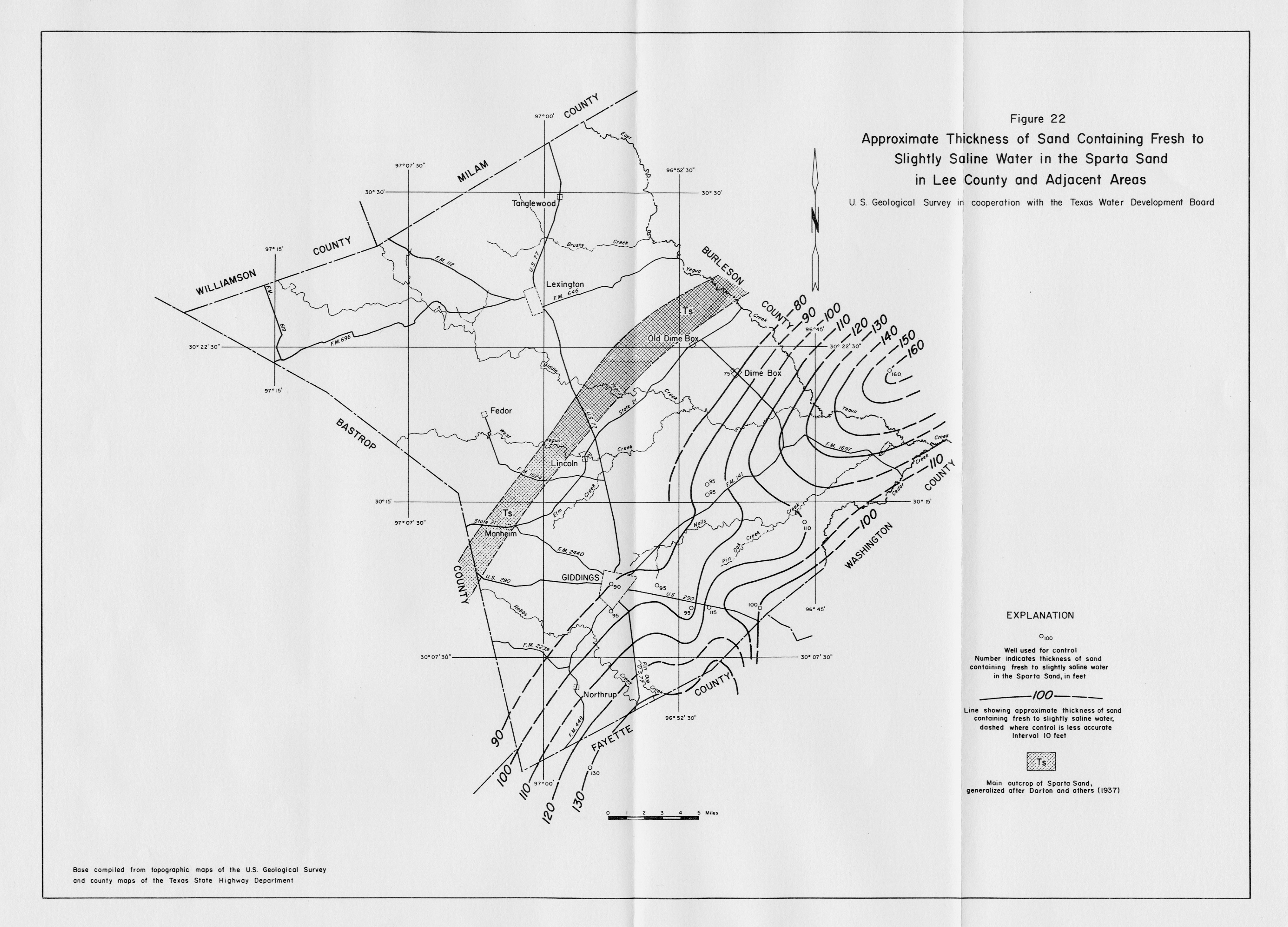
- Figure 22 - Map Showing Approximate Thickness of Sand Containing Fresh to Slightly Saline Water in the Sparta Sand in Lee County and Adjacent Areas
- Plate 1 (pdf - 4.75MB) - Map Showing Locations of Wells, Springs, and Test Holes in Lee County and Adjacent Areas
- Plate 2 (pdf - 4.78MB) - Geologic Section A-A', Lee and Fayette Counties
- Plate 3 (pdf - 4.79MB) - Geologic Section B-B', Milam, Lee, and Fayette Counties