Bulletin 6309 by Richard C. Peckham, Vernon L. Souders, Joe W. Dillard, and Bernard B. Baker (1963)
- Bulletin 6309 - Reconnaissance Investigation of the Ground-Water Resources of the Trinity River Basin, Texas (pdf - 52MB)
- Plate 1 (jpg - 15MB) General Geology and Locations of Wells and Major Drainage Subdivisions, Region I, Trinity River Basin
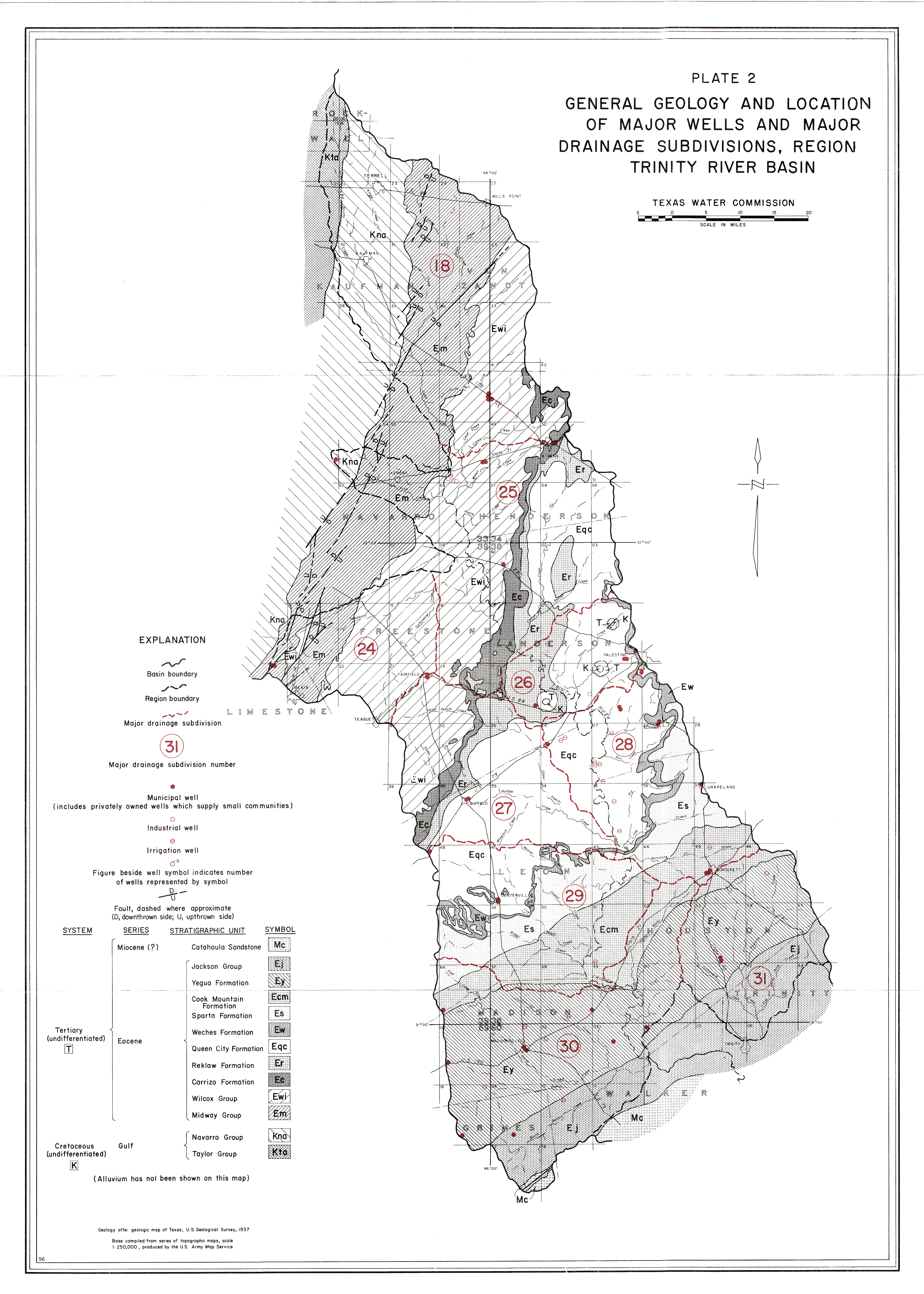
- Plate 2 (jpg - 8.7MB) General Geology and Locations of Wells and Major Drainage Subdivisions, Region II, Trinity River Basin
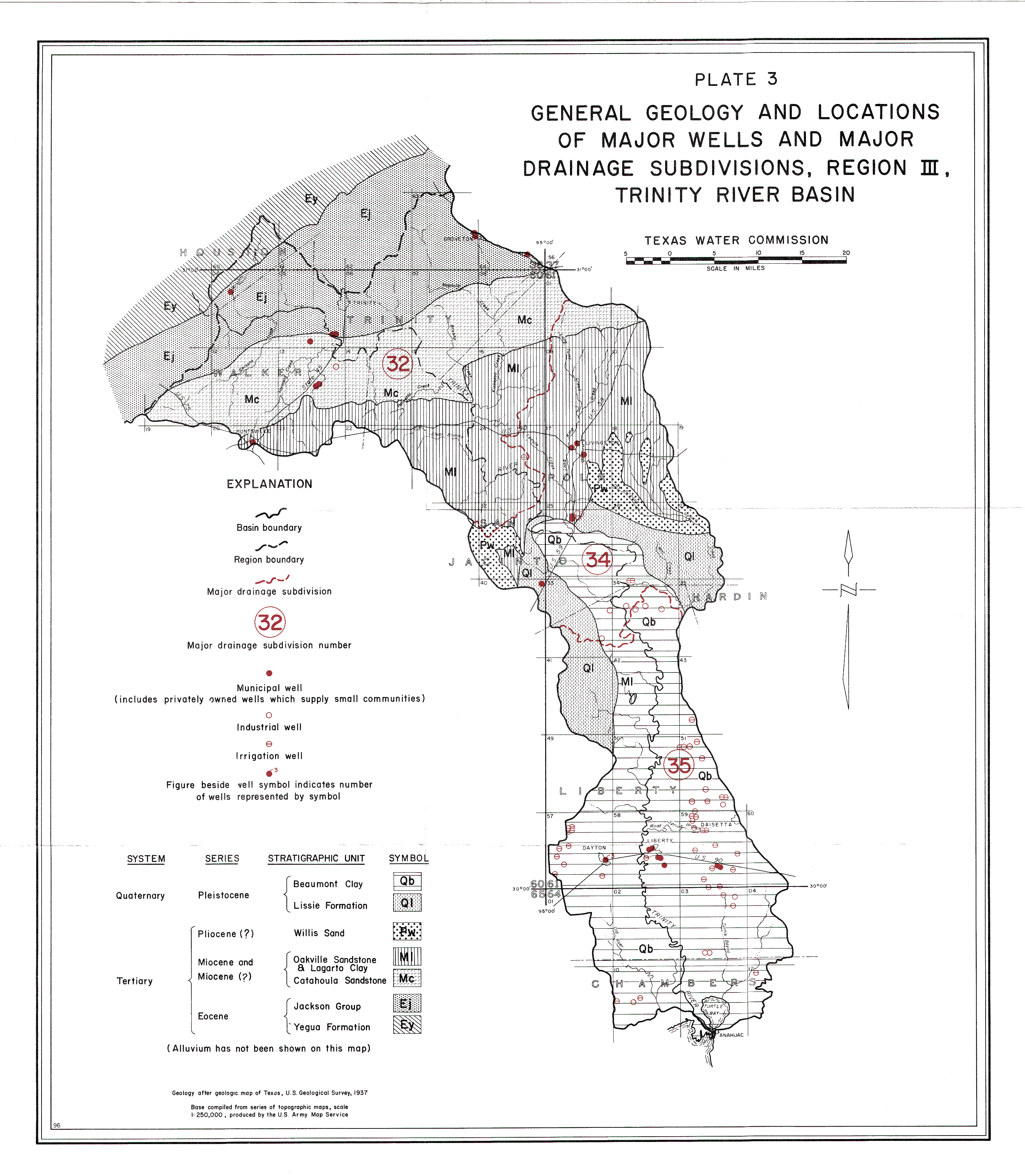
- Plate 3 (jpg - 4.8MB) General Geology and Locations of Major Wells and Major Drainage Subdivisions, Region III, Trinity River Basin
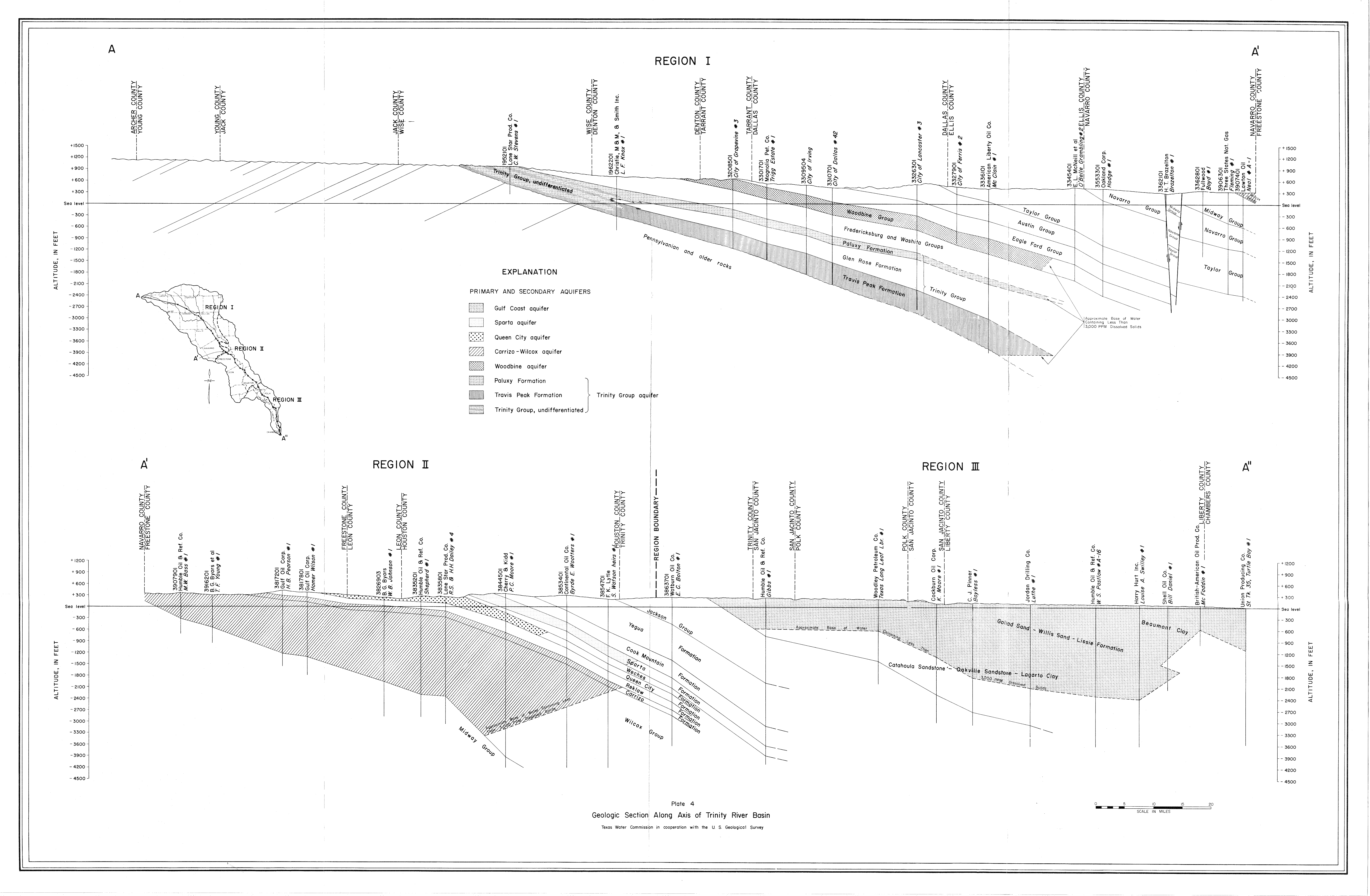
- Plate 4 (jpg - 5.2MB) Geologic Section Along Axis of Trinity River Basin
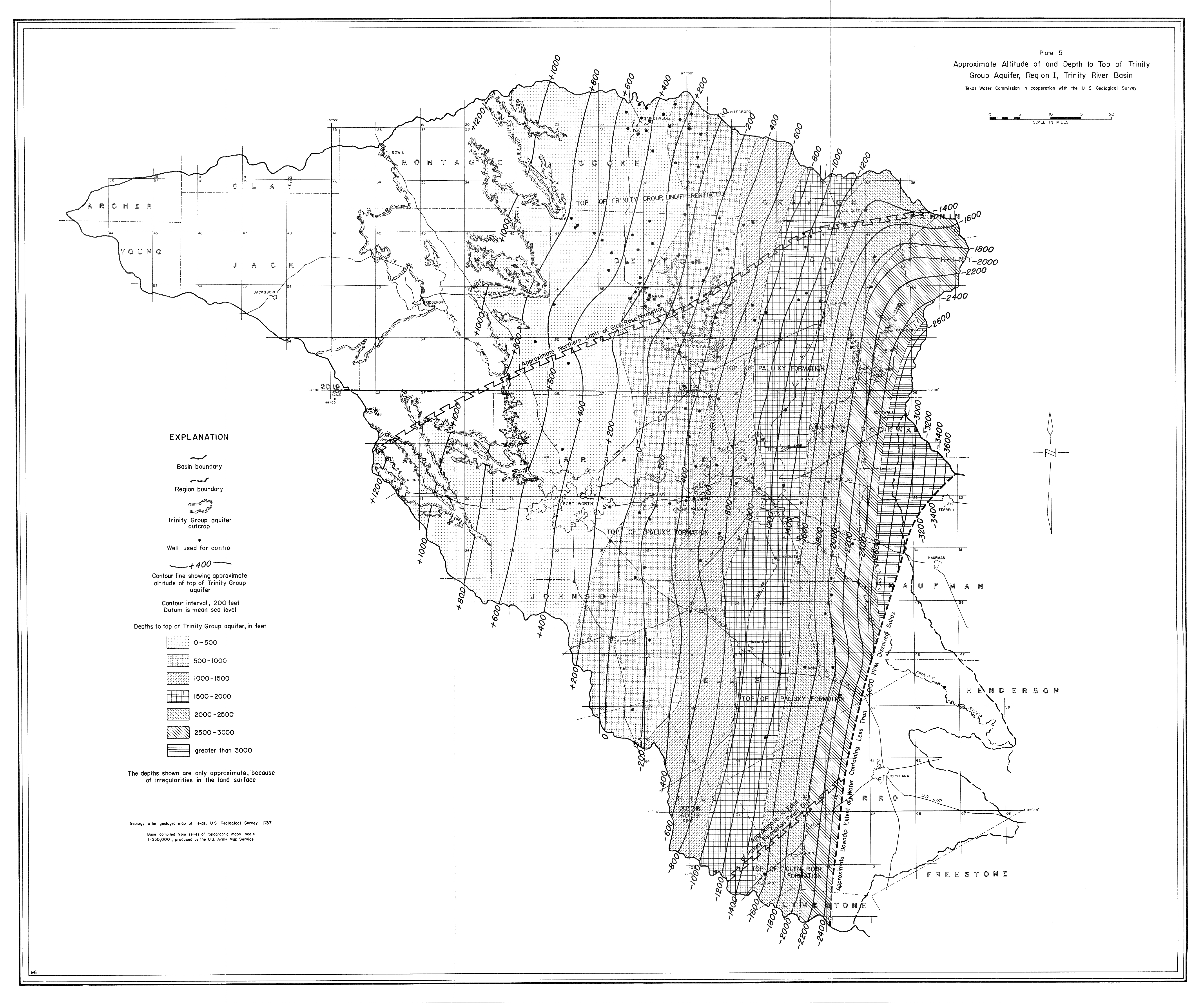
- Plate 5 (jpg - 8.5MB) Approximate Altitude of and Depth to Top of Trinity Group Aquifer, Region I, Trinity River Basin
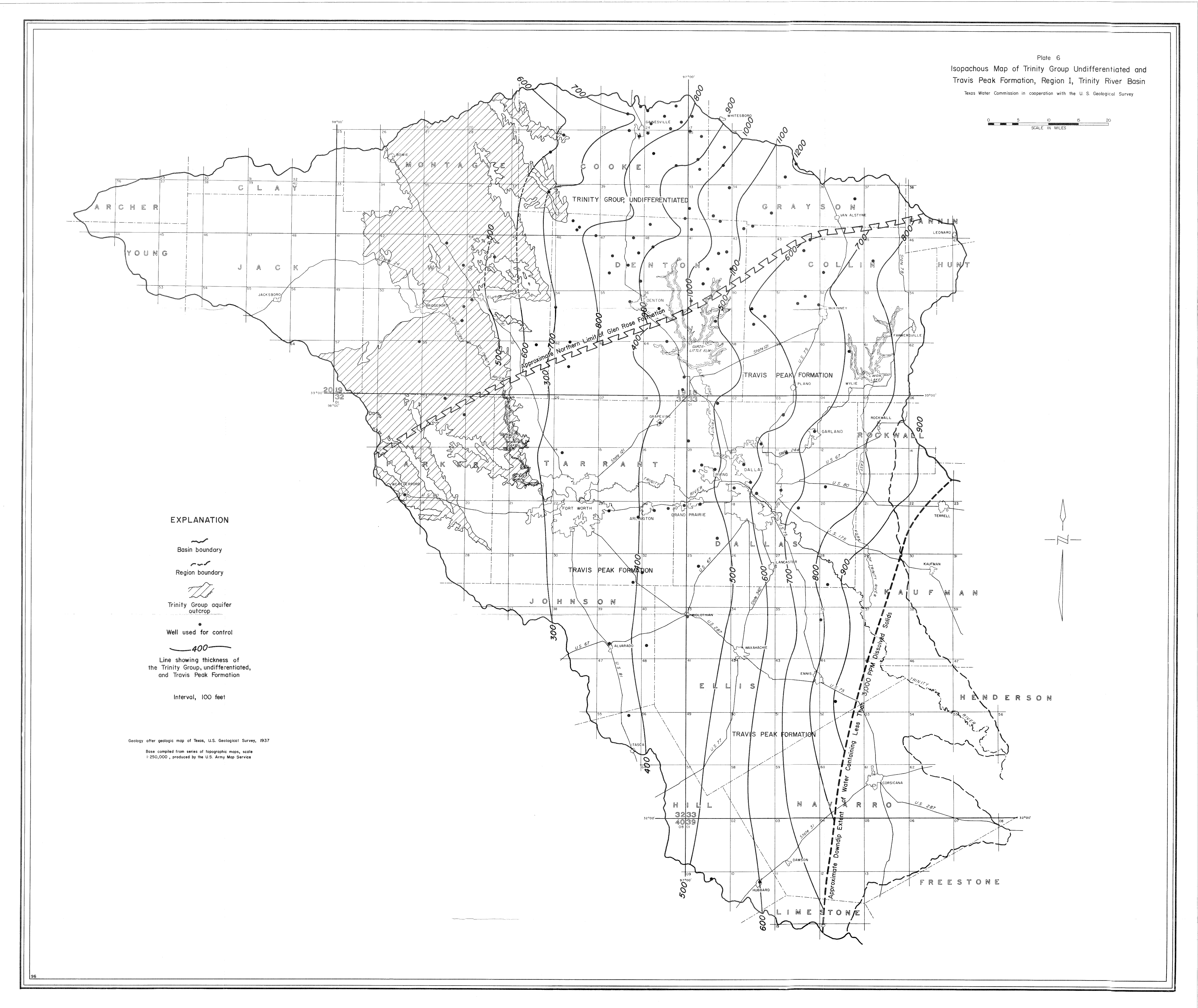
- Plate 6 (jpg - 4.3MB) Isopachous Map of Trinity Group Undifferentiated and Travis Peak Formation, Region I, Trinity River Basin
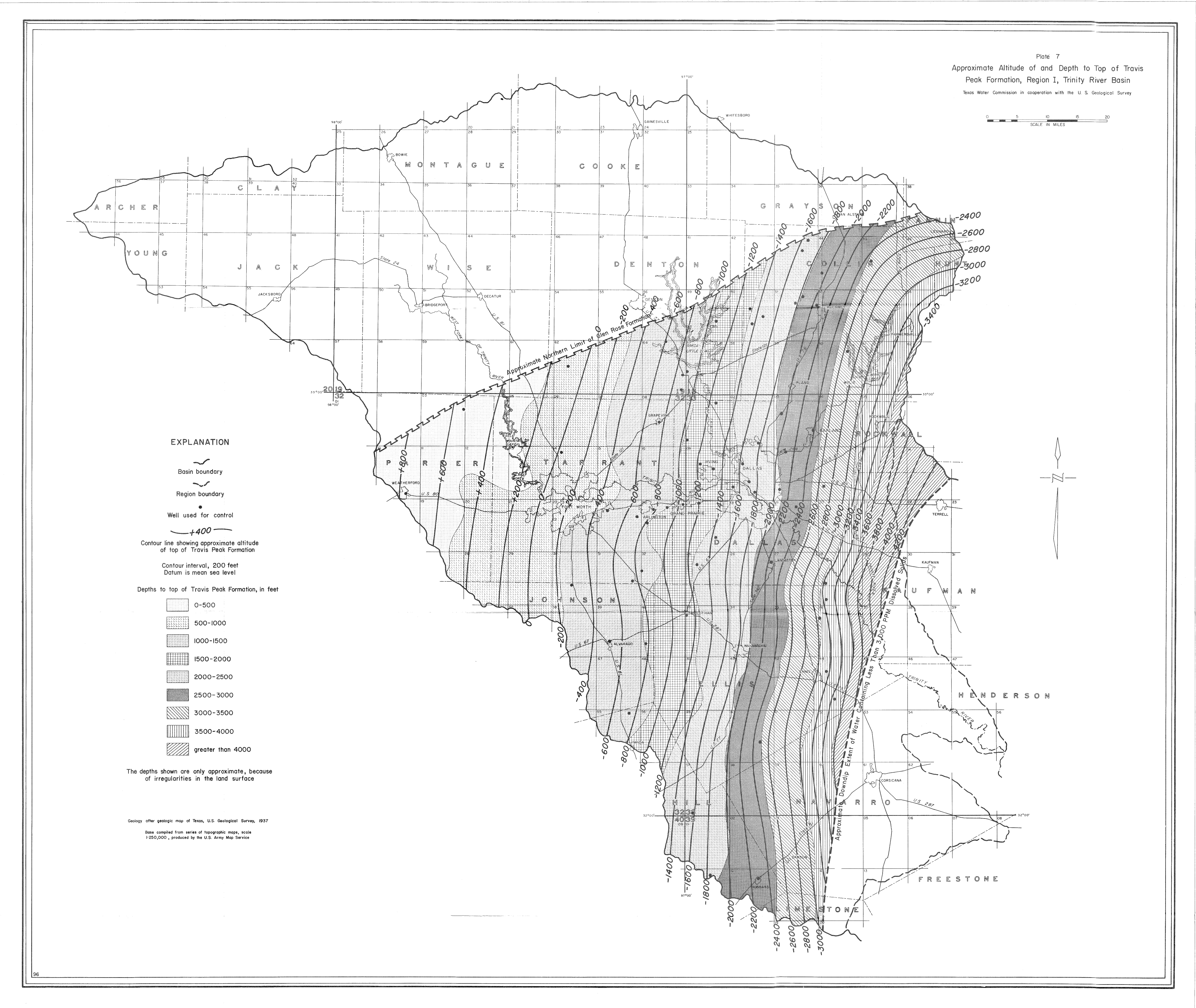
- Plate 7 (jpg - 7MB) Approximate Altitude of and Depth to Top of Travis Peak Formation, Region I, Trinity River Basin
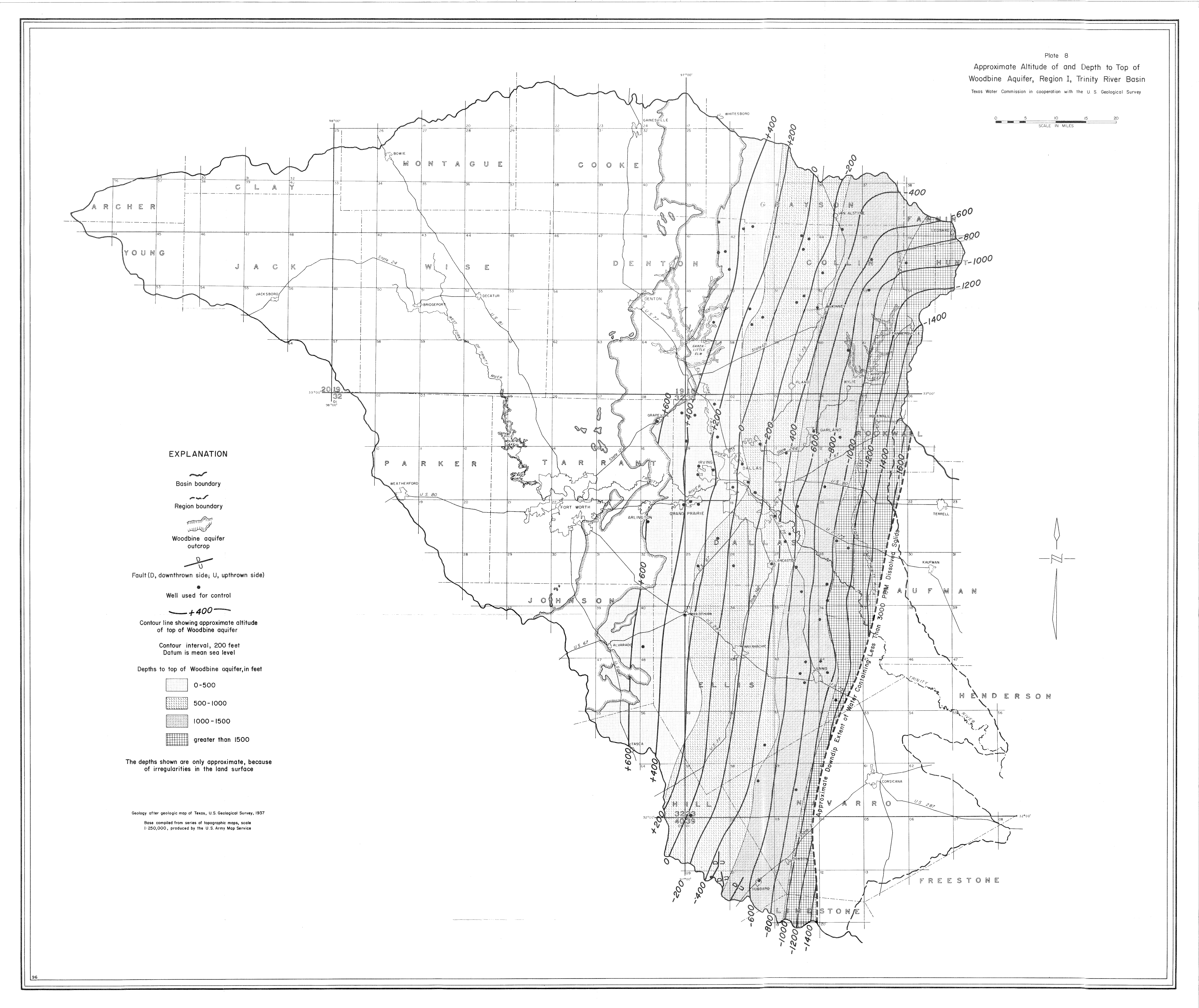
- Plate 8 (jpg - 6MB) Approximate Altitude of and Depth to Top of Woodbine Aquifer, Region I, Trinity River Basin
- Plate 9 (jpg - 3.7MB) Isopachous Map of Woodbine Aquifer, Region I, Trinity River Basin
- Plate 10 (jpg - 3.7MB) Approximate Altitude of and Depth to top of Carrizo-Wilcox Aquifer, Region II, Trinity River Basin
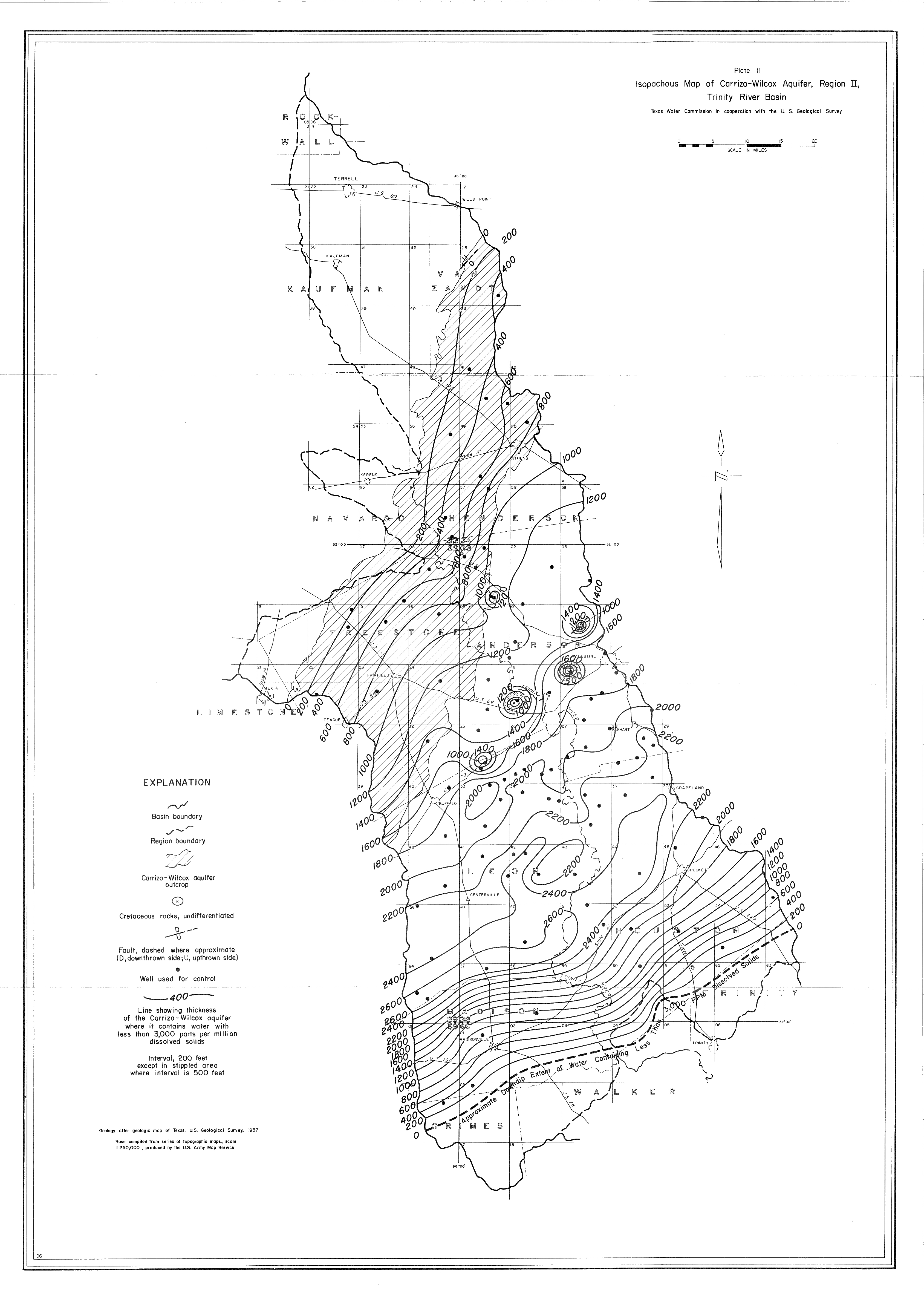
- Plate 11 (jpg - 2.9 MB) Isopachous Map of Carrizo-Wilcox Aquifer, Region II, Trinity River Basin
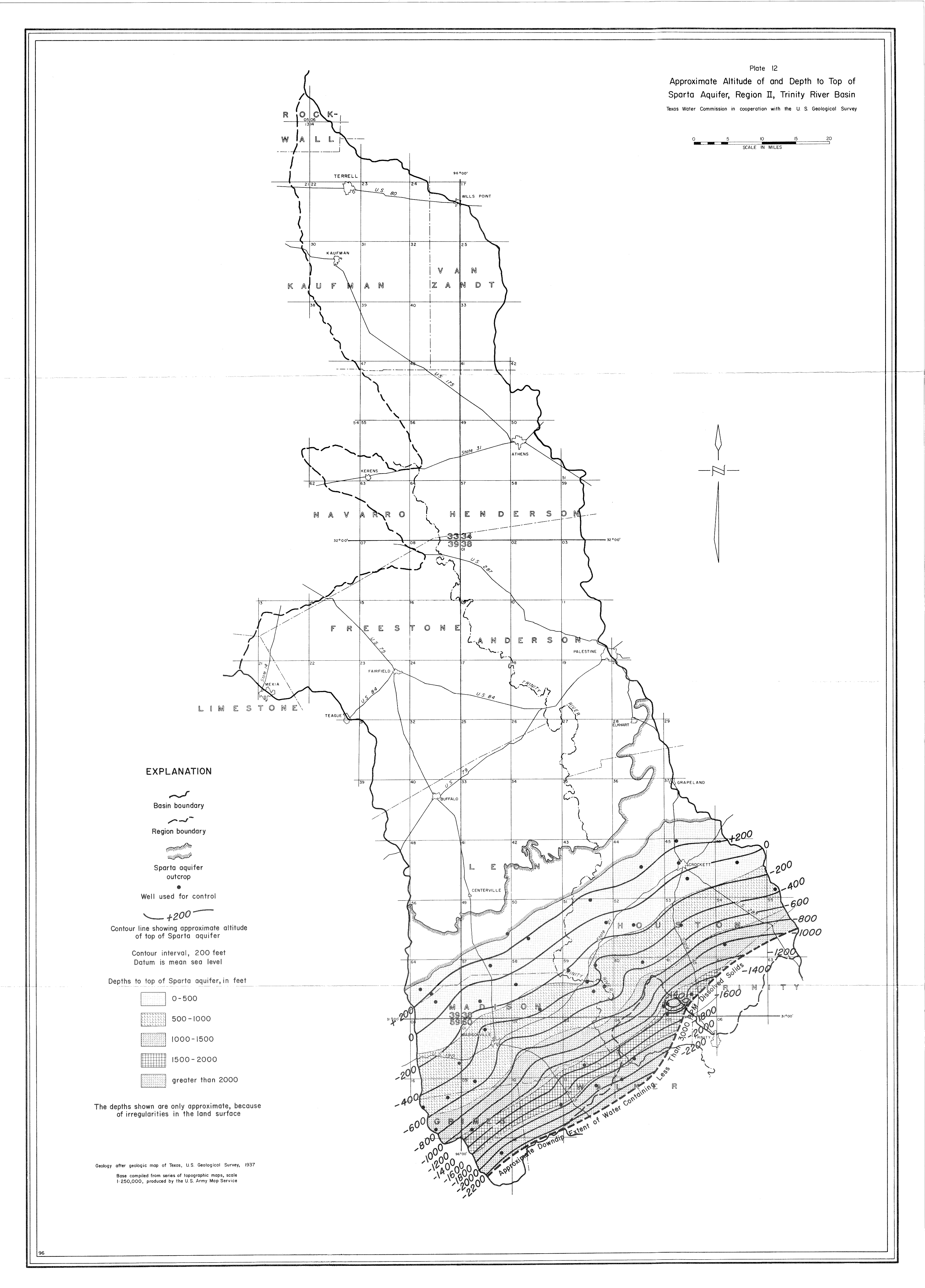
- Plate 12 (jpg - 2.9 MB) Approximate Altitude of and Depth to Top of Sparta Aquifer, Region II, Trinity River Basin
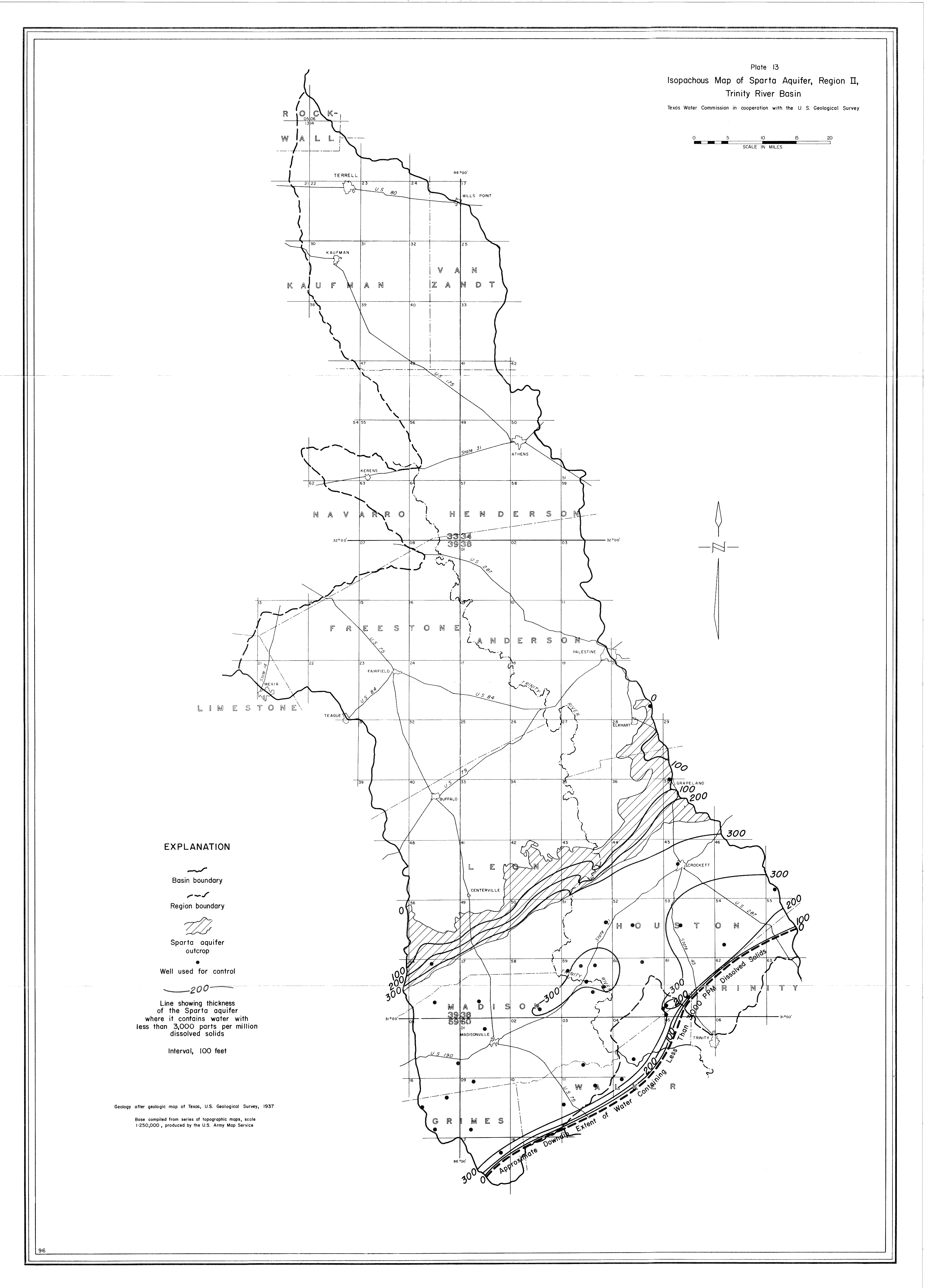
- Plate 13 (jpg - 2 MB) Isopachous Map of Sparta Aquifer, Region II, Trinity River Basin
- Plate 14 (jpg - 3 MB) Approximate Altitude of and Depth to top of Queen City Aquifer, Region II, Trinity River Basin
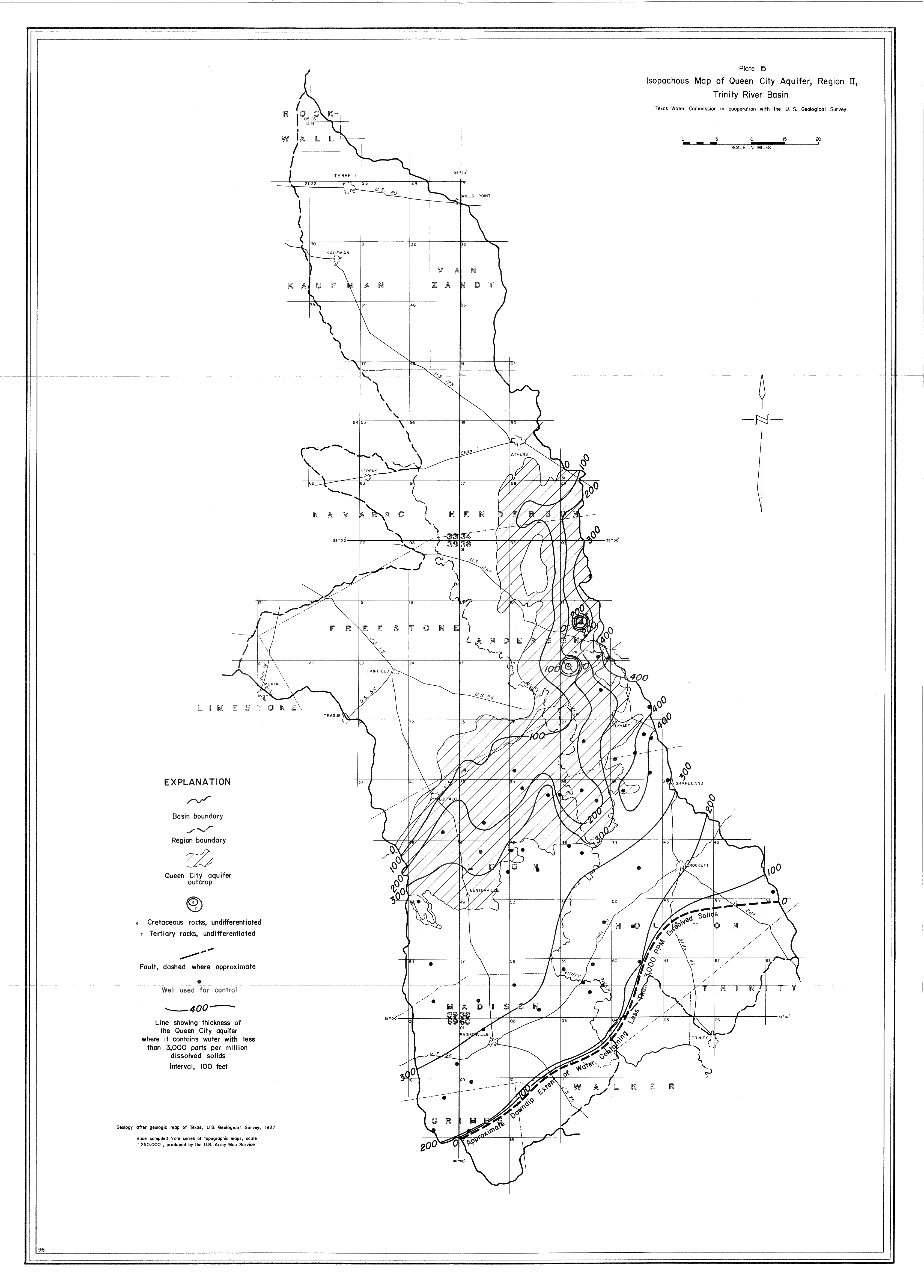
- Plate 15 (jpg - 2.4 MB) Isopachous Map of Queen City Aquifer, Region II, Trinity River Basin
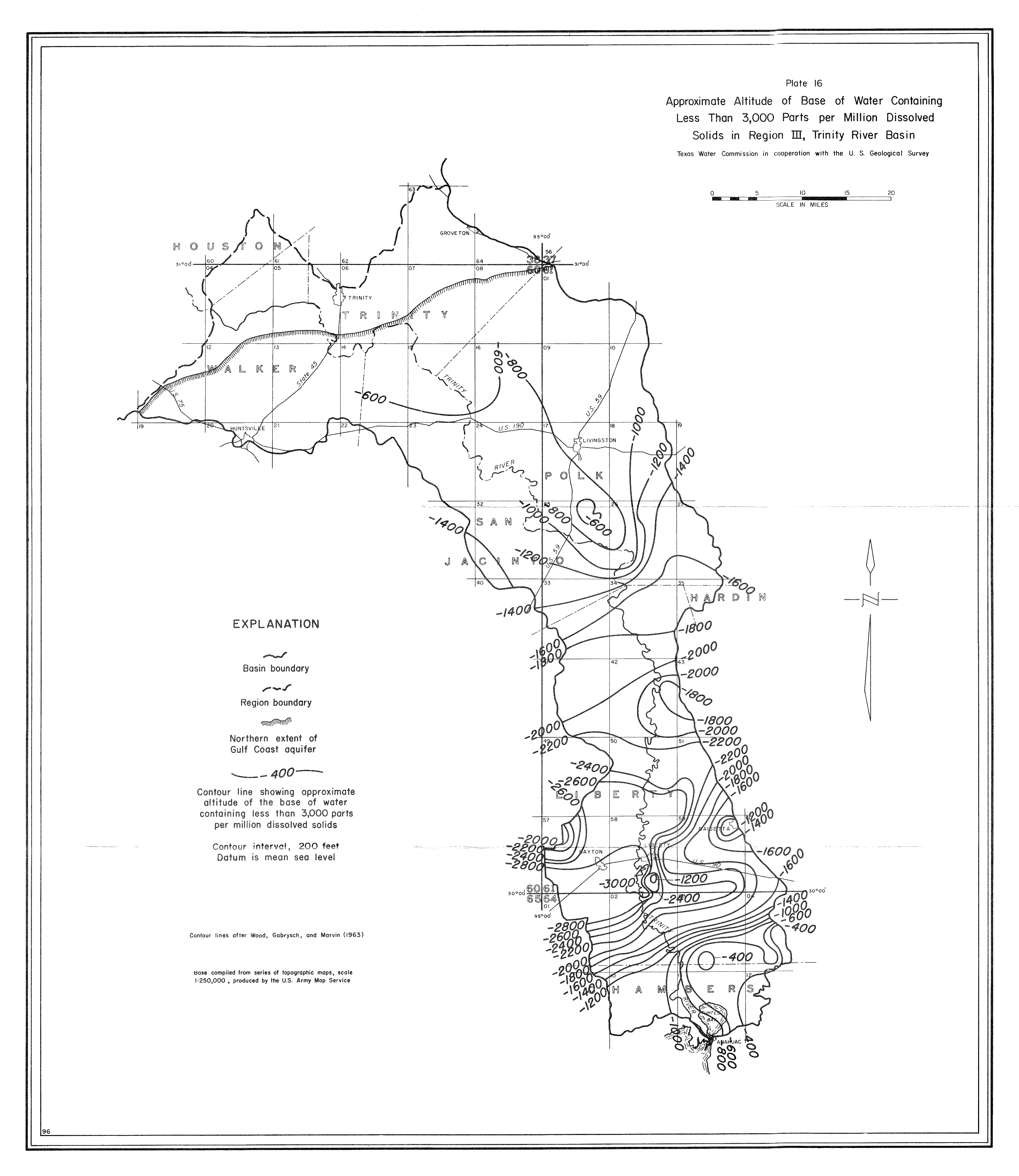
- Plate 16 (jpg - 1.5 MB) Approximate Altitude of Base of Water Containing Less Than 3,000 Parts per Million Dissolved Solids in Region III, Trinity River Basin
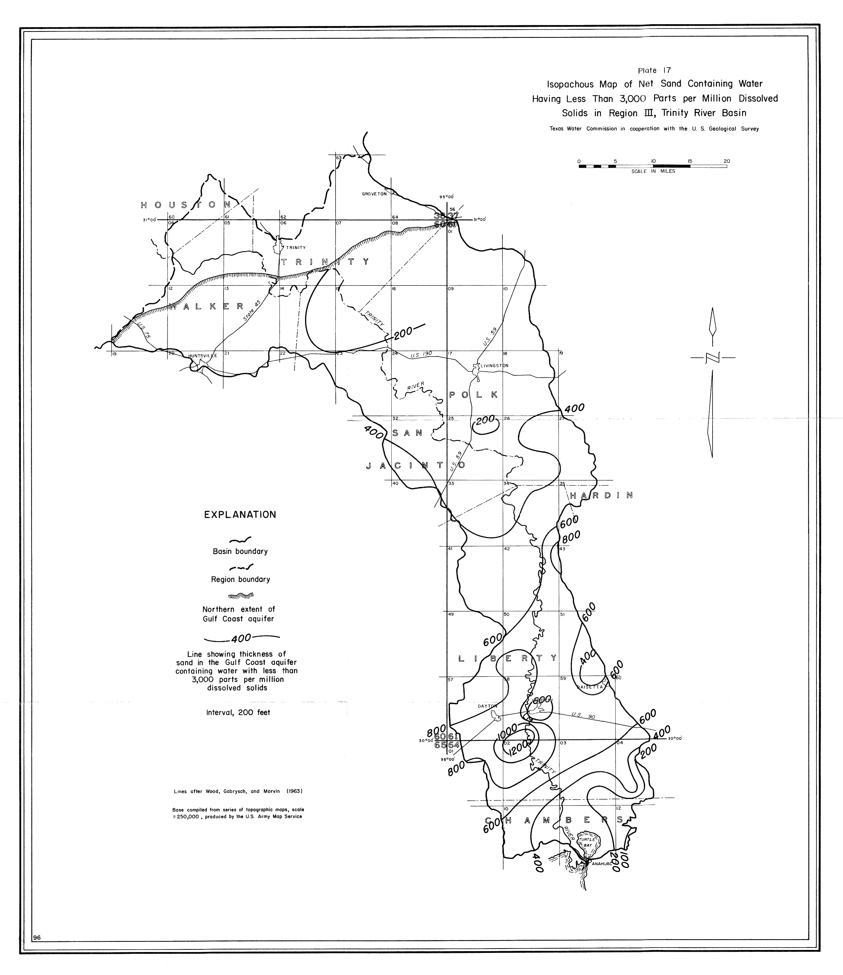
- Plate 17 (jpg - 1.3 MB) Isopachous Map of Net Sand Containing Water Having Less Than 3,000 Parts per Million Dissolved Solids in Region III, Trinity River Basin