Bulletin 6305 By Leonard A. Wood, R. K. Gabrysch, and Richard Marvin, United States Geological Survey | July 1963
Oversize fold out maps were scanned separately from the report above. "Missing pages" in the report are the maps below.
- Bulletin 6305 - Reconnaissance Investigation of the Ground-Water Resources of the Gulf Coast Region, Texas
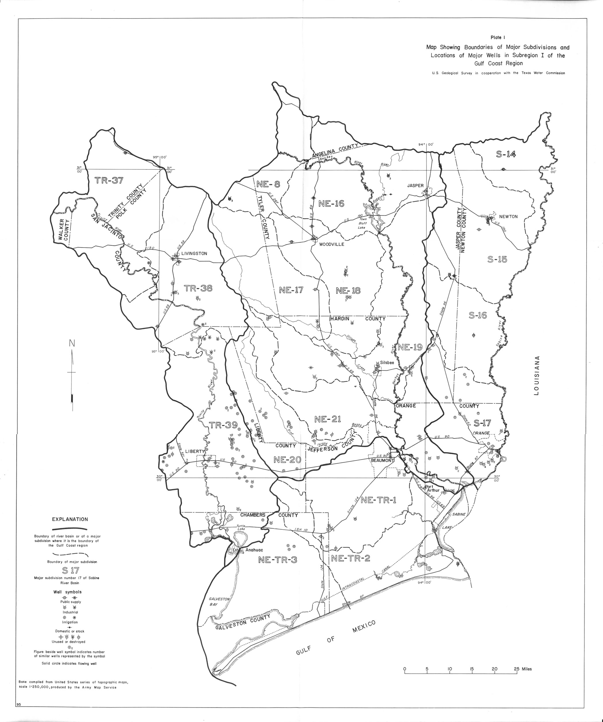
- Plate 1 Map showing boundaries of Major Subdivisions and Locations of Major Wells in Subregion 1 of the Gulf Coast Region
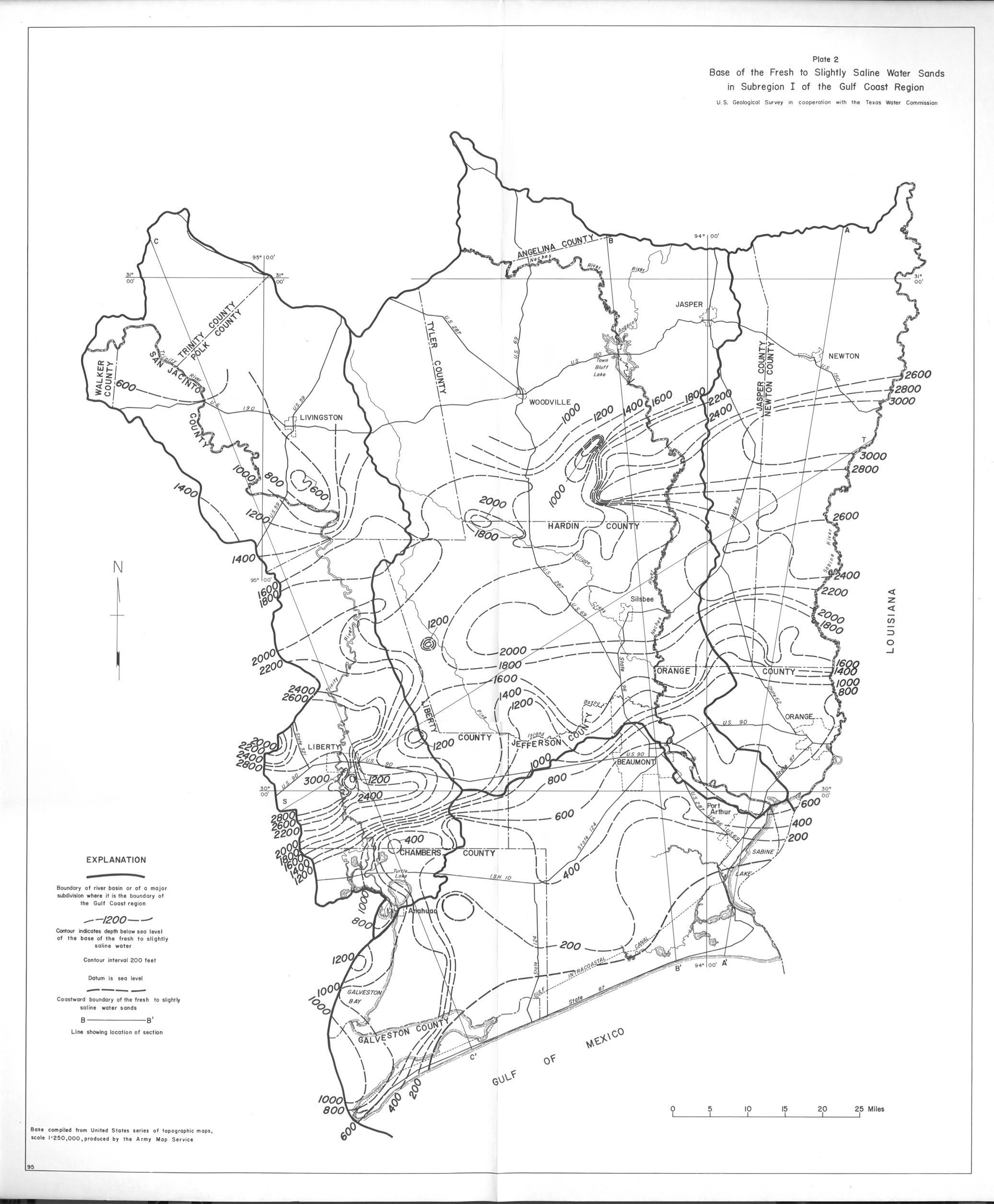
- Plate 2 Base of the Fresh to Slightly Saline Water Sands in Subregion 1 of the Gulf Coast Region
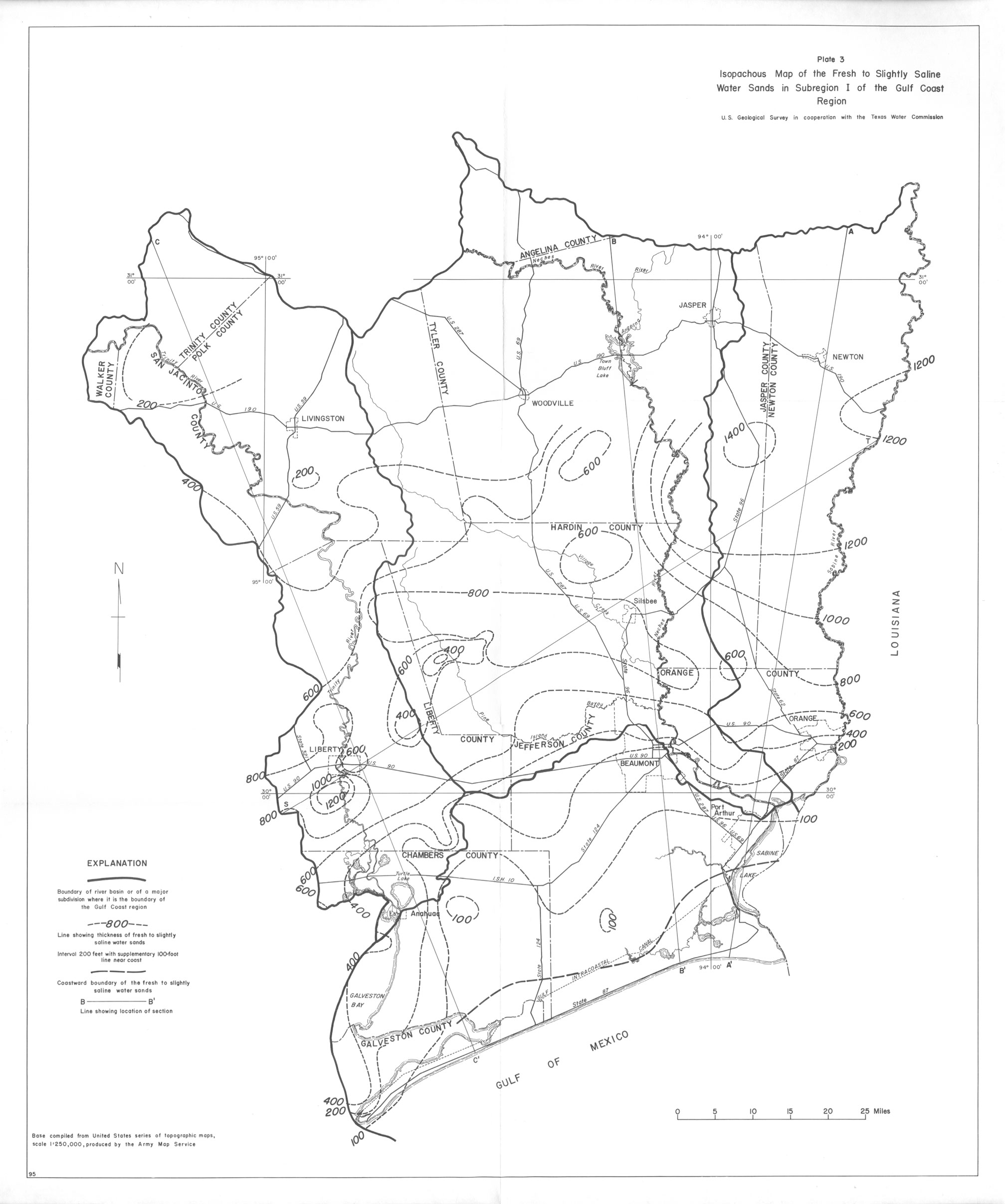
- Plate 3 Isopachous Map of the Fresh to Slightly Saline Water Sands in Subregion 1 of the Gulf Coast Region
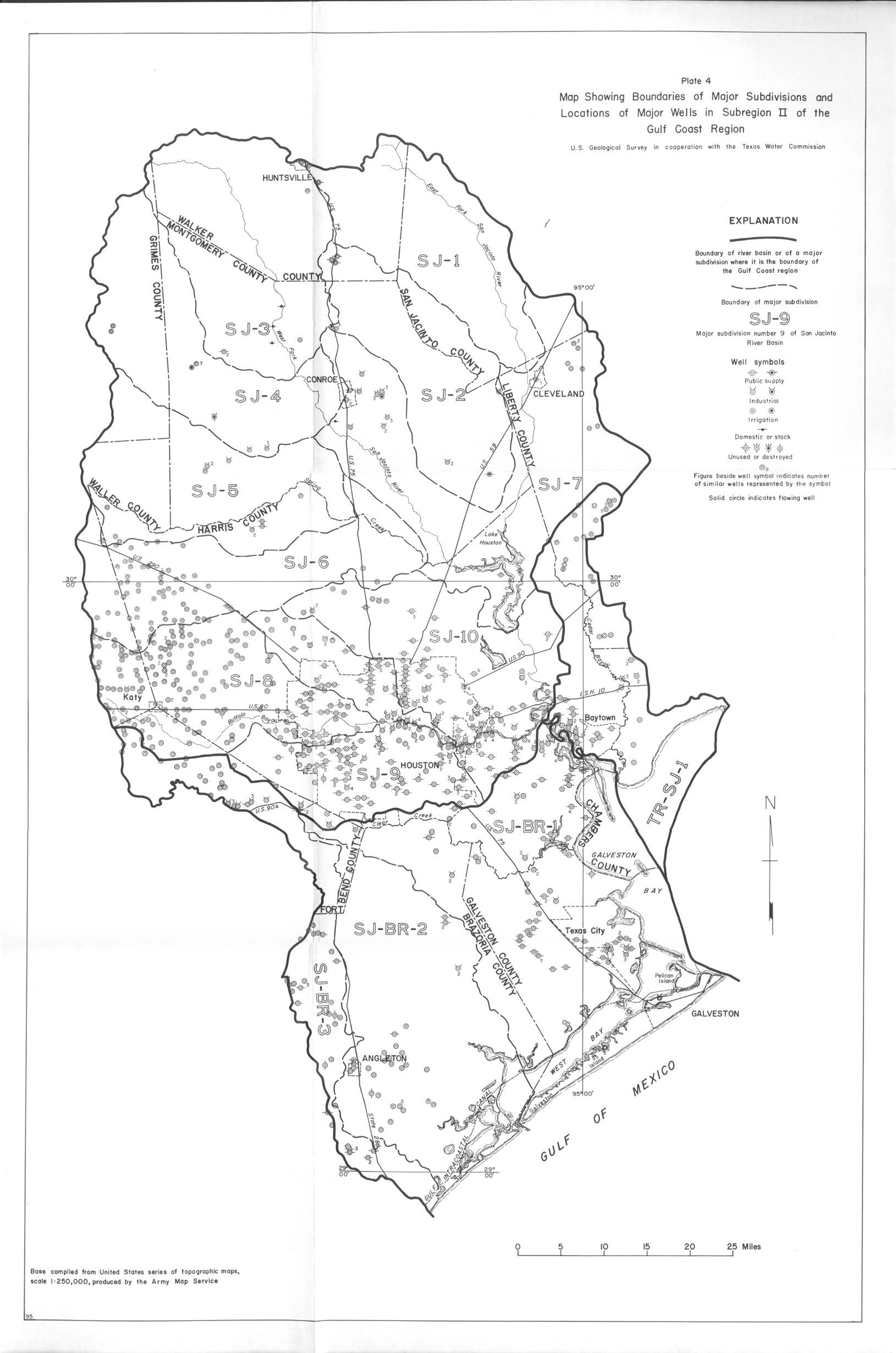
- Plate 4 Map showing boundaries of Major Subdivisions and Locations of Major Wells in Subregion 2 of the Gulf Coast Region
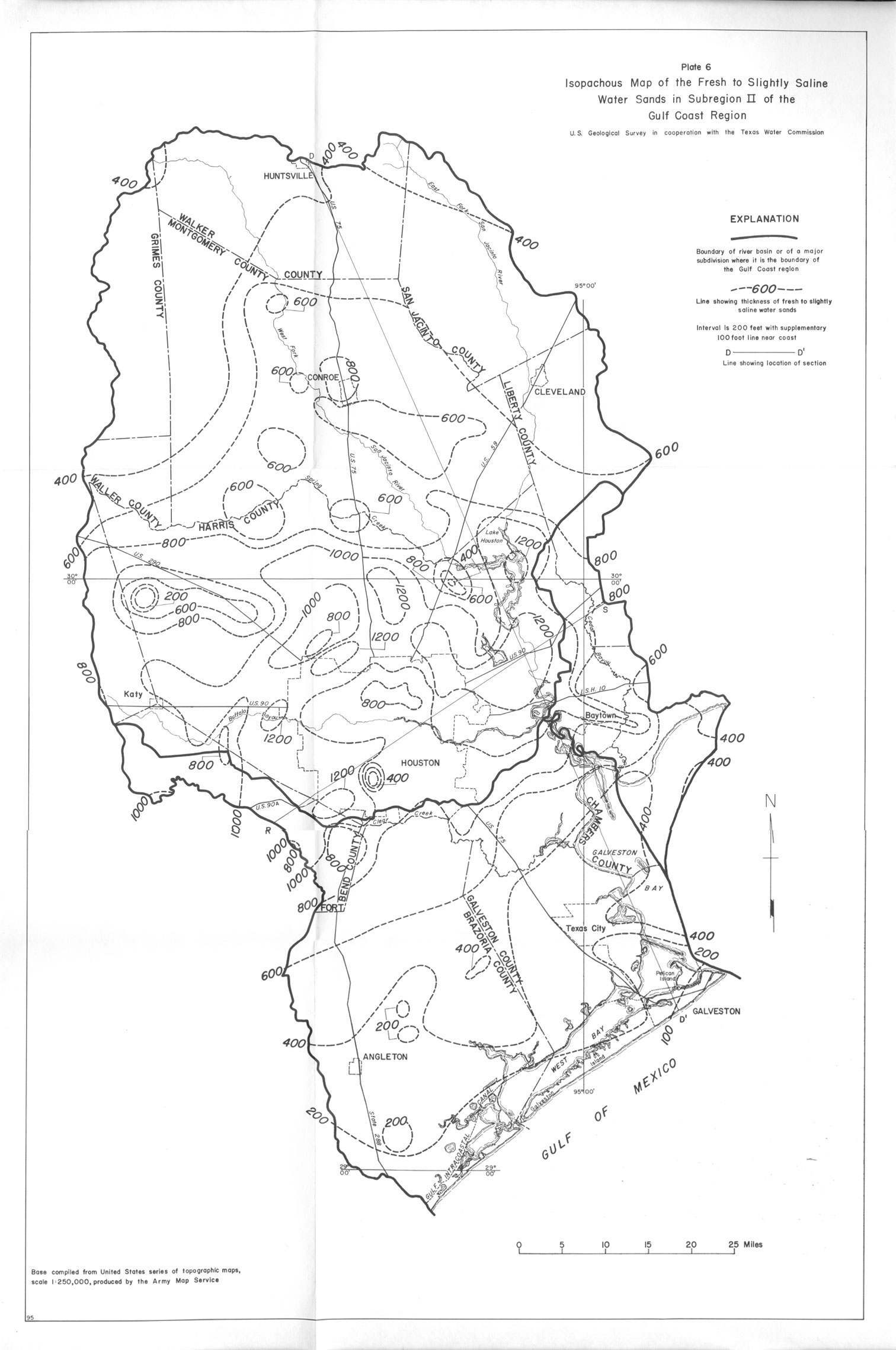
- Plate 6 Isopachous Map of the Fresh to Slightly Saline Water Sands in Subregion 2 of the Gulf Coast Region
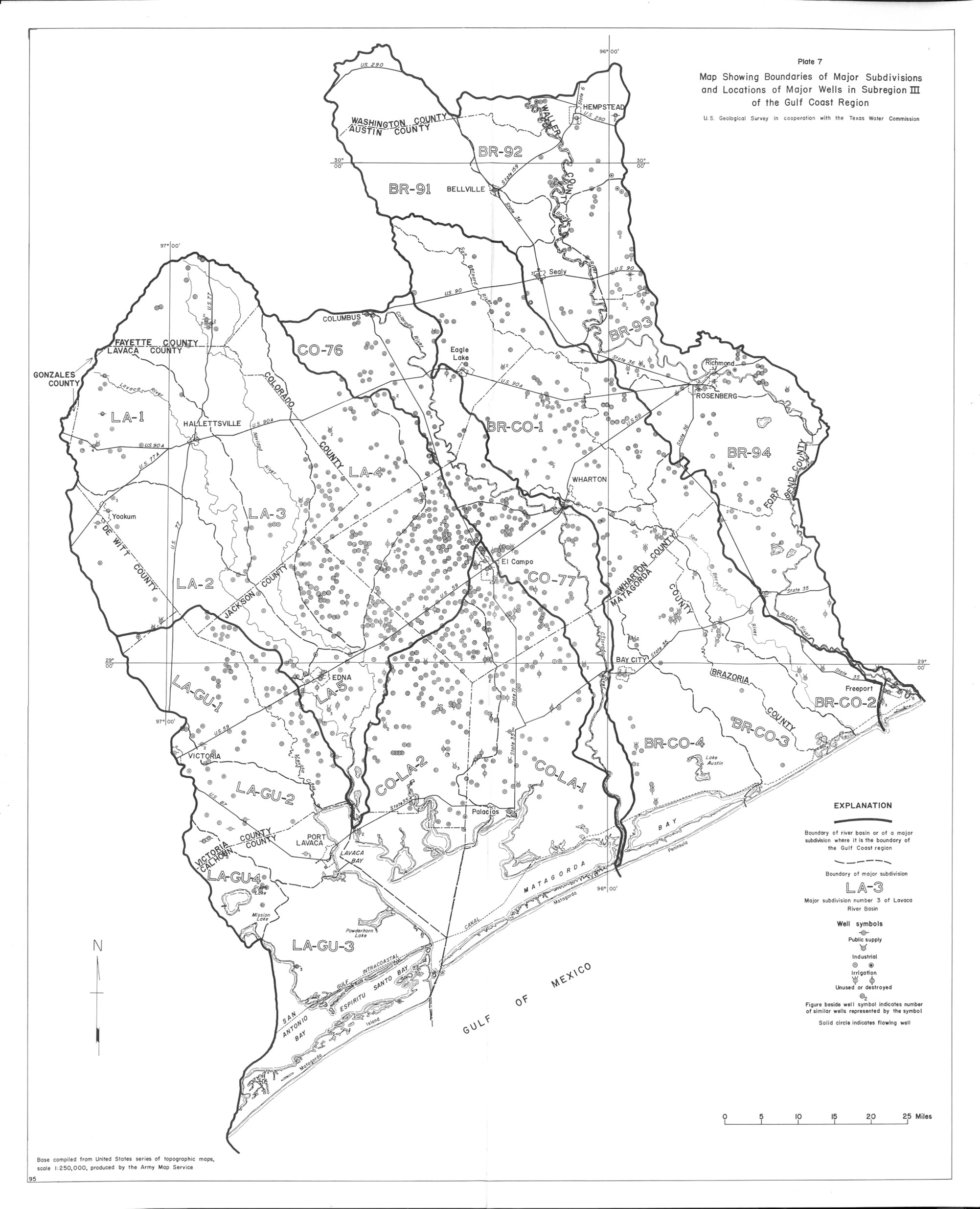
- Plate 7 Map showing boundaries of Major Subdivisions and Locations of Major Wells in Subregion 3 of the Gulf Coast Region
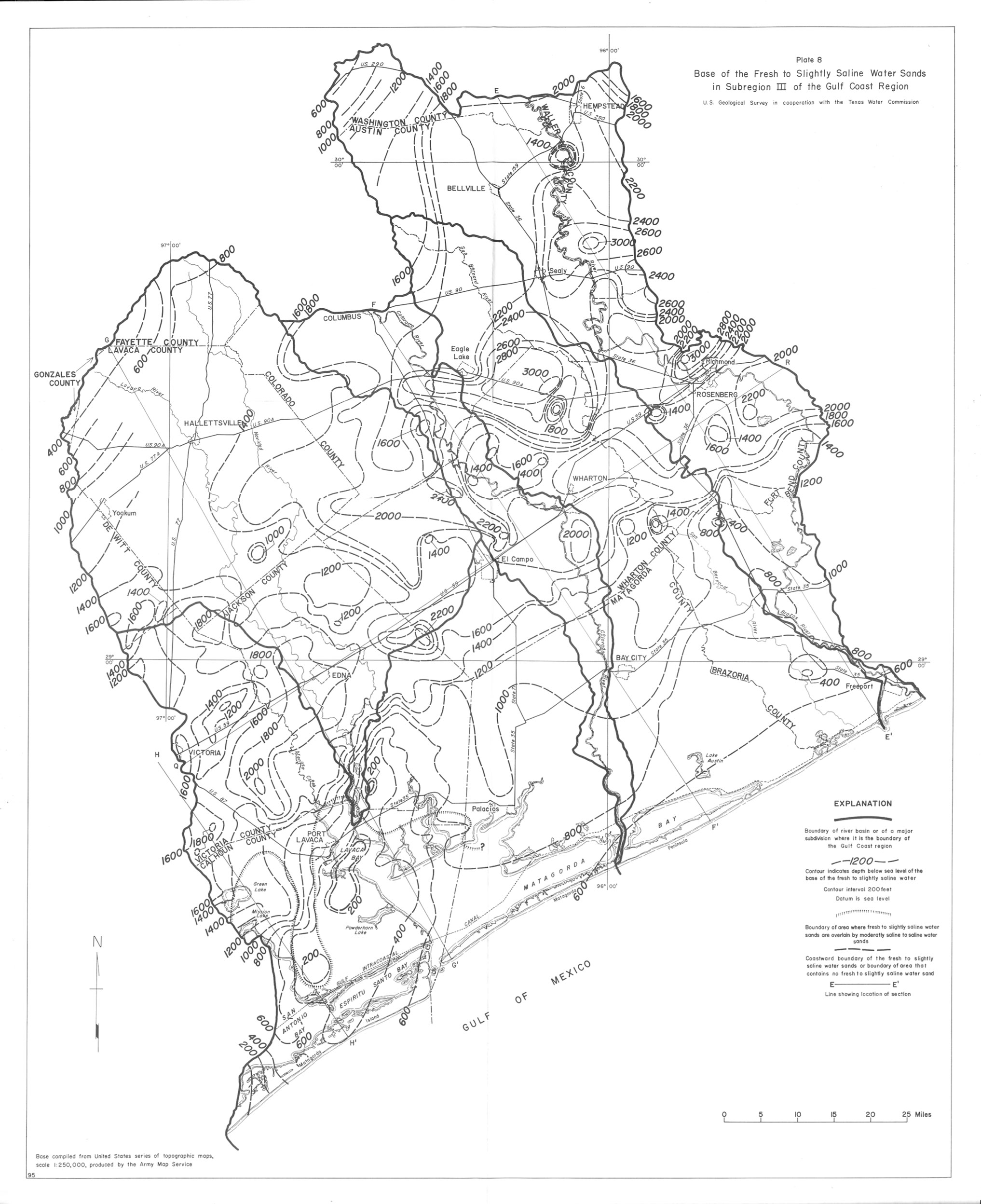
- Plate 8 Base of the Fresh to Slightly Saline Water Sands in Subregion 3 of the Gulf Coast Region
- Plate 9 Isopachous Map of the Fresh to Slightly Saline Water Sands in Subregion 3 of the Gulf Coast Region
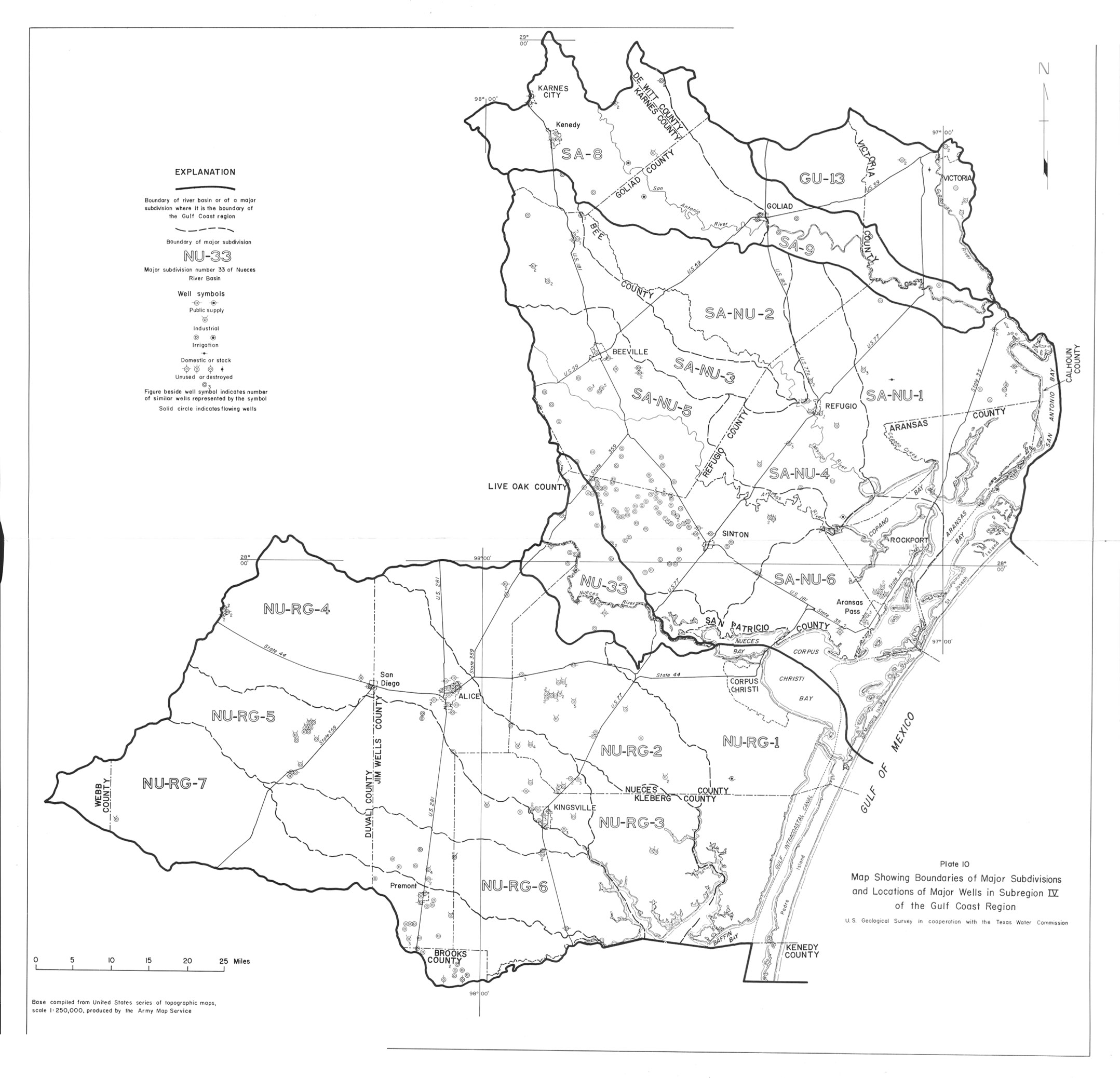
- Plate 10 Map showing boundaries of Major Subdivisions and Locations of Major Wells in Subregion 4 of the Gulf Coast Region
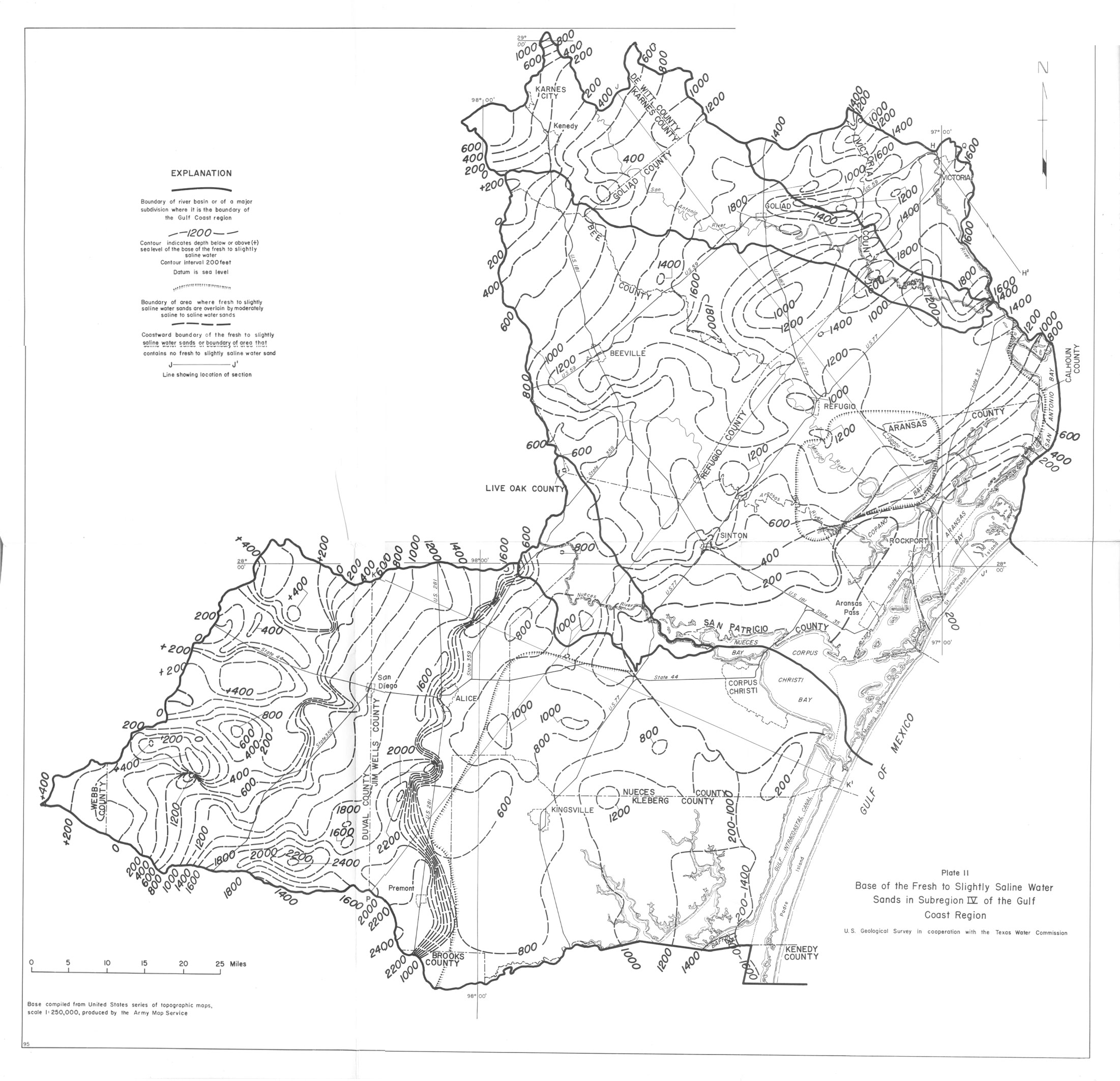
- Plate 11 Base of the Fresh to Slightly Saline Water Sands in Subregion 4 of the Gulf Coast Region
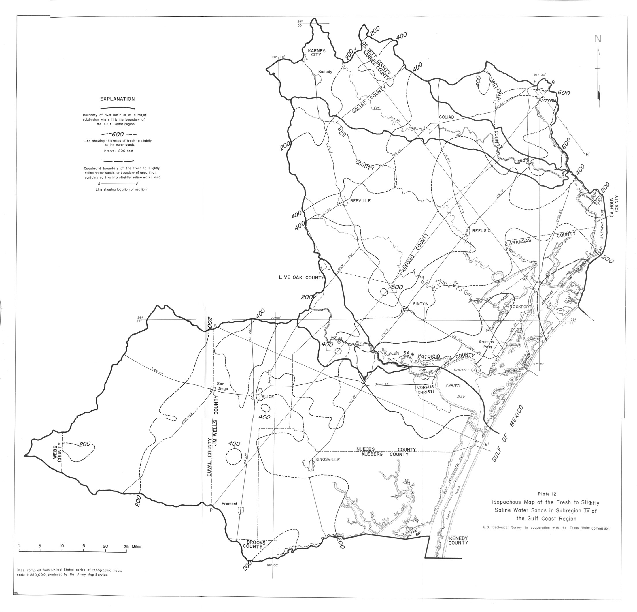
- Plate 12 Isopachous Map of the Fresh to Slightly Saline Water Sands in Subregion 4 of the Gulf Coast Region
- Plate 13 Map showing boundaries of Major Subdivisions and Locations of Major Wells in Subregion 5 of the Gulf Coast Region
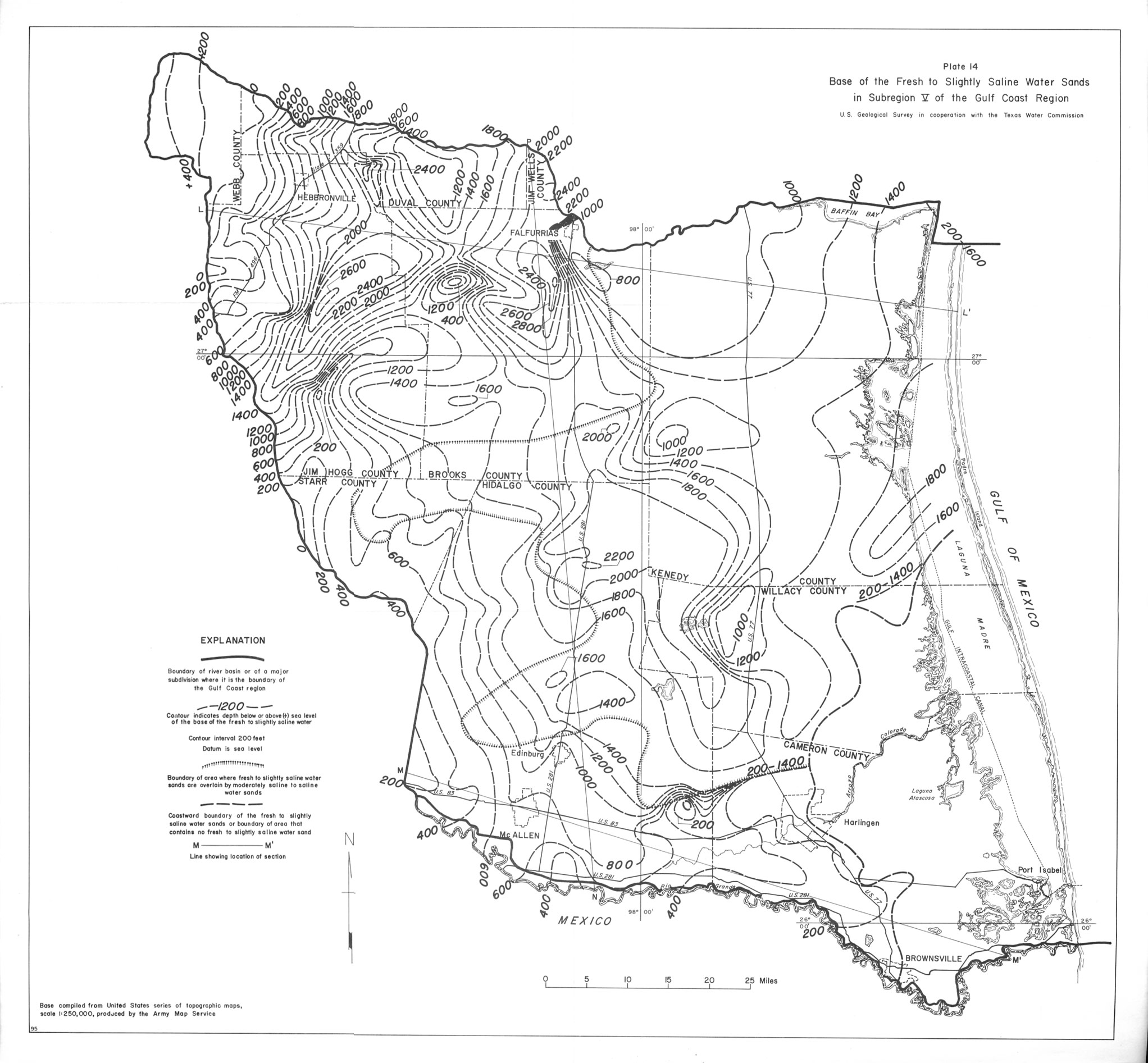
- Plate 14 Base of the Fresh to Slightly Saline Water Sands in Subregion 5 of the Gulf Coast Region
- Plate 15 Isopachous Map of the Fresh to Slightly Saline Water Sands in Subregion 5 of the Gulf Coast Region