Bulletin 6109 By W. H. Alexander, Jr., Geologist United States Geological Survey | November 1961
Oversize fold out maps were scanned separately from the report above. "Missing pages" in the report are the maps below.
- Bulletin 6109 - Geology and Ground-Water Resources of the Northern High Plains of Texas
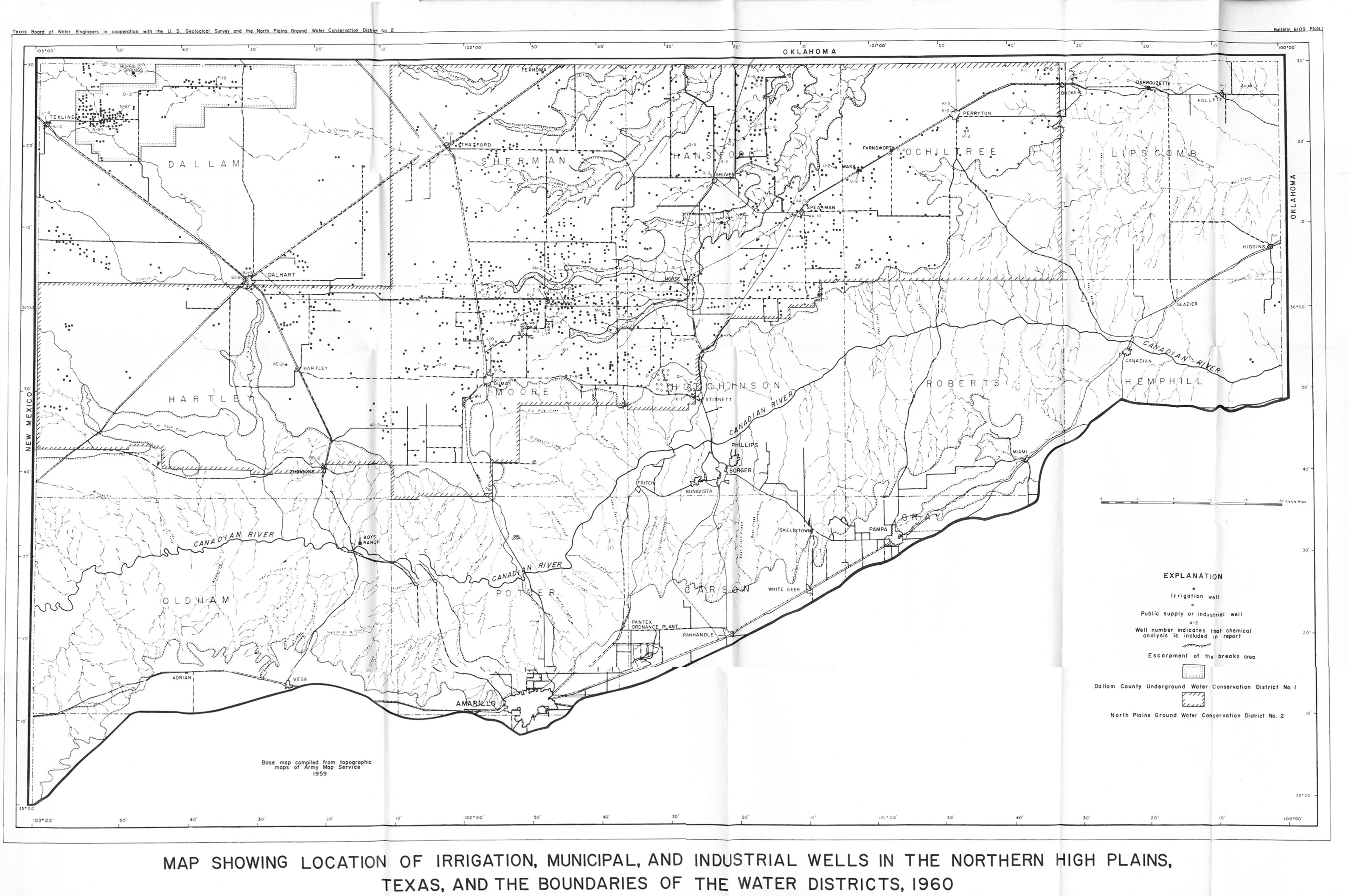
- Plate 1 Map Showing Location of Irrigation, Municipal, and Industrial Wells in Northern High Plains, Texas, and the Boundaries of the Water Districts, 1960
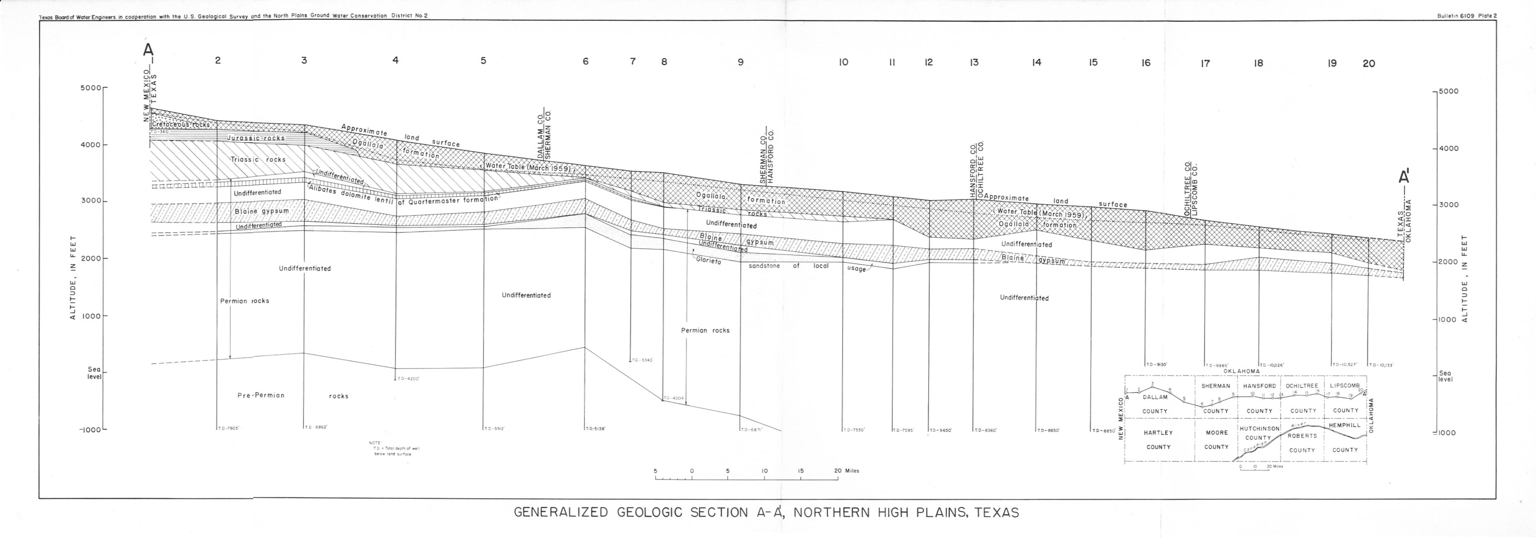
- Plate 2 Generalized Geologic Section A-A', Northern High Plains, Texas
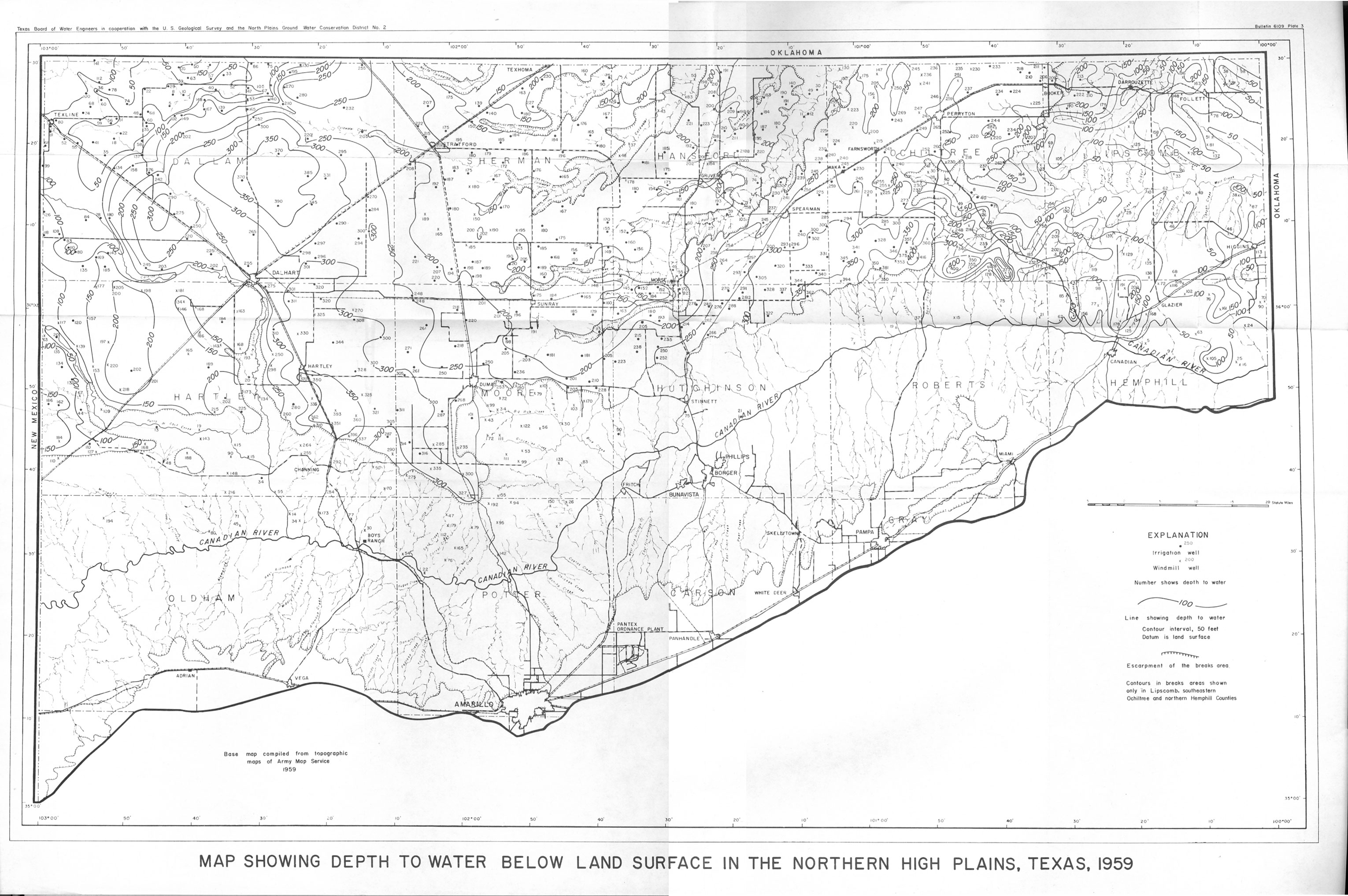
- Plate 3 Map Showing Depth to Water Below Land Surface in the Northern High Plains, Texas, 1959
- Plate 4 Map Showing Thickness of Fresh-Water Material in the Ogallala Formation in the Northern High Plains, Texas, 1959