Open-File Report 99-03
- Open File Report 99-03 Updated Evaluation of Water Resources within the Trinity Aquifer Area, Central Texas
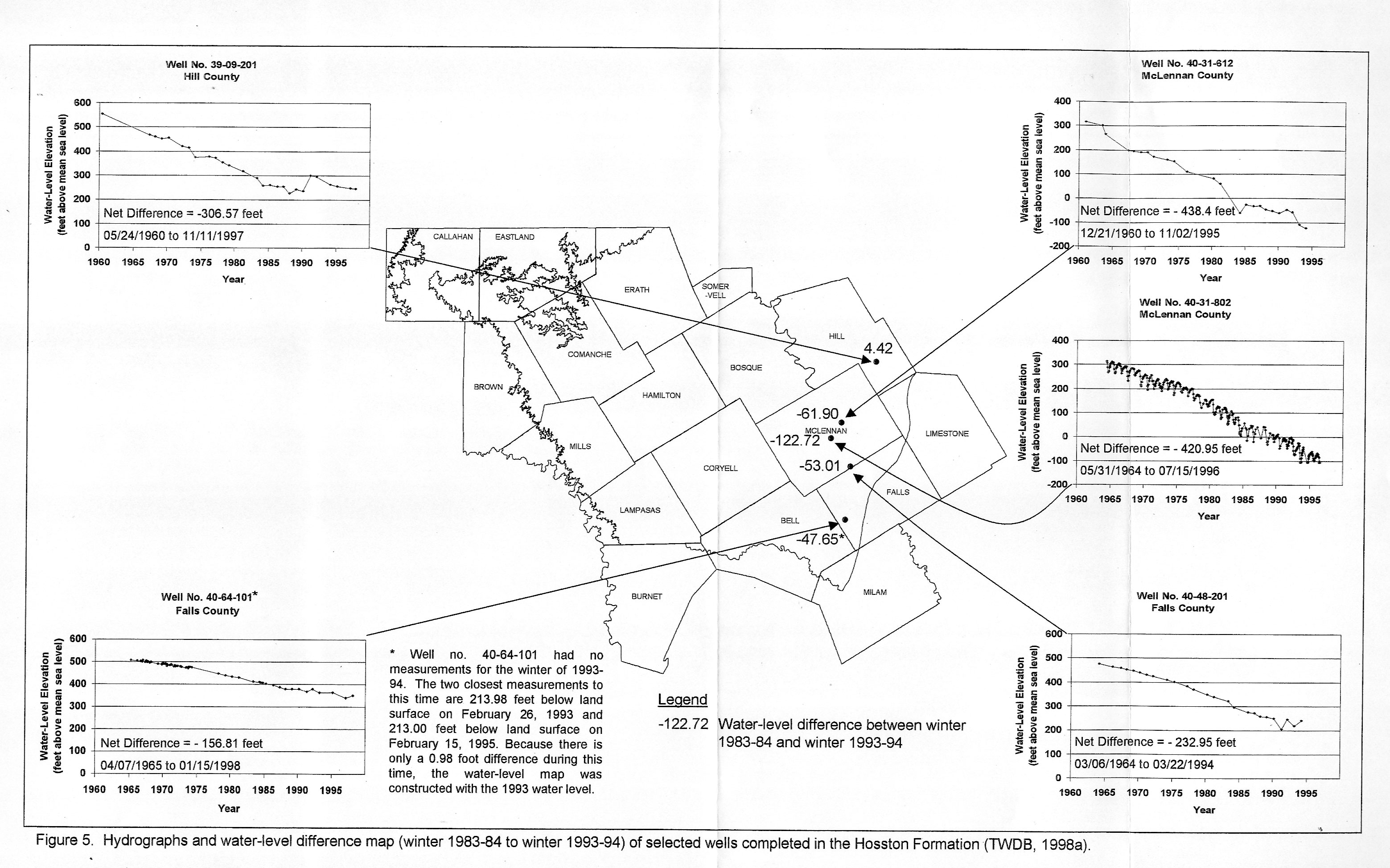
- Figure 5 - Hydrographs and water-level difference map (winter 1983-84 to winter 1993-94) of selected wells completed in the Hosston Formation
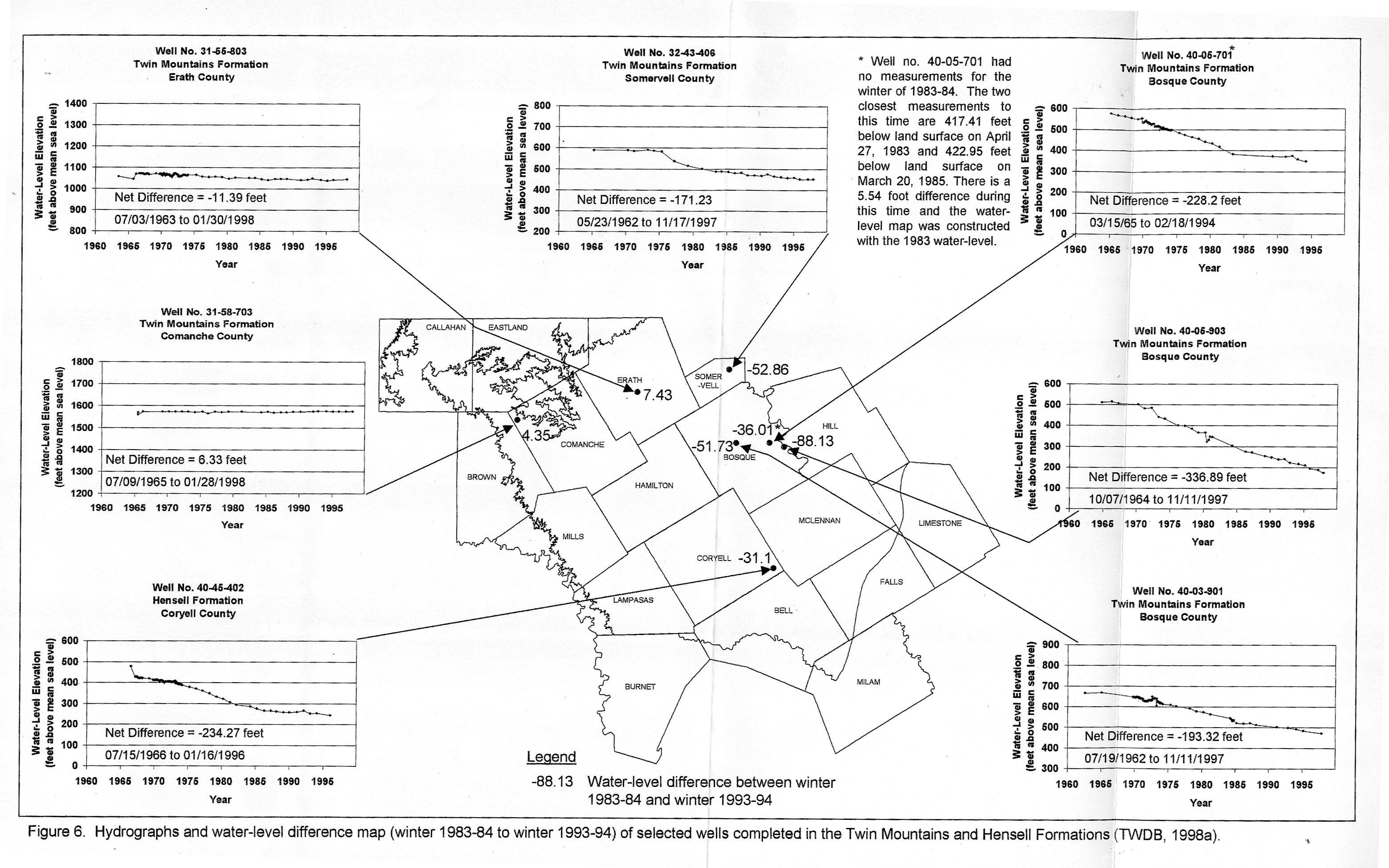
- Figure 6 - Hydrographs and water-level difference map (winter 1983-84 to winter 1993-94) of selected wells completed in the Twin Mountains and Hensell Formations
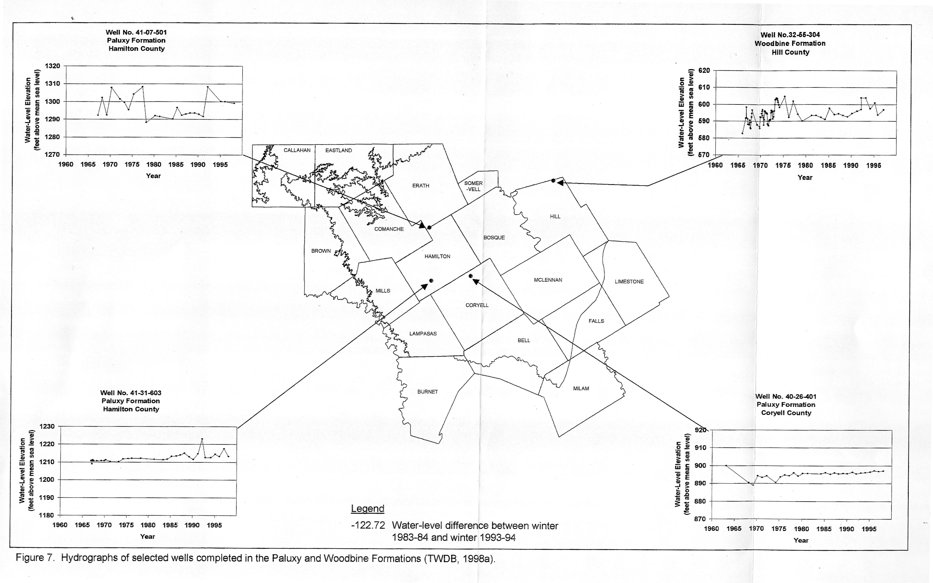
- Figure 7 - Hydrographs of selected wells completed in the Paluxy and Woodbine Formations