Limited Publication 139 By Texas Department of Water Resources | December 1980
Oversize fold out maps were scanned separately from the report. "Missing pages" in the report are the maps below.
- LP 139 - Application and Analysis of Borehole Data For The Edwards Aquifer in the San Antonio Area, Texas
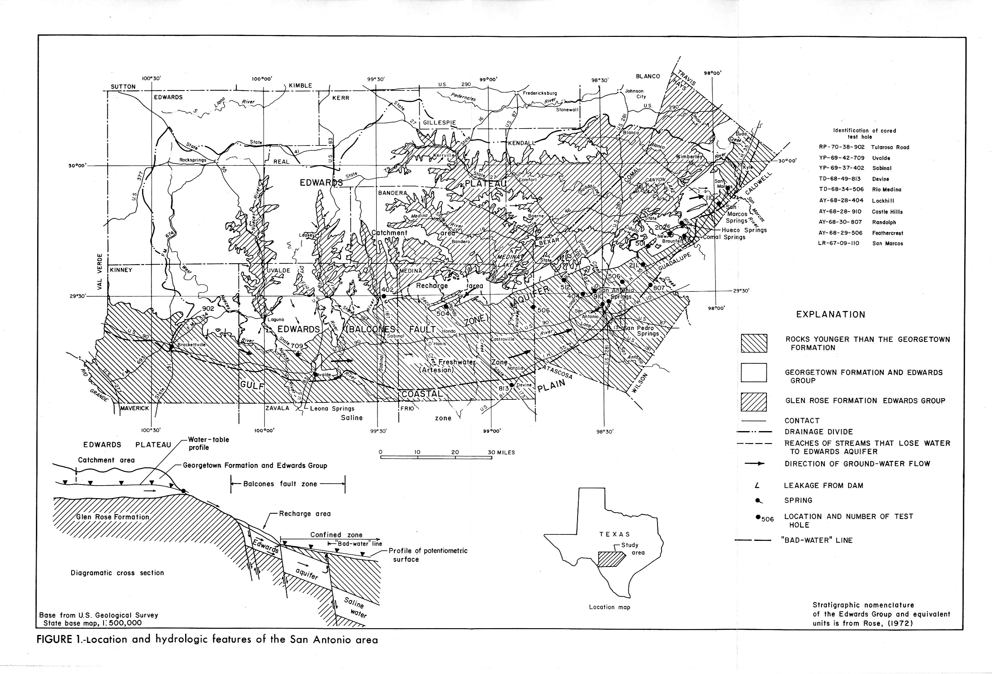
- Figure 1 - Location and hydrologic features of the San Antonio Area
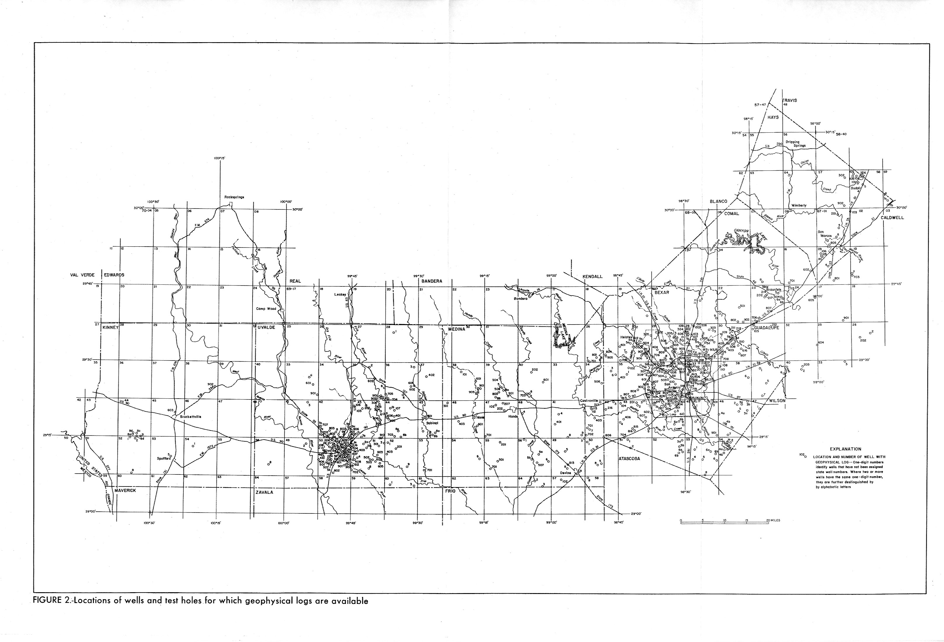
- Figure 2 - Locations of wells and test holes for which geophysical logs are available
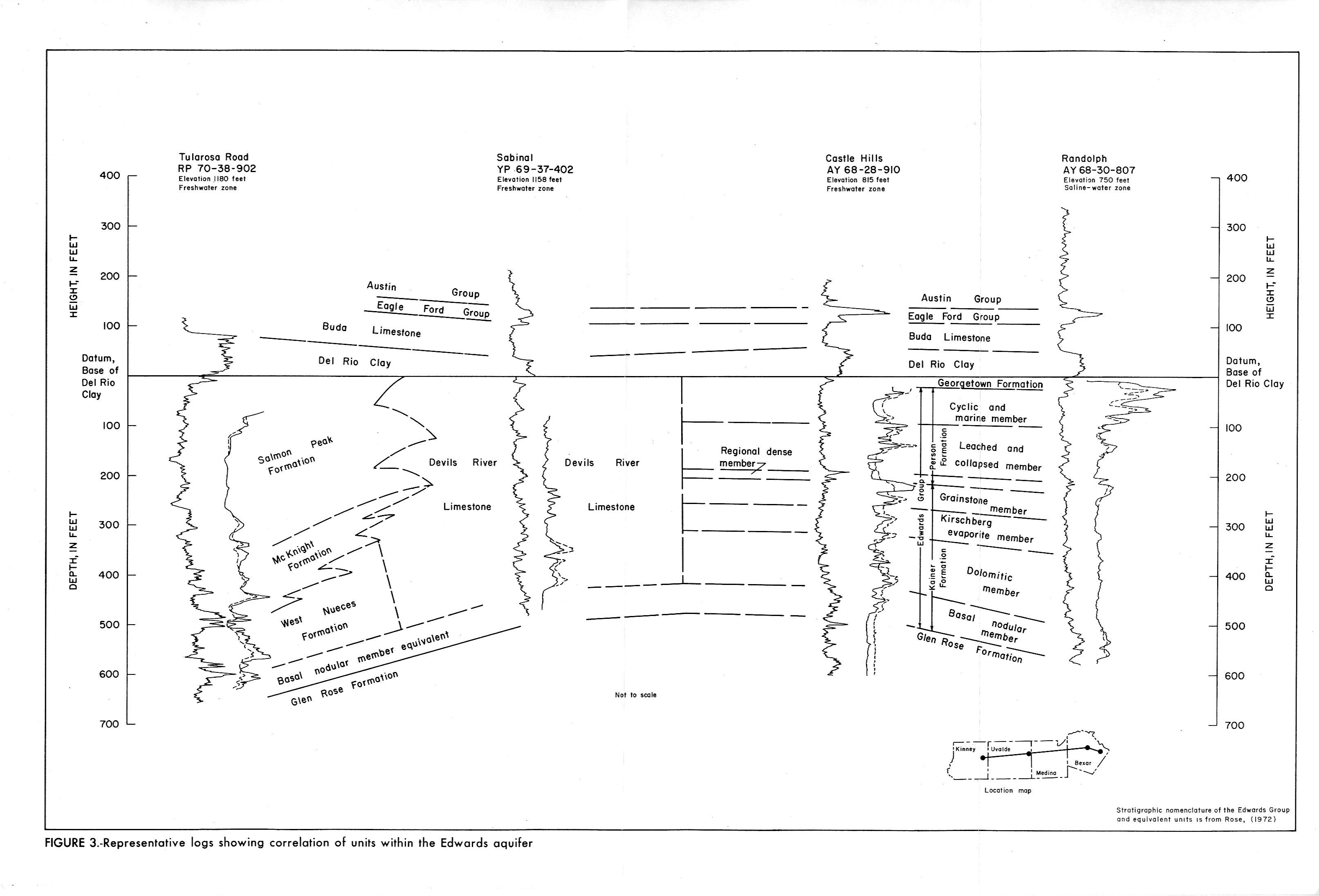
- Figure 3 - Representative logs showing correlation of units within the Edwards Aquifer
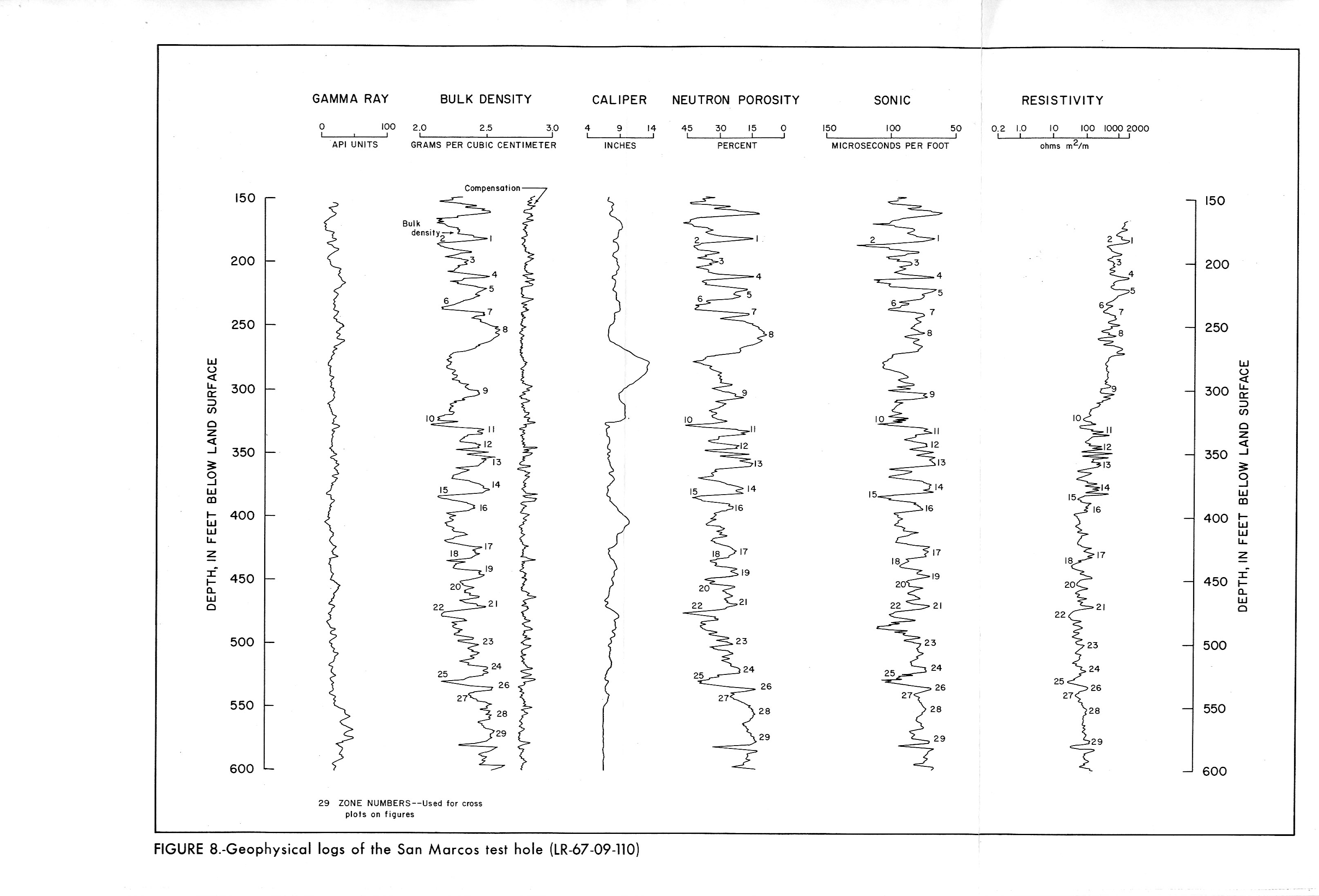
- Figure 8 - Geophysical logs of the San Marcos test hole (LR-67-09-110)
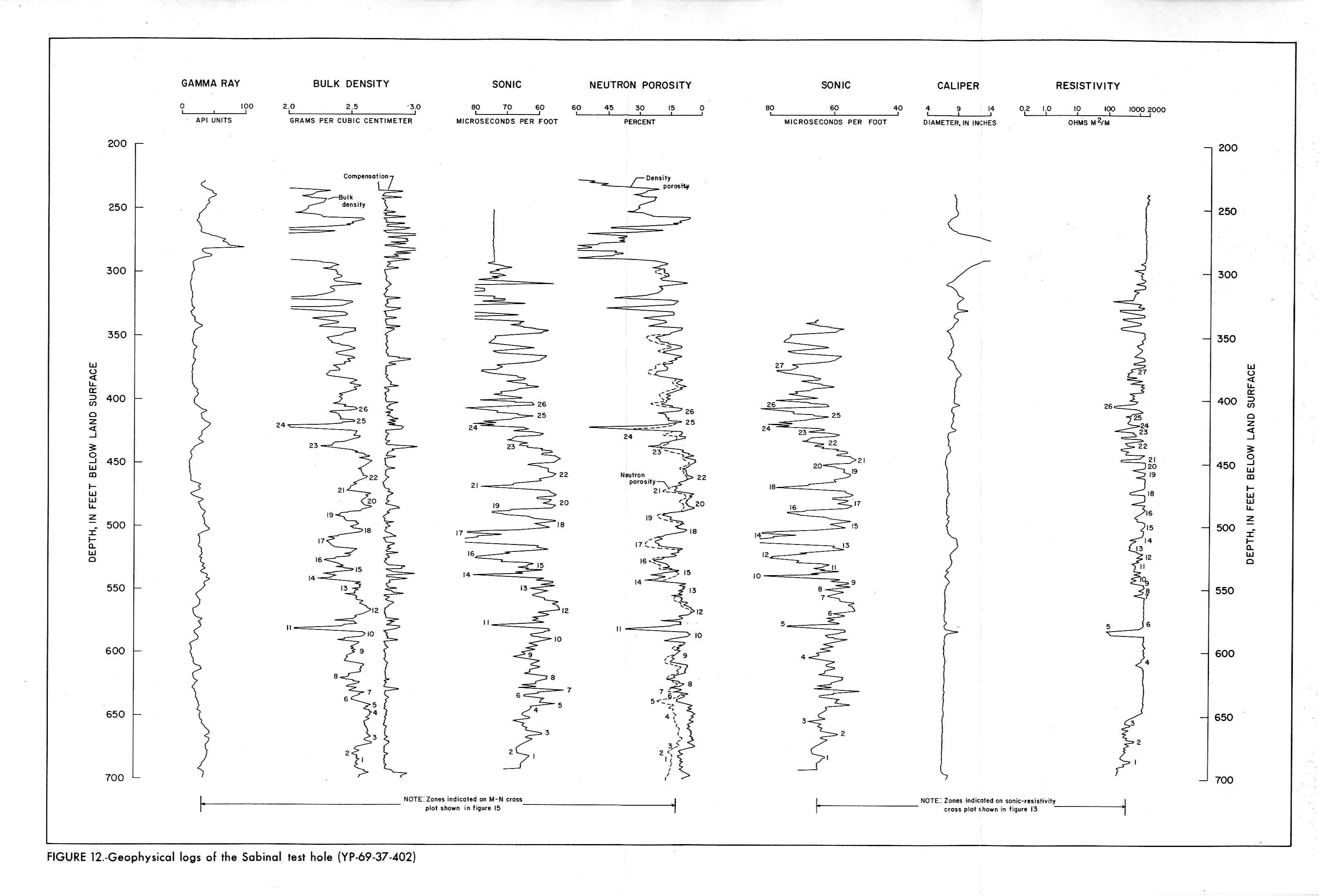
- Figure 12 - Geophysical logs of the Sabinal test hole (YP-69-37-402)
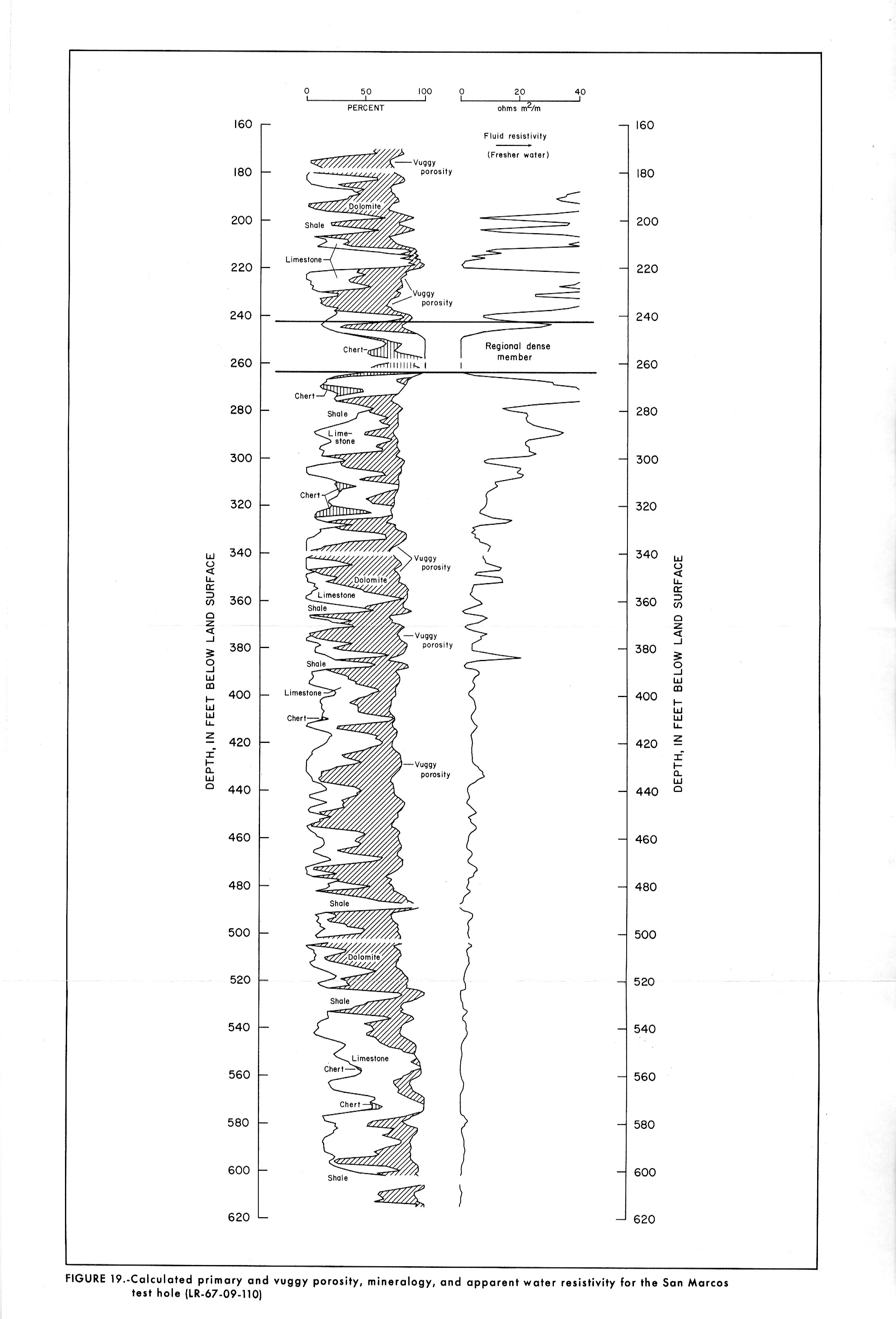
- Figure 19 - Calculated primary and vuggy porosity, mineralology, and apparent water resistivity for the San Marcos test hole (LR-69-09-110)
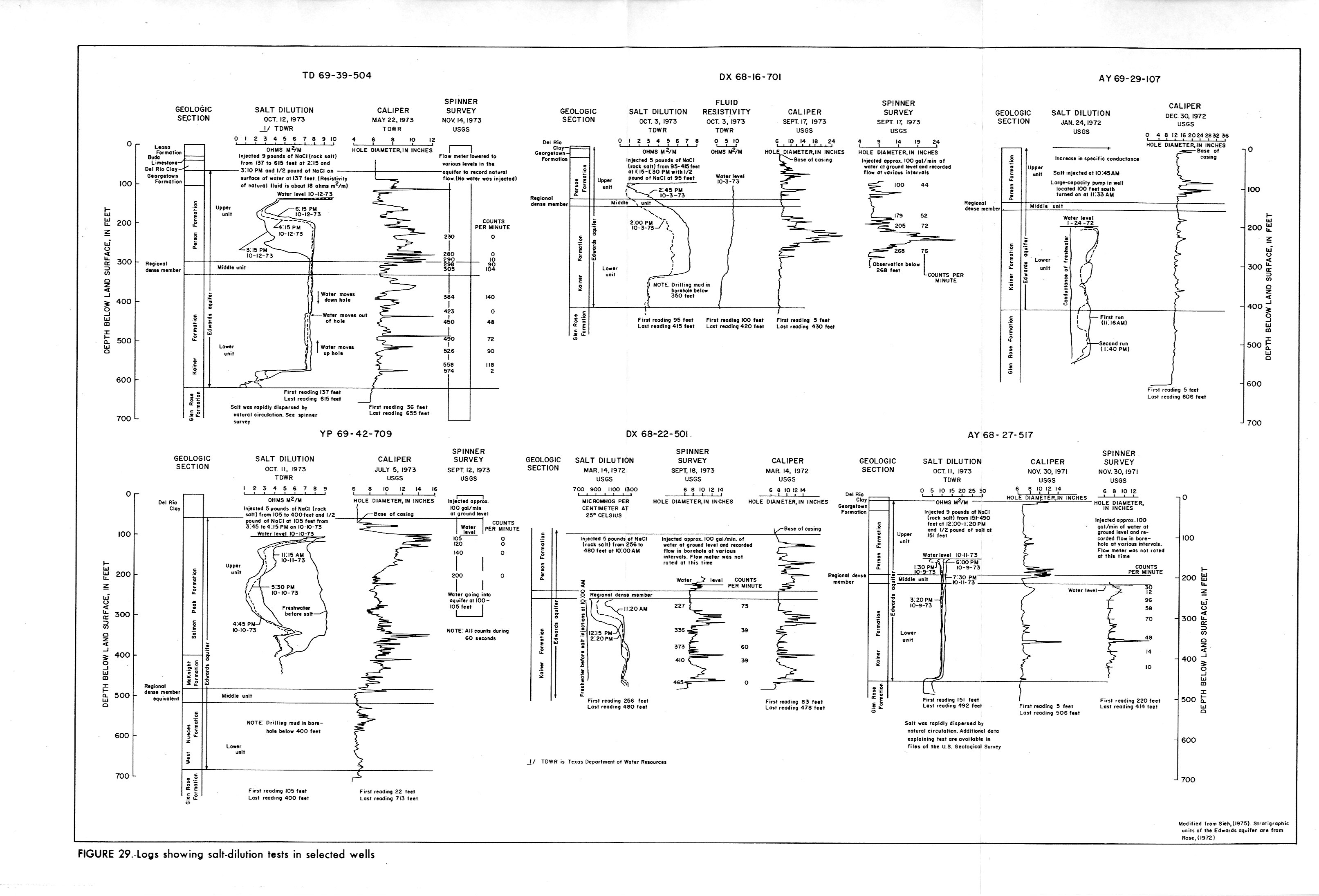
- Figure 29 - Logs showing salt-dilution tests in selected wells