Bulletin 6209 By William Ogilbee, Geologist United States Geological Survey and F. L. Osborne, Jr., Geologist Texas Water Commission | August 1962
Oversize fold out maps were scanned separately from the report above. "Missing pages" in the report are the maps below.
- Bulletin 6209 - Ground-Water Resources of Haskell and Knox Counties, Texas
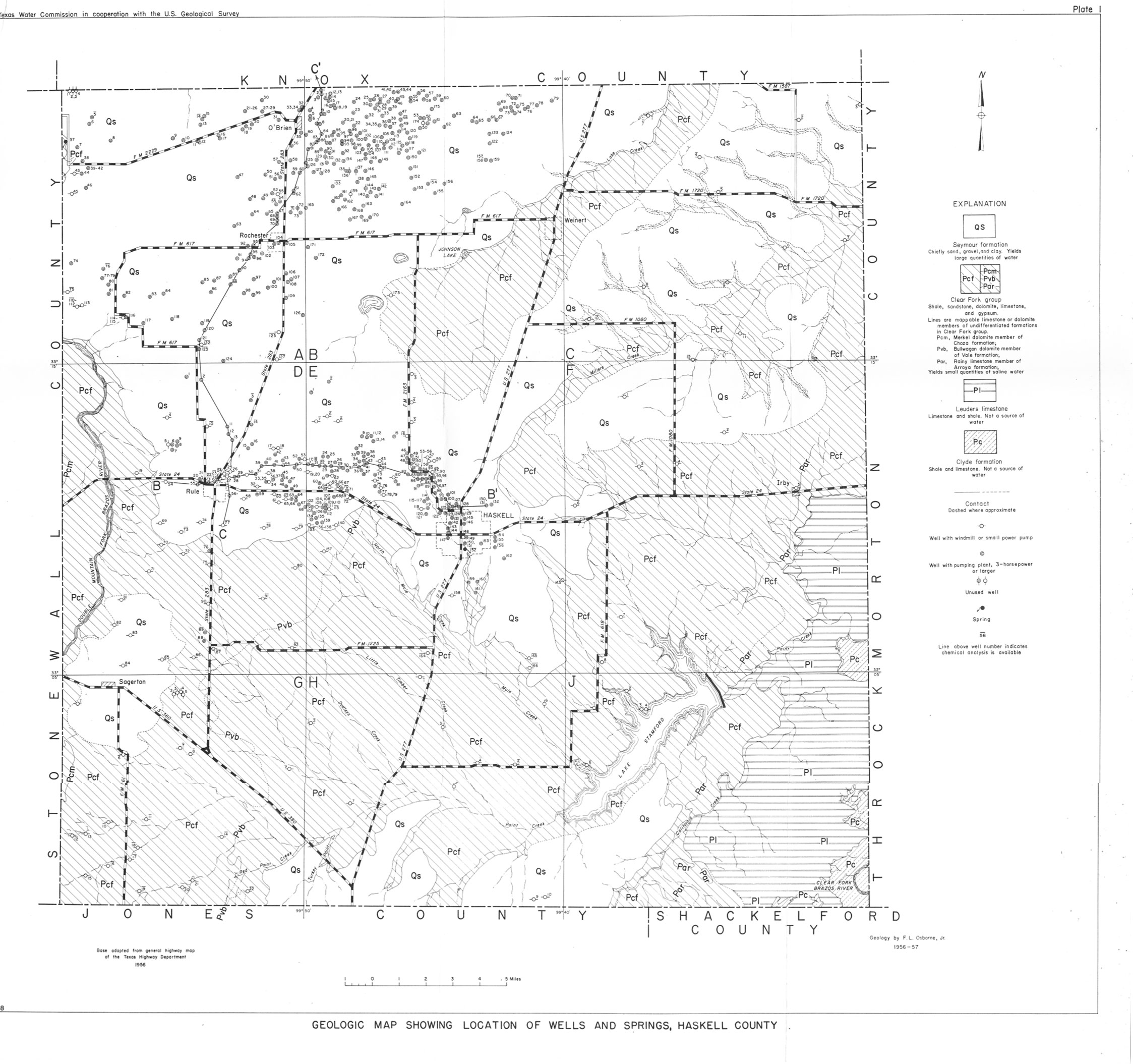
- Plate 1 Geologic Map Showing Location of Wells and Springs, Haskell County
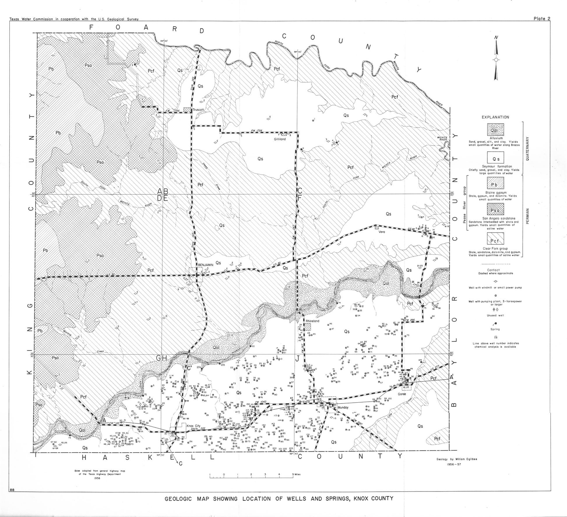
- Plate 2 Geologic Map Showing Location of Wells and Springs, Knox County
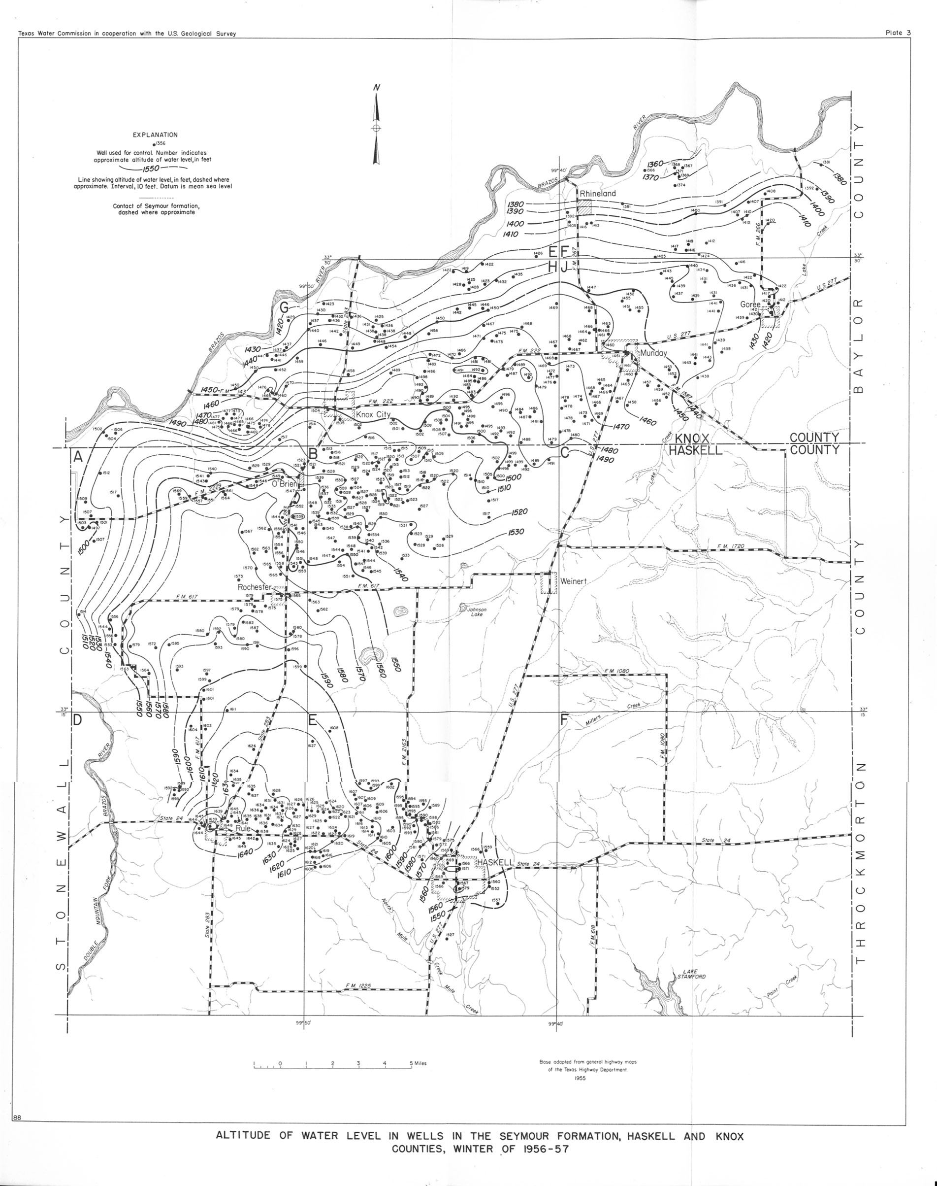
- Plate 3 Altitude of Water Level in Wells in the Seymour Formation, Haskell and Knox Counties, Winter of 1956-57
- Plate 4 Altitude of the Base of the Seymour Formation, Haskell and Knox Counties
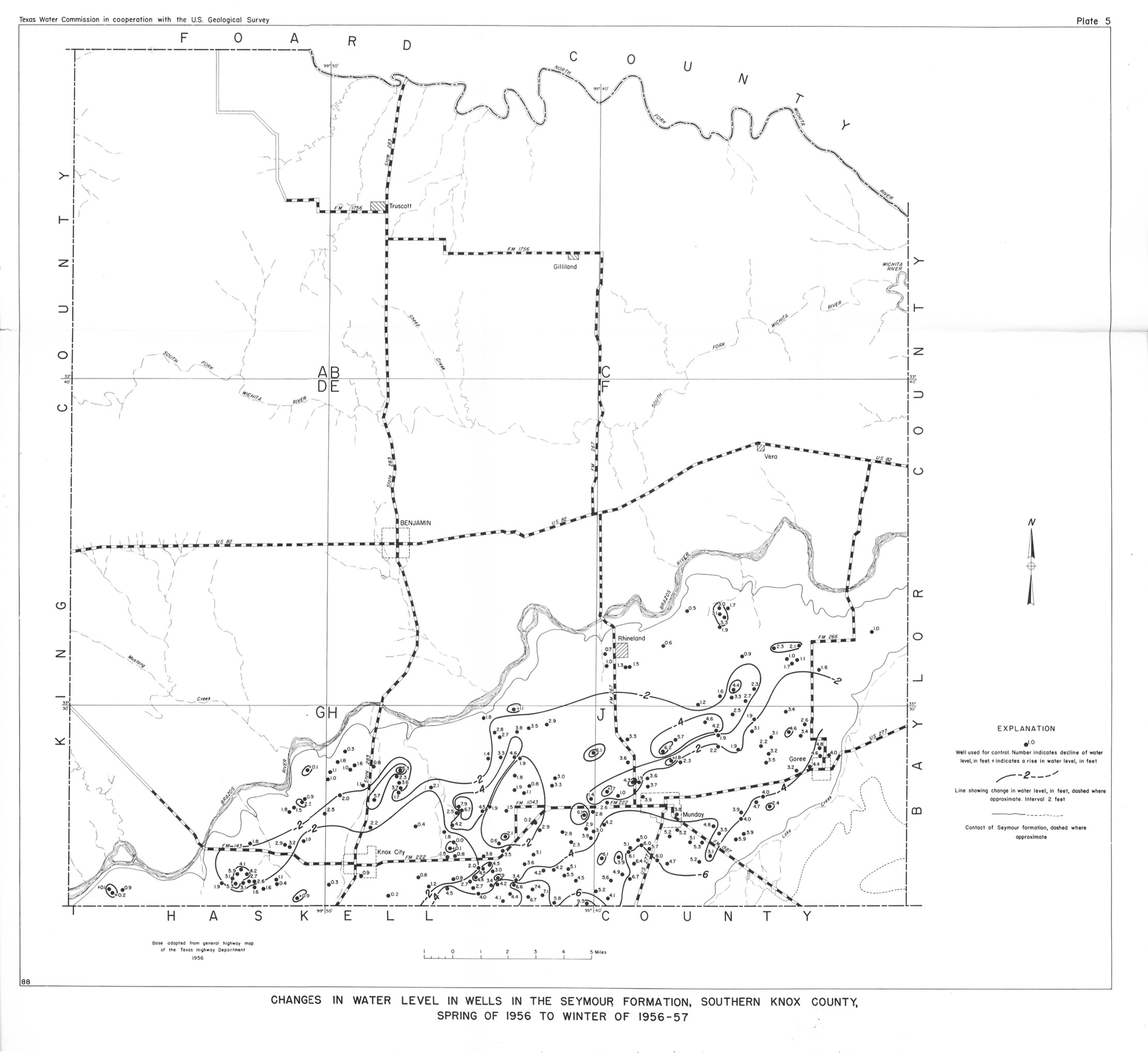
- Plate 5 Changes in Water Level in Wells in the Seymour Formation, Southern Knox County, Spring 1956 to Winter of 1956-57
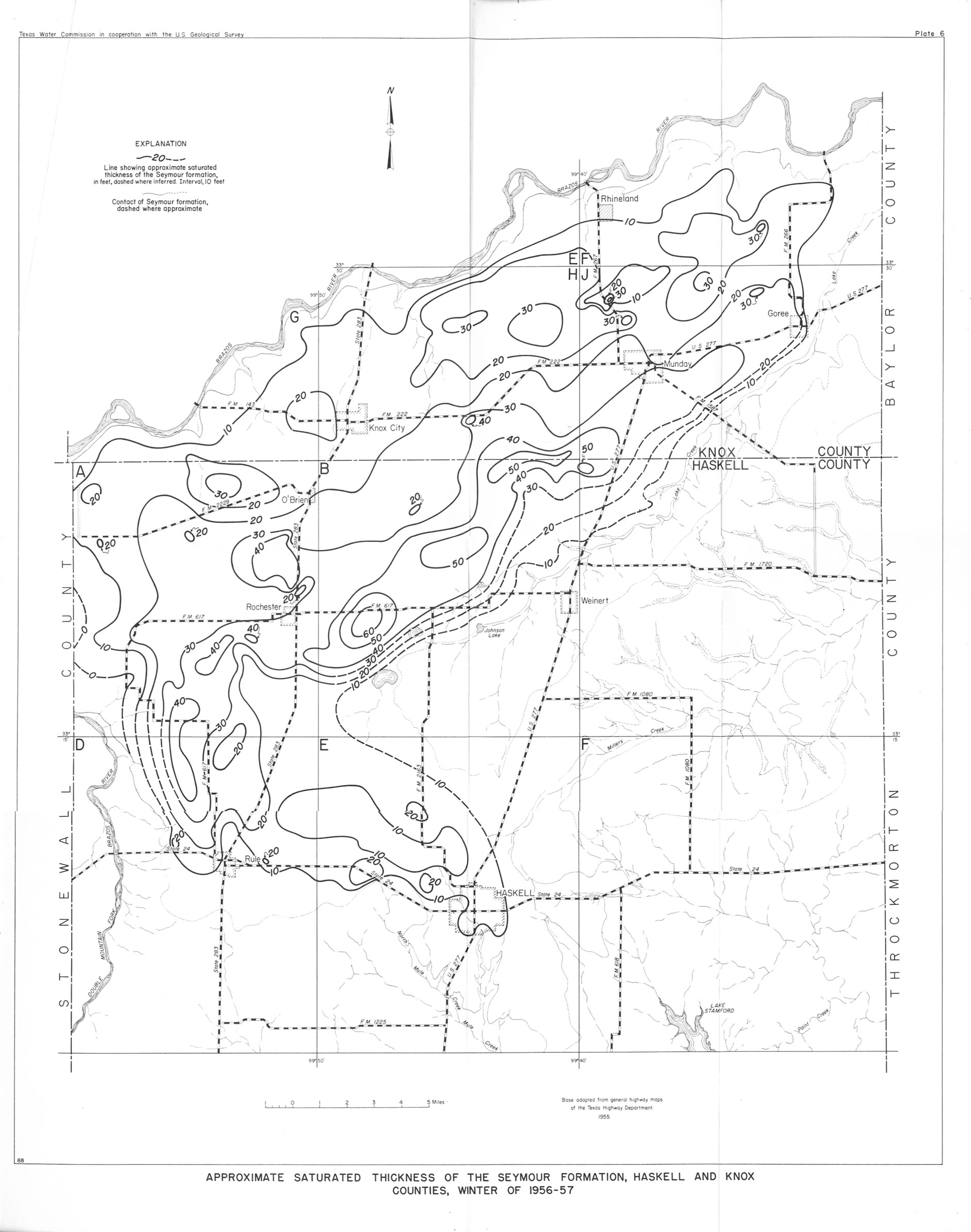
- Plate 6 Approximate Saturated Thickness of the Seymour Formation, Haskell and Knox Counties, Winter of 1956-57
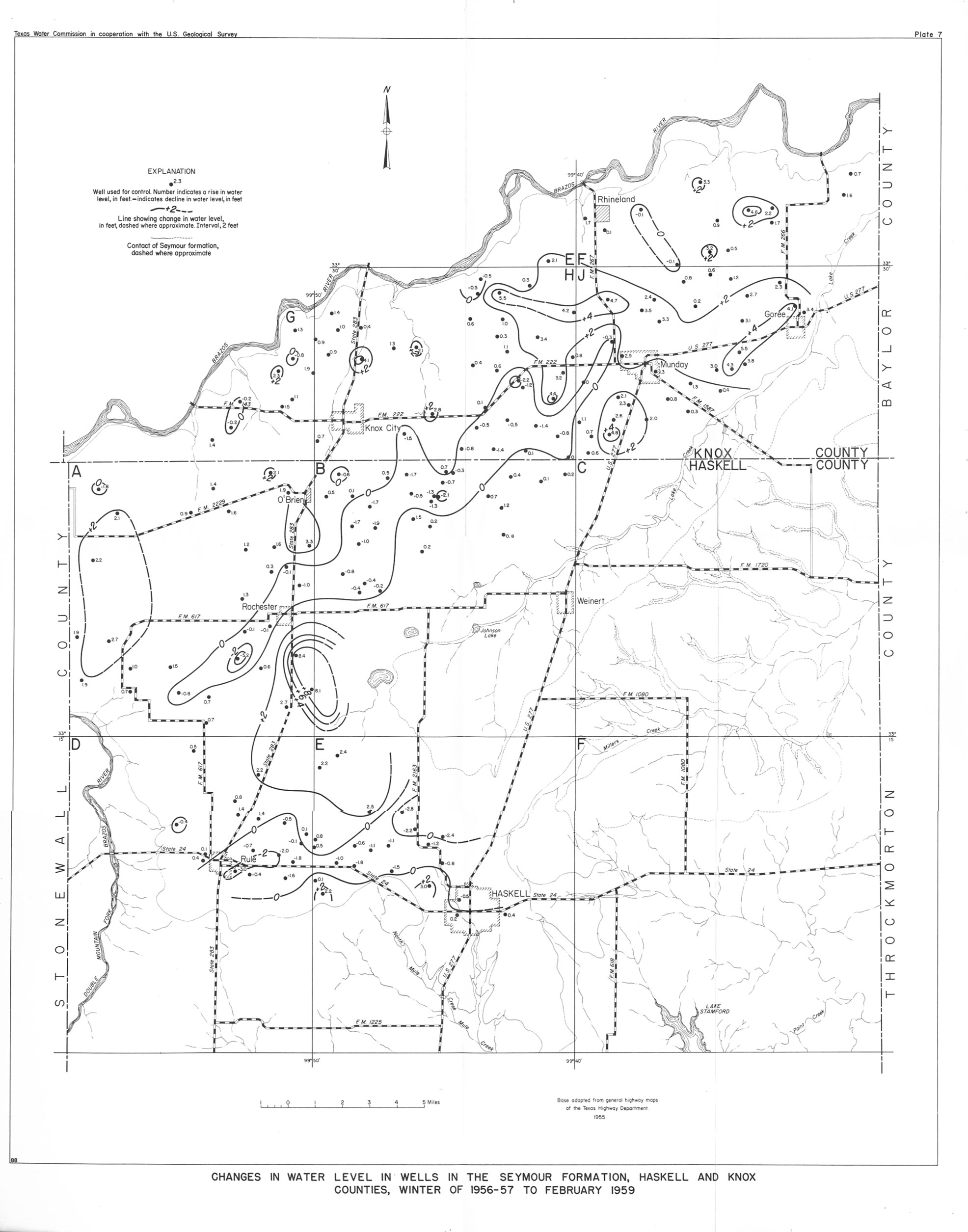
- Plate 7 Changes in Water Level in Wells in the Seymour Formation, Haskell and Knox Counties, Winter of 1956-57 to February 1959