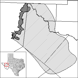
Rustler Aquifer Groundwater Availability Model (GAM)
 In October 2009, the Texas Water Development Board (TWDB) contracted with INTERA, Inc. (who teamed with Dr. Dennis Powers, Dr. John M. Sharp, Jr., and Dr. Robert Holt) to develop a groundwater availability model for the Rustler Aquifer. The project was completed in 2012.
Current GAM
Model Report
"Groundwater Availability Model Report for the Rustler Aquifer."
Model Files and Associated Data
Please see the GAM files download page for the current model files and associated data.
Aquifer data is only available as a package for the entire model area and requires GIS software for processing. Please see the GAM files download page for aquifer data.
Stakeholder Advisory Forums (SAF)
Send us an email if you would like to receive SAF notifications.
| ID | Date | Location |
|---|---|---|
| SAF 1 | 12/10/2009 | Fort Stockton, Texas - Pecos County Courthouse |
| SAF 2 | 5/19/2011 | Fort Stockton, Texas - Pecos County Courthouse |
| SAF 3 | 7/6/2012 | Fort Stockton, Texas - Pecos County Courthouse |
Other Resources
Please see the Rustler Aquifer page for other reports and publications.