Woodbine aquifer: Structure and Brackish Groundwater interactive map
Study Summary:
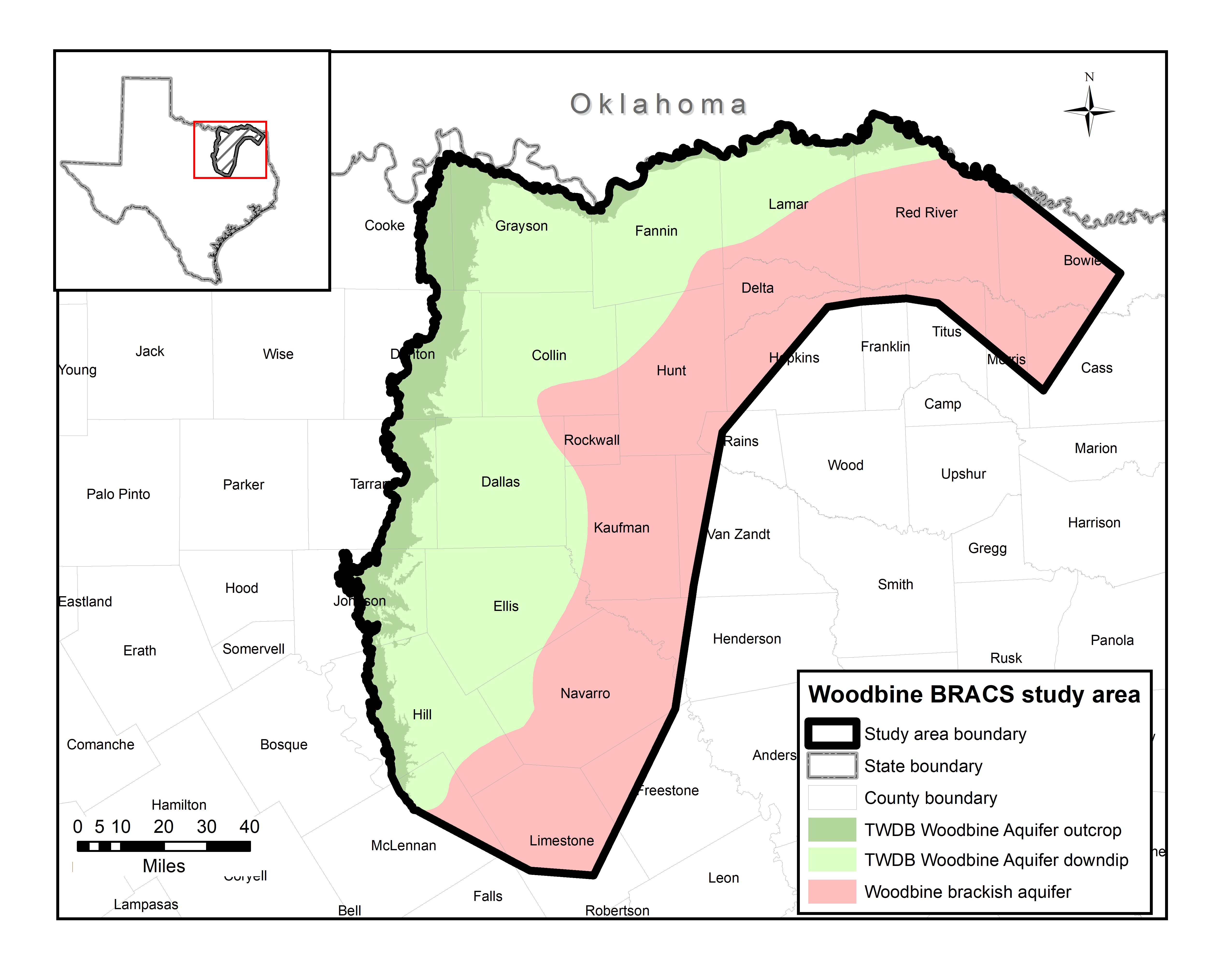
The goals of the study are to (1) map and characterize the brackish parts of the major and minor aquifers of the study area in greater detail using existing water well reports, geophysical well logs, and available aquifer data and (2) build datasets that can be used for groundwater exploration and replicable numerical groundwater models to estimate the volumes of groundwater in as many as five salinity classes. The study area includes all or parts of Bowie, Cass, Collin, Cooke, Dallas, Delta, Denton, Ellis, Falls, Fannin, Franklin, Freestone, Grayson, Henderson, Hill, Hopkins, Hunt, Johnson, Kaufman, Lamar, Limestone, McLennan, Morris, Navarro, Rains, Red River, Rockwall, Tarrant, Titus, and Van Zandt counties.
The objectives of the study are to:
- collect, analyze, and interpret thousands of water well and geophysical well logs;
- map the geological boundaries of the Woodbine aquifer and the bounding aquitards: M;
- map the distribution of total dissolved solids in the aquifer;
- map the distribution of key chemical parameters of interest to desalination;
- map the net sand distribution in the aquifer;
- estimate the volume of fresh and brackish water in the aquifer;
- incorporate newly created information into the publicly available BRACS Database and study GIS datasets;
- prepare and publish study findings in a peer-reviewed TWDB report.
- Study Team Members:
- Sara Sutton, P.G., Olga Bauer and Mark Robinson, P.G.
- Benefits:
- The team anticipates that the publicly available data and report produced by this study will aid researchers and decision-makers in the selection or elimination of locations for site specific studies on groundwater desalination and aquifer storage and recovery. As stipulated by the 84th Texas Legislature in House Bill 30, it will also enable the process of evaluating the Woodbine aquifer for the designation of brackish groundwater production zones.
Study Details
Participants
Study Investigators:
Texas Water Development Board
1700 N. Congress Avenue
Austin, TX 78711
Sara Sutton, P.G.
Sara.Sutton@twdb.texas.gov
512-475-1128
Olga Bauer
Olga.Bauer@twdb.texas.gov
512-475-1611
Mark Robinson, P.G.
Mark.Robinson@twdb.texas.gov
512-463-8010
Engaged Stakeholders:
No stakeholders are engaged yet.
Stakeholder Meetings
| Event | Date |
|---|---|
| Stakeholder Meeting, GMA 8, Prairielands GCD, Cleburne, Texas | July 26, 2022 |