Report 287 1906-80
- Report 287 - Ground-Water Withdrawals and Land-Surface Subsidence in the Houston-Galveston Region (pdf - 13.3MB)
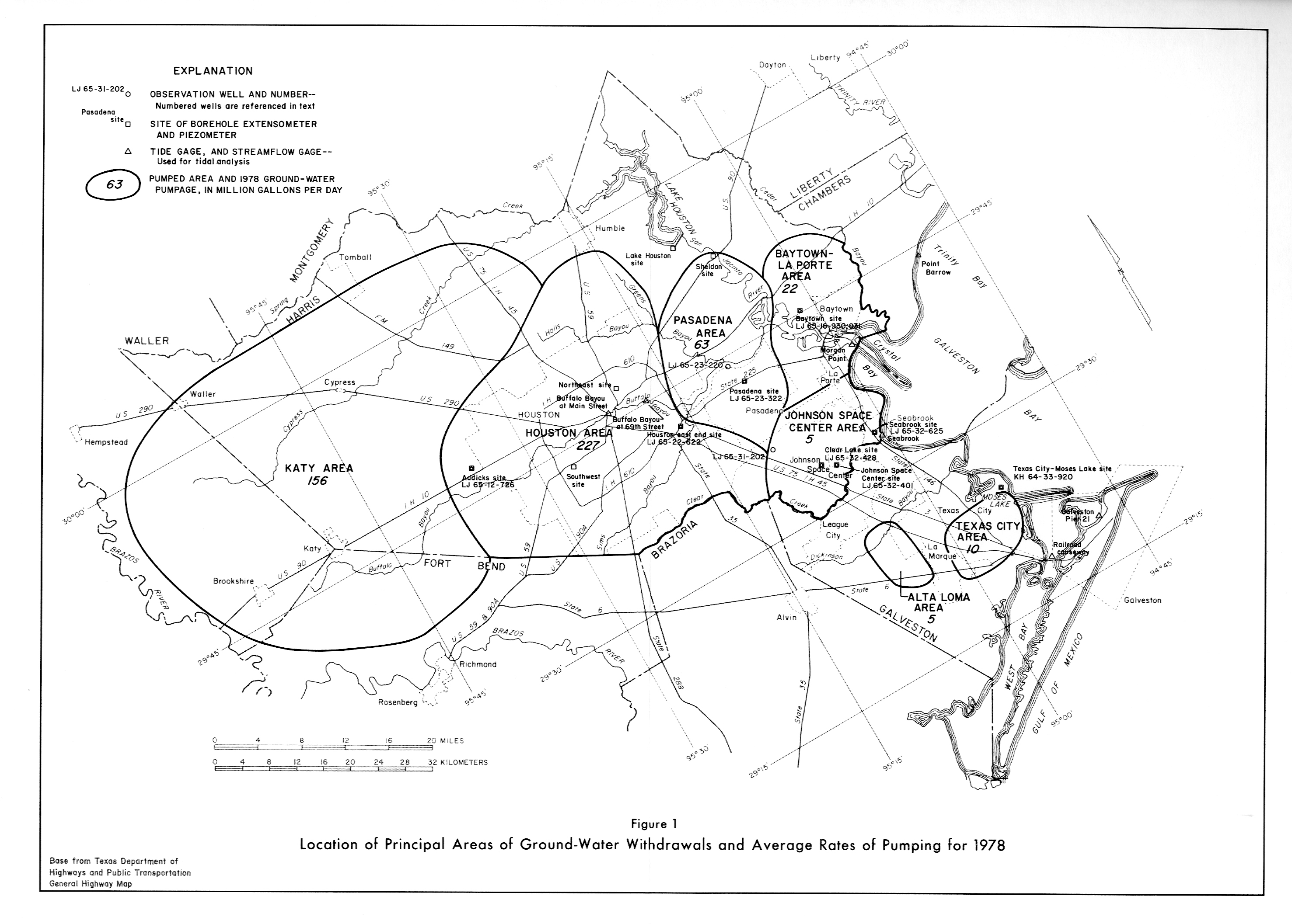
- Figure 1 (jpg - 1.41MB) - Location of Princ. Areas of Ground Water Withdrawals and Avg. Rates of Pumping, 1978.
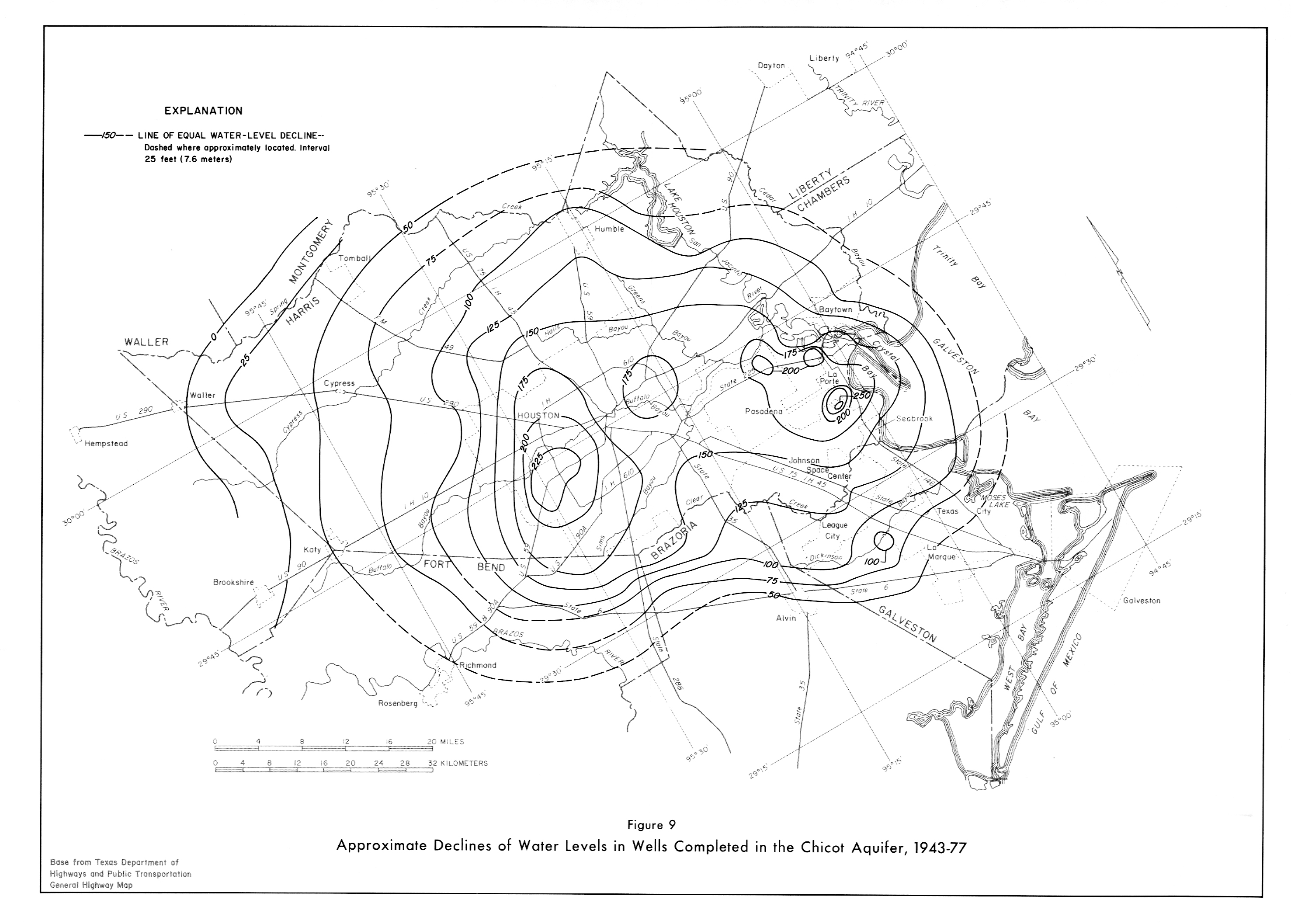
- Figure 9 (jpg - 1.3MB) - Approx. Declines of Water Levels in Wells in Chicot Aqu. 1943-77
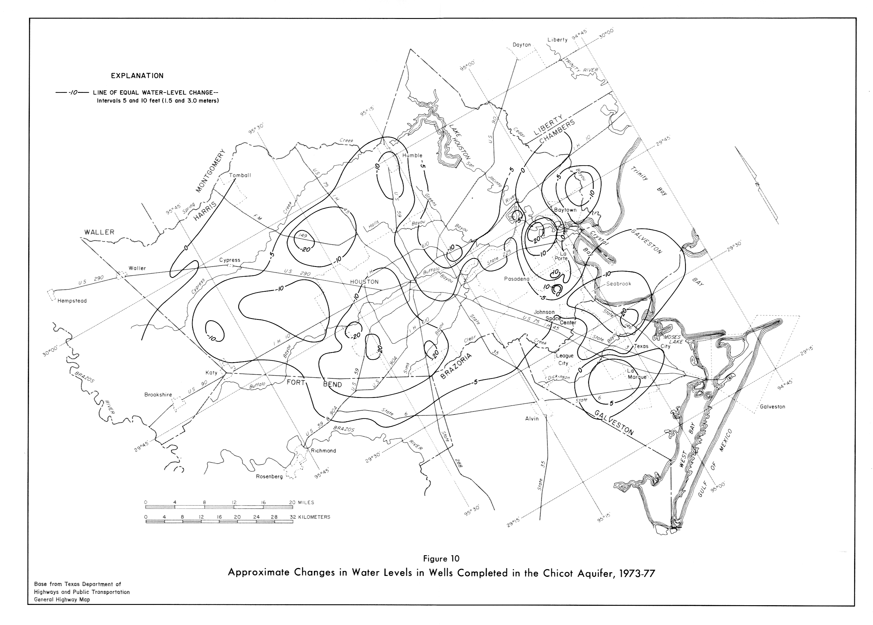
- Figure 10 (jpg - 1.3MB) - Approx. Changes in Water Levels in Wells in Chicot Aqu. 1973-77.
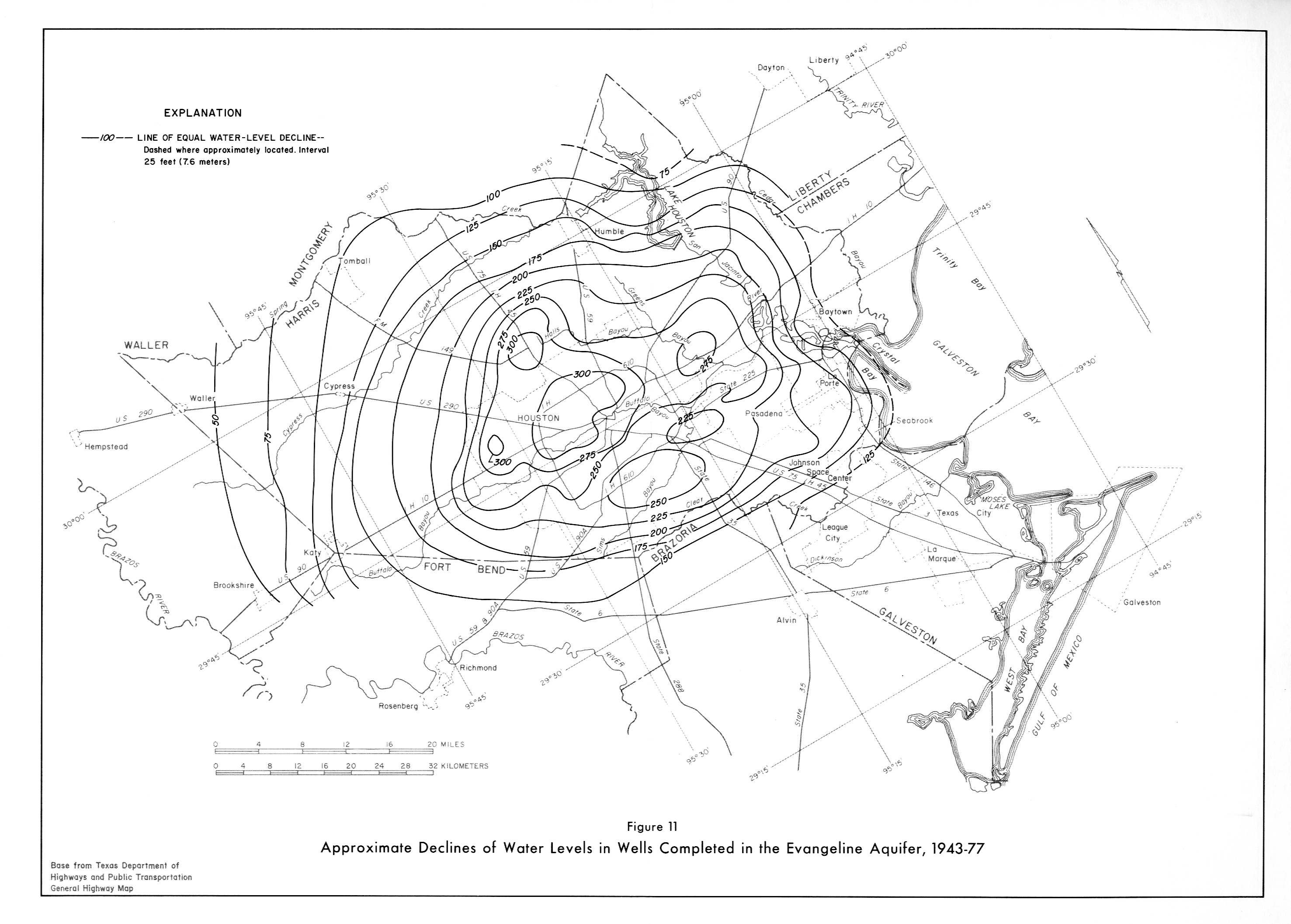
- Figure 11 (jpg - 1.3MB) - Approx. Declines of Water Levels in Wells in Evangeline Aqu. 1943-77
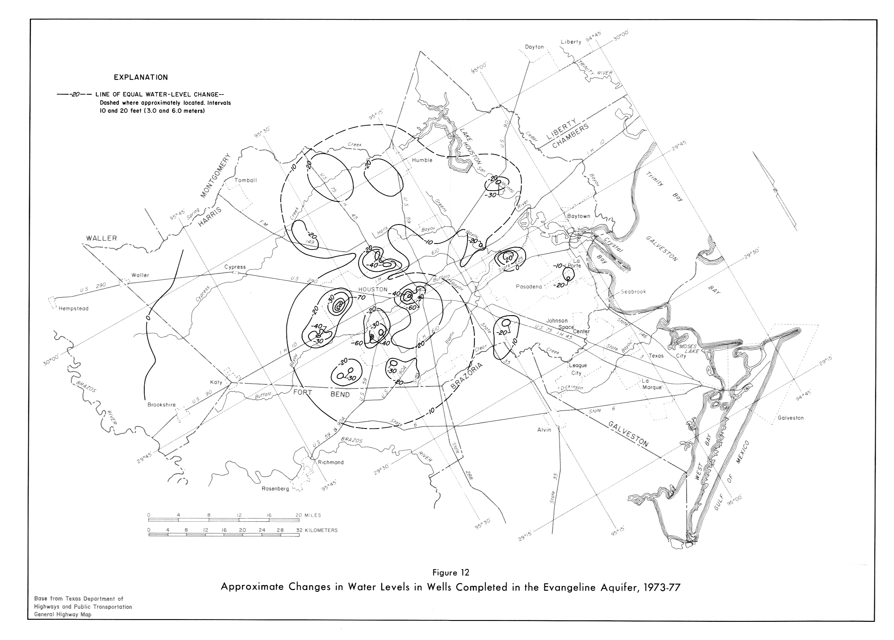
- Figure 12 (jpg - 1.20MB) - Approx. Changes in Water Levels in Wells in Evangeline Aqu. 1973-77
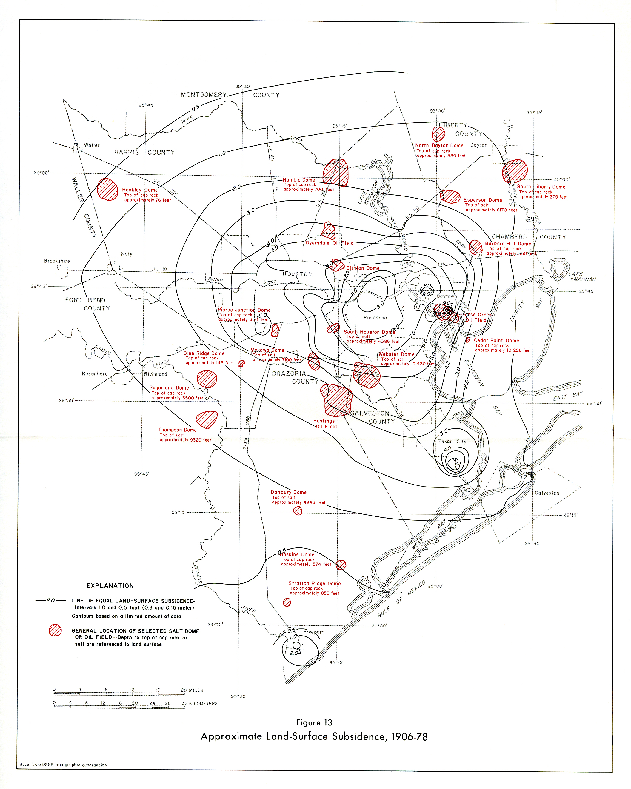
- Figure 13 (jpg - 2.5MB) - Approximate Land-Surface Subsidence 1906-78.
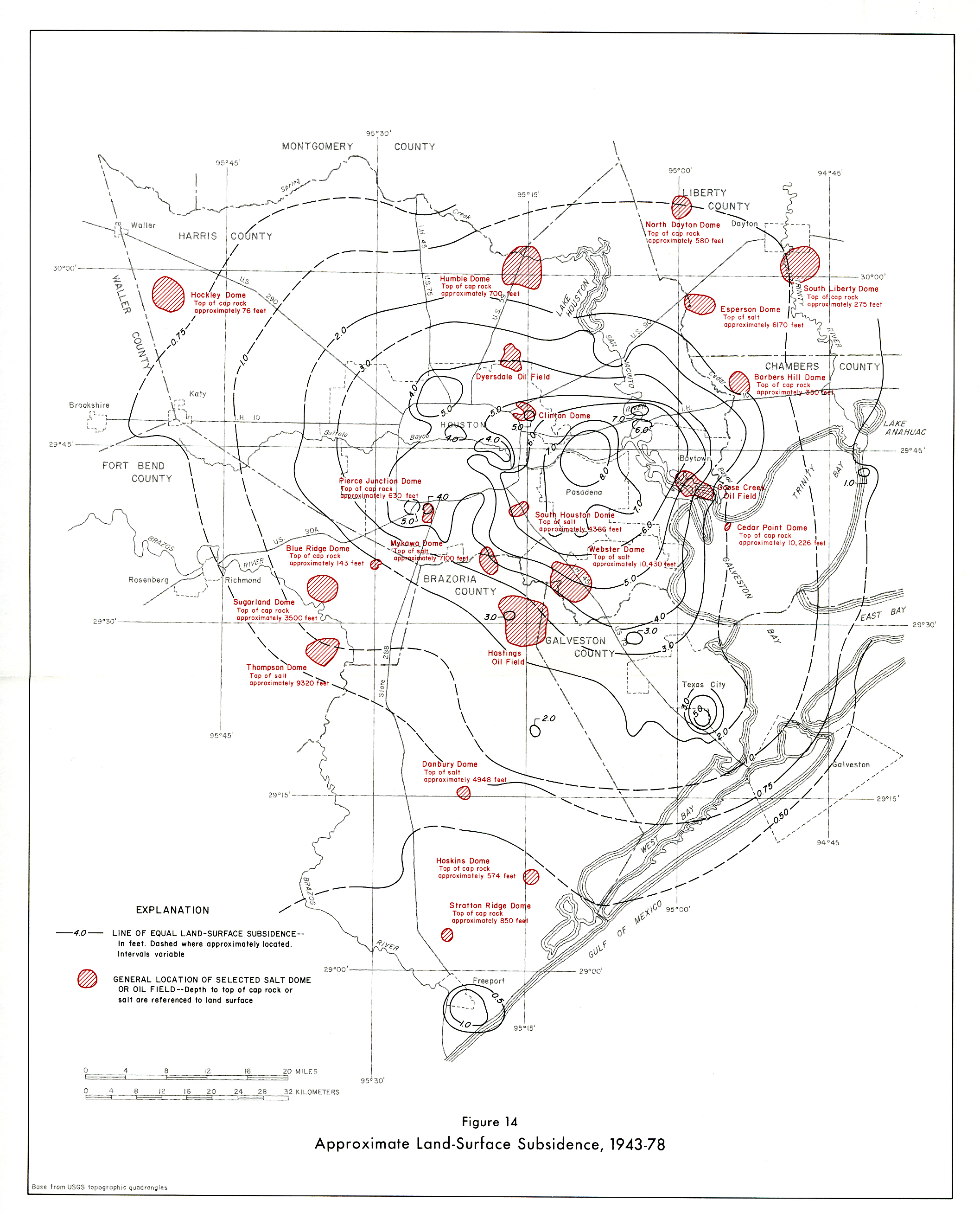
- Figure 14 (jpg - 2.5MB) - Approximate Land-Surface Subsidence 1943-78.
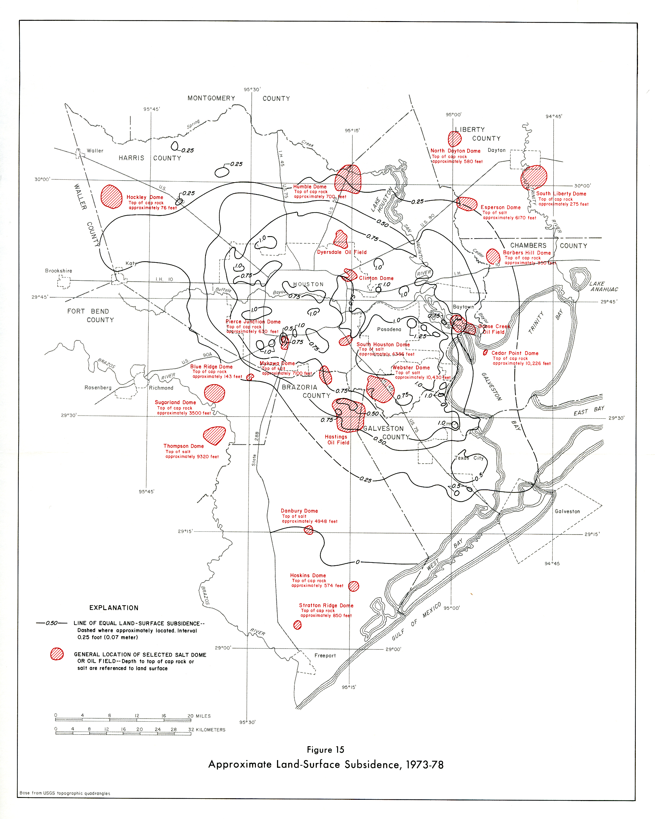
- Figure 15 (jpg - 2.4MB) - Approximate Land-Surface Subsidence 1973-78.
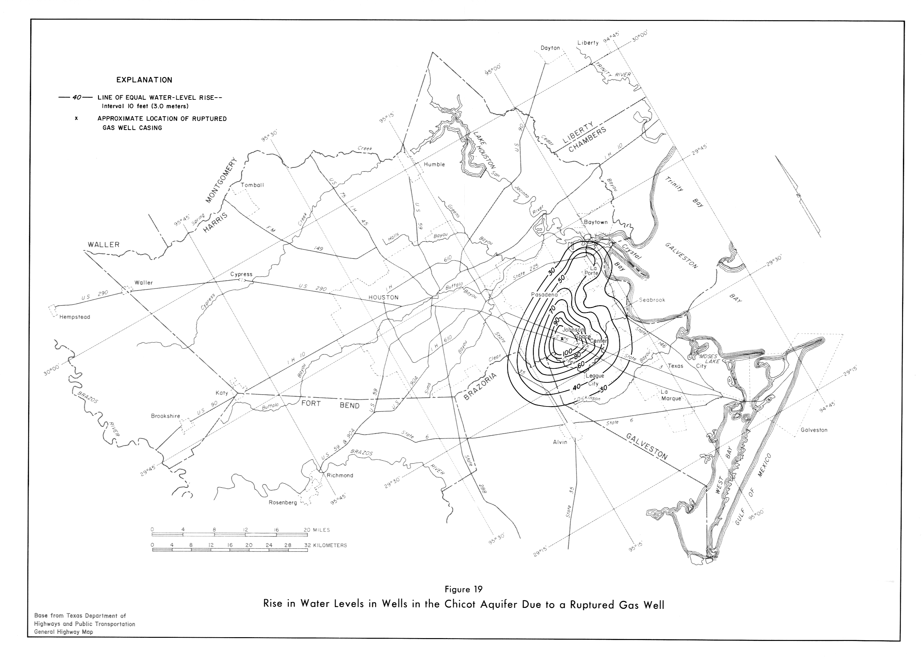
- Figure 19 (jpg - 1.2MB) - Rise in Water Levels in Wells in Chicot Aqu. due to ruptured gas well.
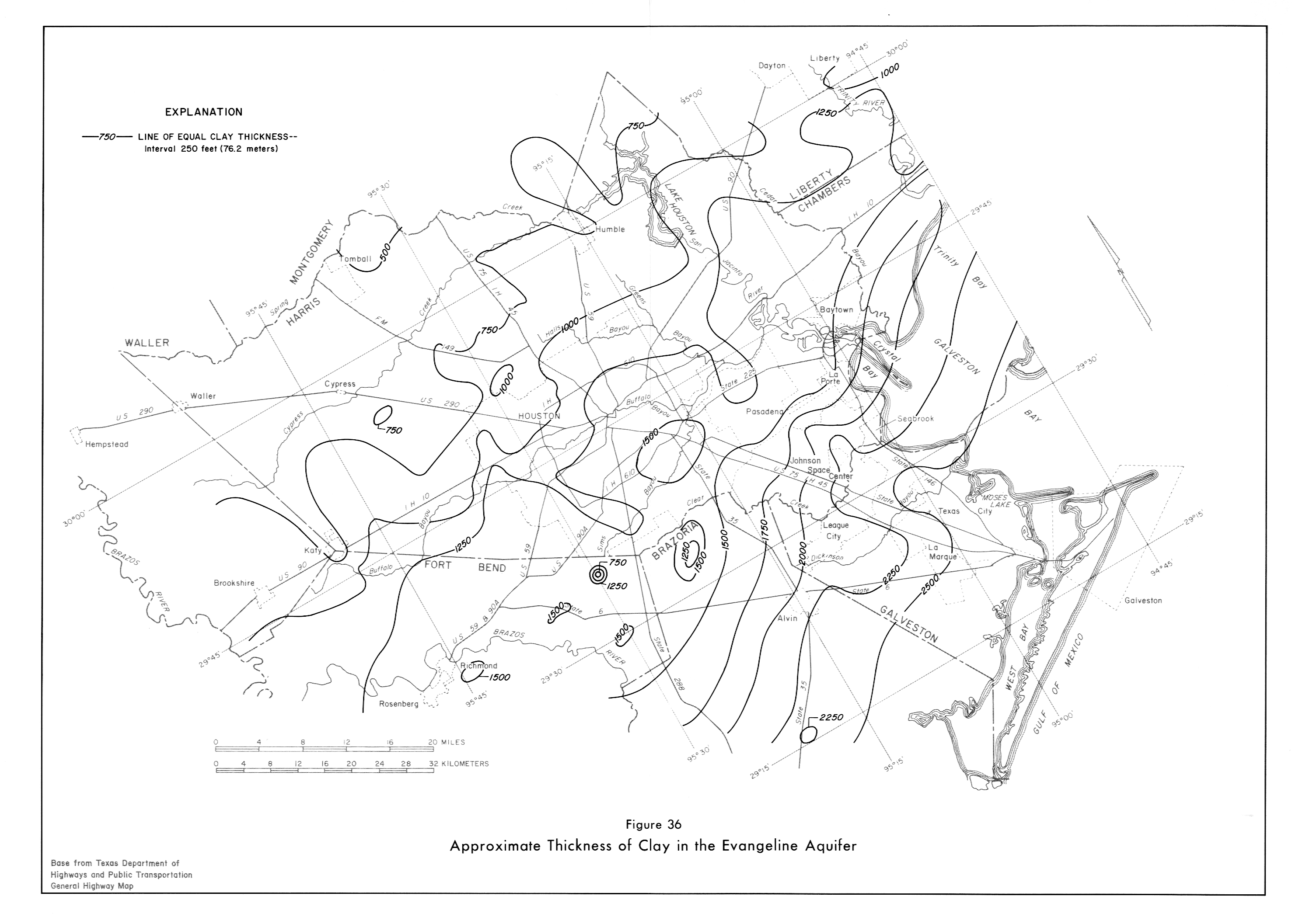
- Figure 36 (jpg - 1.3MB) - Approximate thickness of Clay in Evangeline Aqu.
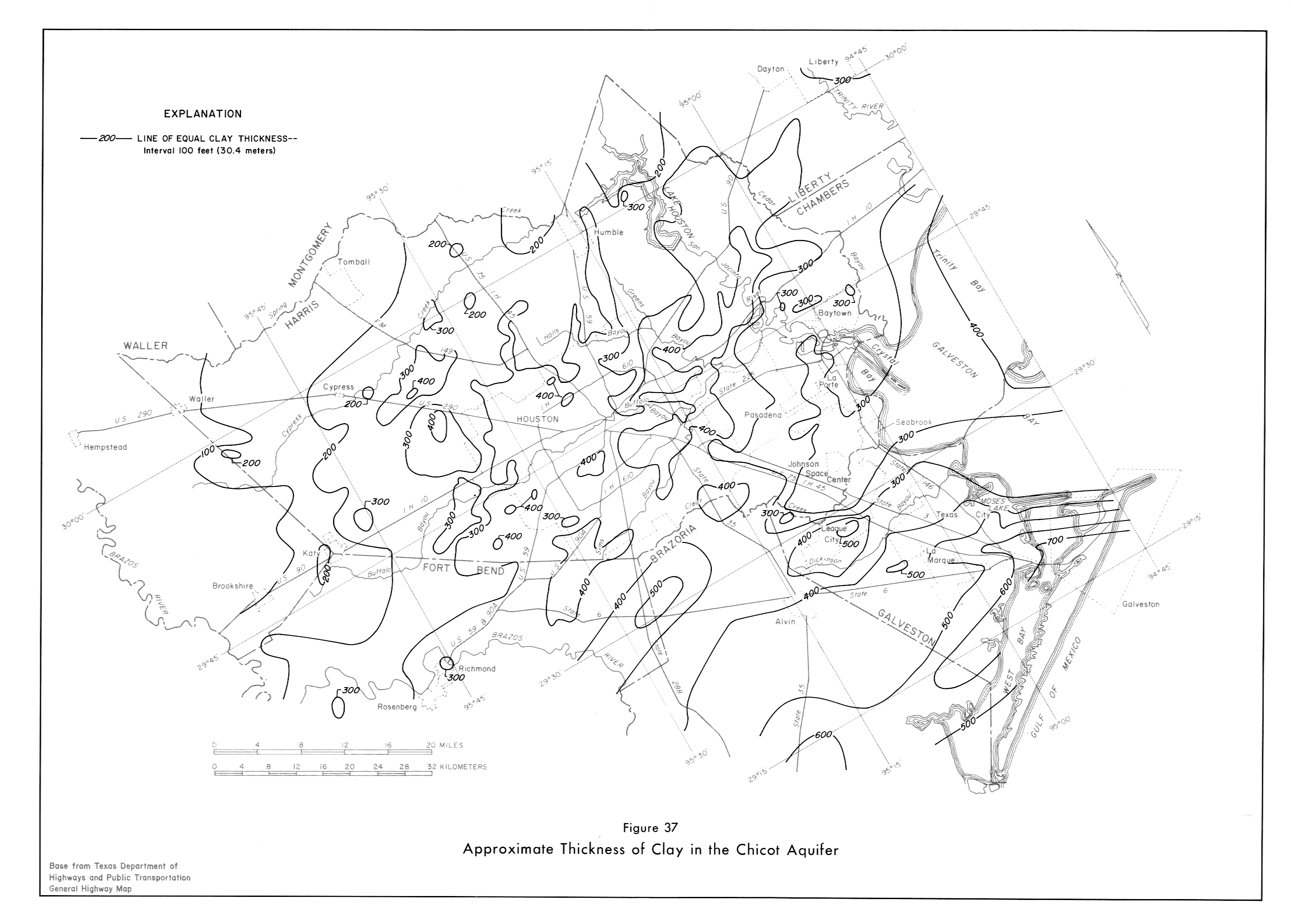
- Figure 37 (jpg - 1.20MB) - Approximate thickness of Clay in Chicot Aqu.