Report 240 By Robert D. Price | November 1979
Note: All figures are jpeg, and oversized fold-out maps scanned separately from the report. Therefore, "missing pages" are really these figures.
- Report 240 - Occurrence, Quality, and Quantity of Ground Water in Wilbarger County, Texas
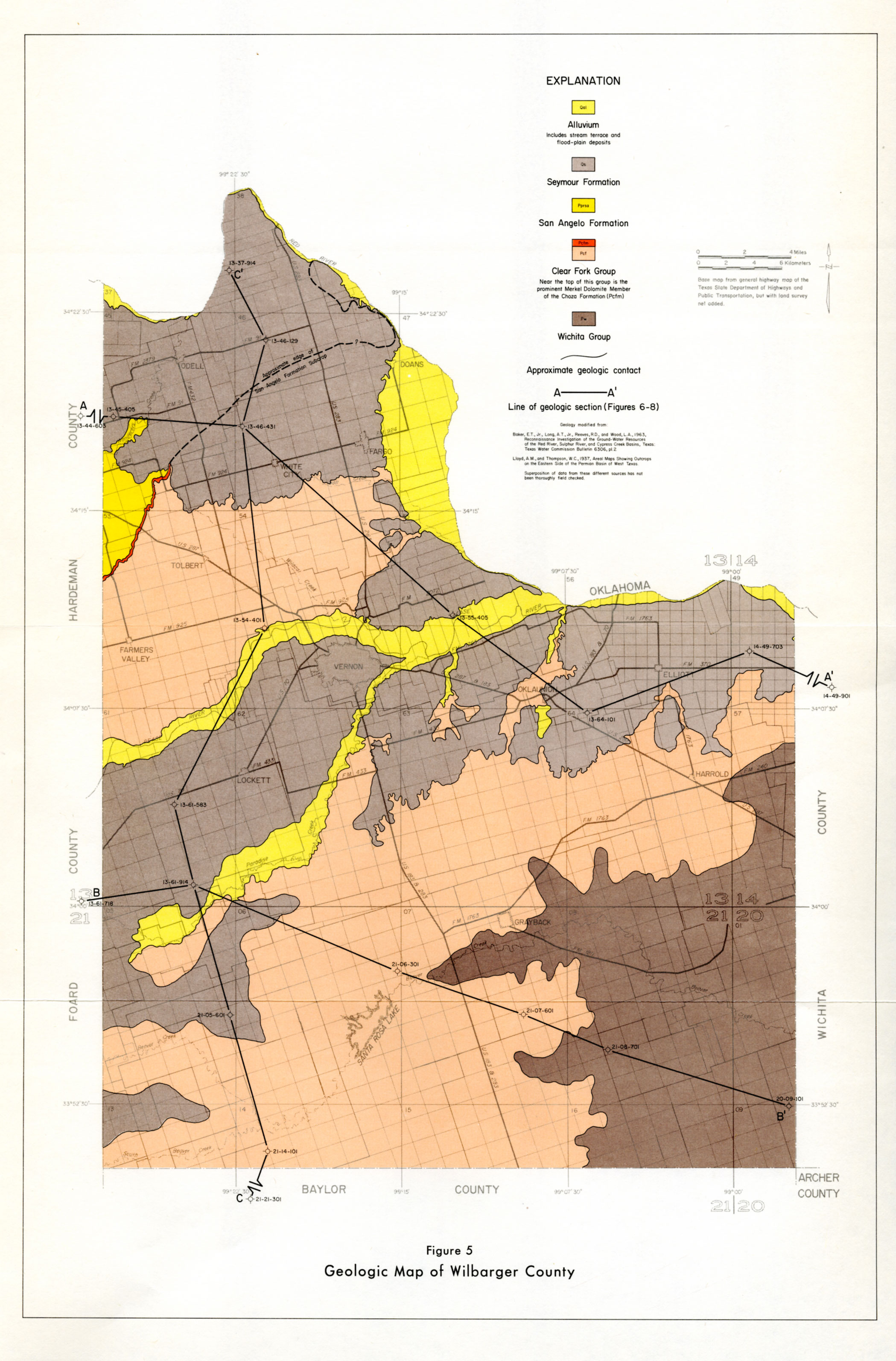
- Figure 5: Geologic Map of Wilbarger County
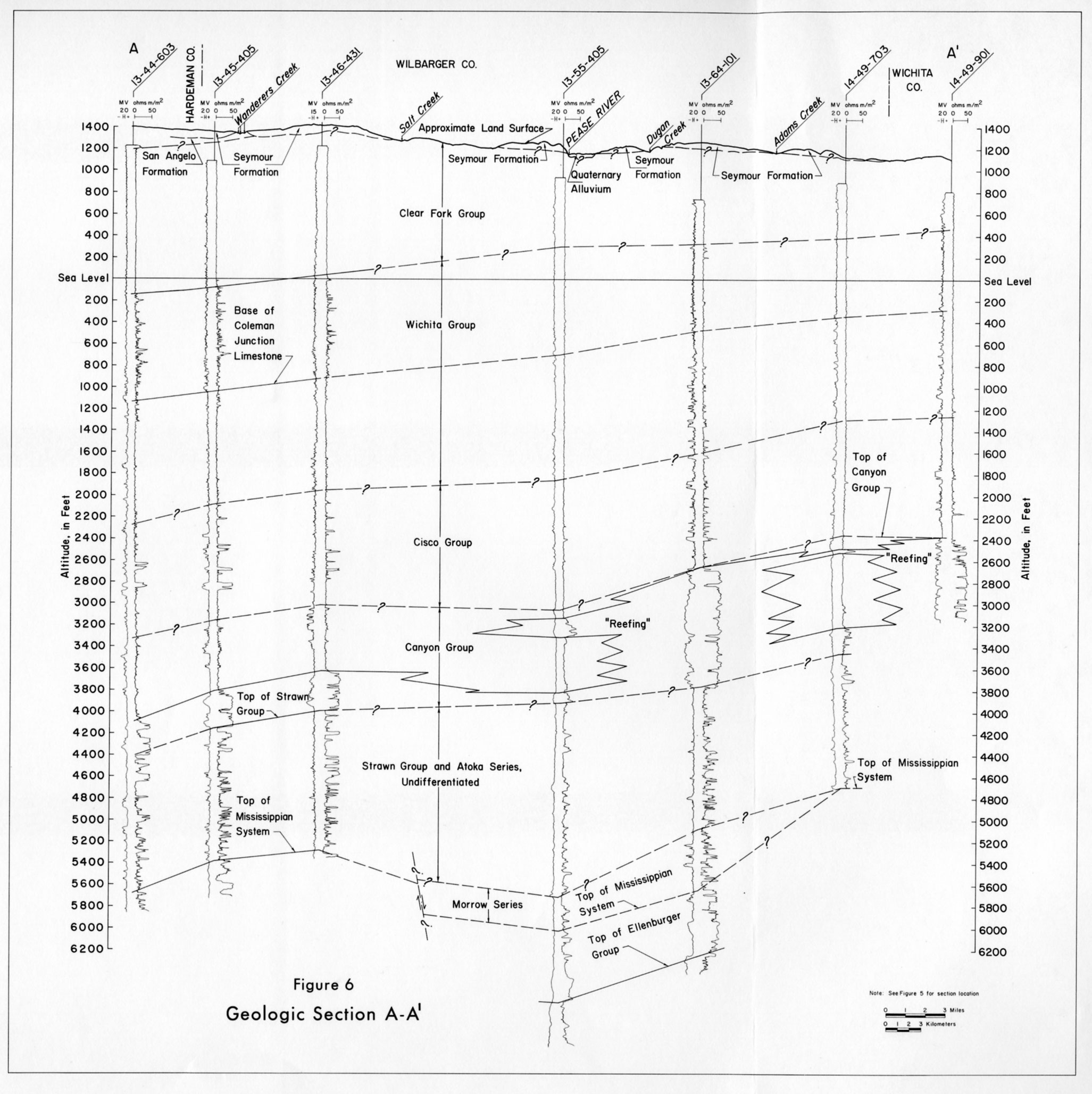
- Figure 6: Geologic Section A-A'
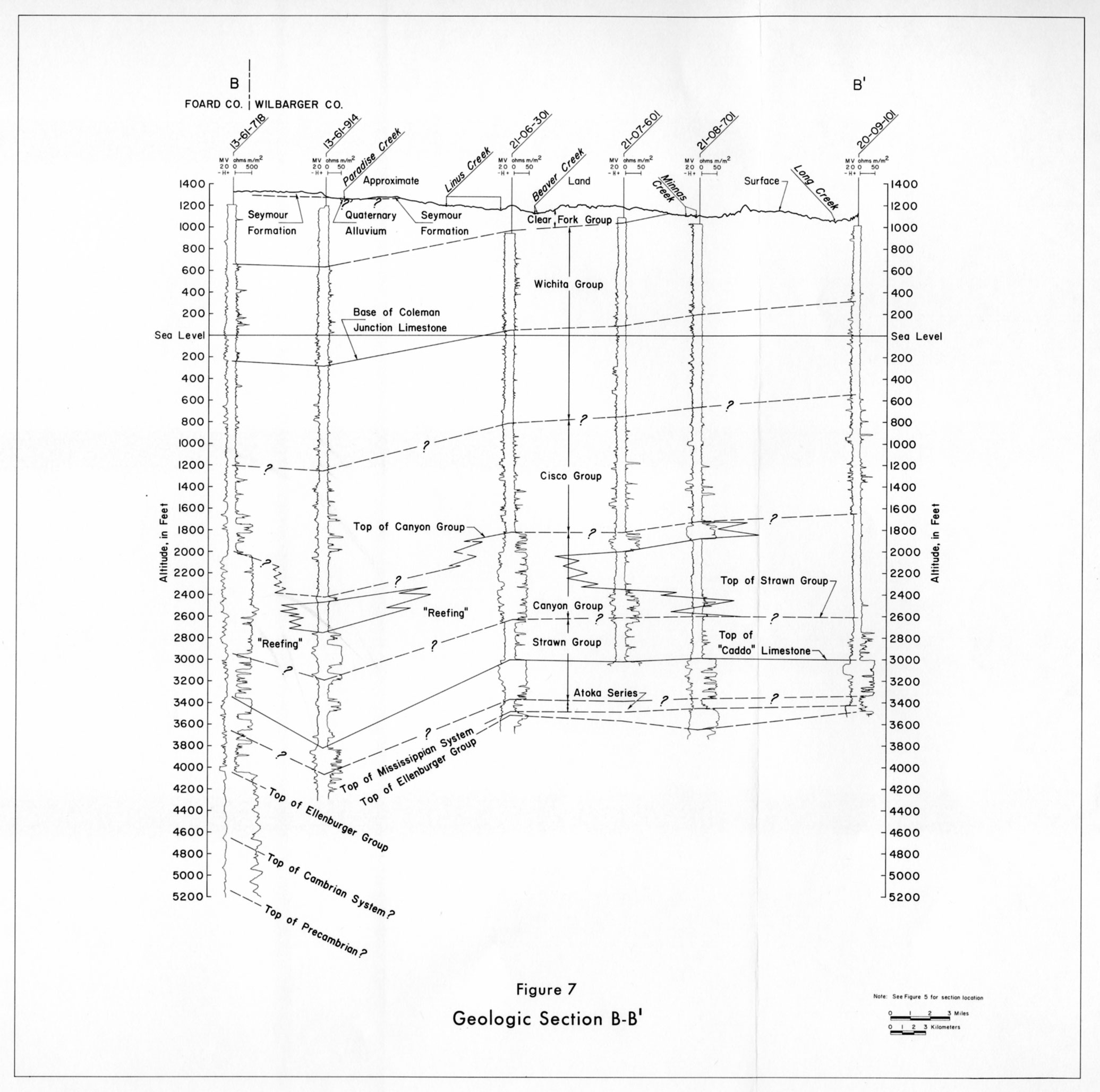
- Figure 7: Geologic Section B-B'
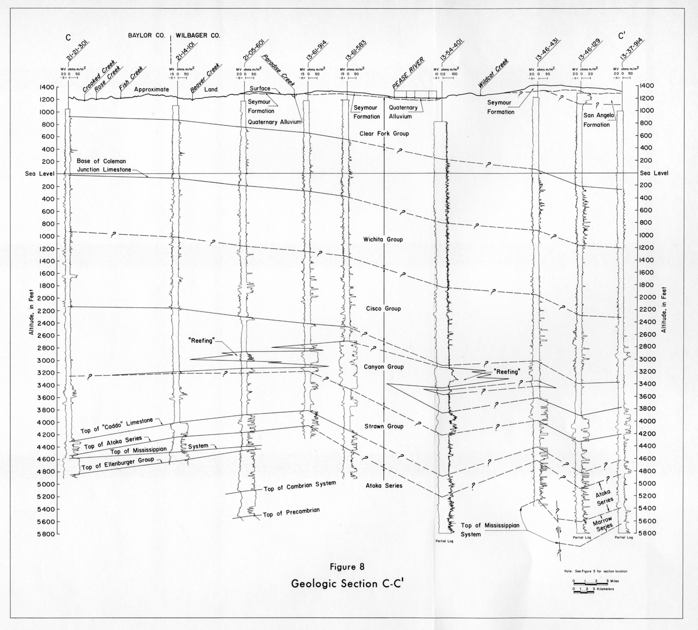
- Figure 8: Geologic Section C-C'
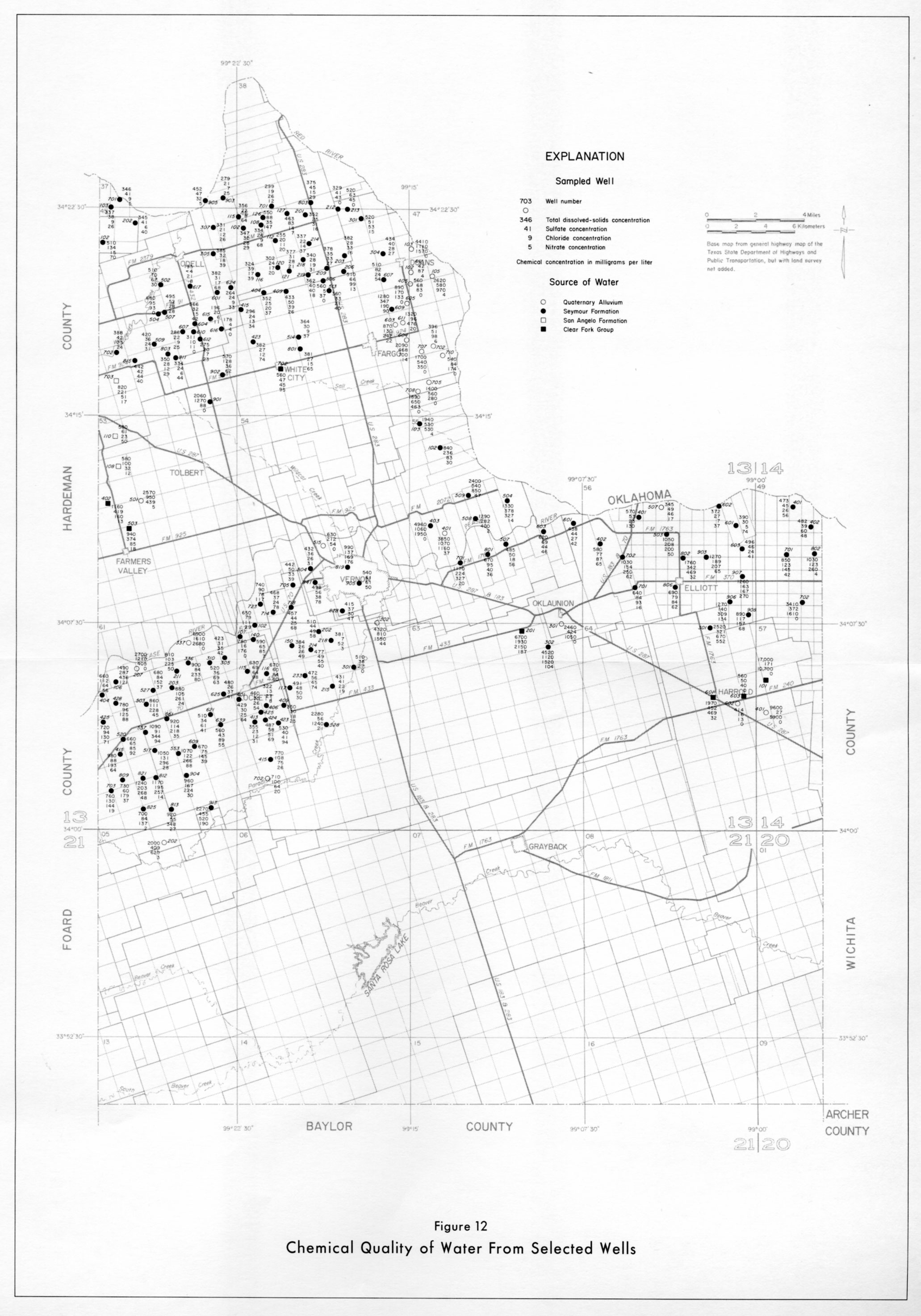
- Figure 12: Chemical Quality of Water from Selected Wells
- Figure 18: Approximate Altitude of the Water Table in the Seymour Formation in West-Central Baylor County, Winter 1969-70
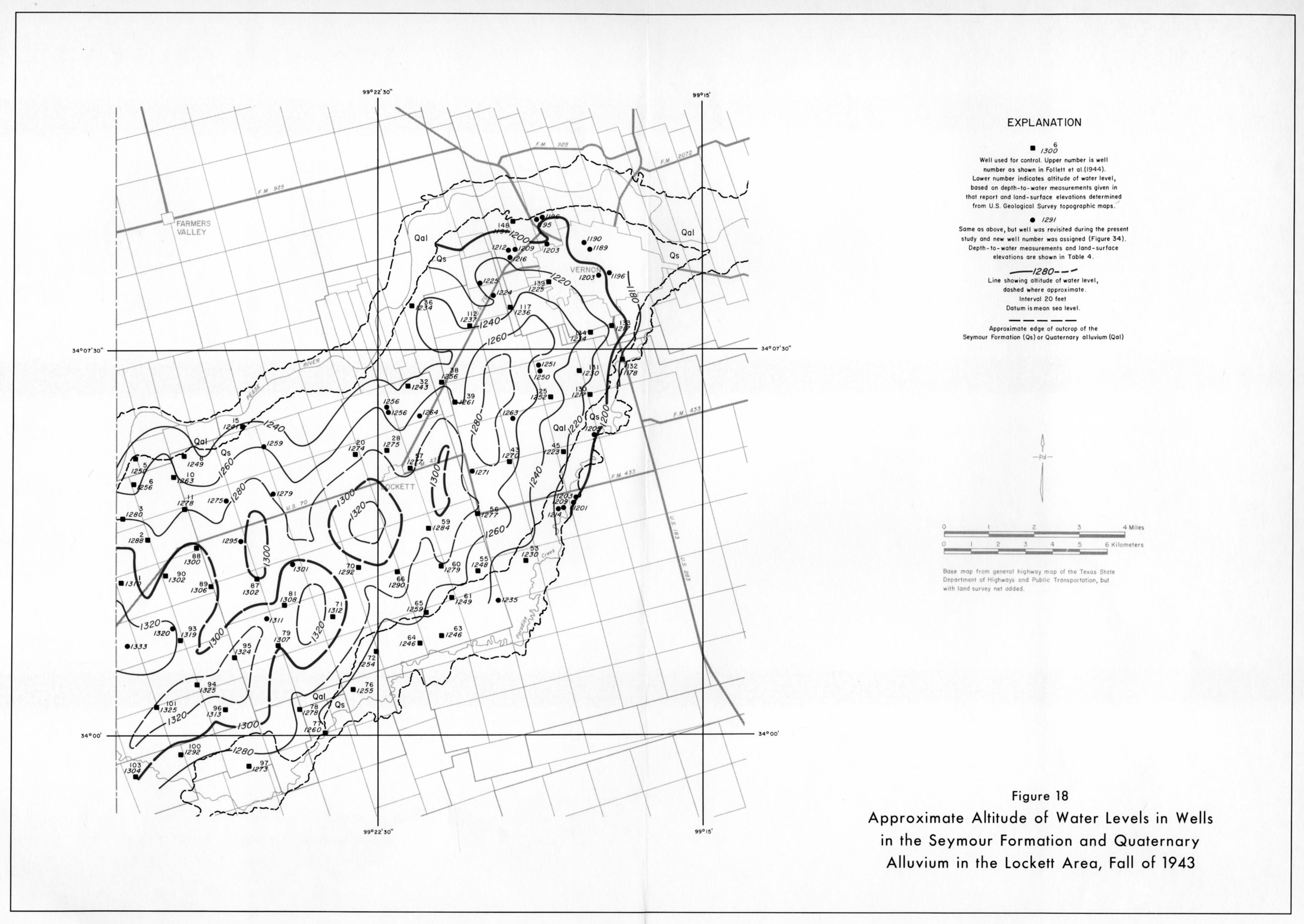
- Figure 18: Approximate Altitude of Water Levels in Wells in the Seymour Formation and Quaternary Alluvium in the Lockett Area, Fall of 1943
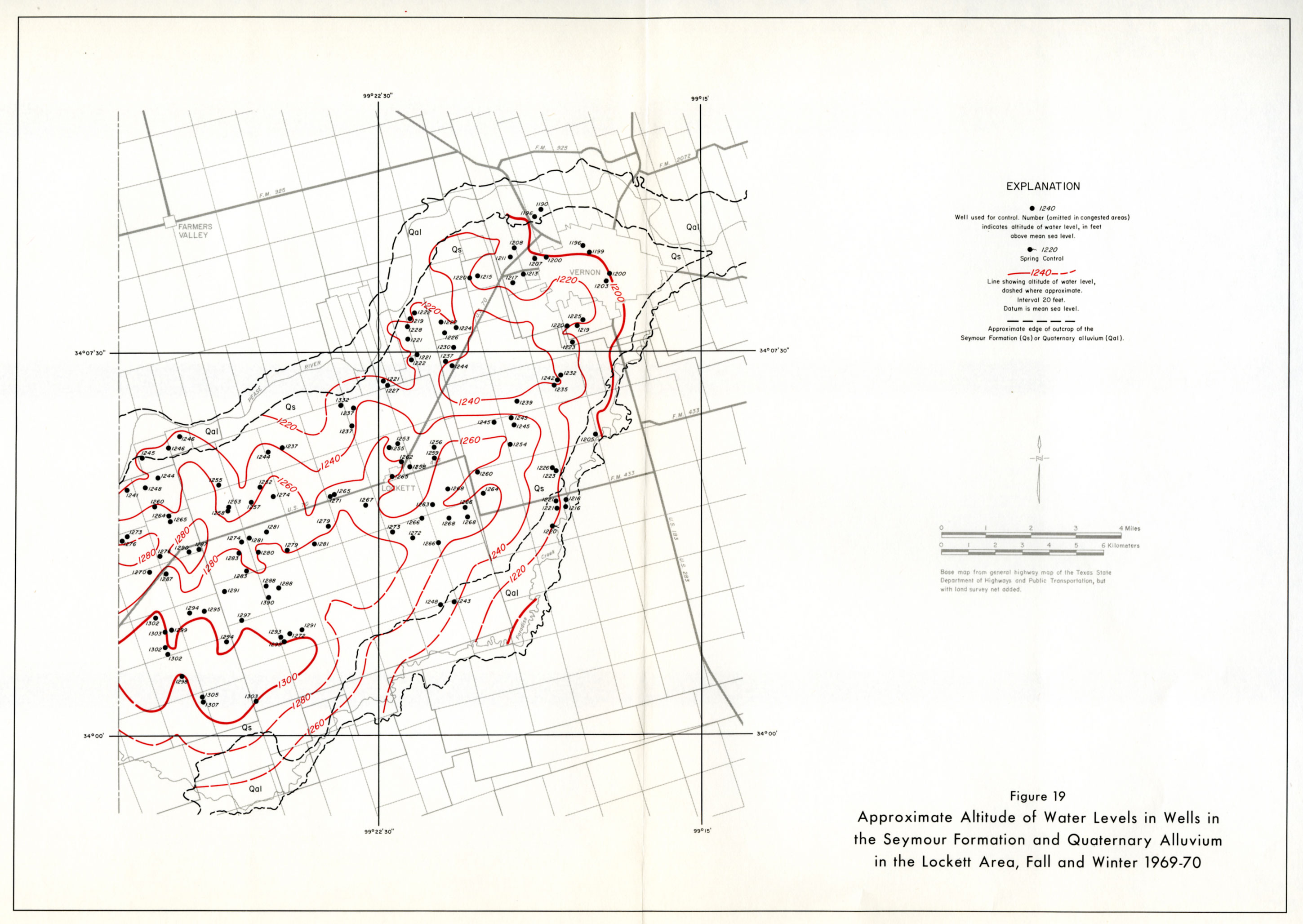
- Figure 19: Approximate Altitude of Water Levels in Wells in the Seymour Formation and Quaternary Alluvium in the Lockett Area, Fall and Winter 1969-70
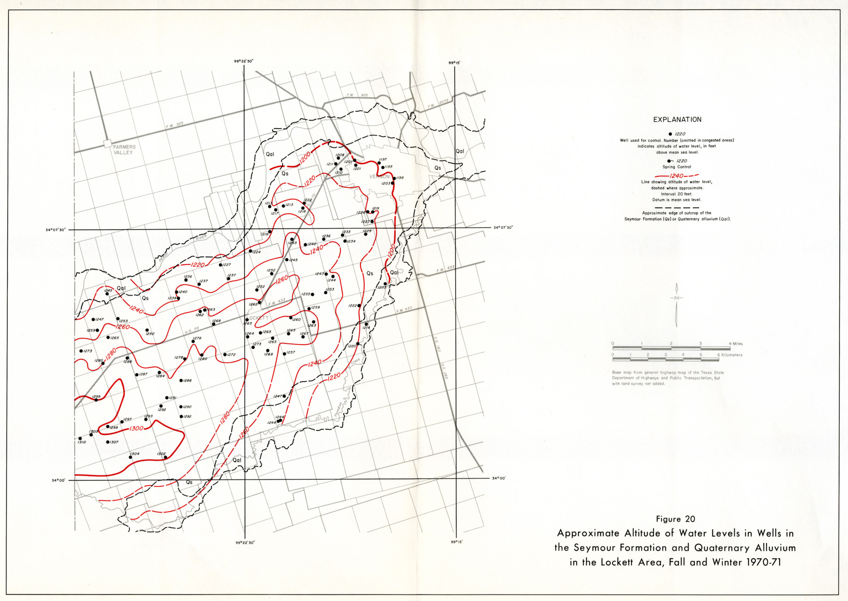
- Figure 20: Approximate Altitude of Water Levels in Wells in the Seymour Formation and Quaternary Alluvium in the Lockett Area, Fall and Winter 1970-71
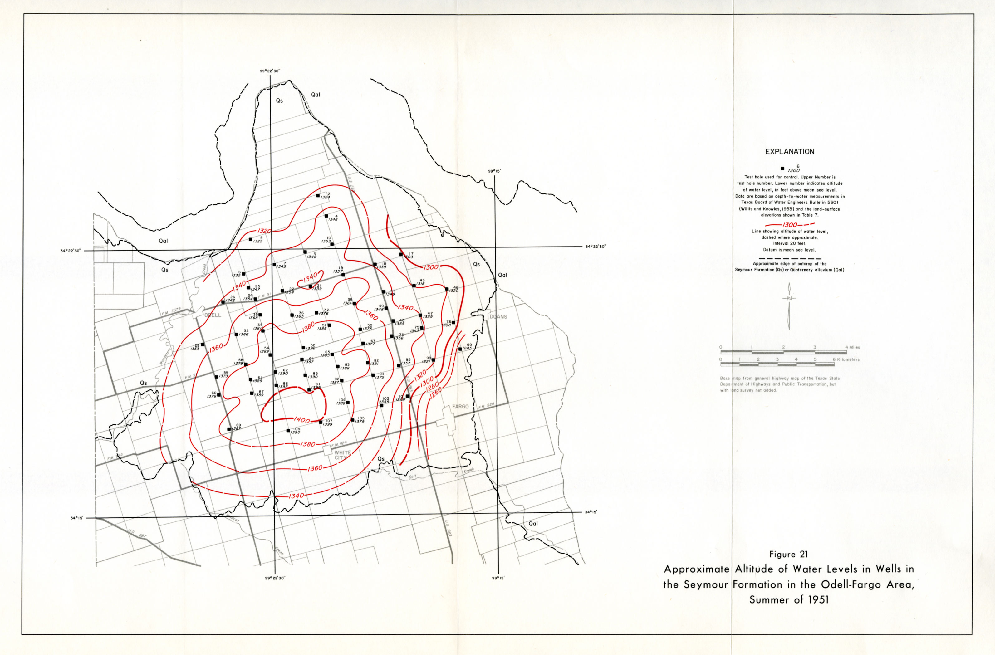
- Figure 21: Approximate Altitude of Water Levels in Wells in the Seymour Formation in the Odell-Fargo Area, Summer of 1951
- Figure 22: Approximate Altitude of Water Levels in Wells in the Seymour Formation and Quaternary Alluvium in the Odell-Fargo Area, Fall and Winter 1969-70
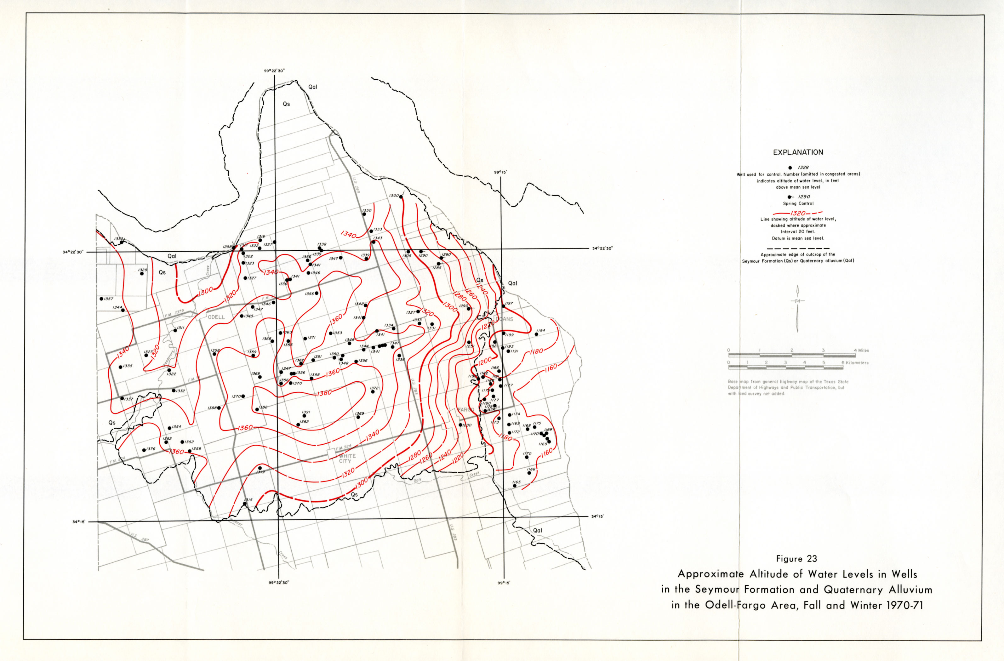
- Figure 23: Approximate Altitude of Water Levels in Wells in the Seymour Formation and Quaternary Alluvium in the Odell-Fargo Area, Fall and Winter 1970-71
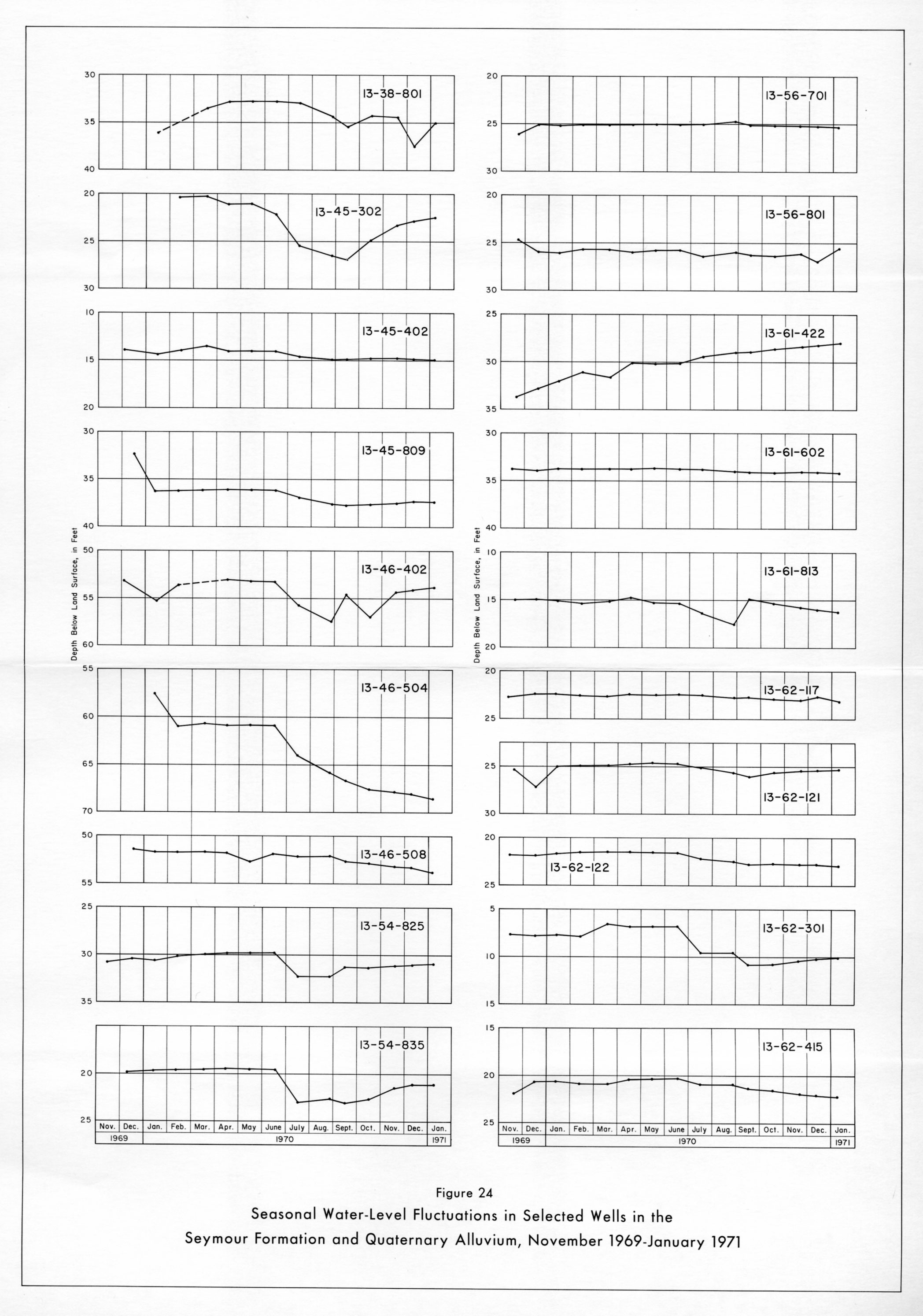
- Figure 24: Seasonal Water-Level Fluctuations in Selected Wells in the Seymour Formation and Quaternary Alluvium, November 1969-January 1971
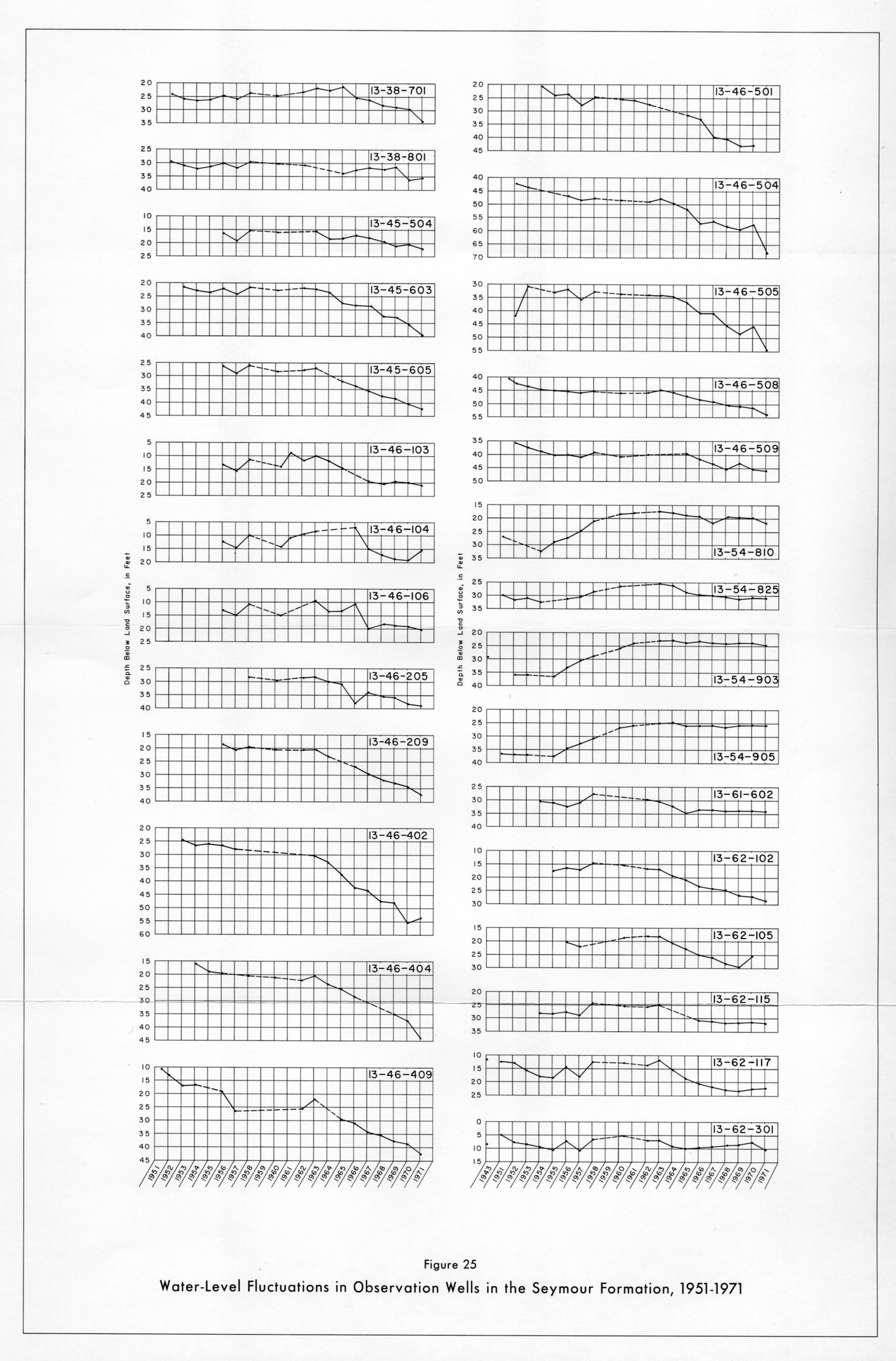
- Figure 25: Water-Level Fluctuations in Observation Wells in the Seymour Formation, 1951-1971
- Figure 28: Approximate Saturated Thickness of the Seymour Formation and Quaternary Alluvium in the Lockett, Fall and Winter 1970-71
- Figure 29: Approximate Saturated Thickness of the Seymour Formation and Quaternary Alluvium in the Odell-Fargo Area, Fall and Winter 1970-71
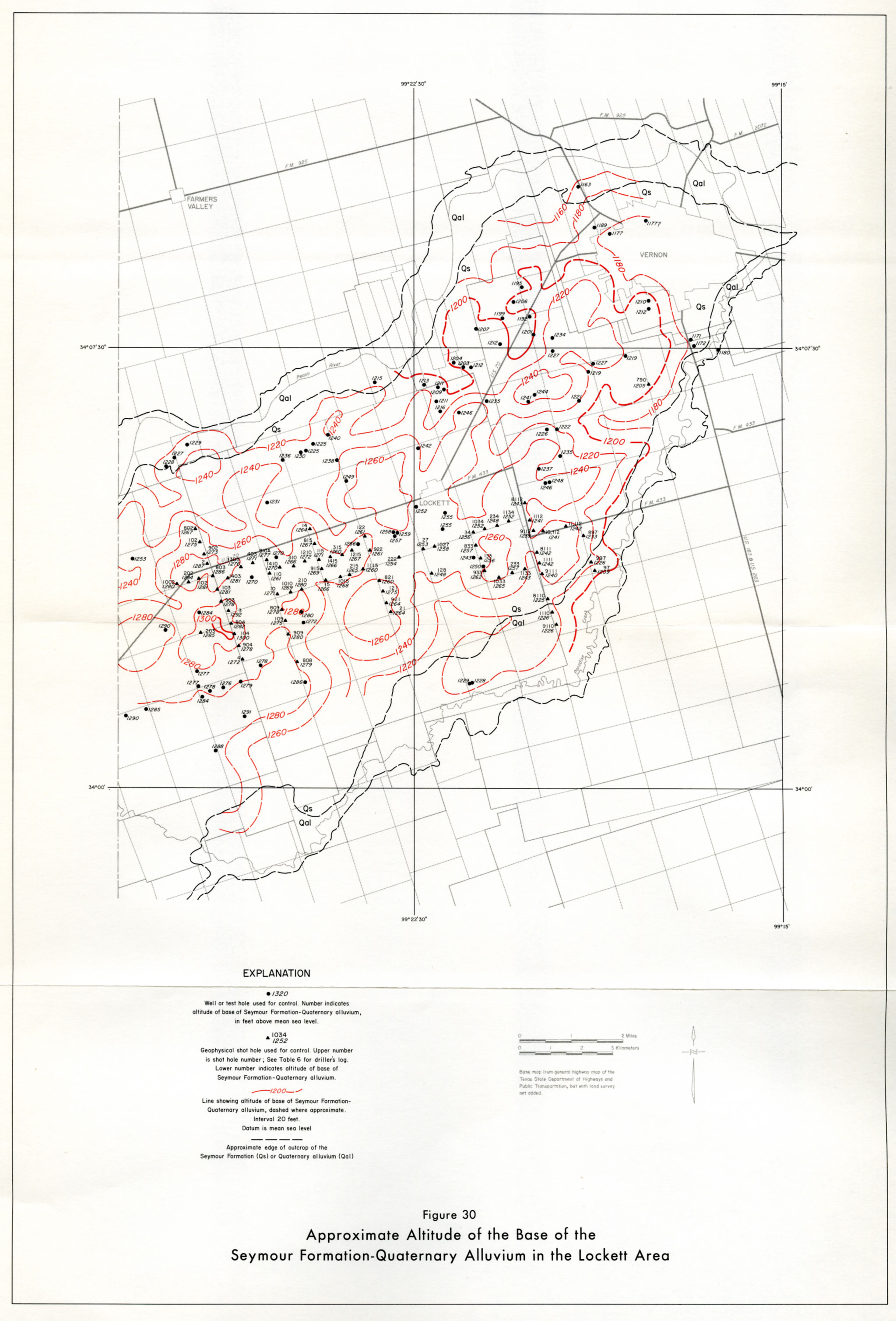
- Figure 30: Approximate Altitude of the Base of the Seymour Formation-Quaternary Alluvium in the Lockett Area
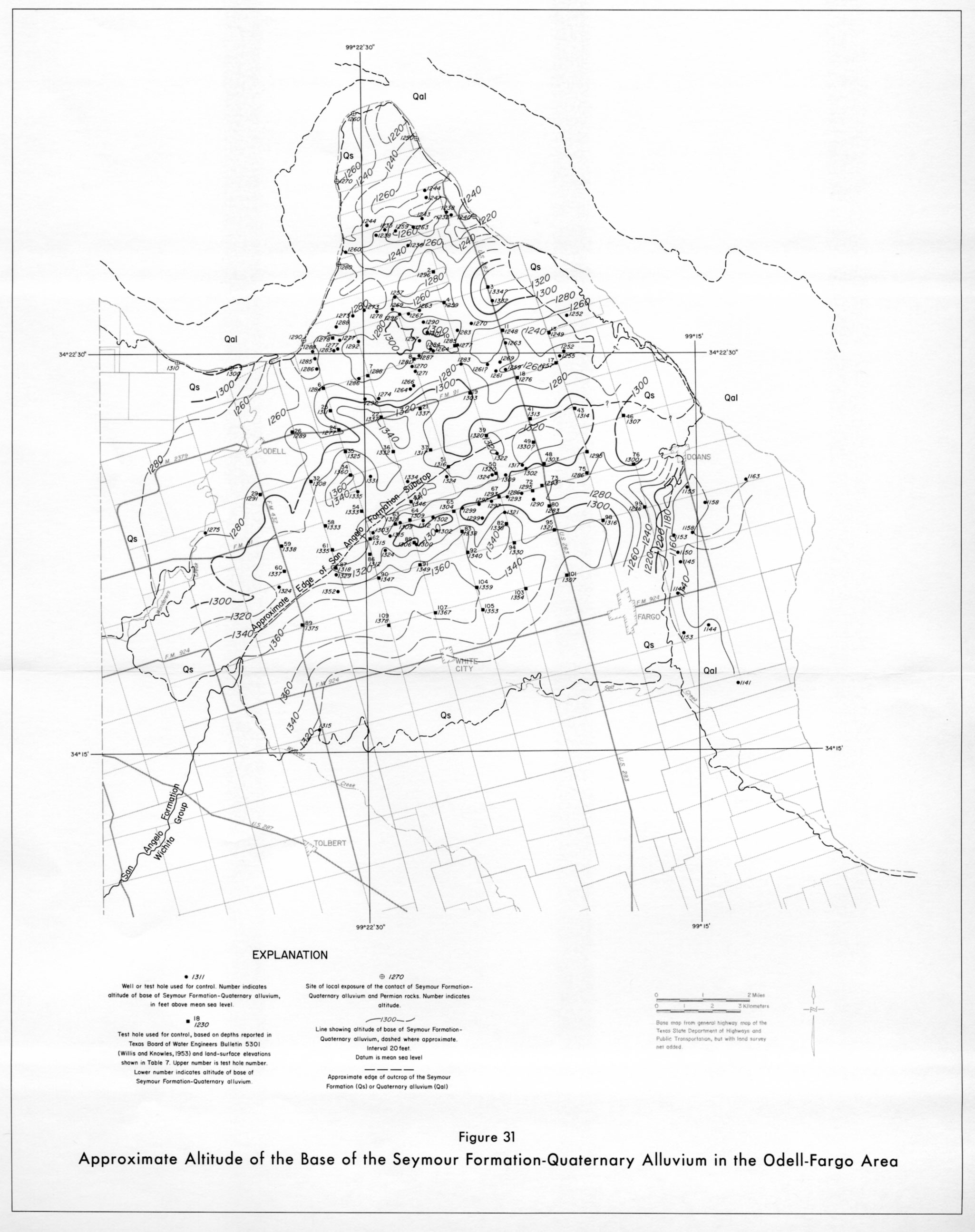
- Figure 31: Approximate Altitude of the Base of the Seymour Formation-Quaternary Alluvium in the Odell-Fargo Area
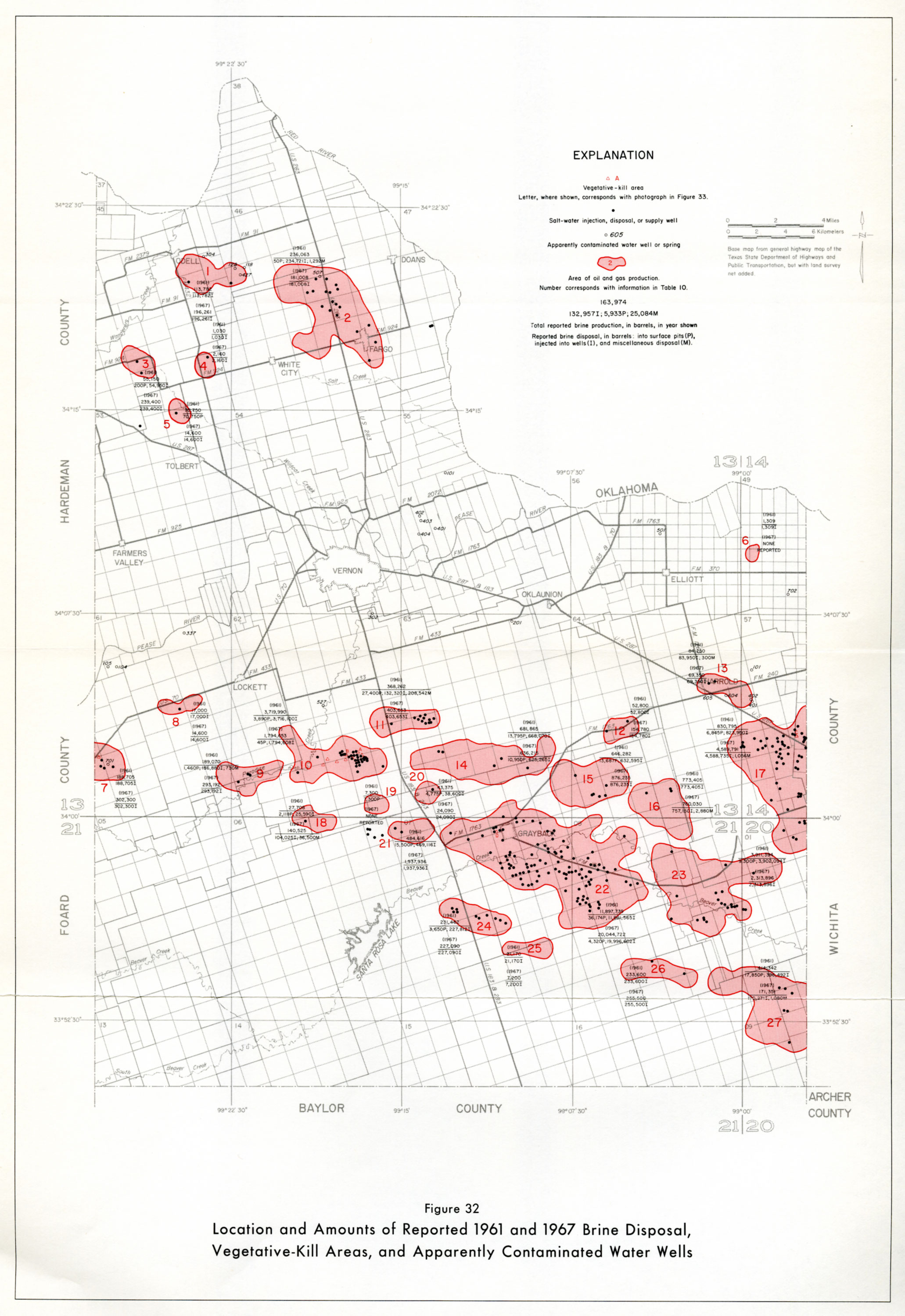
- Figure 32: Location of Amounts of Reported 1961 and 1967 Brine Disposal, Vegetative-Kill Areas, and Apparently Contaminated Water Wells
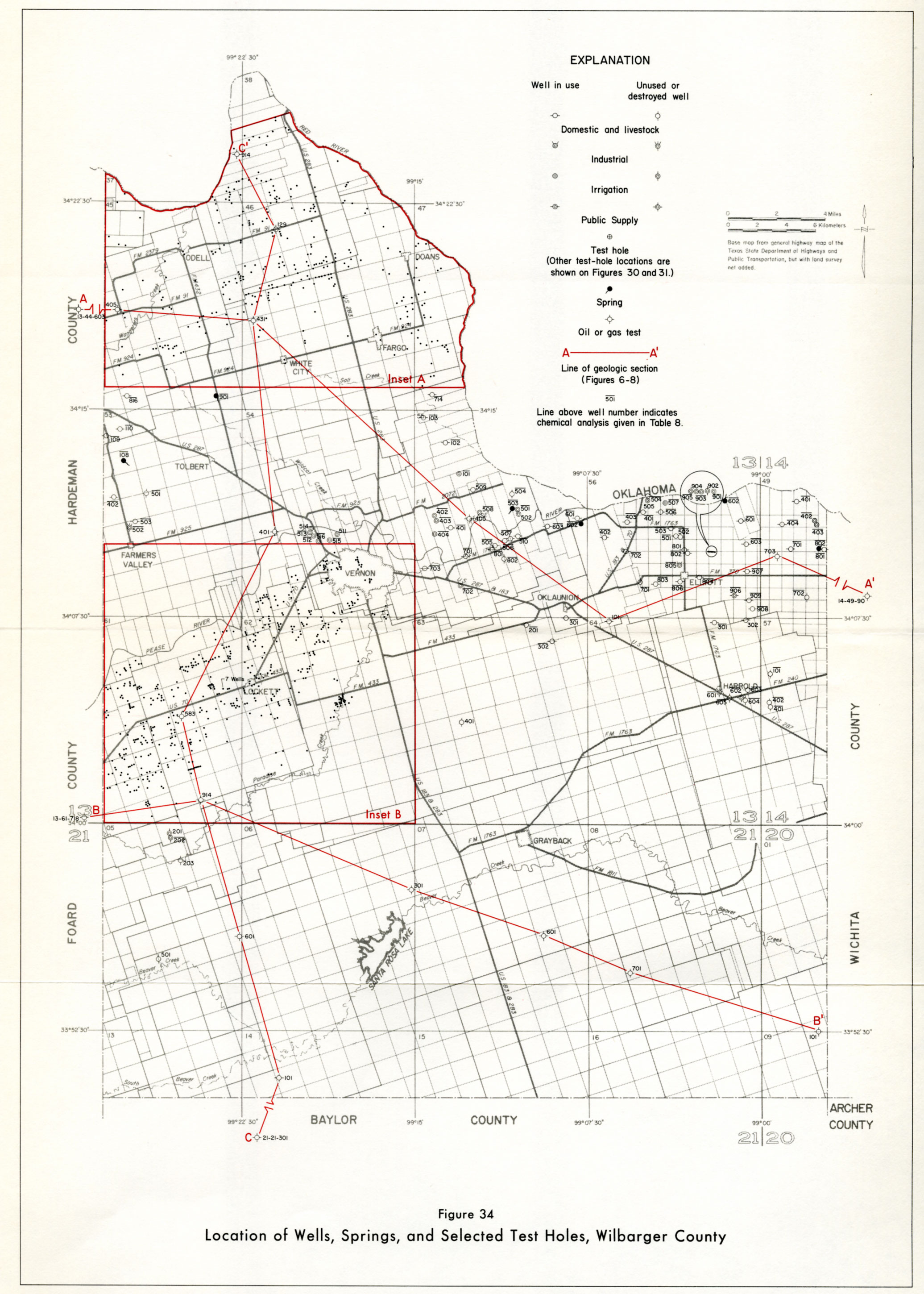
- Figure 34: Location of Wells, Springs, and Selected Test Holes, Wilbarger County
- Figure 34 A Figure 34 continued/ inset A
- Figure 34 B Figure 34 continued/ inset B