Limited Publication 131 By Texas Department of Water Resources, U.S. Geological Survey, City Water Board of San Antonio | October 1980
Oversize fold out maps were scanned separately from the report. "Missing pages" in the report are the maps below.
- LP 131 - Hydrochemical Data for the Edwards Aquifer in the San Antonio Area, Texas
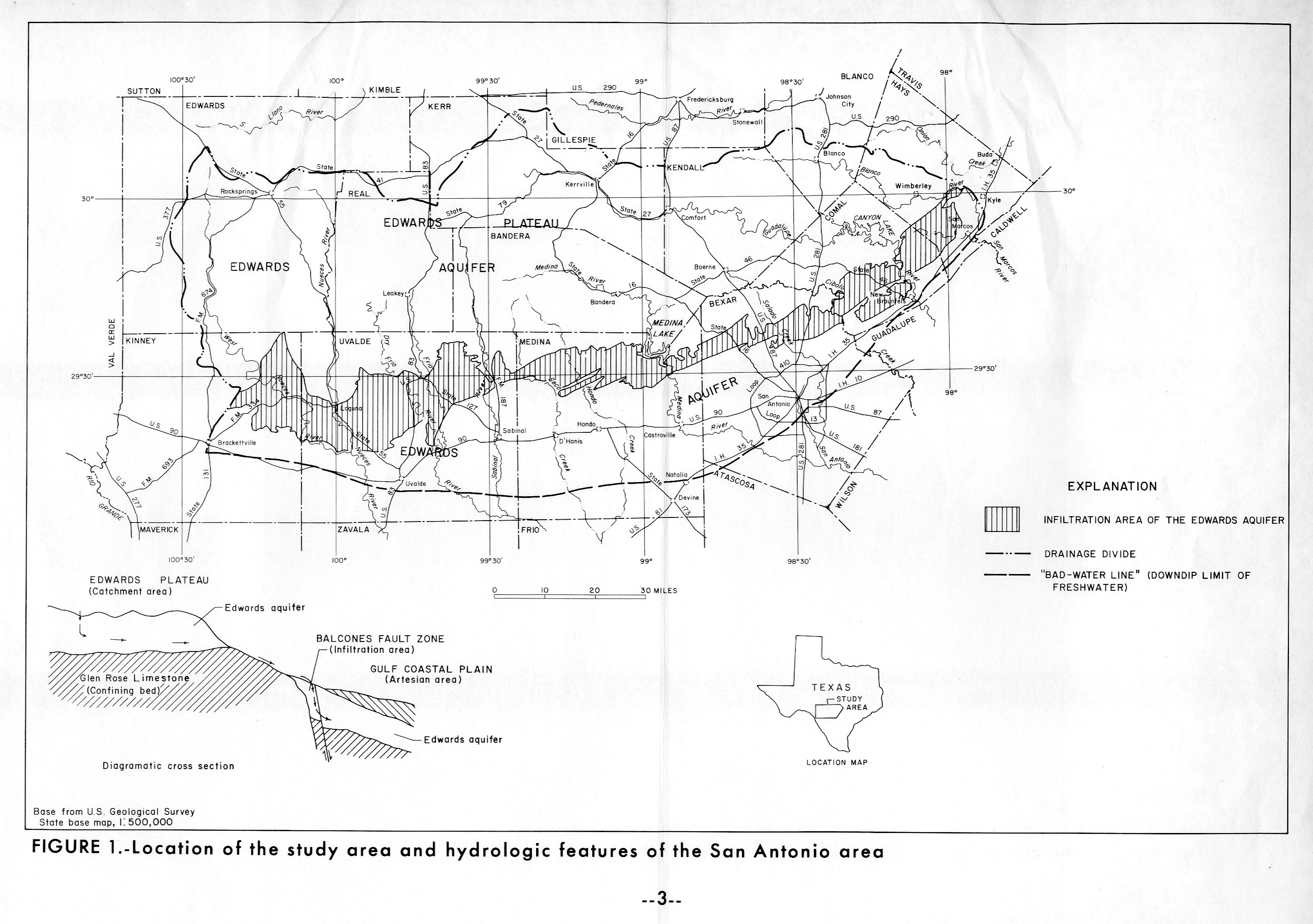
- Figure 1 - Location of the study area and hydrologic features of the San Antonio Area
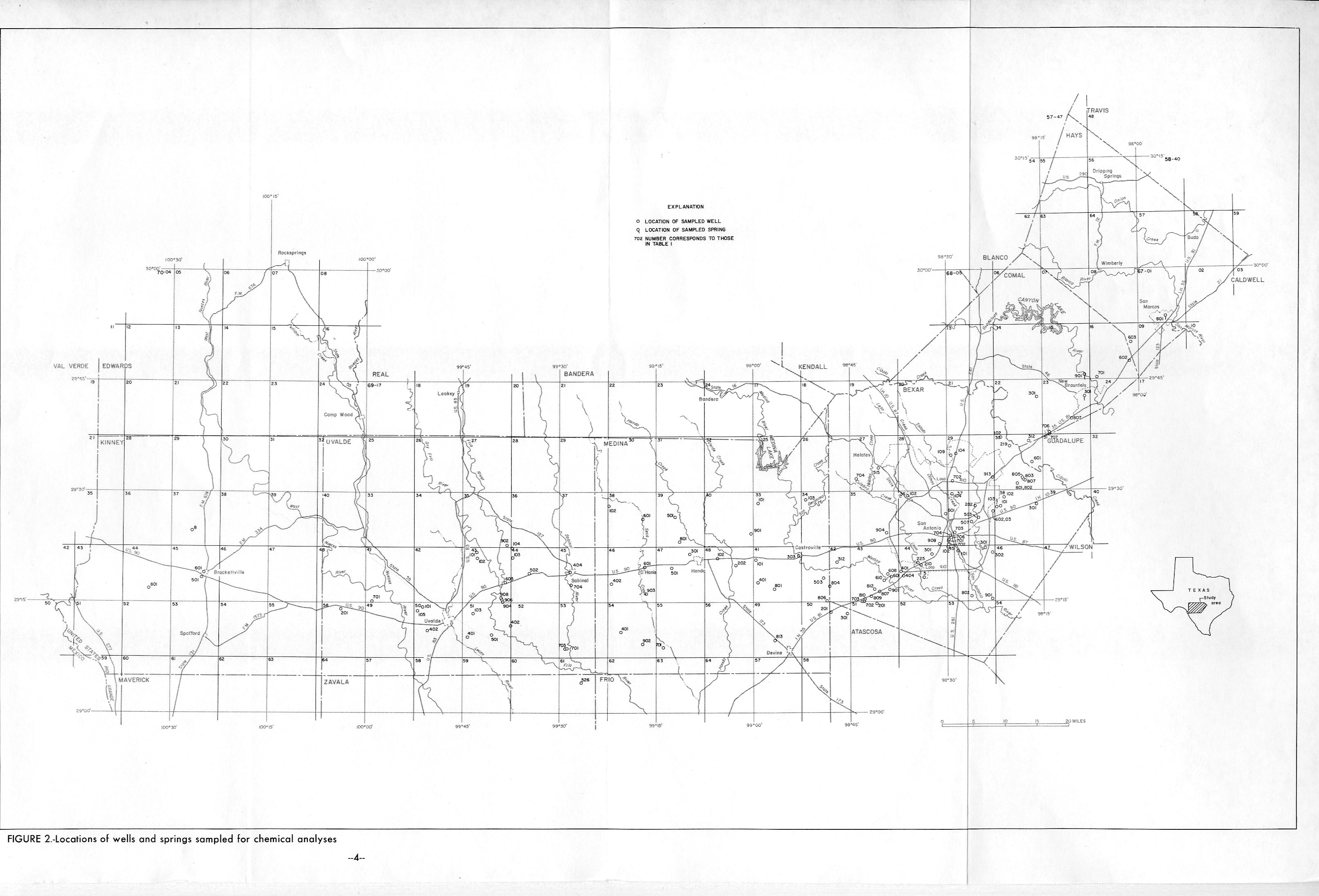
- Figure 2 - Locations of wells and springs sampled for chemical analysis
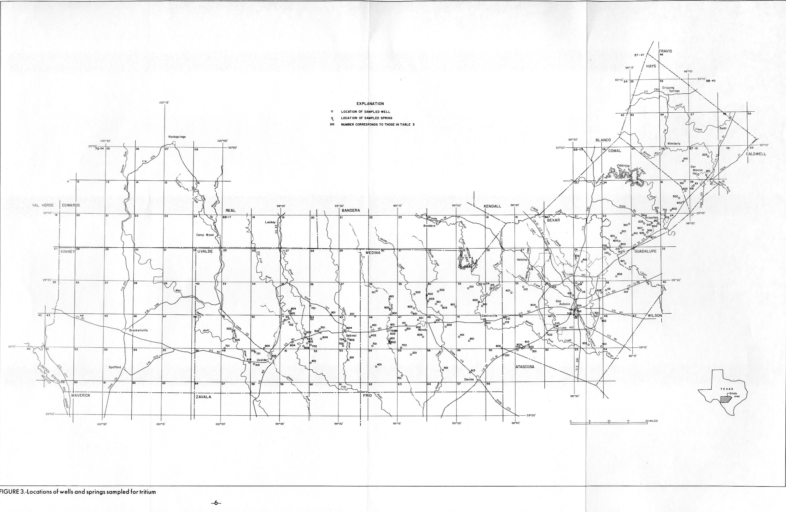
- Figure 3 - Locations of wells and springs sampled for tritium
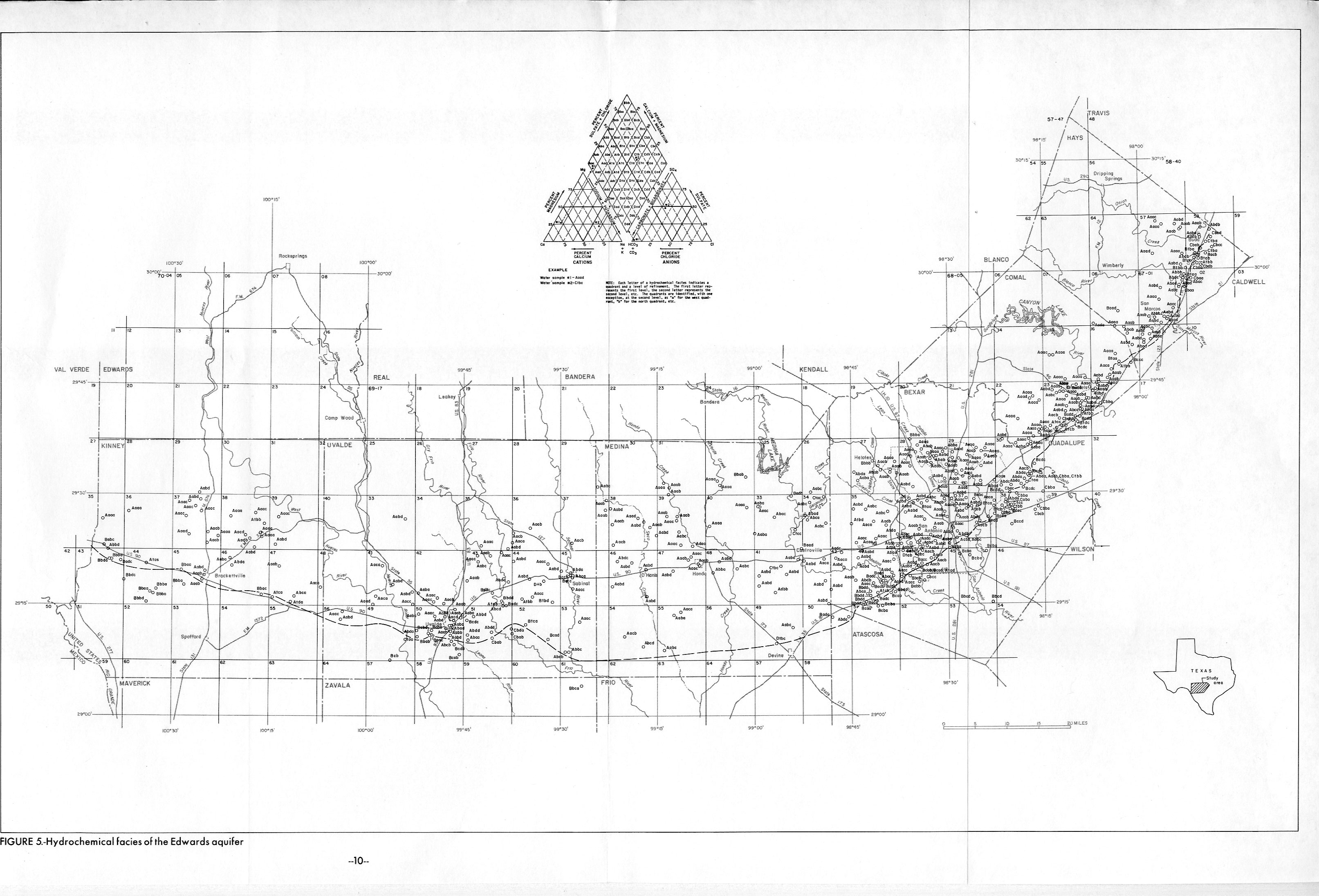
- Figure 5 - Hydrochemical facies of the Edwards Aquifer
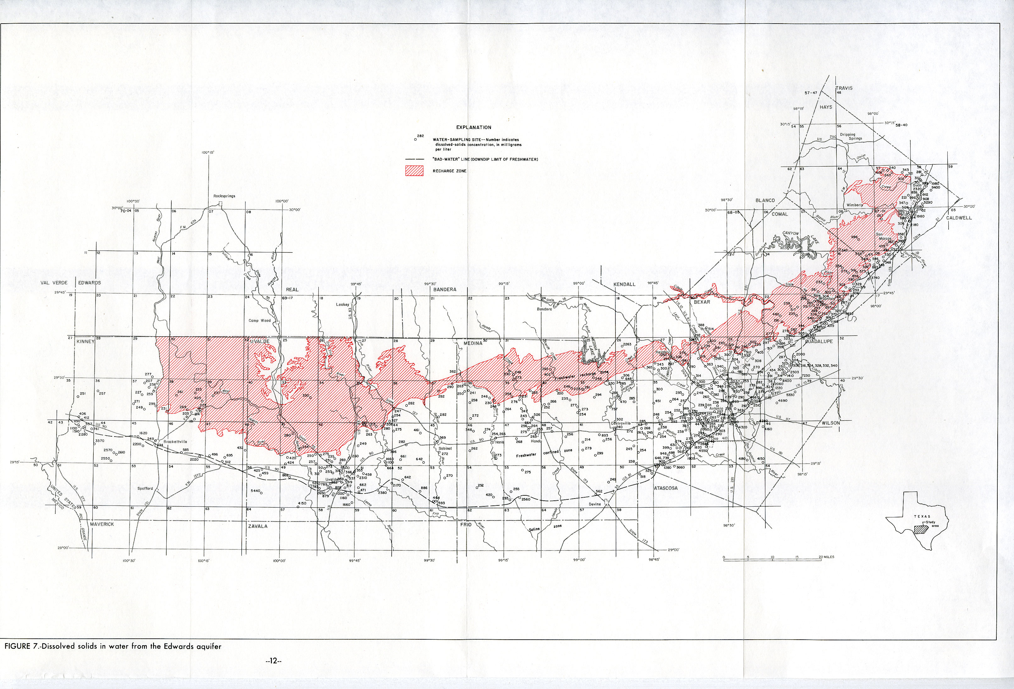
- Figure 7 - Dissolved Solids in water from the Edwards Aquifer
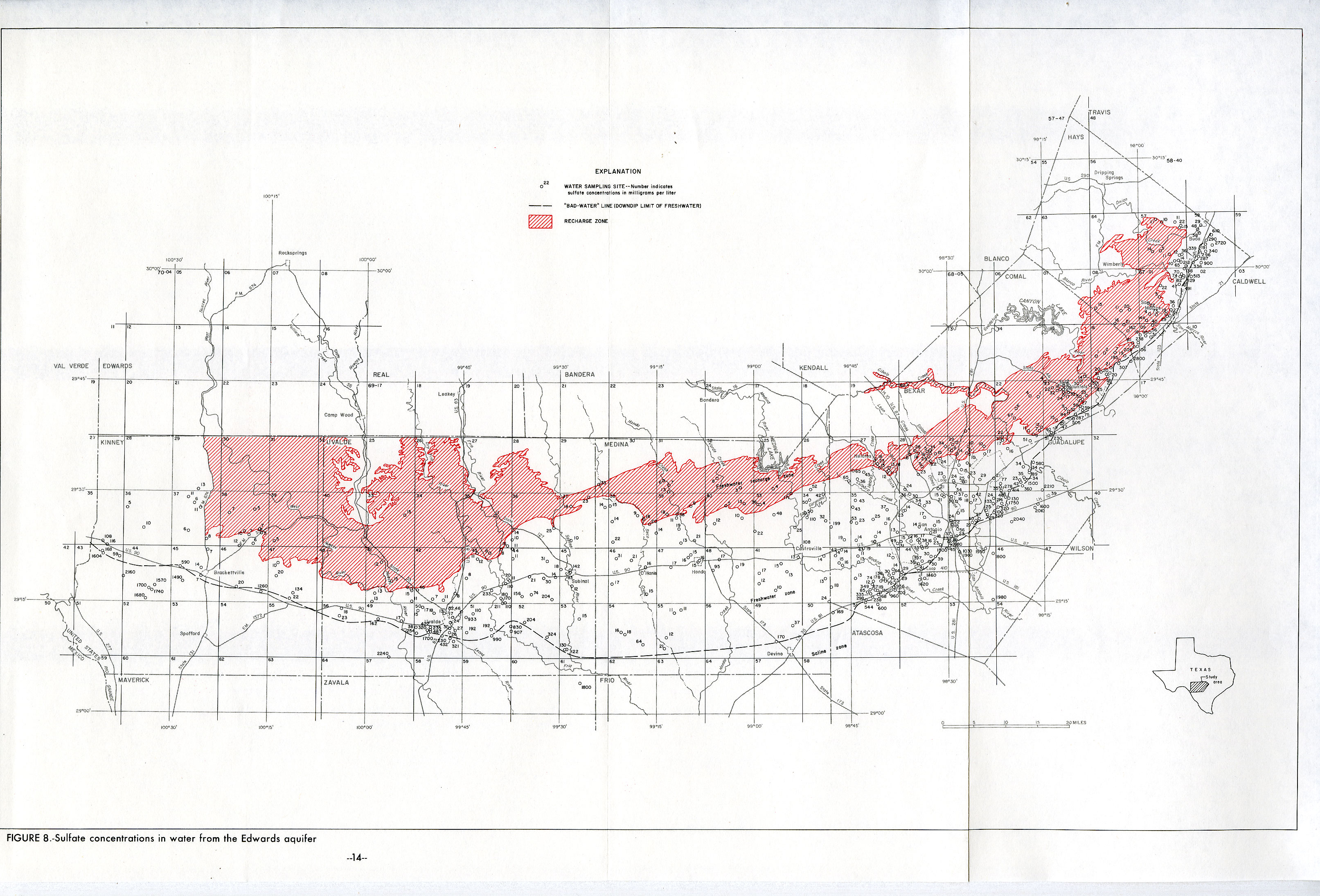
- Figure 8 - Sulfate concentrations in water from the Edwards Aquifer
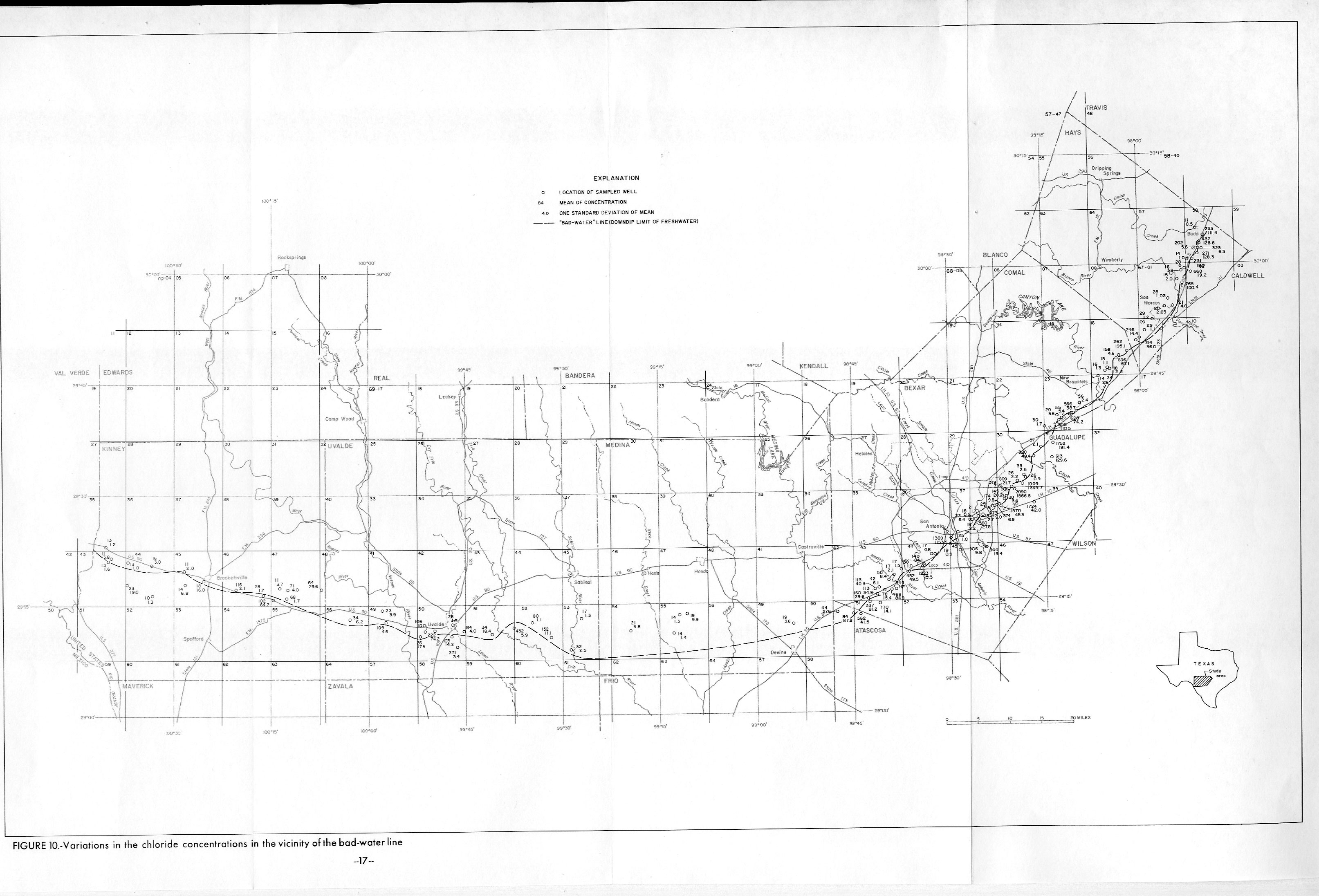
- Figure 10 - Variations in the chloride concentrations in the vicinity of the bad-water line