Bulletin 6306 by E.T. Baker, Jr., R.D. Reeves, and Leonard A. Wood (1963)
- Bulletin 6306 - Reconnaissance Investigation of the Ground-Water Resources of the Red River, Sulphur River, and Cypress Creek Basins, Texas (pdf - 54MB)
- Plate 1 (jpg - 6MB) Geologic Map of Region I Showing Locations of Wells and Major Subdivisions
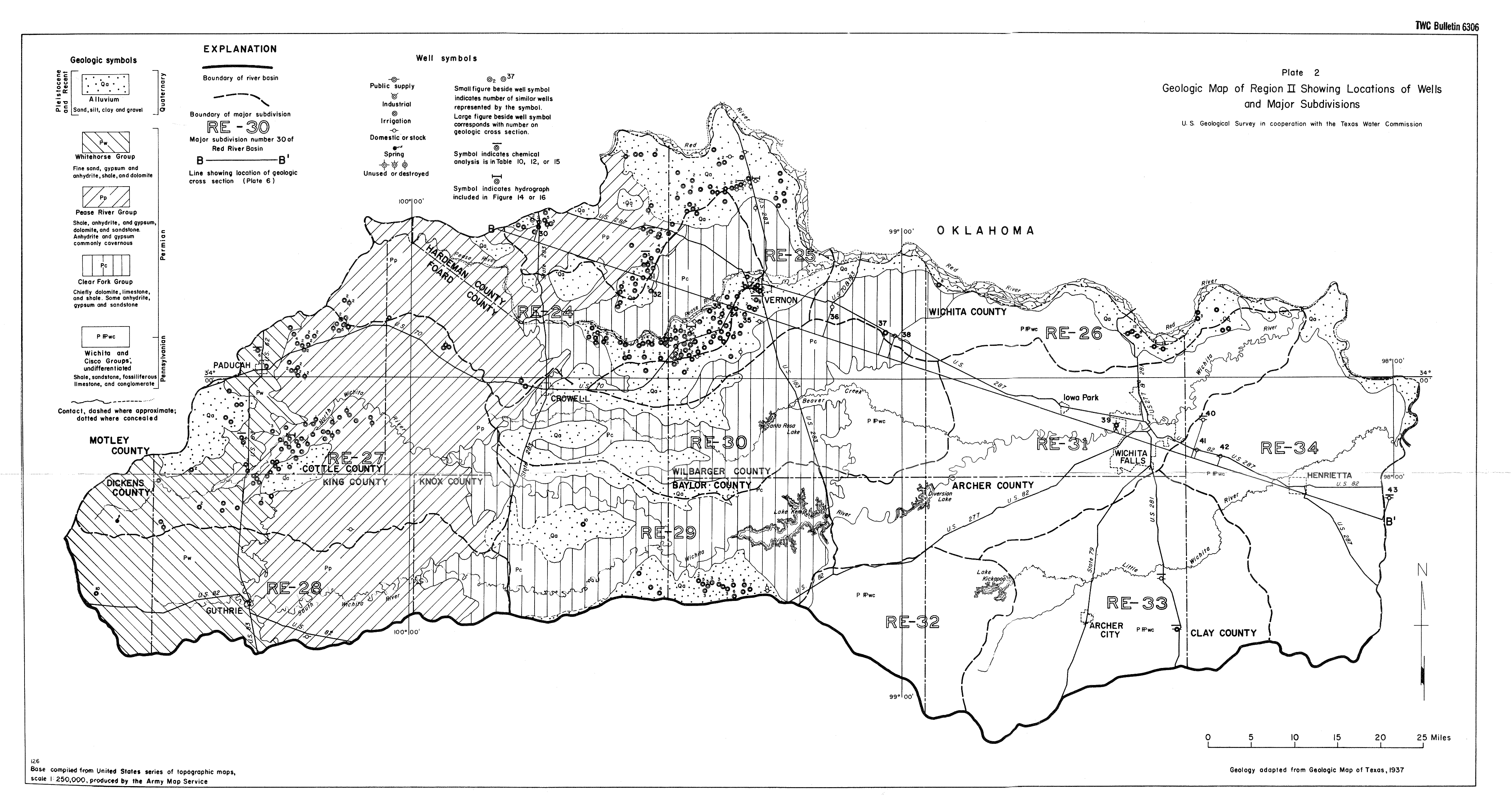
- Plate 2 (jpg - 2.8MB) Geologic Map of Region II Showing Locations of Wells and Major Subdivisions
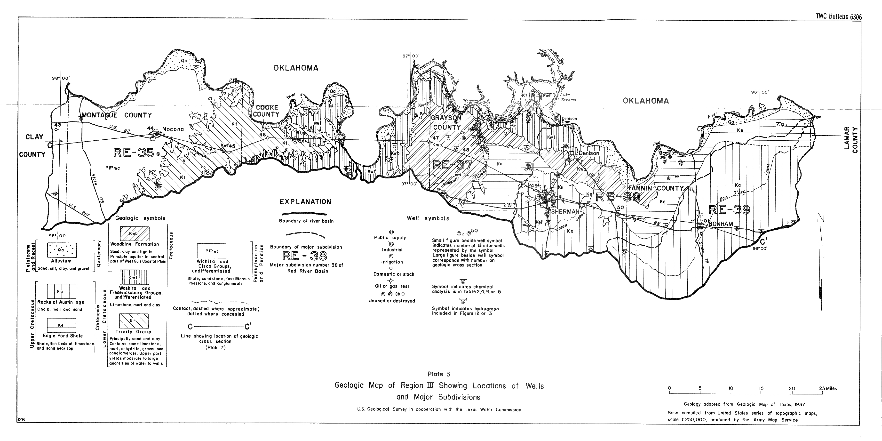
- Plate 3 (jpg - 1.7 MB) Geologic Map of Region III Showing Locations of Wells and Major Subdivisions
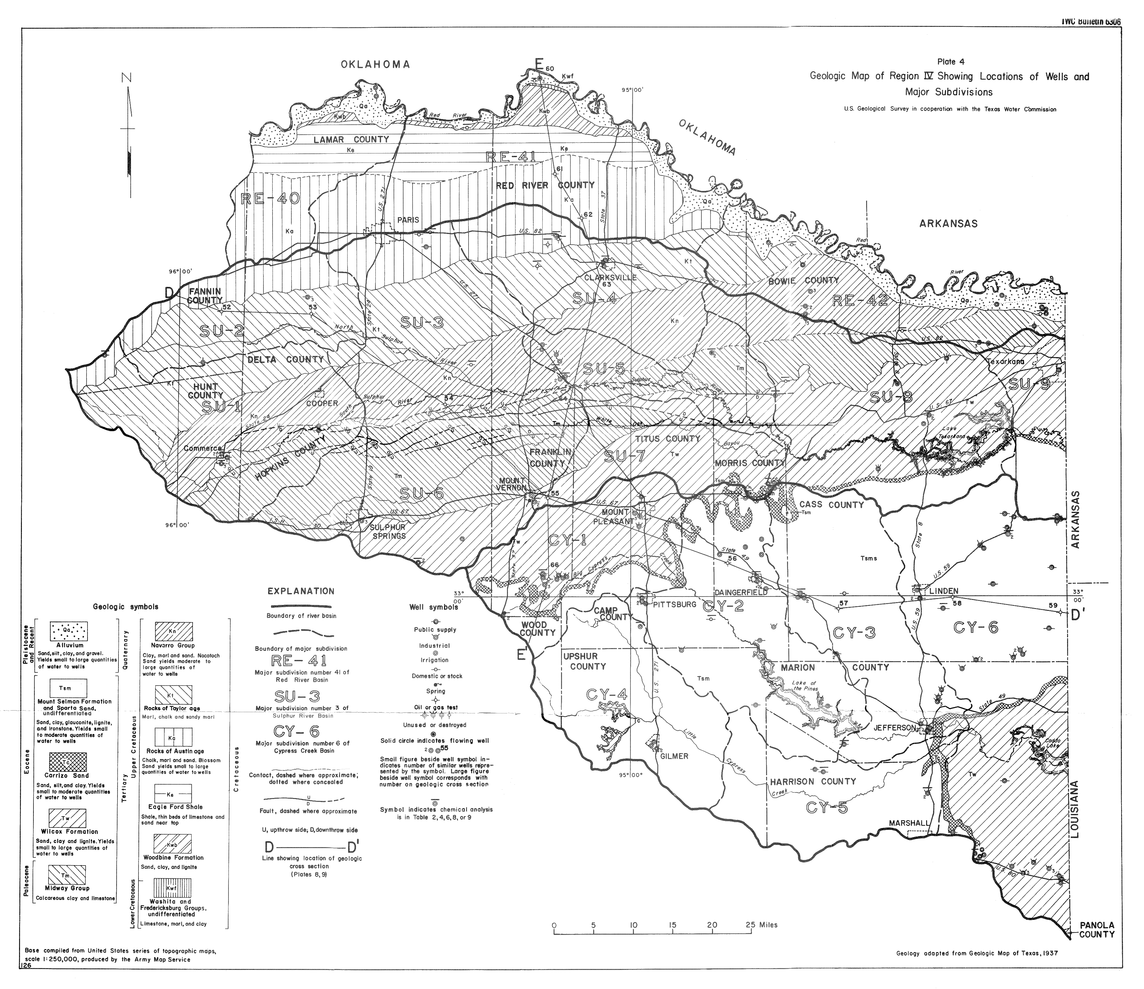
- Plate 4 (jpg - 4MB) Geologic Map of Region IV Showing Locations of Wells and Major Subdivisions
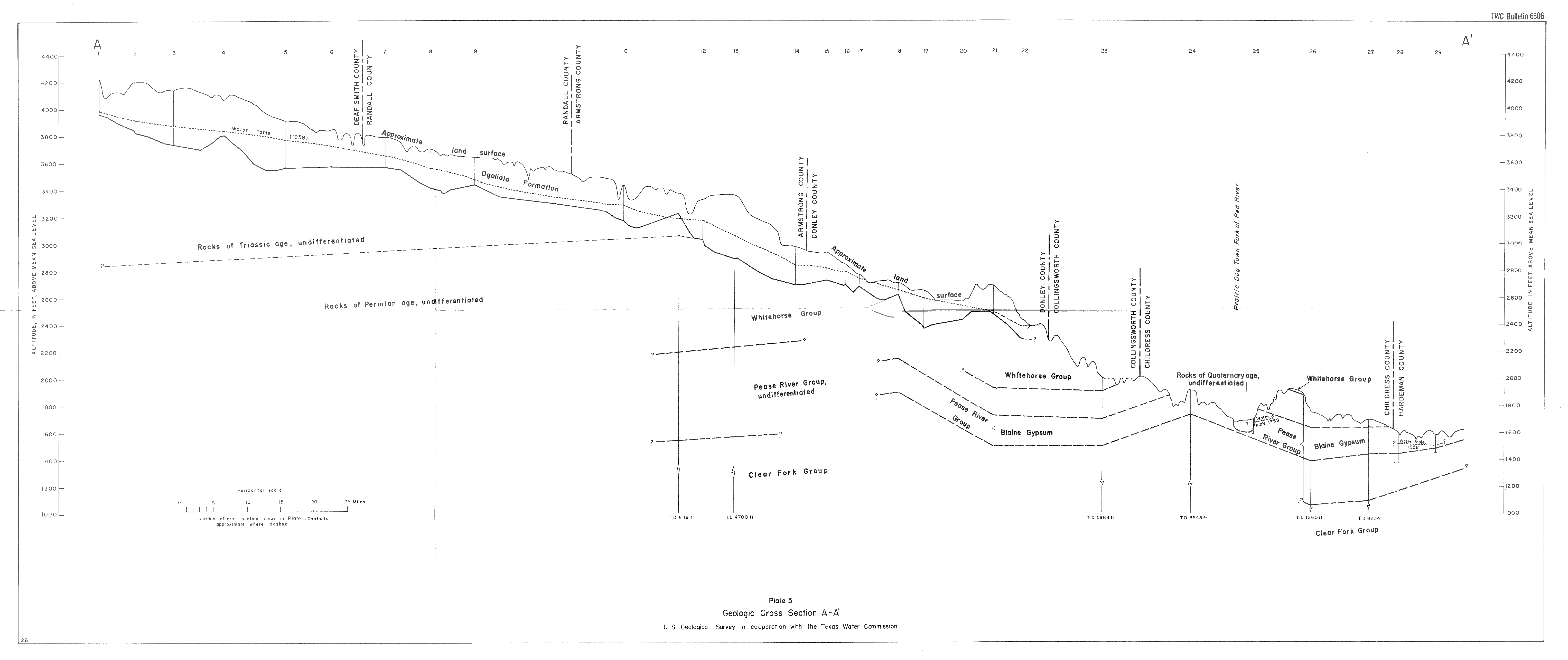
- Plate 5 (jpg - 1.3MB) Geologic Cross Section A-A'
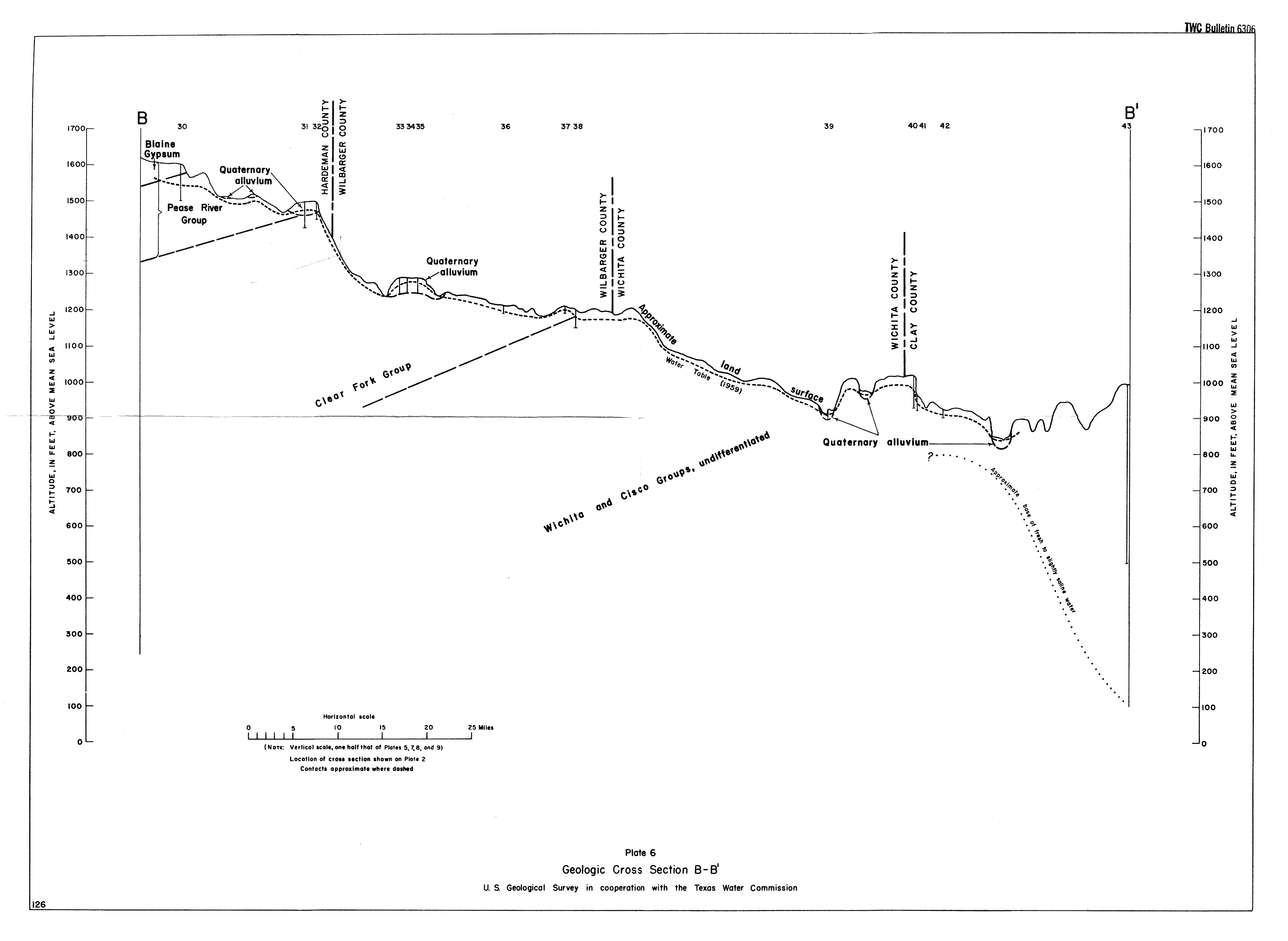
- Plate 6 (jpg - 745KB) Geologic Cross Section B-B'
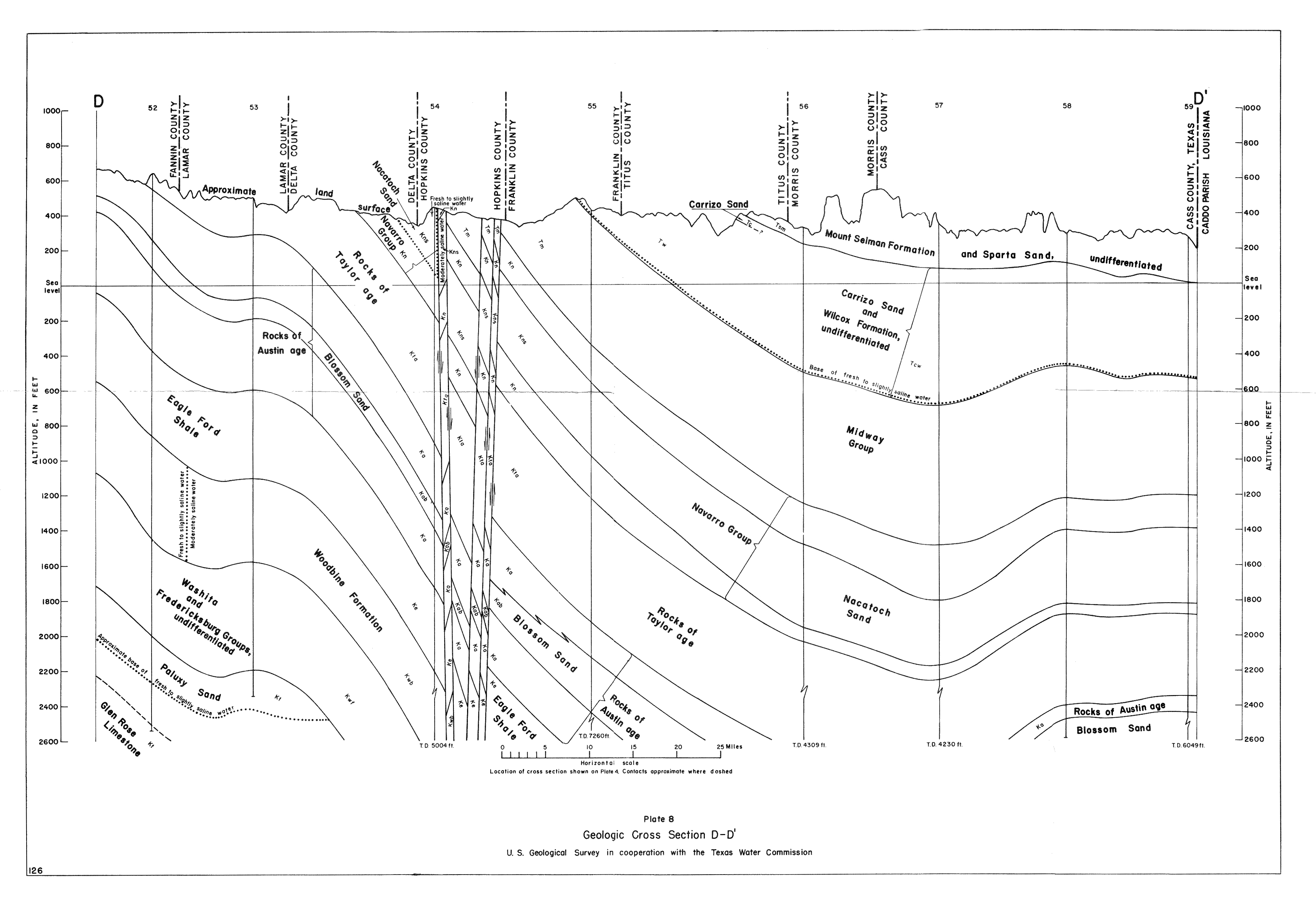
- Plate 8 (jpg - 1.3MB) Geologic Cross Section D-D'
- Plate 9 (jpg - 1MB) Geologic Cross Section E-E'
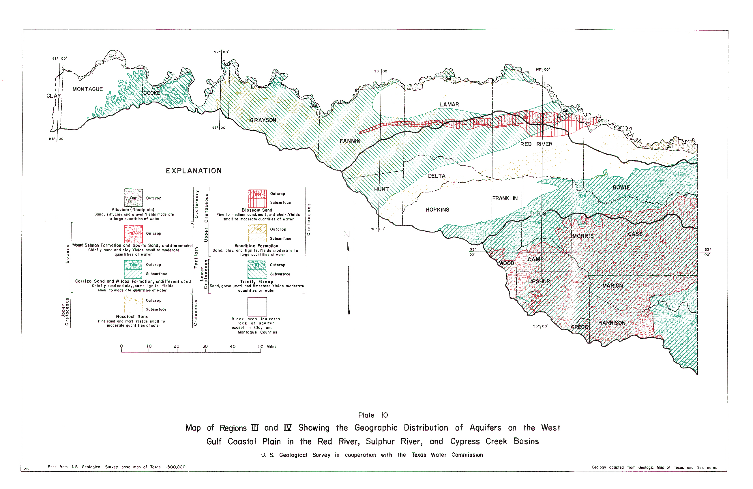
- Plate 10 (jpg - 2.7MB) Map of Regions III and IV Showing Geographic Distribution of Aquifers on the West Gulf Coastal Plain in the Red River, Sulphur River, and Cypress Creek Basins
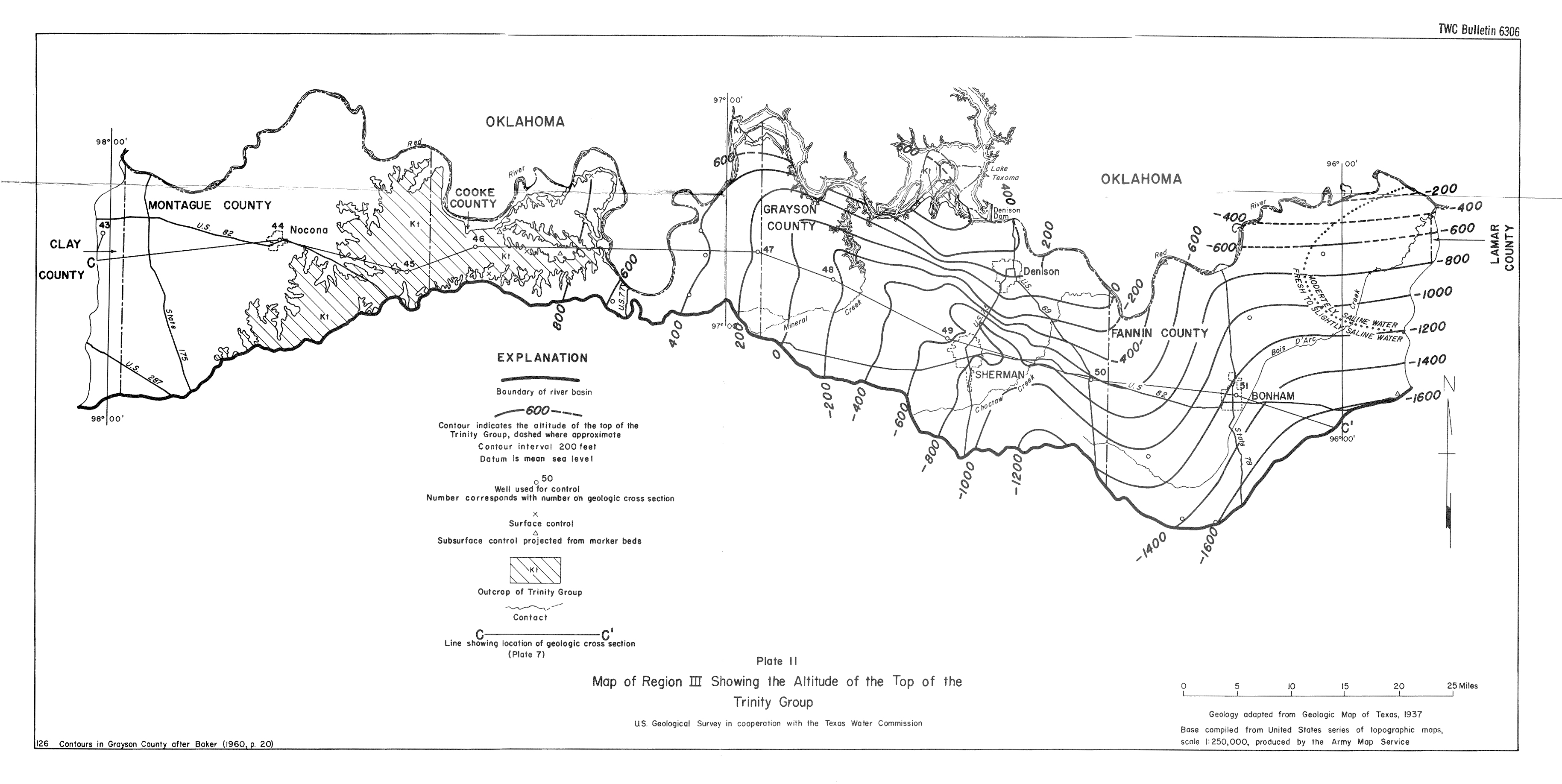
- Plate 11 (jpg - 1.2 MB) Map of Region III Showing the Altitude of the Top of the Trinity Group
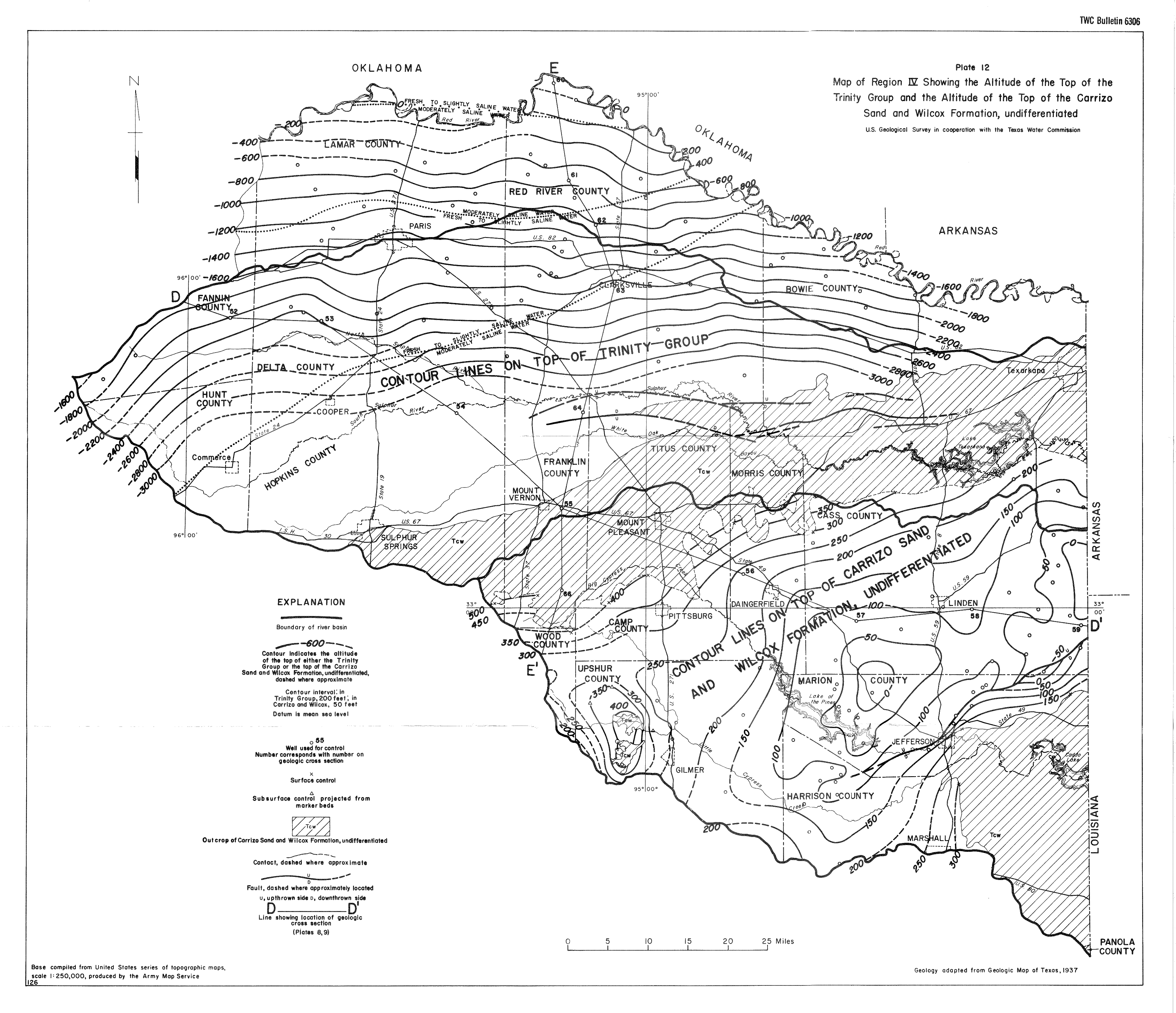
- Plate 12 (jpg - 3.2 MB) Map of Region IV Showing the Altitude of the Top of the Trinity Group and the Altitude of the Top of the Carrizo Sand and Wilcox Formation, undifferentiated
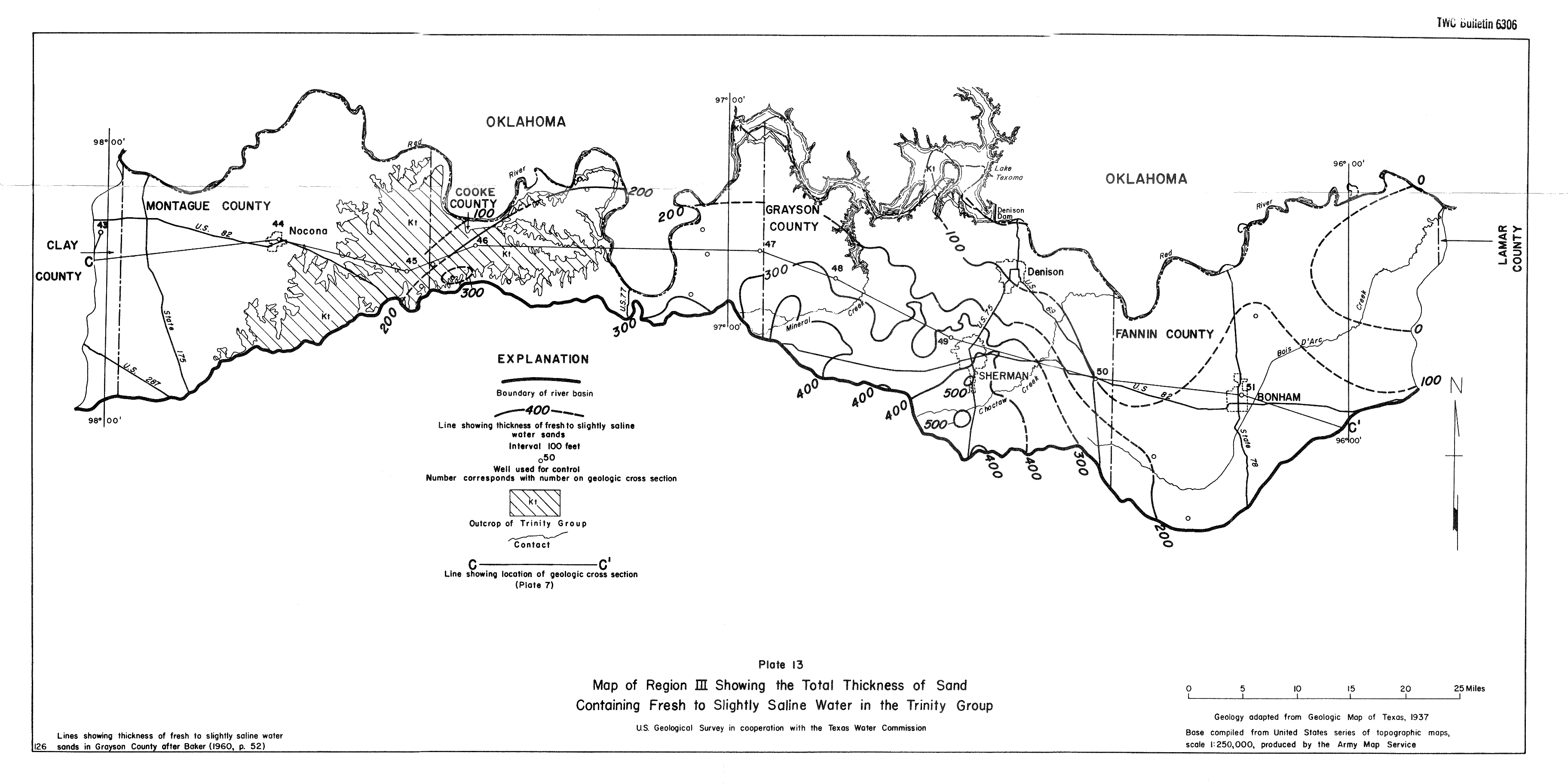
- Plate 13 (jpg - 1.2 MB) Map of Region III Showing the Total Thickness of Sand Containing Fresh to Slightly Saline Water in the Trinity Group
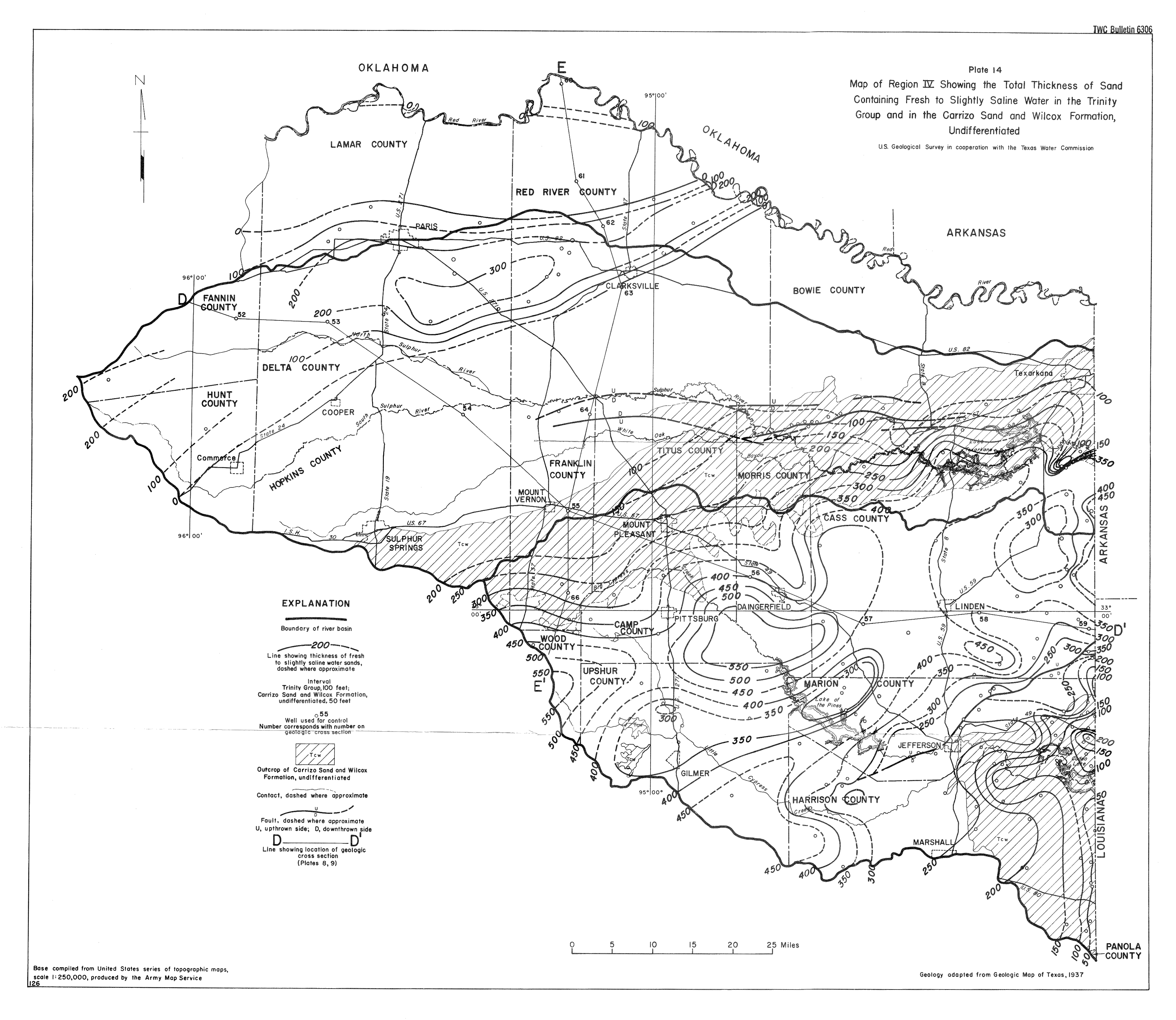
- Plate 14 (jpg - 2.8 MB) Map of Region IV Showing the Total Thickness of Sand Containing Fresh to Slightly Saline Water in the Trinity Group and in the Carrizo Sand and Wilcox Formation, Undifferentiated
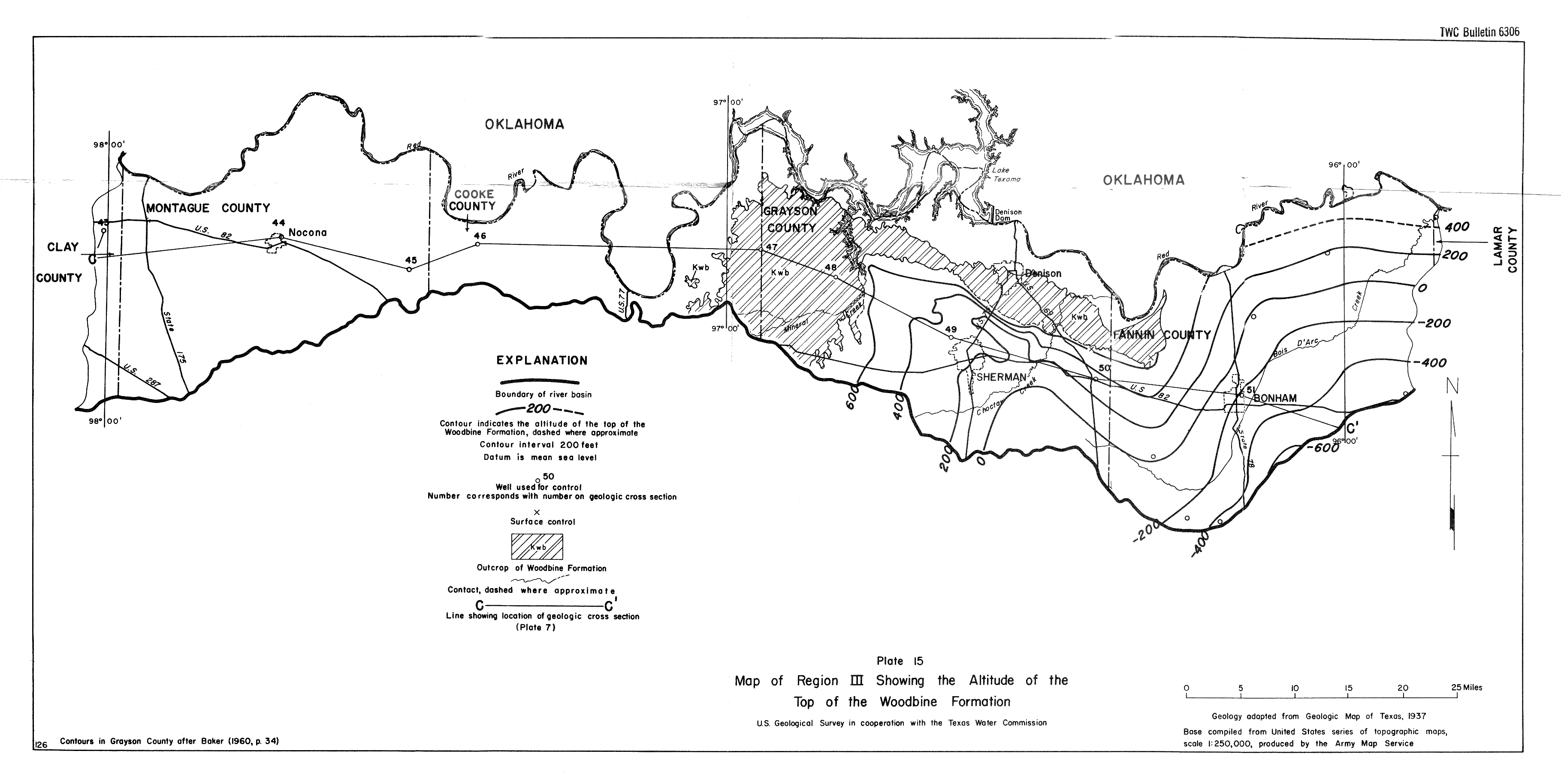
- Plate 15 (jpg - 1.2 MB) Map of Region III Showing the Altitude of the Top of the Woodbine Formation
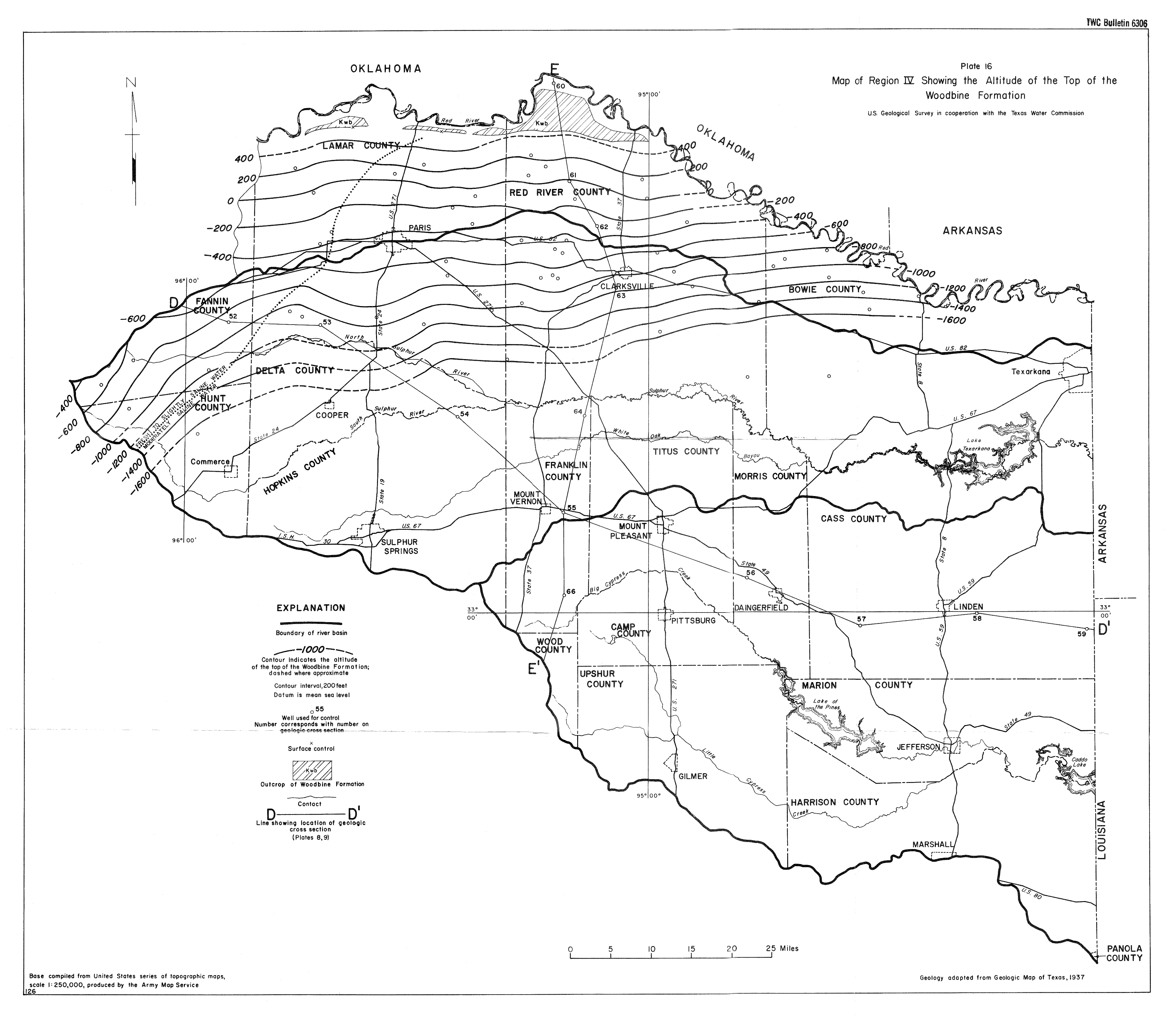
- Plate 16 (jpg - 2.1 MB) Map of Region IV Showing the Altitude of the Top of the Woodbine Formation
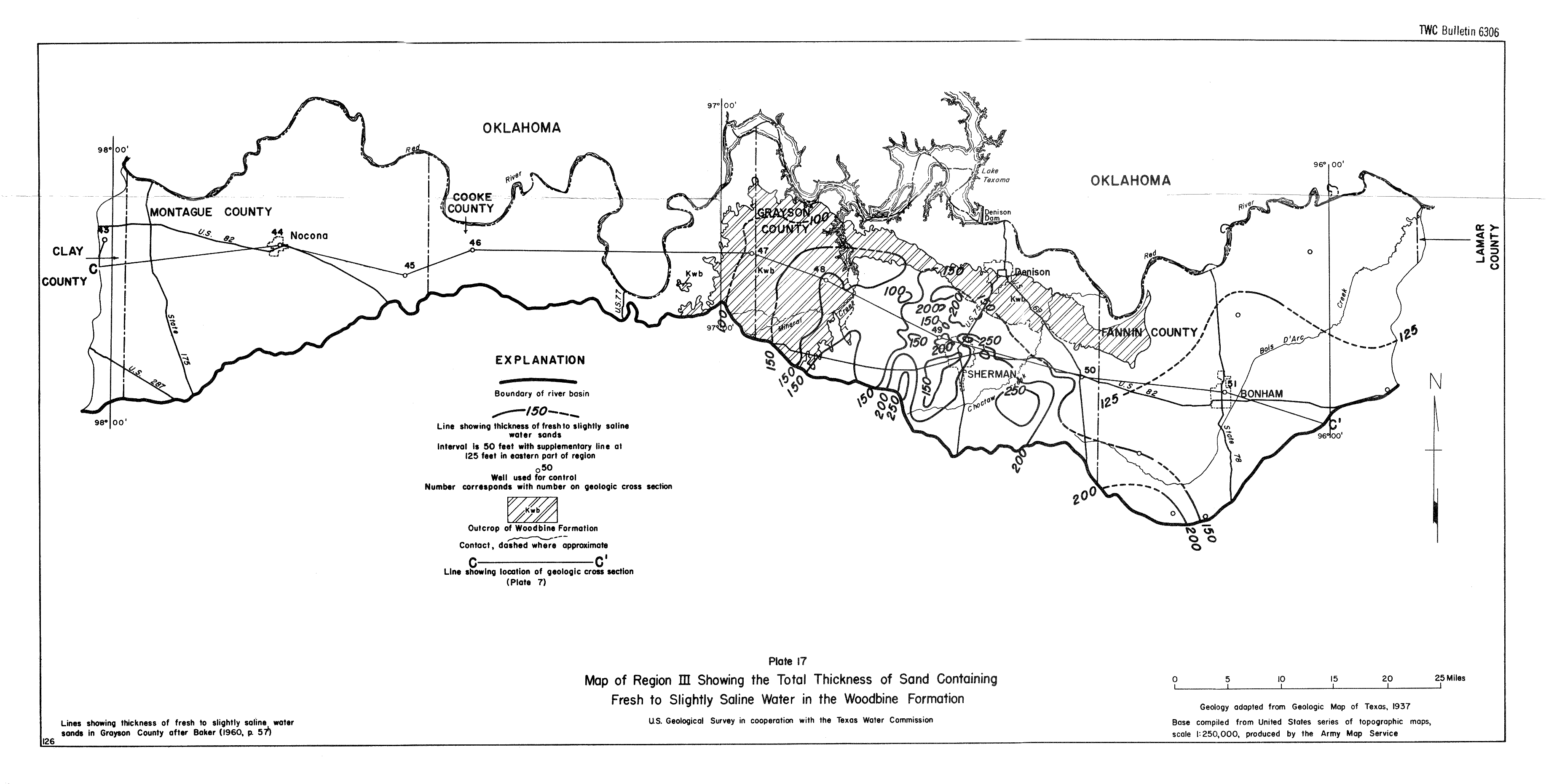
- Plate 17 (jpg - 1.2 MB) Map of Region III Showing the Total Thickness of Sand Containing Fresh to Slightly Saline Water in the Woodbine Formation
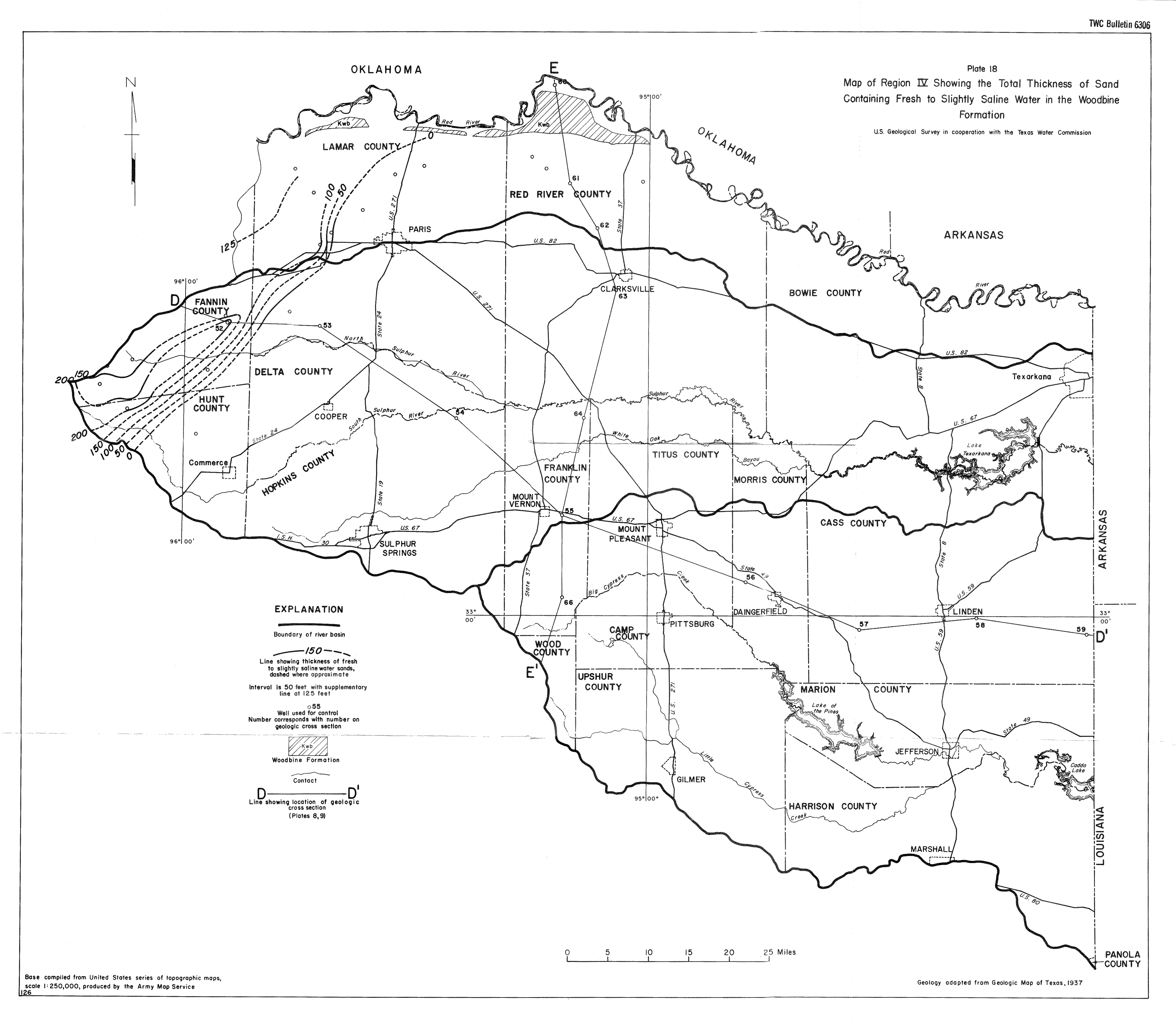
- Plate 18 (jpg - 1.8 MB) Map of Region IV Showing the Total Thickness of Sand Containing Fresh to Slightly Saline Water in the Woodbine Formation
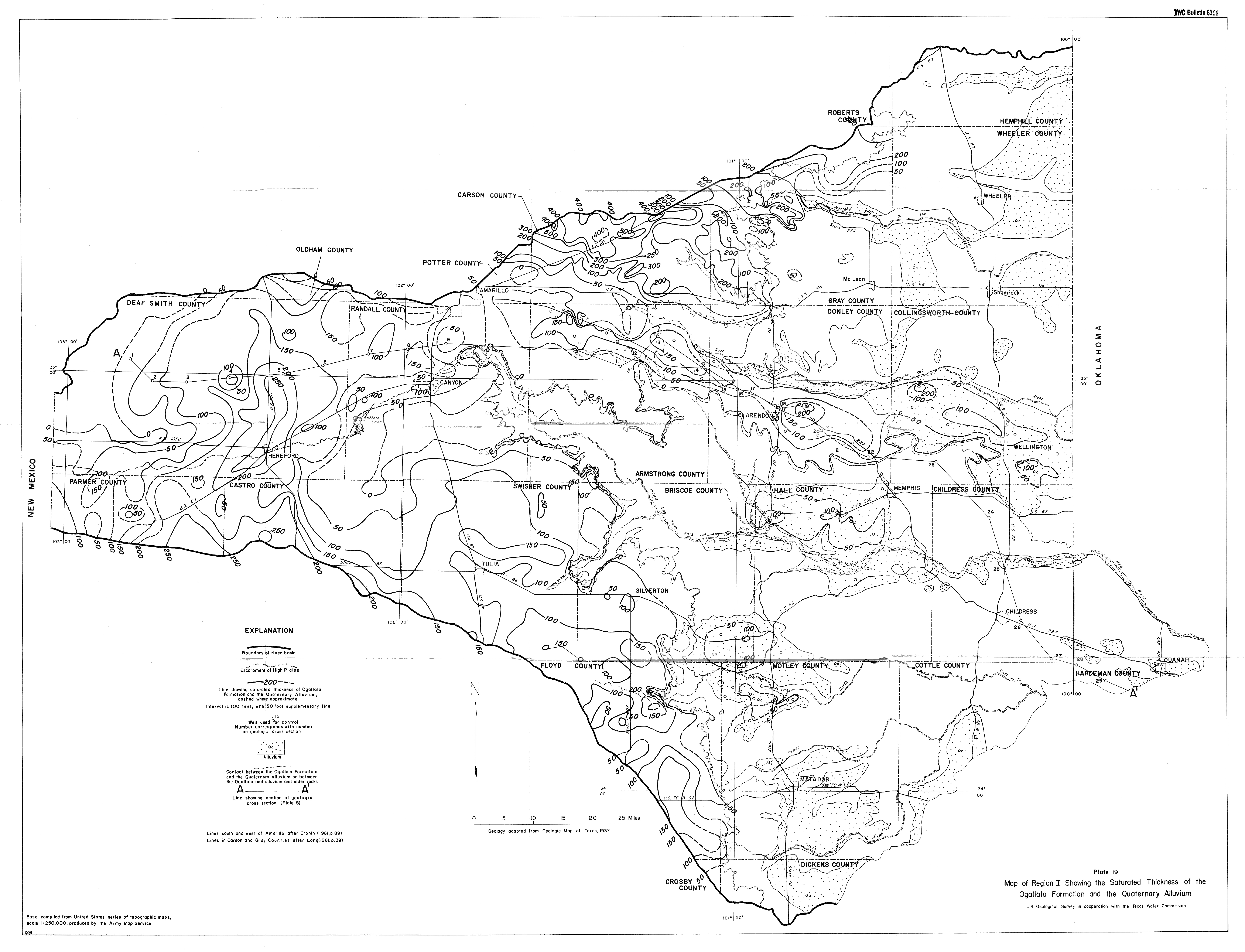
- Plate 19 (jpg - 5 MB) Map of Region I Showing the Saturated Thickness of the Ogallala Formation and the Quaternary Alluvium
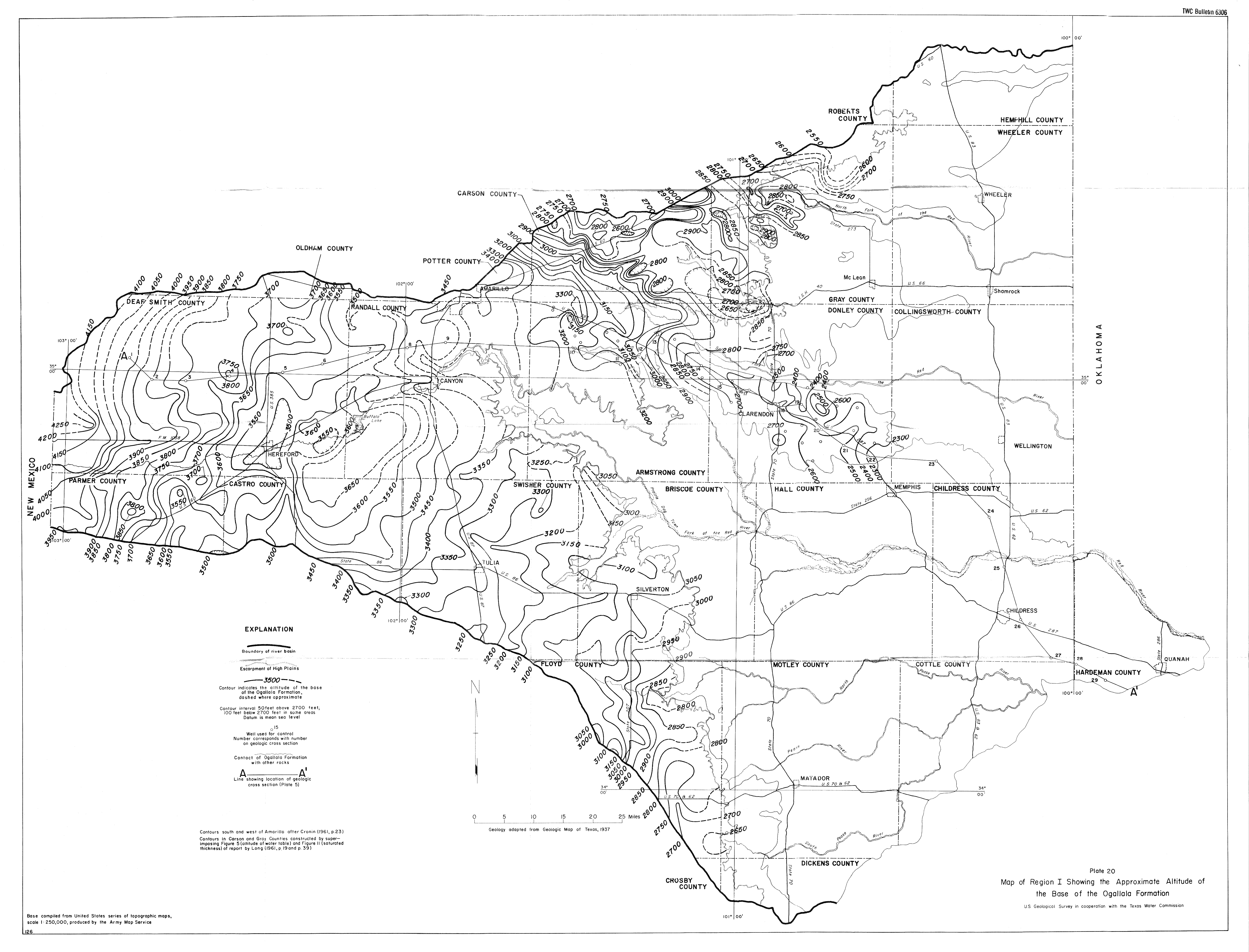
- Plate 20 (jpg - 4.7 MB) Map of Region I Showing the Approximate Altitude of the Base of the Ogallala Formation
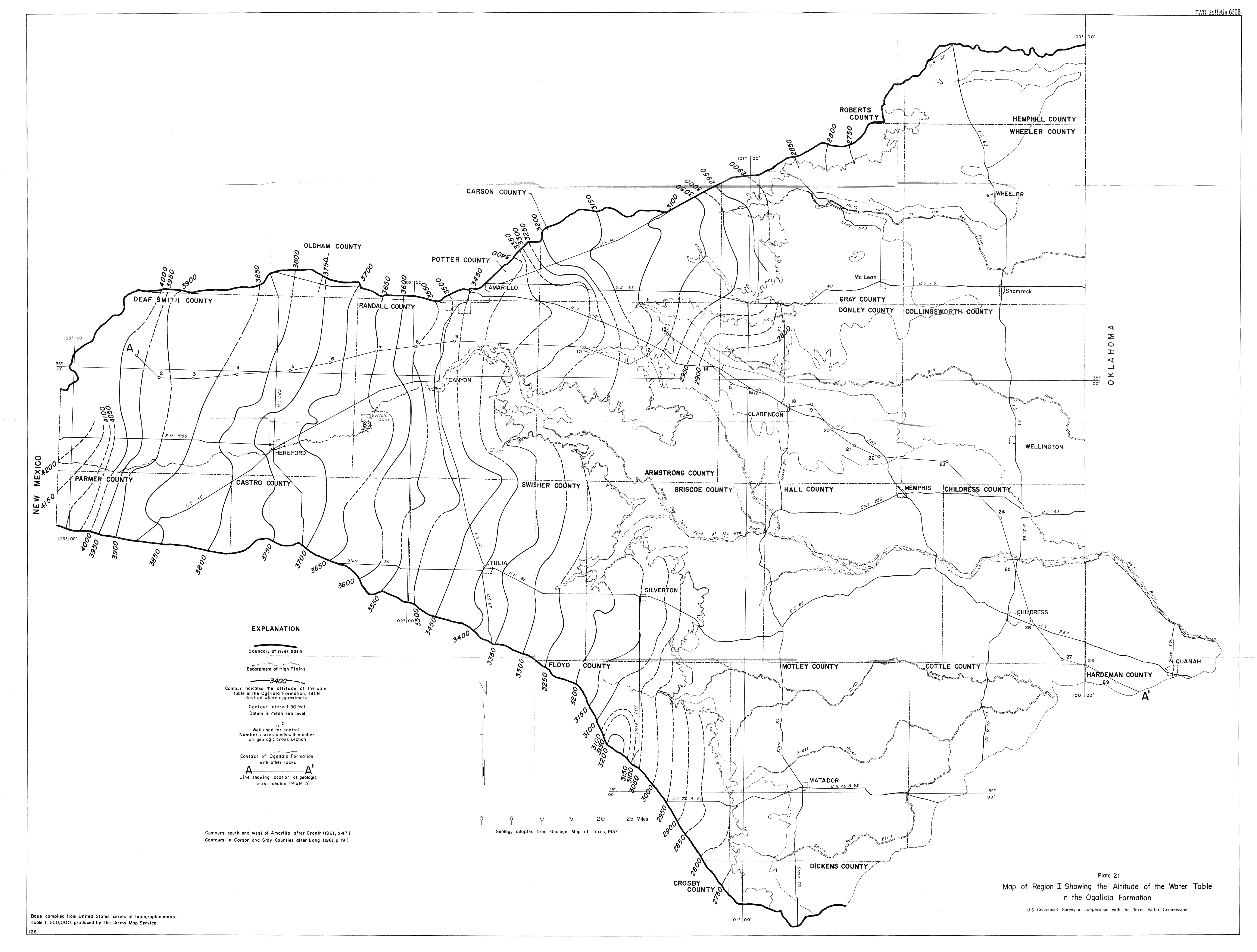
- Plate 21 (jpg - 3.6 MB) Map of Region I Showing the Altitude of the Water Table in the Ogallala Formation
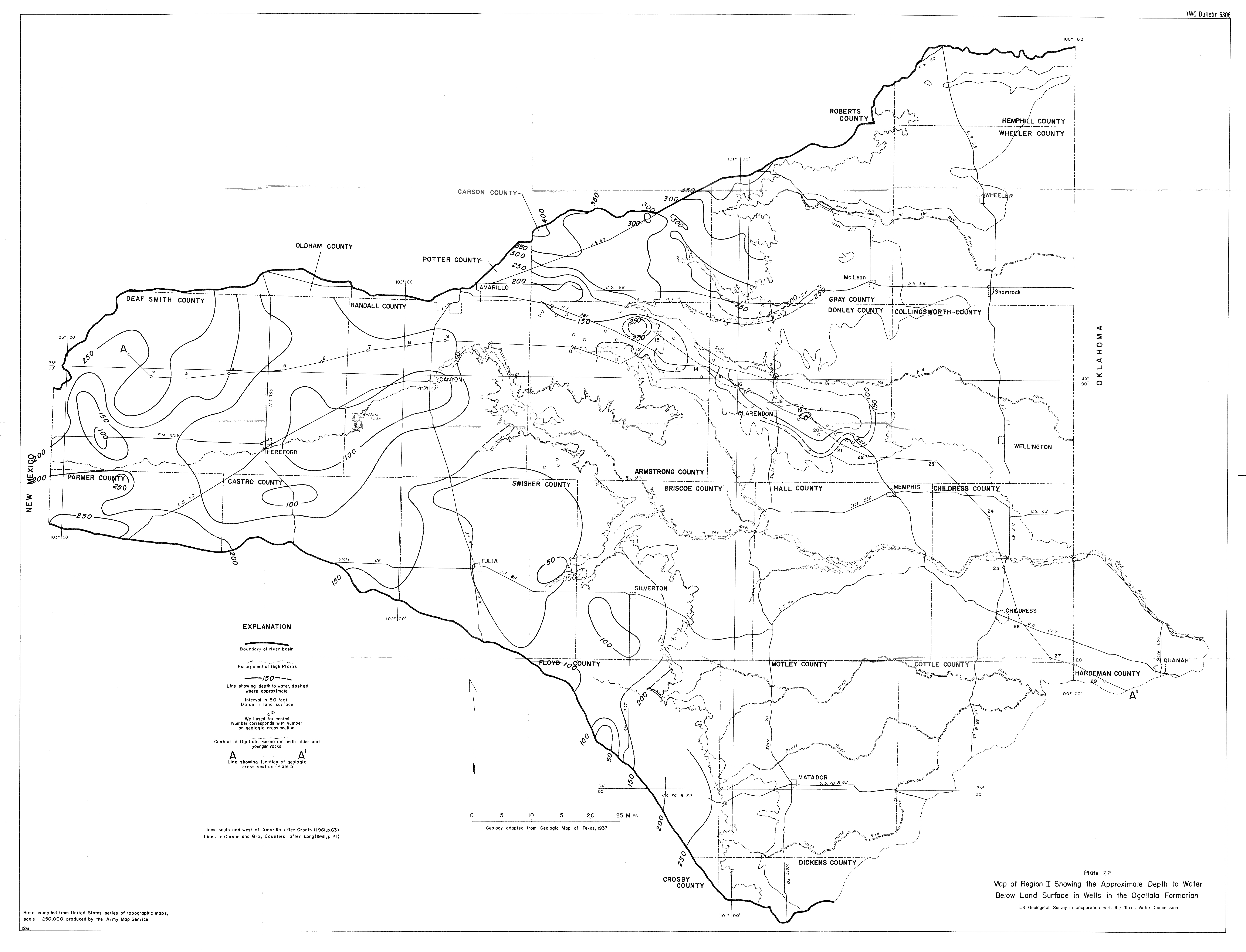
- Plate 22 (jpg - 3.6 MB)Map of Region I Showing the Approximate Depth to Water Below Land Surface in Wells in the Ogallala Formation