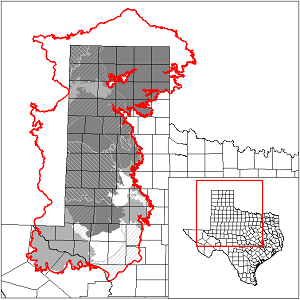
High Plains Aquifer System Groundwater Availability Model (GAM)
 In July 2012, the Texas Water Development Board (TWDB) contracted with INTERA, Inc. to develop a groundwater availability model (GAM) for the High Plains Aquifer System (Ogallala Aquifer, Dockum Aquifer, Edwards-Trinity (High Plains) Aquifer, and Rita Blanca Aquifer). The project was completed and delivered in 2015.
In 2025, the TWDB completed a model extension for the High Plains Aquifer System. The model report and associated data for this extension can be found below.
Model Report
"Conceptual Model for the High Plains Aquifer System Groundwater Availability Model. (v 1.01)"
"Numerical Model for the High Plains Aquifer System Groundwater Availability Model. (v 1.01)"
Model Files and Associated Data
Please see the GAM files download page for the current model files and associated data.
Aquifer data is only available as a package for the entire model area and requires GIS software for processing. Please see the GAM files download page for aquifer data.
Stakeholder Advisory Forums (SAF)
Send us an email if you would like to receive SAF notifications.
| ID | Date | Location/Video |
|---|---|---|
| SAF 1 | 2/11/2013 | Lamesa, Texas - Mesa Underground Water Conservation District |
| Focus Group Meeting | 2/28/2013 | Amarillo, Texas |
| SAF 2 - Amarillo | 5/12/2014 | Amarillo, Texas |
| SAF 2 - Lubbock | 5/14/2014 | Lubbock, Texas |
| SAF 3 - Amarillo | 2/18/2015 | Amarillo, Texas |
| SAF 3 - Lubbock | 8/11/2015 | Lubbock, Texas |
| SAF Update | 09/19/2024 | Online GoToMeeting |
Other Resources
Please see the Ogallala, Dockum, Edwards-Trinity (High Plains), and Rita Blanca aquifer pages for other reports and publications.
For model runs see the GMA 1, GMA 2, GMA 3, GMA 6, and GMA 7 pages.