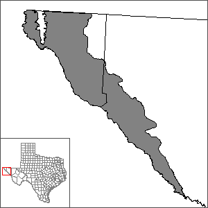
Hueco-Mesilla Bolsons Aquifer Groundwater Availability Model (GAM)
 The U.S. Geological Survey (USGS) in Albuquerque in cooperation with El Paso Water Utilities has developed a numerical groundwater flow model of the Hueco Bolson Aquifer in Texas, New Mexico, and Mexico.
CH2M Hill in cooperation with El Paso Water Utilities has developed a numerical flow model of the Mesilla Bolson Aquifer in Texas based on a previous model by A. Curtis Weeden, Jr and Thomas Maddock III (Simulation of Groundwater Flow in the Rincon Valley Area and Mesilla Basin, New Mexico and Texas).
Mesilla Bolson Aquifer
- Groundwater Modeling of the Cañutillo Wellfield
- Documentation of Files for Cañutillo Wellfield Groundwater Flow Model
- Download Hueco Mesilla Aquifer model files
Hueco Bolson Aquifer
- Simulated Ground-Water Flow in the Hueco Bolson, an Alluvial-Basin Aquifer System near El Paso, Texas | USGS WRIR 02-4108
- Documentation of Files for Steady State and Annual Versions of Groundwater Flow Model of Hueco Bolson
- Download Hueco Bolsons Aquifer model files
Model Files and Associated Data
For the Hueco Bolsons GAM, please see the GAM files download page for the current model files and associated data.
For the Mesilla Bolsons GAM, please see the GAM files download page for the current model files and associated data.
Aquifer data is only available as a package for the entire model area and requires GIS software for processing. Please see the GAM files download page for aquifer data.
Other Resources
Please see the Hueco-Mesilla Bolsons Aquifer page for other reports and publications.