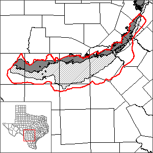
San Antonio segment of the Edwards (Balcones Fault Zone) Aquifer Groundwater Availability Model (GAM)
 The U.S. Geological Survey in cooperation with the U.S. Department of Defense and the Edwards Aquifer Authority (EAA) have developed a GAM for the San Antonio segment of the Edwards Aquifer. However, the Texas Water Development Board will continue to maintain GWSIM as a model with an alternative hydraulic conductivity distribution and as an easier-to-use screening tool.
Current GAM
Model Reports
- "Conceptualization and Simulation of the Edwards Aquifer, San Antonio Region, Texas." | USGS SIR 2004-5277.
- USGS SIR 2004-5277 Plates 1 through 3.
- USGS SIR 2004-5277 Plates 4 through 7.
- "Model Refinement and Applications for the Edwards (Balcones Fault Zone) Aquifer in the San Antonio Region, Texas."
- "Summary of a GWSIM-IV Run Simulating the Effects of the Edwards Aquifer Authority Critical Period Management Plan for the Regional Water Planning Process."
Model Files and Associated Data
Please see the GAM files download page for the current model files and associated data.
Aquifer data is only available as a package for the entire model area and requires GIS software for processing. Please see the GAM files download page for aquifer data.
Stakeholder Advisory Forums (SAF)
Send us an email if you would like to receive SAF notifications.
| ID | Date | Location |
|---|---|---|
| SAF 5 | 3/2/2004 | San Antonio, Texas - Edwards Aquifer Authority Conference Center |
| SAF 4 | 5/9/2003 | San Antonio, Texas - Edwards Aquifer Authority Conference Center |
| SAF 3 | 8/21/2002 | San Antonio, Texas - Edwards Aquifer Authority Conference Center |
| SAF 2 | 2/21/2002 | San Antonio, Texas - Edwards Aquifer Authority Conference Center |
| SAF 1 | 6/5/2001 | San Antonio, Texas - The University of Texas at San Antonio |
Other Resources
Please see the Edwards (Balcones Fault Zone) Aquifer page for other reports and publications.
For model runs see the GMA 10 page.