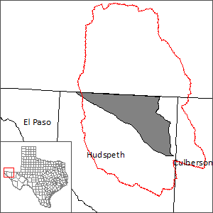
Bone Spring-Victorio Peak Aquifer Groundwater Availability Model (GAM)
 In 2008, the El Paso Water Utilities has completed a study to better understand the potential groundwater yield of the Bone Spring-Victorio Peak Aquifer in support of the regional water planning process. This work resulted in the development and calibration of three groundwater models: the first model looked at the regional structural geology; the second model included groundwater isotope geochemistry data; and the third model was a hybrid of the first two models. In 2016, the Texas Water Development Board adopted the hybrid model as the official Bone Spring-Victorio Peak Aquifer Groundwater Availability Model.
Current GAM
Model Report
Model Files and Associated Data
Please see the GAM files download page for the current model files and associated data.
Stakeholder Advisory Forums (SAF)
| ID | Date | Location |
|---|---|---|
| SAF 1 | 1/14/2016 | Van Horn, Texas - Culberson Country Groundwater Conservation District |
Other Resources
Please see the Bone Spring-Victorio Peak Aquifer page for other reports and publications.
For model runs see the GMA 4 page.