Region 9 Upper Colorado Flood Planning Region
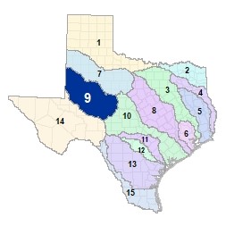 The upper reaches of the Colorado River and its tributaries flow from the High Plains ecoregion near the Texas-New Mexico border towards the Edwards Plateau. The Upper Colorado and Concho Rivers merge at O.H. Ivie Reservoir, which marks the border between the Upper Colorado (Region 9) and Lower Colorado-Lavaca (Region 10) Flood Planning Regions. There are 15 major lakes and reservoirs in this region.
For a detailed map of Region 9, please visit the Texas Geographic Information Office (TxGIO) Flood Planning Regions Map Collection.
Go to Region 9 Upper Colorado RFPG External Host Website
Population Estimate (2019): 629,788
Approximate Area: 21,254 square miles
Approximate Stream Miles: 8,044
Approximate NFIP Claims (1975-2019): $5,860,005
Counties Represented:
- Andrews*
- Borden*
- Cochran
- Coke
- Coleman*
- Concho*
- Crockett*
- Dawson*
- Ector*
- Gaines
- Garza*
- Glasscock
- Hockley*
- Howard
- Irion
- Lynn*
- Martin
- Menard*
- Midland*
- Mitchell*
- Nolan*
- Reagan*
- Runnels*
- Schleicher*
- Scurry*
- Sterling
- Taylor*
- Terry*
- Tom Green
- Upton*
- Winkler*
- Yoakum
*indicates this county is partially within this RFPG and is also represented by at least one other RFPG
Major Cities (Population greater than 25,000):
- Big Spring
- Midland
- Odessa
- San Angelo
- West Odessa
Major Lakes & Reservoirs:
- Champion Creek Reservoir
- E V Spence Reservoir
- Lake Ballinger / Lake Moonen
- Lake Colorado City
- Lake J B Thomas
- Lake Nasworthy
- Lake Winters / New Lake Winters
- Mitchell County Reservoir
- Natural Dam Lake
- O C Fisher Lake
- O H Ivie Reservoir
- Oak Creek Reservoir
- Red Draw Reservoir
- Sulphur Springs Draw Storage Reservoir
- Twin Buttes Reservoir
Ecoregions of Texas Represented:
- Edwards Plateau
- High Plains
- Rolling Plains
- Trans-Pecos
Regional Flood Planning Group Meeting Minutes & Updates
Please see the RFPG Meeting Schedule webpage for information on the past and upcoming meetings.
Contacts
Planning Group Chair:Allison Strube, (325) 657-4209
Sponsor Contact: City of San Angelo, Shane Kelton, (325)-657-4209
TWDB Contact: Belle Gonzalez, (512) 463-5067