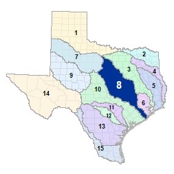
Region 8 Lower Brazos Flood Planning Region
 After exiting Possum Kingdom Lake in Northwest Palo Pinto County, the lower Brazos River crosses a diversity of ecoregions of Texas. The river runs through Waco and College Station on its way to the coast, where it enters the Gulf of Mexico near Lake Jackson and Freeport. Important tributaries of the Lower Brazos include the Paluxy River, the Bosque River, the Little River, the Nolan River, the Leon River, the San Gabriel River, the Lampasas River, and the Navasota River. There are 30 major lakes and reservoirs in the Lower Brazos Region.
For a detailed map of Region 8, please visit the Texas Geographic Information Office (TxGIO) Flood Planning Regions Map Collection.
Go to Region 8 Lower Brazos RFPG External Host Website
Population Estimate (2019): 2,737,859
Approximate Area: 23,442 square miles
Approximate Stream Miles: 19,720
Approximate NFIP Claims (1975-2019): $548,937,763
Counties Represented:
- Archer*
- Austin*
- Bastrop*
- Bell
- Bosque
- Brazoria*
- Brazos
- Brown*
- Burleson
- Burnet*
- Callahan*
- Comanche*
- Coryell
- Eastland*
- Erath
- Falls
- Fort Bend*
- Freestone*
- Grimes*
- Hamilton
- Hill*
- Hood*
- Jack*
- Johnson*
- Lampasas*
- Lee*
- Leon*
- Limestone*
- Madison*
- McLennan
- Milam
- Mills*
- Palo Pinto
- Parker*
- Robertson
- Somervell
- Stephens*
- Waller*
- Washington
- Williamson
- Young*
*indicates this county is partially within this RFPG and is also represented by at least one other RFPG
Major Cities (Population greater than 25,000):
- Alvin*
- Austin*
- Bryan
- Cedar Park*
- Cleburne
- College Station
- Copperas Cove
- Fort Hood
- Georgetown
- Harker Heights
- Killeen
- Lake Jackson
- Leander*
- Missouri City*
- Rosenberg*
- Round Rock*
- Sugar Land*
- Temple
- Waco
- Weatherford*
*indicates this city is partially within this RFPG and is also represented by at least one other RFPG
Major Lakes & Reservoirs:
- Alcoa Lake
- Aquilla Lake
- Belton Lake
- Brazoria Reservoir
- Bryan Utilities Lake
- Camp Creek Lake
- Eagle Nest Lake / Manor Lake
- Gibbons Creek Reservoir
- Granger Lake
- Lake Creek Lake
- Lake Georgetown
- Lake Graham
- Lake Granbury
- Lake Leon
- Lake Limestone
- Lake Mexia
- Lake Mineral Wells
- Lake Palo Pinto
- Lake Pat Cleburne
- Lake Waco
- Lake Whitney
- Possum Kingdom Lake
- Proctor Lake
- Smithers Lake
- Somerville Lake
- Comanche Creek Reservoir
- Stillhouse Hollow Lake
- Tradinghouse Creek Reservoir
- Twin Oak Reservoir
- William Harris Reservoir
Ecoregions of Texas Represented:
- Blackland Prairie
- Cross Timbers
- Gulf Prairies
- Post Oak Savanah
- Rolling Plains
Regional Flood Planning Group Meeting Minutes & Updates
Please see the RFPG Meeting Schedule webpage for information on the past and upcoming meetings.
Contacts
Planning Group Sponsor Contact: Brazos River Authority, Pamela Hannemann, (254) 761-3135
Planning Group Chair: Alysha Girard, (512) 652-3536
TWDB Contact:Alexis Morganroth, EIT, (512) 463-2449