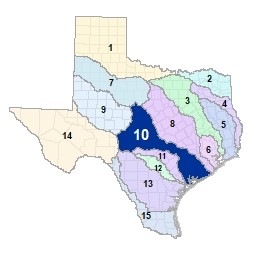
Region 10 Lower Colorado-Lavaca Flood Planning Region
 As the lower Colorado River emerges from O.H. Ivie Reservoir, it crosses the High Plains and Cross Timbers ecoregions on its way to the Edwards Plateau. The San Saba, Llano, Pedernales Rivers and their many tributaries all feed the lower Colorado as it passes through the Highland Lakes of central Texas. The lower Colorado makes its final dam crossing at the end of Lady Bird Lake in Austin on its way to Matagorda Bay. From its headwaters in Gonzales County, the Lavaca River flows to Lavaca Bay, which drains to the Gulf of Mexico. There are 20 major lakes and reservoirs in the Lower Colorado-Lavaca region, and no other river system crosses as many ecoregions along its course.
For a detailed map of Region 10, please visit the Texas Geographic Information Office (TxGIO) Flood Planning Regions Map Collection.
Go to Region 10 Lower Colorado-Lavaca RFPG External Host Website
Population Estimate (2019): 1,877,786
Approximate Area: 24,380 square miles
Approximate Stream Miles: 20,493
Approximate NFIP Claims (1975-2019): $354,032,694
Counties Represented:
- Austin*
- Bastrop*
- Blanco*
- Brazoria*
- Brown*
- Burnet*
- Caldwell*
- Calhoun*
- Callahan*
- Coleman*
- Colorado
- Comanche*
- Concho*
- De Witt*
- Eastland*
- Edwards*
- Fayette*
- Fort Bend*
- Gillespie*
- Gonzales*
- Hays*
- Jackson
- Kendall*
- Kerr*
- Kimble
- Lampasas*
- Lavaca*
- Lee*
- Llano
- Mason
- Matagorda
- McCulloch
- Menard*
- Mills*
- Real*
- Runnels*
- San Saba
- Schleicher*
- Sutton*
- Taylor*
- Travis*
- Victoria*
- Wharton
*indicates this county is partially within this RFPG and is also represented by at least one other RFPG
Major Cities (Population greater than 25,000):
- Austin*
- Cedar Park*
- Leander*
- Pflugerville
- Rosenberg*
- Round Rock*
- Victoria*
*indicates this city is partially within this RFPG and is also represented by at least one other RFPG
Major Lakes & Reservoirs:
- Brady Creek Reservoir
- Cedar Creek Reservoir Colorado
- Cox Lake / Raw Water Lake / Recycle Lake
- Eagle Lake
- Hords Creek Lake
- Inks Lake
- Lake Austin
- Lake Bastrop
- Lake Brownwood
- Lake Buchanan
- Lake Clyde
- Lake Coleman
- Lake Lyndon B Johnson
- Lake Marble Falls
- Lake Texana
- Lake Travis
- Lake Walter E Long
- Mud Lake No. 4
- O H Ivie Reservoir
- South Texas Project Reservoir
Ecoregions of Texas Represented:
- Blackland Prairie
- Cross Timbers
- Edwards Plateau
- Gulf Prairies
- Post Oak Savanah
- Rolling Plains
Regional Flood Planning Group Meeting Minutes & Updates
Please see the RFPG Meeting Schedule webpage for information on the past and upcoming meetings.
Contacts
Planning Group Sponsor Contact: Lower Colorado River Authority, Lauren Graber, (512) 578-7085
Planning Group Chair: Phillip Spenrath, (979) 532-4612
TWDB Contact: Belle Gonzalez, (512) 463-5067