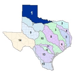
Region 1 Canadian-Upper Red Flood Planning Region
 Twenty-one (21) major lakes and reservoirs are located completely or partially within this region along the Canadian River in the panhandle and the upper reaches of the Red River and their many tributaries along Texas�s Northern border. The Pease River, Wichita River and Little Wichita River feed the Upper Red River before it enters Lake Texoma in the adjacent Region 2. Region 1 includes large expanses of the High and Rolling Plains in the Texas panhandle.
For a detailed map of Region 1, please visit the Texas Geographic Information Office (TxGIO) Flood Planning Regions Map Collection.
Go to Region 1 Canadian-Upper Red RFPG External Host Website
Population Estimate (2019): 603,648
Approximate Area: 34,616 square miles
Approximate Stream Miles: 20,223
Approximate NFIP Claims (1975-2019): $29,850,539
Counties Represented:
- Archer*
- Armstrong
- Baylor*
- Briscoe
- Carson
- Castro*
- Childress
- Clay*
- Collingsworth
- Cooke*
- Cottle
- Crosby*
- Dallam
- Deaf Smith
- Dickens*
- Donley
- Floyd*
- Foard
- Gray
- Hale*
- Hall
- Hansford
- Hartley
- Hemphill
- Hutchinson
- King*
- Knox*
- Lipscomb
- Montague*
- Moore
- Motley
- Ochiltree
- Oldham
- Parmer*
- Potter
- Randall
- Roberts
- Sherman
- Swisher*
- Wheeler
- Wichita
- Wilbarger
- Young*
*indicates this county is partially within this RFPG and is also represented by at least one other RFPG
Major Cities (Population greater than 25,000):
- Amarillo
- Wichita Falls
Major Lakes & Reservoirs:
- Baylor Lake
- Bivins Lake
- Buffalo Lake
- Farmer's Creek Reservoir
- Greenbelt Lake
- Hubert H Moss Lake
- Lake Arrowhead
- Lake Diversion
- Lake Electra
- Lake Kemp
- Lake Kickapoo
- Lake Meredith
- Lake Olney / Lake Cooper
- Lake Pauline
- Lake Rita Blanca
- Lake Wichita
- Mackenzie Reservoir
- North Fork Buffalo Creek Reservoir
- Palo Duro Reservoir
- Santa Rosa Lake
- Truscott Brine Lake
Ecoregions of Texas Represented:
- Cross Timbers
- High Plains
- Rolling Plains
Regional Flood Planning Group Meeting Minutes & Updates
Please see the RFPG Meeting Schedule webpage for information on the past and upcoming meetings.
Contacts
Planning Group Sponsor Contact: Panhandle Regional Planning Commission, Alex Guerrero, (806) 372-3381
Planning Group Chair: Shawn Ballew, (806) 639-2145
TWDB Contact:Luz Lumb, (512) 475-1578