Region L Planning Group
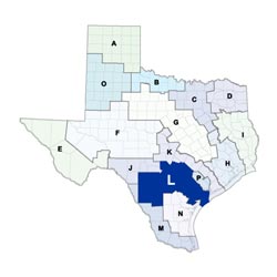 Reaching from the Gulf Coast to the Hill Country, the South Central Texas Regional Water Planning Area includes all or parts of 21 counties, portions of nine river and coastal basins, the Guadalupe Estuary, and San Antonio Bay. The largest cities in the region are San Antonio, Victoria, San Marcos, and New Braunfels. The region's largest economic sectors are tourism, military, medical, service, manufacturing, and retail trade. The region contains the two largest springs in Texas: Comal and San Marcos. Water planning in the region is particularly complex because of the intricate relationships between the region's surface and groundwater resources. With limited local water resources, the region will rely on water supplies from outside the region to meet its future needs.
For a detailed map of Region L, please visit the Texas Geographic Information Office (TxGIO) Regional Water Planning Area Map Collection.
South Central Texas (Region L) RWPG External Website
Region L Counties
- Atascosa
- Bexar
- Caldwell
- Calhoun
- Comal
- DeWitt
- Dimmit
- Frio
- Goliad
- Gonzales
- Guadalupe
- Hays (partial)
- Kendall
- Karnes
- La Salle
- Medina
- Refugio
- Uvalde
- Victoria
- Wilson
- Zavala
Meeting Minutes & Updates
Meeting Minutes: visit the "Meetings" link on Region L's External Website for official planning group meeting minutes.
Next Meeting: Please see the Upcoming Regional Water Planning Group Meetings webpage for information on the next Region L meeting.
Region L Bylaws
Region L Water Plans
Projections Data
Region L Related Links
- San Antonio Water System
- Guadalupe-Blanco River Authority
- Edwards Aquifer Authority
- Groundwater Management Areas - GMAs 7, 9, 10, 13, and 15 overlap Region L
TWDB Contacts for Region L
For regional water planning assistance, please contact Michele Foss, Region L Planner.
For regional water project development assistance, please contact Dain Larsen, Team 5 Manager.