Geographic Information System (GIS) Data
GIS data are available as shapefiles and rasters in compressed .zip or .zipx formats. See the BRACS database data dictionary for field name explanations.

Contents
BRACS program point datasets
GIS point data for well locations exported from the BRACS database, updated quarterly. The database is a "living" database, and interpretations may be modified by overlapping studies. If you need identical data to a specific BRACS study, download the BRACS study dataset.
These datasets use the geographic coordinate system NAD83. All depth values are in feet.
Updated December 2025.
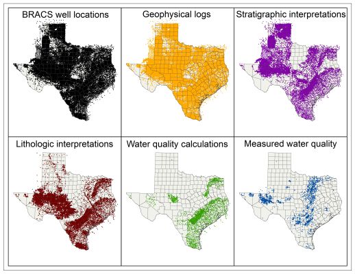
BRACS well locations
The locations of all wells in the BRACS database.
BRACS geophysical logs
Download logs directly by copying and pasting the weblink text into an internet browser.
BRACS stratigraphic interpretations
Depth in feet of the top and bottom of geologic formations.
BRACS lithologic interpretations
Depth in feet of the top and bottom of interpreted lithologies.
BRACS water quality calculations
Total dissolved solid concentrations calculated from geophysical well logs.
BRACS measured water quality
Measured water quality analyses manually entered into the BRACS database from various sources. Some of these data are duplicates of sample data housed in the TWDB Groundwater Database.
BRACS study datasets
GIS datasets for completed BRACS studies. These datasets use a custom projected coordinate system based on the geographic coordinate system NAD83 and the Albers projection, which may be downloaded at the bottom of this page.
Blaine Aquifer (Contract Number 1600011948)
Blossom Aquifer (Contract Number 1600011951)
Eastern Portion of the Sparta Aquifer (Report 390)
Edwards-Trinity (Plateau) Aquifer (IN PROGRESS)
Gulf Coast Aquifer (Contract Number 1600011947)
Gulf Coast Aquifer, Lower Rio Grande Valley (Report 383)
Hill Country Trinity aquifer (Report 388)
Lipan Aquifer (Report 384)
Nacatoch Aquifer (Contract Number 1600011952)
Northern Trinity Aquifer (Technical Note 19-1)
Pecos Valley Aquifer (Report 382)
Rustler Aquifer (Contract Number 1600011949)
Upper Coastal Plains aquifers, Central Texas (Report 385)
Brackish Groundwater Production Zone (BGPZ) boundaries
BGPZ boundaries designated as of 3/28/2019
 Polygons of current brackish groundwater production zones designated by the TWDB.
Other state-wide datasets
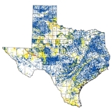
Total Dissolved Solid Values for Wells from the Groundwater Database
 Point locations of the most recent water quality samples for Total Dissolved Solids (TDS) obtained from wells in the Texas Water Development Board Groundwater Database. Geographic projection is NAD83. The data was assembled with queries in the Microsoft Access Groundwater Database. Well sites may be viewed and queried online in an interactive map: Water Data Interactive (WDI). This file was updated in 2024. More information is available in the metadata included with the files.
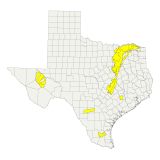
Lateral Extent of Brackish Aquifers in Texas
 The brackish footprint polygons represent regions in Texas underlain by aquifers with existing samples in the Groundwater Database that have a total dissolved solids concentration between 1,000 and 9,999 milligrams per liter (mg/L). This data was originally produced in 2003 by a contractor and is periodically updated by BRACS staff. The last update was in May 2024.
Custom projected coordinate system
TWDB-GAM custom coordinate system file
ESPG code 10481
 This custom coordinate system, which is used for BRACS studies, was developed by combining the NAD83 geographic coordinate system with a modified Albers projection. The coordinate system parameters are listed in the following text file:
Coordinate system parameters (text)
Brackish groundwater maps

Major and Minor Brackish Aquifers of Texas Last revised: May 21, 2024

Distribution of Brackish Water Wells in the TWDB Groundwater Database Last revised: May 21, 2024

Distribution of Brackish Water Wells from the TWDB Groundwater Database in Major and Minor Aquifers Last revised: May 21, 2024

Distribution of Fresh and Brackish Water Wells in the TWDB Groundwater Database Last revised: May 21, 2024
Contact us
If you have any questions, please contact Kristie Laughlin (512-475-1748) or Evan Strickland (512-463-6929).
Except where noted, all of the information provided is believed to be accurate and reliable; however, TWDB assumes no responsibility for any errors. Further, TWDB assumes no responsibility for the use of the information provided. PLEASE NOTE that users of these data are responsible for checking the accuracy, completeness, currency and/or suitability of all information themselves. TWDB makes no guarantees or warranties as to the accuracy, completeness, currency, or suitability of the information provided via the BRACS Database. TWDB specifically disclaims any and all liability for any claims or damages that may result from providing BRACS data or the information it contains.
