Flood Planning Data
The primary purpose of the flood planning data webpage is to support the regional flood planning groups (RFPG).
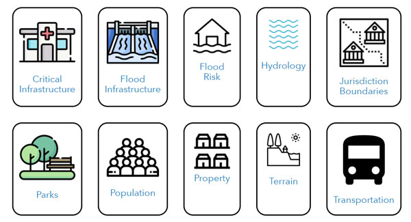
Flood Planning Data Hub
The Flood Planning Data Hub is the source for information compiled by the TWDB for the regional flood planning groups. This includes resources from many entities.
Key Datasets from TWDB
Regional Flood Planning Geodatabase Template
The TWDB generated template GIS geodatabases with multiple feature classes and tables for the RFPGs. Each planning group must fill the template geodatabase with relevant regional flood planning data. Template file geodatabases for each flood planning region can be found under the Geodatabase Templates link in the top blue bar on the Hub. These geodatabases contain feature classes and fields to match the specifications for the RFPGs in Exhibit D: Data Submittal Guidelines for Regional Flood Planning. They are empty except for the Entities feature class which has been populated with entities in the region.
Floodplain Quilt
The floodplain quilt is a comprehensive coverage of existing statewide flood hazard information. This is prepared by TWDB to provide the RFPGs with a common starting point for their own compilation of flood risk data in their regions. The RFPGs are expected to confirm, update, and otherwise enhance the initial floodplain quilt information as appropriate to prepare the deliverables required for their flood risk analyses tasks.
The Floodplain Quilt geodatabase includes Cursory Floodplain (2021) data, and is available for download under Flood Risk on the Hub.
The floodplain quilt is �sewn� together from various sources of data (National Flood Hazard Layer, Base Level Engineering, etc.) to provide one location for all layers. The quilt prioritizes layer types and shows the top layer type available for a particular area. For more information, see the Floodplain Quilt Prioritization overview.
An additional Cursory Floodplain dataset is available for areas not covered by the Quilt.
Building Data with Population and Social Vulnerability Index
Buildings with associated population estimates and Social Vulnerability Index are available in both the Property and Population categories on the Hub. Population estimates are based on Landscan Data from Oak Ridge National Laboratory. The RFPGs are expected to confirm, update, and otherwise enhance the building population estimates as appropriate to prepare the deliverables required for their flood risk analyses tasks.
Comprehensive List of FMEs, FMPs, and FMSs from 1st Planning Cycle
- 2020 - 2023 FME, FMP, FMS Information: The following spreadsheet contains the compiled Flood Management Evaluation (FME), Flood Mitigation Projects (FMP) and Flood Management Strategies (FMS) submitted by the fifteen regional flood planning groups in the 2023 amended regional flood plans. These are based on post-RFI submittals by the RFPGs.
External Resources
- USGS BLE Viewer (on the Hub under Flood Risk)
- Federal Emergency Management Agency (FEMA) National Flood Hazard Layer (on the Hub under Flood Risk)
- Interagency Flood Risk Management (InFRM) Flood Decision Support Toolbox (on the Hub under Flood Risk). The Flood Decision Support Toolbox is intended to communicate the possible extent of flooding in the vicinity of a stream gage. See the User Guide for more information.
- Hurricane Harvey - Local, Regional & State Planning - Texas General Land Office (GLO)
- GLO River Basin Flood Study is a one-time planning effort which will result in detailed flood risk information and mitigation strategies for areas affected by disaster declarations for Hurricane Harvey and Lower Rio Grande Valley flooding in 2015 or 2016.
- Texas Integrated Flooding Framework (TIFF), led by the Texas Water Development Board, U.S. Army Corps of Engineers, and U.S. Geological Survey, will develop the guidelines and processes for implementing an integrated framework to model, visualize, and plan for the risk of coastal flooding in counties affected by Hurricane Harvey over the next four years.
- IDRT Flood Risk Identification Tool (on the Hub under Flood Risk). The Institute for a Disaster Resilient Texas (IDRT) recently updated and improved the original tool for identifying flood risk across 14 counties along the Upper Texas coast. New features include: (1) more explanation of how statistical machine learning techniques are used to identify expected flood impacts based on parcel-level flood damage claims; (2) different return periods/probability of flood events; and (3) a comparison section that allows a user to scroll between traditional physics-based FEMA flood plain designations and IDRT's "damage-plain" approach.