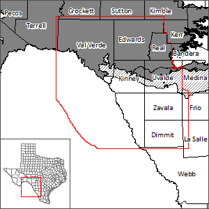
Kinney County Groundwater Flow Model
Kinney County Groundwater Conservation District requested an evaluation of its groundwater resources and the effects of potential groundwater withdrawal at wells on springs and river flows. Specifically, the county was interested in maintaining reasonable flows at the three largest springs (Las Moras, Mud, and Pinto springs) under potential future groundwater use conditions. As a result, TWDB developed this new groundwater flow model to address groundwater issues concerning the Edwards (Balcones Fault Zone) and Edwards-Trinity (Plateau) aquifers that underlie Kinney County.
Model Report
Model Files
Please see the GAM files download page for model files.
Other Resources
Please see the Edwards (Balcones Fault Zone) Aquifer, Edwards-Trinity (Plateau) Aquifer, Edwards-Trinity (Plateau) and Pecos Valley Aquifers GAM, and Edwards-Trinity (Plateau) and Pecos Valley Aquifers One Layer Model pages for other reports and publications.