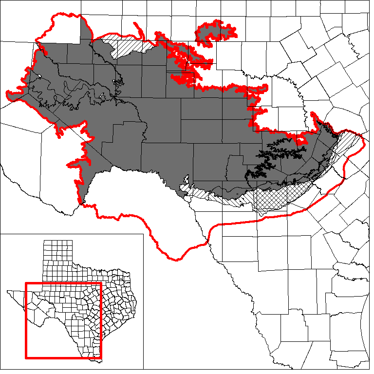
Edwards-Trinity (Plateau) and Pecos Valley aquifersGroundwater Availability Model (GAM)
The Texas Water Development Board has developed a model of the Edwards-Trinity (Plateau) Aquifer that includes the Pecos Valley Aquifer. The model was completed in 2004.
The Texas Water Development Board contracted with URS Corporation in 2008 to determine the feasibility of the groundwater availability modeling program using parameter estimation (PEST) techniques and a high performance computing cluster to calibrate models, using the groundwater availability model for the Edwards-Trinity (Plateau) and Pecos Valley aquifers. The re-calibration project: (1) included stakeholder involvement; and (2) followed all TWDB protocols and standards for groundwater availability models.
Model Report
Model Files
Please contact the GAM Section (512-936-0871) for a copy of the model files.
Model Grid
Model grid cells are geographically assigned to counties, groundwater conservation districts, river basins, groundwater management areas, and regional water planning areas within the model study area using a centroid based approach. The model grid is available in ESRI® shapefile format and comma-delimited text file.
Aquifer Data
Aquifer data is only available as a package for the entire model area and requires GIS software for processing. Due to the size of raw/source data files for this model, this information has not been posted on the web. To request the raw/source data, contact the GAM Section (512-936-0871).
Stakeholder Advisory Forums (SAF)
Send us an email if you would like to receive SAF notifications.
| ID | Date | Location |
|---|---|---|
| PEST SAF 2 | 10/14/2009 | Fredericksburg, Texas - Central Electric Co-Op (386 Friendship Lane) |
| PEST SAF 1 | 12/11/2008 | Sonora, Texas - First United Methodist Church (201 North Water Ave.) |
| SAF 6 | 7/28/2004 | Ozona, Texas - Crockett County Extension Office (1301 Avenue AA) |
| SAF 5 | 11/7/2002 | Big Lake, Texas - Santa Rita Underground Water Conservation District |
| SAF 4 | 6/25/2002 | Ozona, Texas - Crockett County Extension Office (1301 Avenue AA) |
| SAF 3 | 2/11/2002 | Ozona, Texas - Crockett County Extension Office (1301 Avenue AA) |
| SAF 2 | 8/29/2001 | Sonora, Texas - Four-H Civic Center |
| SAF 1 | 5/16/2001 | Sonora, Texas - Four-H Civic Center |
Other Resources
Please see the Edwards-Trinity (Plateau) and Pecos Valley aquifer pages and the Alternative One Layer Groundwater Flow Model of the Edwards-Trinity (Plateau) and Pecos Valley Aquifers page for other reports and publications.
For model runs see the GMA 3, GMA 4, GMA 7, and GMA 9 pages.