Region O Planning Group
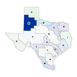 The Llano Estacado (Region O) Regional Water Planning Area encompasses 21 counties in the southern High Plains of Texas. From Garza County in the southeast to Deaf Smith County in the northwest, the region lies within the upstream parts of four major river basins (Canadian, Red, Brazos, and Colorado). Despite this fact, almost no surface water leaves the region, as more than 95 percent is captured by the region's estimated 14,000 playa basins. Groundwater from the Ogallala Aquifer is the region's primary source of water and is used at a rate that exceeds recharge. The largest economic sectors in the region are livestock operations and agricultural crops, with its cotton production equaling about 60 percent of the state's total crop. Major cities in the region include Lubbock, Plainview, Levelland, Lamesa, Hereford, and Brownfield.
For a detailed map of Region O, please visit the Texas Geographic Information Office (TxGIO) Regional Water Planning Area Map Collection.
Llano Estacado (Region O) RWPG External Website
Region O Counties
- Bailey
- Briscoe
- Castro
- Cochran
- Crosby
- Dawson
- Deaf Smith
- Dickens
- Floyd
- Gaines
- Garza
- Hale
- Hockley
- Lamb
- Lubbock
- Lynn
- Motley
- Parmer
- Swisher
- Terry
- Yoakum
Meeting Minutes & Updates
Meeting Minutes: Visit the "Minutes" link on Region O's External Website for official planning group meeting minutes.
Next Meeting: Please see the Upcoming Regional Water Planning Group Meetings webpage for information on the next Region O meeting.
Region O Bylaws
Region O Water Plans
Projections Data
Region O Related Links
- South Plains Association of Governments
- Groundwater Management Areas- GMAs 2 and 6 overlap Region O
TWDB Contacts for Region O
For regional water planning assistance, please contact Kevin Smith, Region O Planner.
For regional water project development assistance, please contact Theresa Finch, Team 1 Manager.