Region J Planning Group
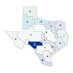 Located on the southern edge of the Edwards Plateau, the six-county Plateau Regional Water Planning Area stretches from the United States-Mexican border in the west to the Texas Hill Country in the east. The region includes portions of the Colorado, Guadalupe, Nueces, Rio Grande, and San Antonio river basins. Land use in the western portion of the region is primarily range land, while the eastern portion is a mix of forest land, range land, and agricultural areas. The economy of the Plateau region's six counties is based on tourism, hunting, ranching, and government (primarily Laughlin Air Force Base in Del Rio). Major cities in the region include Kerrville and Del Rio.
For a detailed map of Region J, please visit the Texas Geographic Information Office (TxGIO) Regional Water Planning Area Map Collection.
Plateau (Region J) RWPG External Website
Region J Counties
- Bandera
- Edwards
- Kerr
- Kinney
- Real
- Val Verde
Meeting Minutes & Updates
Meeting Minutes: Visit Region J's External Website link for official planning group meeting minutes.
Next Meeting: Please see the Upcoming Regional Water Planning Group Meetings webpage for information on the next Region J meeting.
Region J Bylaws
Region J Water Plans
Projections Data
Region J Related Links
- Upper Guadalupe River Authority (UGRA)
- Groundwater Management Areas - GMAs 7, 9, and 10 overlap Region J
TWDB Contacts for Region J
For regional water planning assistance, please contact Lann Bookout, Region J Planner.
For regional water project development assistance, please contact David Firgens, Team 5 Manager.