Report 4 by G. H. Shafer, U.S. Geological Survey | November 1965 (Second Printing November 1978)
Report 4 - Ground-Water Resources of Gonzales County, Texas (pdf - 7.07MB)
Figures
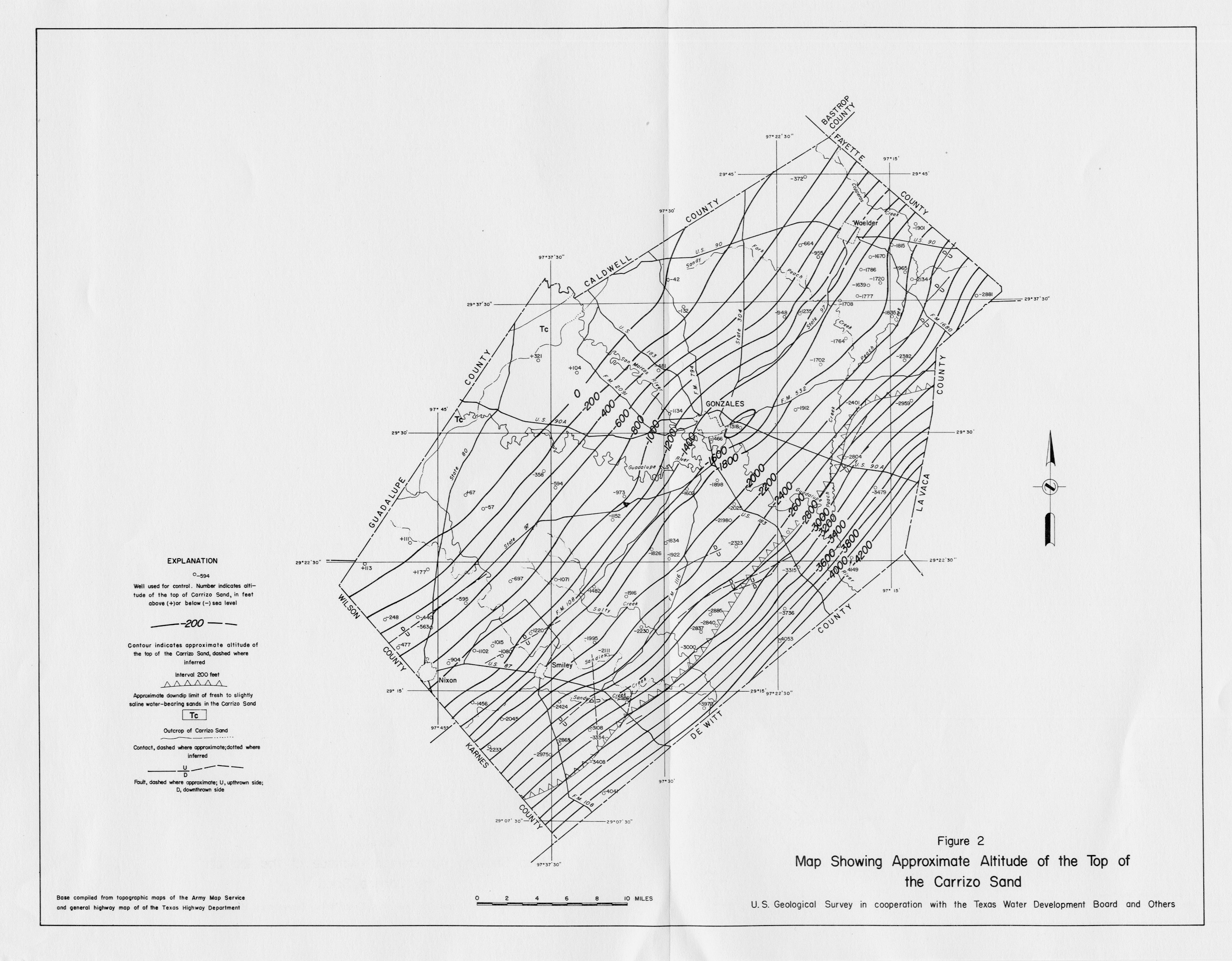
- Figure 2 - Map Showing Approximate Altitude of the Top of the Carrizo Sand
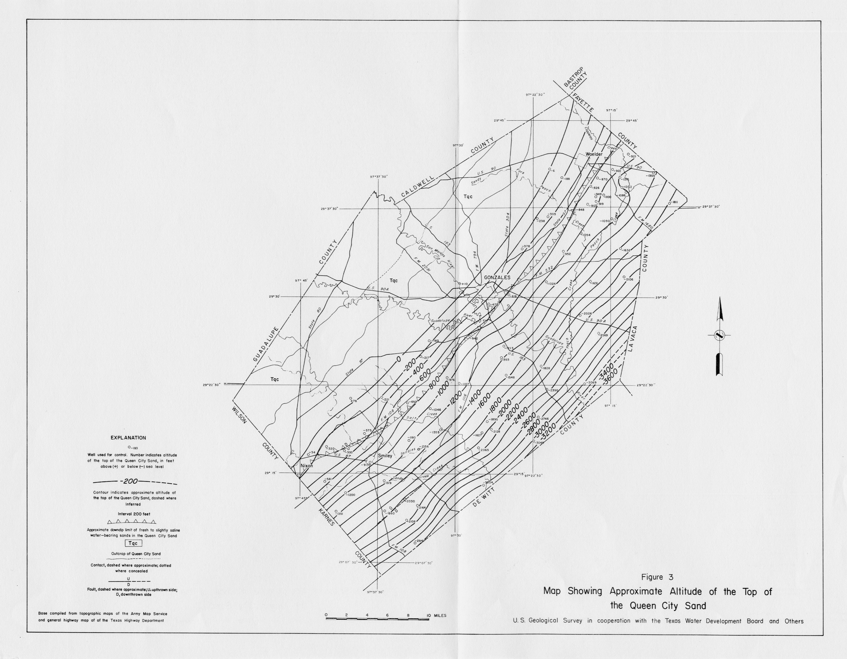
- Figure 3 - Map Showing Approximate Altitude of the Top of the Queen City Sand
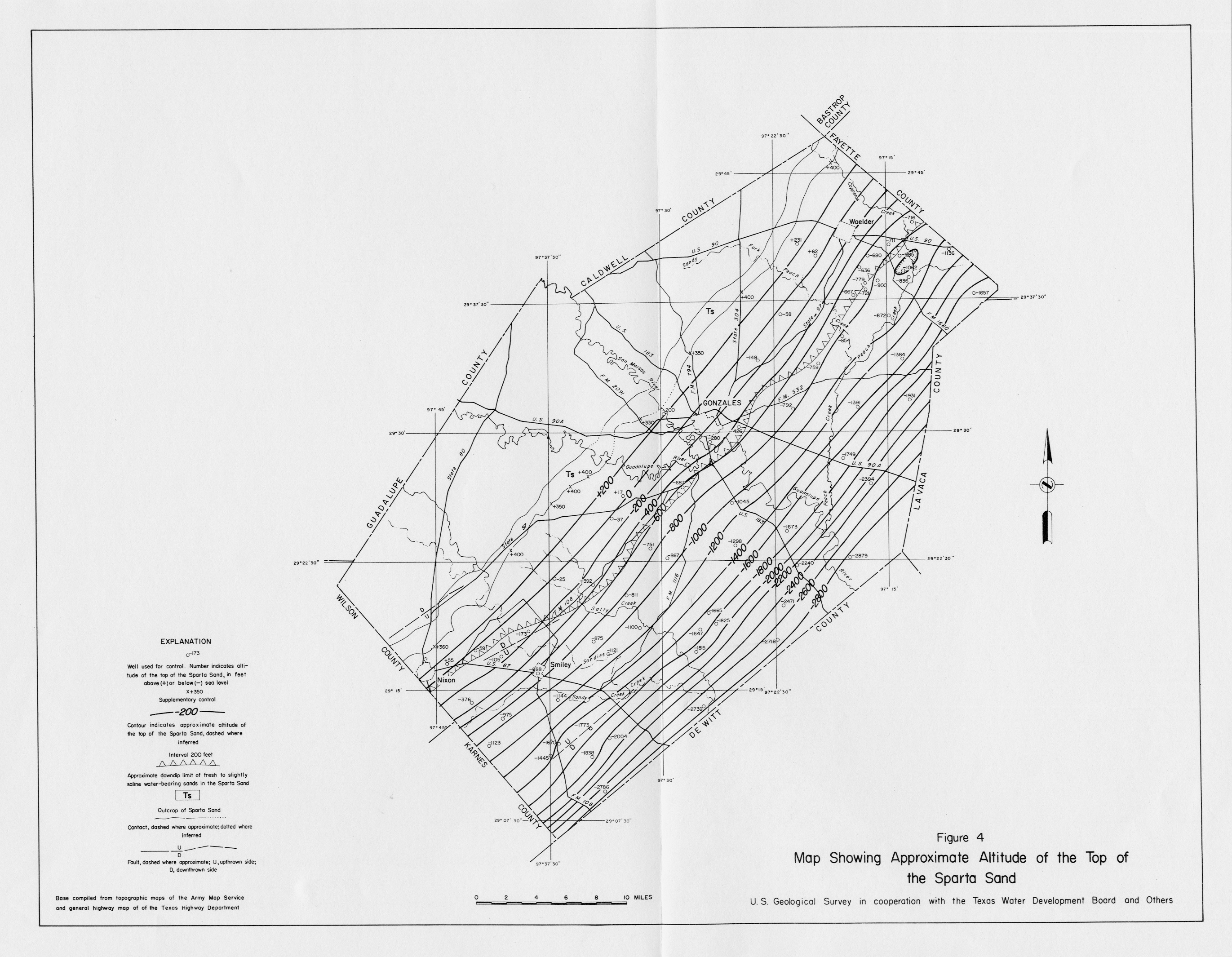
- Figure 4 - Map Showing Approximate Altitude of the Top of the Sparta Sand
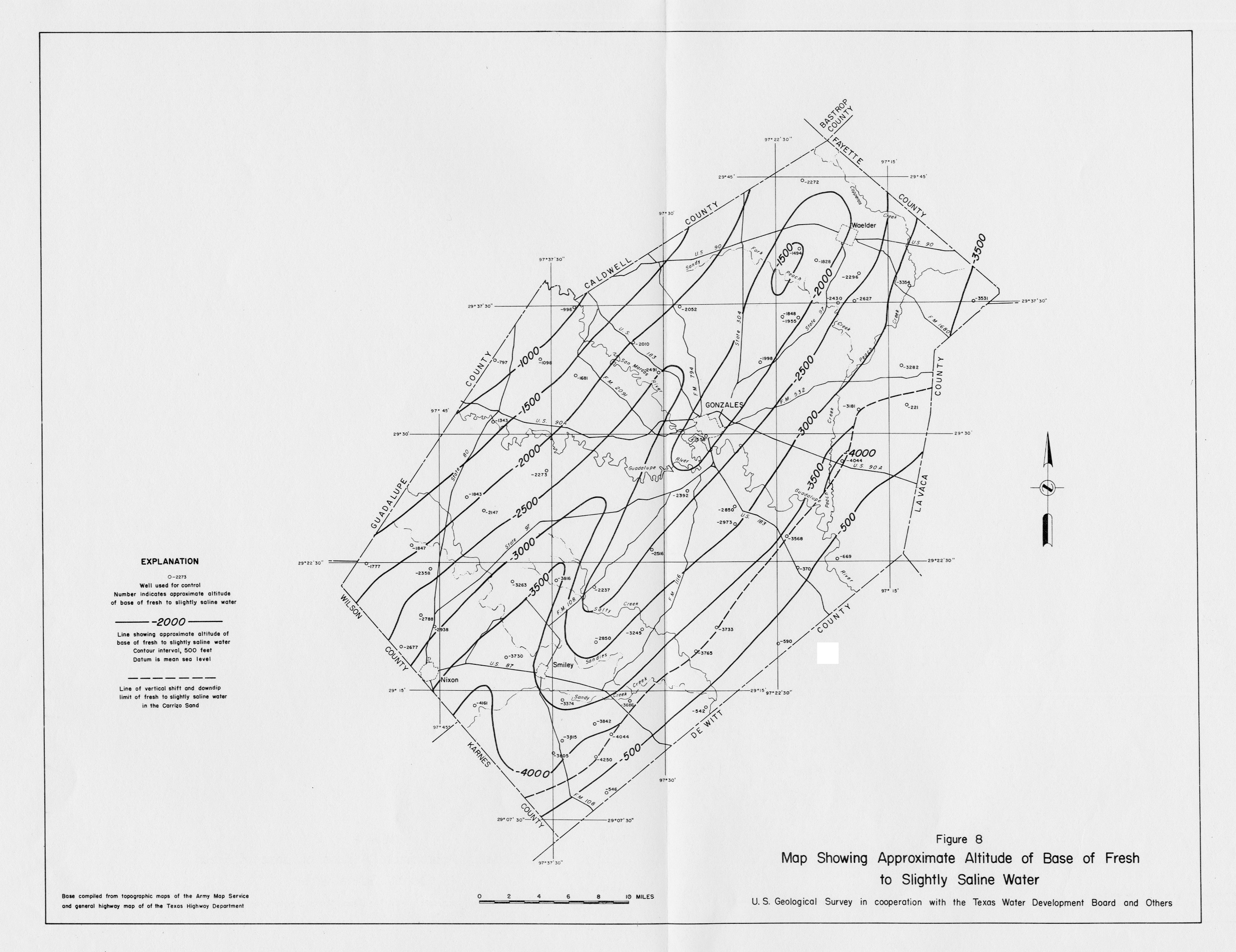
- Figure 8 - Map Showing Approximate Altitude of Base of Fresh to Slightly Saline Water
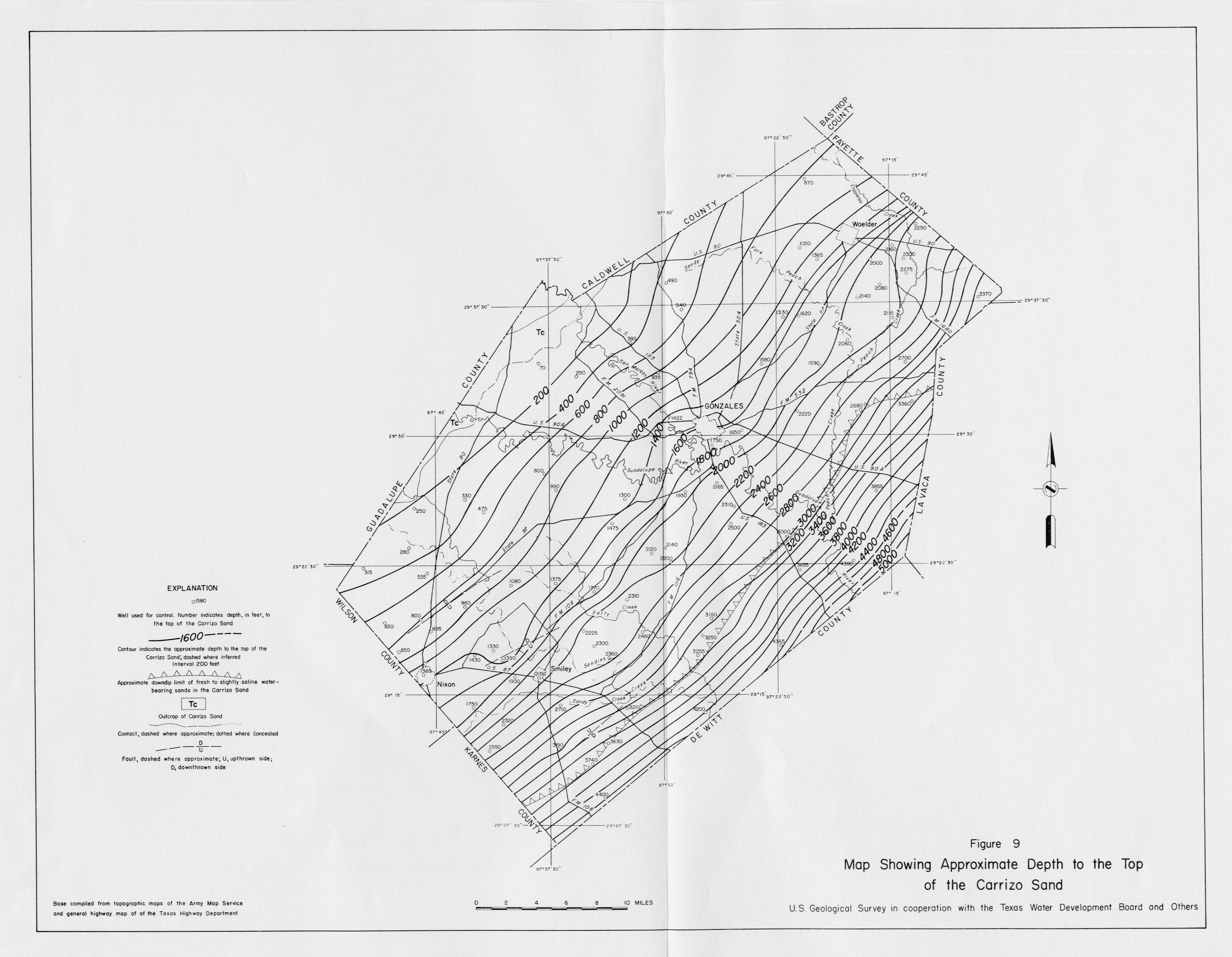
- Figure 9 - Map Showing Approximate Depth to the Top of the Carrizo Sand
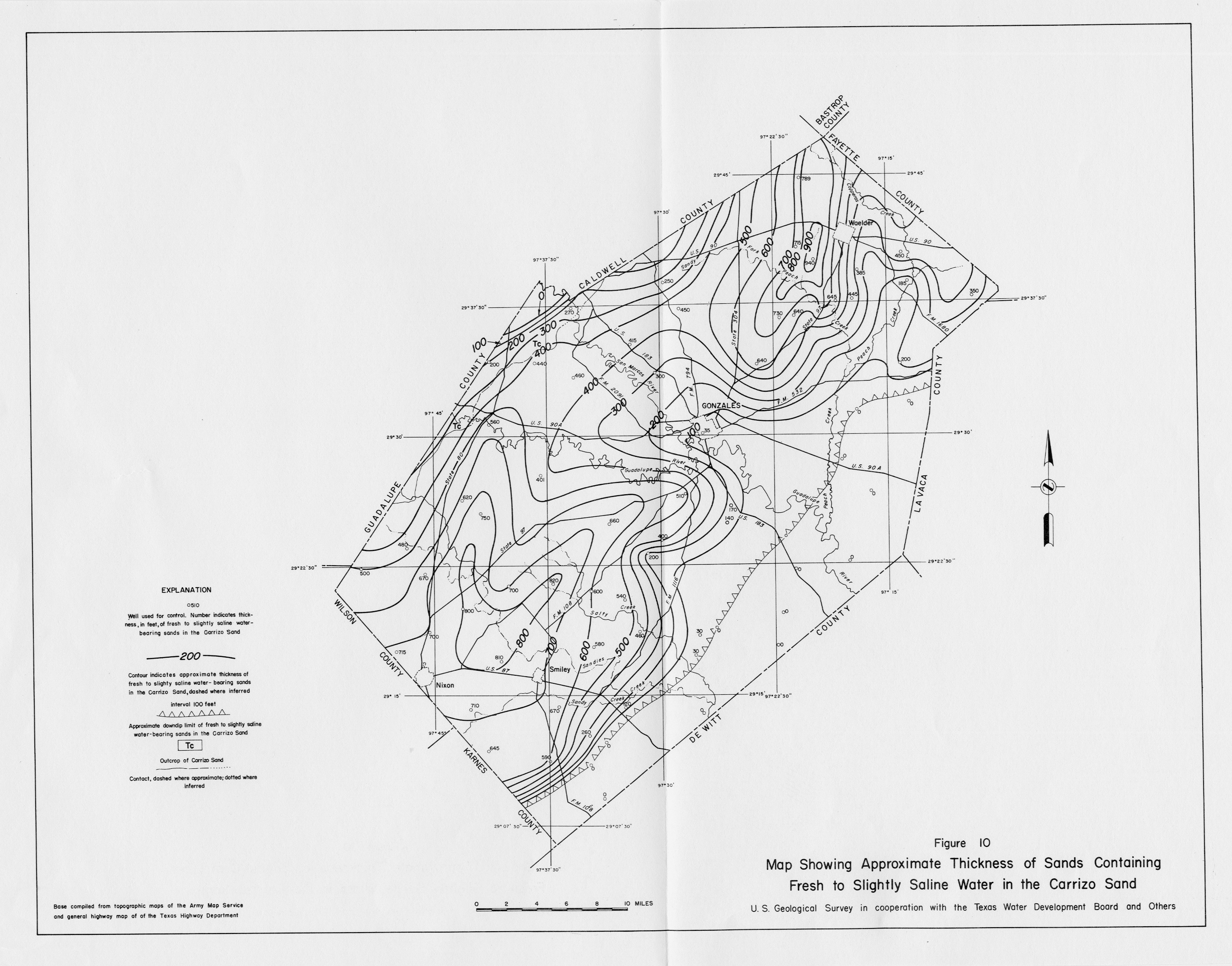
- Figure 10 - Map Showing Approximate Thickness of Sands Containing Fresh to Slightly Saline Water in the Carrizo Sand
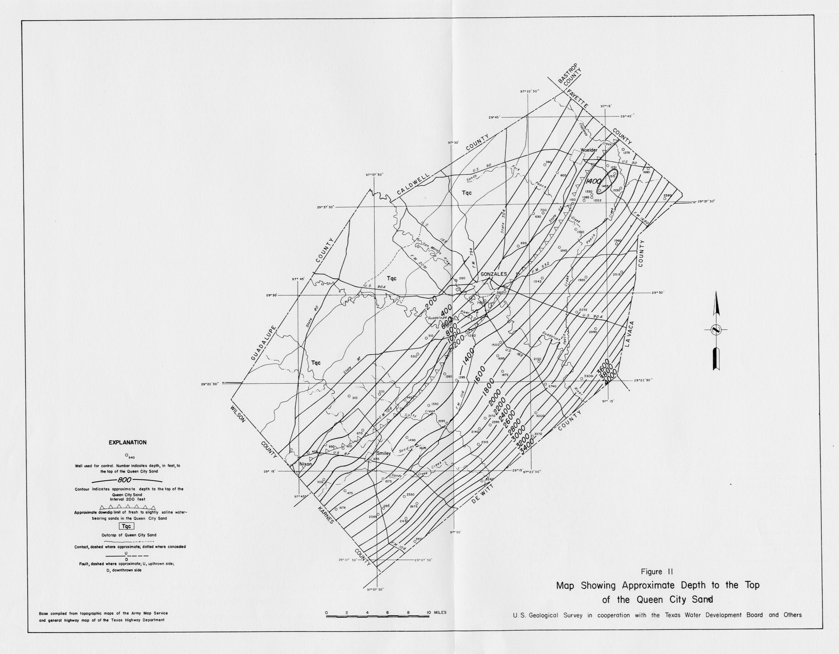
- Figure 11 - Map Showing Approximate Depth to the Top of the Queen City Sand
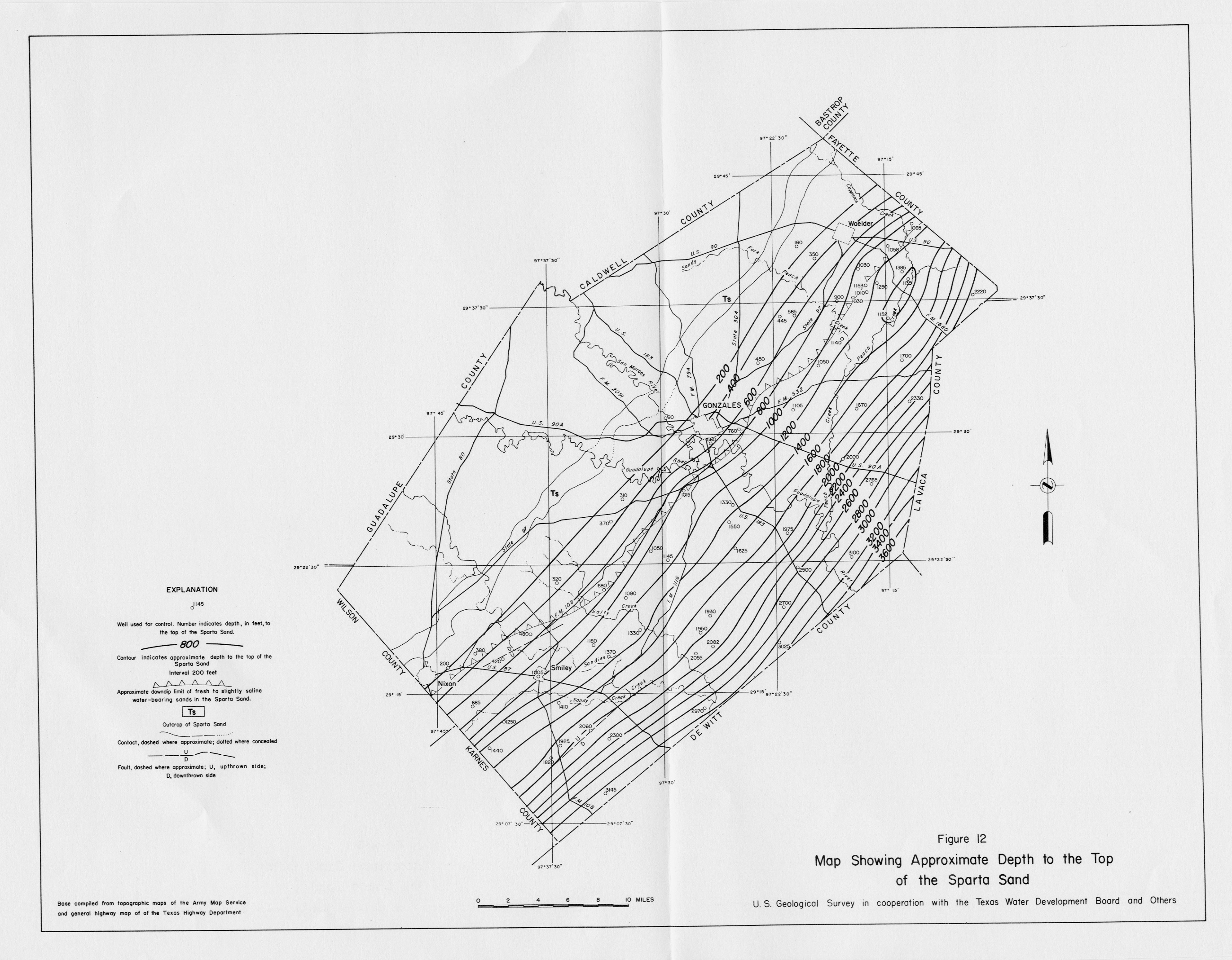
- Figure 12 - Map Showing Approximate Depth to the Top of the Sparta Sand