Report 278 by Robert D. Price, Loyd E. Walker, and Thomas W. Seih | August 1983
note: the oversized fold-out map figures below were scanned separately from the main report. Therefore, apparently "missing pages" in the report are actually these maps. All figures are in jpeg format.
- Report 278 - Occurrence, Quality, and Availability of Ground Water in Callahan County, Texas
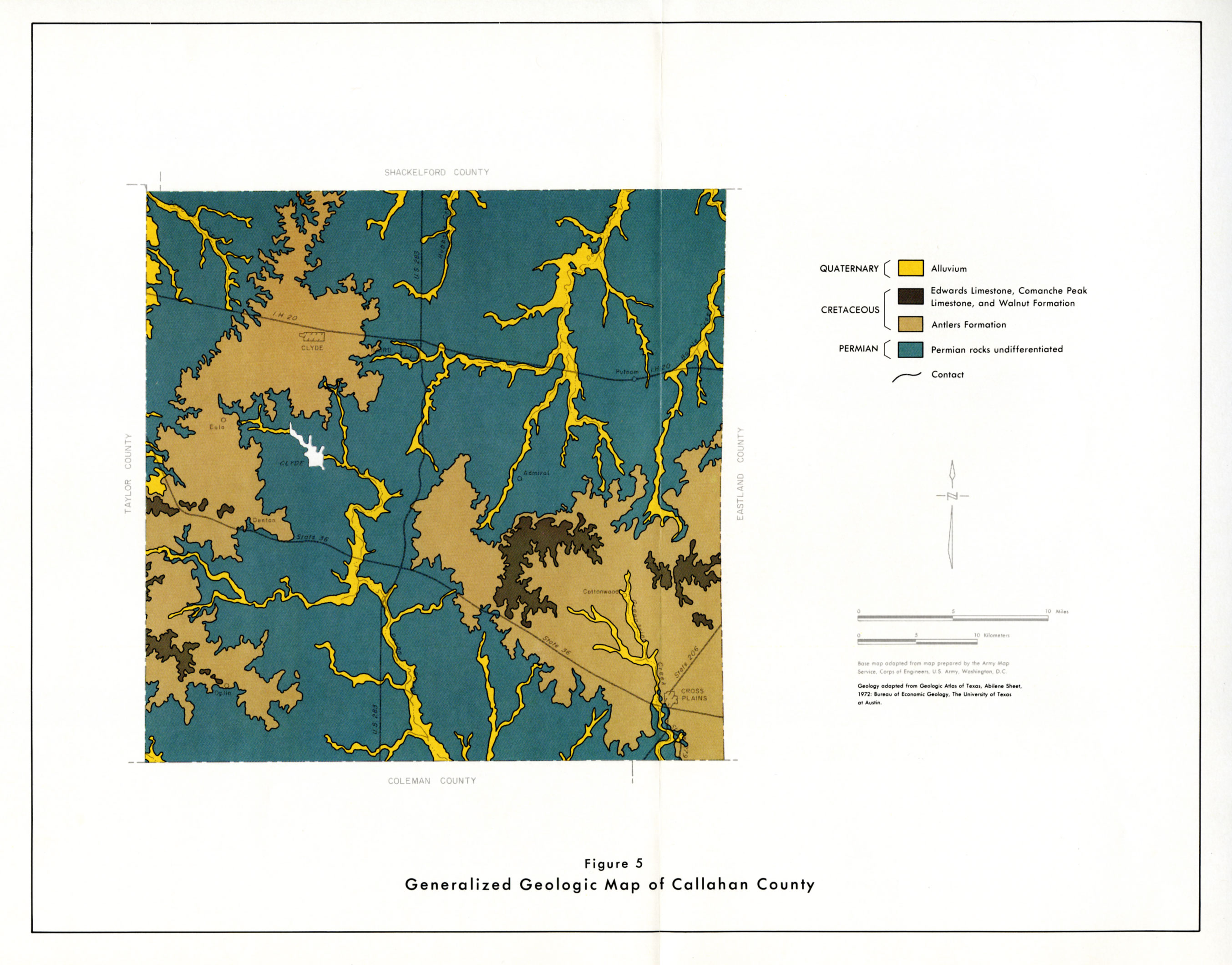
- Figure 5 - Generalized Geologic Map of Callahan County
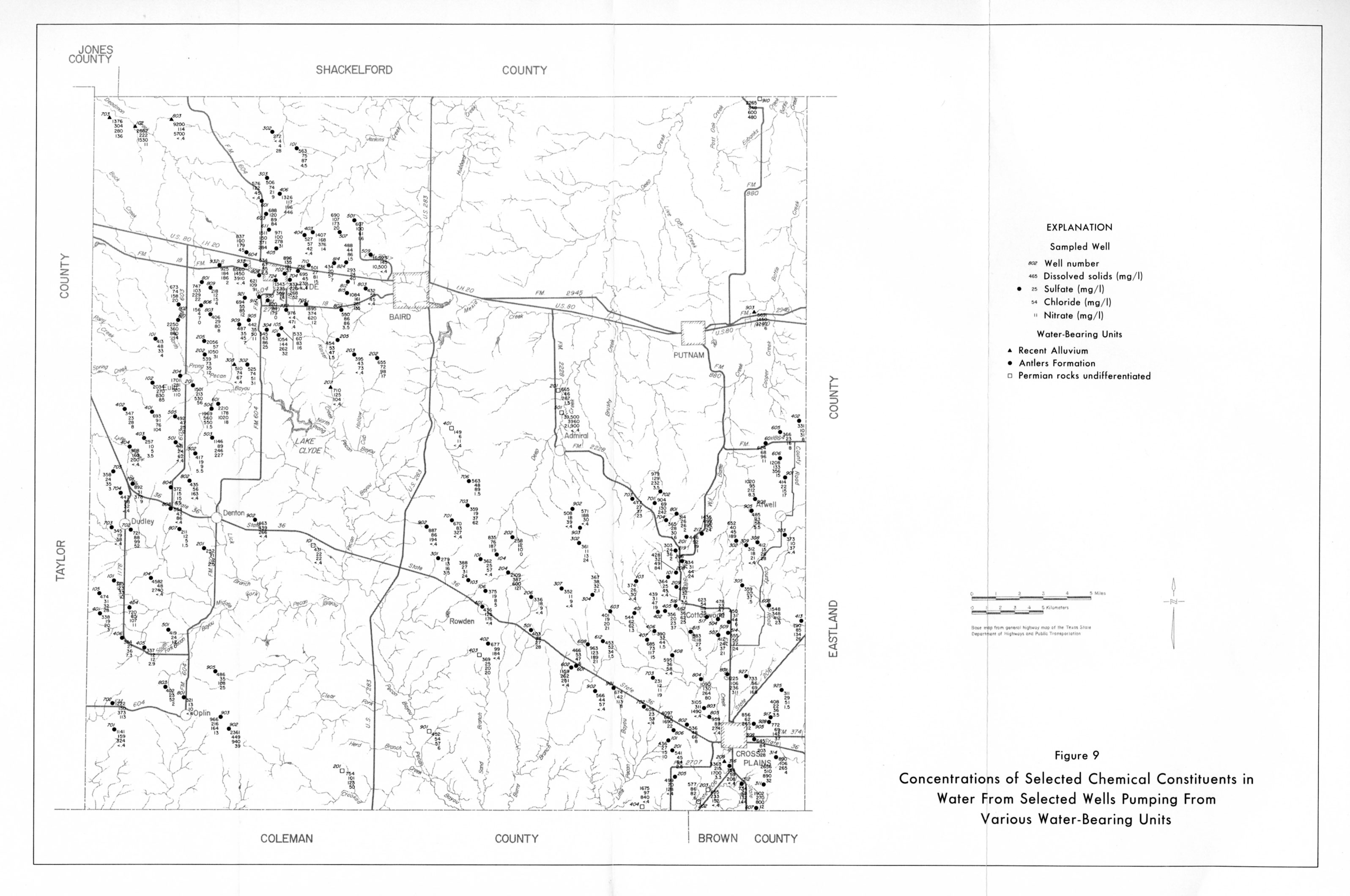
- Figure 9 - Concentrations of Selected Chemical Constituents in water From Selected Wells Pumping From Various Water-Bearing Units
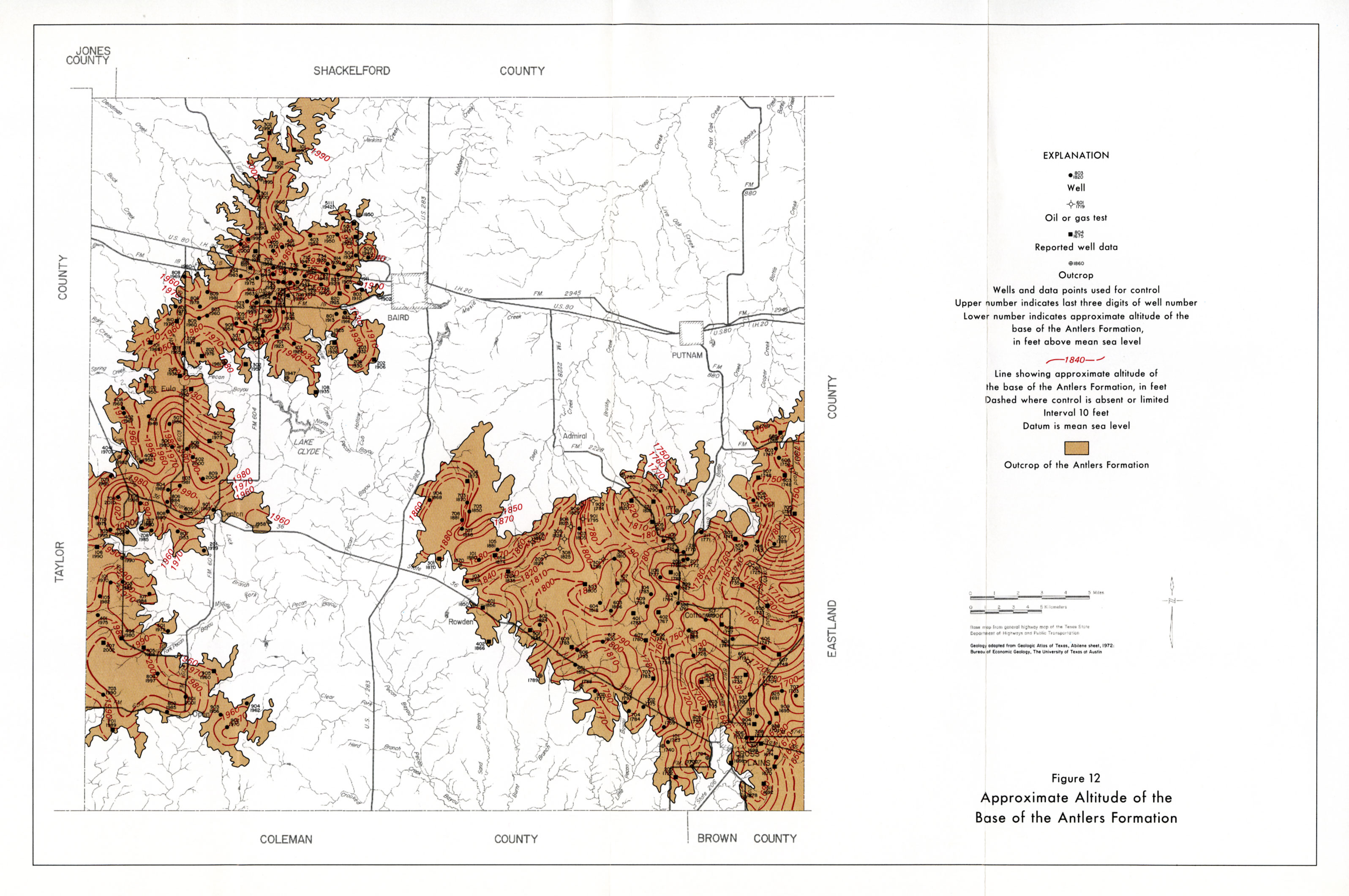
- Figure 12 - Approximate Altitude of the base of the Antlers Formation
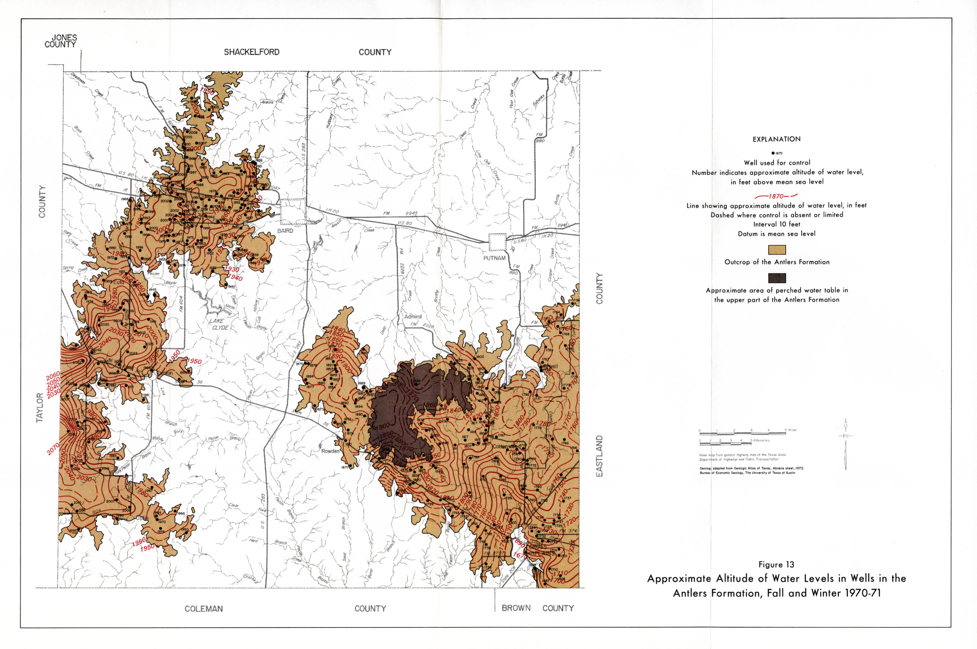
- Figure 13 - Approximate Altitude of Water Levels in Wells in the Antlers Formation, Fall and Winter 1970-71
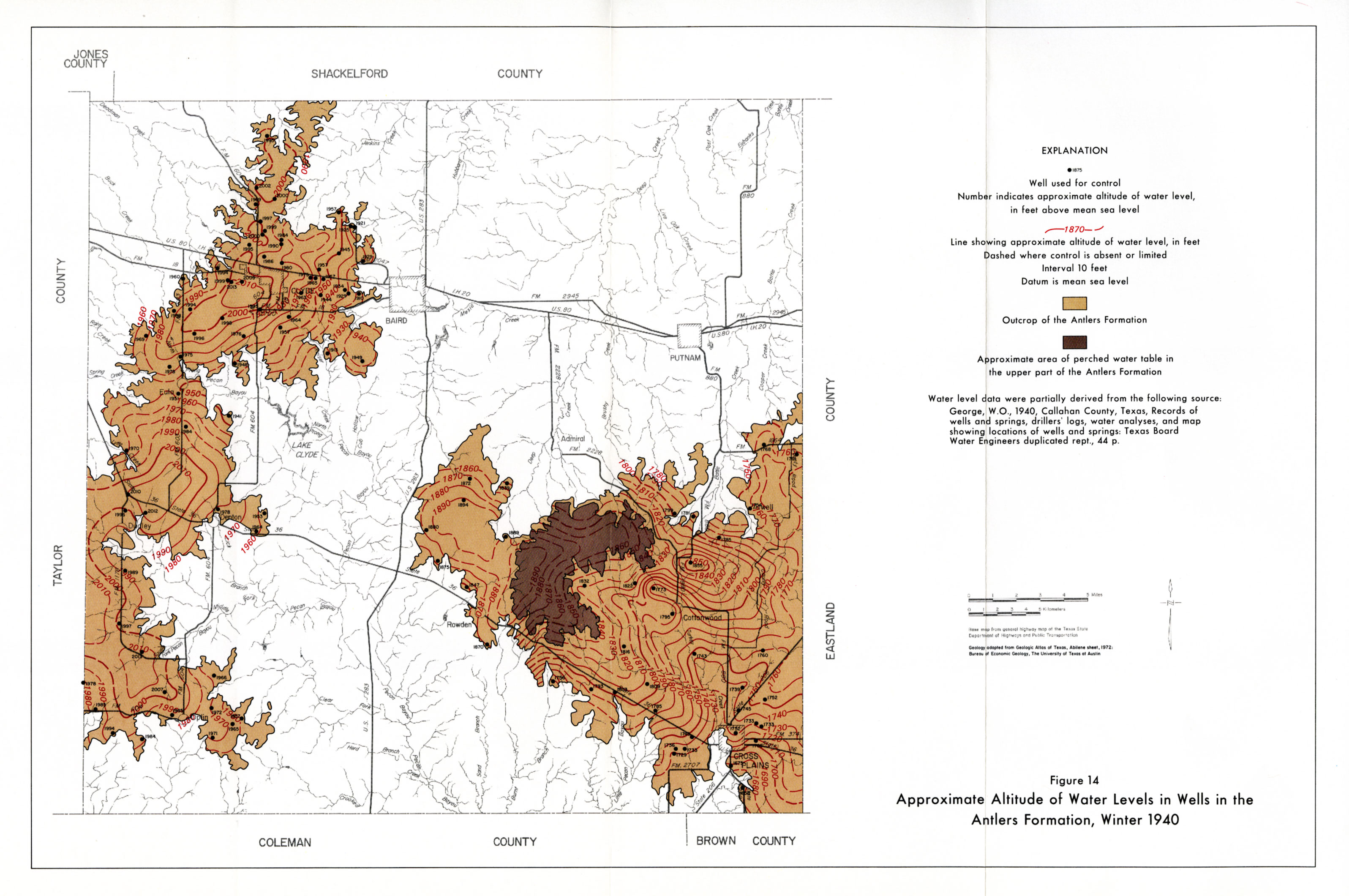
- Figure 14 - Approximate Altitude of Water Levels in Wells in the Antlers Formation, Winter 1940
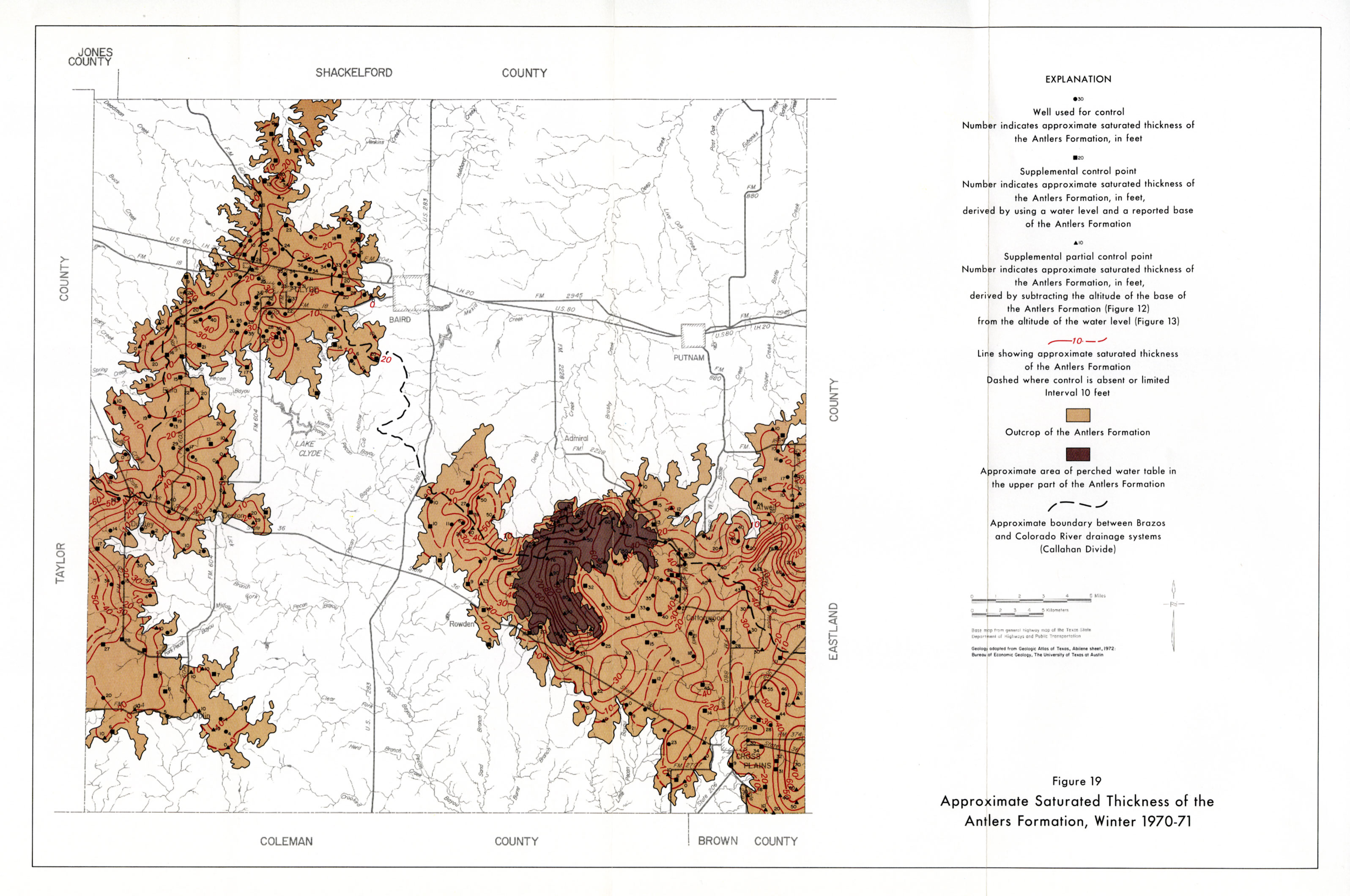
- Figure 19 - Approximate Saturated Thickness of the Antlers Formation, Winter 1970-71
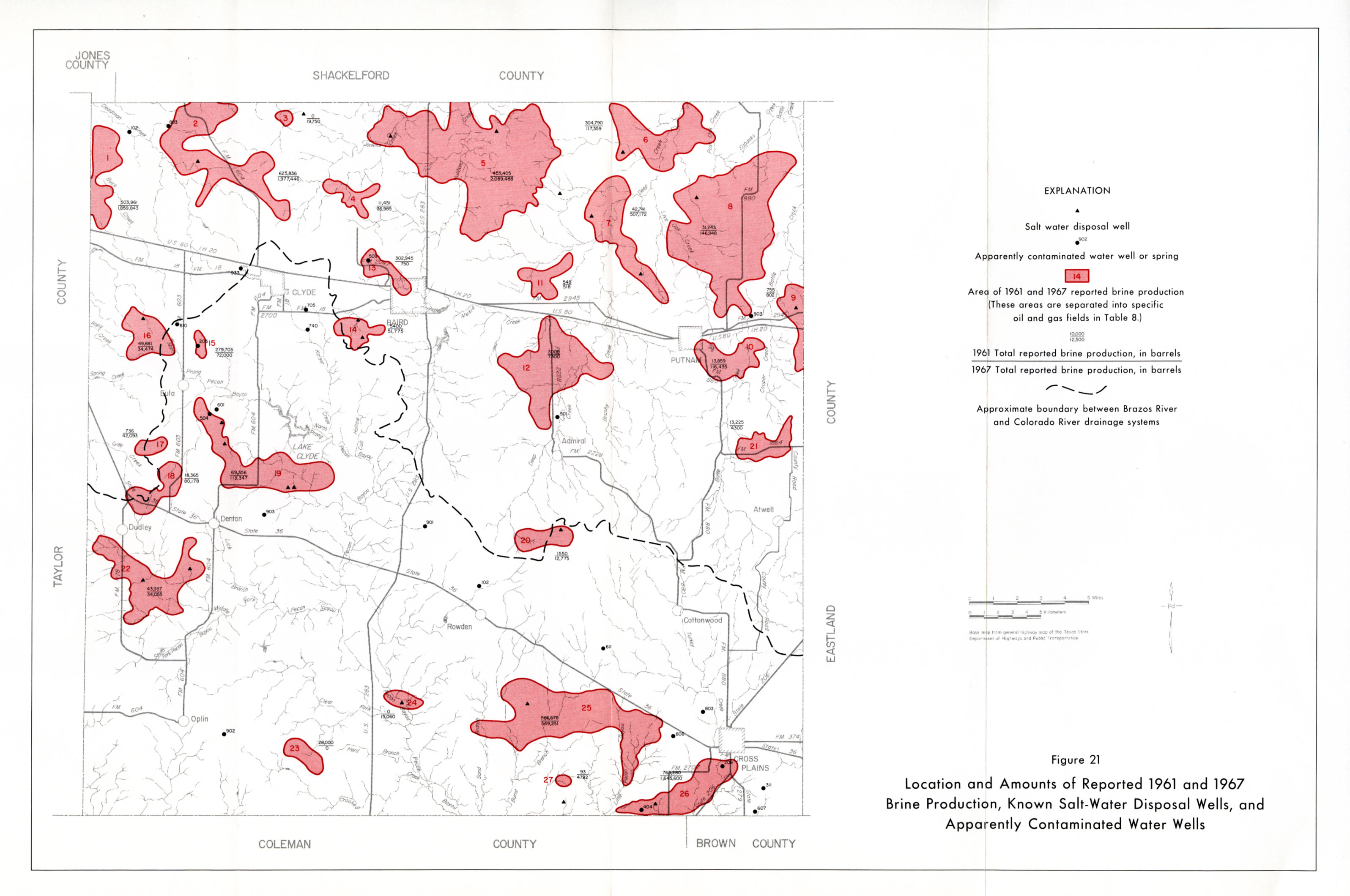
- Figure 21 - Location and Amounts of Reported 1961 and 1967 Brine Production, Known Salt-Water Disposal Wells, and Apparently Contaminated Water Wells
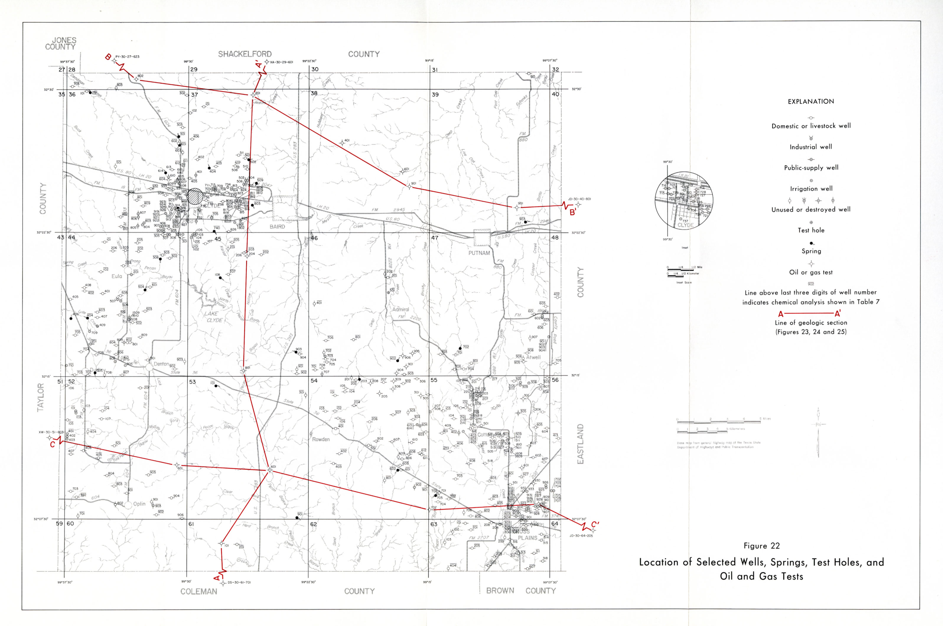
- Figure 22 - Location of Wells, Springs, Test Holes, and Oil and Gas Tests
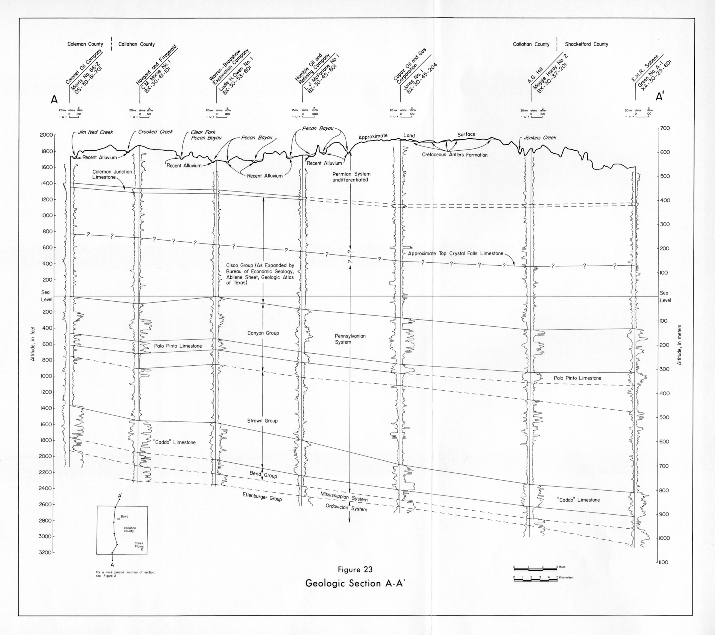
- Figure 23 - Geologic Section A-A'
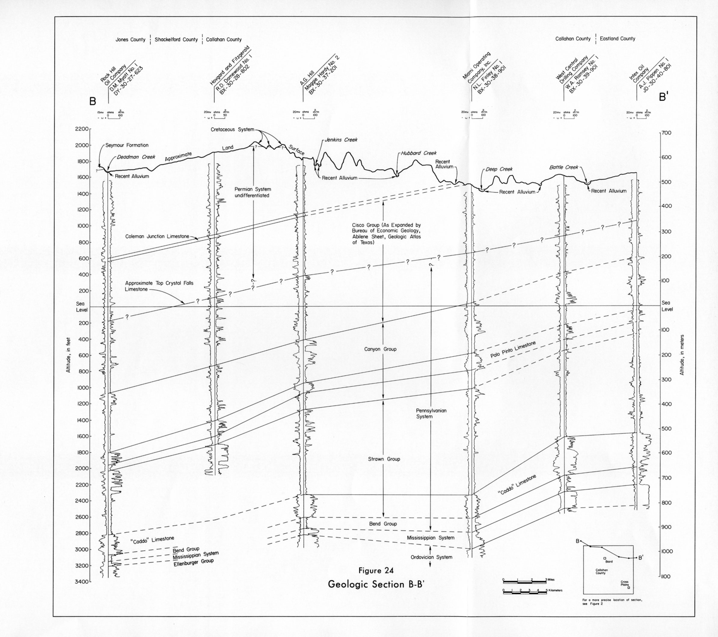
- Figure 24 - Geologic Section B-B'
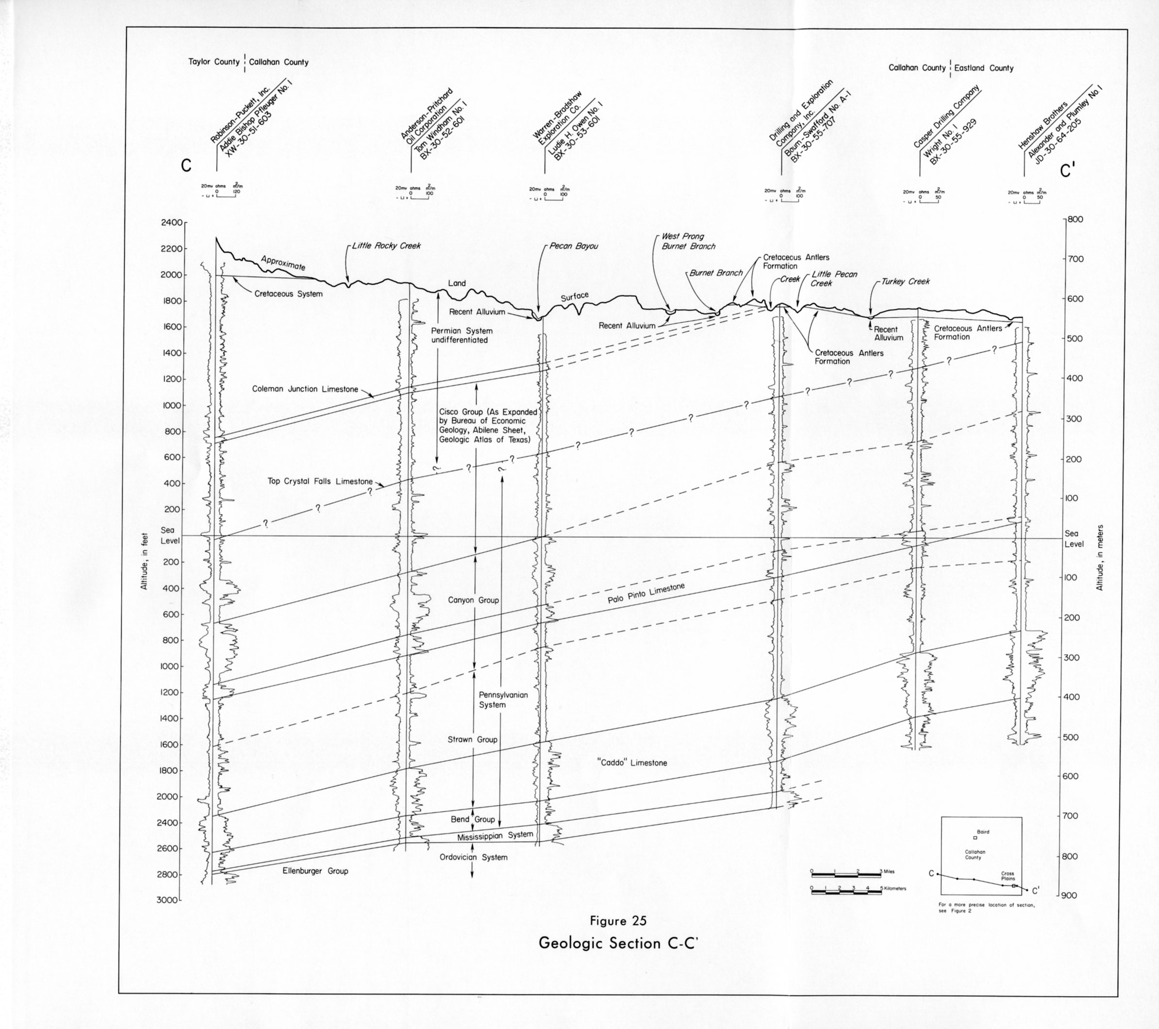
- Figure 25 - Geologic Section C-C'