Deep Glen Rose Formation in South Texas (the 'Maverick Basin' aquifer)
Summary
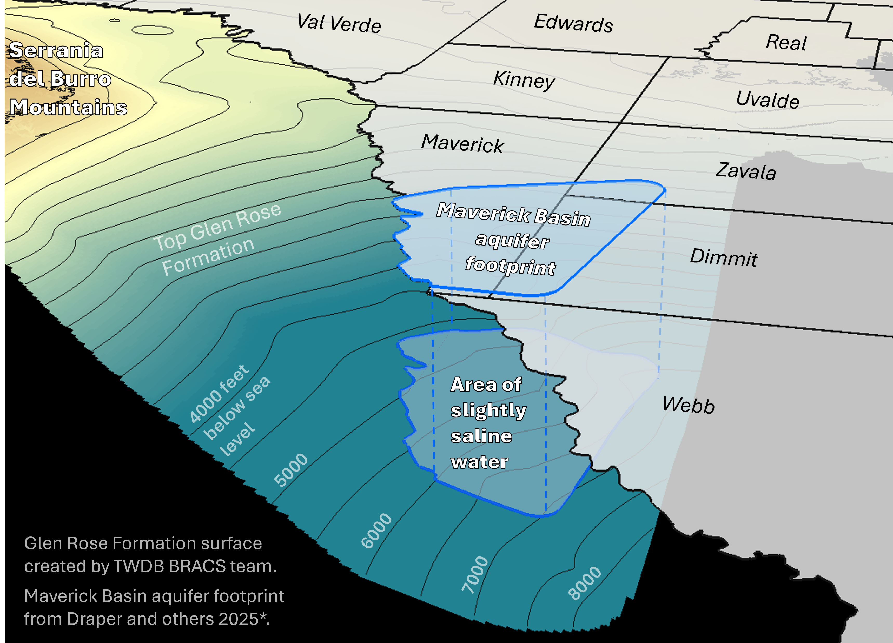
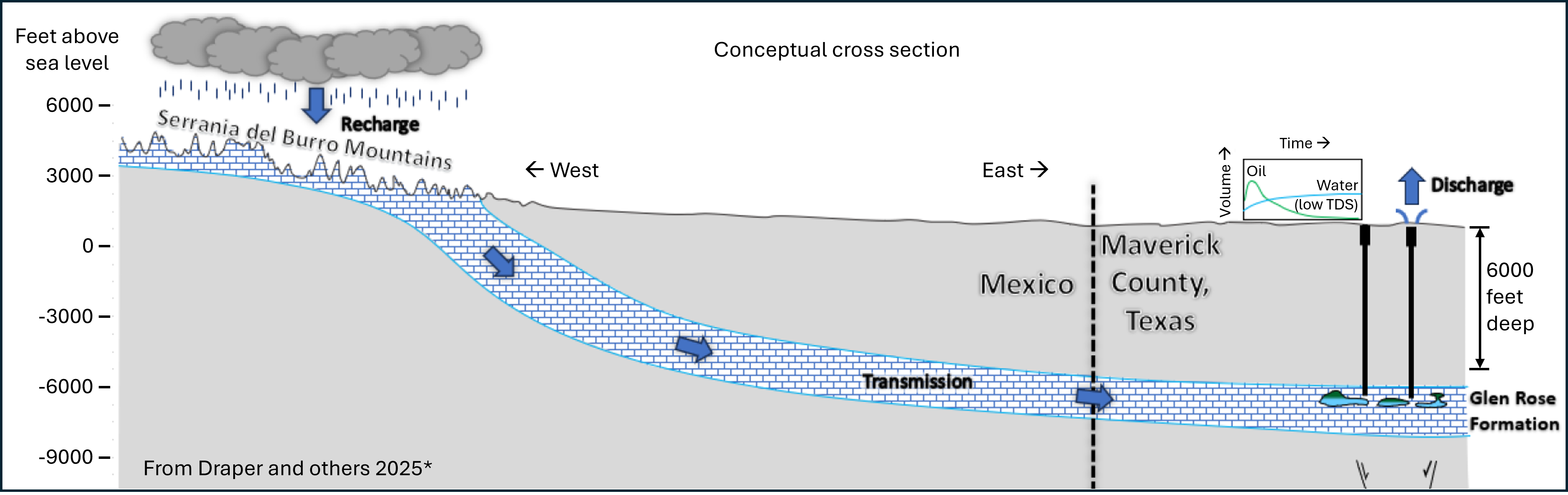
In 2021, the Geologic Advisory Unit of the Railroad Commission of Texas identified reports of fresh to slightly saline produced water in a deep portion of the Glen Rose Formation in Maverick, Zavala, and Dimmit counties that could be a potential source of water for local communities. The aquifer currently has a working name of the Maverick Basin aquifer. Fresh and slightly saline groundwater is reported at depths between 5,000 and 8,000 feet below land surface.
What we currently know
- Aquifer type: confined transborder aquifer with artesian flow
- Formation: Upper Glen Rose Formation, Trinity Group
- Depth: greater than 5,000 feet
- Area of aquifer in Texas: at least 650 square miles
- Recharge zone: believed to be 50 miles west of the Rio Grande in the Serrania del Burro Mountains in Mexico
Contracted report
*Draper and others (2025)
TWDB Contracted Report 2300012710-2 - Maverick Basin aquifer
Status update
- TWDB BRACS staff have entered well logs into the BRACS database in the Maverick Basin and have created elevation and depth surfaces for the top of the Glen Rose Formation (top of Trinity Group) that includes the Maverick Basin area and extends into Mexico. Currently working on water quality calculations and lithologic analysis. Working geologic formation elevation and depth raster files are available for download.
- TWDB BRACS department contracted with INTERA Inc. to summarize known information of this water resource. The study was completed in February 2025. A final report and three page summary is available online.
- On May 8th, 2024, the TWDB hosted a webinar where INTERA presented their findings on the likely structural controls on the aquifer, and their recommendations for performing aquifer tests.
Additional resources
- Railroad Commission of Texas news release
- Railroad Commission of Texas presentation on the Deep Glen Rose Formation
- Journal of Hydrology Article: Transboundary aquifers between Chihuahua, Coahuila, Nuevo Leon and Tamaulipas, Mexico, and Texas, USA: Identification and categorization
- Texas Groundwater Protection Committee White Paper: Transboundary Groundwater Resources along the Texas-Mexico Border
TWDB Reports
| ID | Date | Type | Description |
|---|---|---|---|
| GMR17-01 | April 2017 | Groundwater Management Report | Transborder Aquifers: A Summary of Aquifer Properties, Policies, and Planning Approaches for Texas, Surrounding States, and Mexico |
| LP-214 | February 1995 | Limited publication | Evaluation of Ground-Water Quality in Texas Counties Bordering the Rio Grande |
| 5617 | December 1956 | Bulletin | Records of Water-Level Measurements in Dimmit, Maverick, and Zavala Counties, Texas |
| 5203 | March 1952 | Bulletin | Winter Garden District Dimmit and Zavala Counties and Eastern Maverick County, Texas |
| M302 | 1940 | Historical Groundwater Report | Records of Wells, Winter Garden District, Dimmit and Zavala Counties and Eastern Maverick County, Texas |