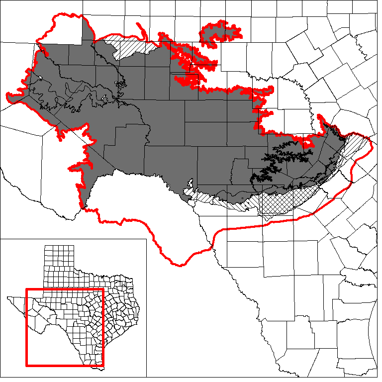
Edwards and Trinity Regional Groundwater Availability Model (GAM)
 In 2020, the Texas Water Development Board (TWDB) has begun to develop a regional groundwater availability model for the Edwards-Trinity (Plateau), Pecos Valley, southern portion of the Trinity, and Edwards aquifers in Texas. A final report and model will be released in early 2025. Upon its release, this regional model will replace the current groundwater availability model for the Edwards-Trinity (Plateau) and Pecos Valley aquifers.
In 2004, the TWDB released a groundwater availability model of the Edwards-Trinity (Plateau) and Pecos Valley aquifers in Texas.
Conceptual Model Report
Groundwater Pumping Study:
The report of the Estimation of Groundwater Pumping Volumes, Locations, and Aquifers for West Texas study is posted in the Improving Estimates of Groundwater Pumping in Aquifers of Central and Western Texas webpage. The geodatabase can be downloaded from the bottom of the Downloads webpage.
Recharge Study:
The report of the development of estimates of recharge and groundwater-surface water interactions in aquifers of central and western Texas is posted in the Development of Estimates of Recharge and Groundwater-Surfacewater Interaction in Aquifers of Central and Western Texas webpage. The geodatabase can be downloaded from the bottom of the Downloads webpage.
Stakeholder Advisory Forums (SAF)
A Stakeholder Advisory Forum (SAF) to develop a regional groundwater availability model (GAM) for the Edwards and Trinity aquifers was held online via
GoToMeeting
Date: Friday, February 25, 2022
Time: 10:00 AM (CST)
For questions about this Stakeholder Advisory Forum, please contact Roberto Anaya (512 463 6115).
Send us an email if you would like to receive SAF notifications.
| ID | Date | Location | Slides | Video |
|---|---|---|---|---|
| SAF 1 | 04/28/2020 | Online meeting | SAF 1 slides | Video recording (size: 121 MB) | SAF 2 | 02/25/2022 | Online meeting | SAF 2 slides |
SAF 2 Video Recording: Part I
SAF 2 Video Recording: Part II SAF 2 Video Recording: Part III |
Model Report
Groundwater Availability Model for the Edwards-Trinity (Plateau) and Pecos Valley aquifers in Texas.
Model Files and Associated Data
Please see the GAM files download page for the current model files and associated data.
Aquifer data is only available as a package for the entire model area and requires GIS software for processing. Please see the GAM files download page for aquifer data.
Stakeholder Advisory Forums (SAF)
Send us an email if you would like to receive SAF notifications.
| ID | Date | Location |
|---|---|---|
| PEST SAF 2 | 10/14/2009 | Fredericksburg, Texas - Central Electric Co-Op (386 Friendship Lane) |
| PEST SAF 1 | 12/11/2008 | Sonora, Texas - First United Methodist Church (201 North Water Ave.) |
| SAF 6 | 7/28/2004 | Ozona, Texas - Crockett County Extension Office (1301 Avenue AA) |
| SAF 5 | 11/7/2002 | Big Lake, Texas - Santa Rita Underground Water Conservation District |
| SAF 4 | 6/25/2002 | Ozona, Texas - Crockett County Extension Office (1301 Avenue AA) |
| SAF 3 | 2/11/2002 | Ozona, Texas - Crockett County Extension Office (1301 Avenue AA) |
| SAF 2 | 8/29/2001 | Sonora, Texas - Four-H Civic Center |
| SAF 1 | 5/16/2001 | Sonora, Texas - Four-H Civic Center |
Other Resources
Please see the Edwards-Trinity (Plateau) and Pecos Valley aquifer pages and the Alternative One Layer Groundwater Flow Model of the Edwards-Trinity (Plateau) and Pecos Valley Aquifers page for other reports and publications.
For model runs see the GMA 3, GMA 4, GMA 7, and GMA 9 pages.