Report 94 by Gerald L. Thompson, U.S. Geological Survey | April 1969
note: the oversized fold out maps and figures below were scanned separately from the body of the report above, so "missing pages" are these figures.
- Report 94 - Ground-Water Resources in Johnson County, Texas
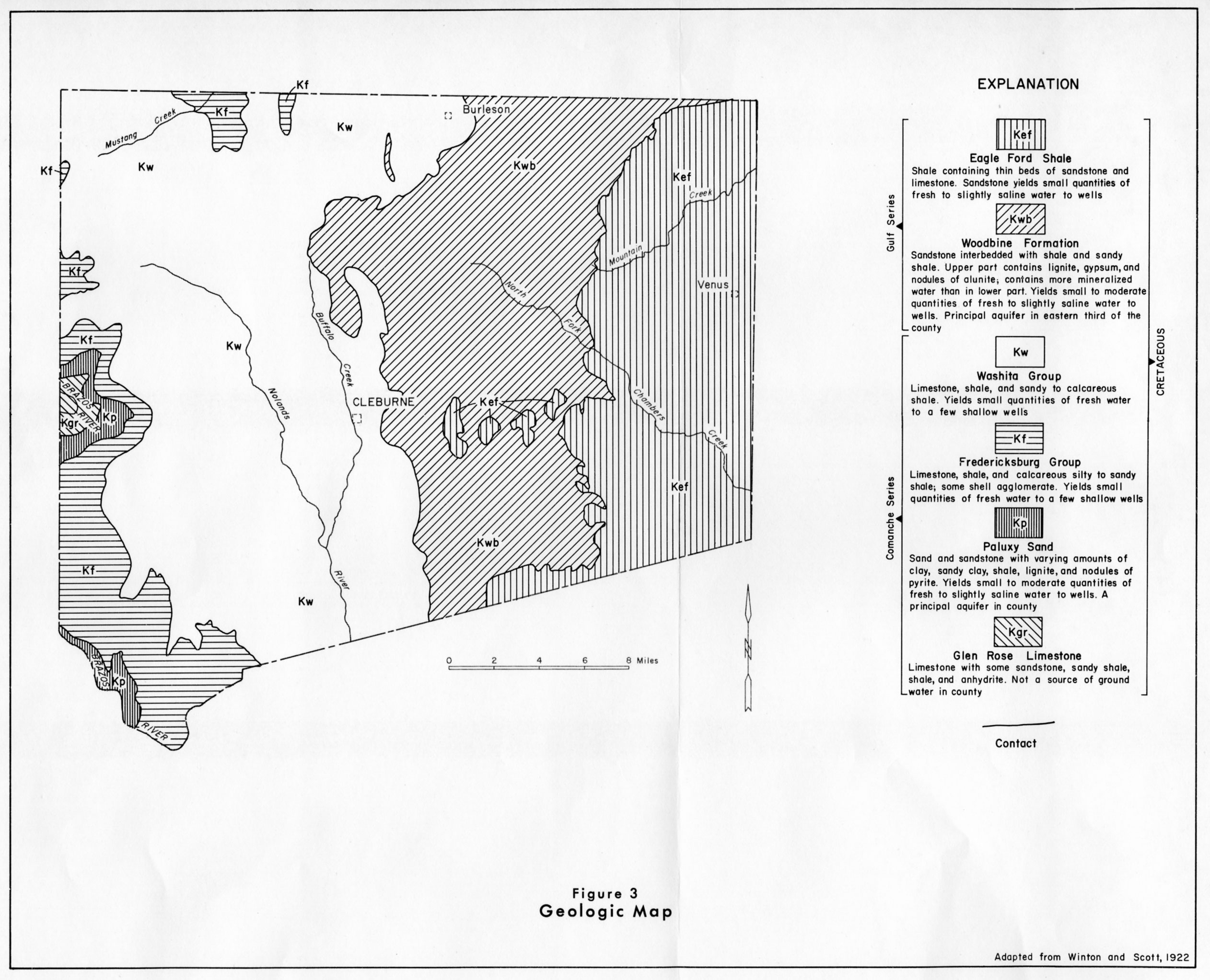
- figure 3 - Geologic Map
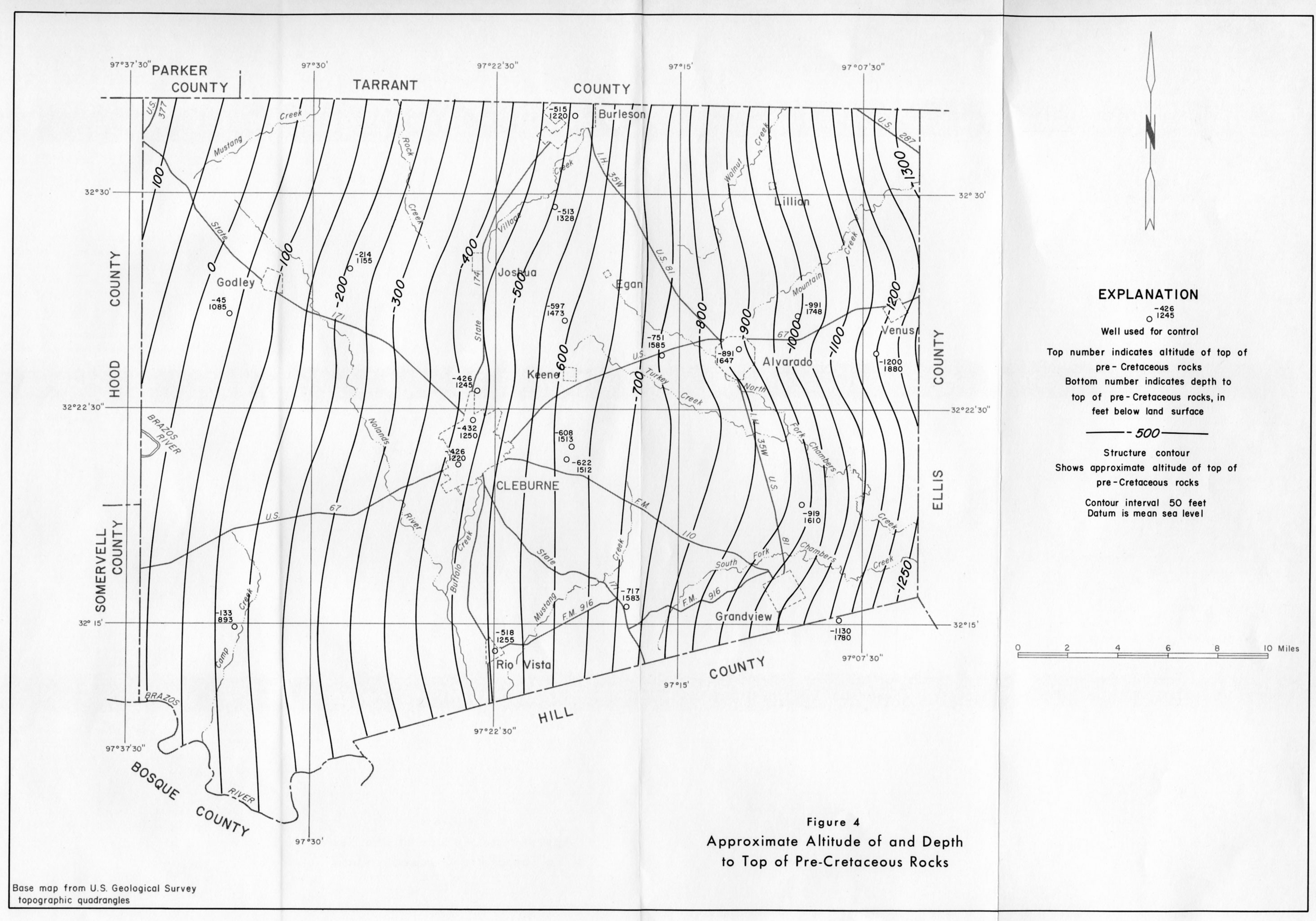
- figure 4 - Approximate Altitude of and Depth to Top of Pre-Cretaceous Rocks
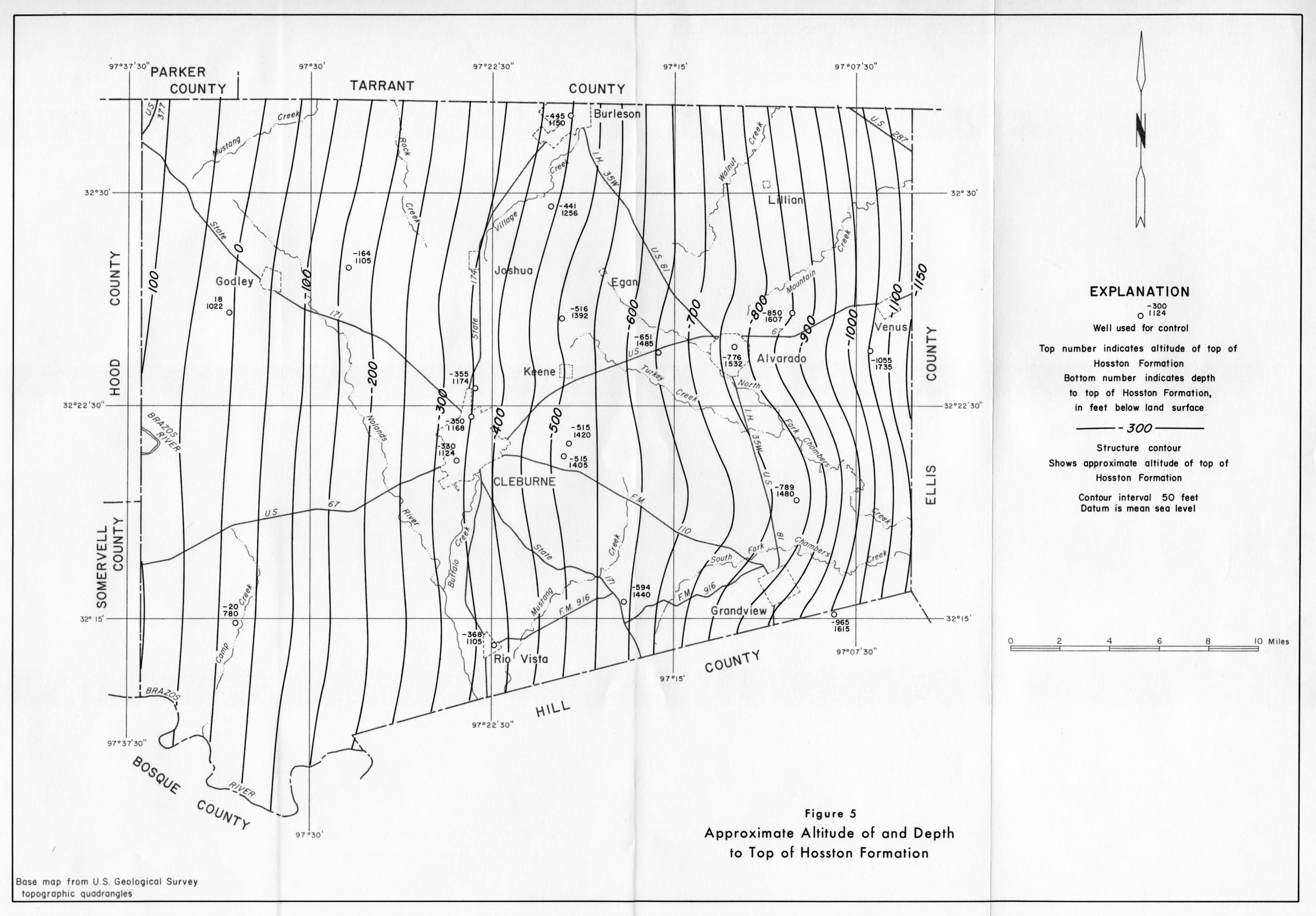
- figure 5 - Approximate Altitude of and Depth to Top of Hosston Formation
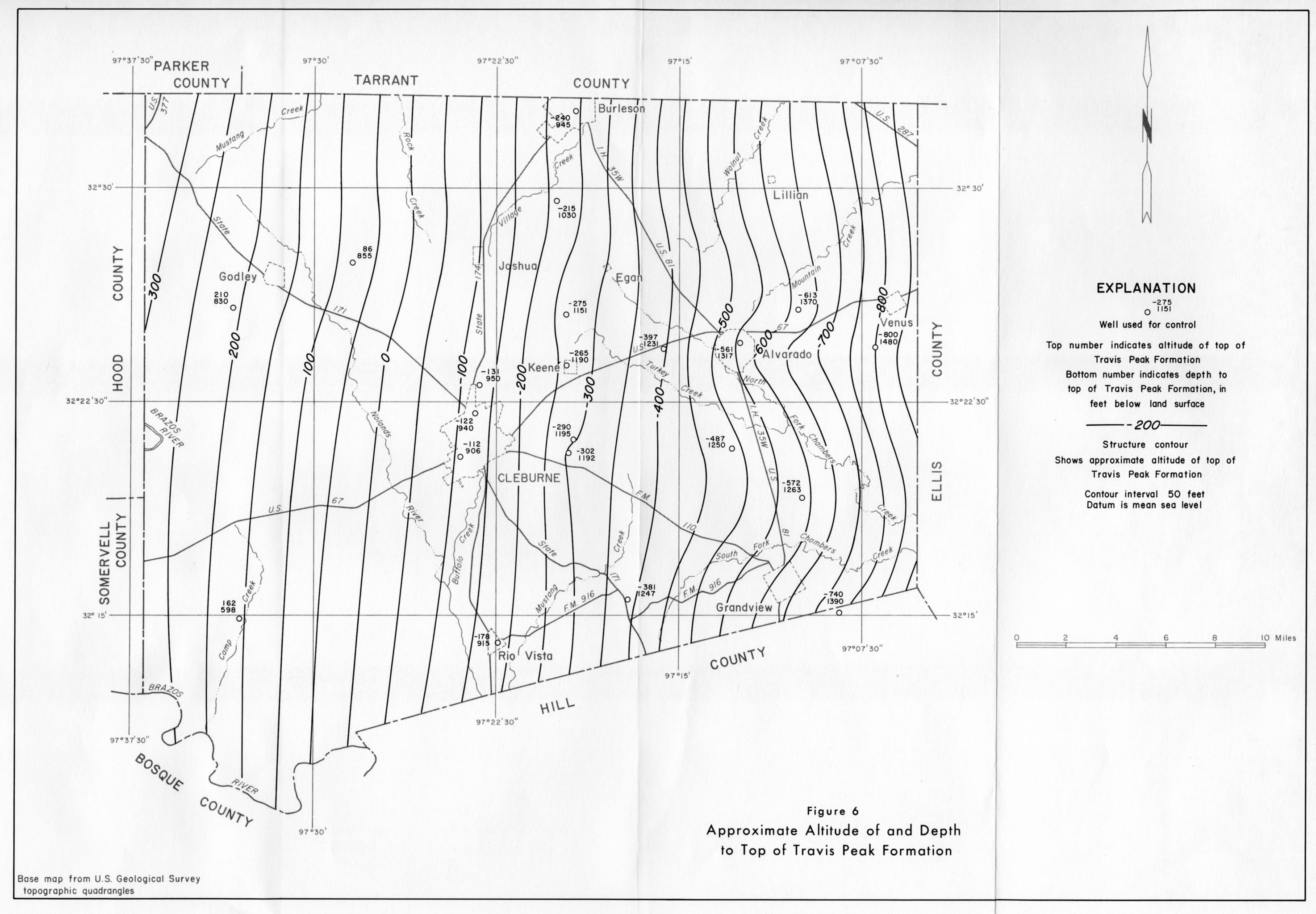
- figure 6 - Approximate Altitude of and Depth to Top of Travis Peak Formation
- figure 7 - Approximate Altitude of and Depth to Top of Paluxy Sand
- figure 8 - Approximate Altitude of water levels in Wells in the Paluxy Sand, 1966
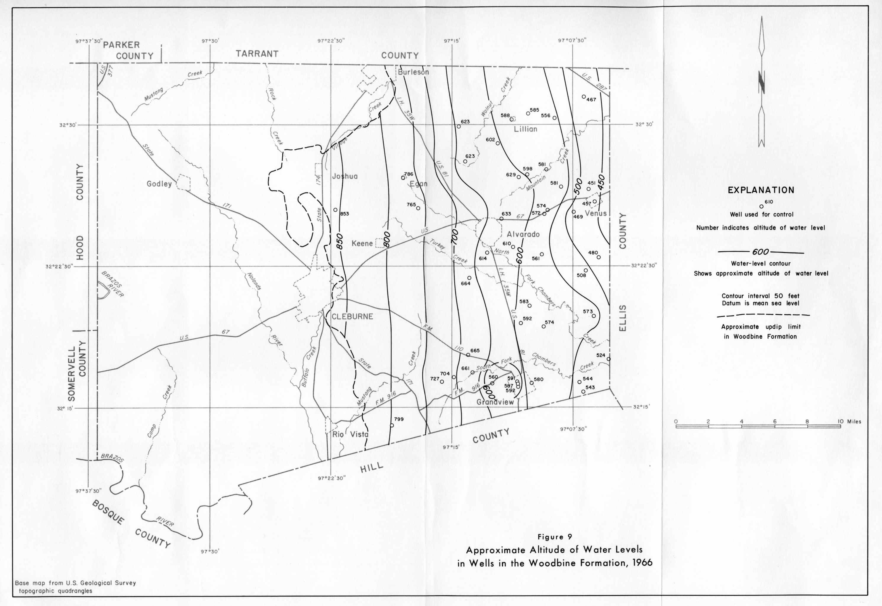
- figure 9 - Approximate Altitude of Water Levels in Wells in the Woodbine Formation, 1966
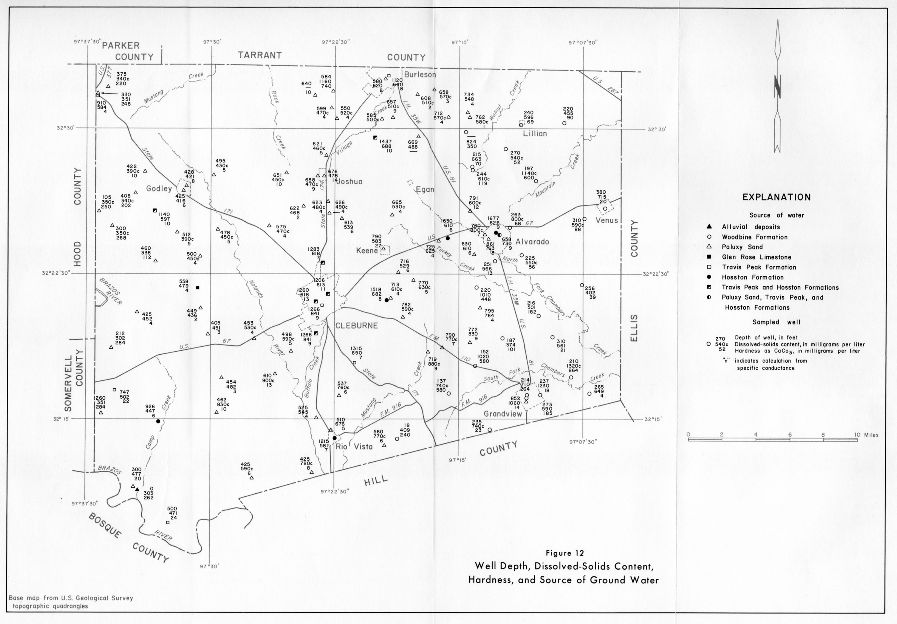
- figure 12 - Well Depth, Dissolved-Solids Content, Hardness, and Source of Ground Water
- figure 13 - Approximate Thickness of Sand Containing Fresh to Slightly Saline Water in the Hosston and Travis Peak Formations
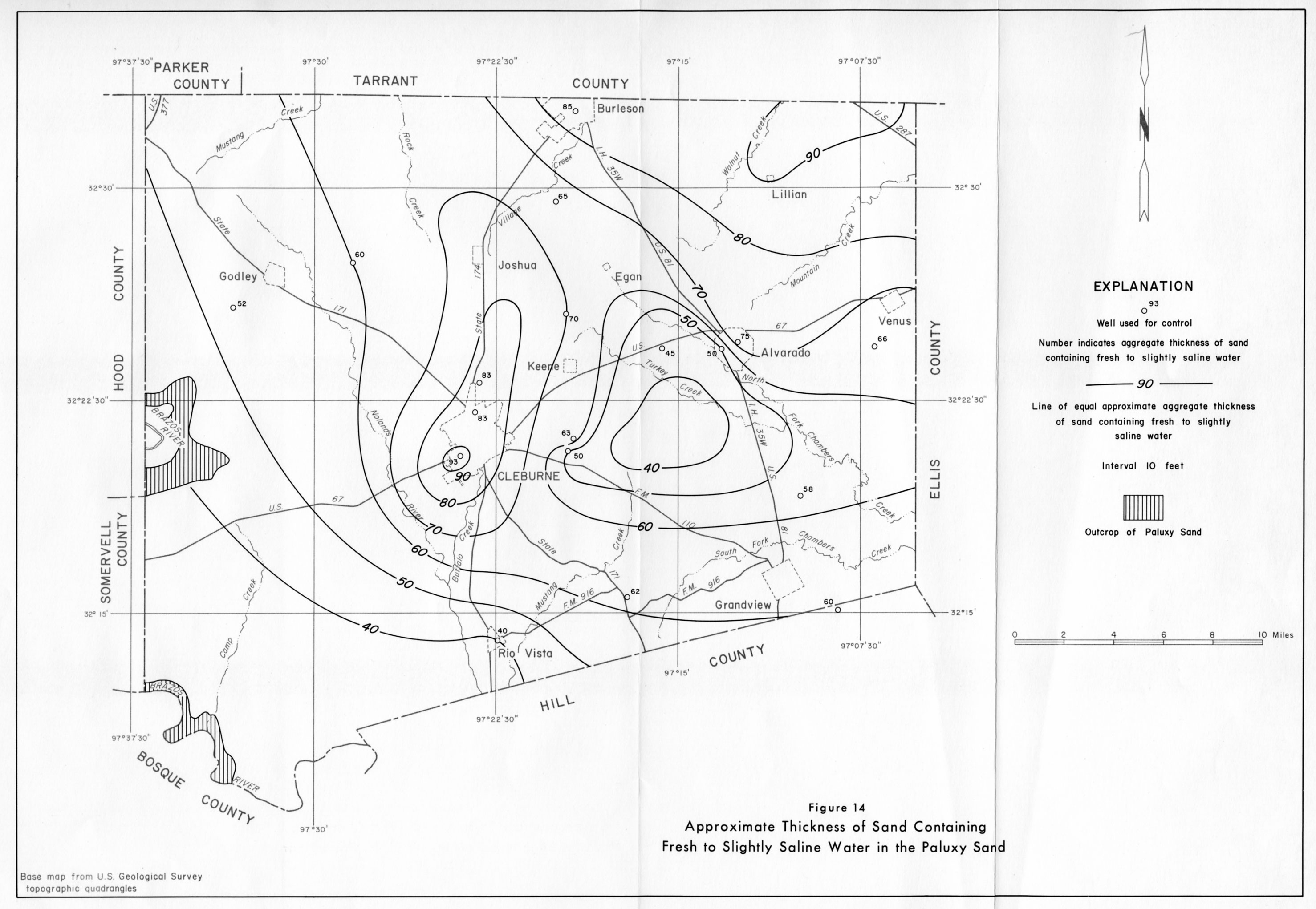
- figure 14 - Approximate Thickness of Sand Containing Fresh to Moderately Saline Water in the Paluxy Sand
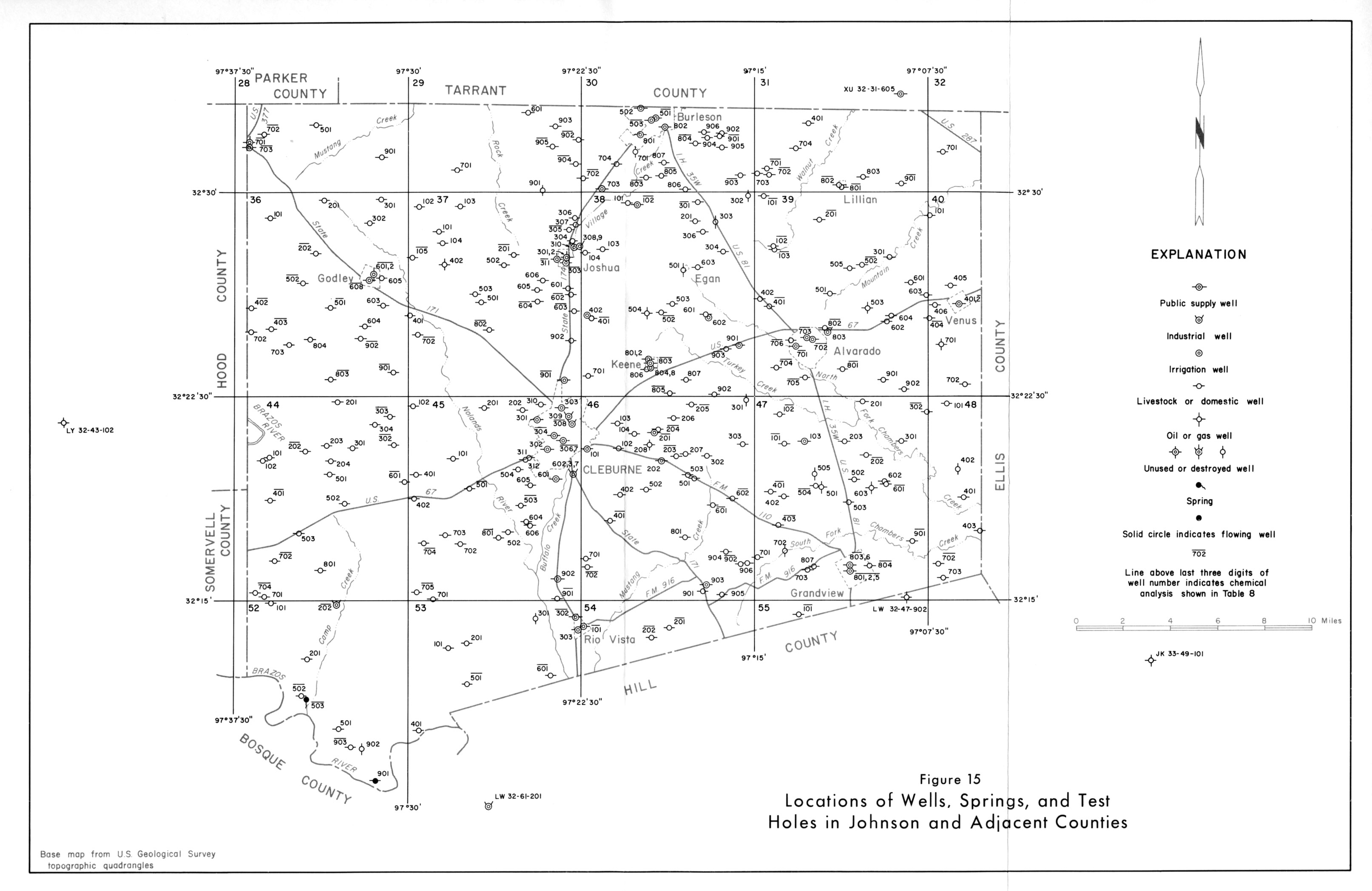
- figure 15 - Locations of Wells, Springs, and test Holes in Johnson and Adjacent Counties
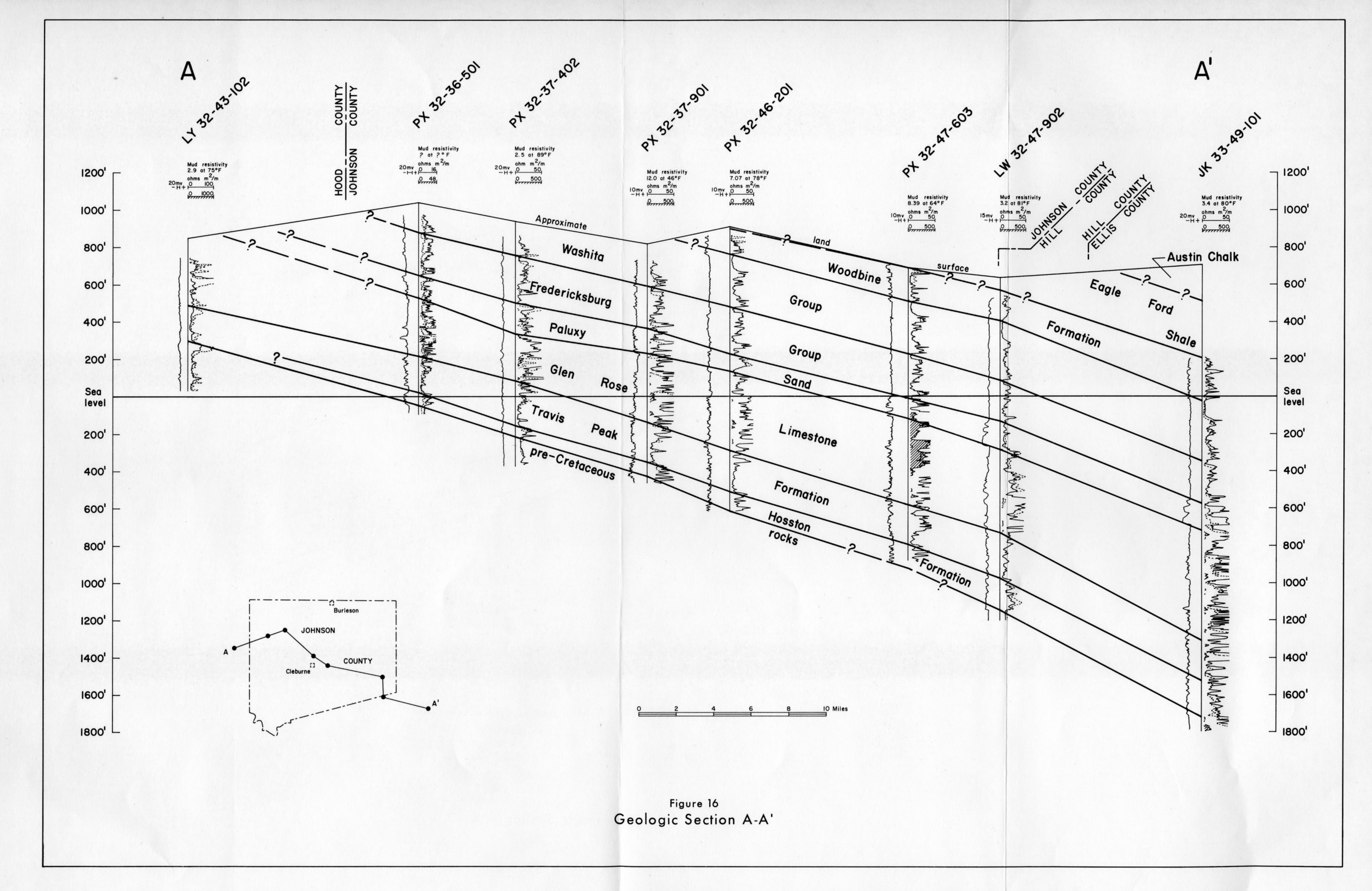
- figure 16 - Geologic Section A-A'
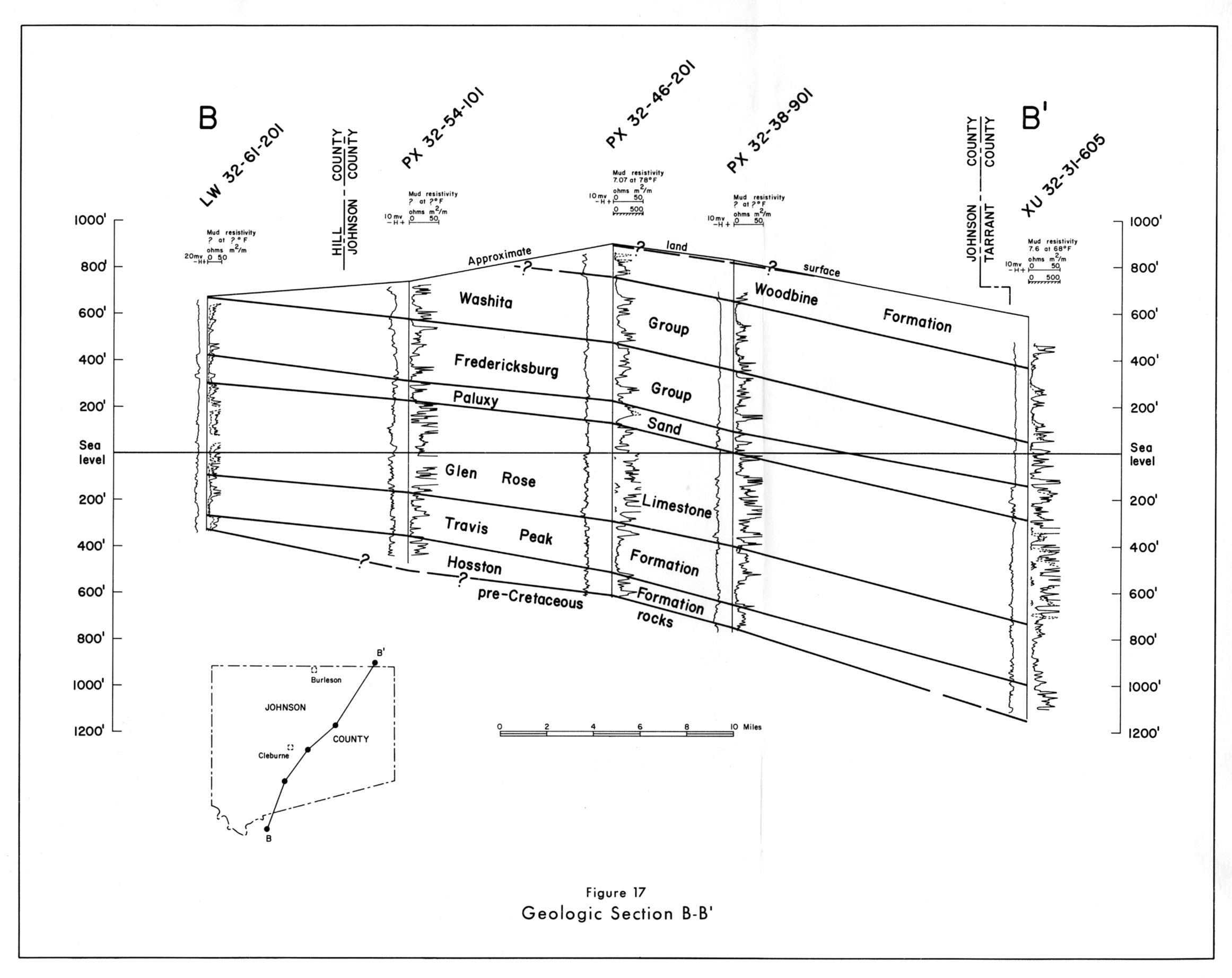
- figure 17 - Geologic Section B-B'