Report 83 by R.U. Grozier, D.C. Hahl, A.E. Hulme, and E.E. Schroeder, U.S. Geological Survey | September 1968
Note: the oversized fold out maps and figures below were scanned separately from the body of the report above, so "missing pages" are these figures.
- Report 83 - Floods from Hurricane Beulah in South Texas and Northeastern Mexico, September-October 1967
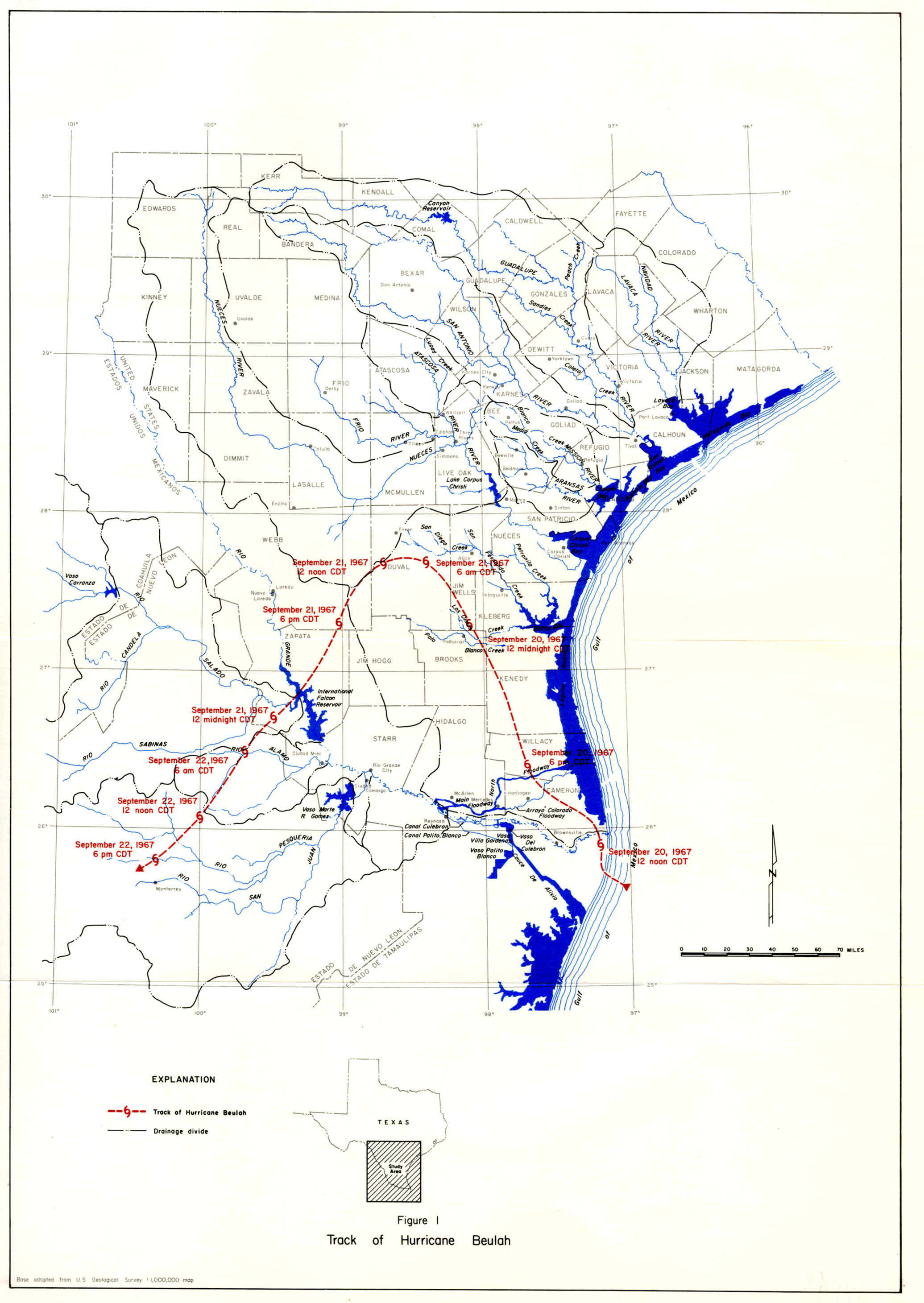
- figure 1 - Track of Hurricane Buelah
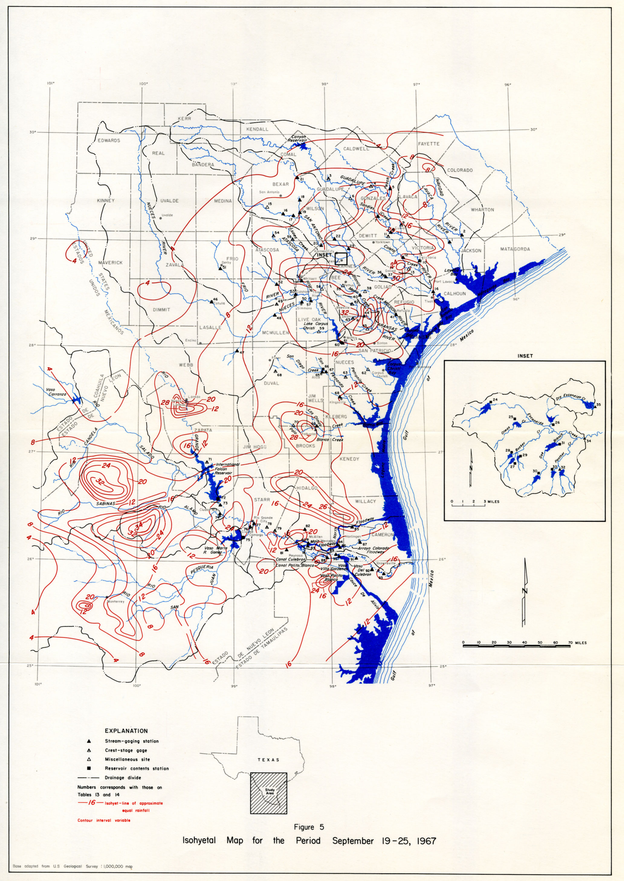
- figure 5 - Isohyetal Map for the Period September 19-25, 1967
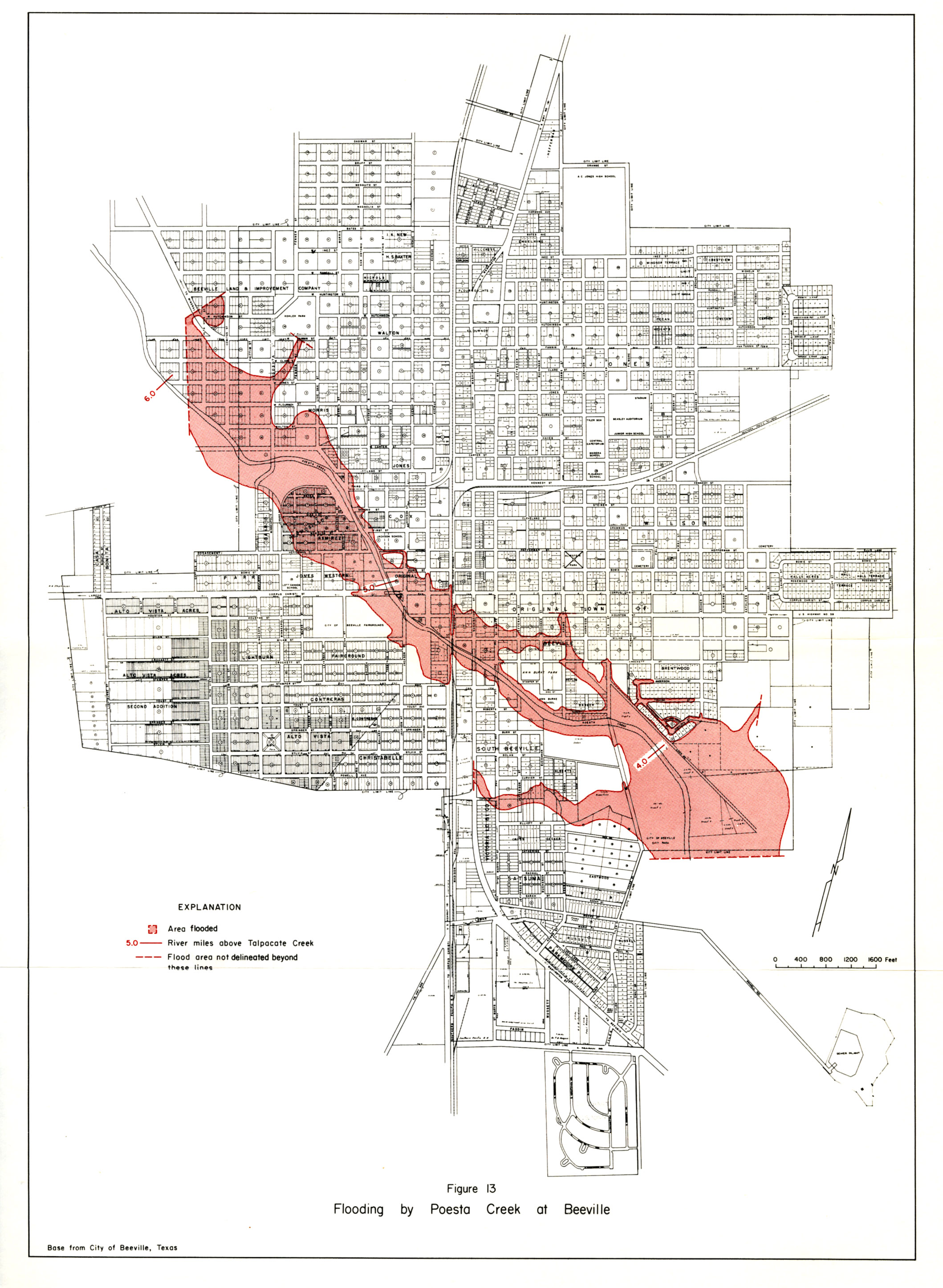
- figure 13 - Flooding by Poesta Creek at Beeville
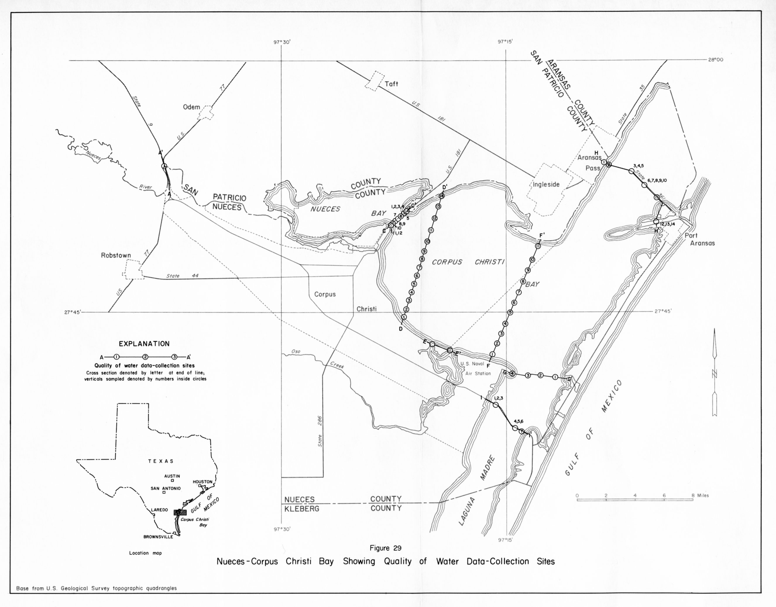
- figure 29 - Nueces-Corpus Christi Bay Showing Quality of Water Data-Collection Sites
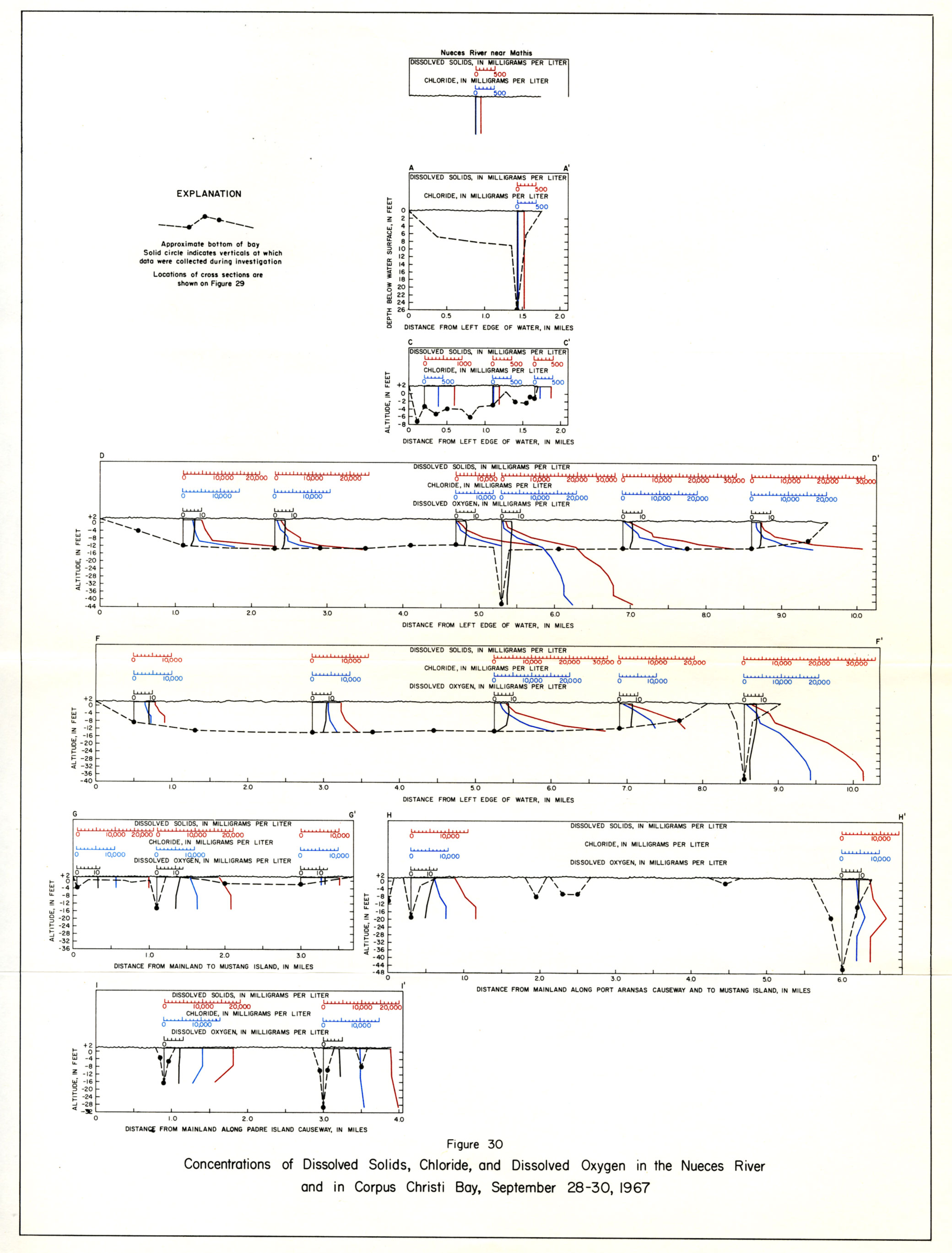
- figure 30 - Concentrations of Dissolved Solids, Chloride, and Dissolved Oxygen in the Nueces River and in Corpus Christi Bay, September 28-30, 1967
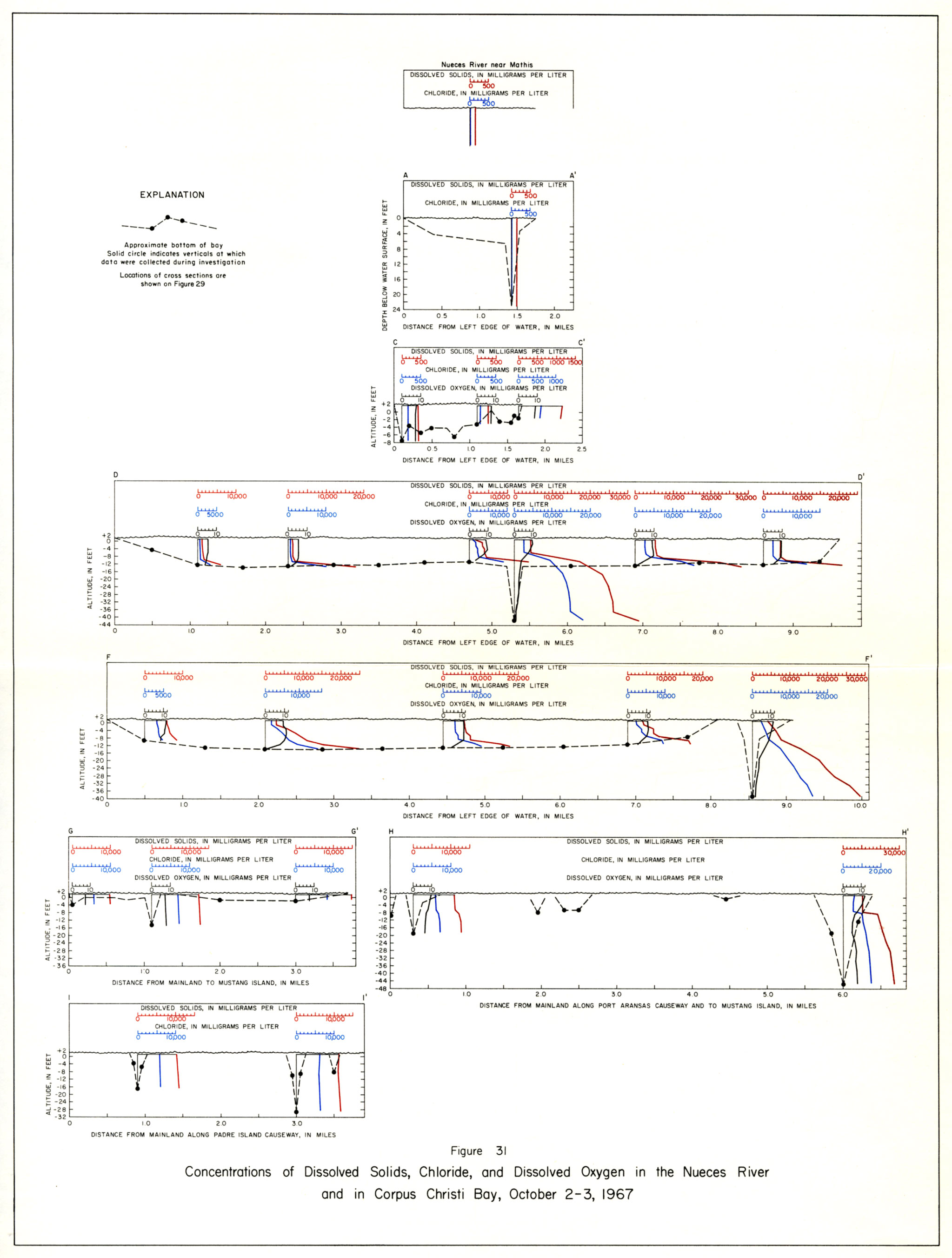
- figure 31 - Concentrations of Dissolved Solids, Chloride, and Dissolved Oxygen in the Nueces River and in Corpus Christi Bay, October 2-3, 1967
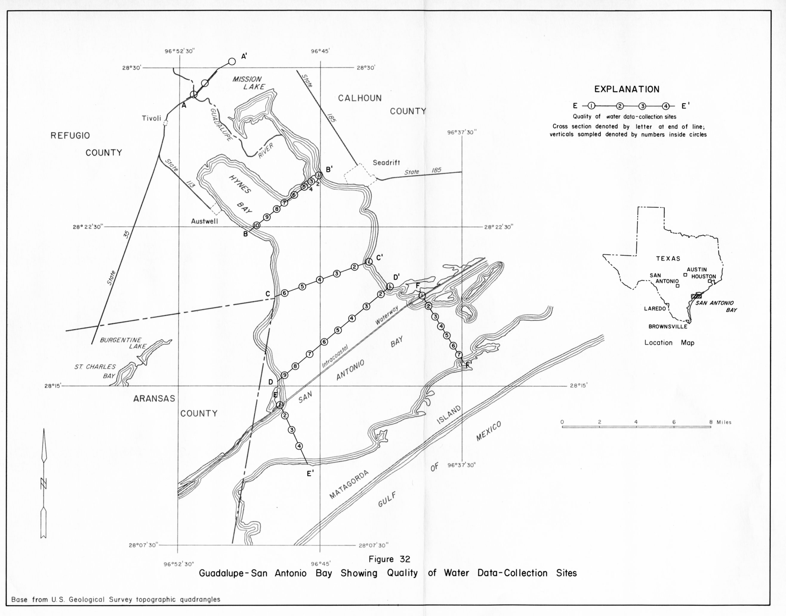
- figure 32 - Guadalupe-San Antonio Bay Showing Quality of Water Data-Collection Sites
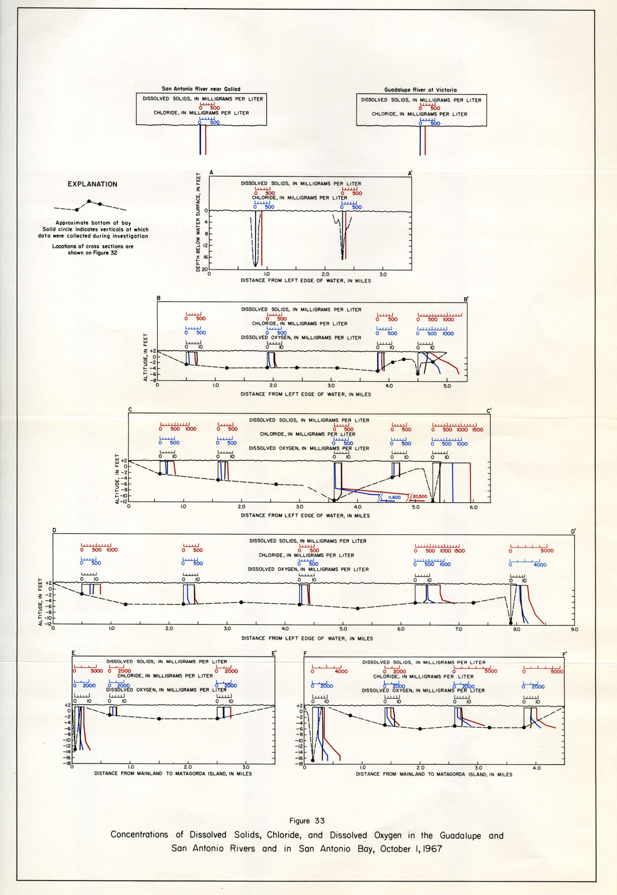
- figure 33 - Concentrations of Dissolved Solids, Chloride, and Dissolved Oxygen in the Guadalupe and San Antonio Rivers and in San Antonio Bay, October 1967
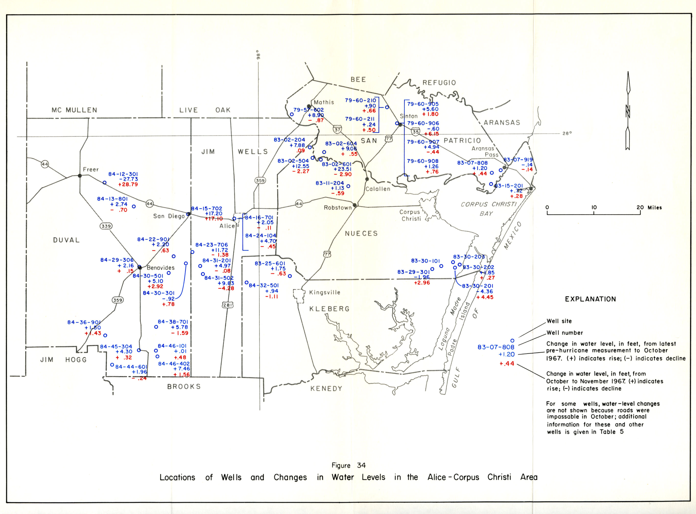
- figure 34 - Locations of wells and Changes in Water levels in the Alice-Corpus Christi Area
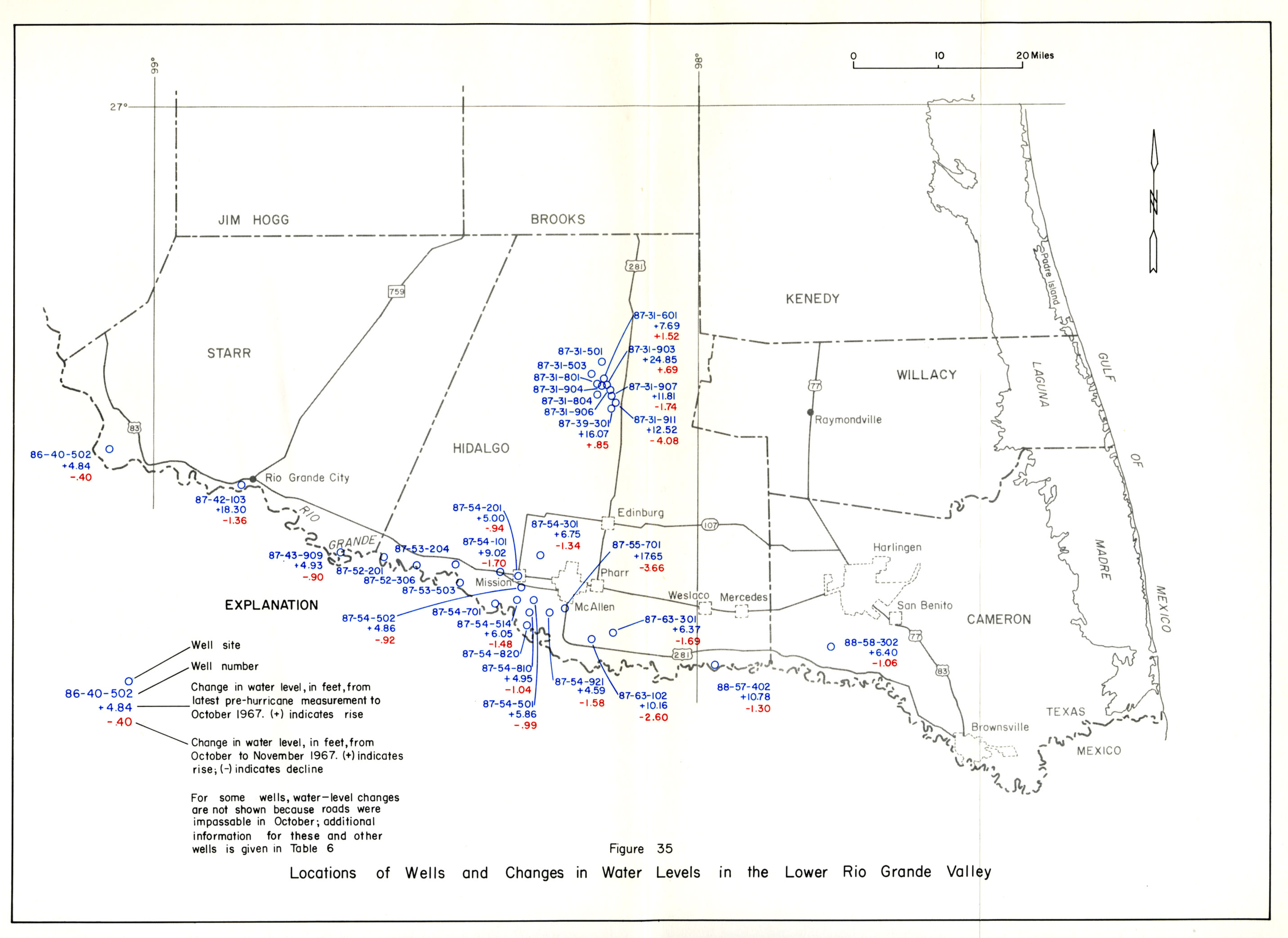
- figure 35 - Locations of wells and Changes in Water levels in the Lower Rio Grande Valley
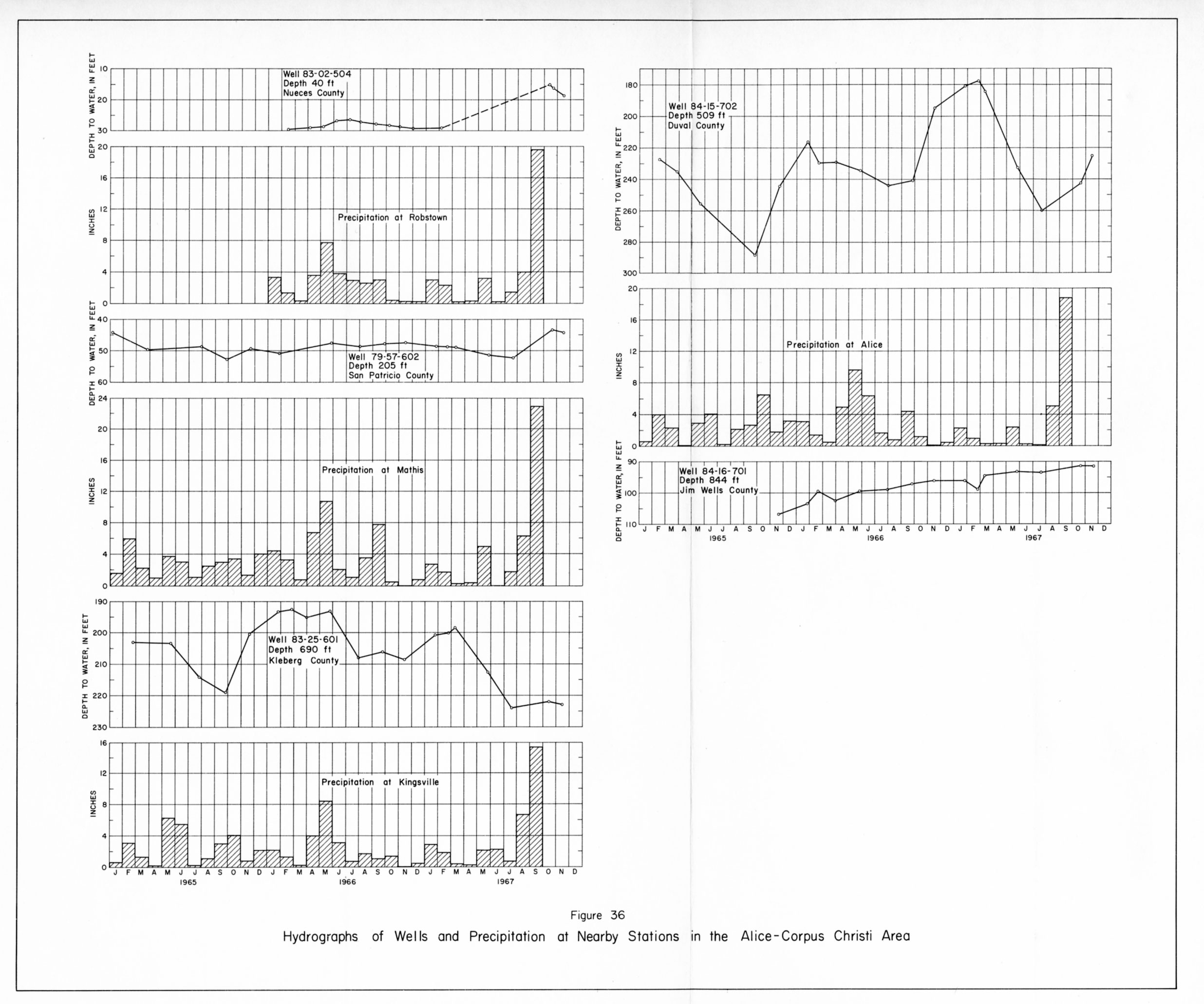
- figure 36 - Hydrographs of Wells and Precipitation at Nearby Stations in the Alice-Corpus Christi Area
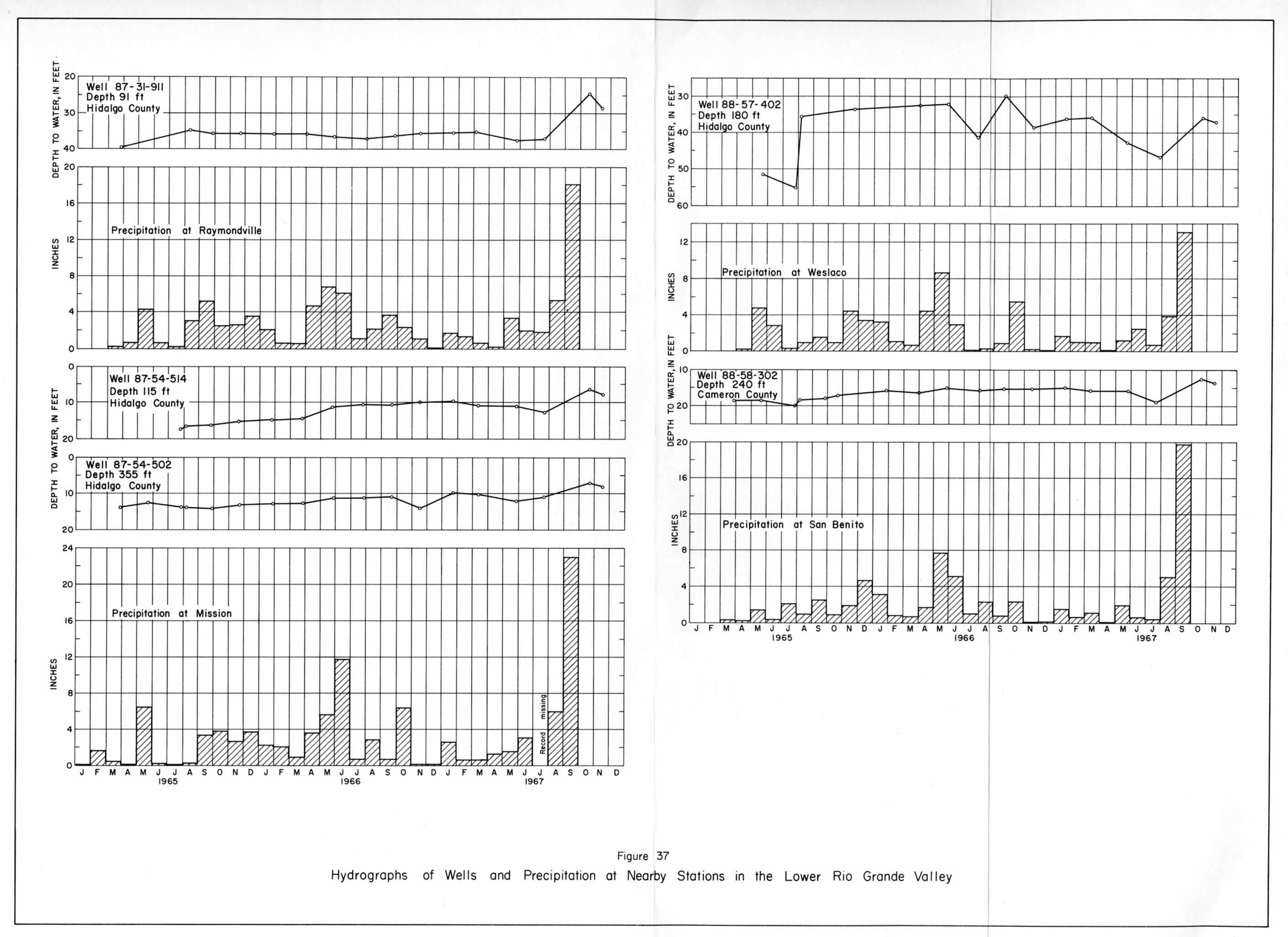
- figure 37 - Hydrographs of Wells and Precipitation at Nearby Stations in the Lower Rio Grande Valley
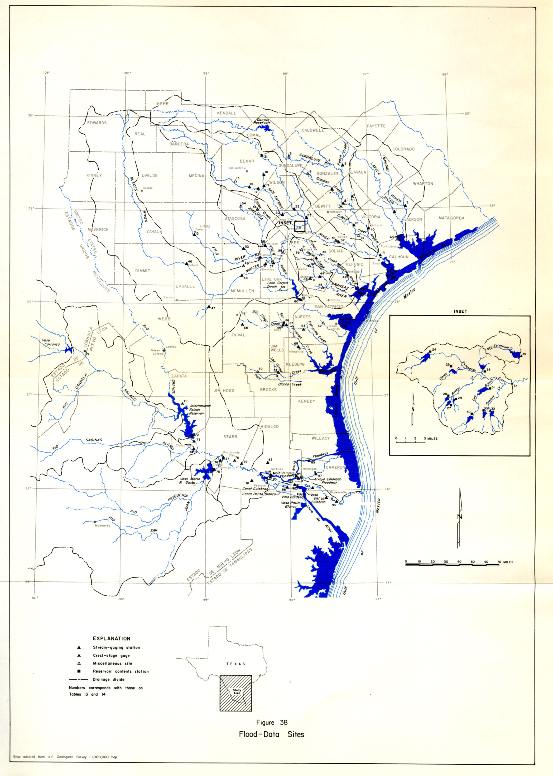
- figure 38 - Flood-Data Sites
see also Report 138