Report 82 by George R. Tarver, U.S. Geological Survey | August 1968
- Report 82 - Ground-Water Resources of Polk County, Texas
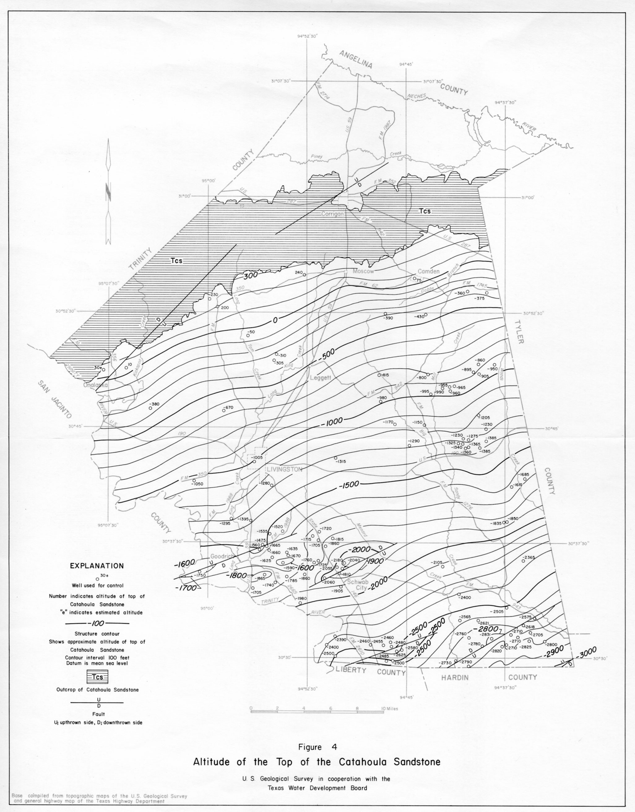
- figure 4 - Altitude of the Top of the Catahoula Sandstone
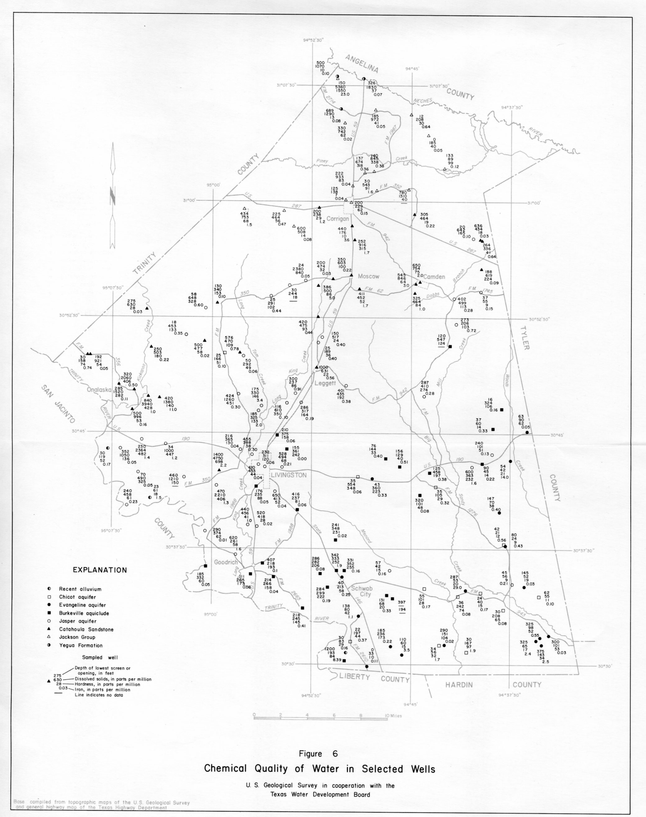
- figure 6 - Chemical Quality of Water in Selected Wells
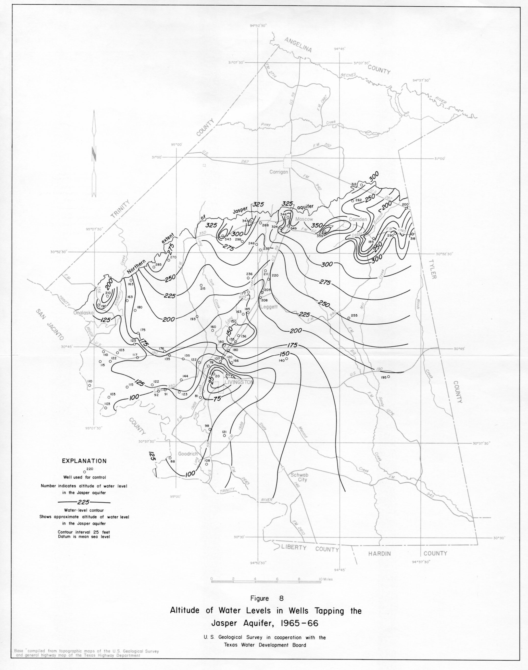
- figure 8 - Altitude of Water Levels in Wells Tapping the Jasper Aquifer, 1965-66
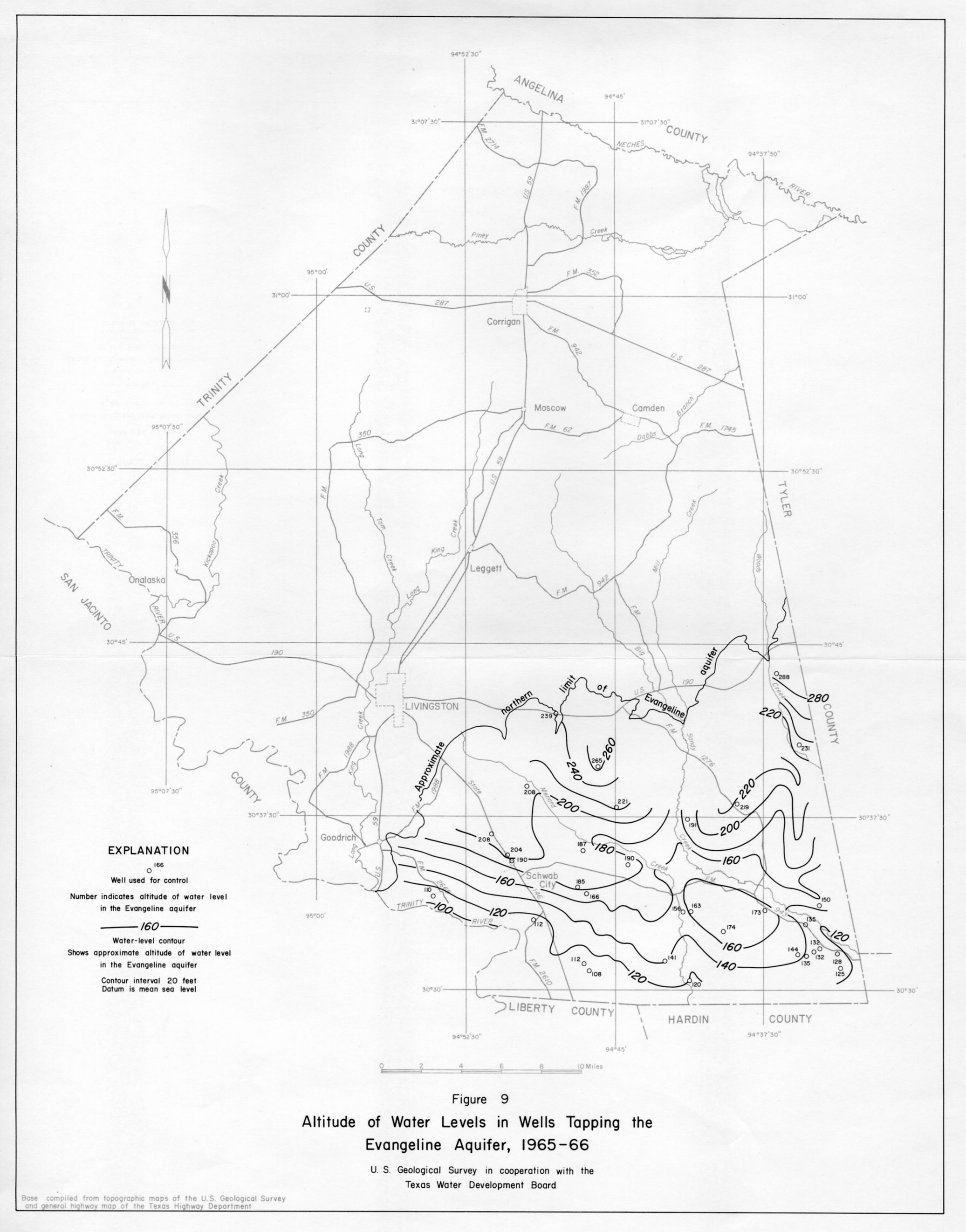
- figure 9 - Altitude of Water Levels in Wells Tapping the Evangeline Aquifer, 1965-66
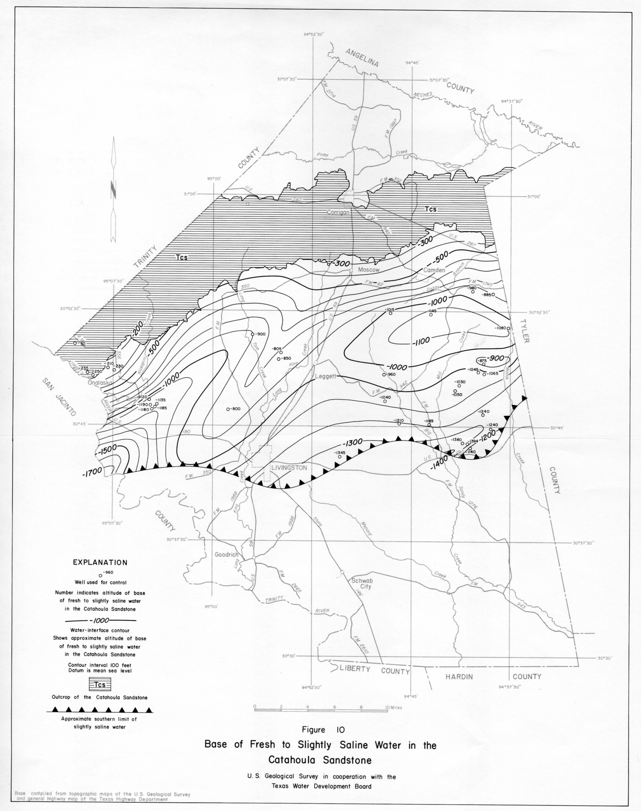
- figure 10 - Base of Fresh to Slightly Saline Water in the Catahoula Sandstone
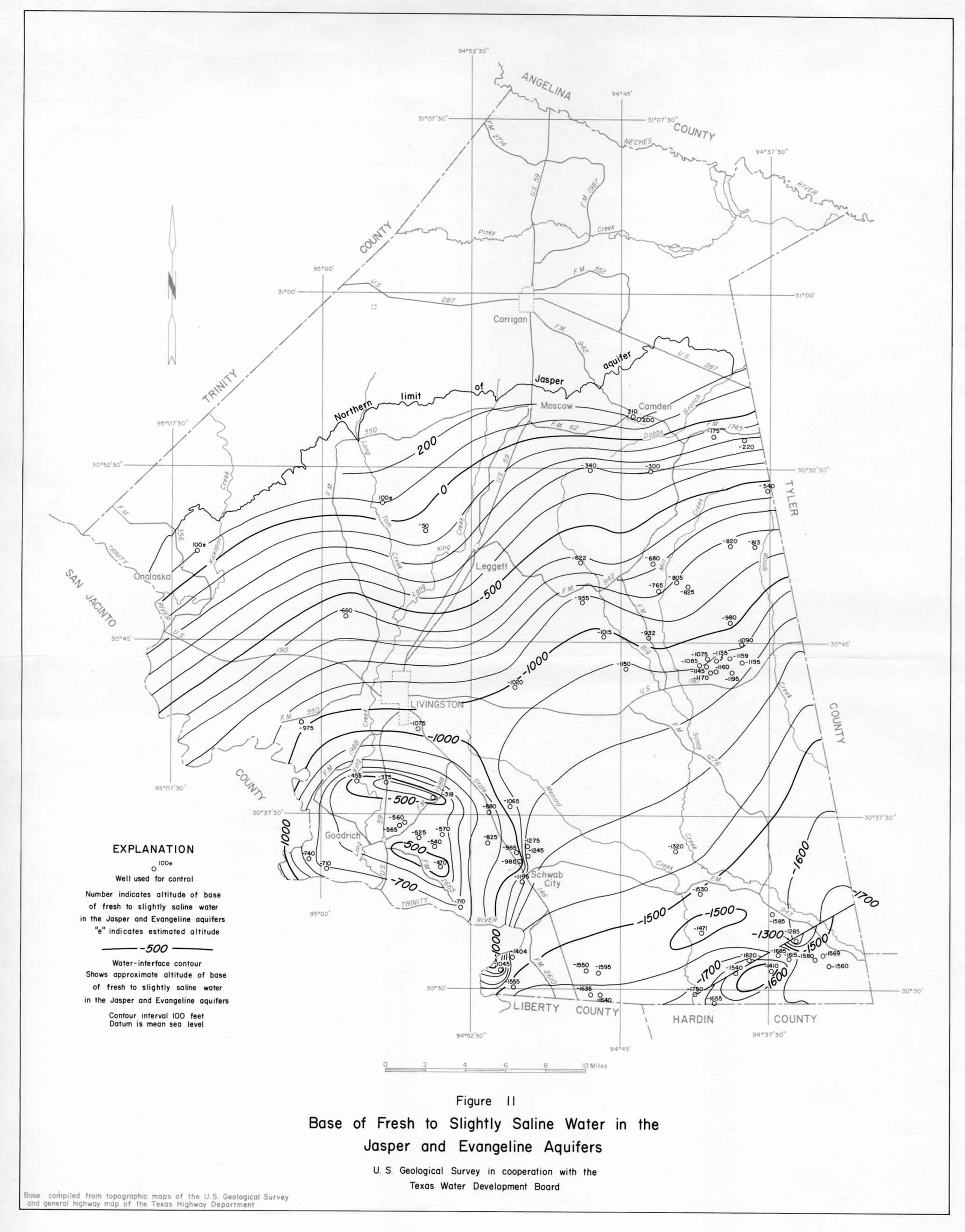
- figure 11 - Base of Fresh to Slightly Saline Water in the Jasper and Evangeline Aquifers
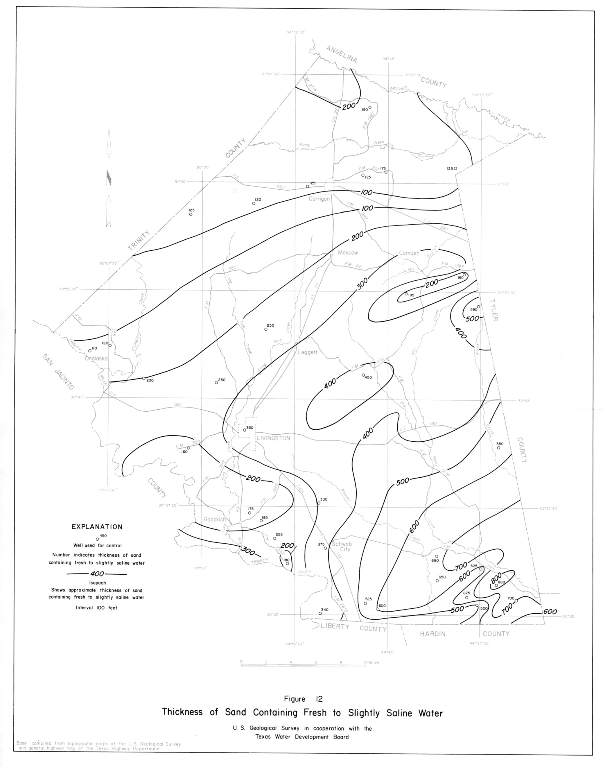
- figure 12 - Thickness of Sand Containing Fresh to Slightly Saline Water
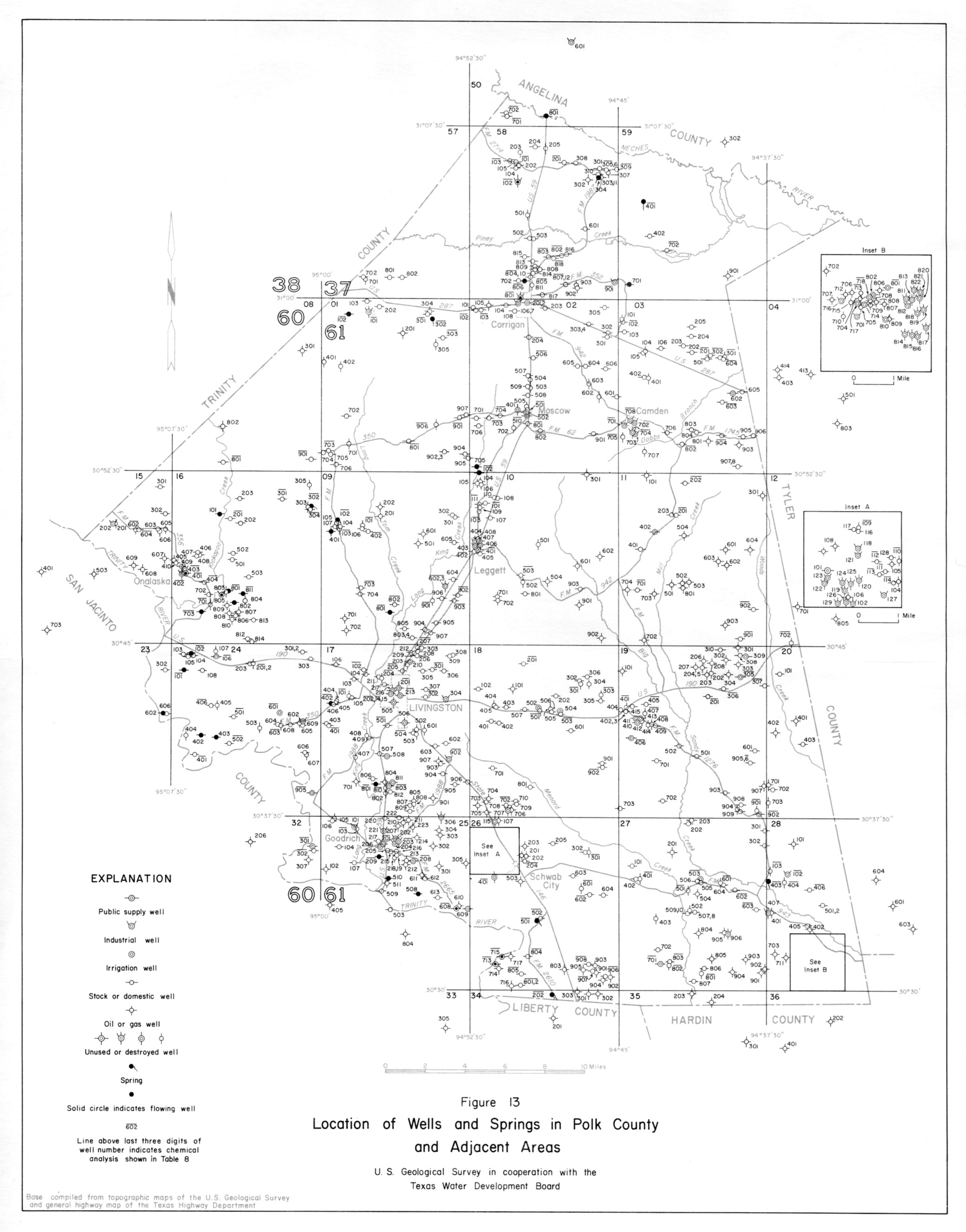
- figure 13 - Location of Wells and Springs in Polk County and Adjacent Areas
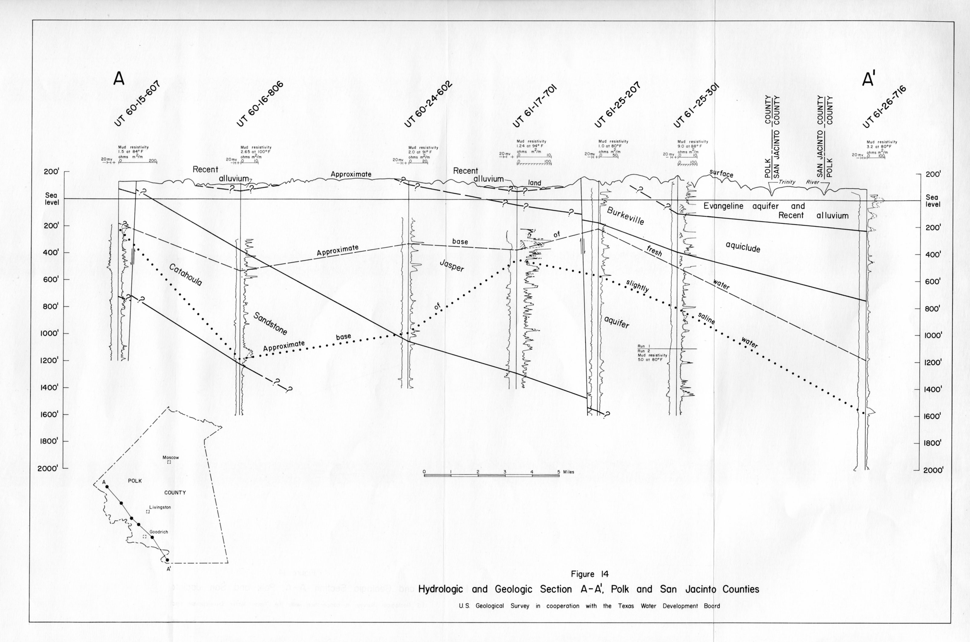
- figure 14 - Hydrologic and Geologic Section A-A,' Polk and San Jacinto Counties
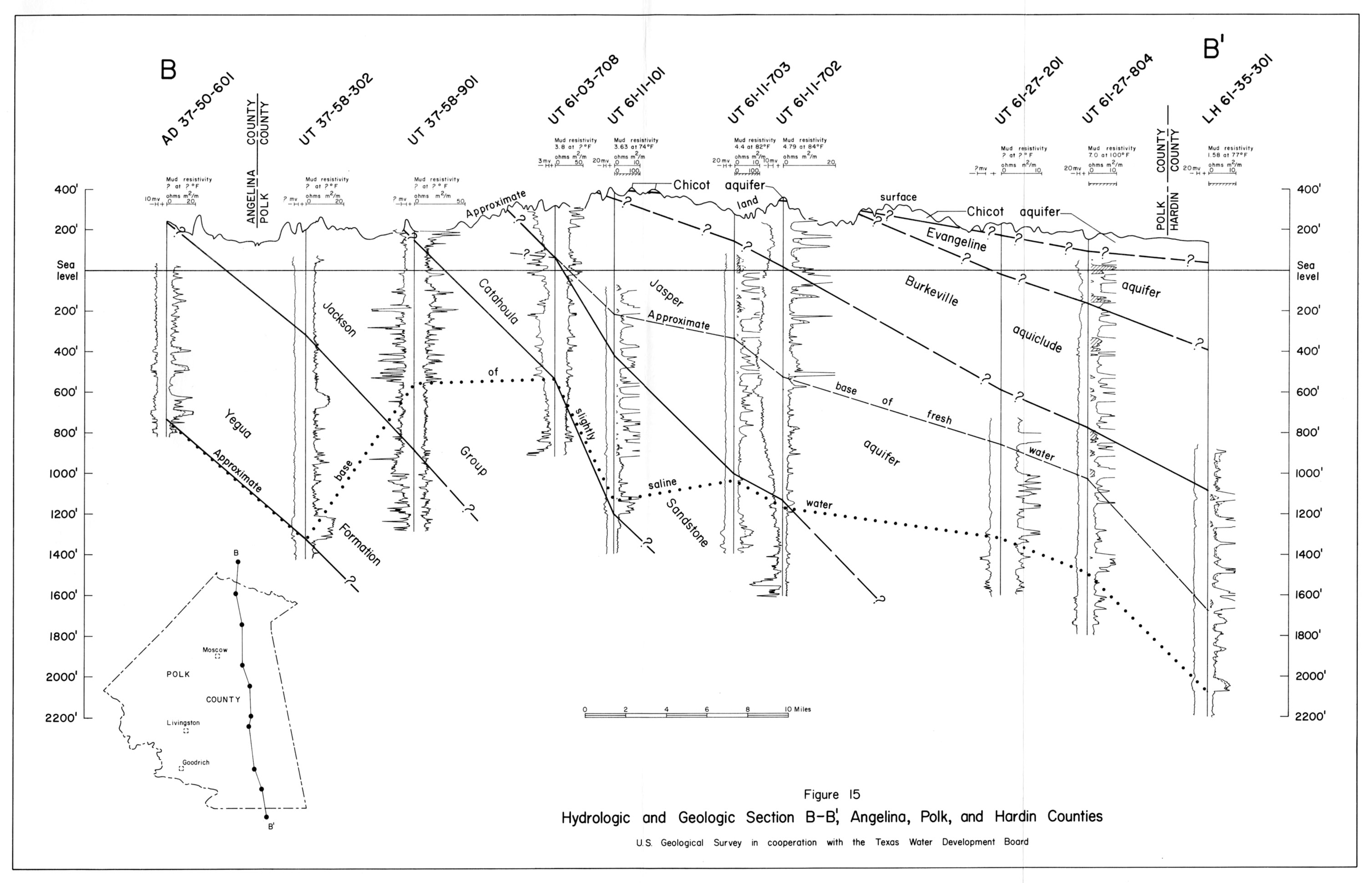
- figure 15 - Hydrologic and Geologic Section B-B,' Angelina, Polk, and Hardin Counties
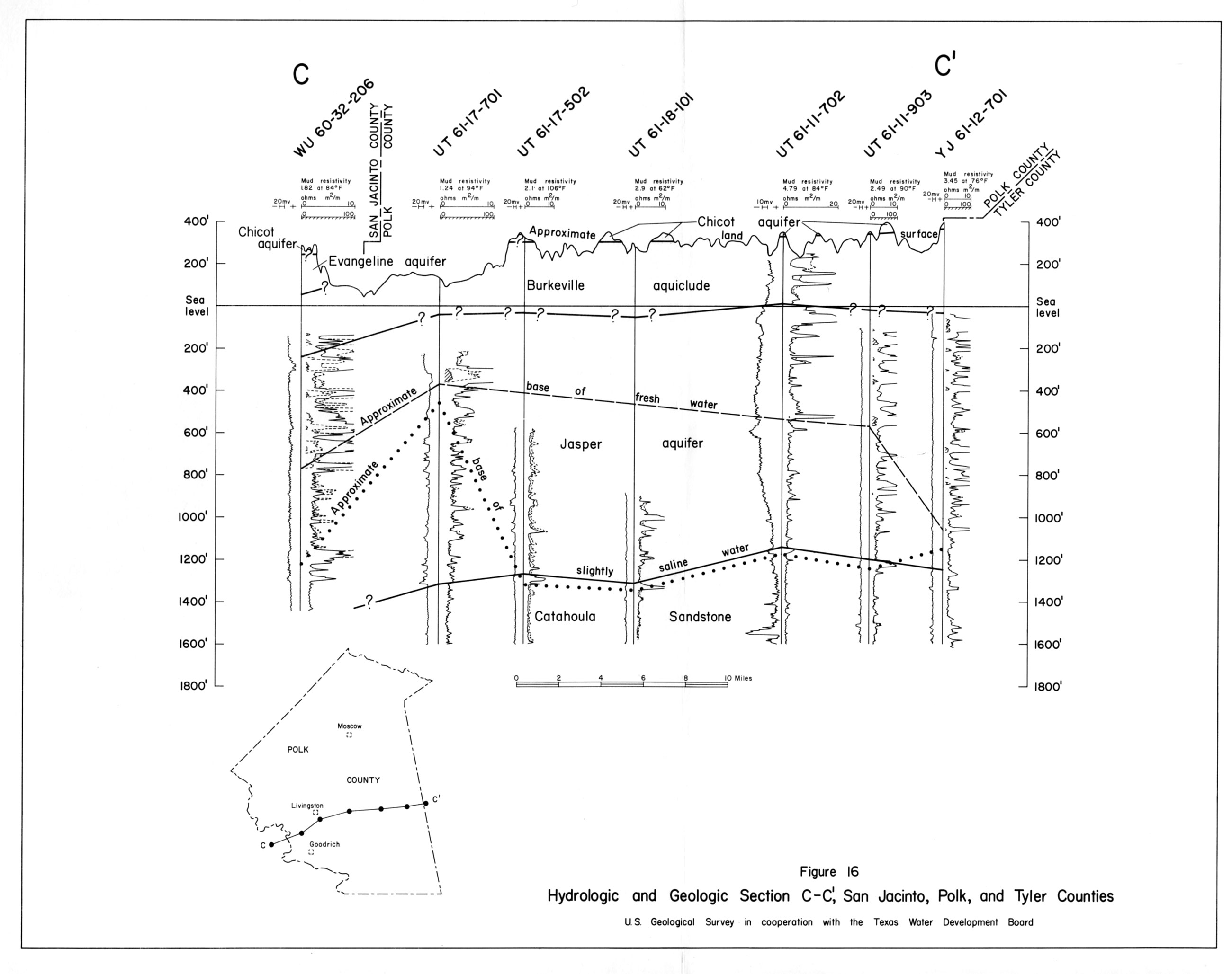
- figure 16 - Hydrologic and Geologic Section C-C,' San Jacinto, Polk, and Tyler Counties