Report 63 by R.K. Gabrysch, U.S. Geological Survey | October 1967
Note: the oversized fold-out maps below were scanned separately from the report and "missing pages" in the report are these maps.
- Report 63 - Development of Ground Water in the Houston District Texas, 1961-65
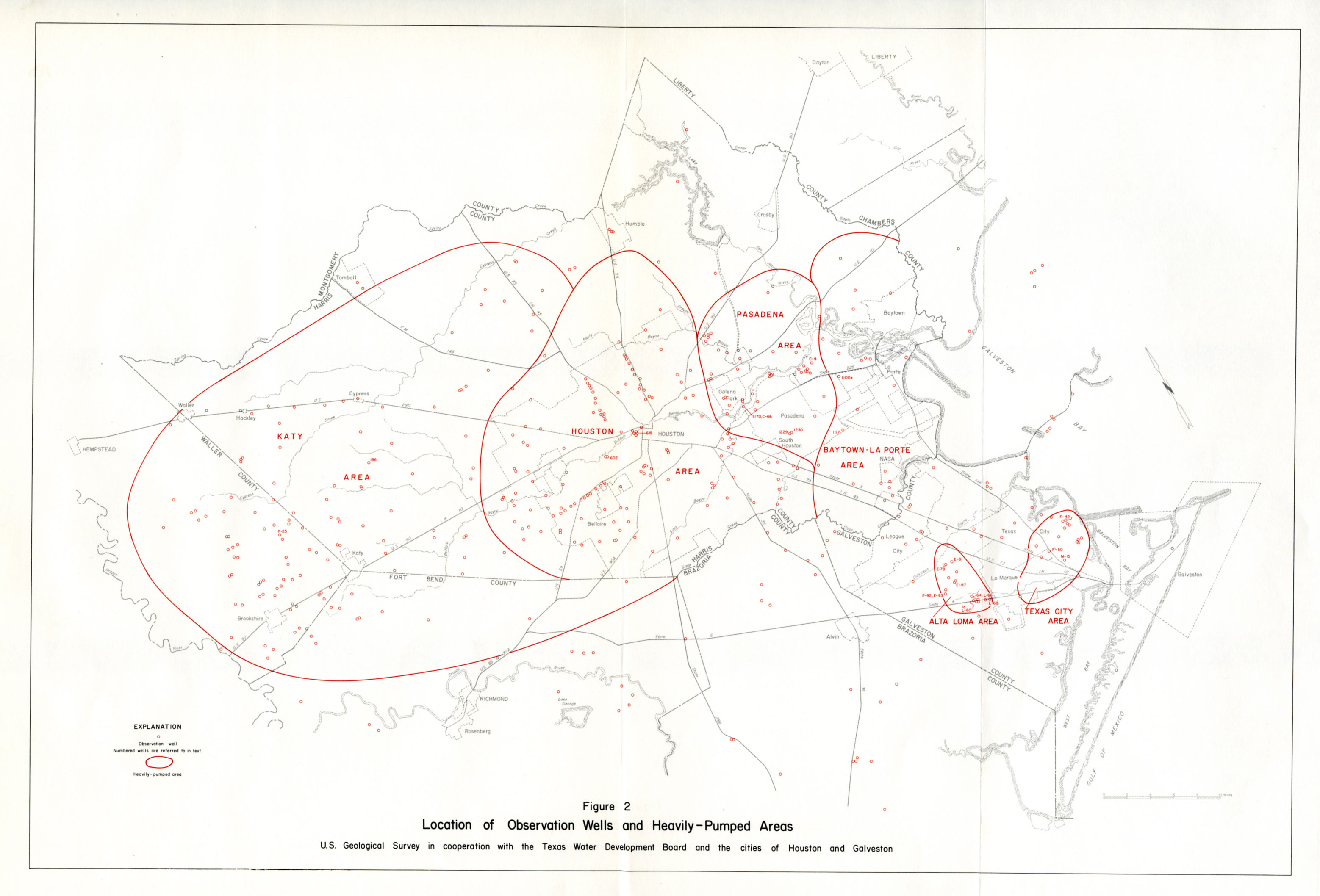
- figure 2 - Location of Observation Wells and Heavily-Pumped Areas
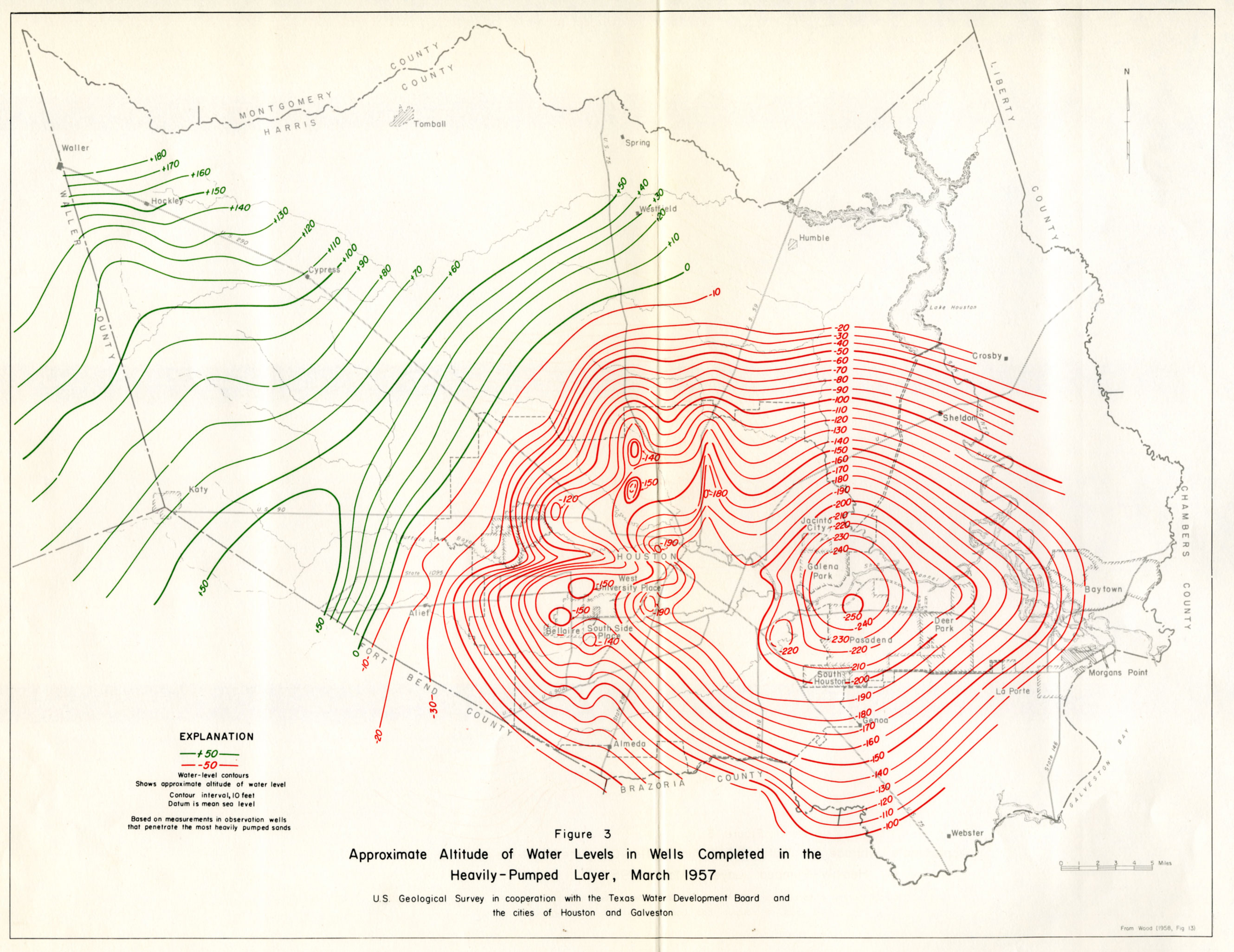
- figure 3 - Approximate Altitude of Water Levels in Wells Completed in the Heavily-Pumped Layer, March 1957
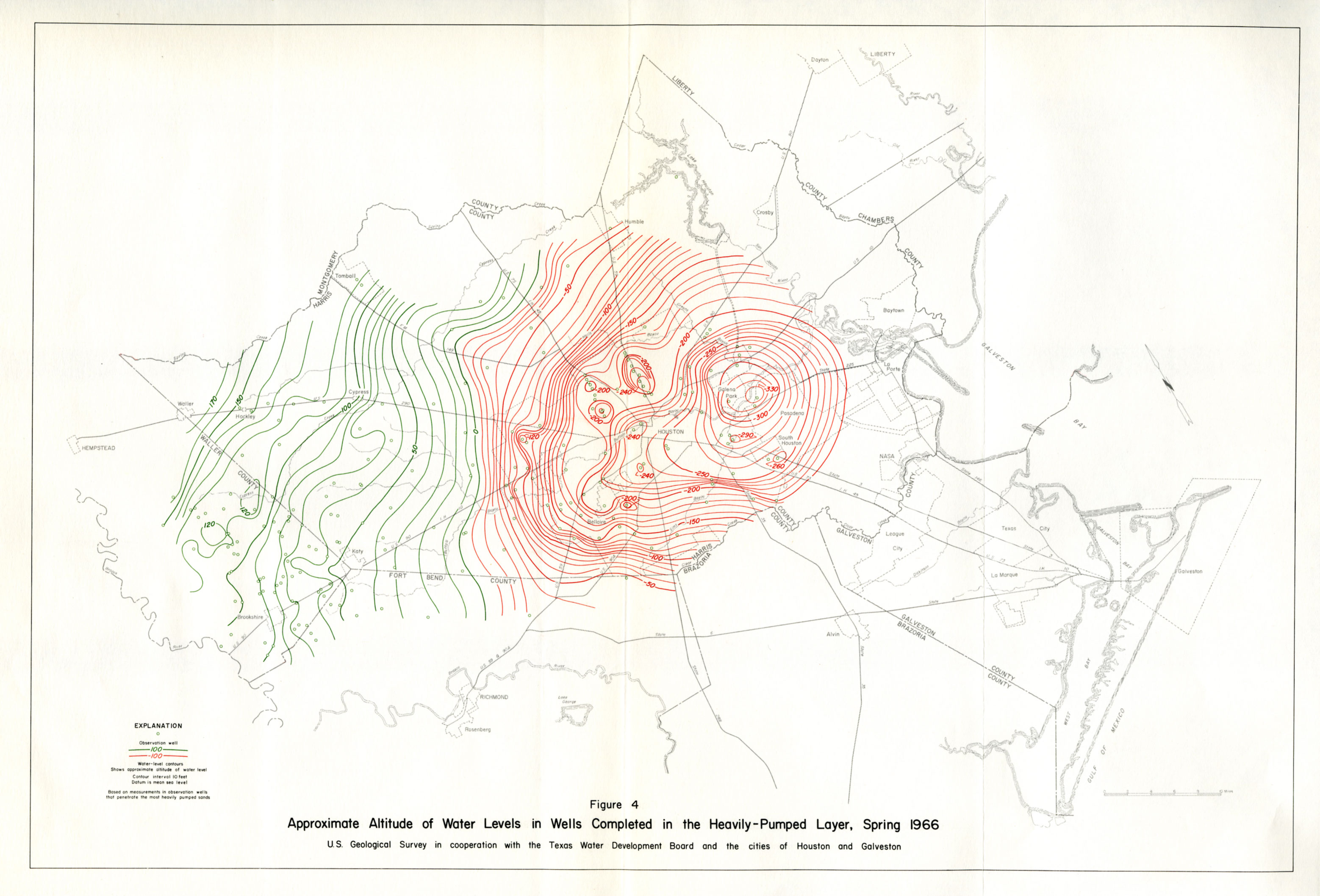
- figure 4 - Approximate Altitude of Water Levels in Wells Completed in the Heavily-Pumped Layer, Spring 1966
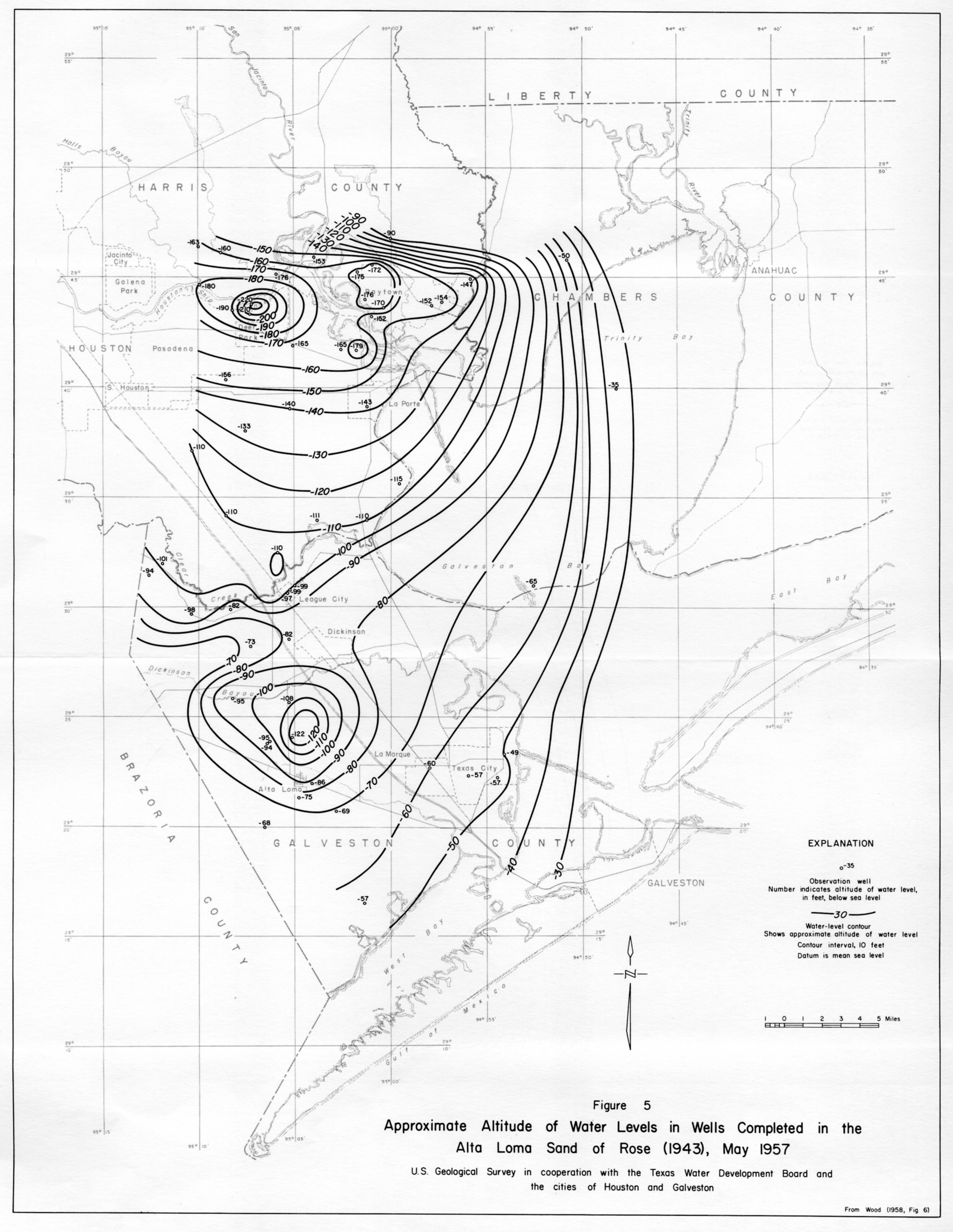
- figure 5 - Approximate Altitude of Water Levels in Wells Completed in the Alta Loma Sand of Rose (1943), May 1957
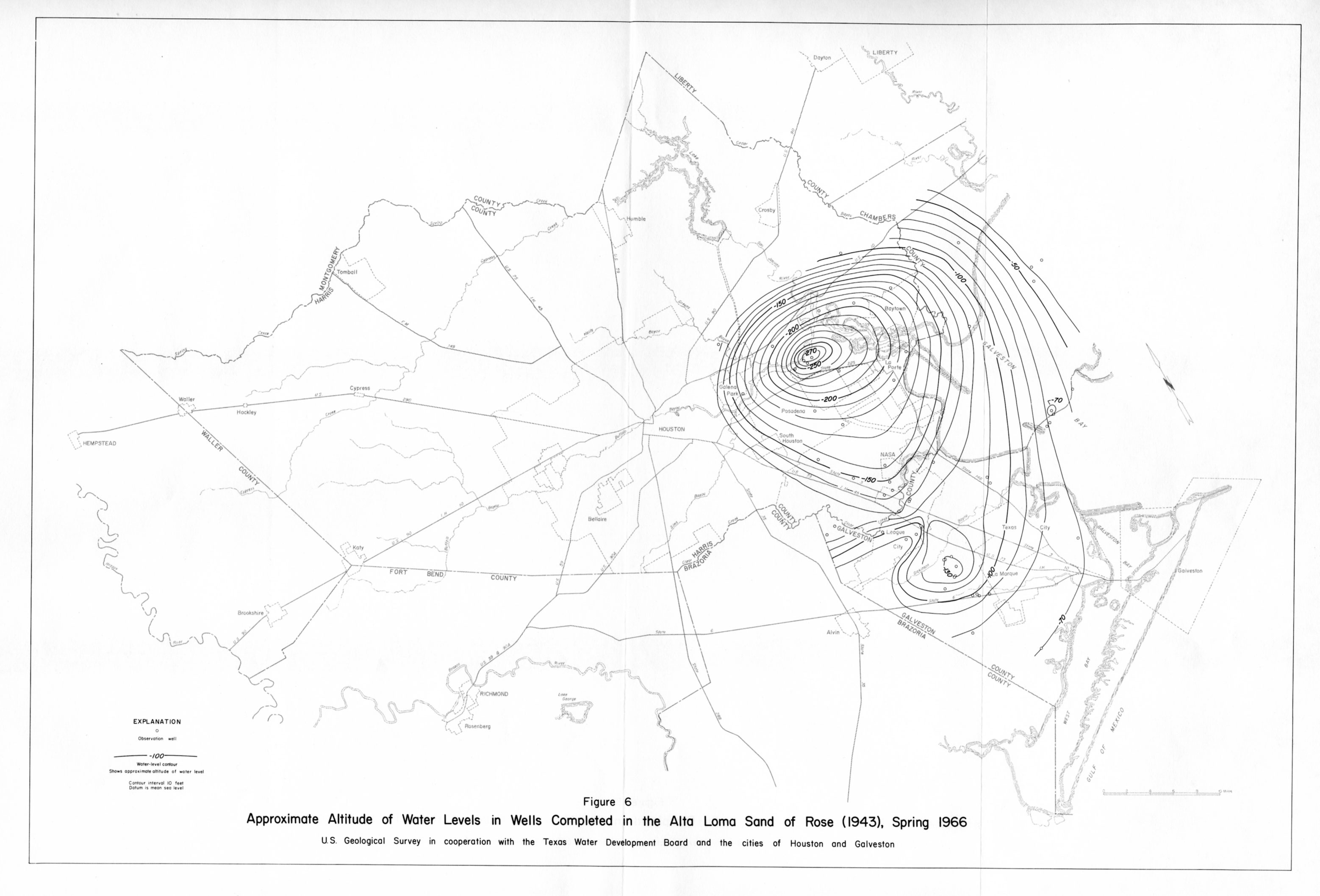
- figure 6 - Approximate Altitude of Water Levels in Wells Completed in the Alta Loma Sand of Rose (1943), Spring 1966
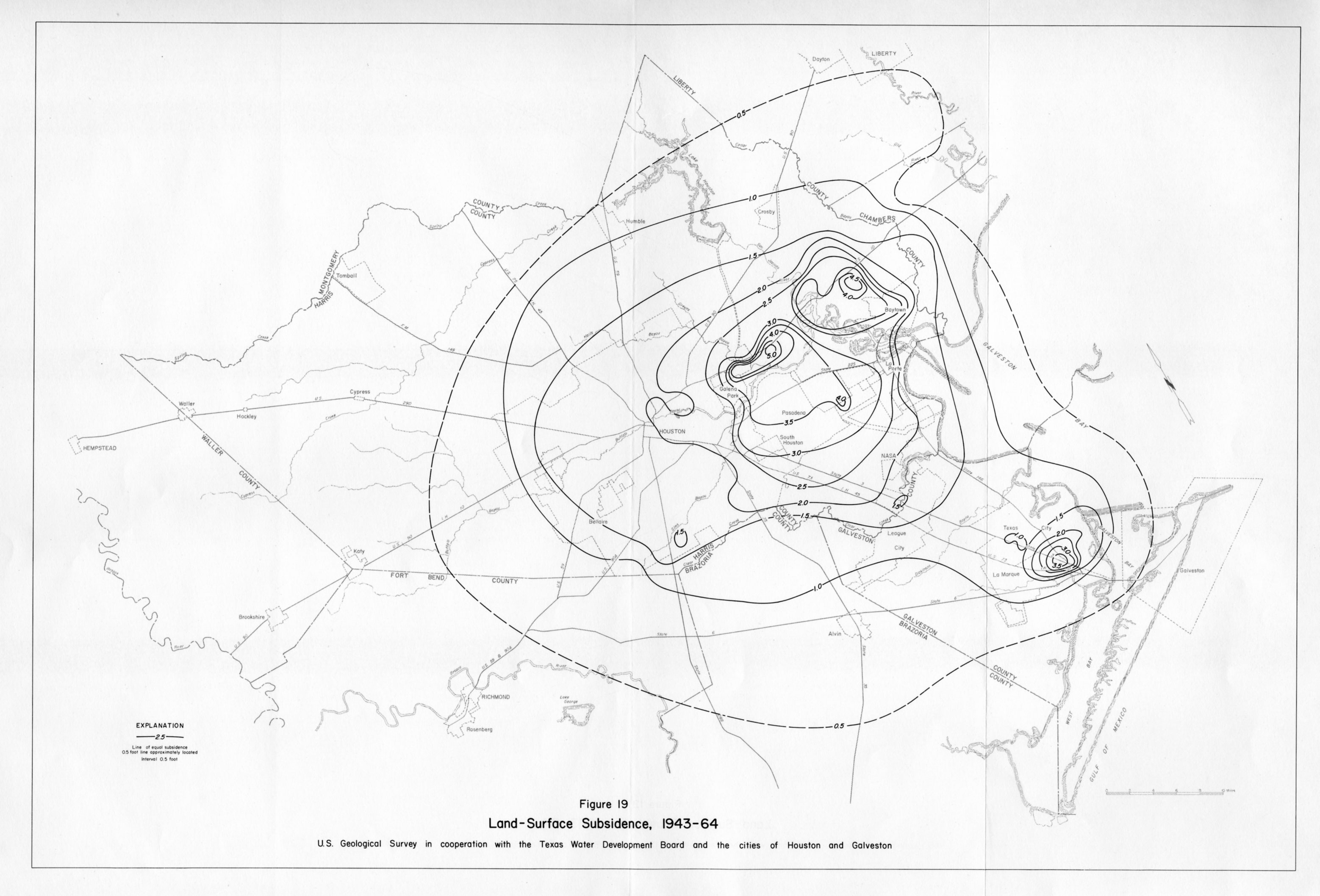
- figure 19 - Land-Surface Subsidence, 1943-64