Report 62 By Gerald L. Thompson U.S. Geological Survey | October 1967 (reprinted February 1987)
The oversize fold out map figures below were scanned separately from the report, so "missing pages" are these figures.
- Report 62 - Ground-Water Resources of Ellis County, Texas
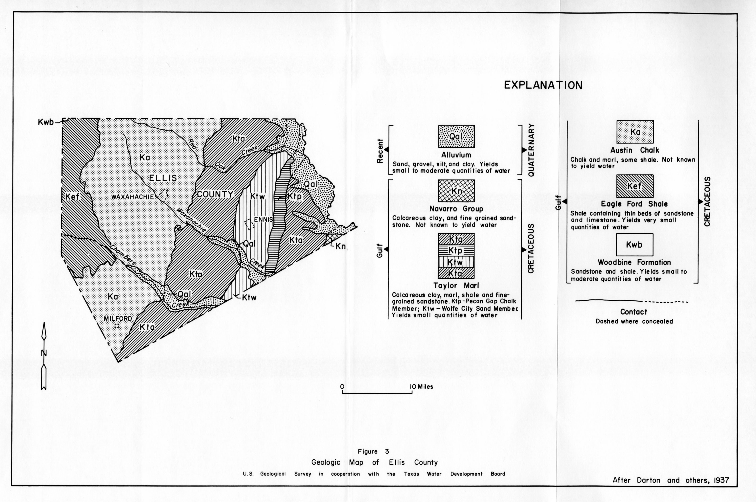
- figure 3 - Geologic Map of Ellis County
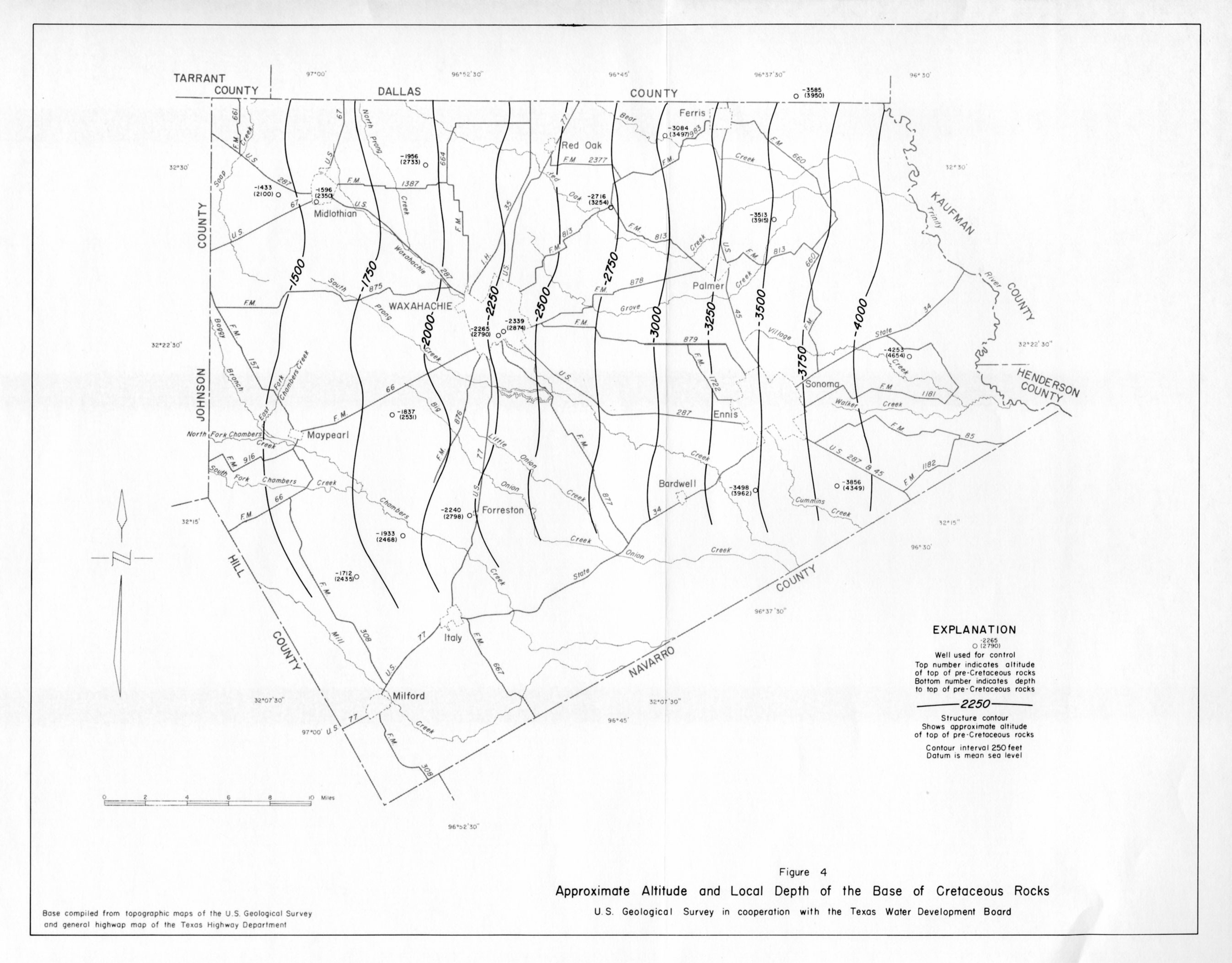
- figure 4 - Approximate Altitude and Local Depth of the Base of Cretaceous Rocks
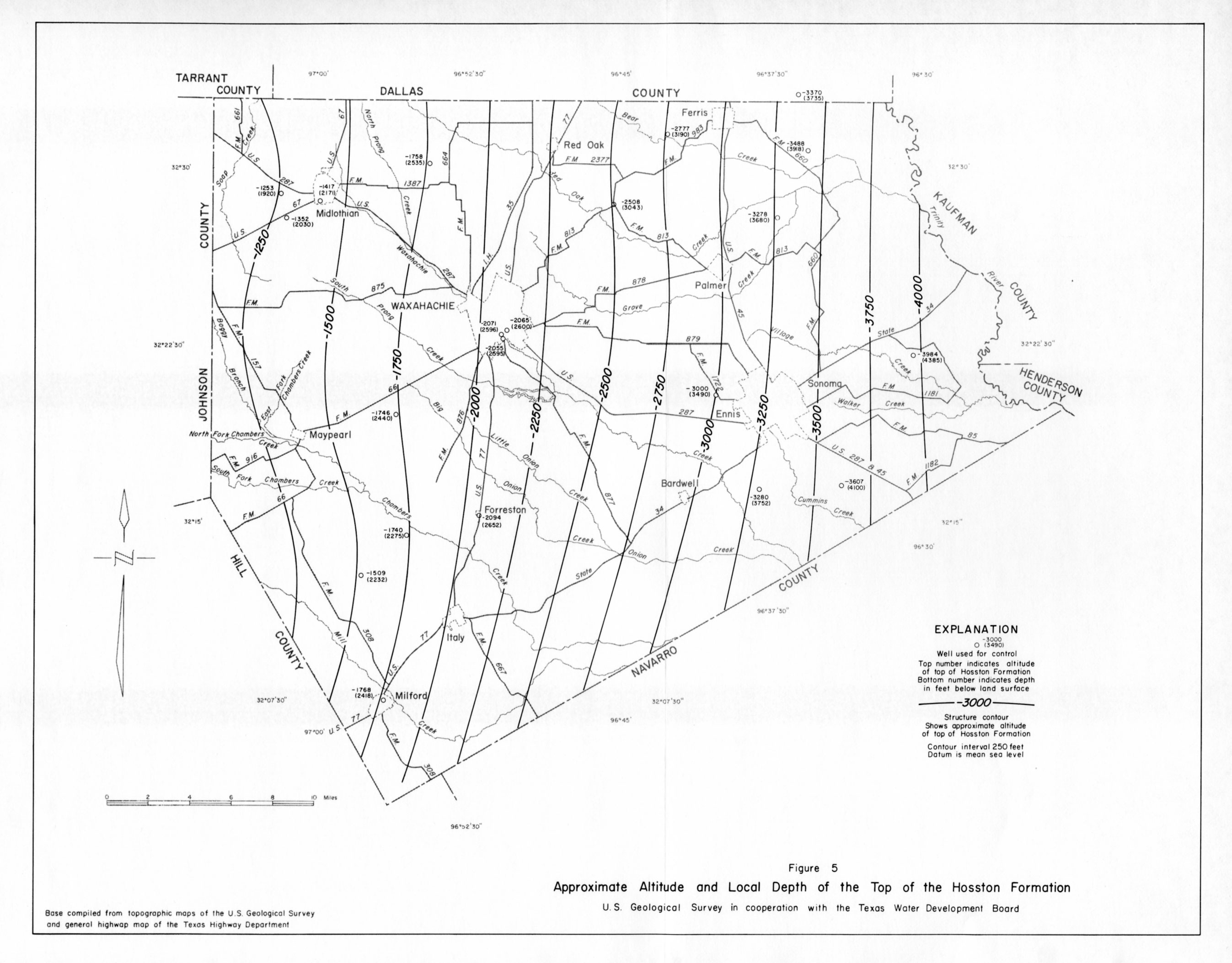
- figure 5 - Approximate Altitude and Local Depth of the Top of the Hosston Formation
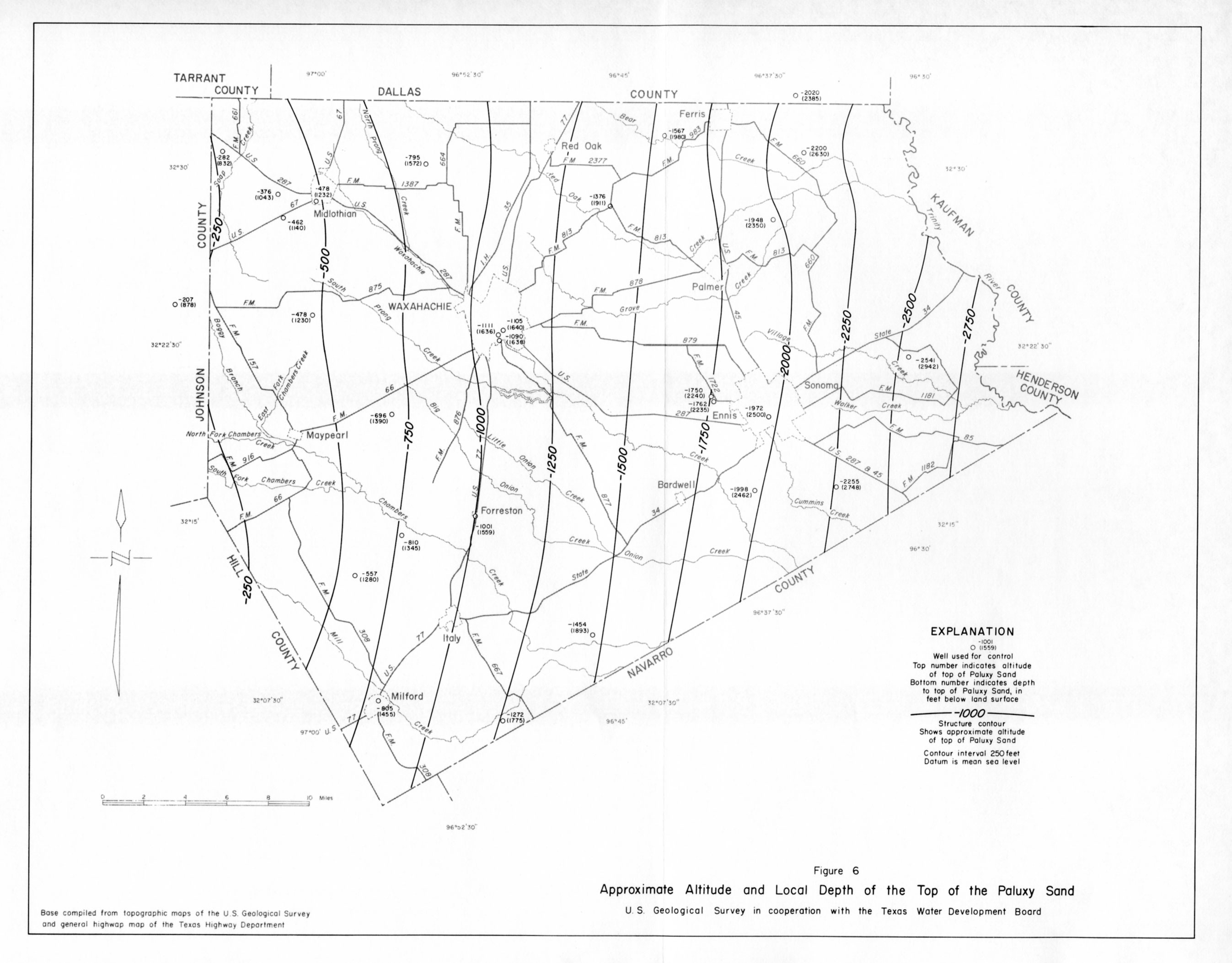
- figure 6 - Approximate Altitude and Local Depth of the Top of the Paluxy Sand
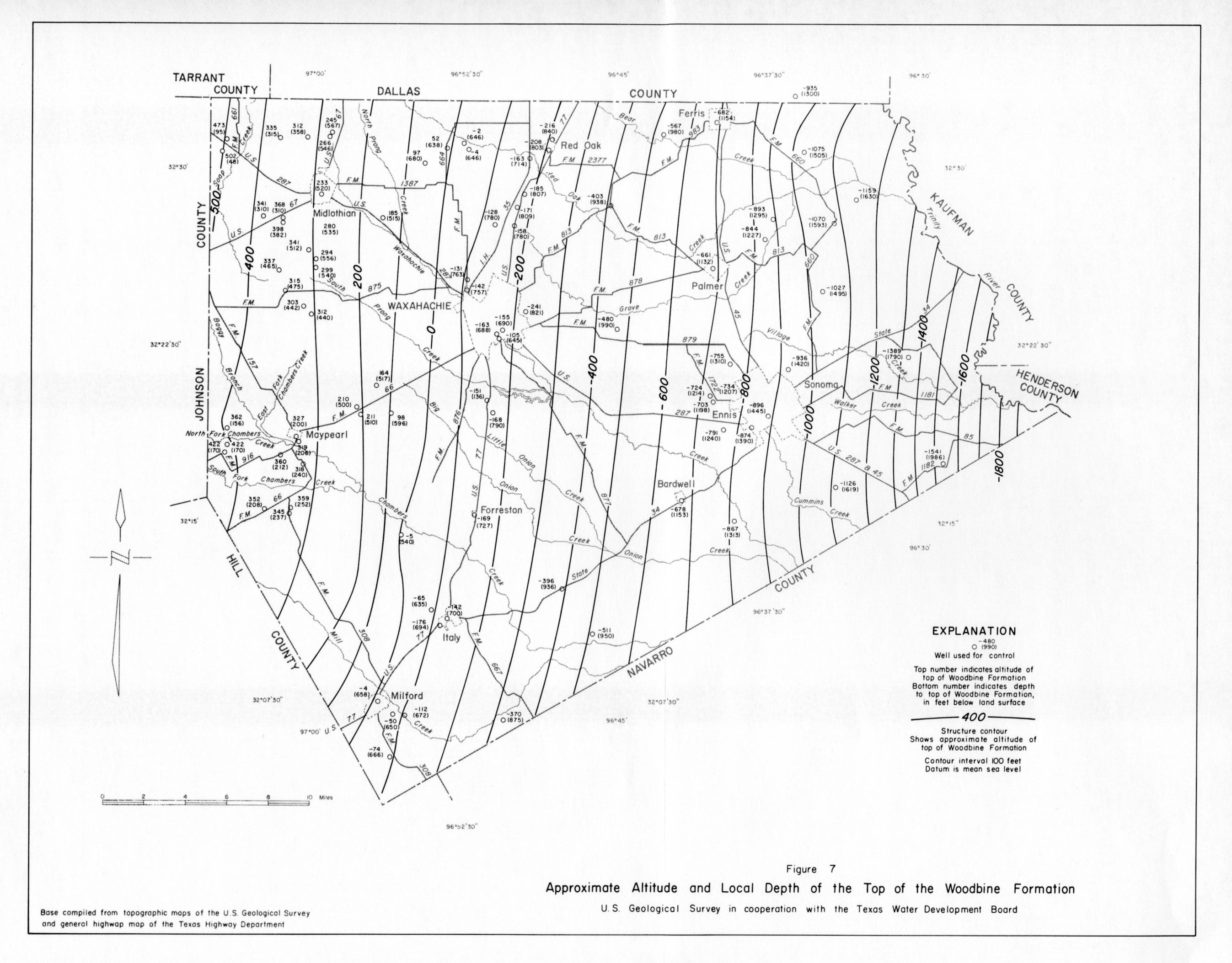
- figure 7 - Approximate Altitude and Local Depth of the Top of the Woodbine Formation
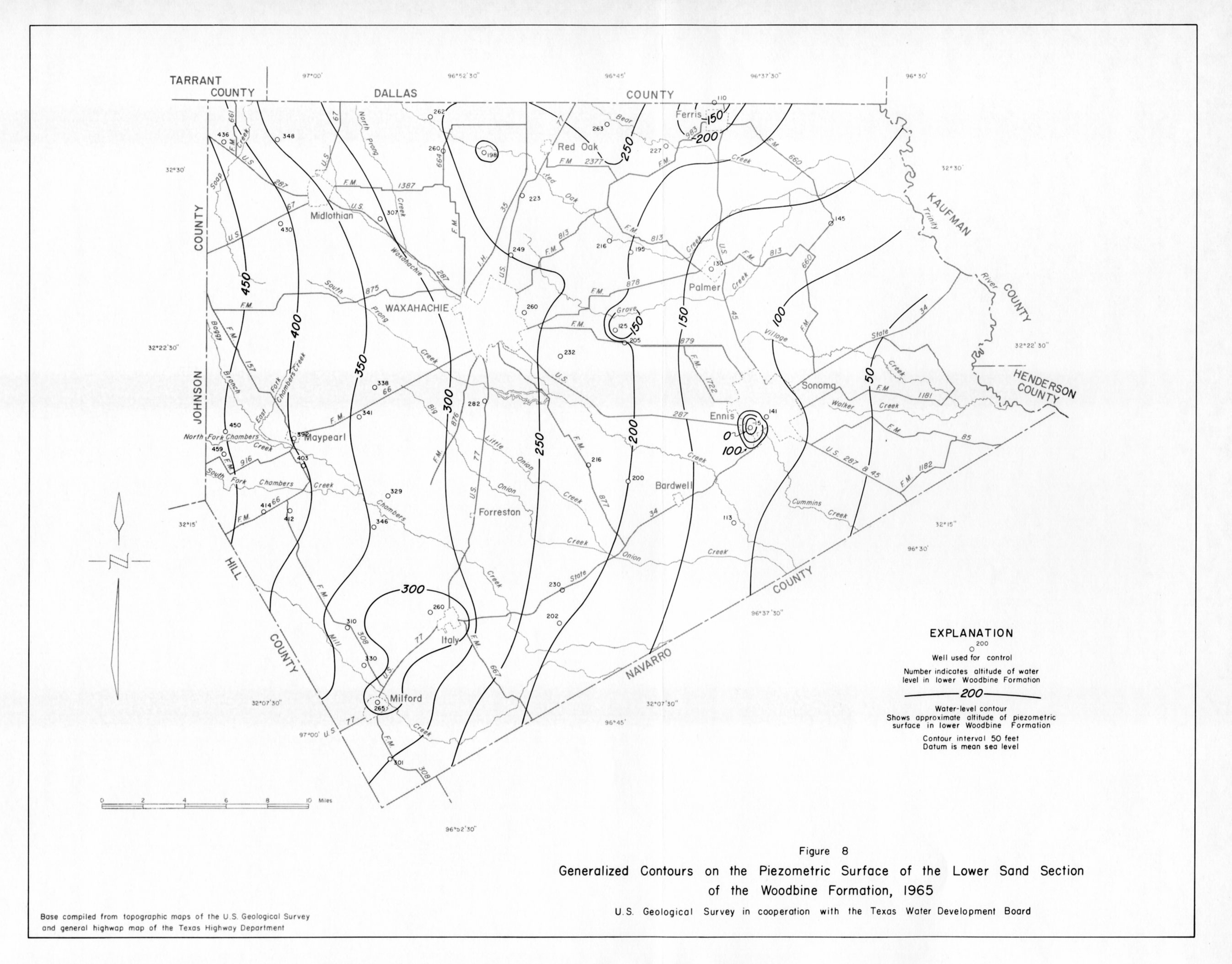
- figure 8 - Generalized Contours on the Piezometric Surface of the Lower Sand Section of the Woodbine Formation, 1965
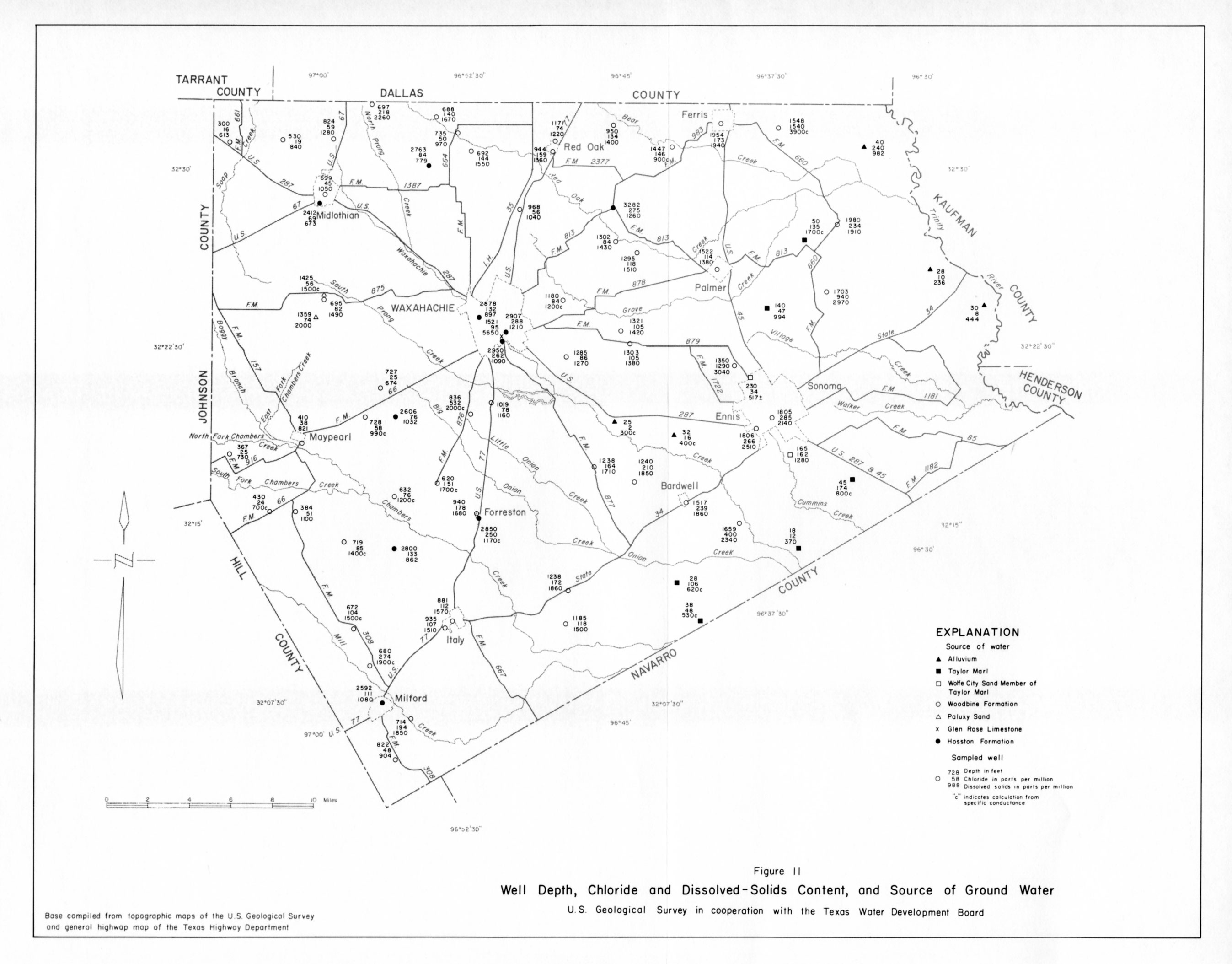
- figure 11 - Well Depth, Chloride and Dissolved-Solids Content, and Source of Ground Water
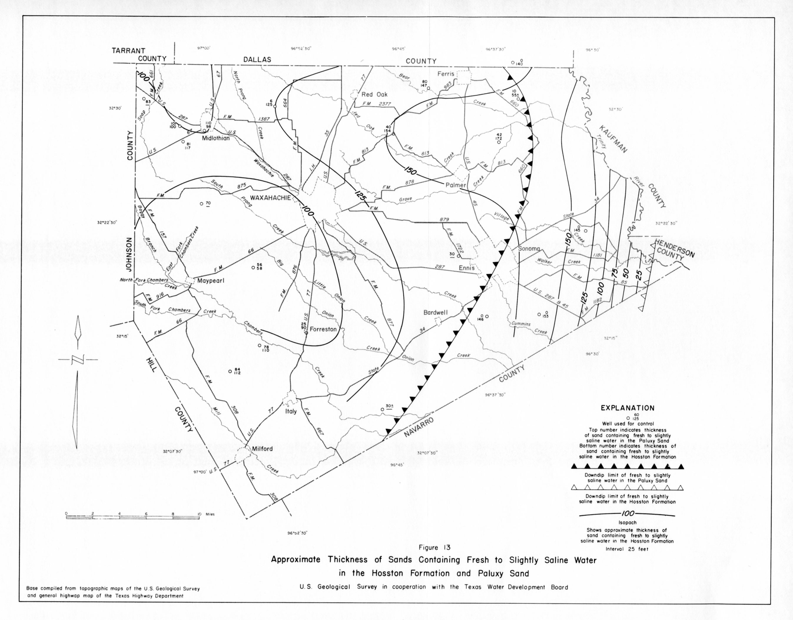
- figure 13 - Approximate Thickness of Sands Containing Fresh to Slightly Saline Water in the Hosston Formation and Paluxy Sand
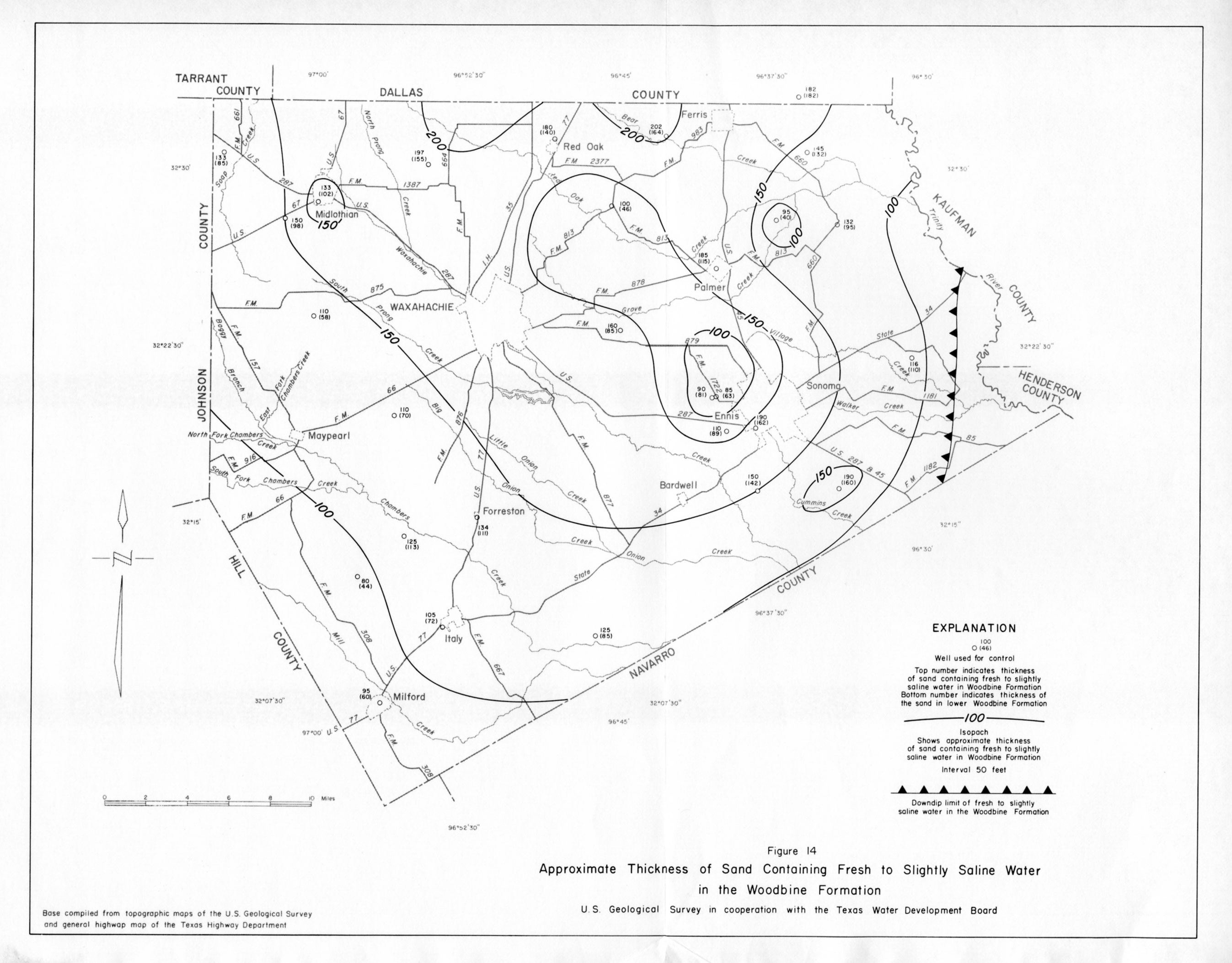
- figure 14 - Approximate Thickness of Sand Containing Fresh to Slightly Saline Water in the Woodbine Formation
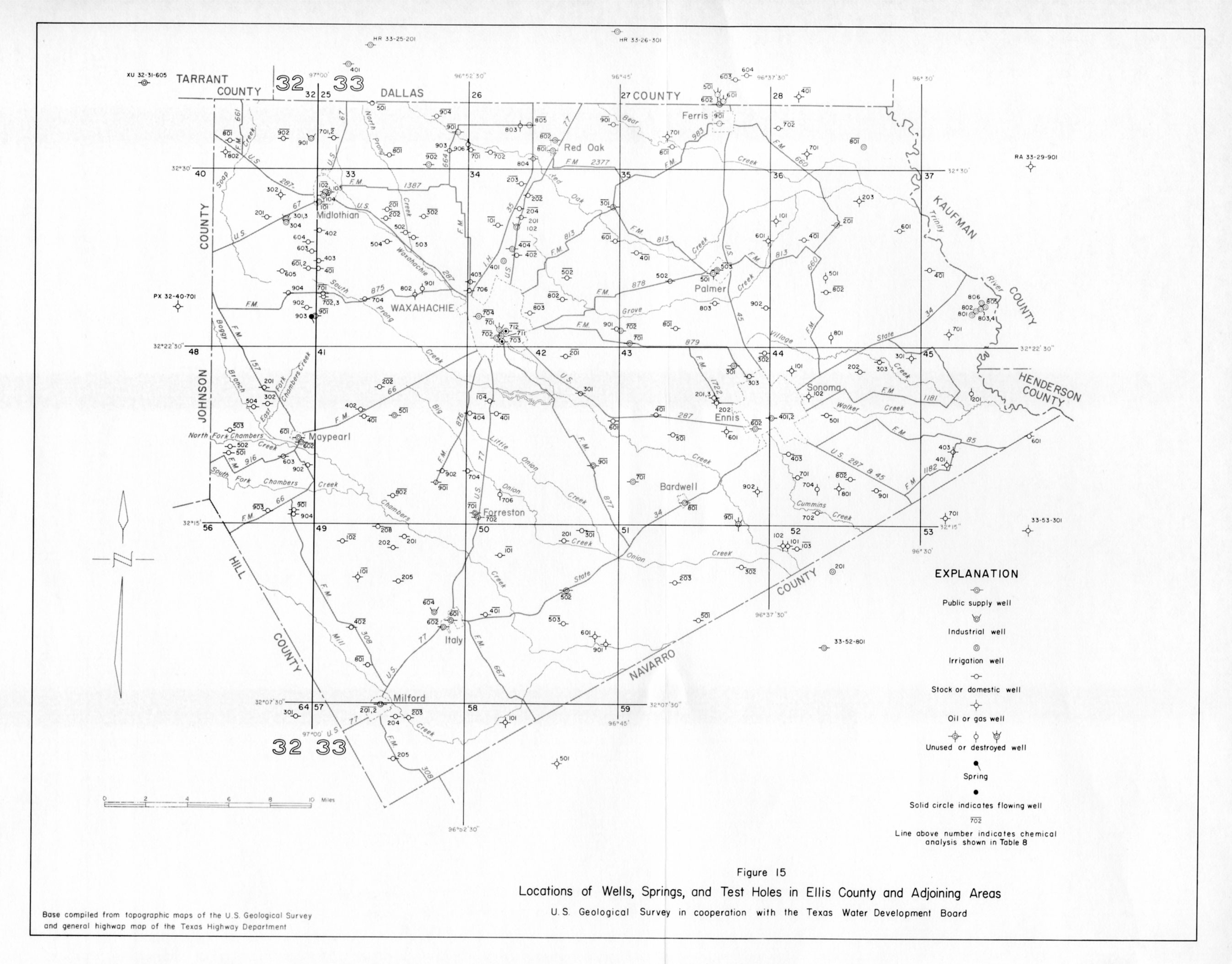
- figure 15 - Locations of wells, Springs, and Test Holes in Ellis County and Adjoining Areas
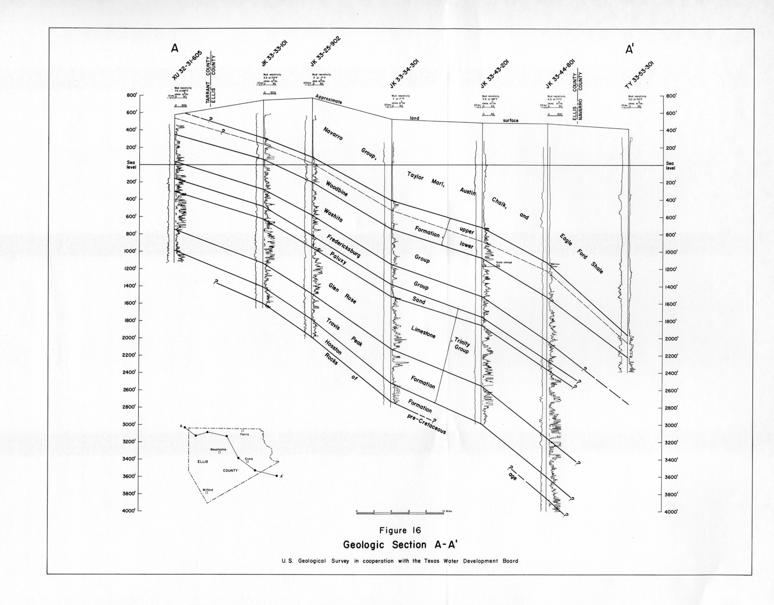
- figure 16 - Geologic Section A-A'
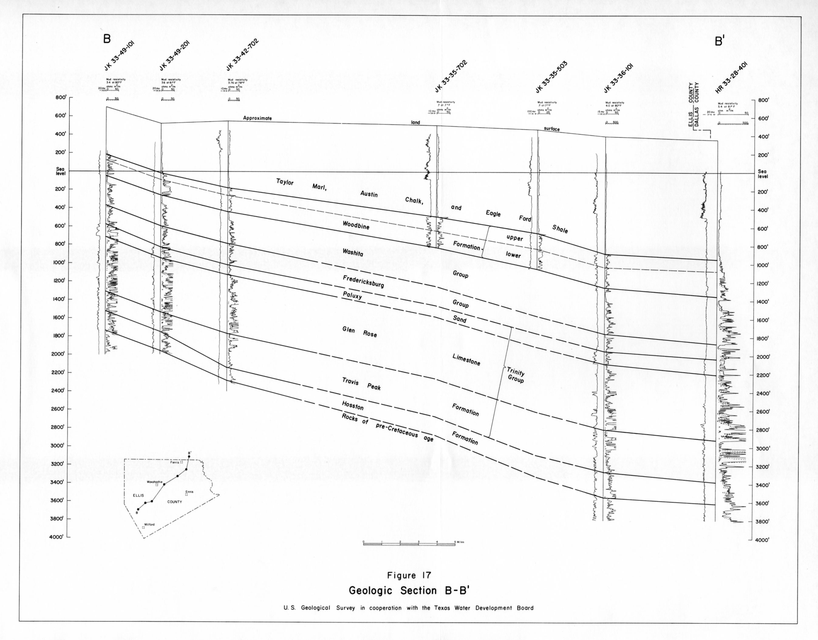
- figure 17 - Geologic Section B-B'