Report 61 By B.N. Myers and O.C. Dale, U.S. Geological Survey | October, 1967
- Report 61 - Ground-Water Resources of Brooks County, Texas
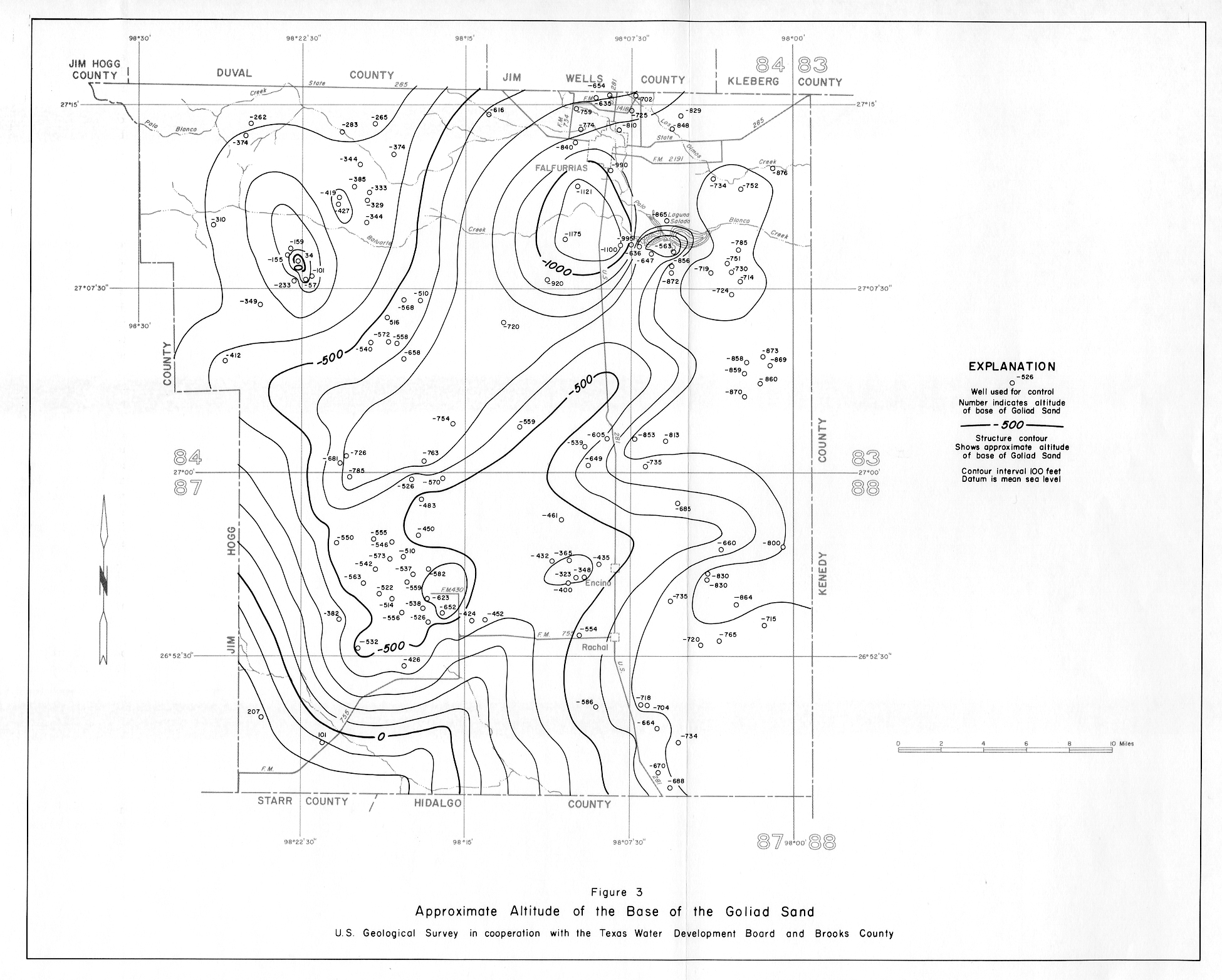
- Figure 3 - Approximate Altitude of the Base of the Goliad Sand
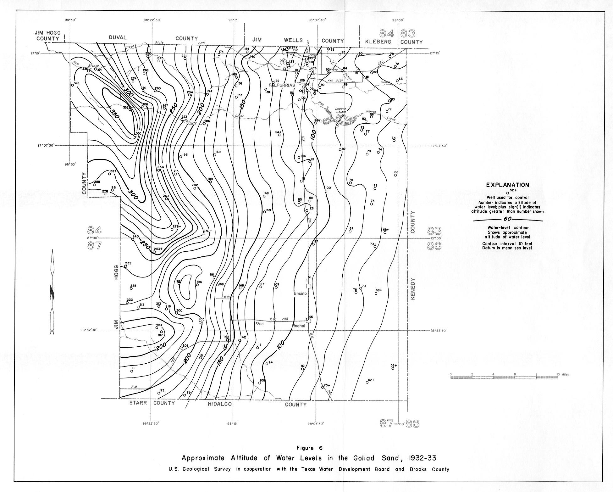
- Figure 6 - Approximate Altitude of Water Levels in the Goliad Sand, 1932-33
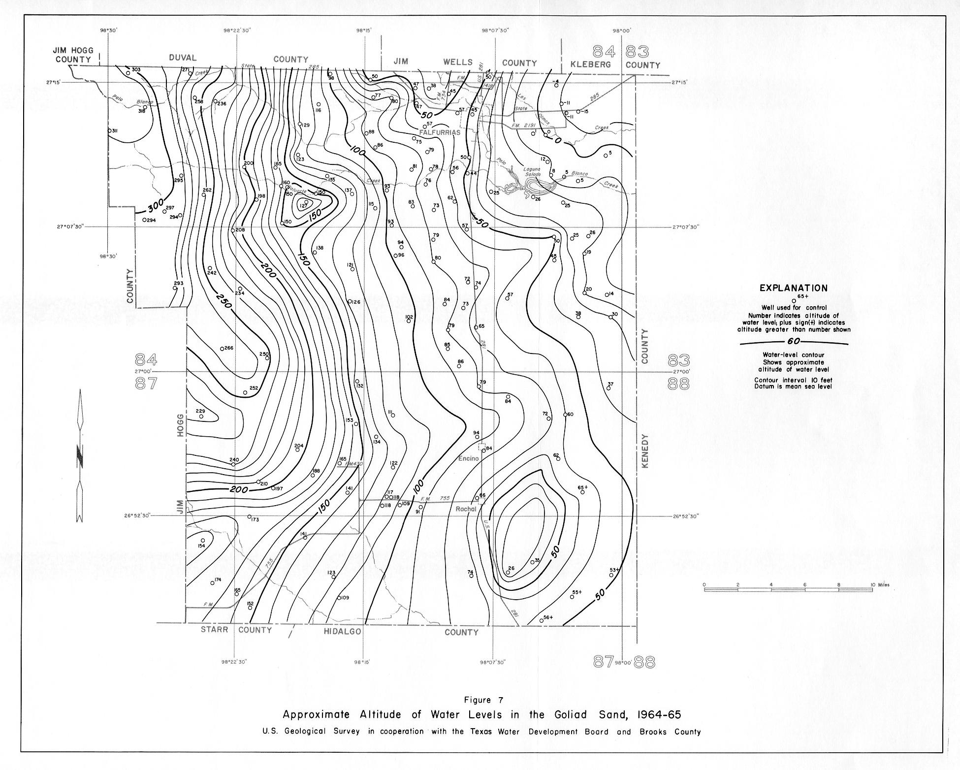
- Figure 7 - Approximate Altitude of Water Levels in the Goliad Sand, 1964-65
- Figure 8 - Approximate Changes in Water Levels in the Goliad Sand, 1932-33 to 1964-65
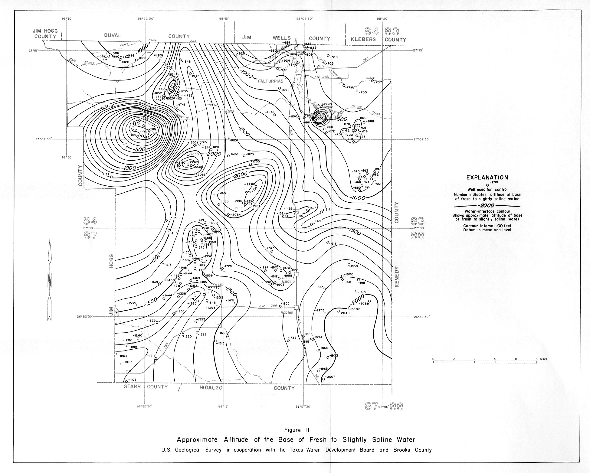
- Figure 11 - Approximate Altitude of the Base of Fresh to Slightly Saline Water
- Figure 12 - Depth of Wells tapping the Goliad Sand and Oakville Sandstone, and Chloride and Dissolved-Solids Content of water from Selected Wells and Salt-Water Disposal Pits
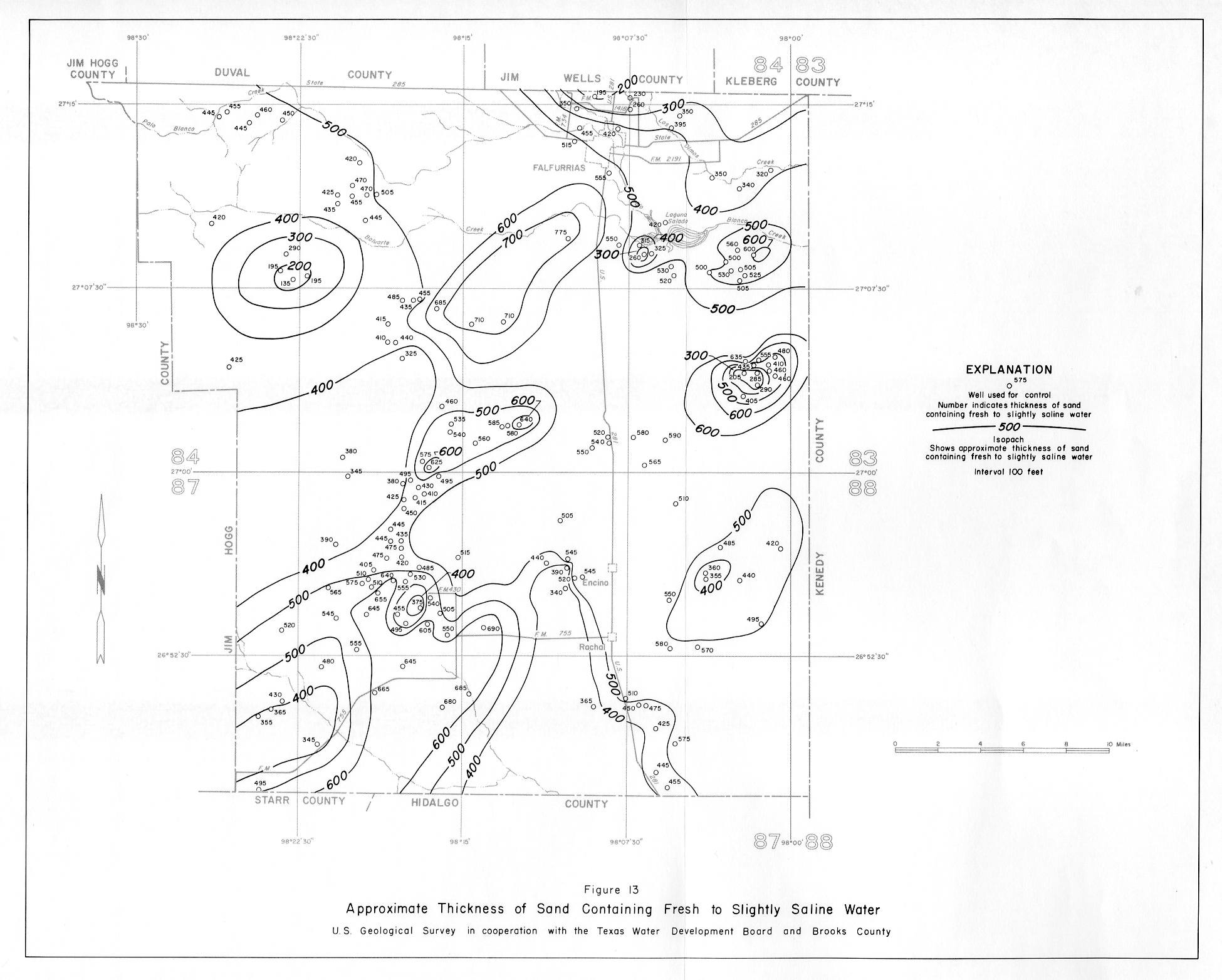
- Figure 13 - Approximate Thickness of Sand Containing Fresh to Slightly Saline Water
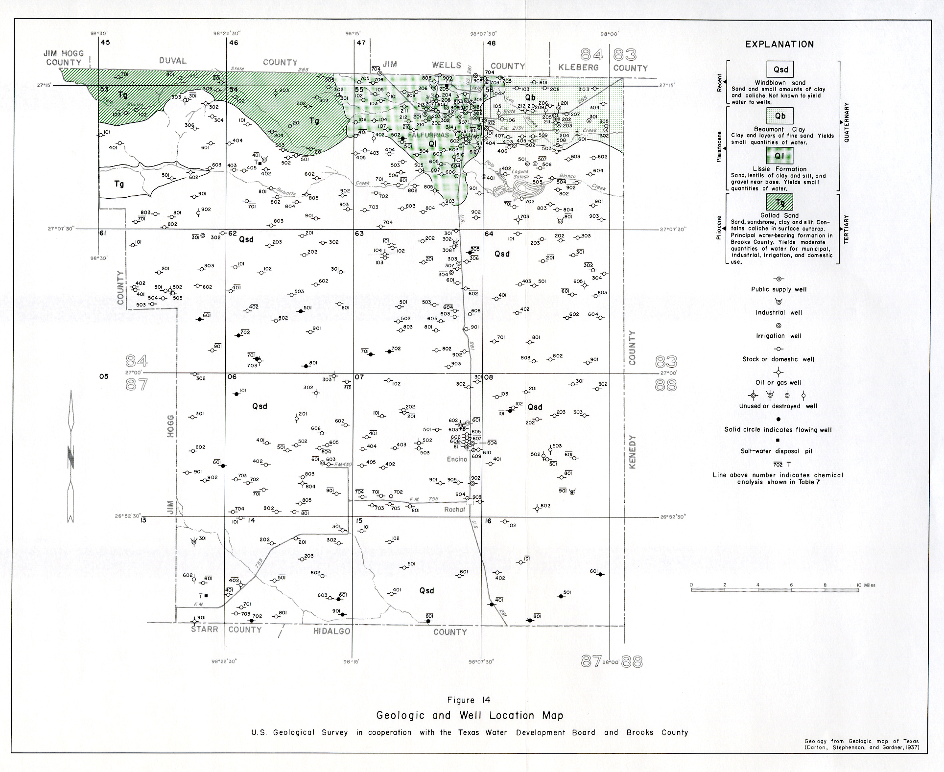
- Figure 14 - Geologic and Well Location map
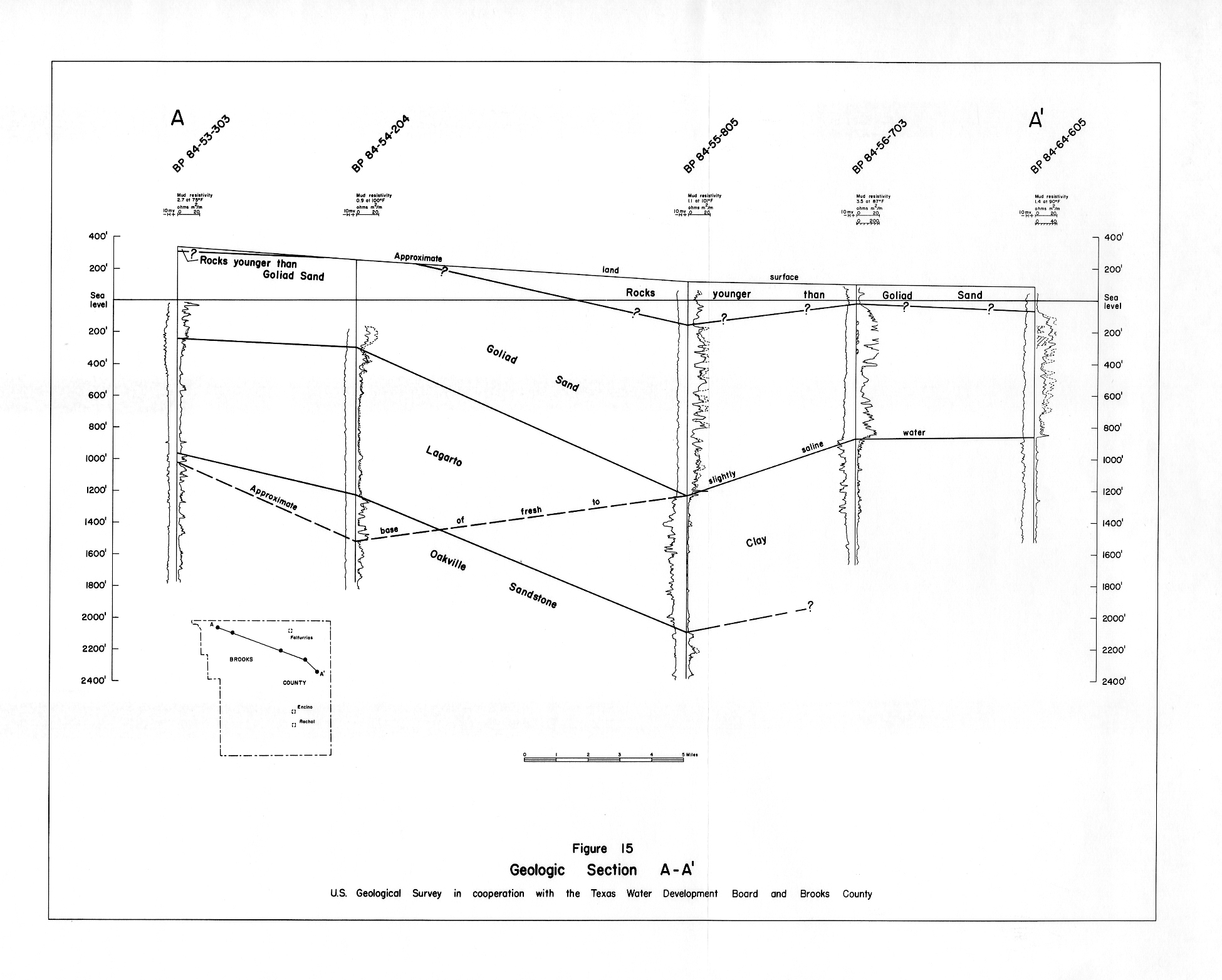
- Figure 15 - Geologic Section A-A'
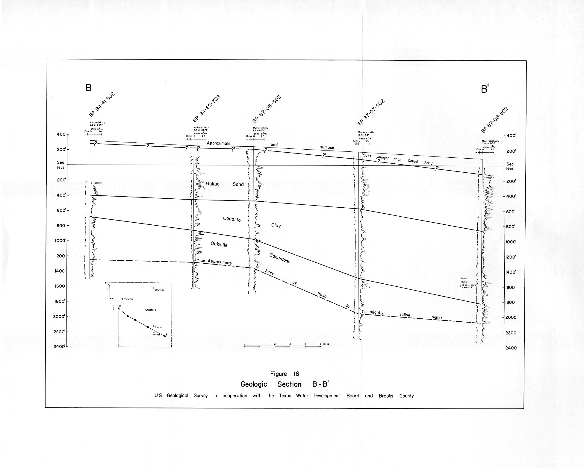
- Figure 16 - Geologic Section B-B'
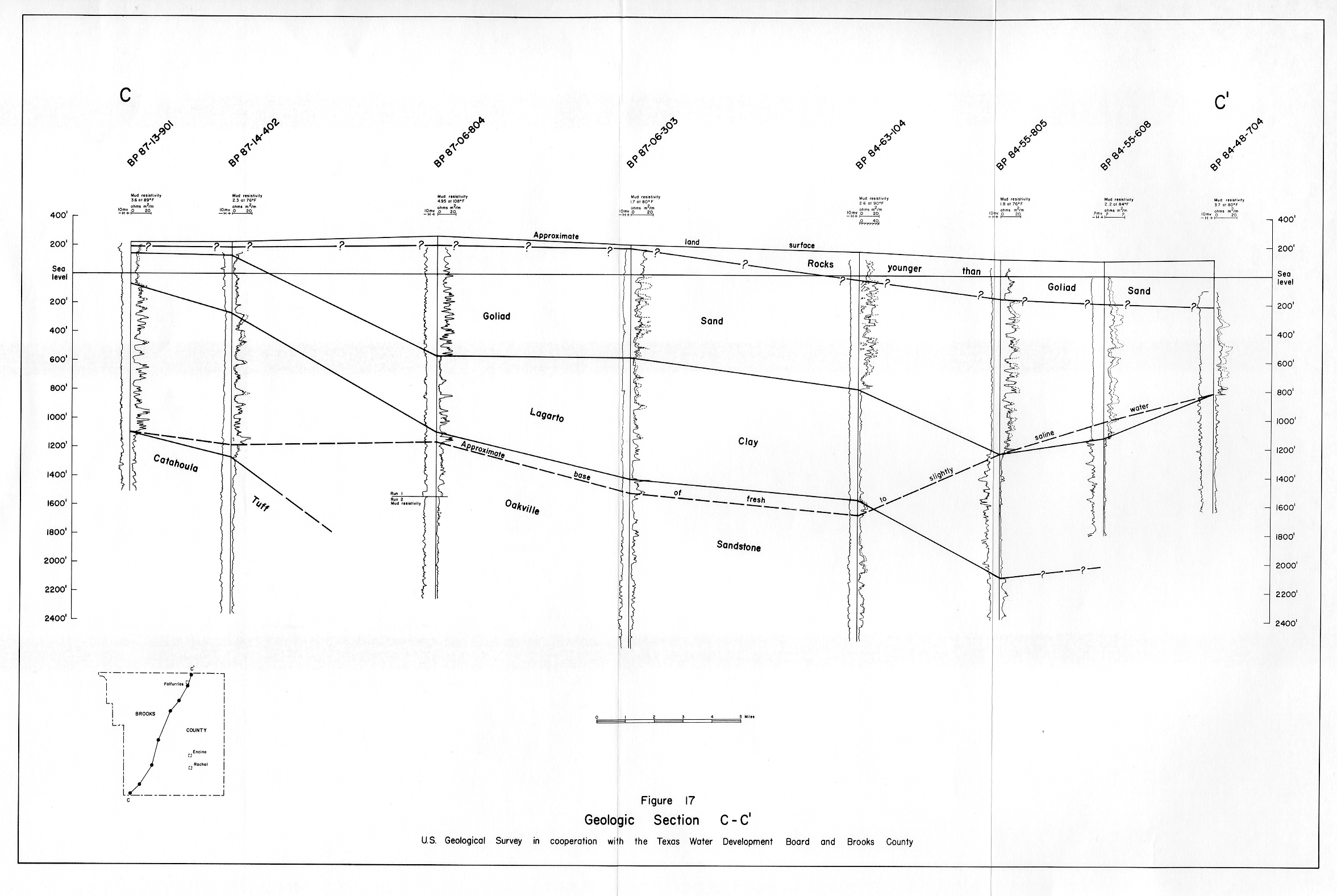
- Figure 17 - Geologic Section C-C'