Report 334 by T. Wesley McCoy | October 1991
- Report 334 - Evaluation of the Ground-Water Resources of the Western Portion of the Winter Garden Area, Texas
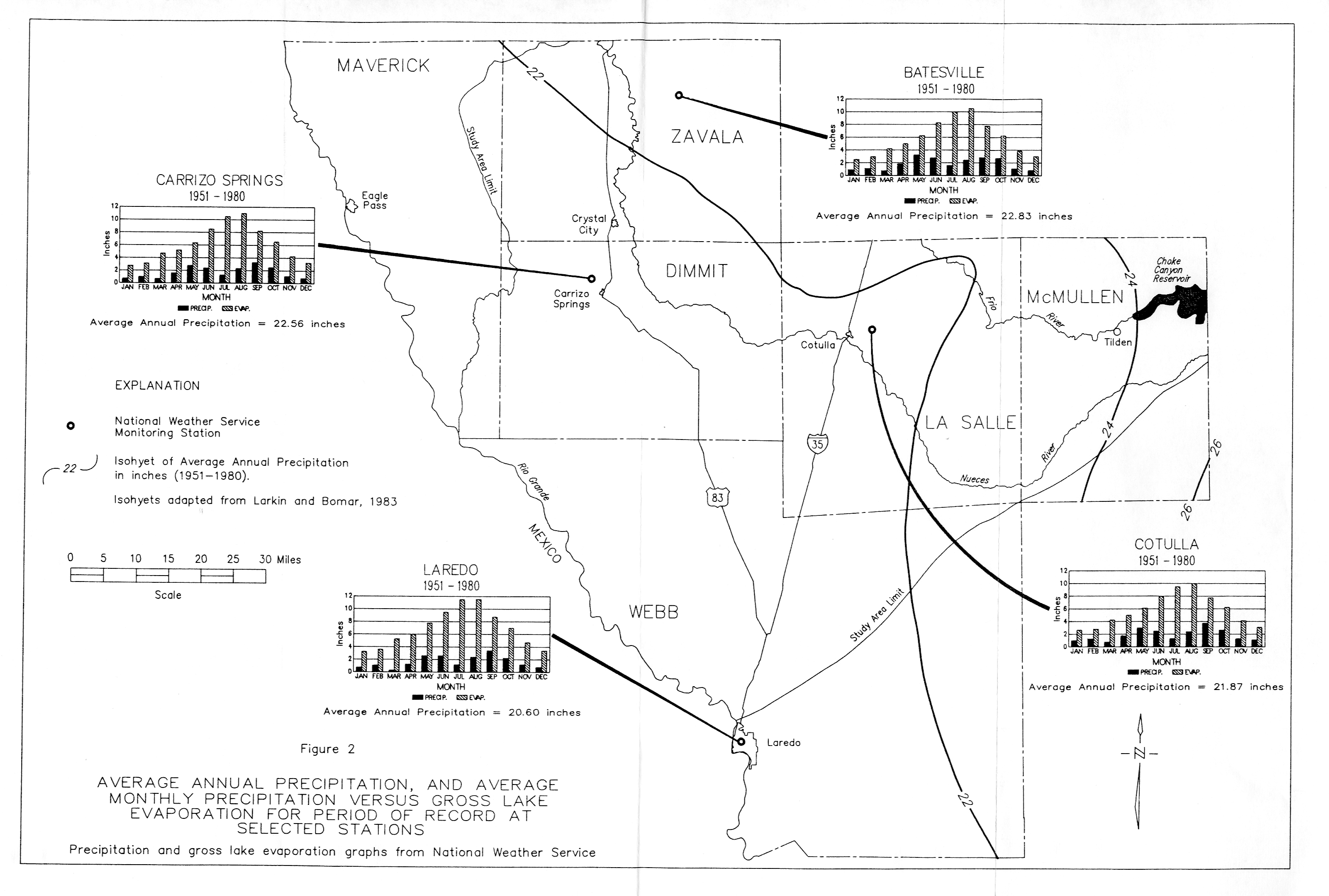
- Figure 2 - Average Annual Precipitation, and Average Monthly Precipitation verses Gross Lake Evaporation for Period of Record at Selected Stations
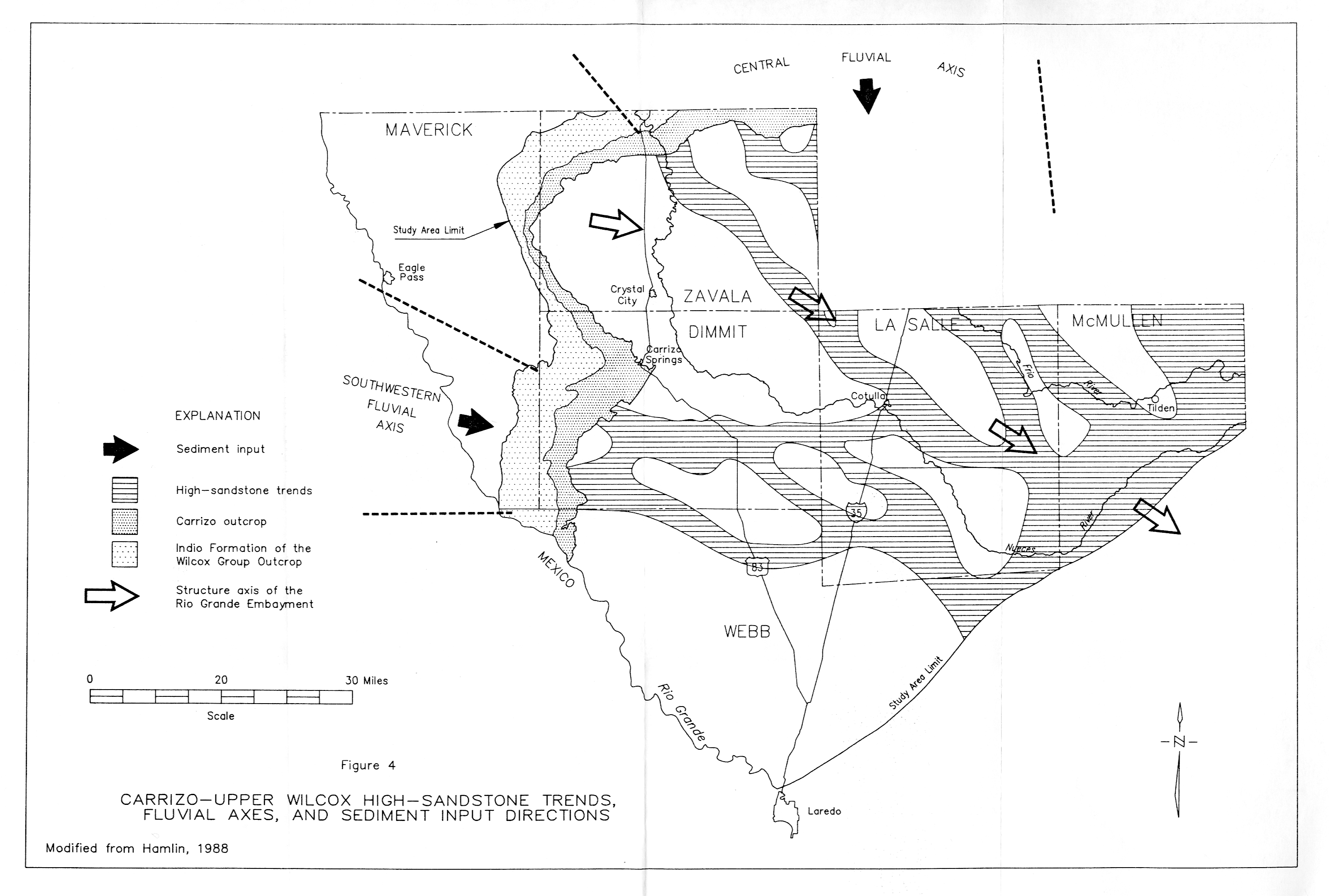
- Figure 4 - Carrizo-Upper Wilcox High-Sandstone Trends, Fluvial Axes, and sediment Input Directions
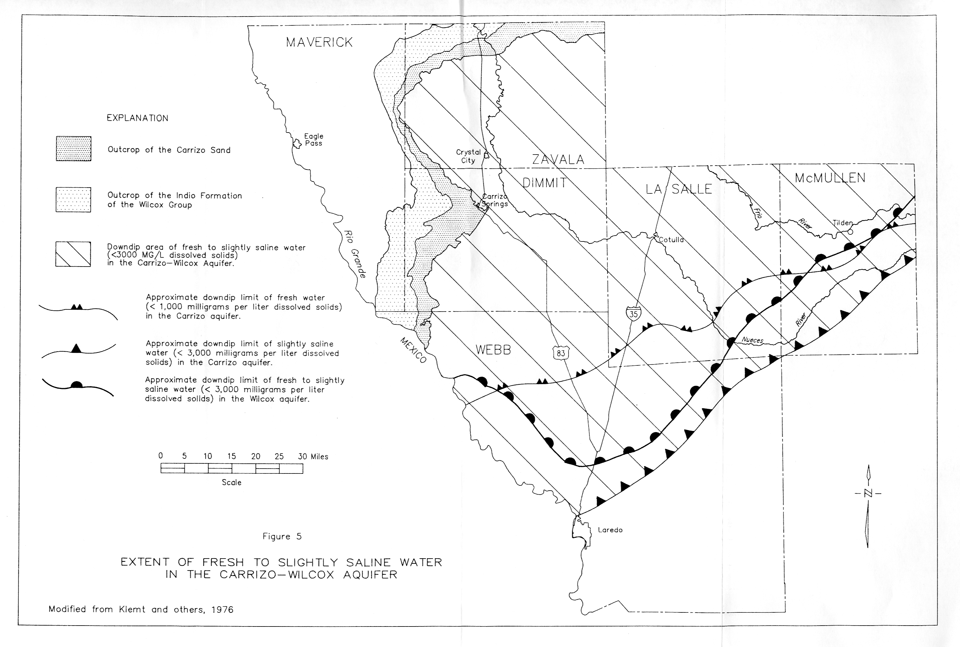
- Figure 5 - Extent of Fresh to Slightly Saline Water in the Carrizo-Wilcox Aquifer
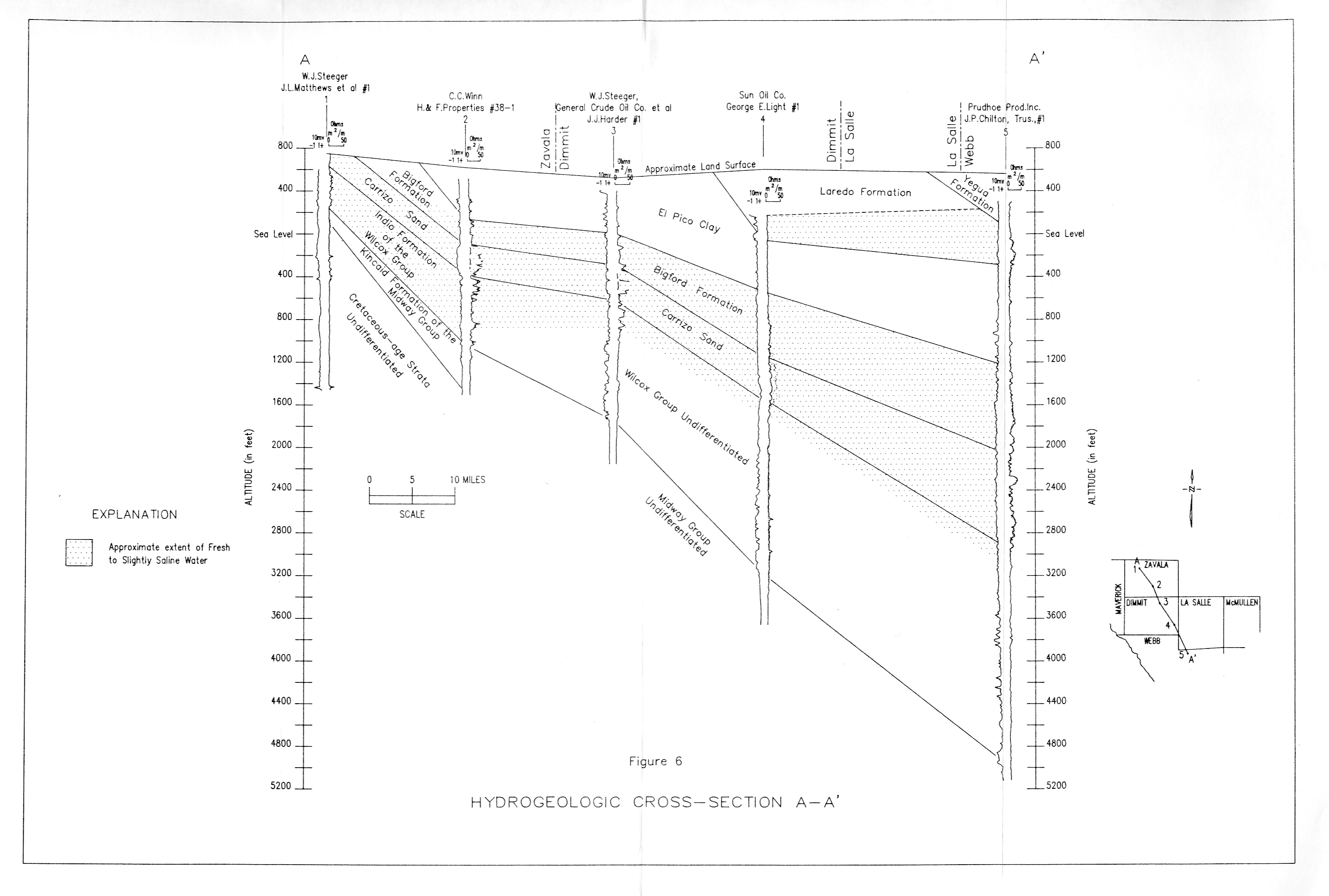
- Figure 6 - Hydrogeologic Cross section A-A'
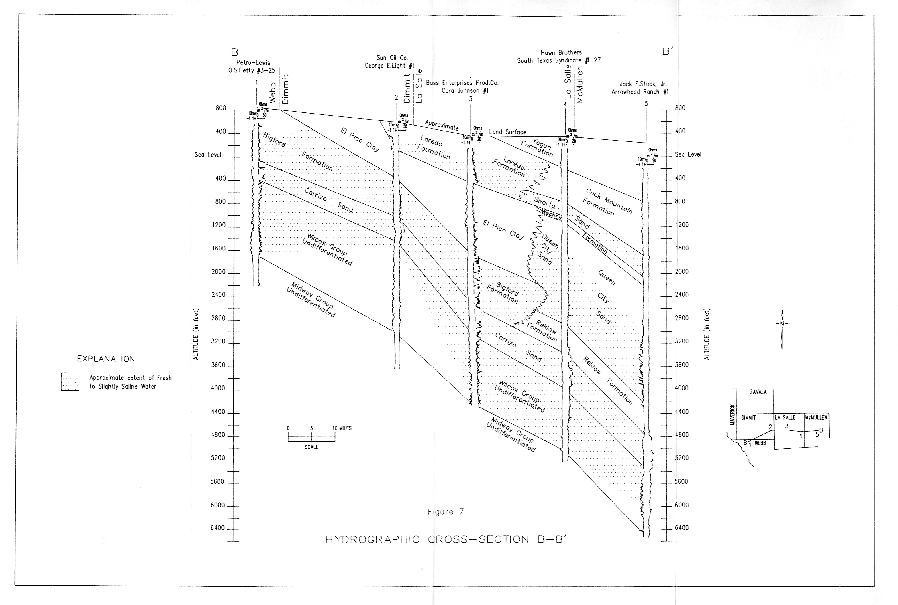
- Figure 7 - Hydrogeologic Cross section B-B'
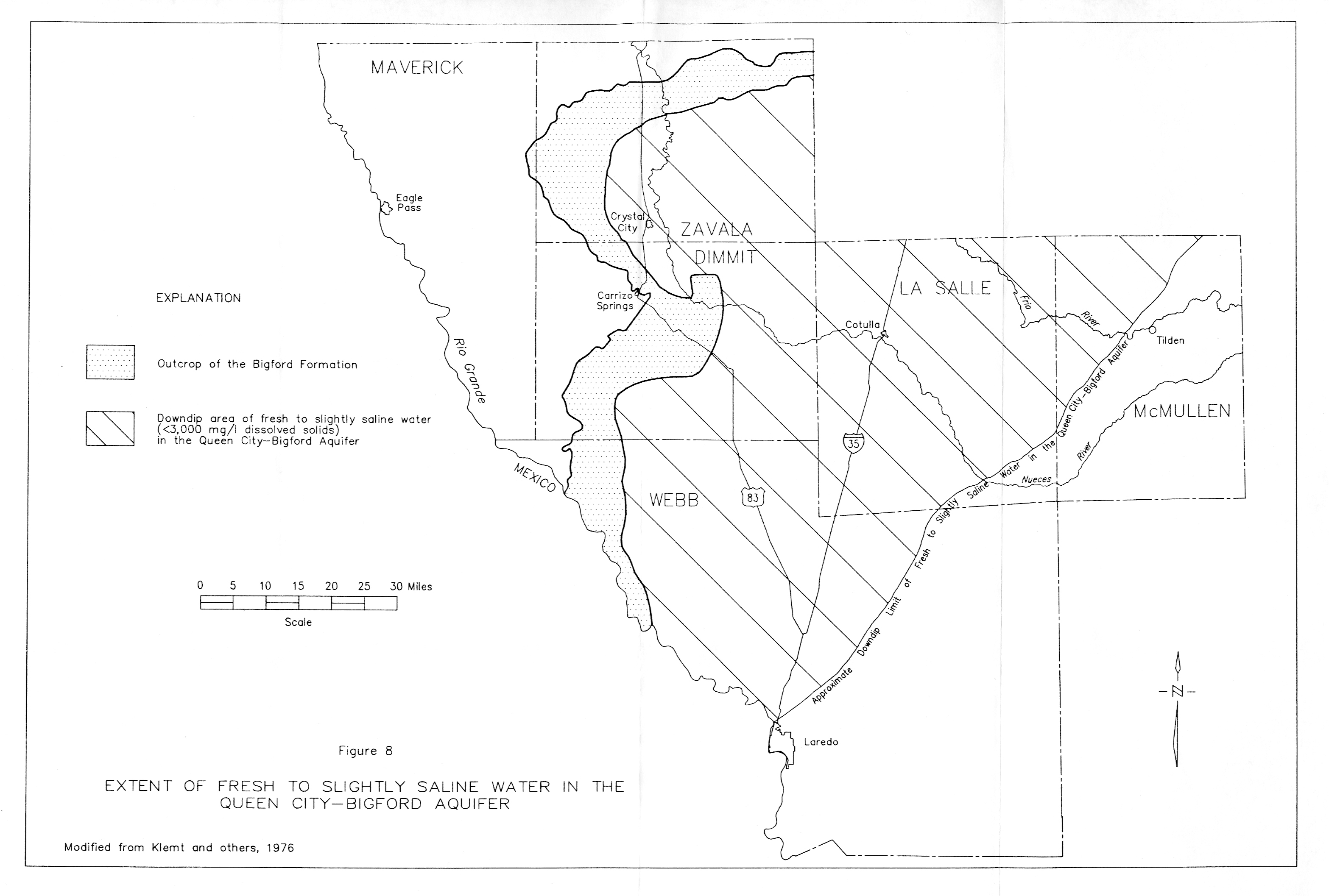
- Figure 8 - Extent of Fresh to Slightly Saline Water in the Queen City-Bigford Aquifer
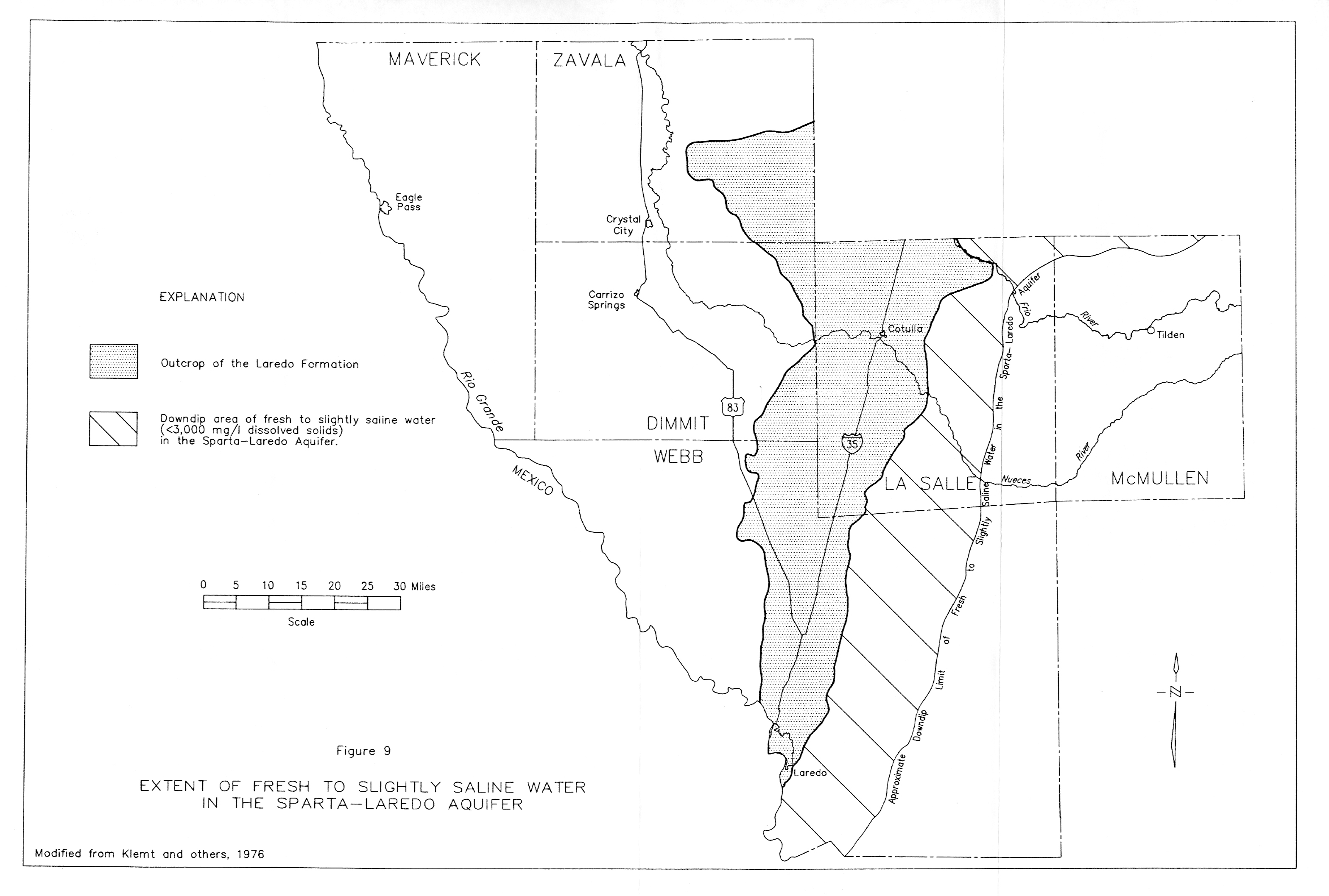
- Figure 9 - Extent of Fresh to Slightly Saline Water in the Sparta-Laredo Aquifer
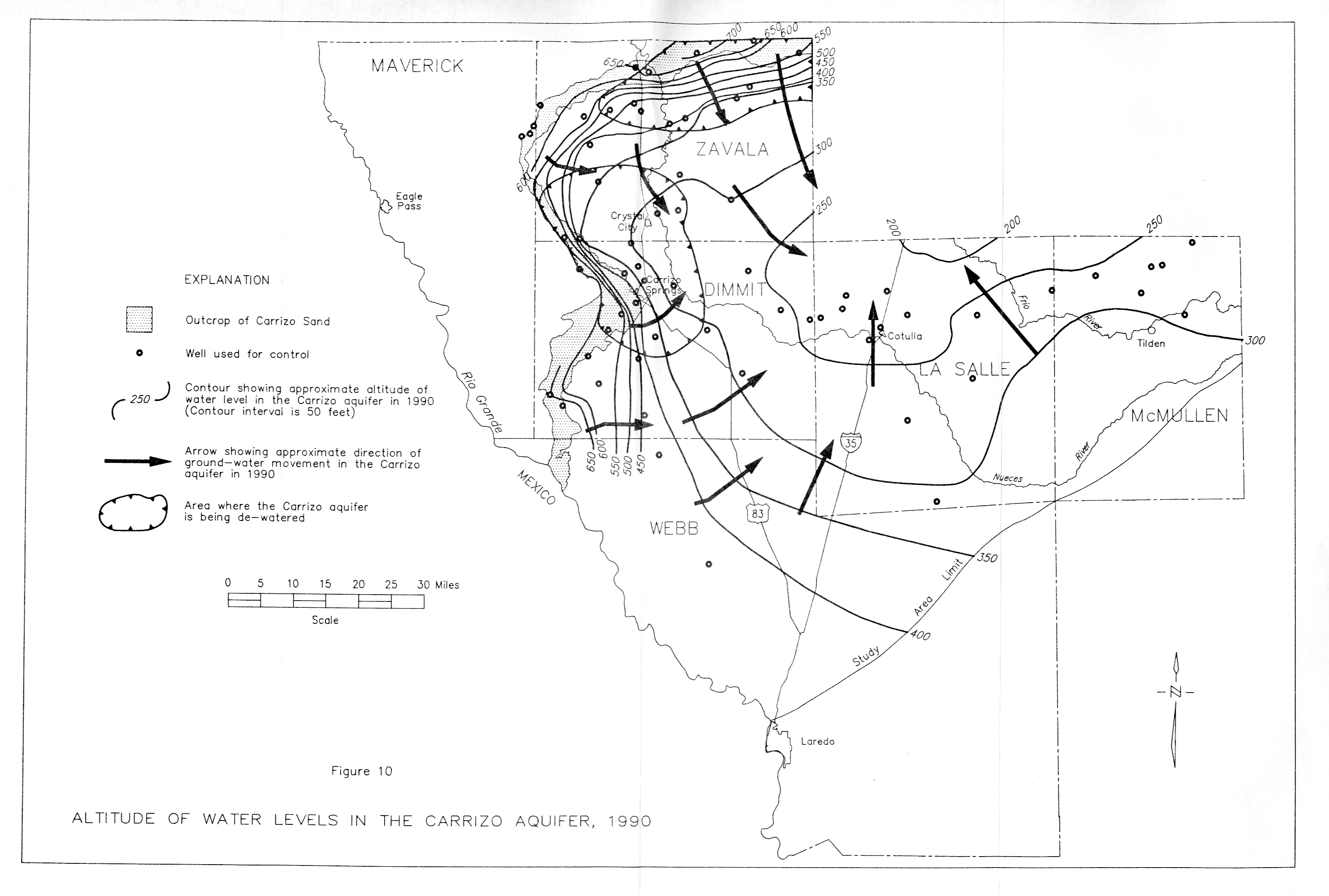
- Figure 10 - Altitude of water Levels in the Carrizo Aquifer, 1980
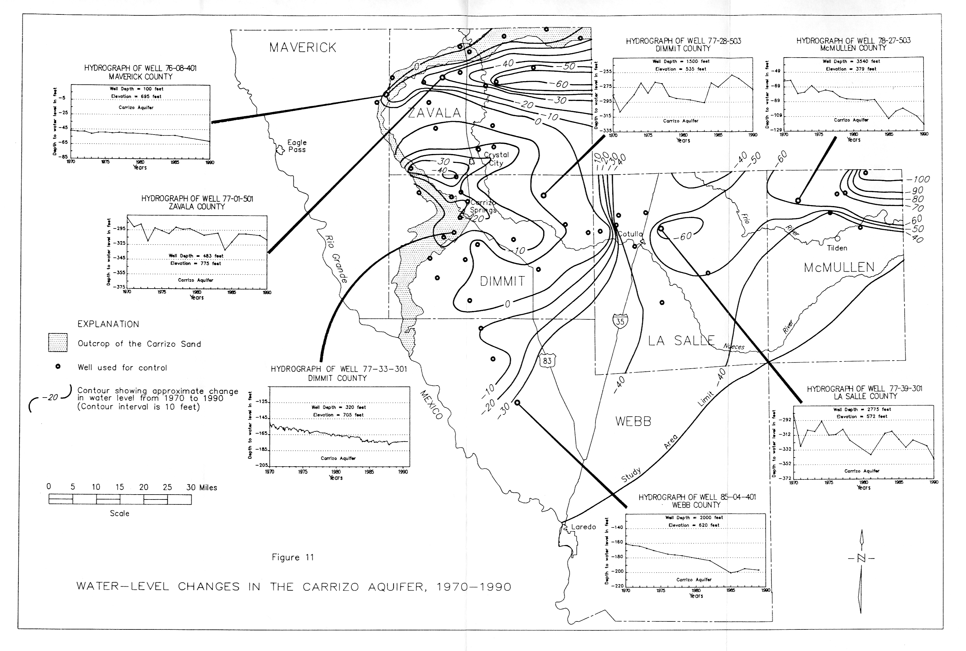
- Figure 11 - Water-level Changes in the Carrizo Aquifer, 1970-1990
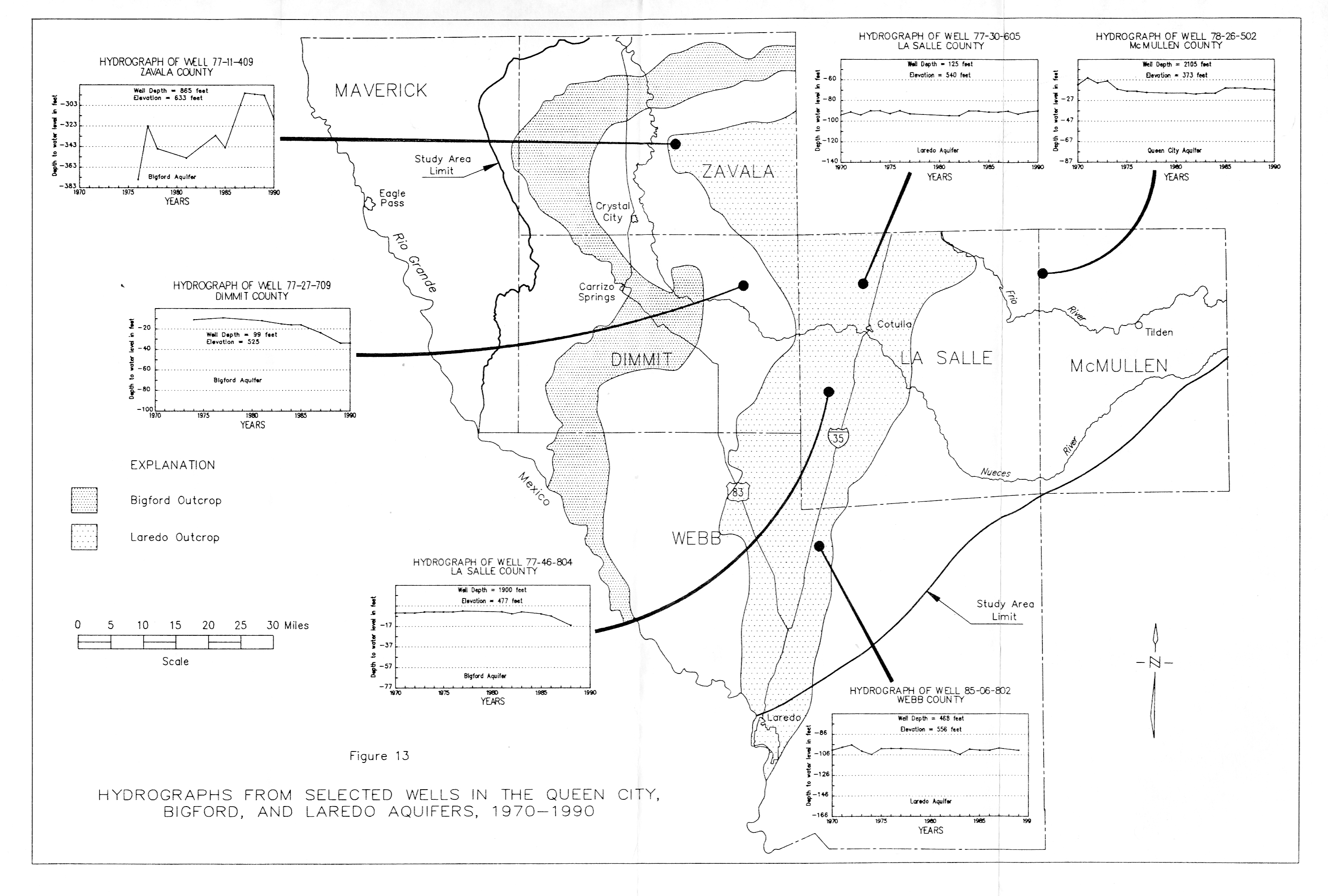
- Figure 13 - Hydrographs from Selected wells in the Queen City, Bigford, and Laredo Aquifers, 1970-1990
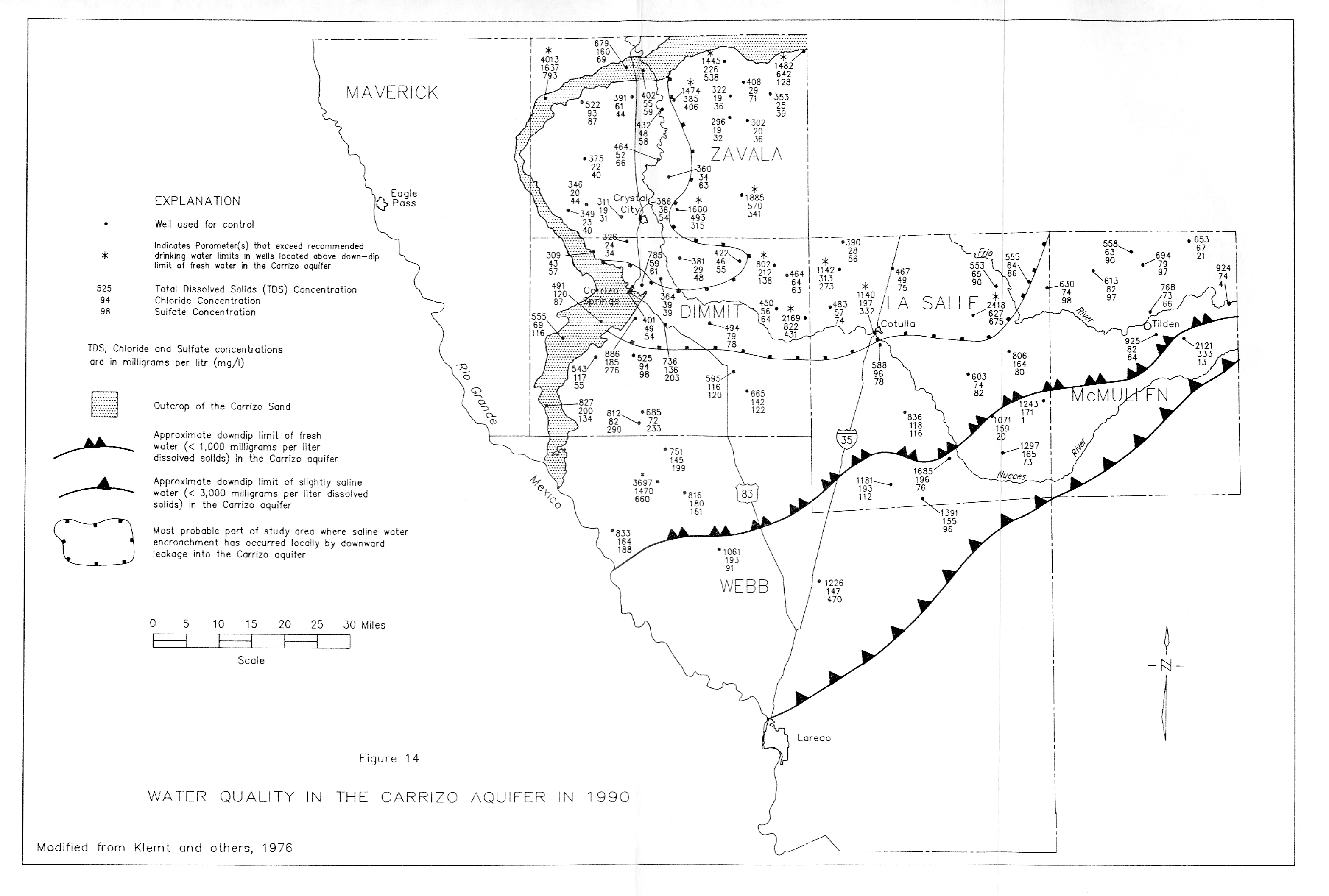
- Figure 14 - Water Quality in the Carrizo Aquifer in 1990
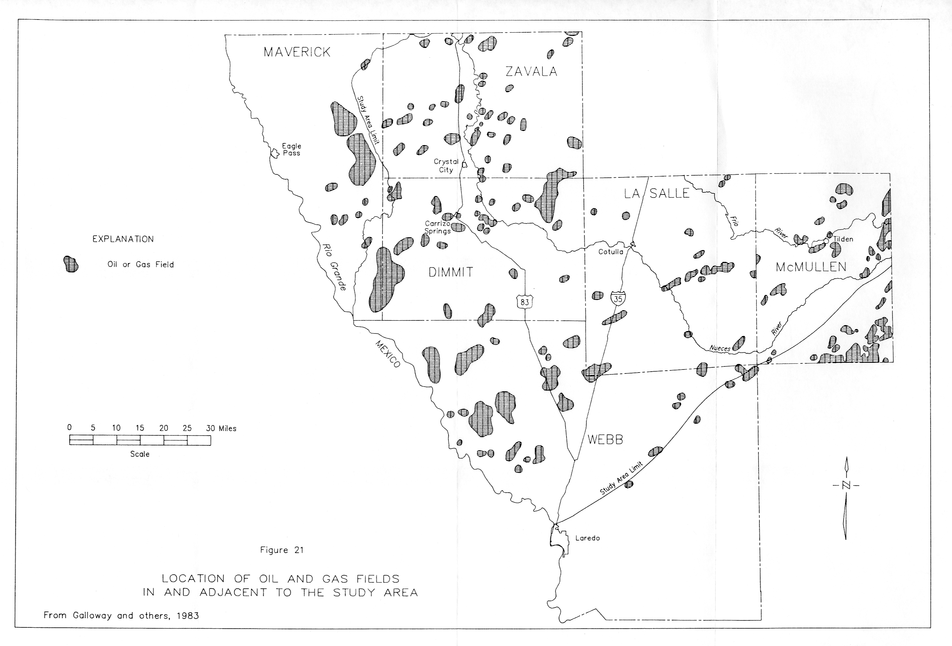
- Figure 21 - Location of Oil and Gas fields in and adjacent to the Study Area