Report 300 by D.E. White, U.S. Geological Survey | August 1987
- Report 300 - Summary of Hydrologic Information in the El Paso, Texas, Area, With Emphasis on Ground-Water Studies, 1903-80 (pdf - 12.3 MB)
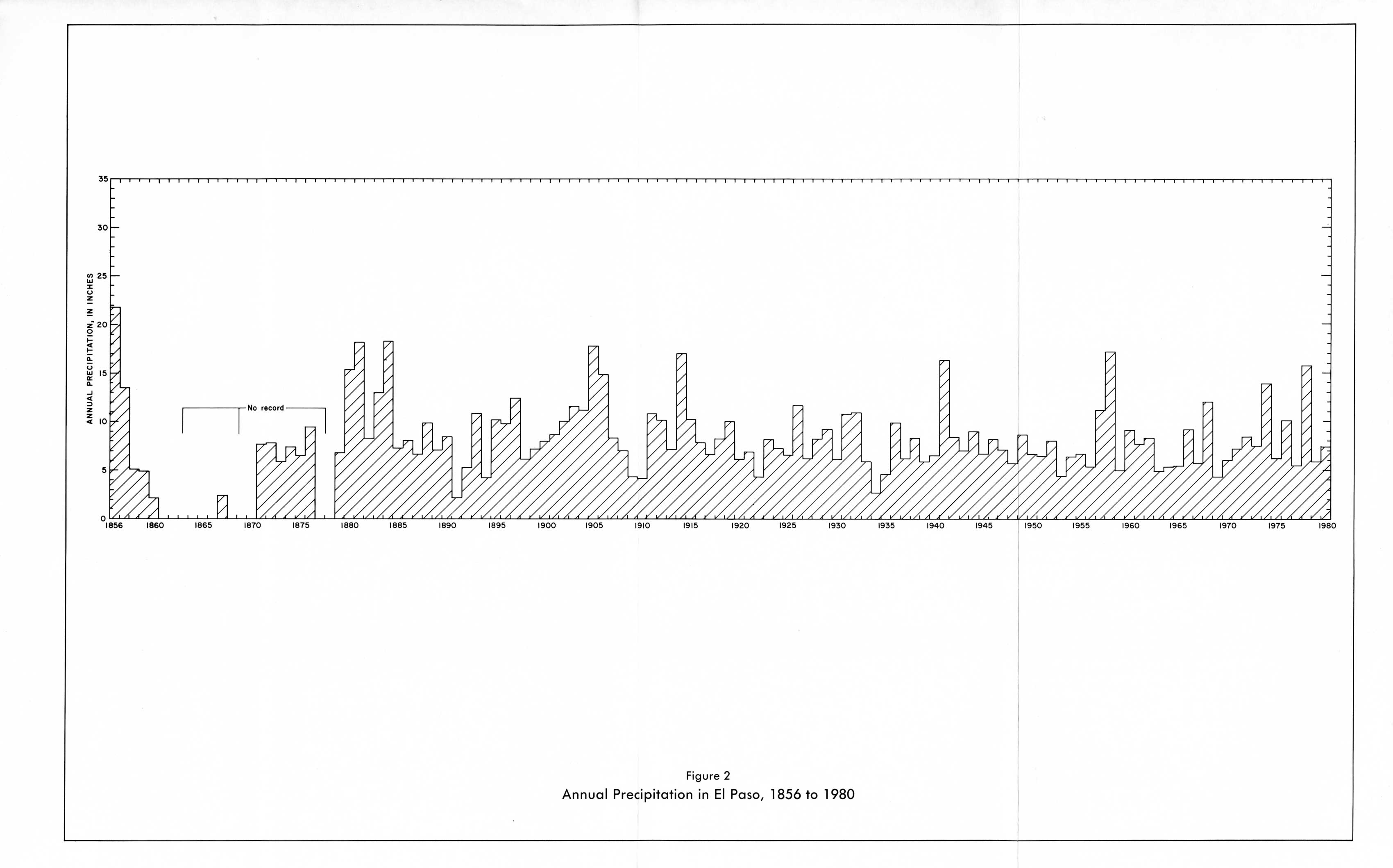
- Figure 2 - Annual Precipitation in El Paso, 1856 to 1980
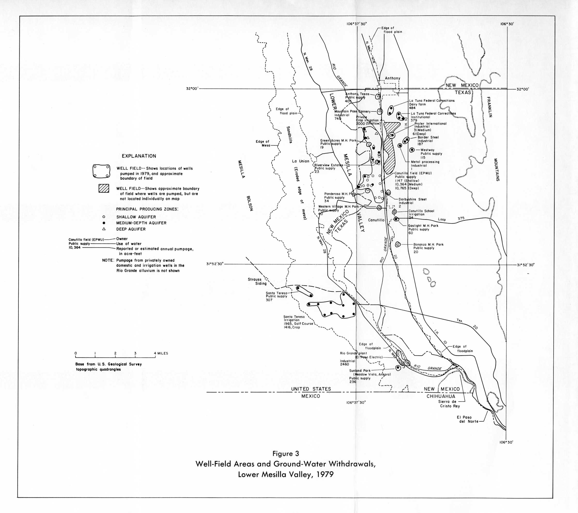
- Figure 3 - Well-Field Areas and Ground-Water Withdrawals, Lower Mesilla Valley, 1979
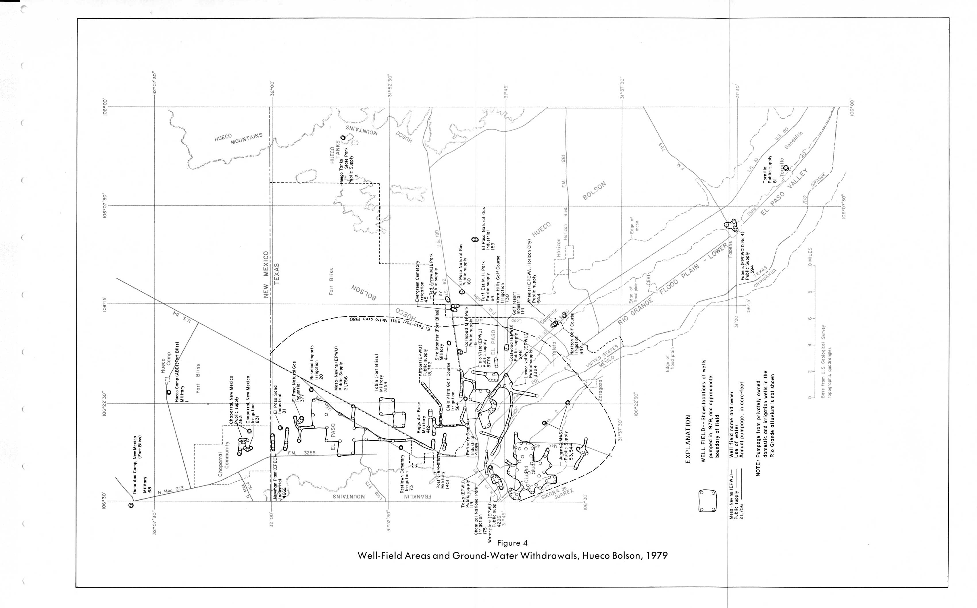
- Figure 4 - Well-Field Areas and Ground-Water Withdrawals, Hueco Bolson, 1979
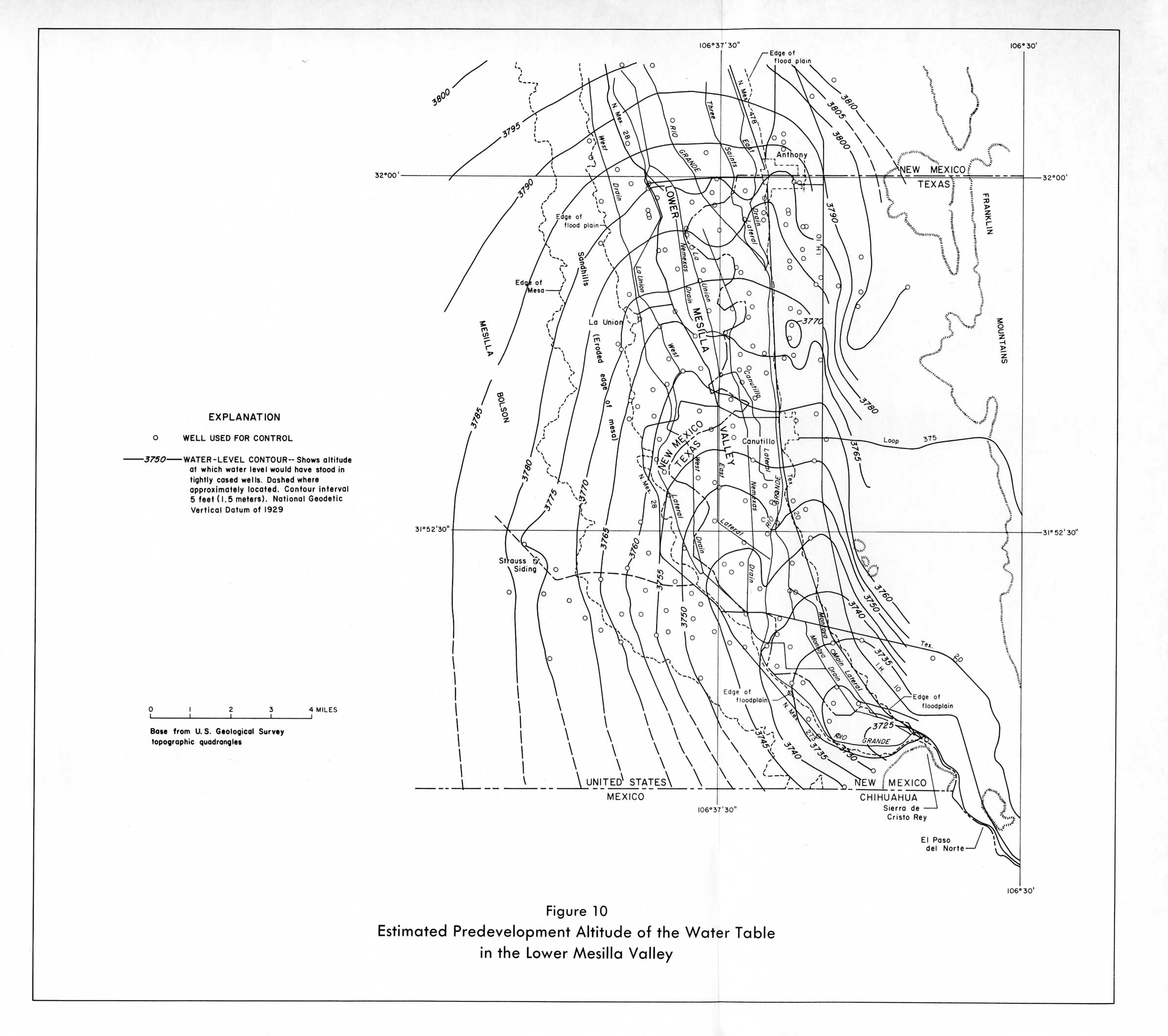
- Figure 10 - Estimated Predevelopment Altitude of the Water Table in the Lower Mesilla Valley
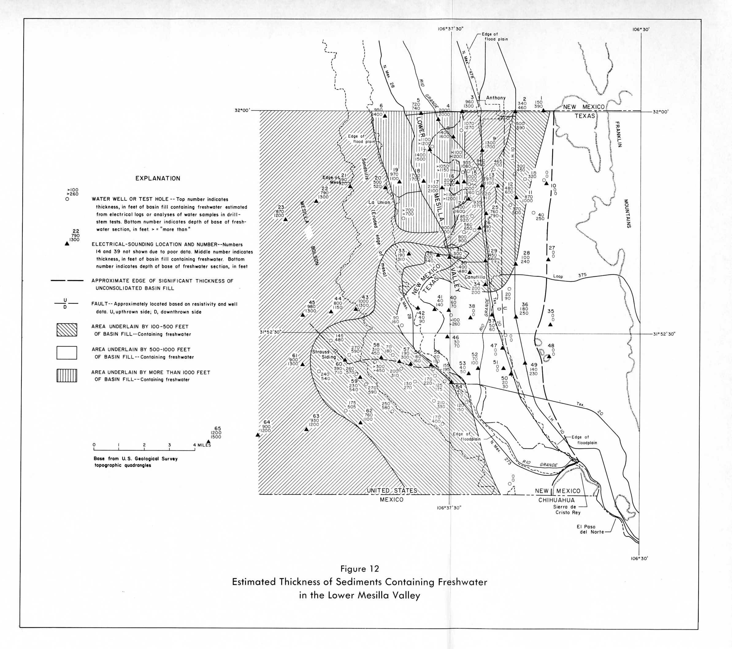
- Figure 12 - Estimated Thickness of Sediments Containing Freshwater in the Lower Mesilla Valley
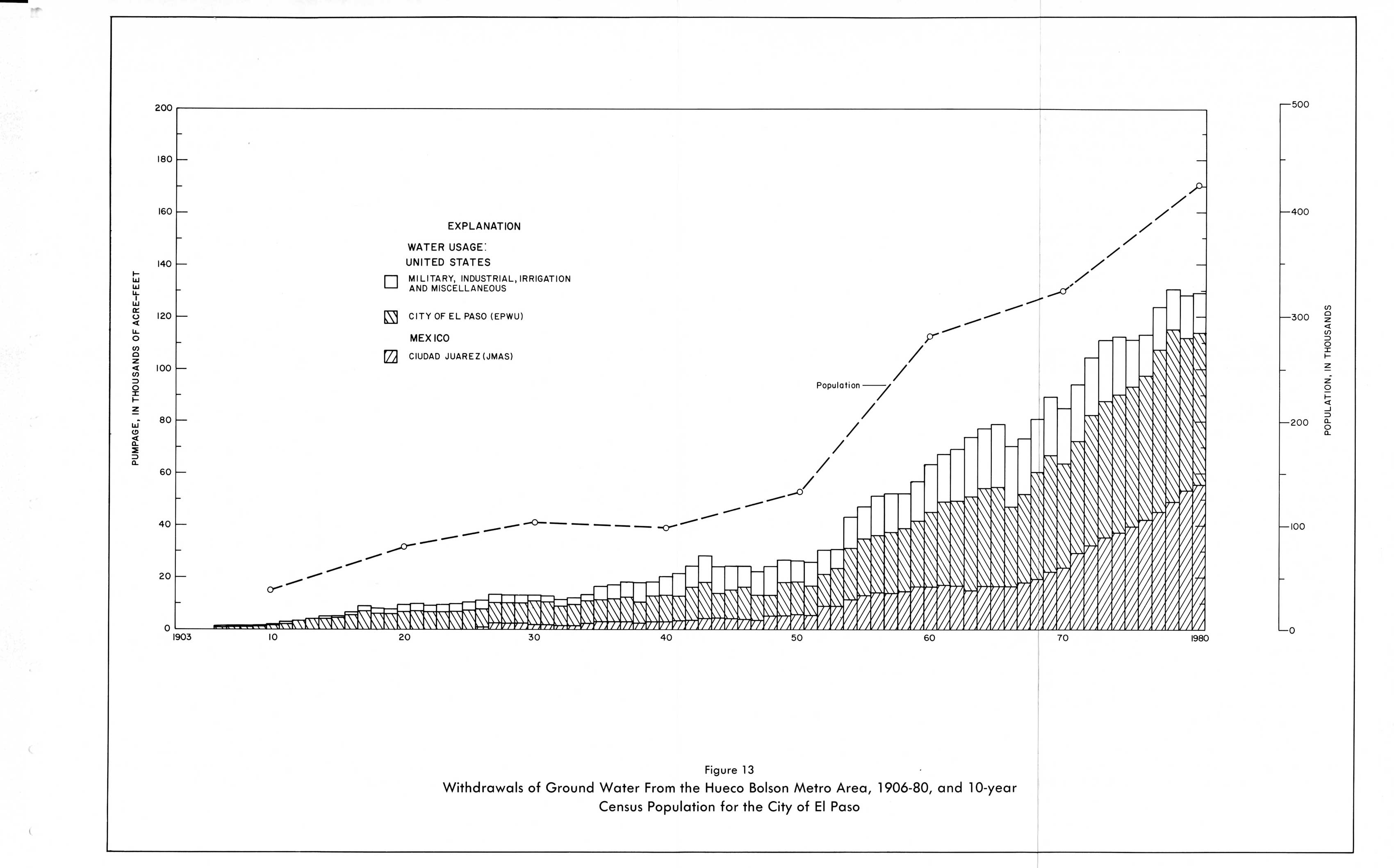
- Figure 13 - Withdrawals of Ground Water From the Hueco Bolson Metro Area, 1906-80, and 10-year Census Population for the City of El Paso
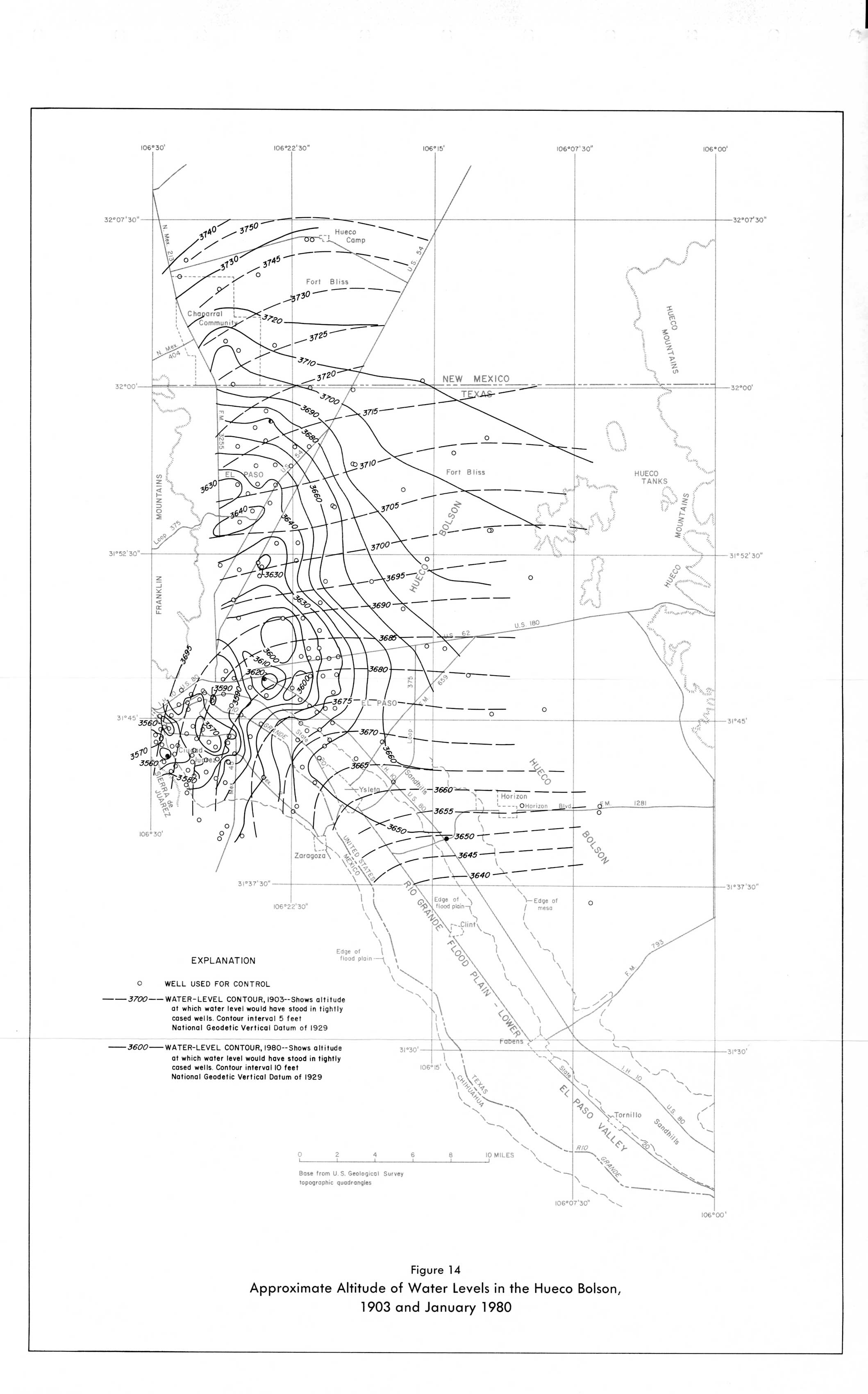
- Figure 14 - Approximate Altitude of Water Levels in the Hueco Bolson, 1903 and January 1980
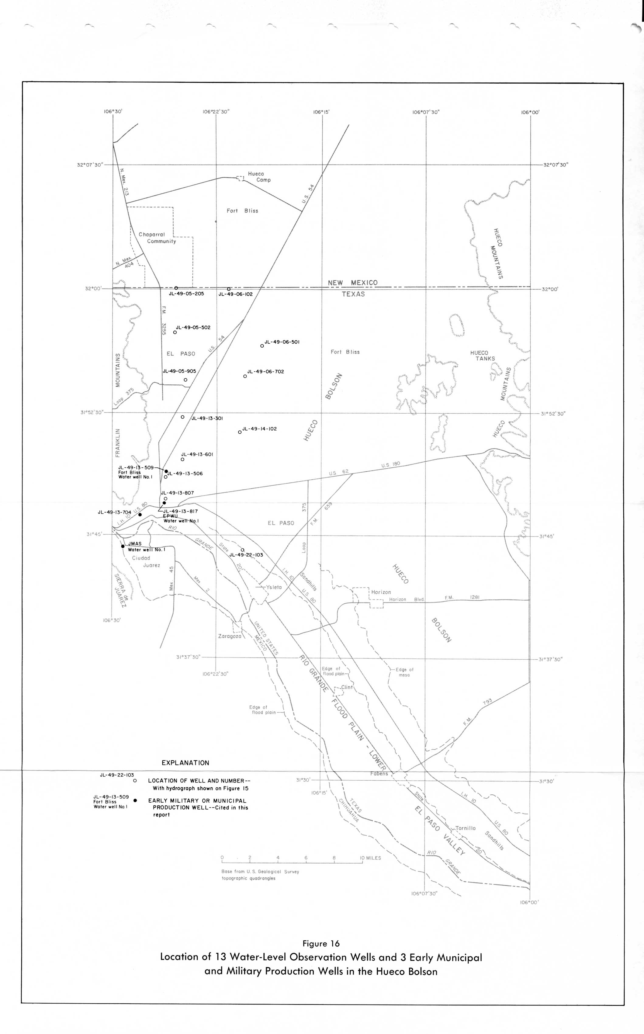
- Figure 16 - Location of 13 Water-level Observation Wells and 3 early Municipal and Military Production Wells in the Hueco Bolson
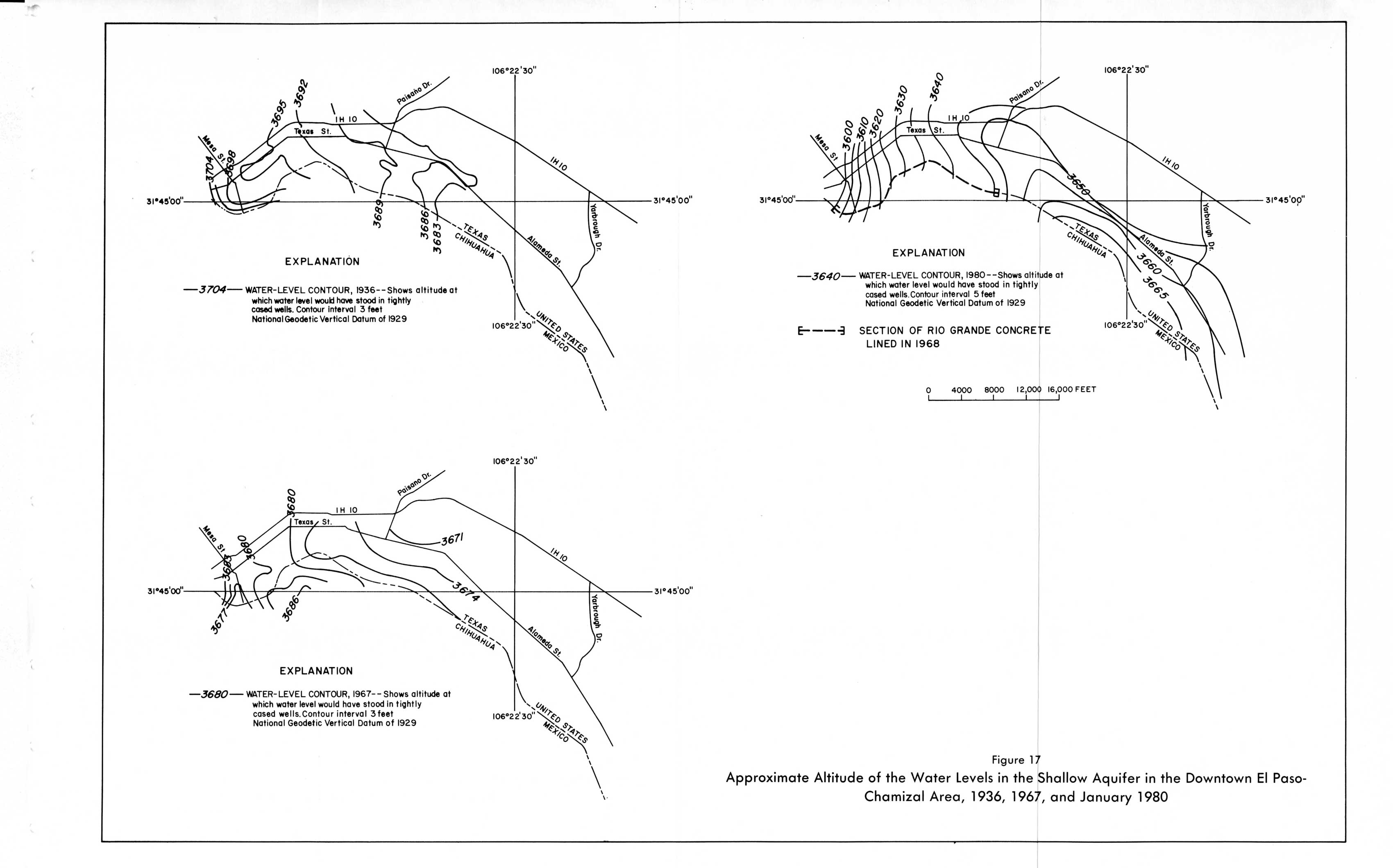
- Figure 17 - Approximate Altitude of Water Levels in the Shallow Aquifer in the Downtown El Paso-Chamizal Area, 1936, 1967, and January 1980
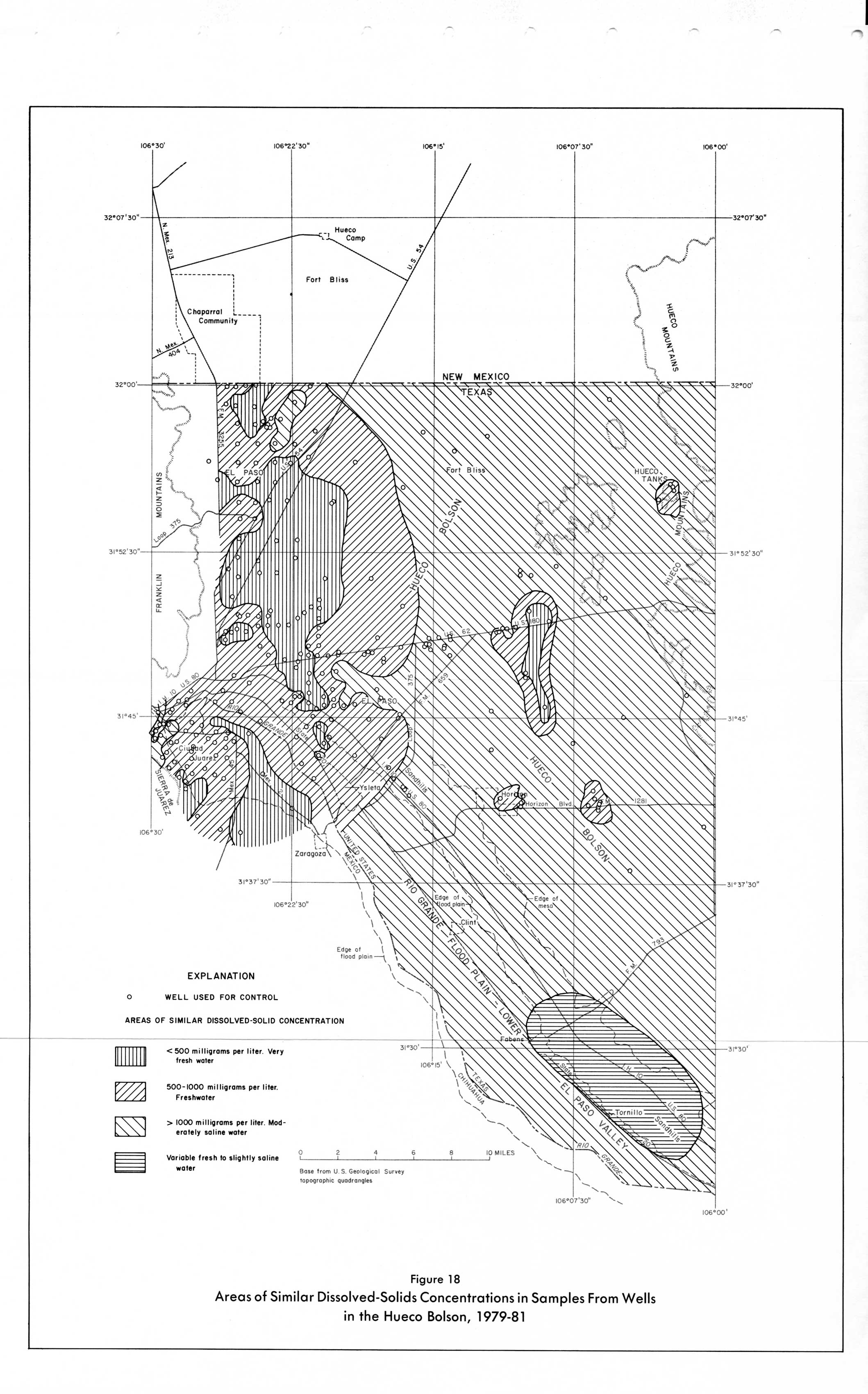
- Figure 18 - Areas of Similar Dissolved-Solids Concentrations in Samples From Wells in the Hueco Bolson, 1979-81
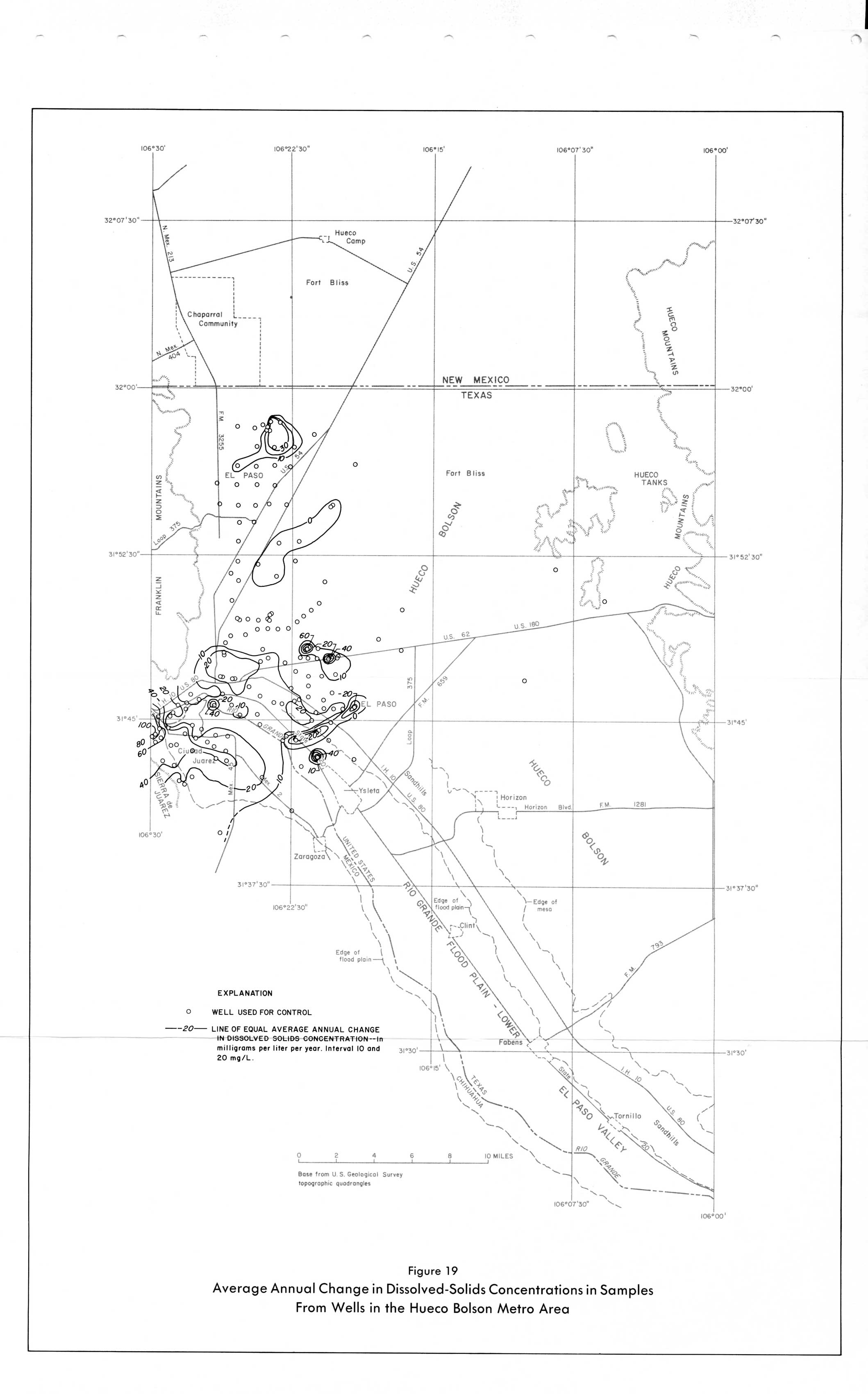
- Figure 19 - Average Annual Change in Dissolved-Solids Concentrations in Samples From Wells in the Hueco Bolson Metro Area
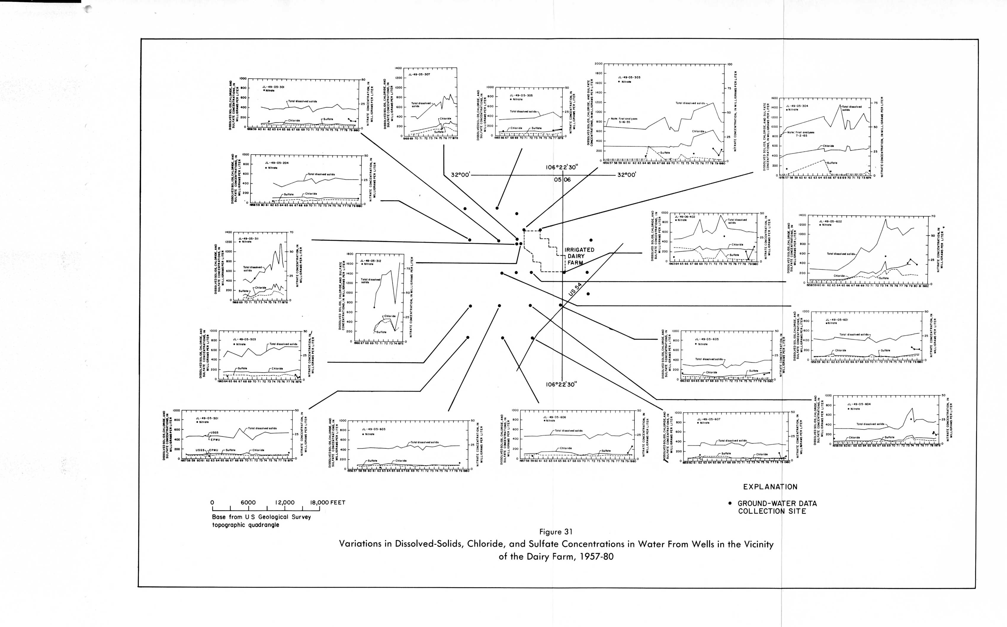
- Figure 31 - Variations in Dissolved-Solids, Chloride, and Sulfate Concentrations in Water from Wells in the Vicinity of the Dairy Farm, 1957-80
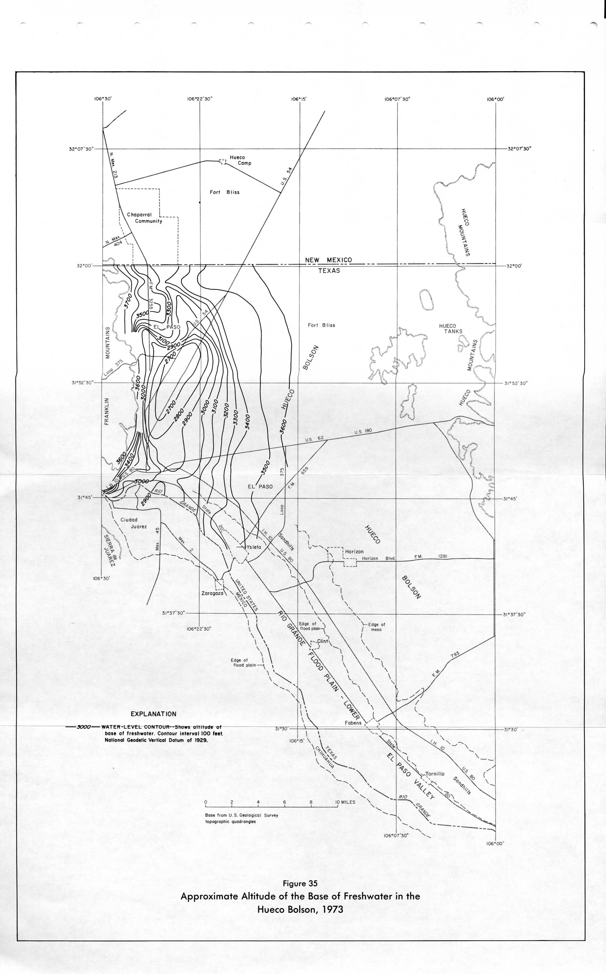
- Figure 35 - Approximate Altitude of the Base of Freshwater in the Hueco Bolson, 1973
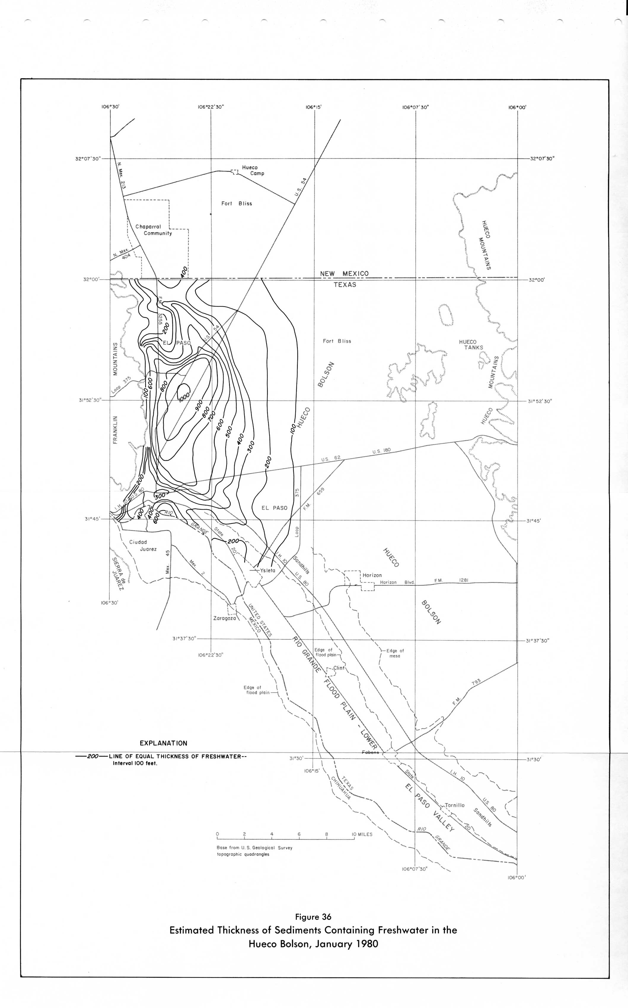
- Figure 36 - Estimated Thickness of Sediments Containing Freshwater in the Hueco Bolson, January 1980