Report 241 By R.K. Gabrysch U.S. Geological Survey | January 1980
- Report 241 - Development of Ground Water in the Houston District, Texas, 1970-74
- Figure 2 - Approximate Altitude of the Base of the Chicot Aquifer
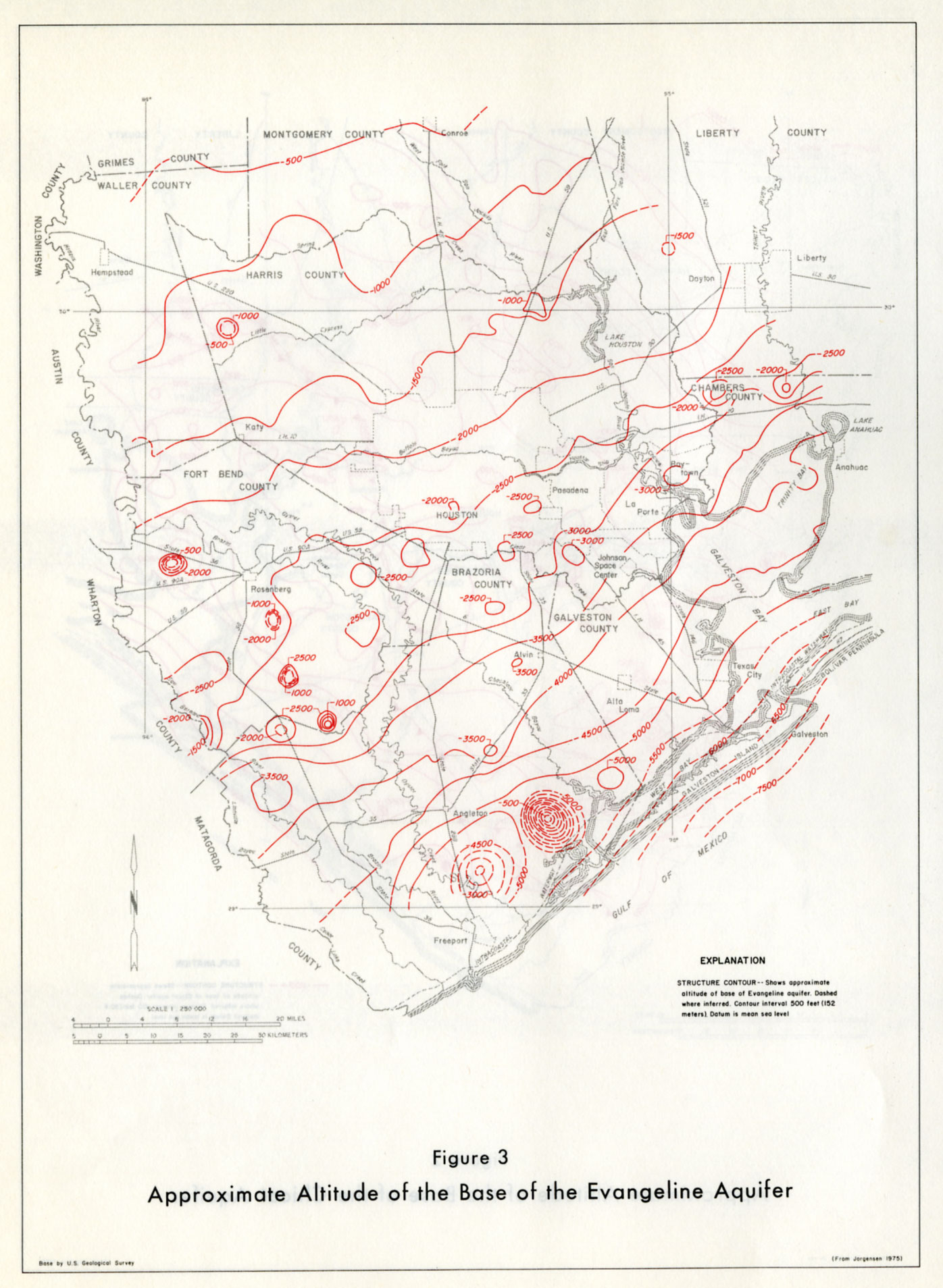
- Figure 3 - Approximate Altitude of the Base of the Evangeline Aquifer
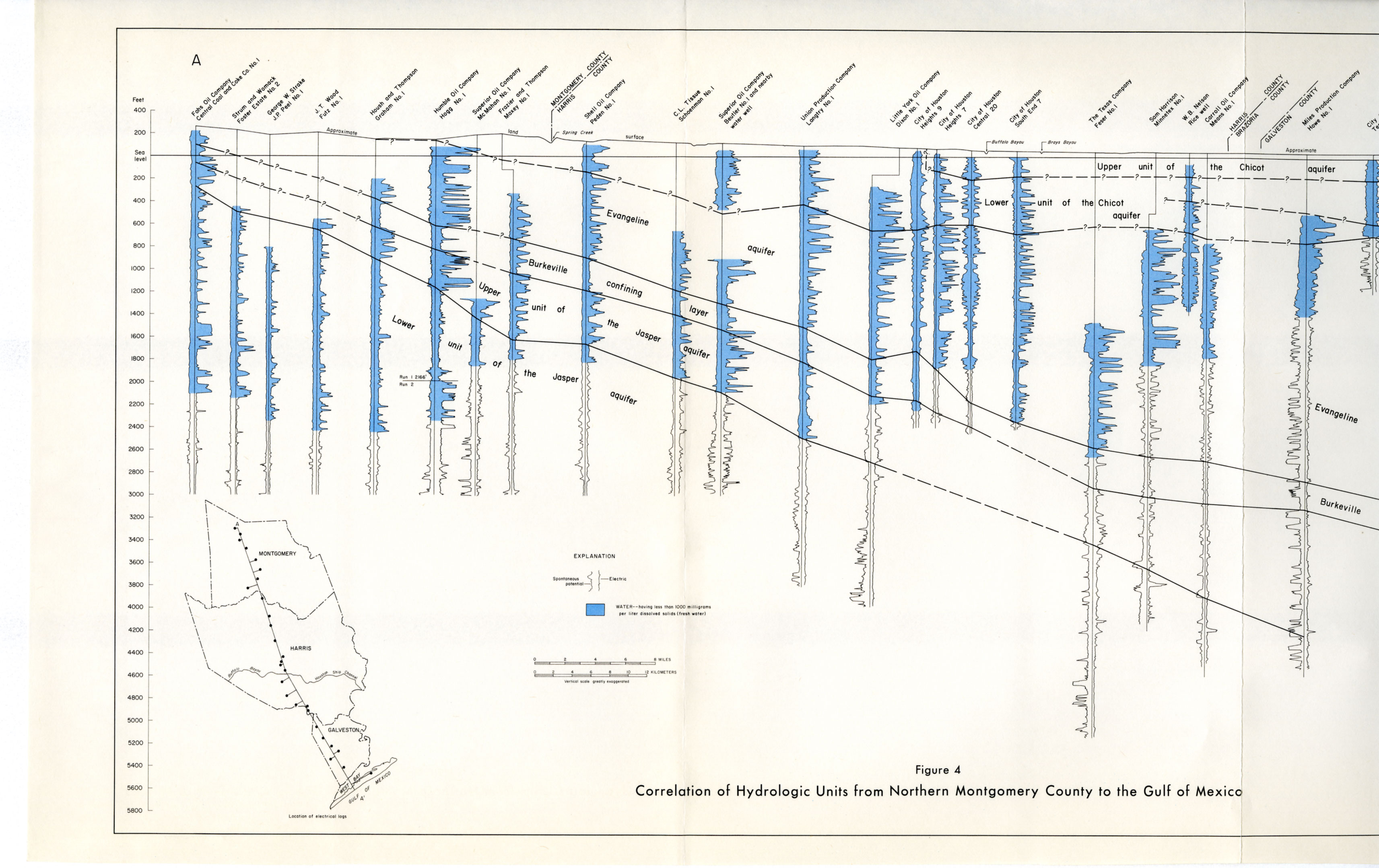
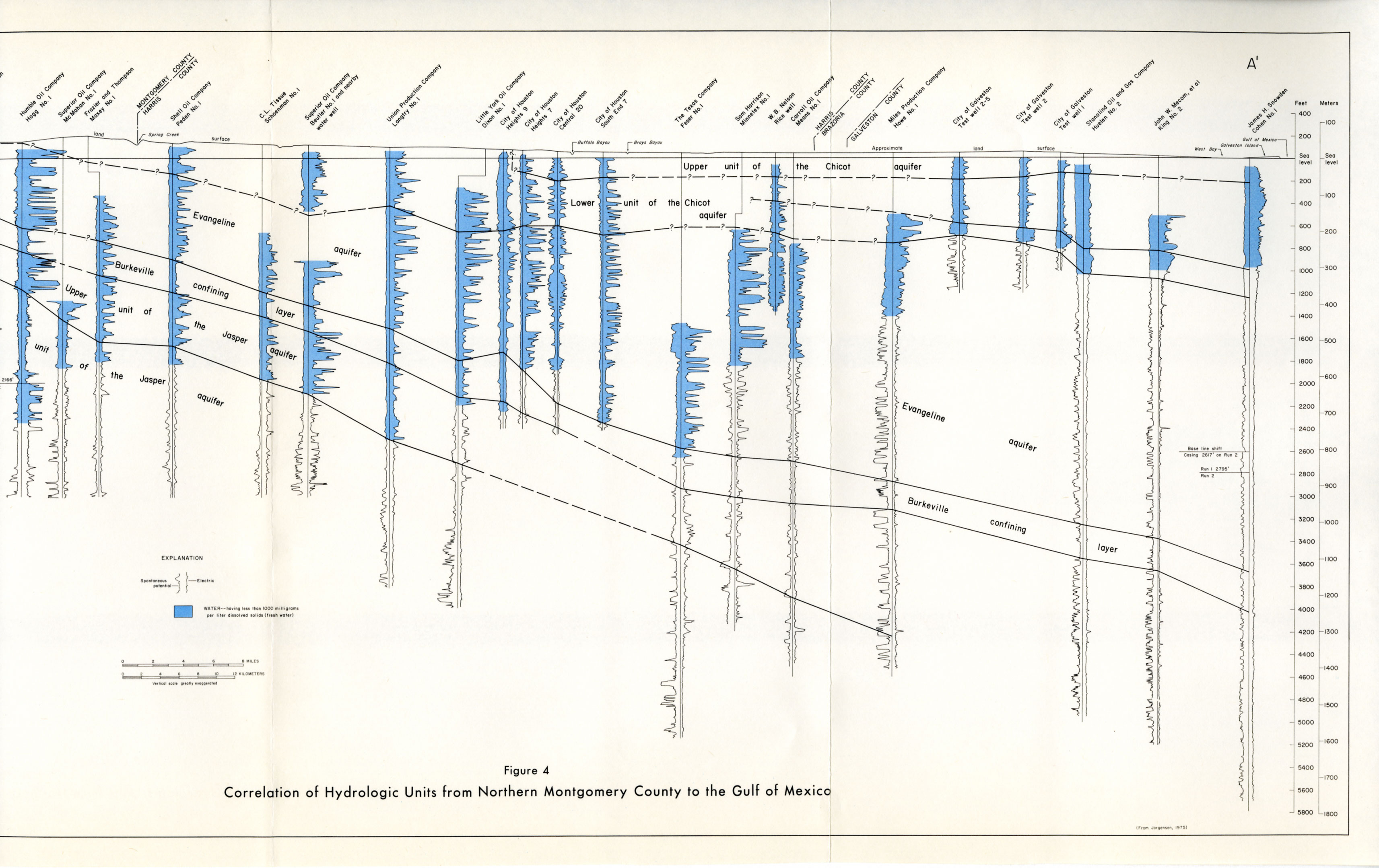
- Figure 4A and 4B (same oversized map scanned in 2 pieces) - Correlation of Hydrologic Units from Northern Montgomery County to the Gulf of Mexico
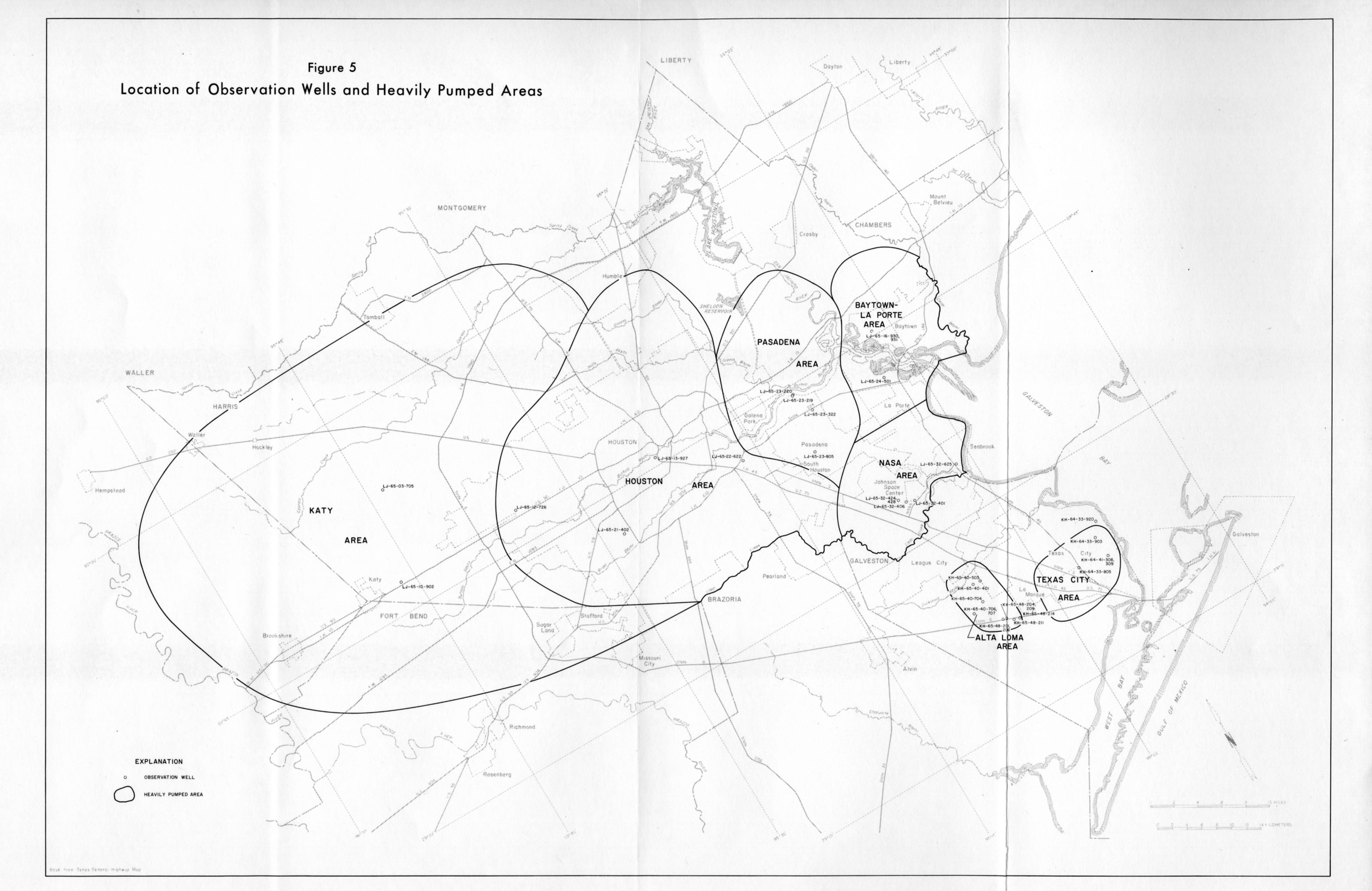
- Figure 5 - Location of Observation Wells and Heavily Pumped Areas
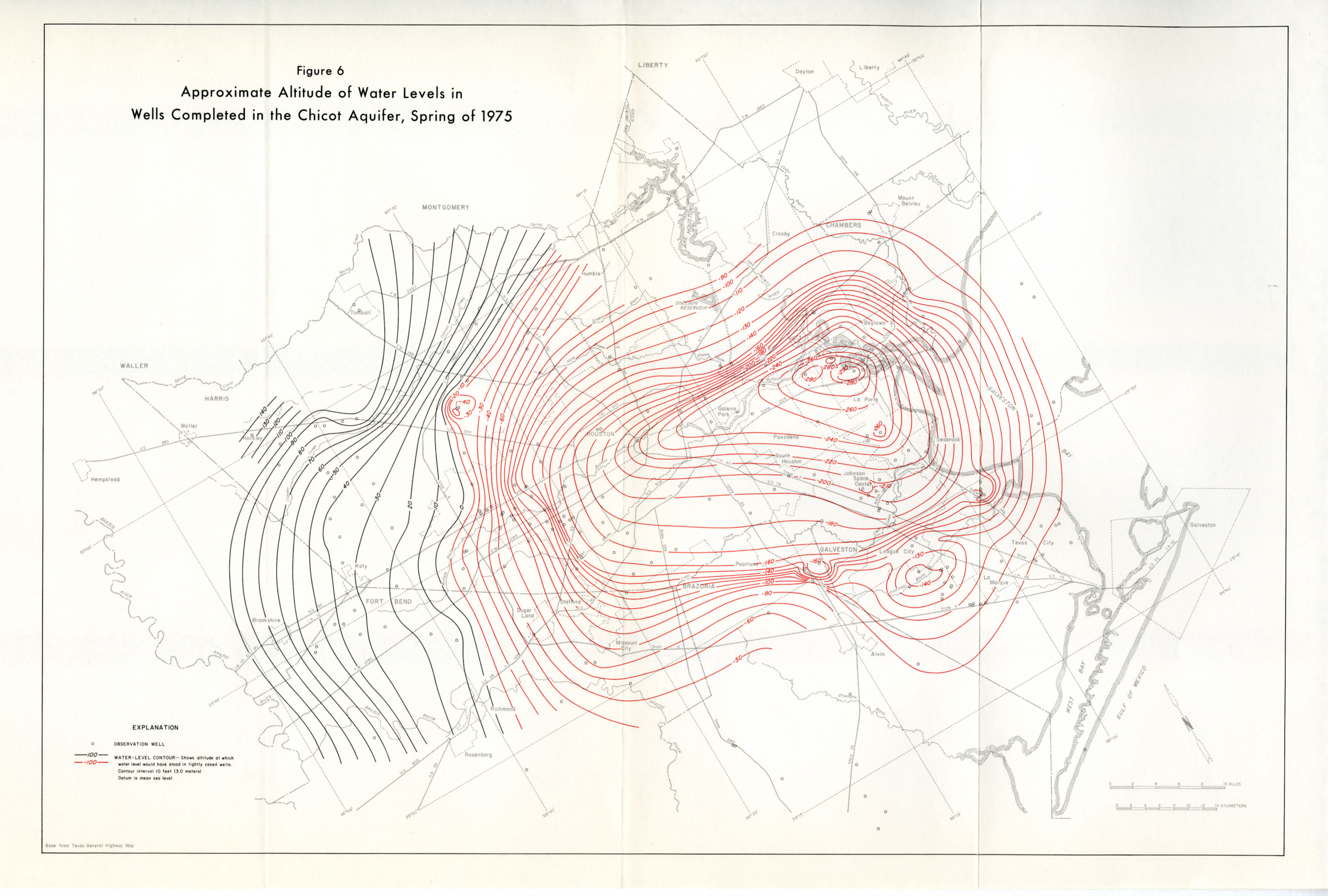
- Figure 6 - Approximate Altitude of Water Levels in Wells Completed in the Chicot Aquifer, Spring of 1975
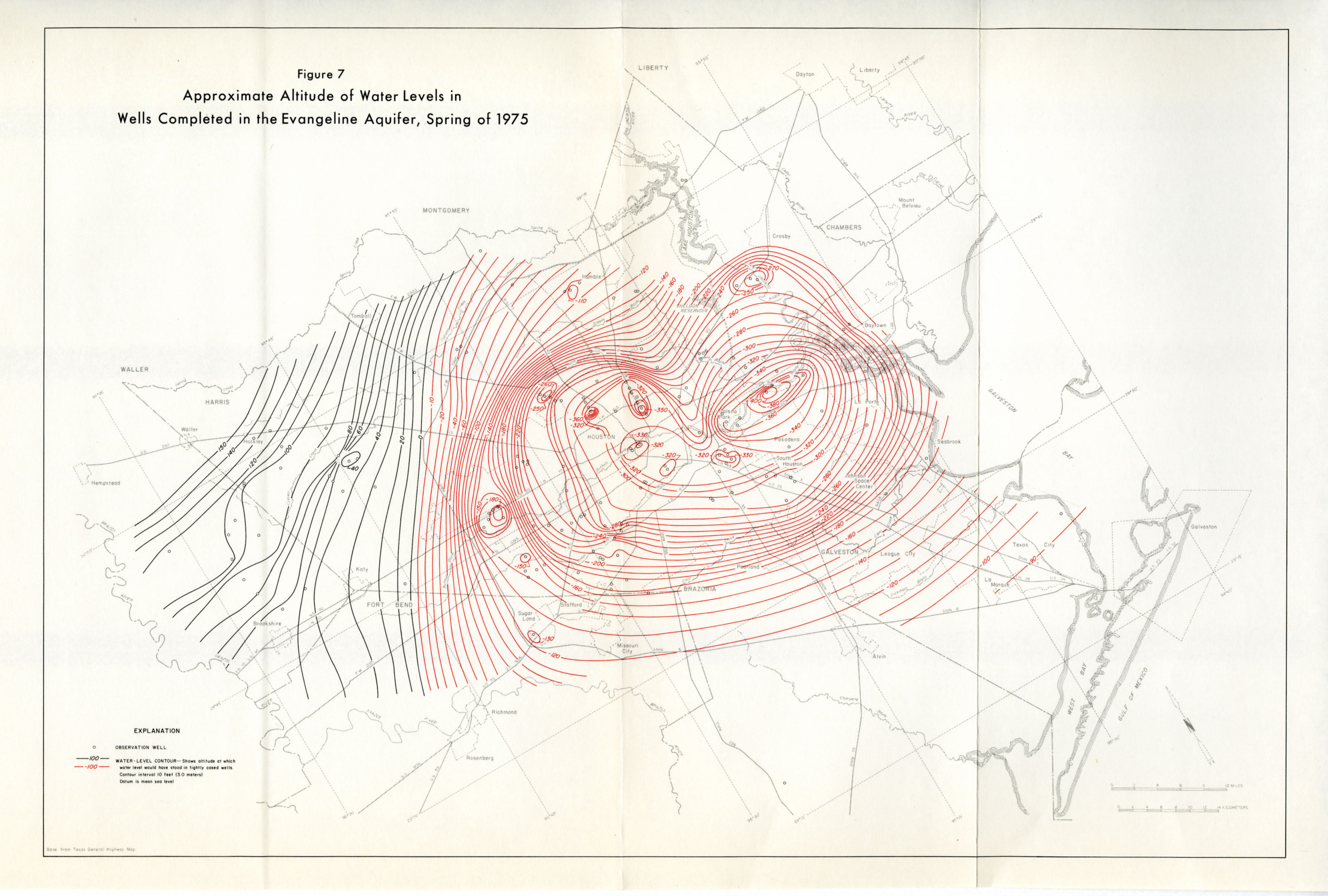
- Figure 7 - Approximate Altitude of Water Levels in Wells Completed in the Evangeline Aquifer, Spring of 1975
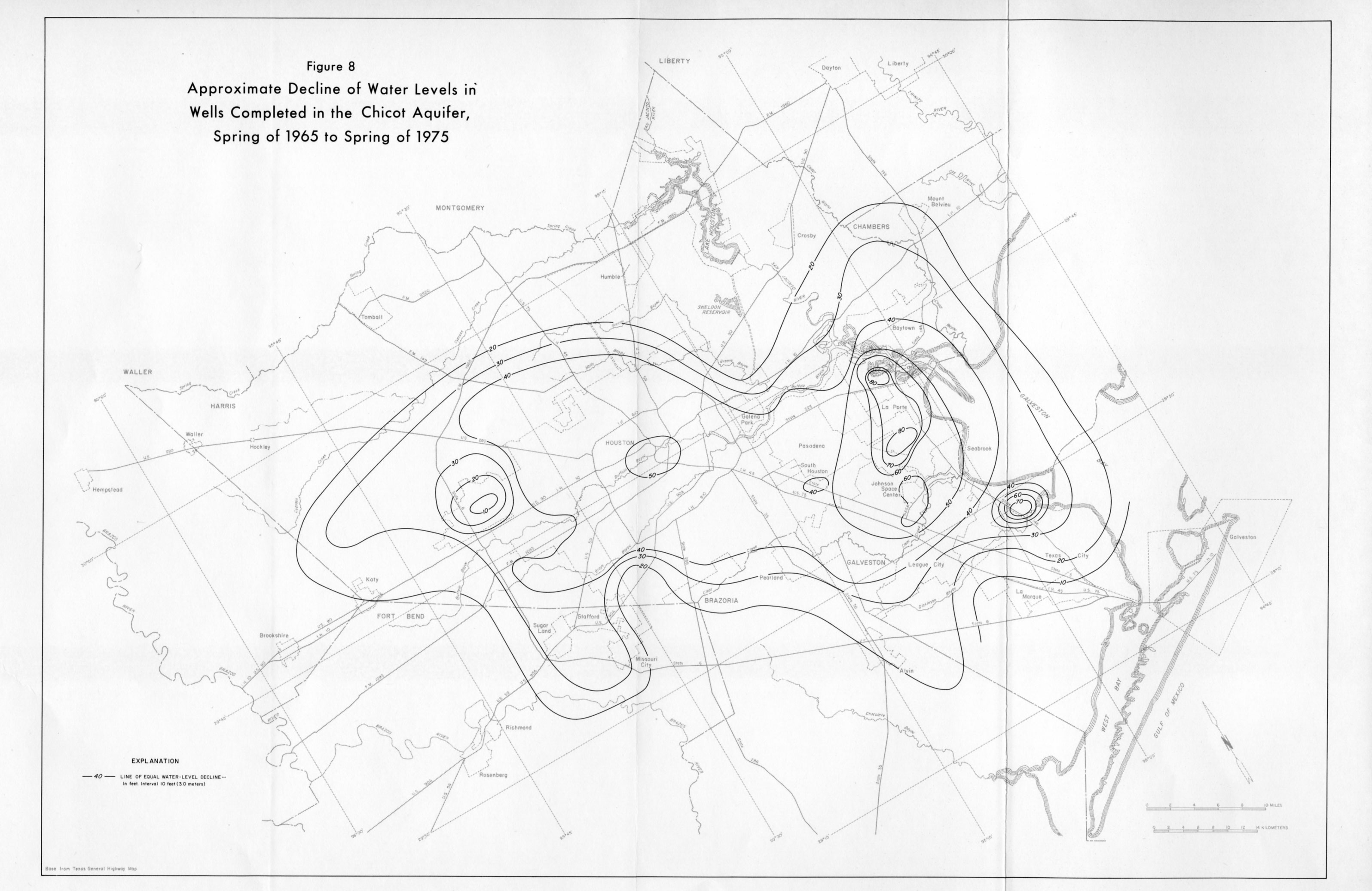
- Figure 8 - Approximate Decline of Water Levels in Wells Completed in the Chicot Aquifer, Spring of 1965 to Spring of 1975
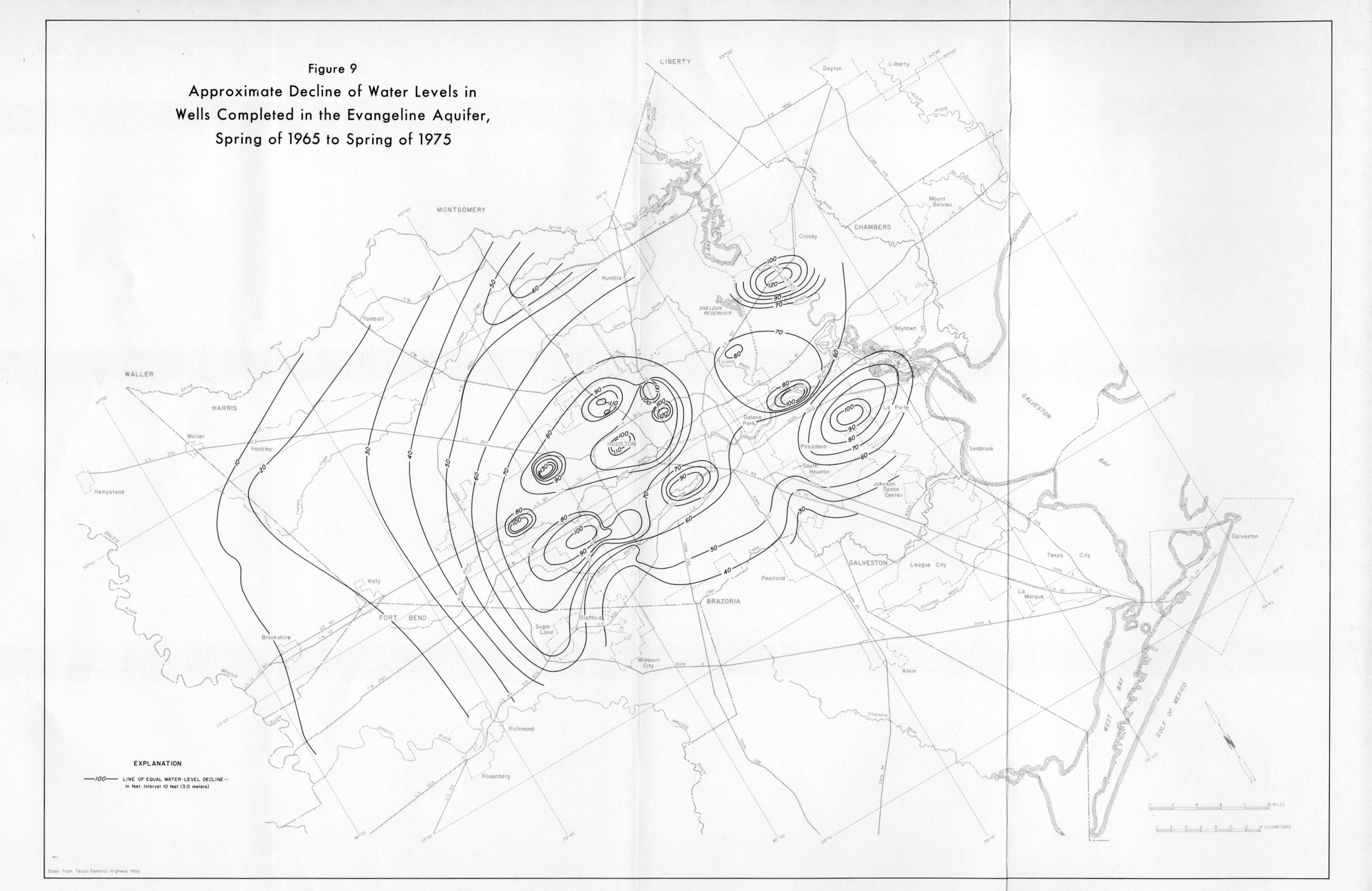
- Figure 9 - Approximate Decline of Water Levels in Wells Completed in the Evangeline Aquifer, Spring of 1965 to Spring of 1975
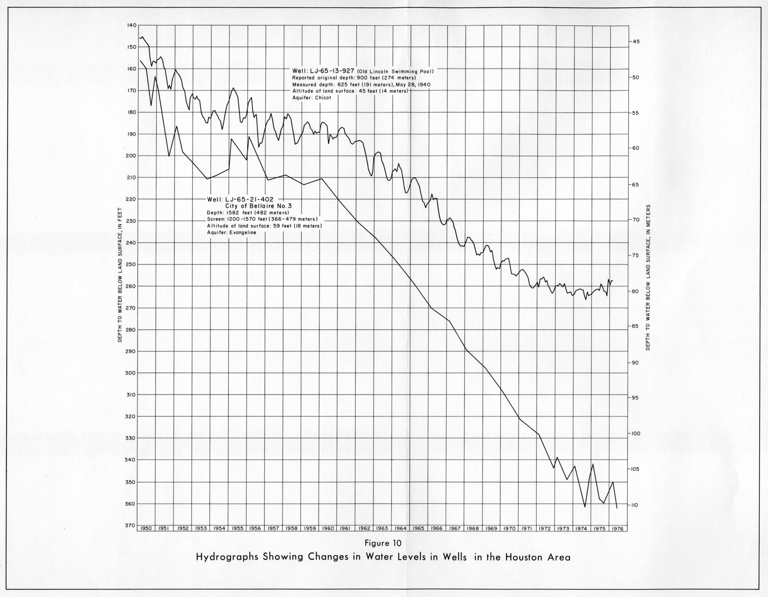
- Figure 10 - Hydrographs Showing Changes in Water Levels in Wells in the Houston Area
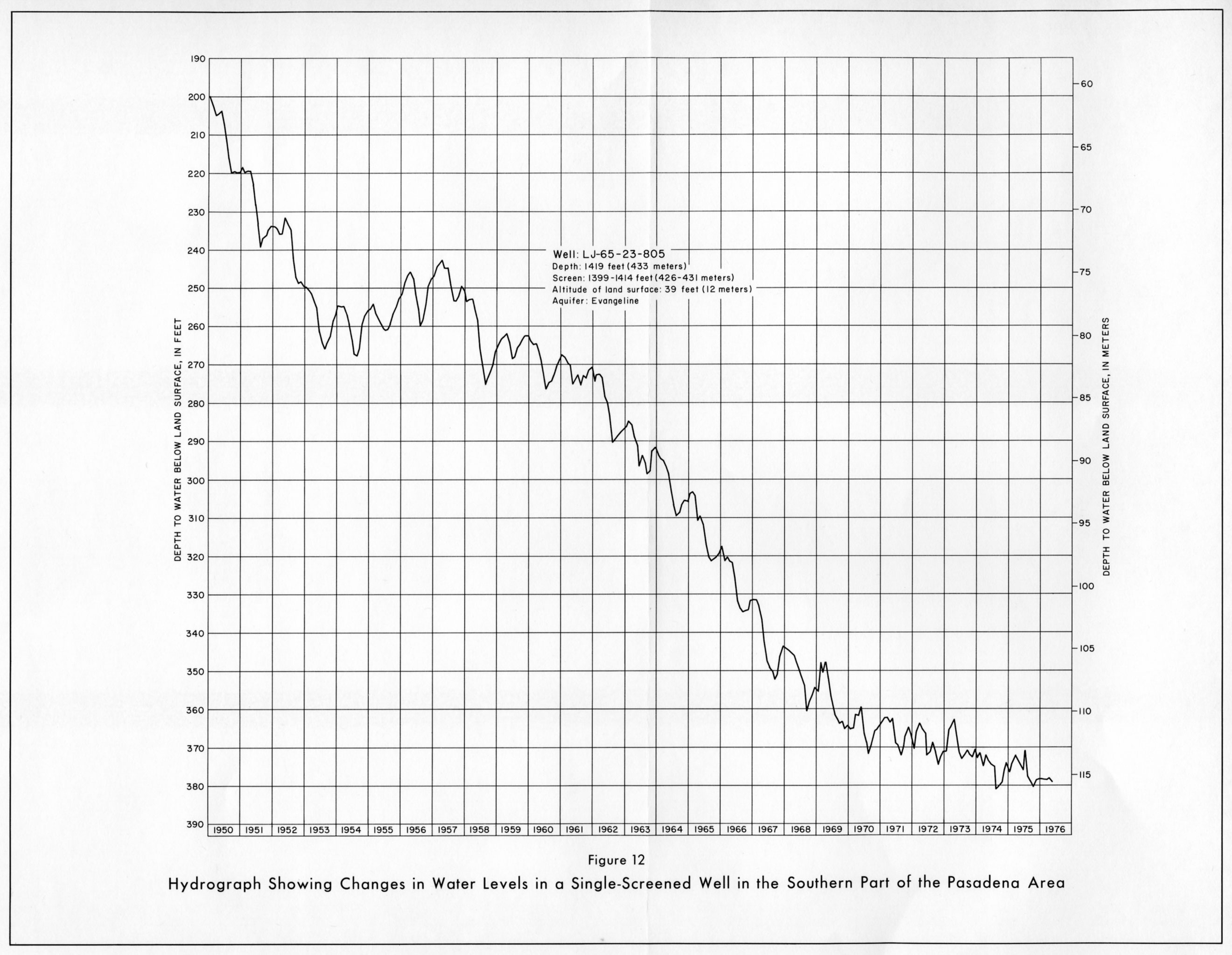
- Figure 12 - Hydrograph Showing Changes in Water Levels in a Single-Screened Well in the Southern Part of the Pasadena Area
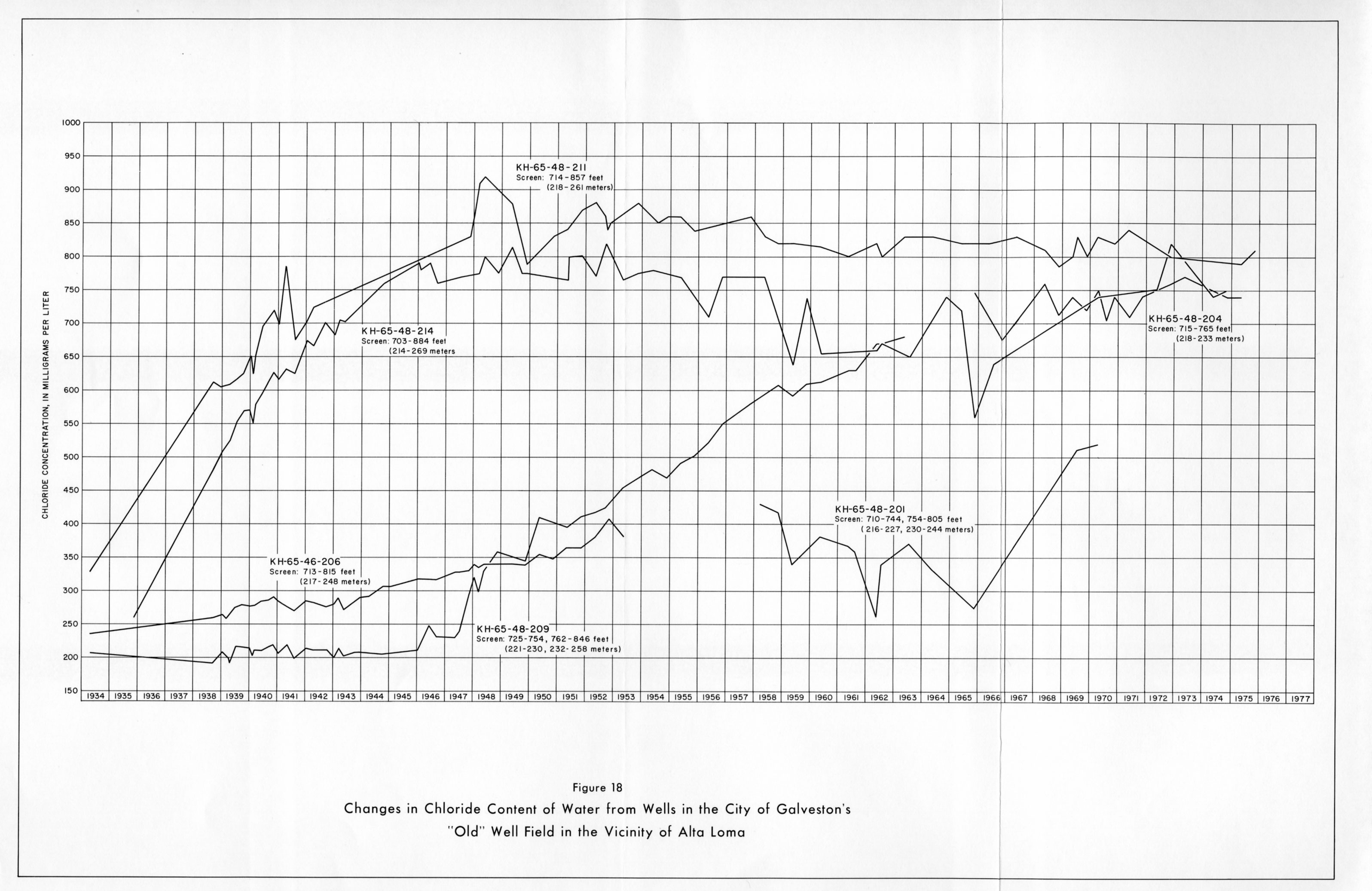
- Figure 18 - Changes in Chloride Content of Water from Wells in the City of Galveston's "Old" Well Field in the Vicinity of Alta Loma
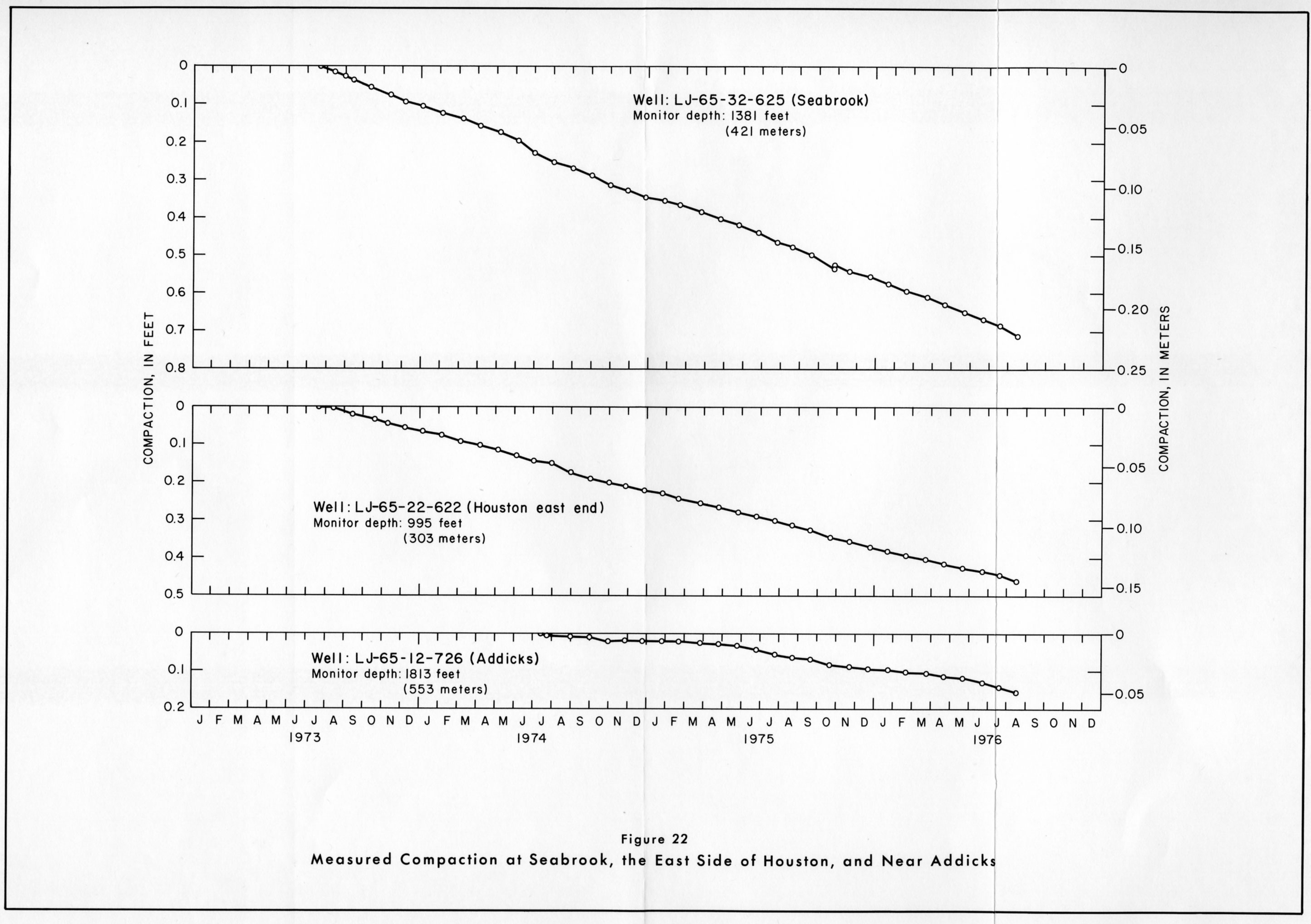
- Figure 22 - Measured Compaction at Seabrook, the East Side of Houston, and near Addicks