Report 15 By P. L. Rettman and E.R. Leggat U.S. Geological Survey | February 1966, (reprinted April 1982)
- Report 15 (35.6 MB) - Ground-Water Resources of Gaines County, Texas
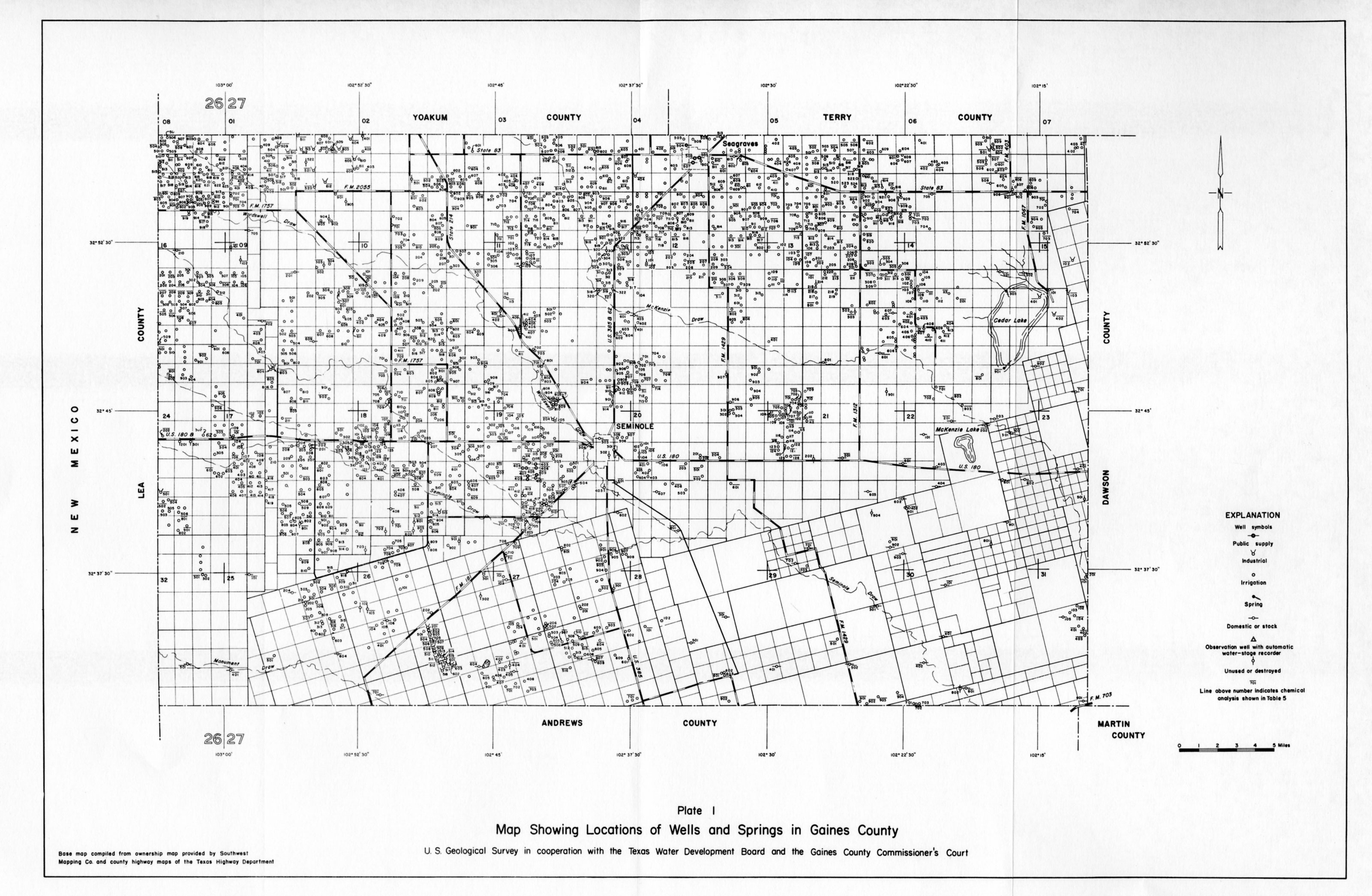
- Plate 1 - Map Showing Locations of Wells and Springs in Gaines County
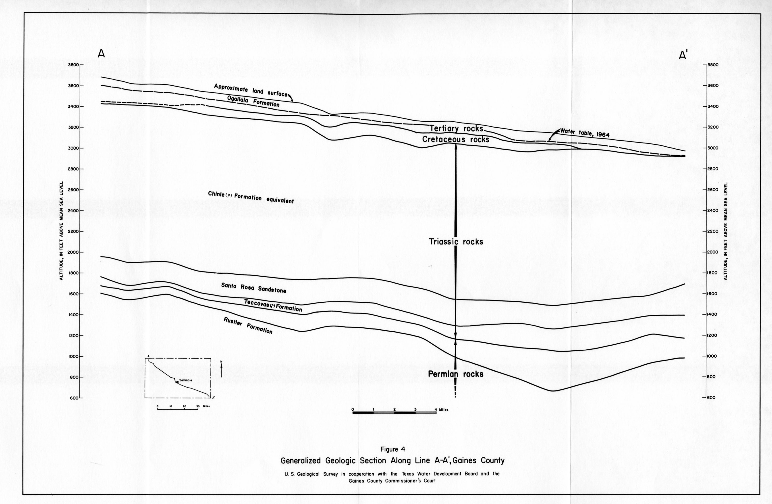
- Figure 4 - Generalized Geologic Section Along Line A-A', Gaines County
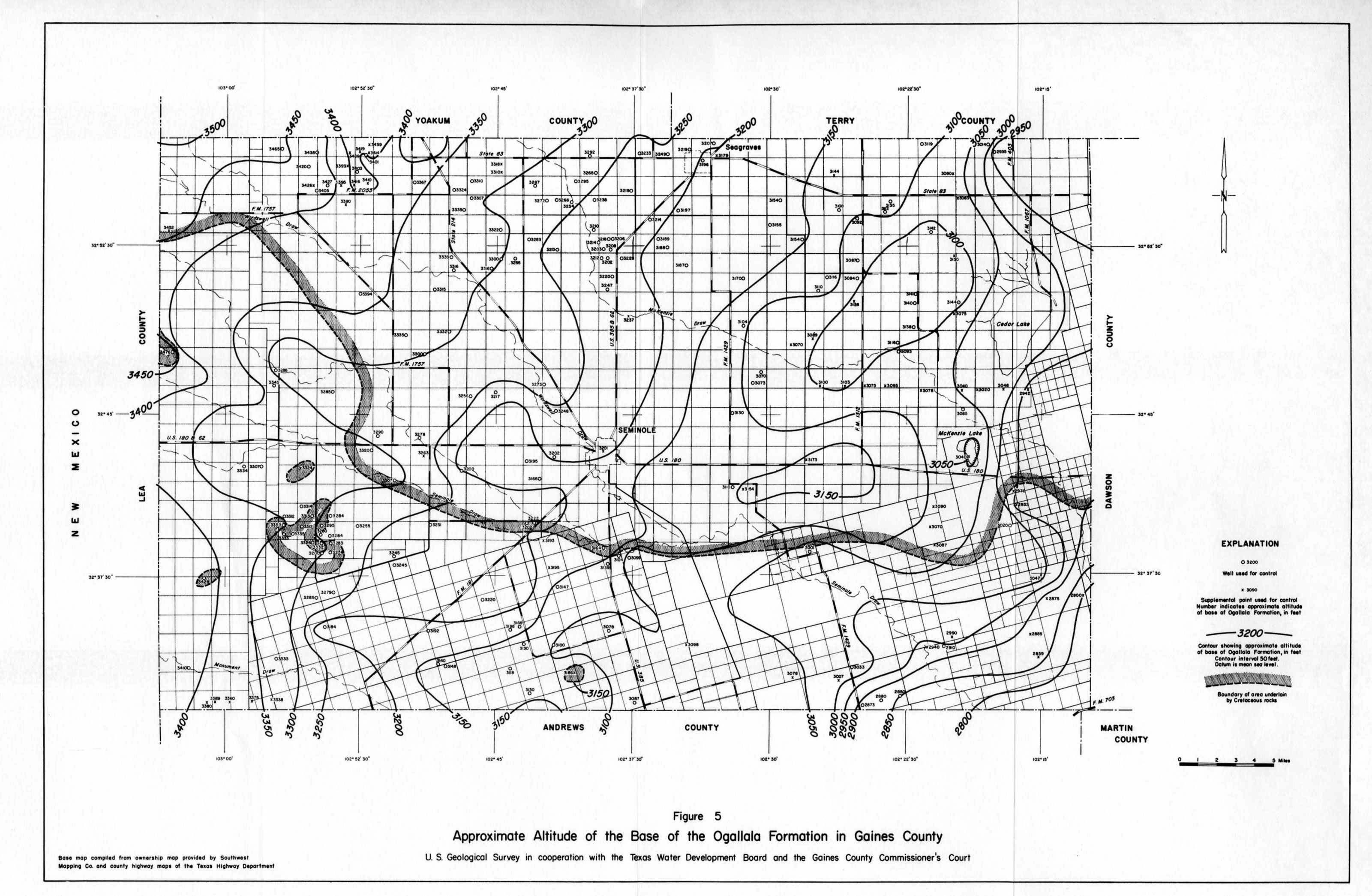
- Figure 5 - Approximate Altitude of the Base of the Ogallala Formation in Gaines County
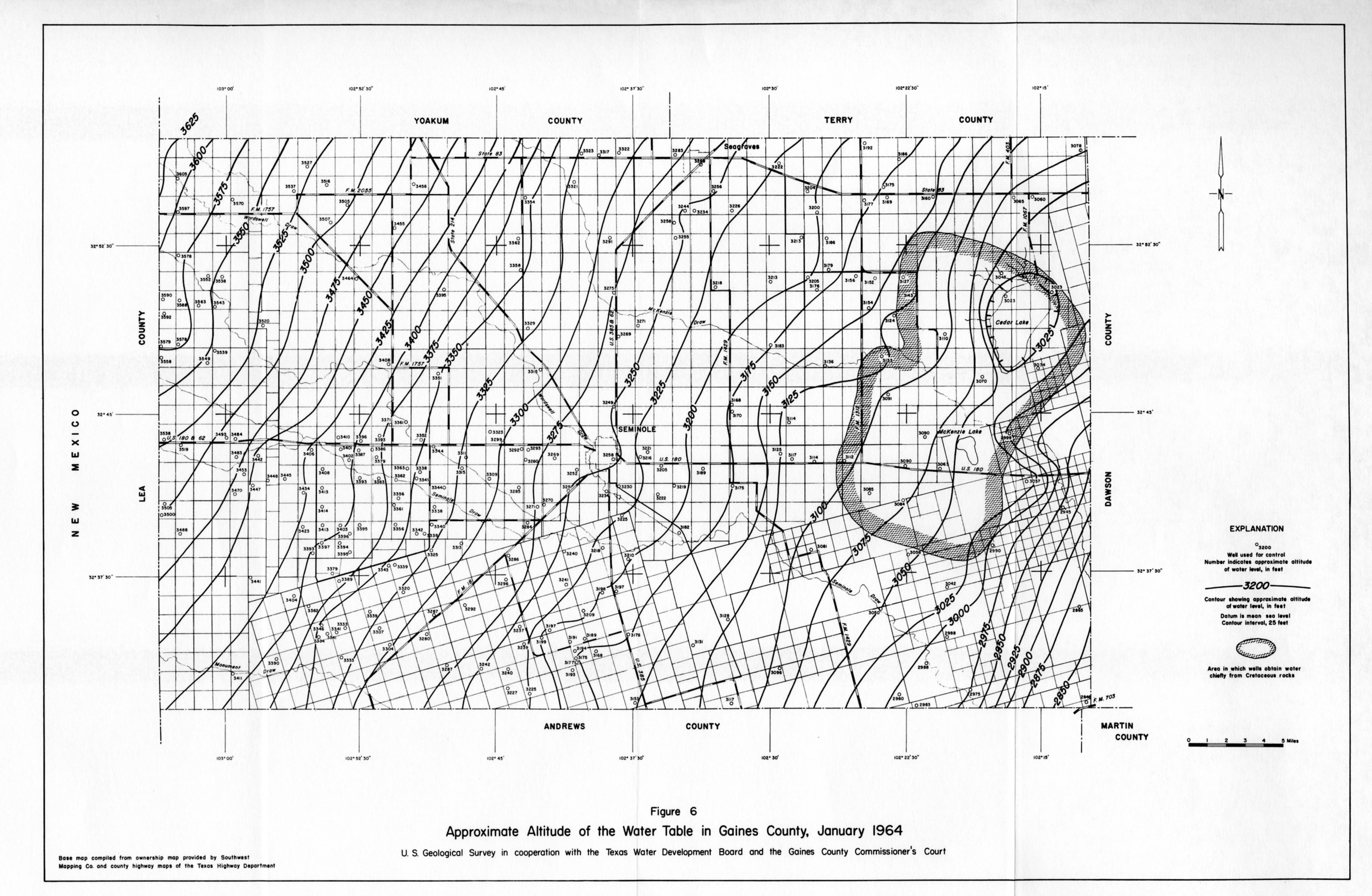
- Figure 6 - Approximate Altitude of the Water Table in Gaines County, January 1964
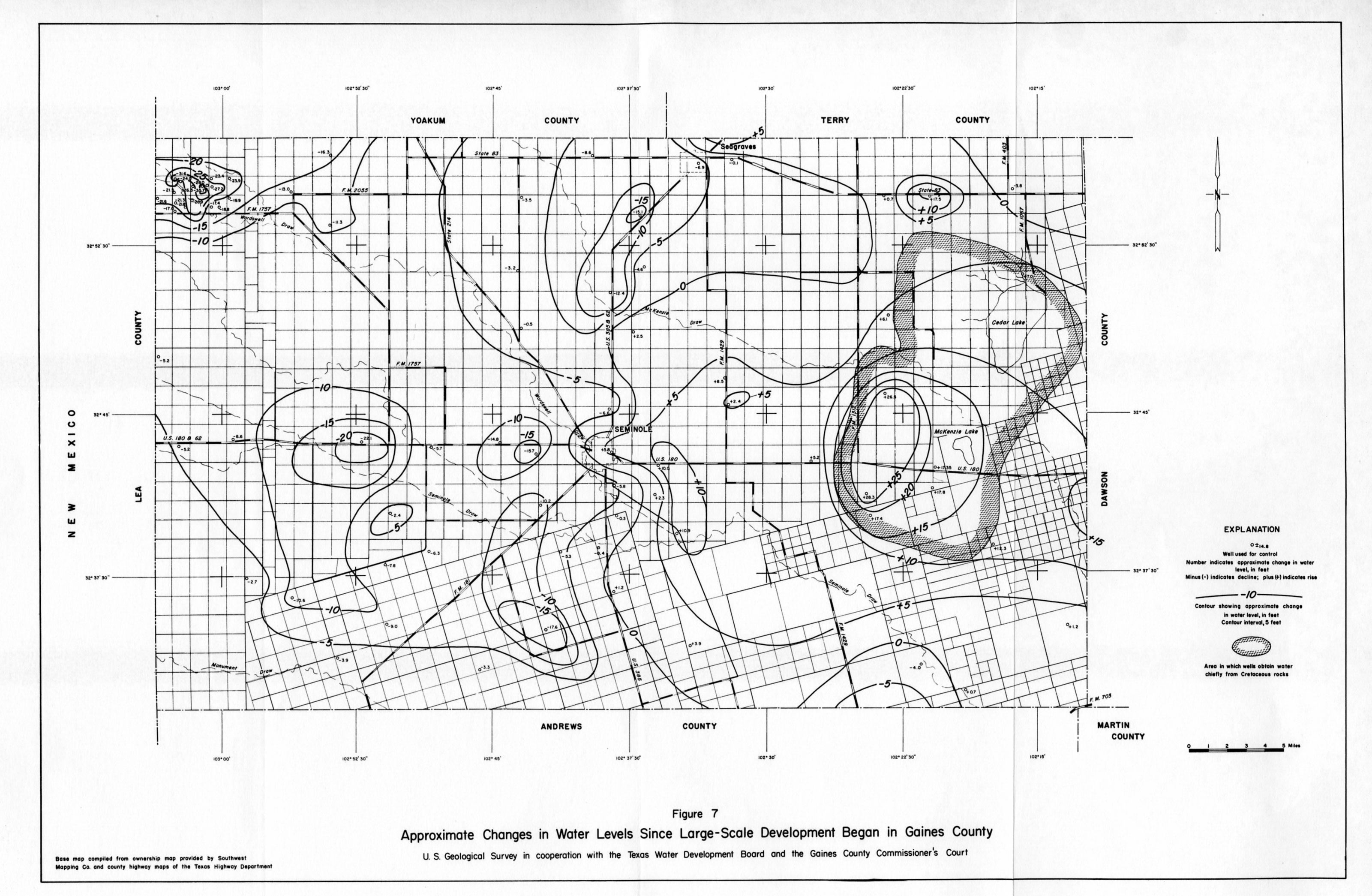
- Figure 7 - Approximate Changes in Water Levels Since Large-Scale Development Began in Gaines County
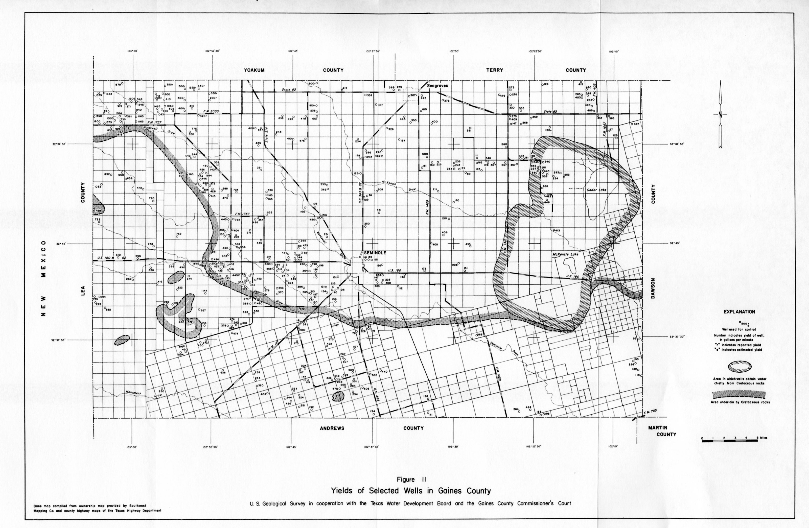
- Figure 11 - Yields of Selected Wells in Gaines County
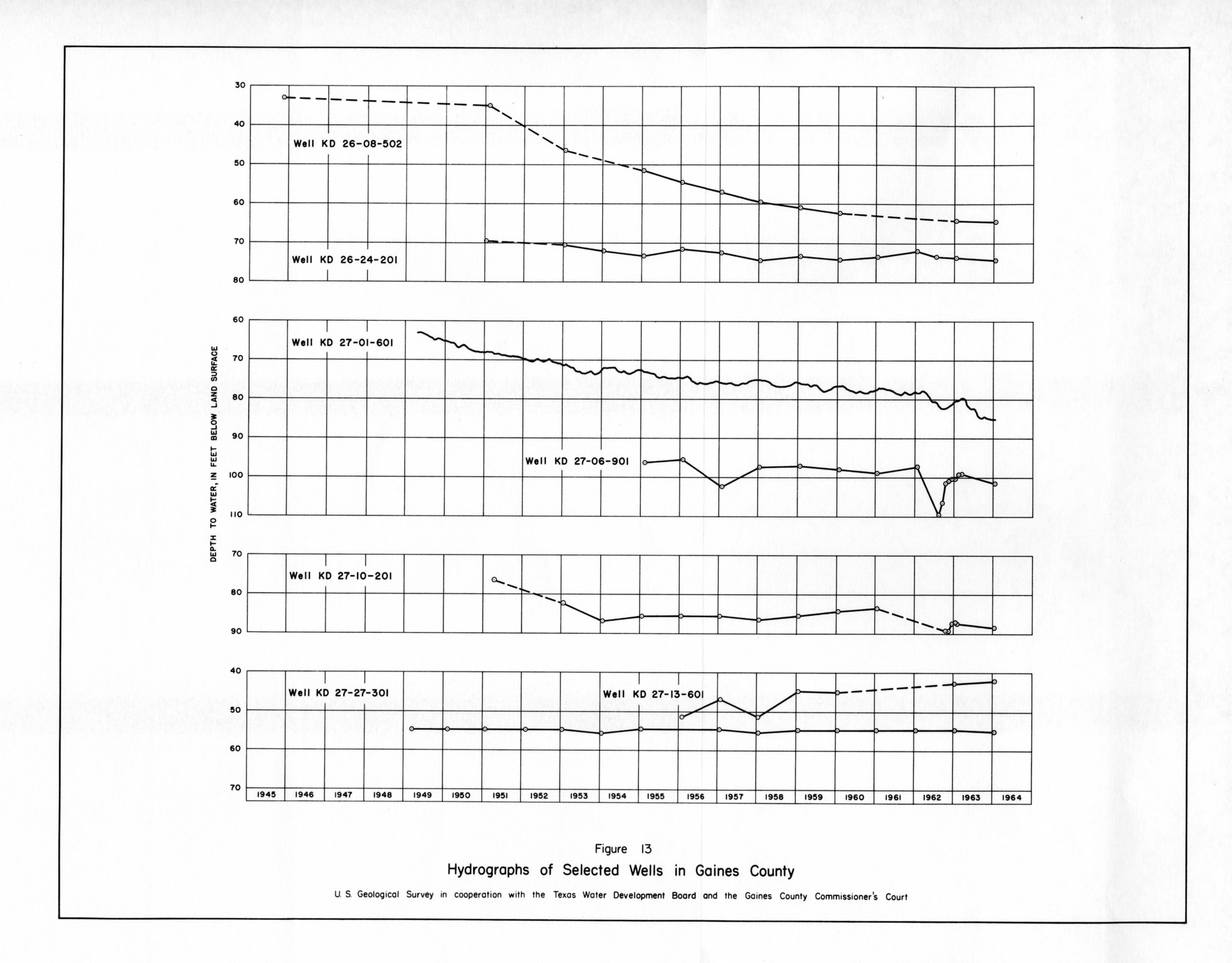
- Figure 13 - Hydrographs of Selected Wells in Gaines County
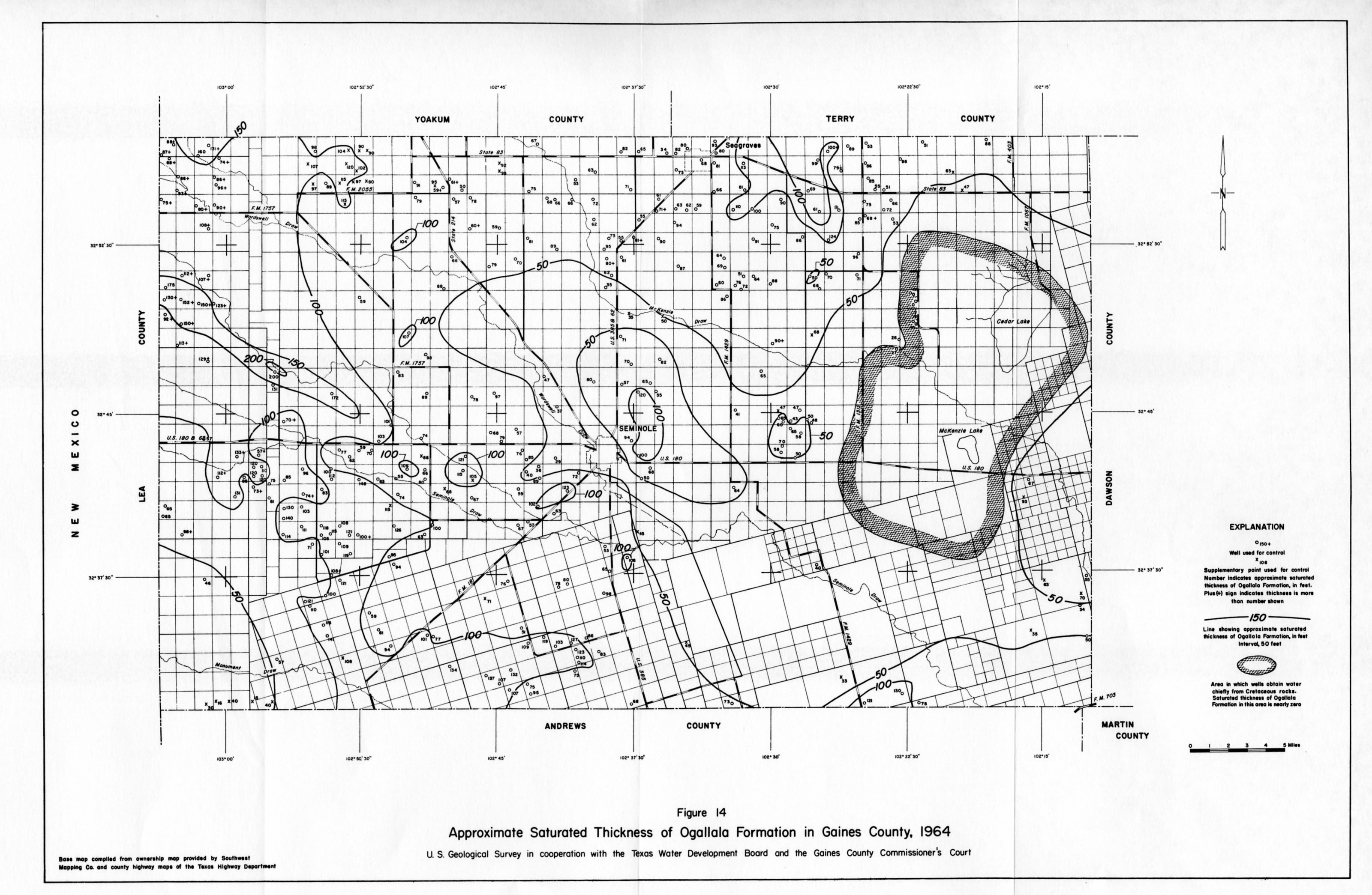
- Figure 14 - Approximate Saturated Thickness of Ogallala Formation in Gaines County, 1964
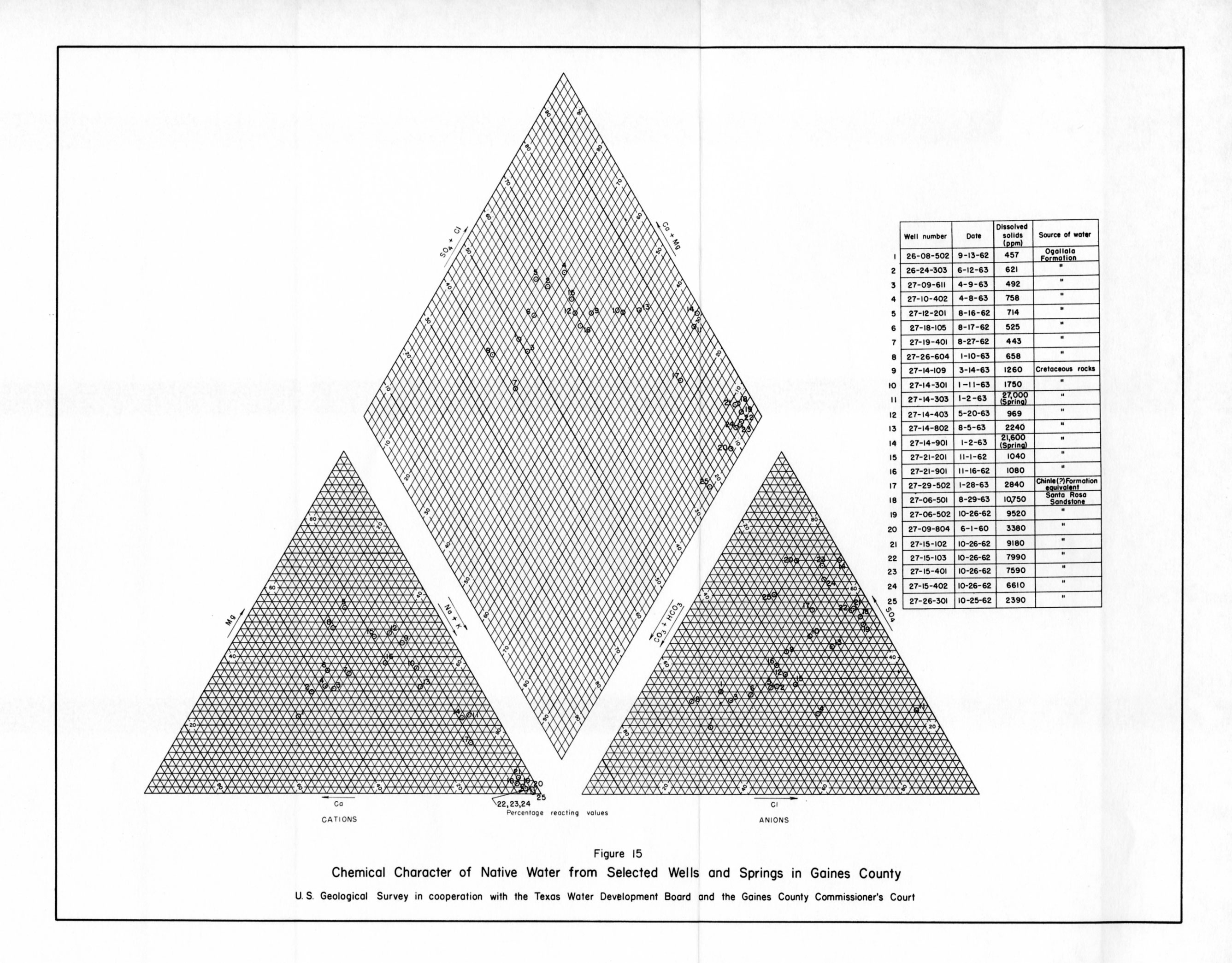
- Figure 15 - Chemical Character of Native water from Selected Wells and Springs in Gaines County
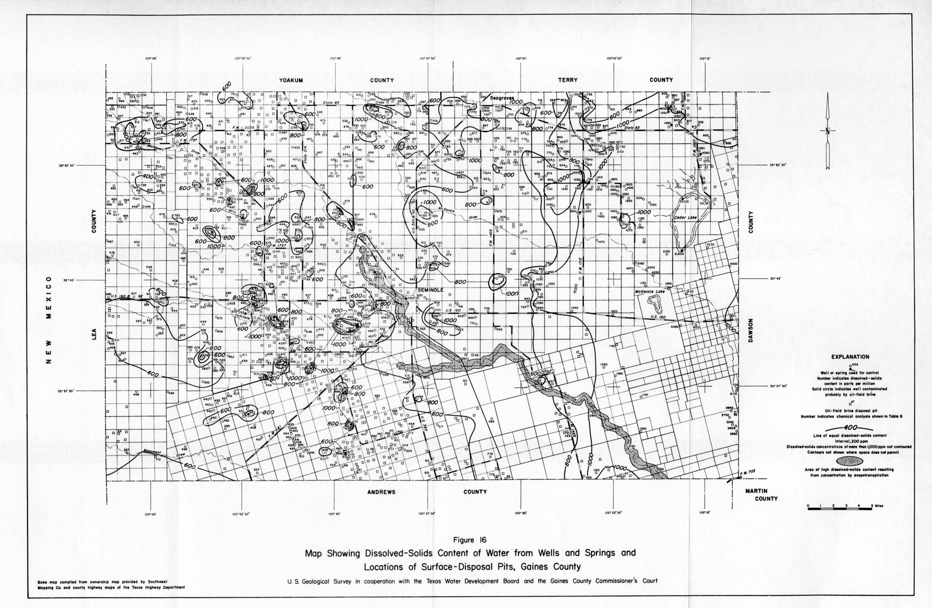
- Figure 16 - Map Showing Dissolved Solids Content of water from Wells and Springs and Locations of Surface-Disposal Pits, Gaines County